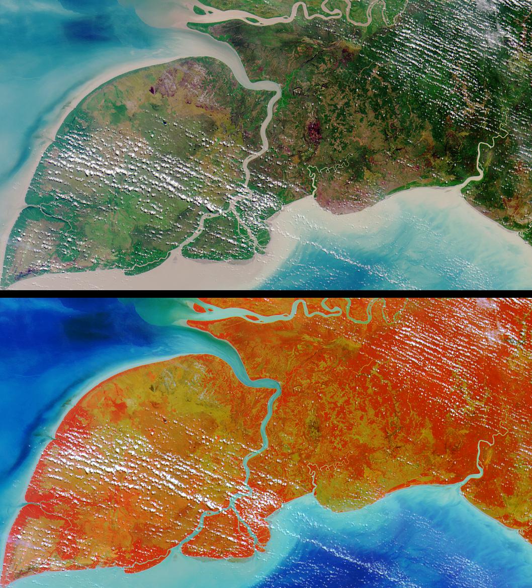
Pulau Kimaam, Pulau Dolok, Pulau Yos Sudarso, and Frederik Hendrik Island
are all names used to refer to this island, which is part of the
Indonesian province of West Papua (also known as Irian Jaya).
The answers to this quiz appear in blue below each question.
1. The island is known by at least three different names.
TRUE: Pulau Kimaam, Pulau Dolok, Pulau Yos Sudarso, and Frederik
Hendrik Island are all names used to refer to this island, which is part of
the Indonesian province of West Papua (also known as Irian Jaya).
2. At least one language spoken on the island is not in common usage
anywhere else.
TRUE: Linguists have identified over 500 languages spoken within the
"Trans-New Guinea" region (comprising West Papua and Papua New
Guinea). At least two languages within this group, Ndom and Riantana,
are only used by people living on the island.
3. The capital city of the province to which the island belongs is located
within 200 kilometers of the northern boundary of the image area.
FALSE: Jayapura, the capital city of West Papua, is located more than
500 kilometers from the northern boundary of the image area.
4. The island's shores are home to its country's most spectacular coral reefs.
FALSE: Although there are many well-developed reefs in the waters of West
Papua, none are found along the southeastern coast. Large amounts of
sediment (apparent in the image around the entire coastline) prohibit reef
development in this region.
5. Due to the extreme depth of the sea floor surrounding the island, sea
level fluctuations during the Quaternary Period have not changed the
horizontal location of its coastline by more than 500 meters.
FALSE: Sea level fluctuations cause major displacements in the horizontal
location of coastlines in this region. The Arafura Sea surrounding the island
is a shallow (50 to 80 meters) continental shelf, and sea levels during the
peak of the last ice age (about 20,000 years ago), were more than 100
meters lower than today.
6. There are no fruit bats on the island.
FALSE: Among the bats known to live on the island are the Lesser tube-nosed
fruit bat and Broad-striped tube-nosed fruit bat.
7. The region within which the island is situated harbors a freshwater
turtle that is exceptional in its possession of an anatomical characteristic
otherwise typical of marine turtles.
TRUE: The pig-nosed turtle found in northern Australia and southern Papua,
possesses flippers resembling those of marine turtles.
8. Insect control has been tested as a means of combatting an invasive
aquatic weed that threatens wetland habitats in the island's vicinity.
TRUE: Many of the wetland areas in this region are choked with Water
Hyacinth. In November 2000, a course was conducted on the breeding
and use of insect biocontrol agents (weevil Neochetina) of Water Hyacinth
infestations.
9. Species of Avicennia are found in the island's coastal regions.
TRUE: The island's coastline includes some of the largest mangrove forests
in the world, and several types of Avicennia mangroves can be found at the
Pulau Kimaam Wildlife Reserve.
MISR was built and is managed by NASA's Jet Propulsion Laboratory,
Pasadena, CA, for NASA's Office of Earth Science, Washington, DC. The
Terra satellite is managed by NASA's Goddard Space Flight Center,
Greenbelt, MD. JPL is a division of the California Institute of
Technology.
 Planetary Data System


