Figure 1
Click on the image for larger versionAtmospheric methane is a potent greenhouse gas and an important contributor to air quality. Future instruments on orbiting satellites can help improve our understanding of important methane emission sources. NASA is currently conducting a California Methane Survey to demonstrate such technologies on aircraft, using NASA's next-generation Airborne Visible/Infrared Imaging Spectrometer (AVIRIS-NG) instrument. Funded jointly by the California Air Resources Board, California Energy Commission and NASA, the California Methane Survey is determining the locations and magnitudes of the largest methane emission sources in the state, including those associated with landfills, refineries, dairies, wastewater treatment plants, oil and gas fields and natural gas infrastructure.
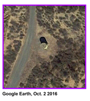
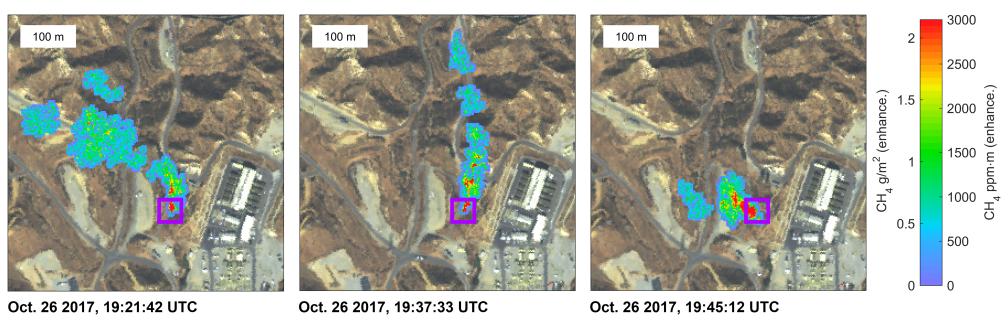
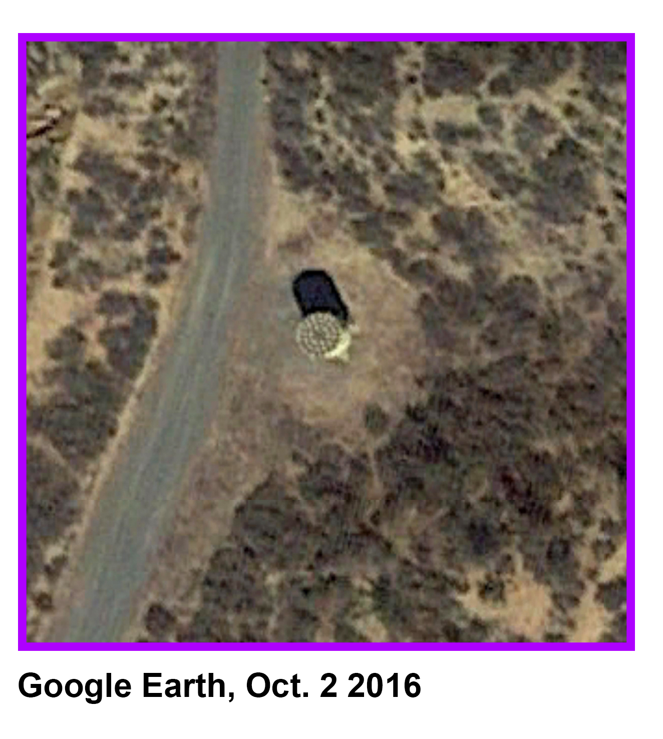
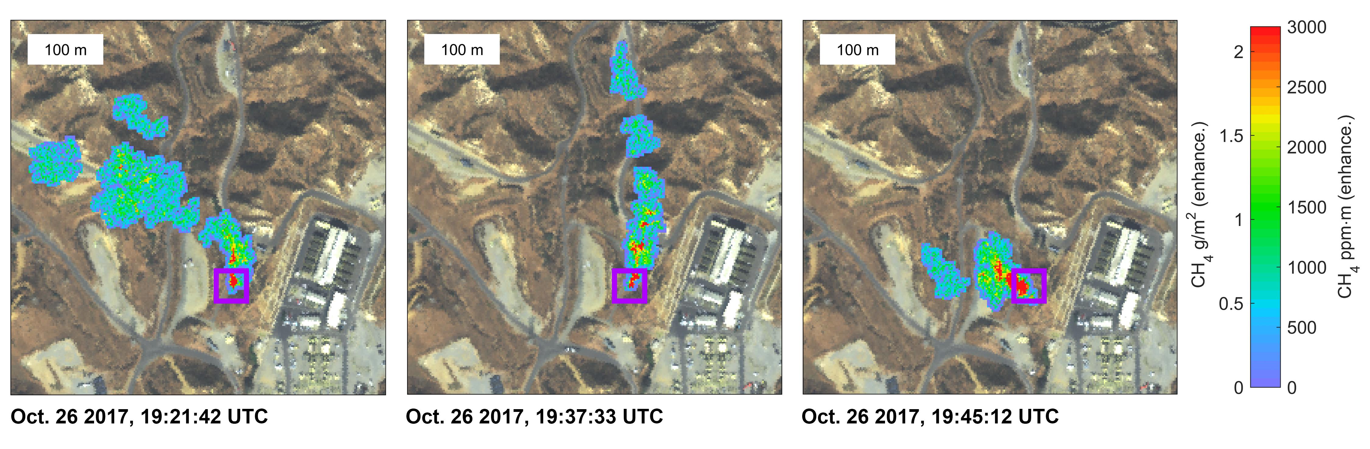
These three images show a time-series of methane plumes detected by AVIRIS-NG during multiple overflights of the Honor Rancho gas storage facility on Oct. 26, 2017. The color scale indicates concentrations of methane in the gas plume relative to background air, overlaid on AVIRIS-NG true-color land surface images. The aircraft was flying at an altitude of about 10,000 feet (3,000 meters) above ground level and the AVIRIS-NG image pixels are about 10 feet (3 meters) across. The plume shape varies with changing wind speed and direction. Figure 1 shows a higher-resolution close-up (source: Google Earth) view indicating that the methane plume originates from the facility's shutdown stack -- suggesting that venting is underway.
For more information on AVIRIS-NG, visit https://avirisng.jpl.nasa.gov/.