Click on an image for detailed information
Click on a column heading to sort in ascending or descending order

My
List |
Addition Date
|
Target
|
Mission
|
Instrument
|
Size
|

|
1998-07-03 |
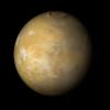
Mars
|
Mars Global Surveyor (MGS)
|
Mars Orbiter Camera (MOC)
|
815x1072x1 |
|
-
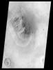
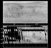
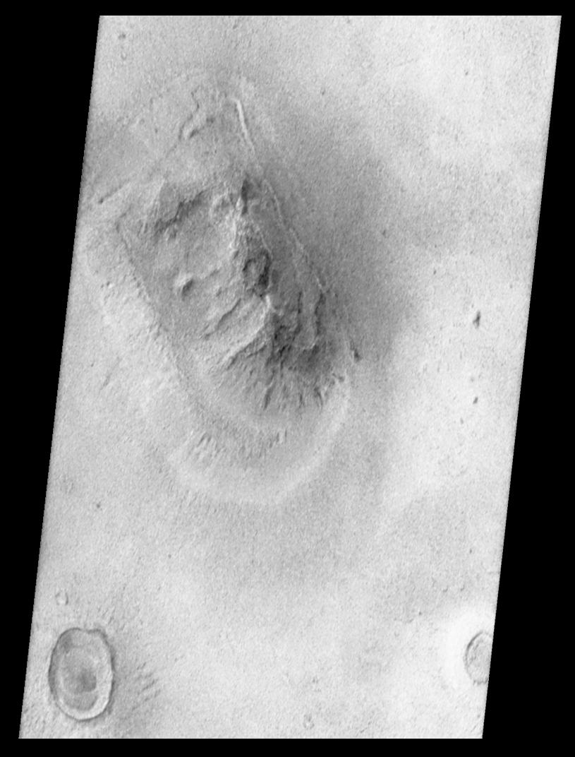
PIA01441:
-
Mars Orbiter Camera Views the "Face on Mars" - calibrated, contrast enhanced, filtered, brightness-inverted
Full Resolution:
TIFF
(570.9 kB)
JPEG
(93.52 kB)
|
|
|
1998-07-03 |
Mars
|
Mars Global Surveyor (MGS)
|
Mars Orbiter Camera (MOC)
|
1600x500x1 |
|
-
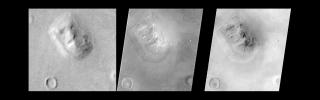
PIA01442:
-
Mars Orbiter Camera Views the "Face on Mars" - Comparison with Viking
Full Resolution:
TIFF
(423.4 kB)
JPEG
(62.18 kB)
|
|
|
1998-07-03 |
Mars
|
Mars Global Surveyor (MGS)
|
Mars Orbiter Camera (MOC)
|
800x800x3 |
|
-
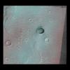
PIA01443:
-
Mars Orbiter Camera Acquires High Resolution Stereoscopic Images of the Viking One Landing Site
Full Resolution:
TIFF
(1.416 MB)
JPEG
(83.23 kB)
|
|
|
1998-07-03 |
Mars
|
Mars Global Surveyor (MGS)
|
Mars Orbiter Camera (MOC)
|
1024x1467x1 |
|
-
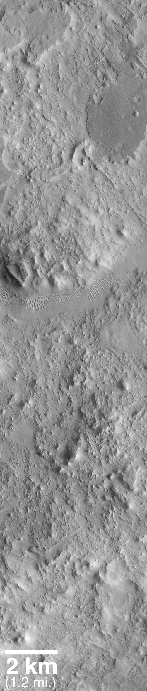
PIA01444:
-
Cloudy Image of Cerberus Rupes Dark Lineation
Full Resolution:
TIFF
(815.1 kB)
JPEG
(348.6 kB)
|
|
|
1998-07-03 |
Mars
|
Mars Global Surveyor (MGS)
|
Mars Orbiter Camera (MOC)
|
1024x2816x1 |
|
-
PIA01445:
-
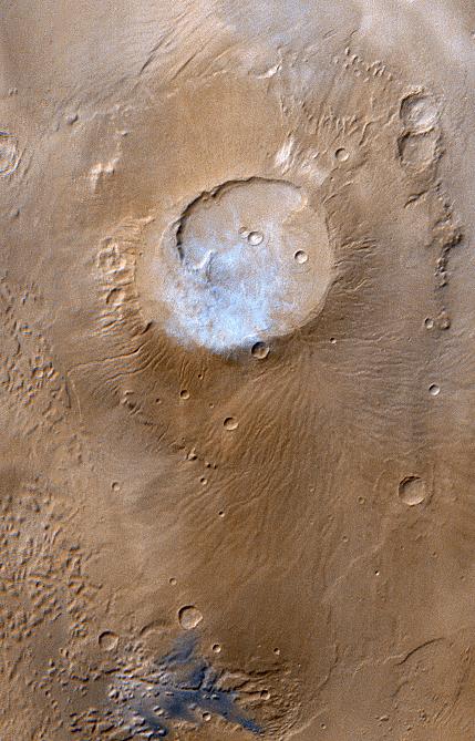
Eroded Crater Adjacent to Huygens Impact Basin
Full Resolution:
TIFF
(1.517 MB)
JPEG
(151.2 kB)
|
|
|
1998-07-03 |
Mars
|
Mars Global Surveyor (MGS)
|
Mars Orbiter Camera (MOC)
|
512x512x1 |
|
-
PIA01446:
-
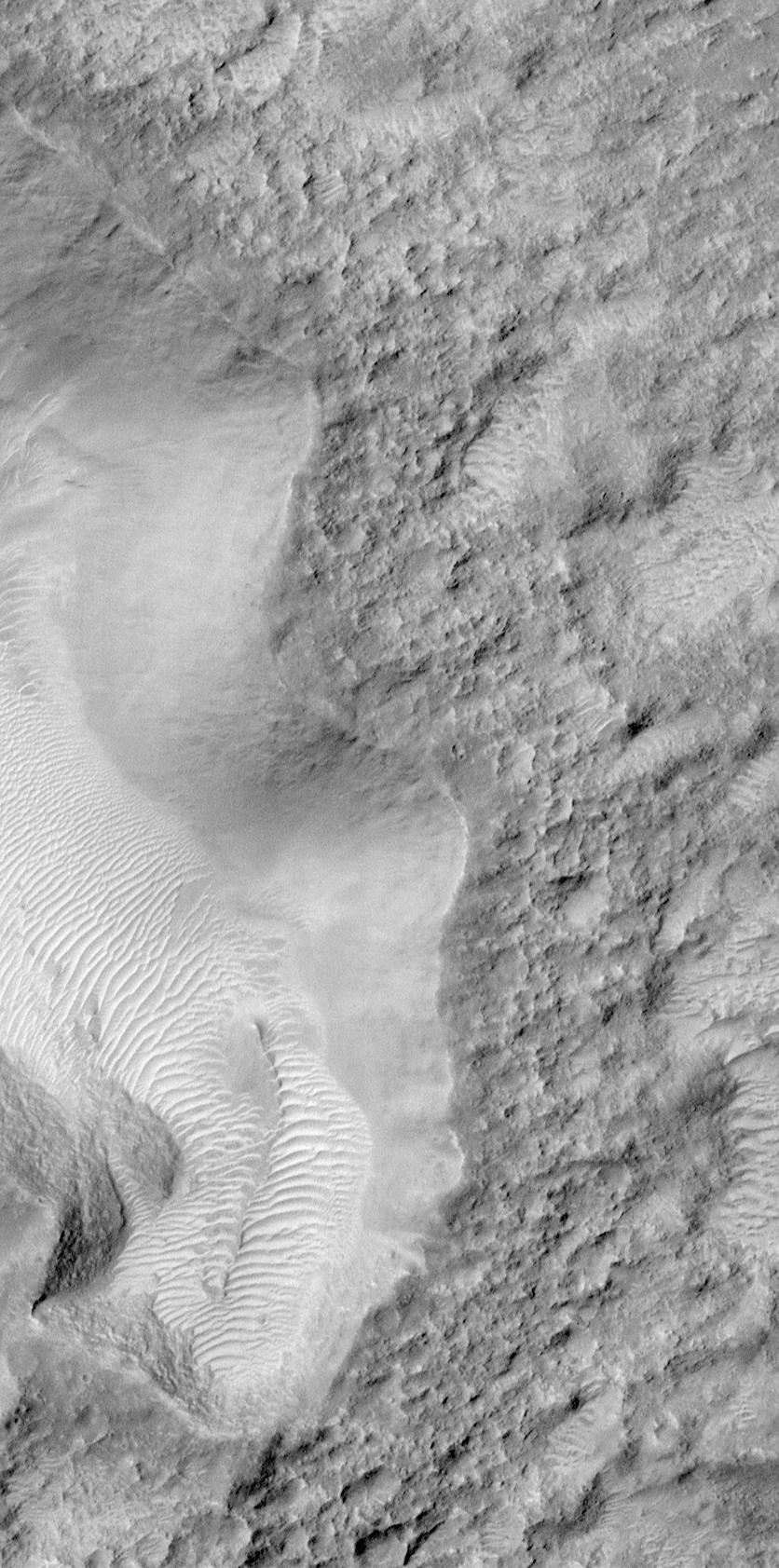
Windblown Dunes on the Floor of Herschel Impact Basin
Full Resolution:
TIFF
(119.6 kB)
JPEG
(35.75 kB)
|
|
|
1998-07-03 |
Mars
|
Mars Global Surveyor (MGS)
|
Mars Orbiter Camera (MOC)
|
1385x1024x3 |
|
-
PIA01447:
-
Mars Pathfinder First Anniversary Special -- Refined Landing Site Location
Full Resolution:
TIFF
(2.262 MB)
JPEG
(289.2 kB)
|
|
|
2000-09-16 |
Mars
|
Mars Global Surveyor (MGS)
|
Mars Orbiter Camera (MOC)
|
802x804x1 |

|
-
PIA01454:
-
Moon/Mars Landing Commemorative Release: Gusev Crater and Ma'adim Vallis
Full Resolution:
TIFF
(561.2 kB)
JPEG
(88.35 kB)
|
|
|
1998-07-20 |
Mars
|
Mars Global Surveyor (MGS)
|
Mars Orbiter Camera (MOC)
|
256x3040x1 |

|
-
PIA01455:
-
Elysium Mons Volcano
Full Resolution:
TIFF
(804.2 kB)
JPEG
(150.6 kB)
|
|
|
2000-09-18 |
Mars
|
Mars Global Surveyor (MGS)
|
Mars Orbiter Camera (MOC)
|
512x512x1 |

|
-
PIA01456:
-
Elysium Mons Volcano - Detail of Southern Caldera Wall and Floor
Full Resolution:
TIFF
(247 kB)
JPEG
(37.07 kB)
|
|
|
1998-07-20 |
Mars
|
Mars Global Surveyor (MGS)
|
Mars Orbiter Camera (MOC)
|
1027x987x3 |
|
-
PIA01457:
-
Elysium Mons Volcanic Region
Full Resolution:
TIFF
(1.699 MB)
JPEG
(51.09 kB)
|
|
|
2000-09-16 |
Mars
|
Mars Global Surveyor (MGS)
|
Mars Orbiter Camera (MOC)
|
512x512x1 |

|
-
PIA01458:
-
Western Candor Chasma, Valles Marineris
Full Resolution:
TIFF
(139.4 kB)
JPEG
(33.9 kB)
|
|
|
2000-09-18 |
Mars
|
Mars Global Surveyor (MGS)
|
Mars Orbiter Camera (MOC)
|
512x512x1 |
|
-
PIA01459:
-
Western Candor Chasma - Layers Exposed near the Middle
Full Resolution:
TIFF
(275.5 kB)
JPEG
(60.23 kB)
|
|
|
2000-09-18 |
Mars
|
Mars Global Surveyor (MGS)
|
Mars Orbiter Camera (MOC)
|
512x512x1 |
|
-
PIA01460:
-
Candor Chasma - Massive (non-layered) Material Expos
Full Resolution:
TIFF
(247.5 kB)
JPEG
(46.76 kB)
|
|
|
1998-07-31 |
Mars
|
Mars Global Surveyor (MGS)
|
Mars Orbiter Camera (MOC)
|
560x730x1 |
|
-
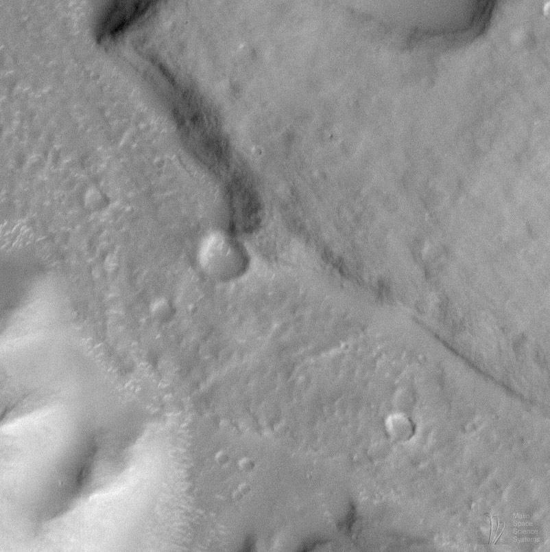
PIA01463:
-
SUV Tracks On Mars? The "Devil" is in the Details
Full Resolution:
TIFF
(367.8 kB)
JPEG
(52.76 kB)
|
|
|
2000-09-16 |
Mars
|
Mars Global Surveyor (MGS)
|
Mars Orbiter Camera (MOC)
|
837x2350x1 |
|
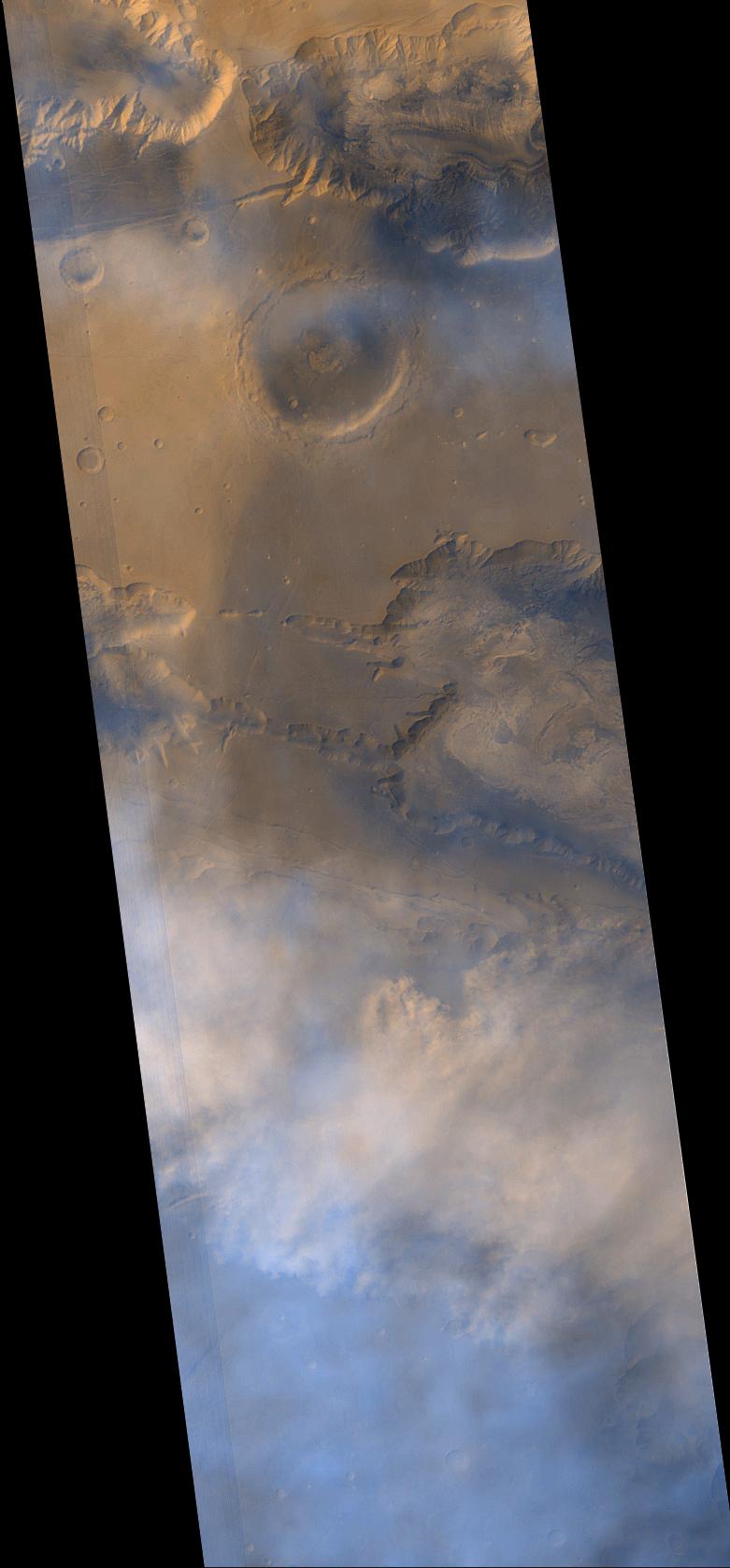
-
PIA01467:
-
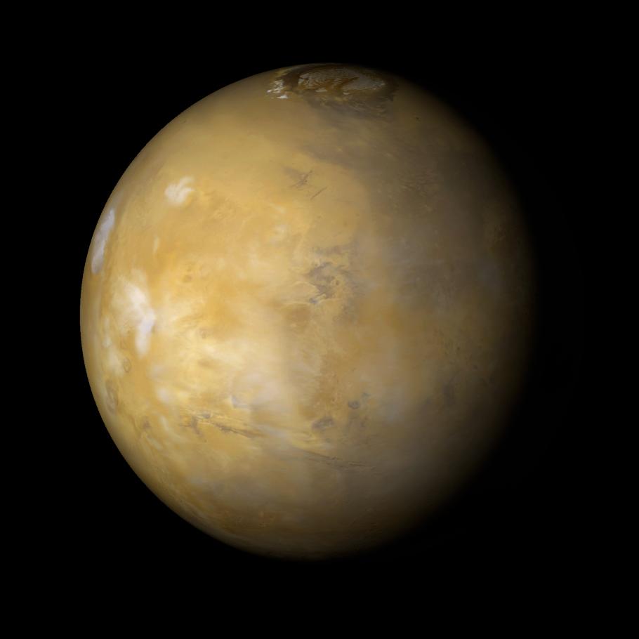
Seeing Mars' Northern Plains Through Springtime Haze
Full Resolution:
TIFF
(1.486 MB)
JPEG
(408.3 kB)
|
|
|
1998-09-26 |
Mars
|
Mars Global Surveyor (MGS)
|
Mars Orbiter Camera (MOC)
|
418x888x1 |
|
-
PIA01468:
-
Small Volcano in Tempe Terra
Full Resolution:
TIFF
(384 kB)
JPEG
(80.91 kB)
|
|
|
2000-09-16 |
Mars
|
Mars Global Surveyor (MGS)
|
Mars Orbiter Camera (MOC)
|
400x400x1 |
|
-
PIA01469:
-
Giant "Polygon" Troughs, Elysium Planitia
Full Resolution:
TIFF
(140.4 kB)
JPEG
(33.37 kB)
|
|
|
2000-09-18 |
Mars
|
Mars Global Surveyor (MGS)
|
Mars Orbiter Camera (MOC)
|
542x256x1 |
|
-
PIA01470:
-
Giant "Polygon" Troughs, Elysium Planitia at Full Resolution
Full Resolution:
TIFF
(126.2 kB)
JPEG
(28.23 kB)
|
|
|
2000-09-18 |
Mars
|
Mars Global Surveyor (MGS)
|
Mars Orbiter Camera (MOC)
|
1586x459x3 |
|
-
PIA01471:
-
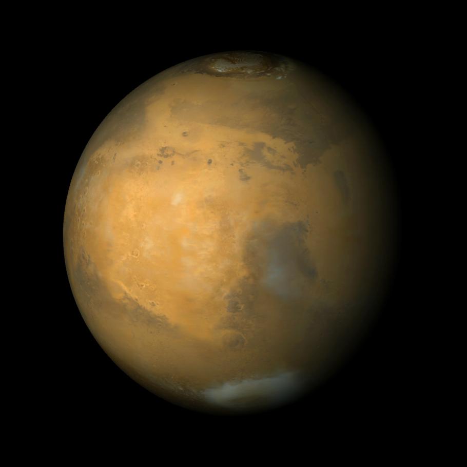
Martian North Polar Cap on September 12, 1998 (color)
Full Resolution:
TIFF
(1.444 MB)
JPEG
(45.56 kB)
|
|
|
2000-09-16 |
Mars
|
Mars Global Surveyor (MGS)
|
Mars Orbiter Camera (MOC)
|
492x227x1 |
|
-
PIA01472:
-
Martian North Polar Cap on September 12, 1998
Full Resolution:
TIFF
(72.89 kB)
JPEG
(9.976 kB)
|
|
|
2000-09-16 |
Mars
|
Mars Global Surveyor (MGS)
|
Mars Orbiter Camera (MOC)
|
683x1138x1 |
|
-
PIA01475:
-
Exhumed Crater in Kasei Valles
Full Resolution:
TIFF
(692.1 kB)
JPEG
(86.29 kB)
|
|
|
2000-09-18 |
Mars
|
Mars Global Surveyor (MGS)
|
Mars Orbiter Camera (MOC)
|
692x1448x3 |
|
-
PIA01476:
-
Olympus Mons, 1998 (Color)
Full Resolution:
TIFF
(2.4 MB)
JPEG
(91.12 kB)
|
|
|
2000-09-16 |
Mars
|
Mars Global Surveyor (MGS)
|
Mars Orbiter Camera (MOC)
|
1872x1036x1 |
|
-
PIA01479:
-
Detailed View of Cliff-face in the North Polar Layered Deposits
Full Resolution:
TIFF
(1.101 MB)
JPEG
(259.6 kB)
|
|
|
2000-09-16 |
Mars
|
Mars Global Surveyor (MGS)
|
Mars Orbiter Camera (MOC)
|
502x1138x1 |
|
-
PIA01494:
-
Ancient Lakes on Mars? Results for Elysium Basin
Full Resolution:
TIFF
(582.1 kB)
JPEG
(141.6 kB)
|
|
|
2000-09-16 |
Mars
|
Mars Global Surveyor (MGS)
|
Mars Orbiter Camera (MOC)
|
443x746x1 |
|
-
PIA01495:
-
Evidence for Recent Wind Action on Martian Sand Dunes
Full Resolution:
TIFF
(257.5 kB)
JPEG
(39.56 kB)
|
|
|
1998-12-10 |
Mars
|
Mars Global Surveyor (MGS)
|
Mars Orbiter Camera (MOC)
|
512x1223x1 |
|
-
PIA01499:
-
Mars Water: Valley Networks
Full Resolution:
TIFF
(582.1 kB)
JPEG
(93.9 kB)
|
|
|
2000-09-18 |
Mars
|
Mars Global Surveyor (MGS)
|
Mars Orbiter Camera (MOC)
|
690x1017x1 |
|
-
PIA01500:
-
Mars Boulders: On a Hill in Utopia Planitia
Full Resolution:
TIFF
(711.1 kB)
JPEG
(149.8 kB)
|
|
|
2000-09-16 |
Mars
|
Mars Global Surveyor (MGS)
|
Mars Orbiter Camera (MOC)
|
512x1488x1 |
|
-
PIA01501:
-
Mars Volcanism: Large, Fluid Lava Flows
Full Resolution:
TIFF
(943.9 kB)
JPEG
(263.4 kB)
|
|
|
2000-09-18 |
Mars
|
Mars Global Surveyor (MGS)
|
Mars Orbiter Camera (MOC)
|
421x1634x1 |

|
-
PIA01502:
-
Mars Fretted Terrain: Lineated Valley Fill
Full Resolution:
TIFF
(661.3 kB)
JPEG
(128.5 kB)
|
|
|
1999-02-19 |
Mars
|
Mars Global Surveyor (MGS)
|
Mars Orbiter Camera (MOC)
|
1024x1298x1 |
|
-
PIA01505:
-
Corasis Fossae Valley
Full Resolution:
TIFF
(1.148 MB)
JPEG
(203.2 kB)
|
|
|
1999-02-19 |
Mars
|
Mars Global Surveyor (MGS)
|
Mars Orbiter Camera (MOC)
|
1424x1894x1 |
|
-
PIA01506:
-
Channels on Bakhuysen Crater Wall
Full Resolution:
TIFF
(2.797 MB)
JPEG
(518.9 kB)
|
|
|
1999-02-19 |
Mars
|
Mars Global Surveyor (MGS)
|
Mars Orbiter Camera (MOC)
|
1023x1300x1 |
|
-
PIA01507:
-
Dissected Terrain Near Parana Valles
Full Resolution:
TIFF
(1.424 MB)
JPEG
(293.4 kB)
|
|
|
1999-02-19 |
Mars
|
Mars Global Surveyor (MGS)
|
Mars Orbiter Camera (MOC)
|
1024x1280x1 |
|
-
PIA01508:
-
Small Valley Network Near Schiaparelli Crater
Full Resolution:
TIFF
(1.251 MB)
JPEG
(239.5 kB)
|
|
|
2000-09-16 |
Mars
|
Mars Global Surveyor (MGS)
|
Mars Orbiter Camera (MOC)
|
776x779x1 |
|
-
PIA01670:
-
MOC Focus Test Images
Full Resolution:
TIFF
(628.2 kB)
JPEG
(127.6 kB)
|
|
|
2000-09-16 |
Mars
|
Mars Global Surveyor (MGS)
|
Mars Orbiter Camera (MOC)
|
597x238x1 |
|
-
PIA01671:
-
North Polar Region Dunes Focus Test Image
Full Resolution:
TIFF
(110.4 kB)
JPEG
(16.19 kB)
|
|
|
2000-09-18 |
Mars
|
Mars Global Surveyor (MGS)
|
Mars Orbiter Camera (MOC)
|
788x1048x1 |
|
-
PIA01672:
-
Mars Surfaces at 15.6�N Latitude, March 1999
Full Resolution:
TIFF
(755 kB)
JPEG
(141.3 kB)
|
|
|
2000-09-16 |
Mars
|
Mars Global Surveyor (MGS)
|
Mars Orbiter Camera (MOC)
|
1512x828x3 |
|
-
PIA01673:
-
Early MOC Global Color Mosaics
Full Resolution:
TIFF
(2.521 MB)
JPEG
(86.82 kB)
|
|
|
2000-09-16 |
Mars
|
Mars Global Surveyor (MGS)
|
Mars Orbiter Camera (MOC)
|
668x513x1 |
|
-
PIA01674:
-
1.5 Meter Per Pixel View of Boulders in Ganges Chasma
Full Resolution:
TIFF
(321.5 kB)
JPEG
(58.38 kB)
|
|
|
2000-09-18 |
Mars
|
Mars Global Surveyor (MGS)
|
Mars Orbiter Camera (MOC)
|
714x609x1 |
|
-
PIA01675:
-
Sand Dunes of Nili Patera, Syrtis Major
Full Resolution:
TIFF
(420.8 kB)
JPEG
(77.16 kB)
|
|
|
1999-03-13 |
Mars
|
Mars Global Surveyor (MGS)
|
Mars Orbiter Camera (MOC)
|
525x771x3 |

|
-
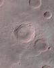
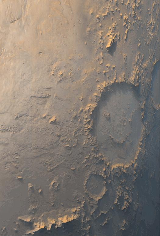
PIA01676:
-
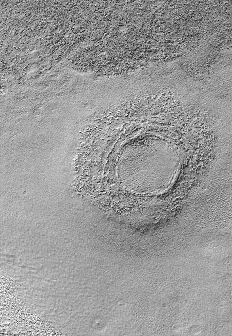
"Happy Face" Crater Greets MGS at the Start of the Mapping
Full Resolution:
TIFF
(1.089 MB)
JPEG
(54.33 kB)
|
|
|
2000-09-16 |
Mars
|
Mars Global Surveyor (MGS)
|
Mars Orbiter Camera (MOC)
|
1024x768x1 |
|
-
PIA01677:
-
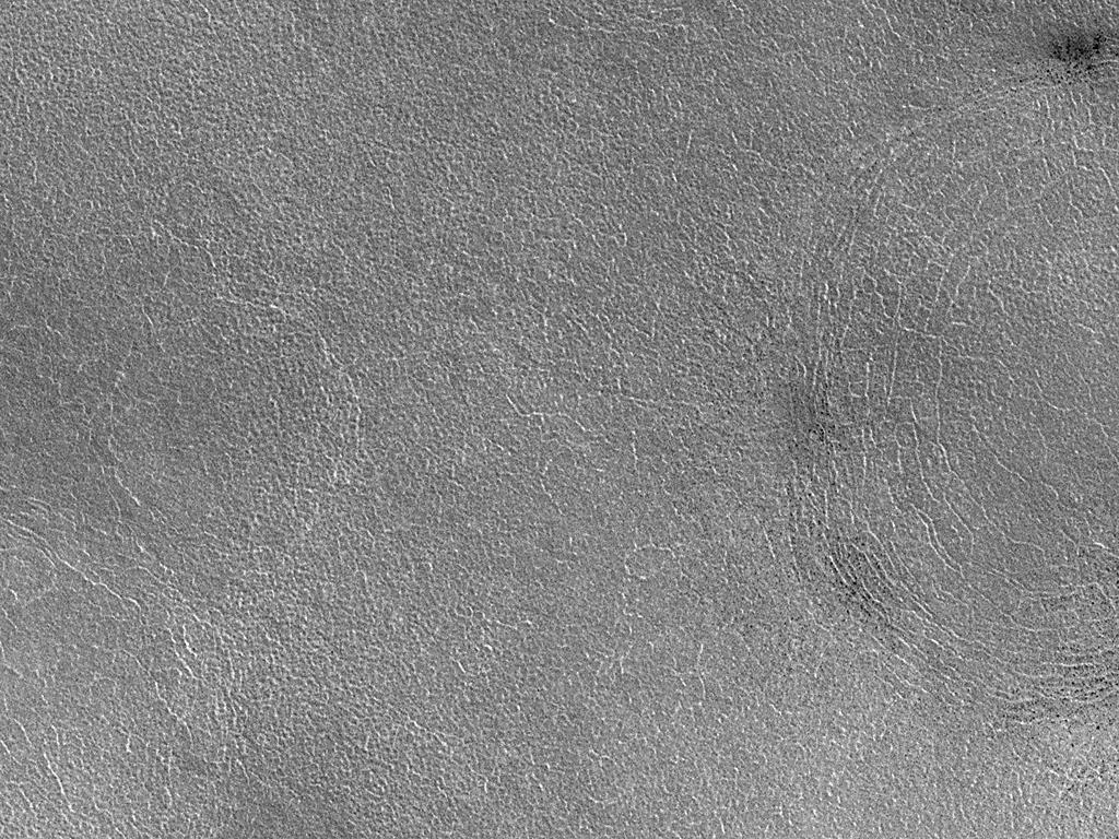
High Resolution View of Northern Plains Surface
Full Resolution:
TIFF
(874.7 kB)
JPEG
(248.3 kB)
|
|
|
2000-09-16 |
Mars
|
Mars Global Surveyor (MGS)
|
Mars Orbiter Camera (MOC)
|
990x1540x1 |
|
-
PIA01678:
-
Craters and Bright Dunes of Isidis Planitia
Full Resolution:
TIFF
(1.365 MB)
JPEG
(274.1 kB)
|
|
|
2000-09-18 |
Mars
|
Mars Global Surveyor (MGS)
|
Mars Orbiter Camera (MOC)
|
669x1254x1 |
|
-
PIA01679:
-
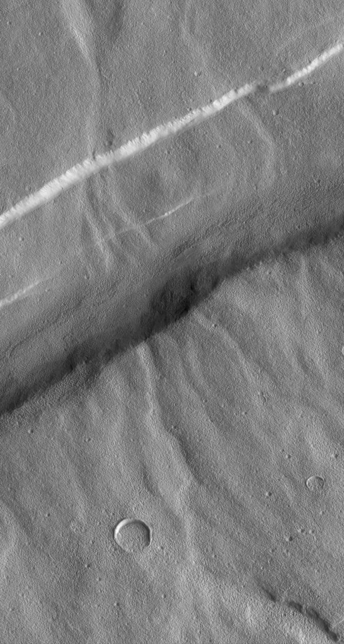
Valleys on Northwest Flank of Alba Patera Volcano
Full Resolution:
TIFF
(824.4 kB)
JPEG
(171 kB)
|
|
|
2000-09-16 |
Mars
|
Mars Global Surveyor (MGS)
|
Mars Orbiter Camera (MOC)
|
1323x1975x1 |

|
-
PIA01680:
-
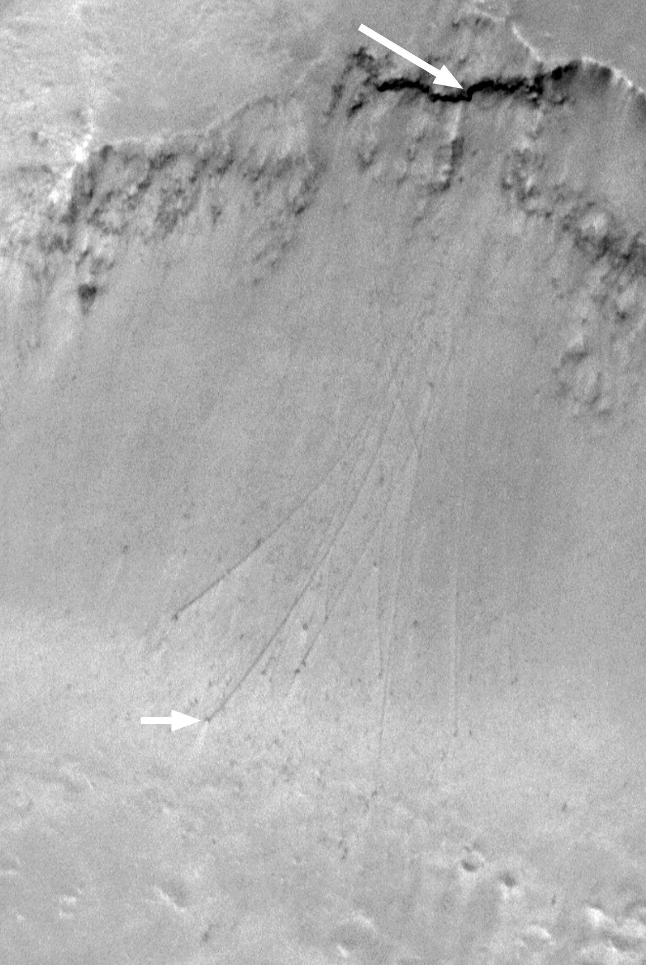
Boulder Tracks on Schiaparelli Basin South Wall
Full Resolution:
TIFF
(1.978 MB)
JPEG
(321.9 kB)
|
|
|
2000-09-16 |
Mars
|
Mars Global Surveyor (MGS)
|
Mars Orbiter Camera (MOC)
|
928x609x1 |
|
-
PIA01681:
-
Eroded Layered Material in Southwest Utopia Planitia
Full Resolution:
TIFF
(381.5 kB)
JPEG
(62.5 kB)
|
|
|
2000-09-18 |
Mars
|
Mars Global Surveyor (MGS)
|
Mars Orbiter Camera (MOC)
|
1204x650x1 |
|
-
PIA01682:
-
Layers in Cratered Highland Crust Exposed by Tagus Vallis
Full Resolution:
TIFF
(631 kB)
JPEG
(92.22 kB)
|
|
|
2000-09-18 |
Mars
|
Mars Global Surveyor (MGS)
|
Mars Orbiter Camera (MOC)
|
720x944x1 |

|
-
PIA01683:
-
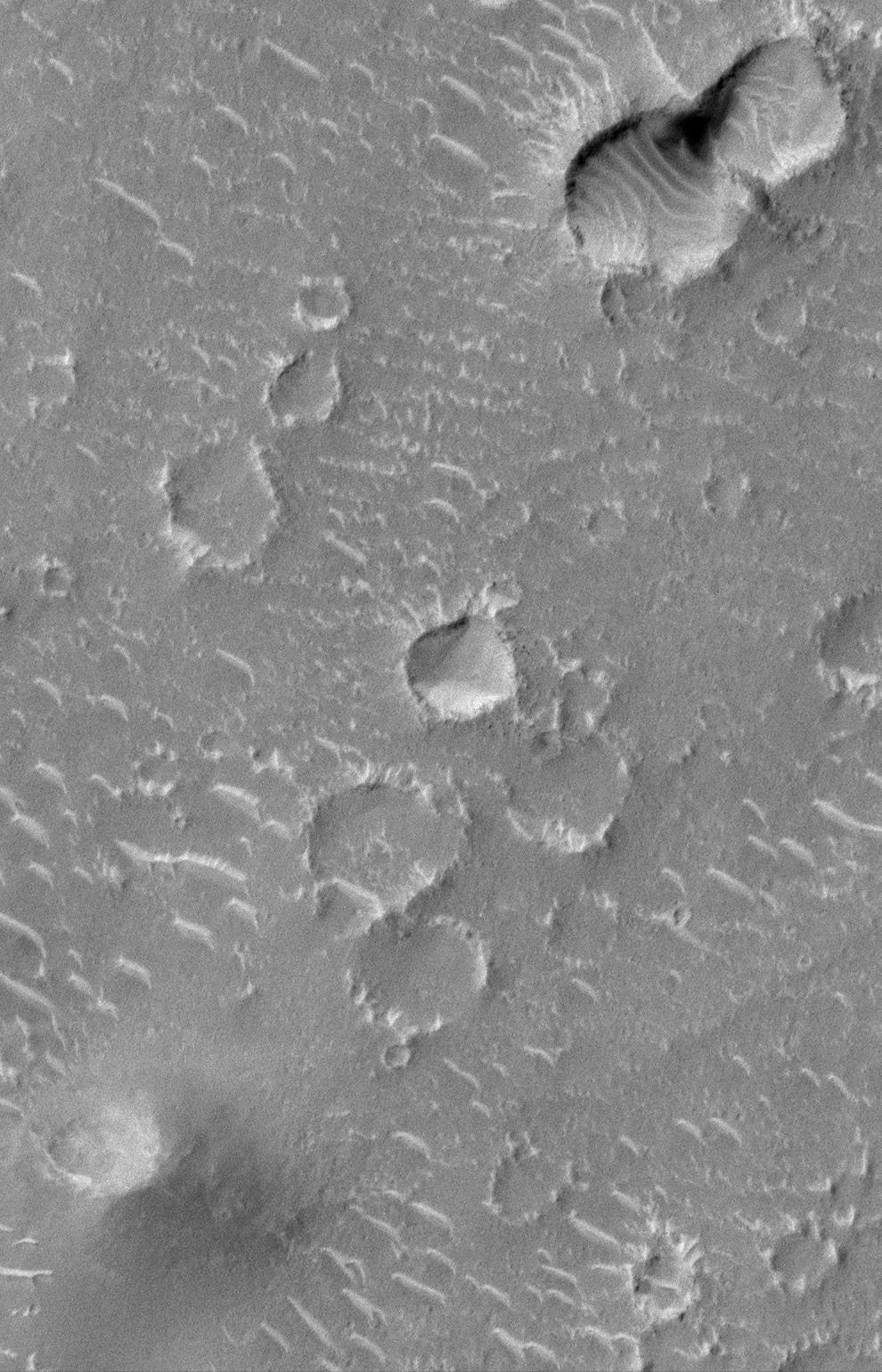
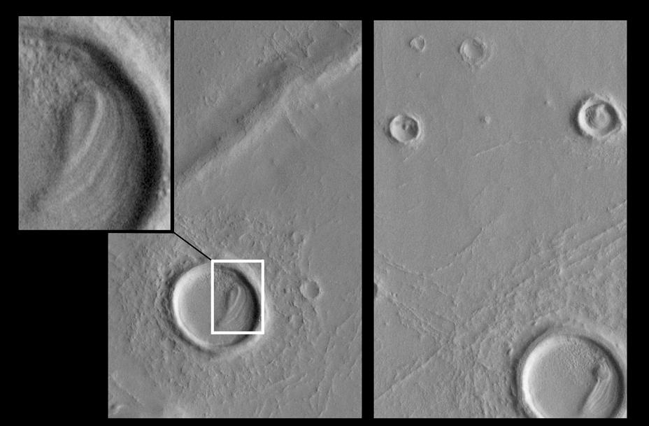
Small Impact Craters with Dark Ejecta Deposits
Full Resolution:
TIFF
(674.7 kB)
JPEG
(150.9 kB)
|
|
|
2000-09-16 |
Mars
|
Mars Global Surveyor (MGS)
|
Mars Orbiter Camera (MOC)
|
837x762x1 |
|
-
PIA01684:
-
Hot Dog and Butterfly, Nereidum Montes
Full Resolution:
TIFF
(465.4 kB)
JPEG
(97.42 kB)
|
|
|
2000-09-16 |
Mars
|
Mars Global Surveyor (MGS)
|
Mars Orbiter Camera (MOC)
|
1001x1454x1 |
|
-
PIA01685:
-
Mariner 4 Meets Mars Global Surveyor -- Mariner Crater 1965 and 1999
Full Resolution:
TIFF
(1.4 MB)
JPEG
(227.6 kB)
|
|
|
2000-06-17 |
Mars
|
Mars Global Surveyor (MGS)
|
Mars Orbiter Camera (MOC)
|
659x740x1 |
|
-
PIA01686:
-
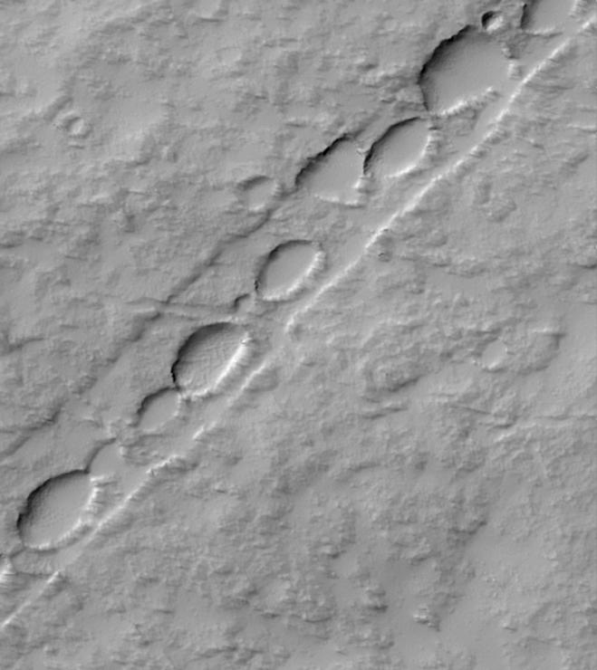
Chain of Pits on Pavonis Mons
Full Resolution:
TIFF
(344.8 kB)
JPEG
(52.37 kB)
|
|
|
2000-06-17 |
Mars
|
Mars Global Surveyor (MGS)
|
Mars Orbiter Camera (MOC)
|
806x1168x1 |
|
-
PIA01687:
-
Floor of Alexey Tolstoy Crater
Full Resolution:
TIFF
(954.1 kB)
JPEG
(213.9 kB)
|
|
|
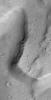
2000-06-17 |
Mars
|
Mars Global Surveyor (MGS)
|
Mars Orbiter Camera (MOC)
|
914x1282x1 |
|
-
PIA01688:
-
Patches of Remnant Frost/Snow on Crater Rim in Northern Summer
Full Resolution:
TIFF
(725.4 kB)
JPEG
(103.4 kB)
|
|
|
2000-06-17 |
Mars
|
Mars Global Surveyor (MGS)
|
Mars Orbiter Camera (MOC)
|
850x1387x1 |
|
-
PIA01689:
-
Valleys and Lava Flows near Olympus Mons
Full Resolution:
TIFF
(1.057 MB)
JPEG
(177.5 kB)
|
|
|
1999-03-29 |
Mars
|
Mars Global Surveyor (MGS)
|
Mars Orbiter Camera (MOC)
|
1006x1240x1 |
|
-
PIA01690:
-
Wind Streaks on Daedalia Planum
Full Resolution:
TIFF
(1.067 MB)
JPEG
(161.6 kB)
|
|
|
2000-06-17 |
Mars
|
Mars Global Surveyor (MGS)
|
Mars Orbiter Camera (MOC)
|
836x1196x1 |
|
-
PIA01691:
-
Melas Chasma Floor
Full Resolution:
TIFF
(885.3 kB)
JPEG
(136.5 kB)
|
|
|
2000-06-17 |
Mars
|
Mars Global Surveyor (MGS)
|
Mars Orbiter Camera (MOC)
|
802x2137x3 |
|
-
PIA01692:
-
Western Melas and Candor Chasms, Valles Marineris
Full Resolution:
TIFF
(4.175 MB)
JPEG
(210 kB)
|
|
|
2000-06-17 |
Mars
|
Mars Global Surveyor (MGS)
|
Mars Orbiter Camera (MOC)
|
836x1115x1 |
|
-
PIA01693:
-
Margin of Lava Flow in Daedalia Planum
Full Resolution:
TIFF
(715.5 kB)
JPEG
(116.4 kB)
|
|
|
2000-06-17 |
Mars
|
Mars Global Surveyor (MGS)
|
Mars Orbiter Camera (MOC)
|
1024x1025x1 |
|
-
PIA01694:
-
Ripples on Cratered Terrain North of Hesperia Planum
Full Resolution:
TIFF
(955.1 kB)
JPEG
(180.5 kB)
|
|
|
2000-06-17 |
Mars
|
Mars Global Surveyor (MGS)
|
Mars Orbiter Camera (MOC)
|
512x2392x1 |
|
-
PIA01695:
-
Martian Variety Exhibited by the Olympica Fossae
Full Resolution:
TIFF
(1.288 MB)
JPEG
(218.2 kB)
|
|
|
2000-06-17 |
Mars
|
Mars Global Surveyor (MGS)
|
Mars Orbiter Camera (MOC)
|
819x1993x1 |
|
-
PIA01696:
-
East Tithonium Chasma Wall, Valles Marineris
Full Resolution:
TIFF
(1.32 MB)
JPEG
(222.8 kB)
|
|
|
2000-06-14 |
Mars
|
Mars Global Surveyor (MGS)
|
Mars Orbiter Camera (MOC)
|
724x1926x1 |
|
-
PIA01697:
-
Northern Plains Textures Visible Near the Terminator
Full Resolution:
TIFF
(1.286 MB)
JPEG
(375.6 kB)
|
|
|
2000-06-14 |
Mars
|
Mars Global Surveyor (MGS)
|
Mars Orbiter Camera (MOC)
|
540x954x1 |
|
-
PIA01698:
-
Pedestal Craters and Wind Streaks, South Medusae Fossae
Full Resolution:
TIFF
(458.7 kB)
JPEG
(84.24 kB)
|
|
|
2000-06-14 |
Mars
|
Mars Global Surveyor (MGS)
|
Mars Orbiter Camera (MOC)
|
836x1057x1 |
|
-
PIA01699:
-
A Complex, Ridged Terrain in North Terra Cimmeria
Full Resolution:
TIFF
(612 kB)
JPEG
(96.2 kB)
|
|
|
2000-06-14 |
Mars
|
Mars Global Surveyor (MGS)
|
Mars Orbiter Camera (MOC)
|
910x910x3 |
|
-
PIA02000:
-
Acidalia and Chryse Plains, Mars
Full Resolution:
TIFF
(1.02 MB)
JPEG
(32.77 kB)
|
|
|
2000-06-14 |
Mars
|
Mars Global Surveyor (MGS)
|
Mars Orbiter Camera (MOC)
|
965x824x1 |

|
-
PIA02001:
-
Polar Dunes In Summer Exhibit Frost Patches, Wind Streaks
Full Resolution:
TIFF
(631.3 kB)
JPEG
(82.96 kB)
|
|
|
2000-06-14 |
Mars
|
Mars Global Surveyor (MGS)
|
Mars Orbiter Camera (MOC)
|
1024x772x1 |
|
-
PIA02002:
-
Layers of Cratered Highland Bedrock Exposed in Amenthes Slope
Full Resolution:
TIFF
(679.6 kB)
JPEG
(129.8 kB)
|
|
|
2000-06-14 |
Mars
|
Mars Global Surveyor (MGS)
|
Mars Orbiter Camera (MOC)
|
863x827x1 |
|
-
PIA02003:
-
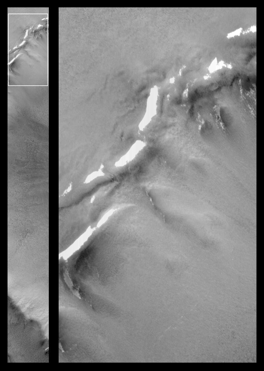
On the Edge: The Retreating Mars Polar Ice Cap
Full Resolution:
TIFF
(701.8 kB)
JPEG
(146.4 kB)
|
|
|
2000-06-14 |
Mars
|
Mars Global Surveyor (MGS)
|
Mars Orbiter Camera (MOC)
|
910x910x3 |
|
-
PIA02004:
-
Syrtis Major and Arabia Terra, Mars
Full Resolution:
TIFF
(909.1 kB)
JPEG
(32.2 kB)
|
|
|
2000-06-14 |
Mars
|
Mars Global Surveyor (MGS)
|
Mars Orbiter Camera (MOC)
|
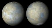
910x910x3 |
|
-
PIA02005:
-
Tharsis Volcanoes and Valles Marineris, Mars
Full Resolution:
TIFF
(977.4 kB)
JPEG
(31.85 kB)
|
|
|
2000-06-14 |
Mars
|
Mars Global Surveyor (MGS)
|
Mars Orbiter Camera (MOC)
|
429x669x3 |
|
-
PIA02006:
-
Apollinaris Patera, Mars
Full Resolution:
TIFF
(954.3 kB)
JPEG
(66.37 kB)
|
|
|
2000-06-14 |
Mars
|
Mars Global Surveyor (MGS)
|
Mars Orbiter Camera (MOC)
|
836x1683x1 |
|
-
PIA02007:
-
Once Pitted, Twice Spied: A New High Resolution View Inside Escalante Crater
Full Resolution:
TIFF
(1.337 MB)
JPEG
(235.6 kB)
|
|
|
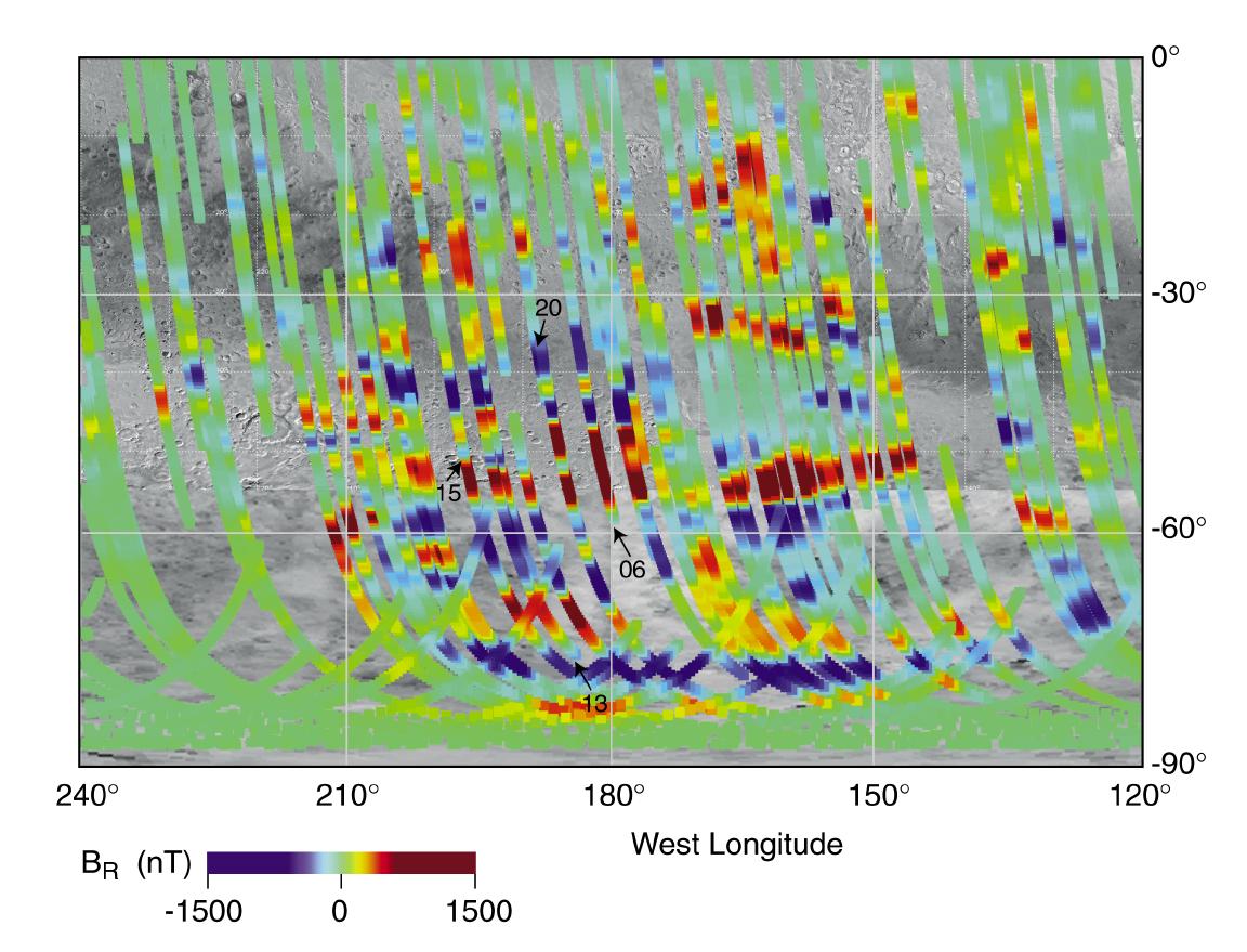
1999-05-03 |
Mars
|
Mars Global Surveyor (MGS)
|
Magnetometer
|
1152x879x3 |
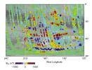
|
-
PIA02008:
-
Magnetic Strips Preserve Record of Ancient Mars
Full Resolution:
TIFF
(1.369 MB)
JPEG
(147.9 kB)
|
|
|
2000-06-14 |
Mars
|
Mars Global Surveyor (MGS)
|
Mars Orbiter Camera (MOC)
|
614x1013x1 |

|
-
PIA02011:
-
Look Out Below! Rough Terrain In the Warrego Valles Region
Full Resolution:
TIFF
(631 kB)
JPEG
(161.9 kB)
|
|
|
1999-05-04 |
Mars
|
Mars Global Surveyor (MGS)
|
Mars Orbiter Camera (MOC)
|
672x1330x1 |
|
-
PIA02012:
-
Lower Northeastern Flank of Tyrrhena Patera
Full Resolution:
TIFF
(903.5 kB)
JPEG
(153.2 kB)
|
|
|
1999-05-06 |
Mars
|
Mars Global Surveyor (MGS)
|
Thermal Emission Spectrometer
|
2362x1667x3 |
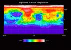
|
-
PIA02014:
-
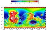
Temperature of the Martian Surface
Full Resolution:
TIFF
(1.195 MB)
JPEG
(434.8 kB)
|
|
|
1999-05-06 |
Mars
|
Mars Global Surveyor (MGS)
|
Thermal Emission Spectrometer
|
300x300x3 |
|
-
PIA02015:
-
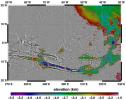
Martian Temperatures Measured by the Thermal Emission Spectrometer (TES). Pathfinder Landing Aite View
Full Resolution:
TIFF
(32.88 kB)
JPEG
(23.63 kB)
|
|
|
1999-05-06 |
Mars
|
Mars Global Surveyor (MGS)
|
Thermal Emission Spectrometer
|
300x300x3 |
|
-
PIA02016:
-
Martian Temperatures Measured by the Thermal Emission Spectrometer (TES). Isidis Planitia View
Full Resolution:
TIFF
(30.37 kB)
JPEG
(23.21 kB)
|
|
|
2000-06-14 |
Mars
|
Mars Global Surveyor (MGS)
|
Mars Orbiter Camera (MOC)
|
512x2113x1 |

|
-
PIA02017:
-
MOC "Looking Into" Martian Craters
Full Resolution:
TIFF
(841.4 kB)
JPEG
(113.2 kB)
|
|
|
2000-06-14 |
Mars
|
Mars Global Surveyor (MGS)
|
Mars Orbiter Camera (MOC)
|
512x2115x1 |
|
-
PIA02018:
-
MOC "Looking Into" Martian Craters
Full Resolution:
TIFF
(811.8 kB)
JPEG
(109.5 kB)
|
|
|
2000-06-14 |
Mars
|
Mars Global Surveyor (MGS)
|
Mars Orbiter Camera (MOC)
|
512x2115x1 |
|
-
PIA02019:
-
MOC "Looking Into" Martian Craters
Full Resolution:
TIFF
(835.5 kB)
JPEG
(145 kB)
|
|
|
2000-06-14 |
Mars
|
Mars Global Surveyor (MGS)
|
Mars Orbiter Camera (MOC)
|
233x449x1 |
|
-
PIA02020:
-
South Melea Planum, By The Dawn's Early Light
Full Resolution:
TIFF
(79.2 kB)
JPEG
(17.16 kB)
|
|
|
2000-06-14 |
Mars
|
Mars Global Surveyor (MGS)
|
Mars Orbiter Camera (MOC)
|
233x449x1 |
|
-
PIA02021:
-
South Melea Planum, By The Dawn's Early Light
Full Resolution:
TIFF
(60.38 kB)
JPEG
(9.541 kB)
|
|
|
1999-05-17 |
Mars
|
Mars Global Surveyor (MGS)
|
Mars Orbiter Camera (MOC)
|
1024x980x1 |
|
-
PIA02022:
-
The Geodesy Campaign
Full Resolution:
TIFF
(454.5 kB)
JPEG
(199 kB)
|
|
|
1999-05-17 |
Mars
|
Mars Global Surveyor (MGS)
|
Mars Orbiter Camera (MOC)
|
685x856x3 |
|
-
PIA02023:
-
The Geodesy Campaign
Full Resolution:
TIFF
(1.522 MB)
JPEG
(68.92 kB)
|
|
|
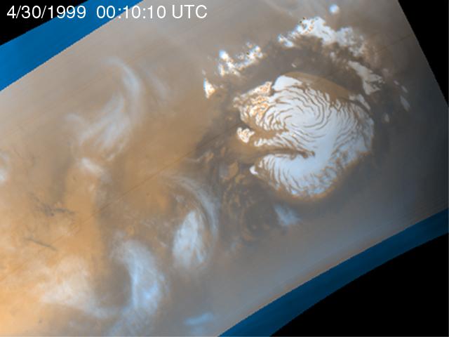
1999-05-20 |
Mars
|
Mars Global Surveyor (MGS)
|
Mars Orbiter Camera (MOC)
|
640x480x3 |

|
-
PIA02024:
-
Martian Storm 04/30/99
Full Resolution:
TIFF
(732.2 kB)
JPEG
(27.26 kB)
|
|
|
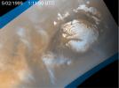
1999-05-20 |
Mars
|
Mars Global Surveyor (MGS)
|
Mars Orbiter Camera (MOC)
|
640x480x3 |
|
-
PIA02025:
-
Martian Storm 05/01/99
Full Resolution:
TIFF
(710.3 kB)
JPEG
(25.55 kB)
|
|
|
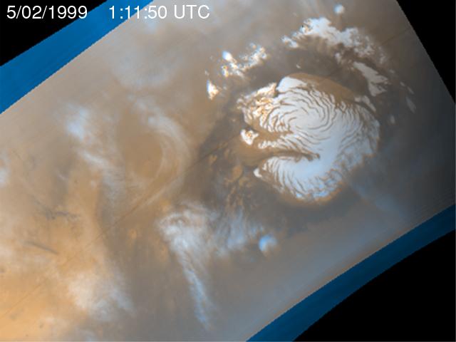
1999-05-20 |
Mars
|
Mars Global Surveyor (MGS)
|
Mars Orbiter Camera (MOC)
|
640x480x3 |
|
-
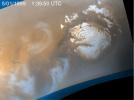
PIA02026:
-
Martian Storm 05/02/99
Full Resolution:
TIFF
(726.7 kB)
JPEG
(27.11 kB)
|
|
|
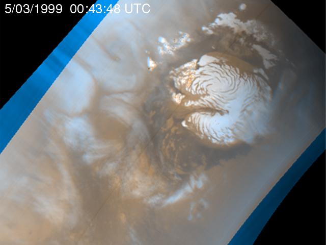
1999-05-20 |
Mars
|
Mars Global Surveyor (MGS)
|
Mars Orbiter Camera (MOC)
|
640x480x3 |
|
-
PIA02027:
-
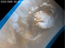
Martian Storm 05/03/99
Full Resolution:
TIFF
(733.7 kB)
JPEG
(27.93 kB)
|
|
|
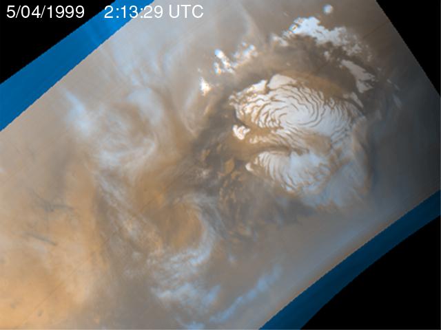
1999-05-20 |
Mars
|
Mars Global Surveyor (MGS)
|
Mars Orbiter Camera (MOC)
|
640x480x3 |

|
-
PIA02028:
-
Martian Storm 05/04/99
Full Resolution:
TIFF
(741.8 kB)
JPEG
(27.8 kB)
|
|
|
1999-05-26 |
Mars
|
Mars Global Surveyor (MGS)
|
Mars Orbiter Camera (MOC)
|
400x400x3 |
|
-
PIA02029:
-
Clouds in North Polar Region Tracked by MOC Over Five Day Period

Full Resolution:
|
|
|
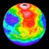
1999-05-27 |
Mars
|
Mars Global Surveyor (MGS)
|
MOLA
|
2497x2221x3 |
|
-
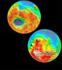
PIA02031:
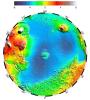
-
Maps of Mars Global Topography
Full Resolution:
TIFF
(11.74 MB)
JPEG
(1.145 MB)
|
|
|
1999-05-27 |
Mars
|
Mars Global Surveyor (MGS)
|
MOLA
|
1909x2353x3 |
|
-
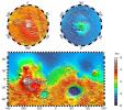
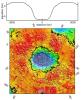
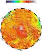
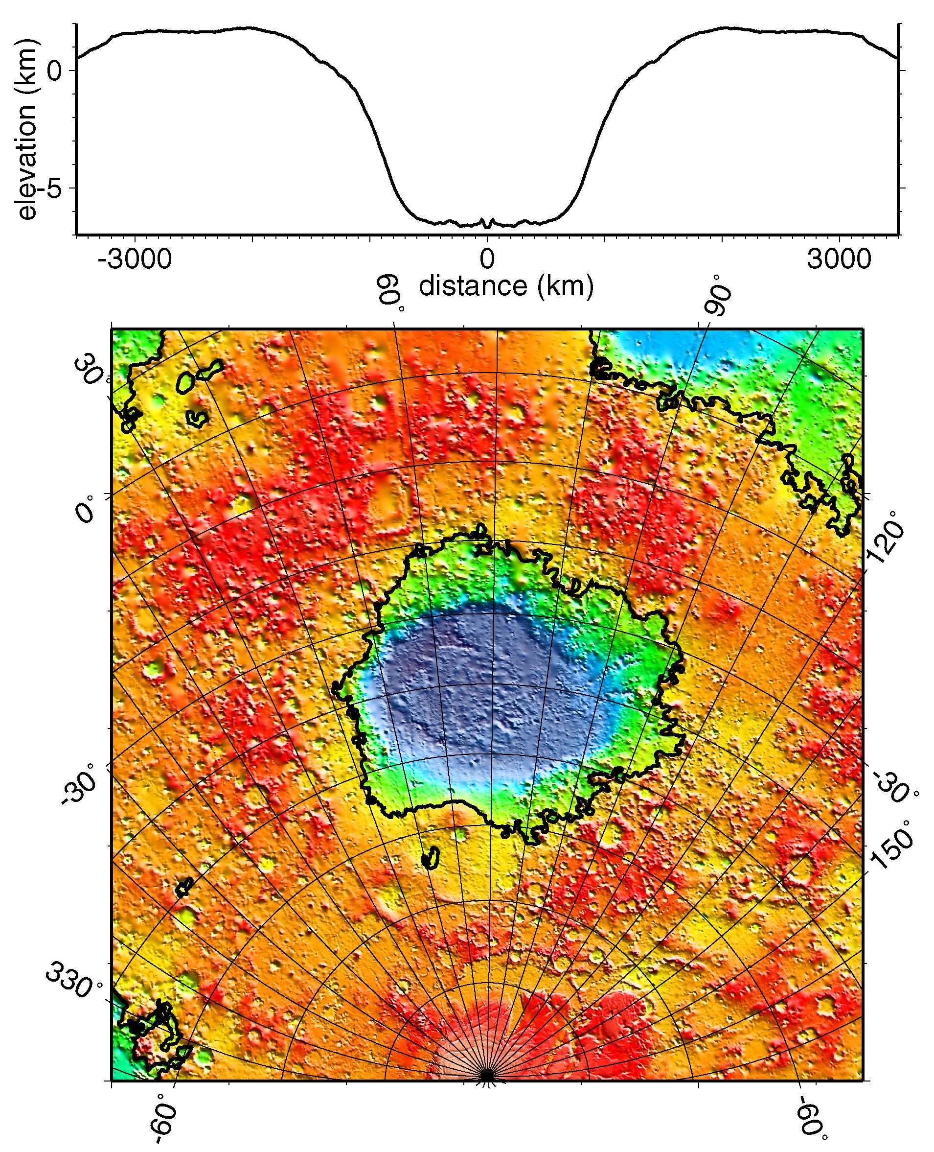
PIA02033:
-
Regional Topographic Model of the Hellas Basin
Full Resolution:
TIFF
(8.461 MB)
JPEG
(901.7 kB)
|
|
|
1999-05-27 |
Mars
|
Mars Global Surveyor (MGS)
|
MOLA
|
2761x1759x3 |
|
-
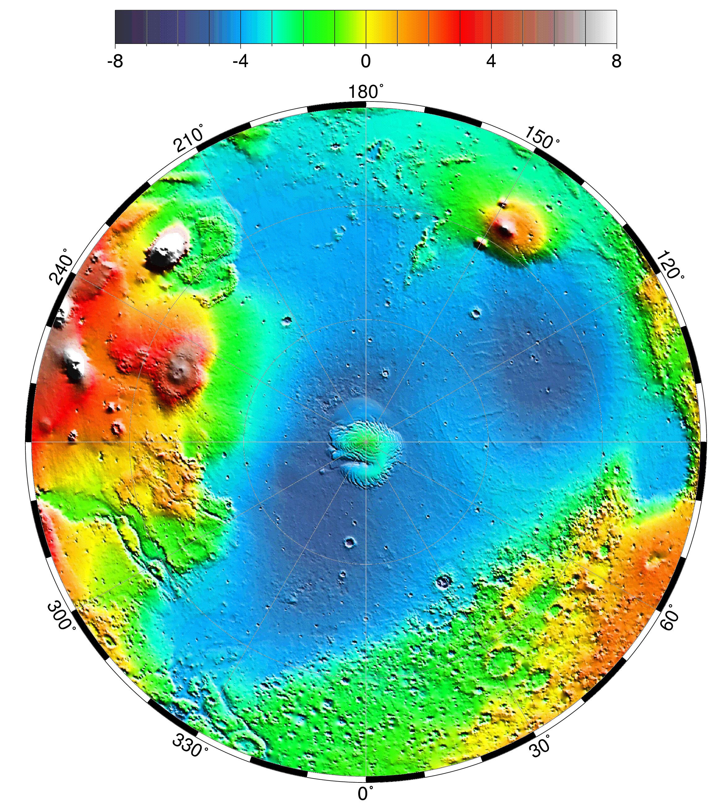
PIA02035:
-
Map of Mars' Topography
Full Resolution:
TIFF
(10.08 MB)
JPEG
(1.115 MB)
|
|
|
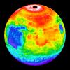
1999-05-27 |
Mars
|
Mars Global Surveyor (MGS)
|
MOLA
|
2335x2617x3 |
|
-
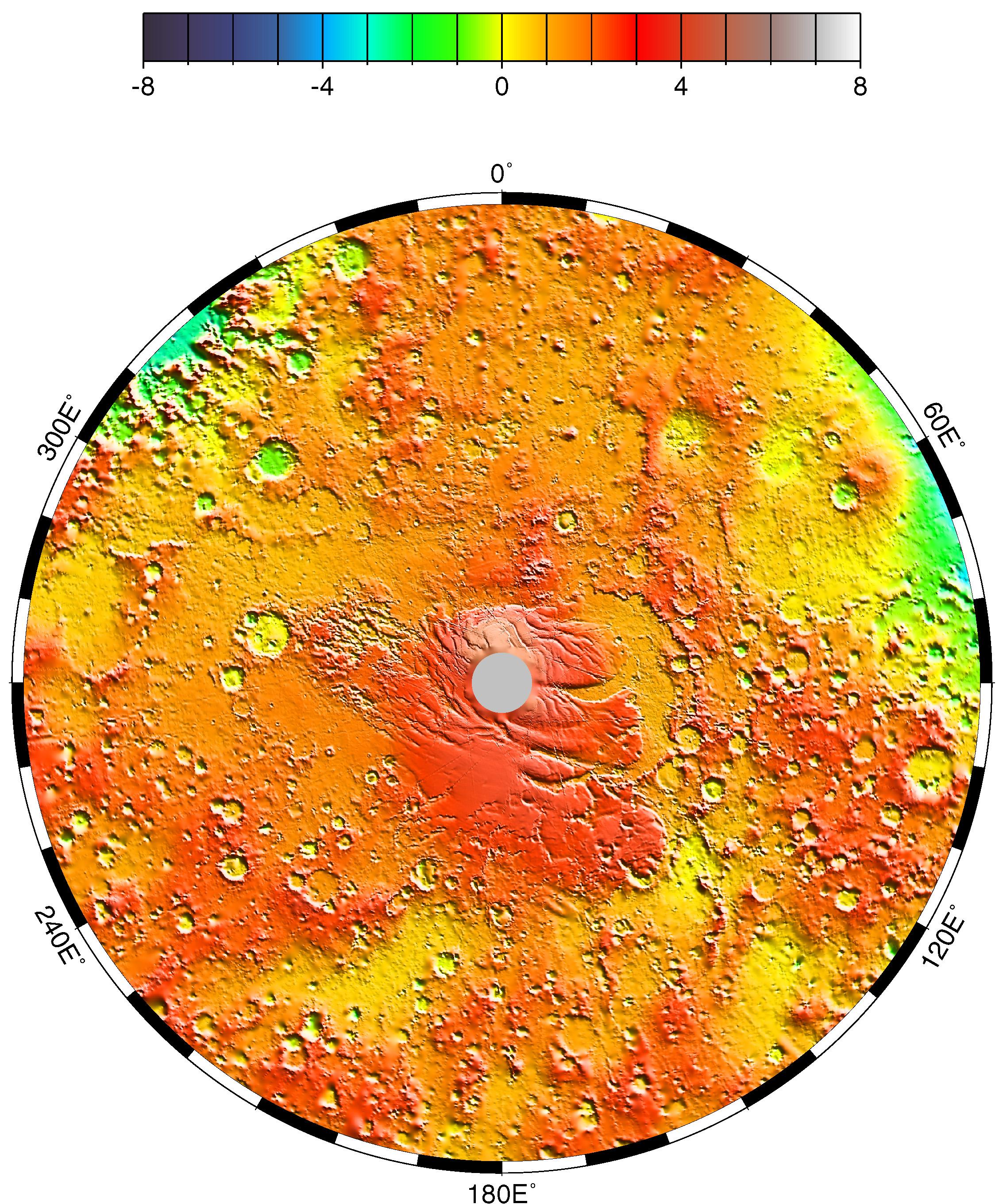
PIA02036:
-
Lambert Equal-Area Projection of Pole-to-Equator
Full Resolution:
TIFF
(12.39 MB)
JPEG
(1.28 MB)
|
|
|
1999-05-27 |
Mars
|
Mars Global Surveyor (MGS)
|
MOLA
|
2257x2719x3 |
|
-
PIA02037:
-
Polar Stereographic Projection
Full Resolution:
TIFF
(13.35 MB)
JPEG
(1.042 MB)
|
|
|
1999-05-27 |
Mars
|
Mars Global Surveyor (MGS)
|
MOLA
|
2545x2023x3 |
|
-
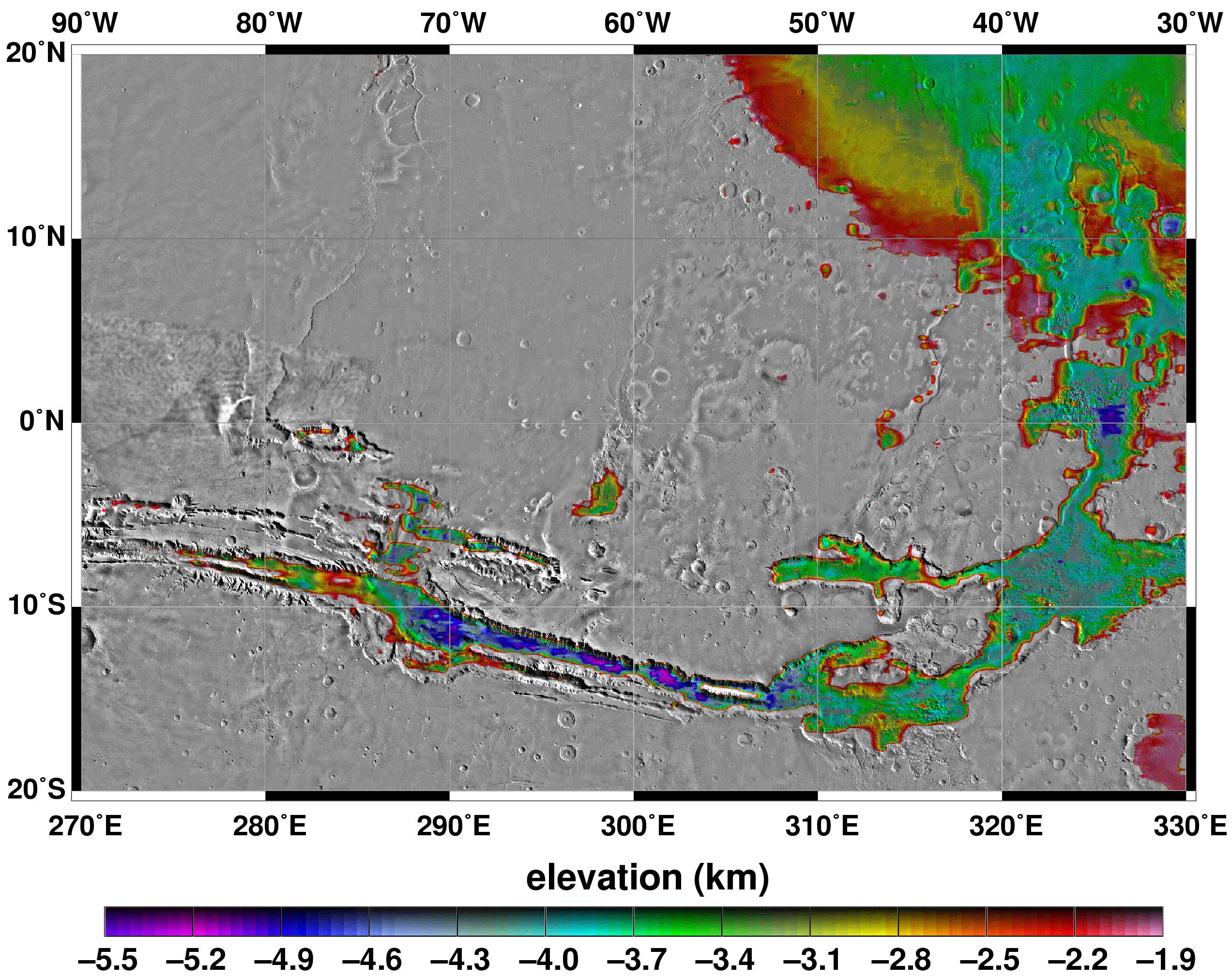
PIA02039:
-
Elevations Within the Floor of the Valles Marineris
Full Resolution:
TIFF
(7.378 MB)
JPEG
(1.035 MB)
|
|
|
1999-05-27 |
Mars
|
Mars Global Surveyor (MGS)
|
MOLA
|
2700x3075x3 |
|
-
PIA02040:
-
Science Magazine Cover Image
Full Resolution:
TIFF
(12.35 MB)
JPEG
(948.9 kB)
|
|
|
2000-06-07 |
Mars
|
Mars Global Surveyor (MGS)
|
Mars Orbiter Camera (MOC)
|
502x2347x1 |
|
-
PIA02043:
-
Eroded, Layered Cratered Highlands of Eastern Arabia Terra
Full Resolution:
TIFF
(1.162 MB)
JPEG
(210.9 kB)
|
|
|
2000-06-07 |
Mars
|
Mars Global Surveyor (MGS)
|
Mars Orbiter Camera (MOC)
|
781x1677x3 |
|
-
PIA02045:
-
May 1999 Dust Storm in Valles Marineris
Full Resolution:
TIFF
(2.463 MB)
JPEG
(93.21 kB)
|


