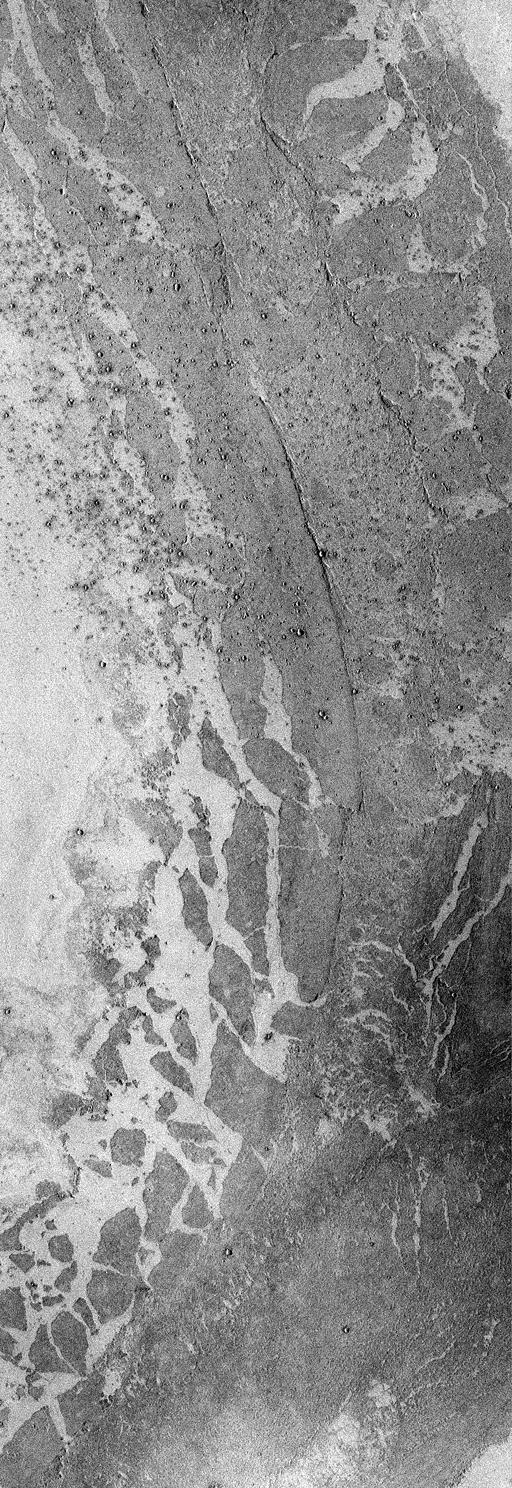
The Mars Global Surveyor (MGS) Mars Orbiter Camera (MOC) in 1998 confirmed that a vast region of Mars south of the Elysium volcanoes is covered by a relatively young lava surface that was very fluid when it erupted--so fluid that it ran more than a thousand kilometers (more than 600 miles) across a region known as the Elysium Basin and a channel named Marte Vallis. This result was initially reported by MOC scientists in October 1998 (CLICK HERE for the previous Elysium Basin release). The picture above expands upon these results.
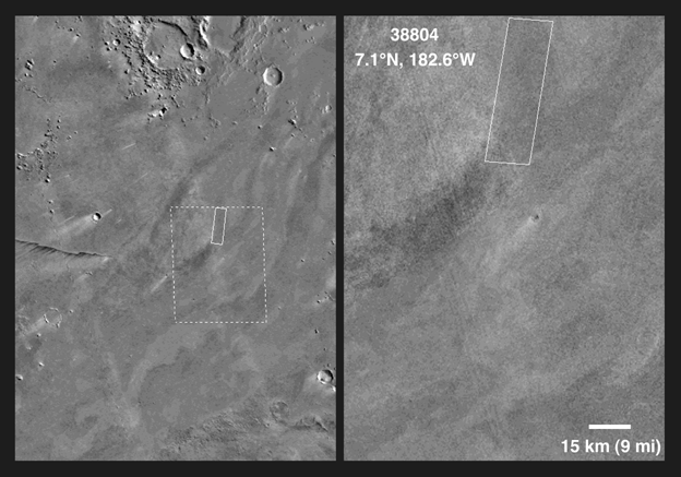
MOC image 38804 (above) shows a portion of Marte Vallis. Marte Vallis has been thought by some to have been carved by a giant water flood. However, the picture shown here does not have any flood features. If there ever was a water flood, all of the evidence in this particular location (at 7.1°N latitude and 182.7°W longitude; CLICK HERE for a context image) has been covered-up by a vast lava flow. When it was forming, the lava flowed from the lower left, toward the center right, then curved to the left and flowed toward the top-center of the frame.
The center of the lava flow in image 38804 has a wide, shallow channel bounded by steep, discontinuous walls--also known as levees. Such leveed channels are commonly the conduit through which some of the later stages of molten rock are transported along a lava flow. The margins of the lava flow are broken into plates--some of them several kilometers across. These plates were once part of a hard, rock crust that floated on molten lava. As the lava flowed down Marte Vallis, huge chunks of this crust broke off at the margins of the flow and floated a few kilometers away from where they had originated. Long after the lava had cooled and hardened, a distant meteorite impact splashed ejecta across the martian surface such that a field of small craters--known as secondary craters--formed on top of the lava flow shown here.
MOC image 38804 was taken on June 25, 1998. This subframe shows an area 15.8 km by 45.8 km (9.8 miles by 28.5 miles) in size. The image here has a resolution of about 31 meters (101 feet) per pixel. North is approximately up, illumination is from the right.
Malin Space Science Systems and the California Institute of Technology built the MOC using spare hardware from the Mars Observer mission. MSSS operates the camera from its facilities in San Diego, CA. The Jet Propulsion Laboratory's Mars Surveyor Operations Project operates the Mars Global Surveyor spacecraft with its industrial partner, Lockheed Martin Astronautics, from facilities in Pasadena, CA and Denver, CO.
 Planetary Data System


