- Original Caption Released with Image:
-
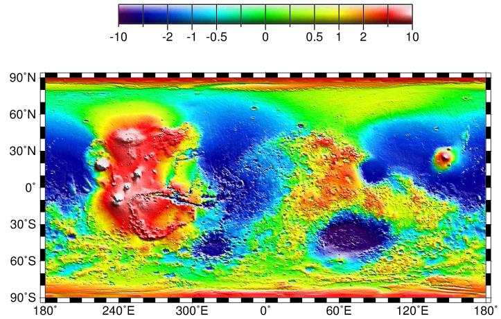
Map of Mars' topography with zonal spherical harmonic degree 1 (COM/COF offset along the polar z-axis) removed. The projection is rectangular to show topography from pole to pole. Note the general similarity in elevation between the northern and southern hemispheres. The figure highlights the two other significant components of martian topography: the Tharsis province and the Hellas impact basin. Here we have not removed shorter-wavelength topographic features, including those comprising the dichotomy boundary scarp.
- Image Credit:
-
NASA/JPL/GSFC
Image Addition Date: -
1999-05-27
|