 Click here to see a higher resolution version of MOC2_129a and MOC2_129b
Mars Orbiter Camera (MOC) narrow angle images provide high resolution views of the Martian surface that rival the quality of aerial photographs used to study the geology of Earth. Over the past year and a half, MOC images have helped to highlight the fact that much of the almost Moon-like heavily cratered terrains of Mars consist of layered materials.
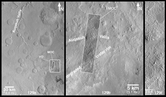
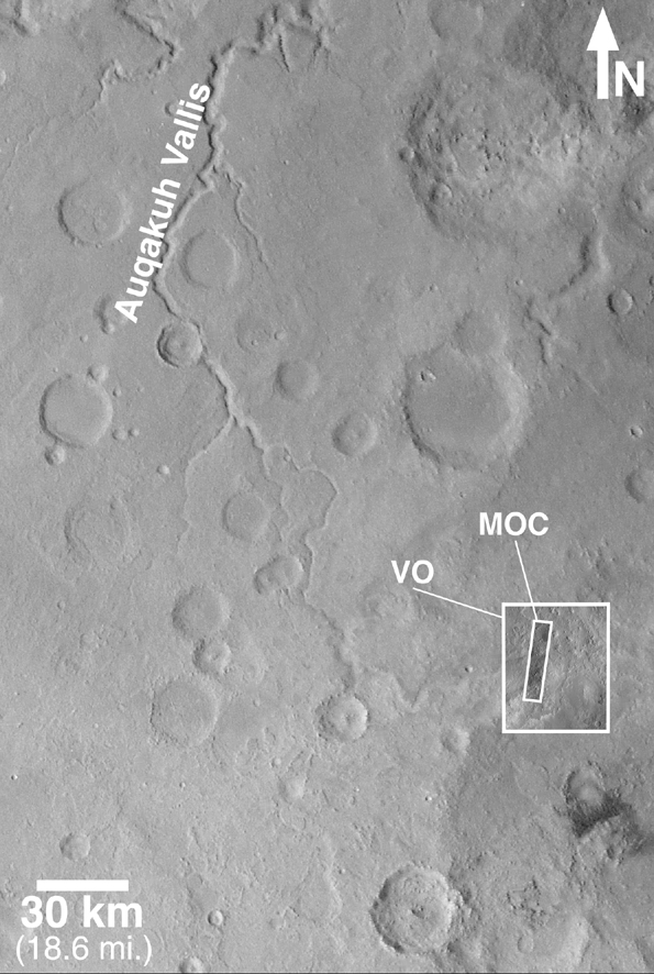
Eastern Arabia Terra is a region that was known from the Viking orbiter missions(1976-1980) to show vast tracts of eroded terrain. The image on the left, above, shows a regional view from Viking. Eastern Arabia is distinct for its rough-textured cratered terrain, and for the presence of the ancient, perhaps water-carved valley, Auqakuh Vallis. The center image (above) includes a high-resolution view from the Viking 1 orbiter, with a more recent image from the Mars Global Surveyor (MGS) MOC shown as an inset.
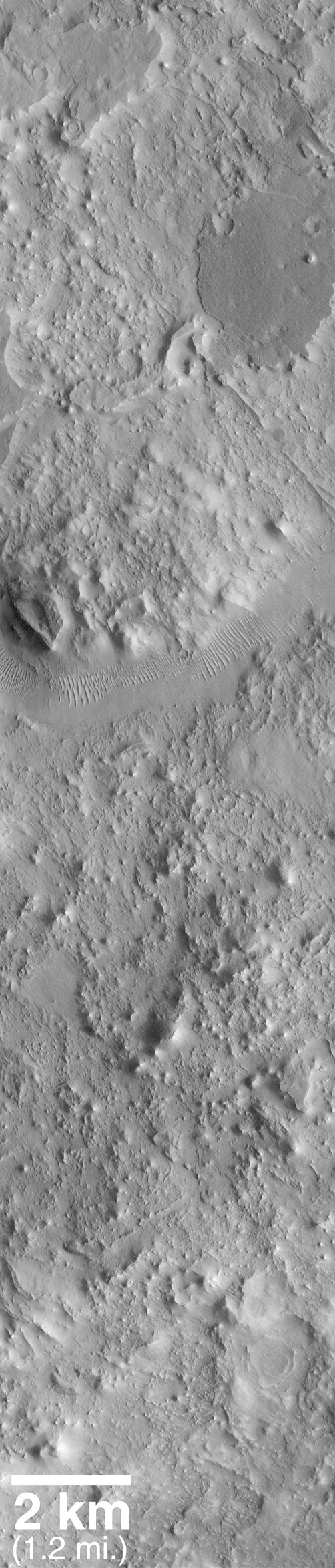
The third image (above, right) is a MOC high resolution view that shows a portion of the ancient Auqakuh Vallis (just above center) and many eroded remnants of the ancient cratered terrain. The MOC image reveals dunes on the floor of Auqakuh Vallis, and shows a plethora of small, straight and curved ridges running across the terrain. The geological term for these ridges is "dike." Dikes most commonly form on Earth in volcanic terrain, when molten rock (magma) is injected into a crack in the subsurface. The magma cools, hardens, and later erosion removes the surrounding rock to leave behind the more resistant volcanic rock as a ridge. Shiprock in the northwest corner of New Mexico, U.S.A., is an example of a place on Earth where dike ridges are found. This MOC image is one of many that are being examined by the MOC Science Team in order to decipher the ancient geological history of the red planet.
Malin Space Science Systems and the California Institute of Technology built the MOC using spare hardware from the Mars Observer mission. MSSS operates the camera from its facilities in San Diego, CA. The Jet Propulsion Laboratory's Mars Surveyor Operations Project operates the Mars Global Surveyor spacecraft with its industrial partner, Lockheed Martin Astronautics, from facilities in Pasadena, CA and Denver, CO.
