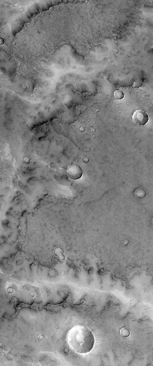
The ancient cratered terrains of Mars exhibit many branching valley "networks." These were first observed by Mariner 9 in 1972, and immediately they were considered to be evidence that Mars had liquid water running across its surface during its earliest years(i.e., about 4 billion years ago). The Mars Global Surveyor (MGS) Mars Orbiter Camera (MOC) took pictures of a number of valley networks in the martian heavily cratered terrains during late 1997 and early 1998. Seen at resolutions ranging from 2 to 30 meters (7 to 98 feet) per pixel, most of these valley networks are found to be so old that their floors are covered by dunes and their walls obscured by dust and debris. Because of this obscuration, many of the small features that could be used to determine the origin of these valleys are missing.
The MOC image 24106 subframe (above) shows a portion of a typical valley network system in central Terra Meridiani near the martian Equator and Prime Meridian. The surface into which the valley has formed has a low albedo (that is, it is dark) and exhibits many circular impact craters and pits. The valley appears brighter than its surroundings, owing to sand and dust deposits; bright sand can also be seen on the floors of craters. The outline of the valley wall shows attributes--for example, various protrusions and alcoves--that suggest the margin of a lava flow (which would be consistent with the dark surface). Crater-like rings within the valley adjacent to the wall are the resistant portions of impact craters that survived the retreat of the wall as the valley widened. This is evidence that processes of valley widening were relatively gentle, probably related to groundwater seeping from beneath a resistant cap of volcanic rock.
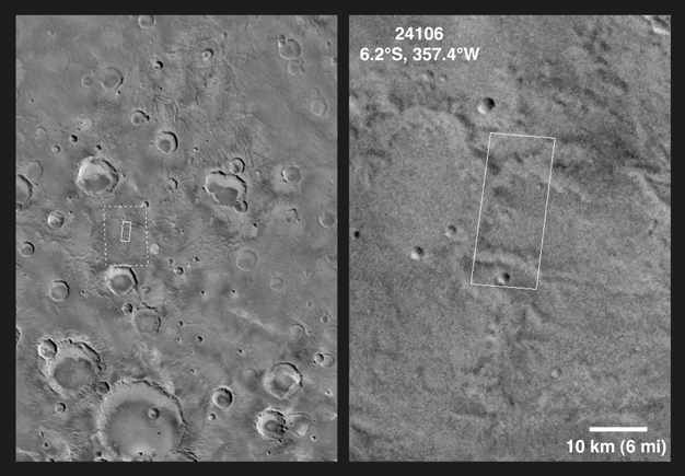
MOC image 24106 was taken on April 14, 1998. The subframe shown here covers an area 11.5 km by 27.4 km (7.1 miles by 17.0 miles) in size. The image as presented here has a resolution of about 22.4 meters (74 feet) per pixel. The subframe is centered at 6.2°S latitude and 357.4°W longitude. (CLICK HERE for a context image). North is approximately up, illumination is from the lower right.
Malin Space Science Systems and the California Institute of Technology built the MOC using spare hardware from the Mars Observer mission. MSSS operates the camera from its facilities in San Diego, CA. The Jet Propulsion Laboratory's Mars Surveyor Operations Project operates the Mars Global Surveyor spacecraft with its industrial partner, Lockheed Martin Astronautics, from facilities in Pasadena, CA and Denver, CO.
 Planetary Data System


