Click on an image for detailed information
Click on a column heading to sort in ascending or descending order

My
List |
Addition Date
|
Target
|
Mission
|
Instrument
|
Size
|

|
2002-06-17 |
Mars
|
2001 Mars Odyssey
|
THEMIS
|
1227x3025x1 |
|
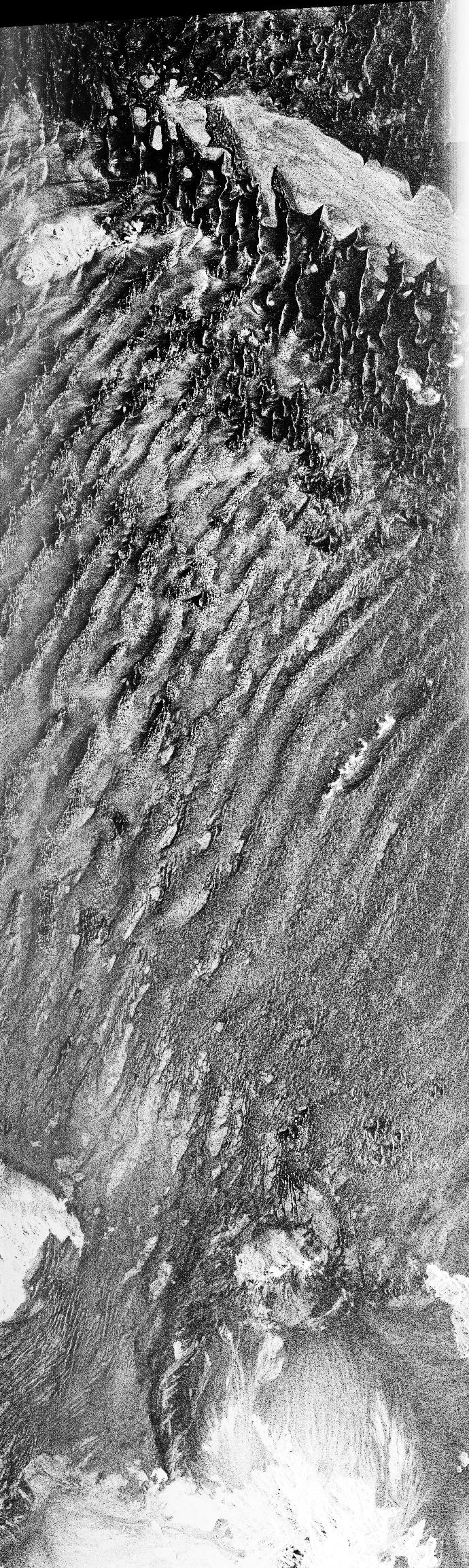
-
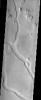
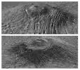
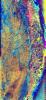
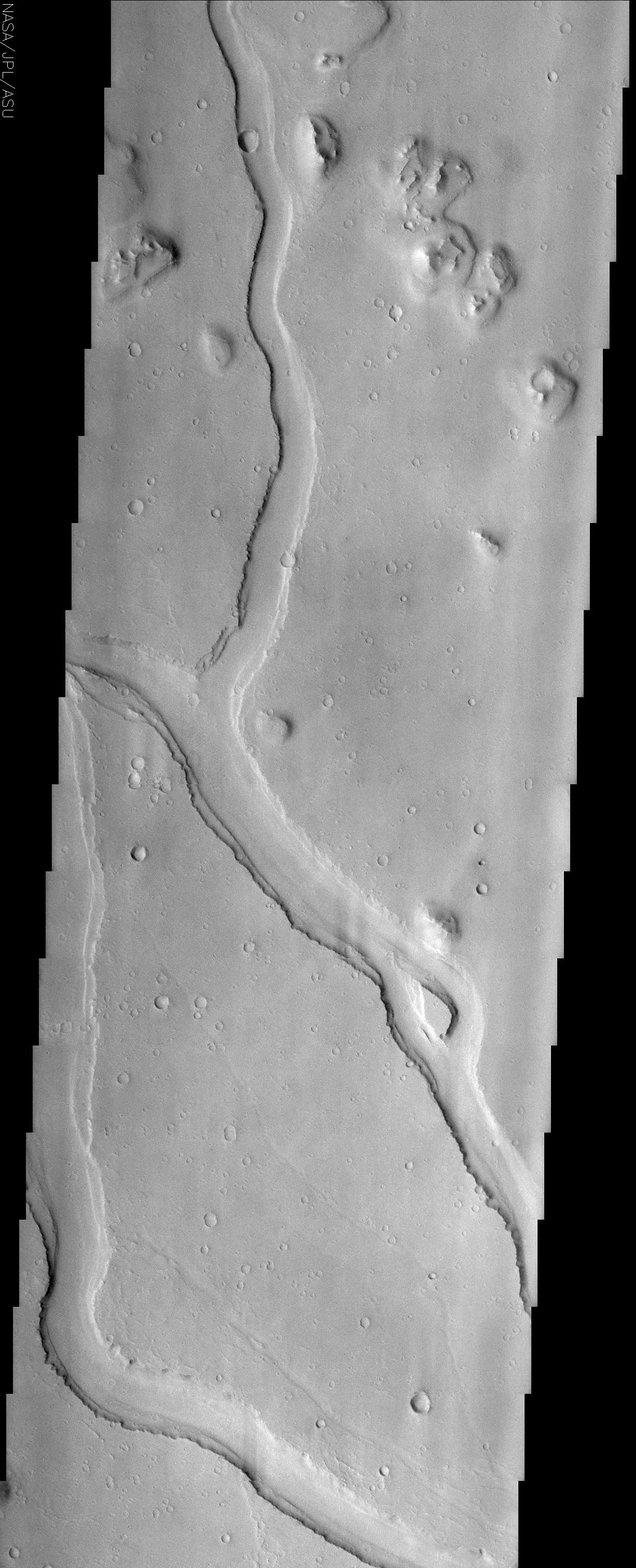
PIA03820:
-
Hebrus Valles
Full Resolution:
TIFF
(1.868 MB)
JPEG
(494 kB)
|
|
|
2002-06-04 |
Mars
|
2001 Mars Odyssey
|
THEMIS
|
1237x3043x1 |
|
-
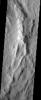
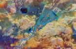
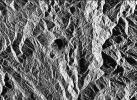
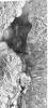
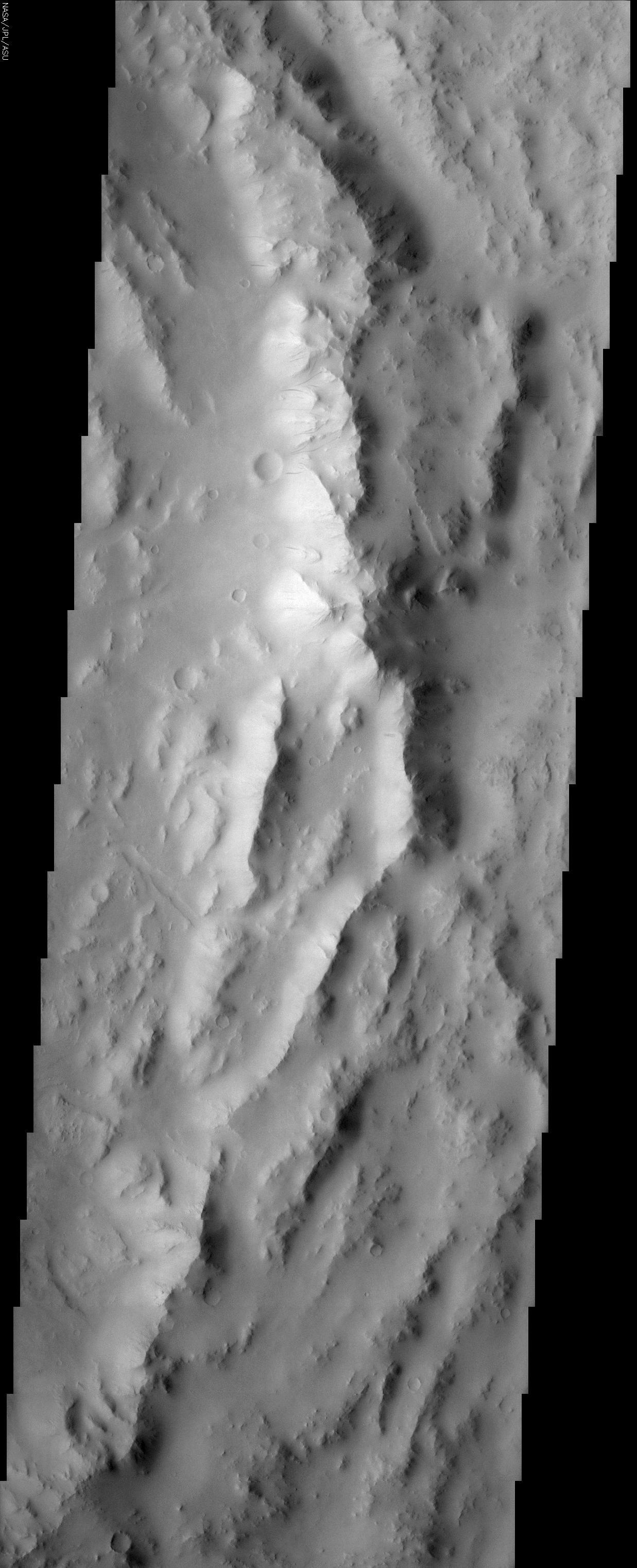
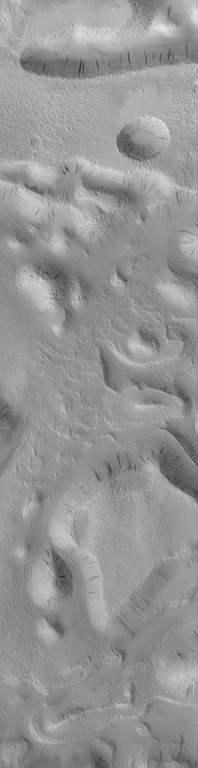
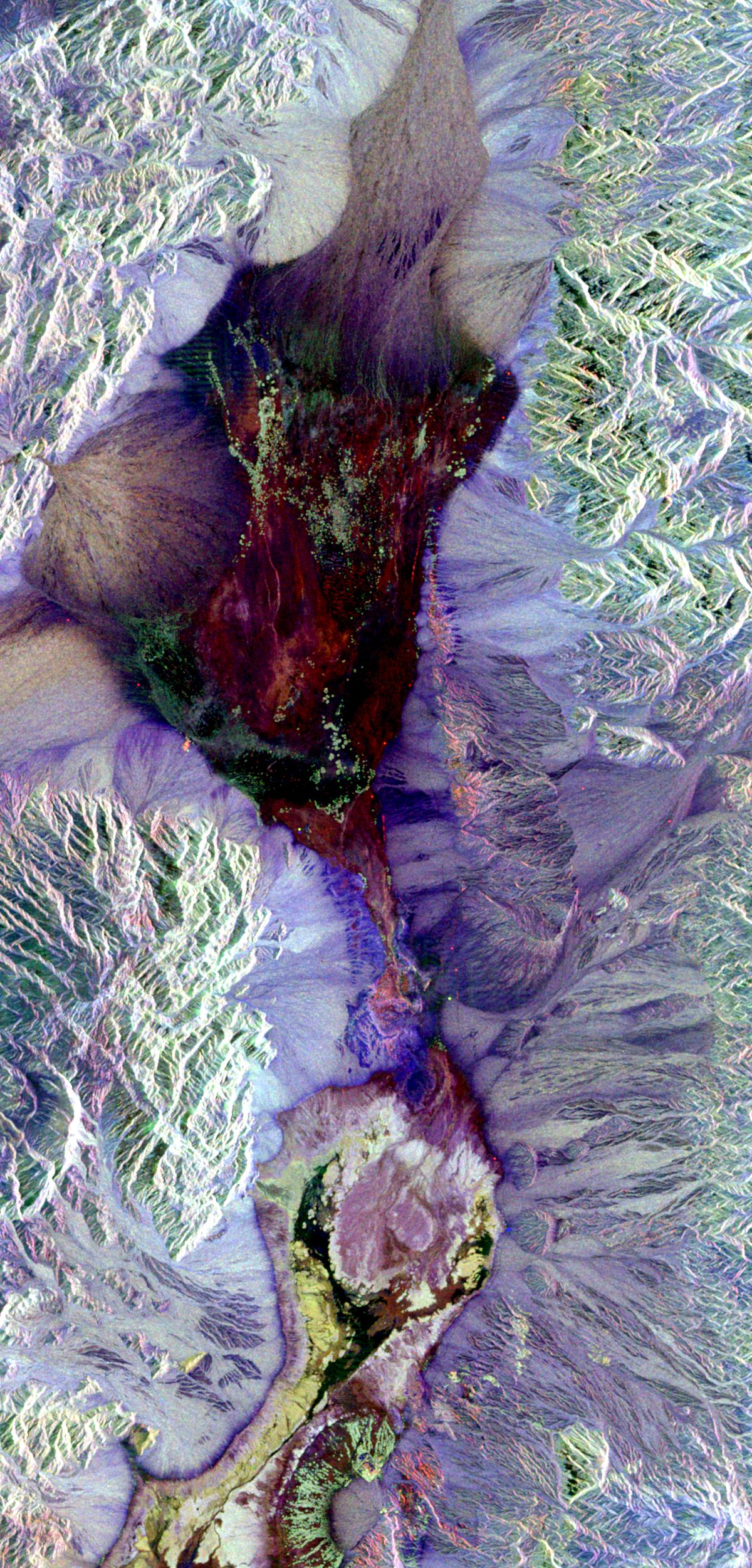
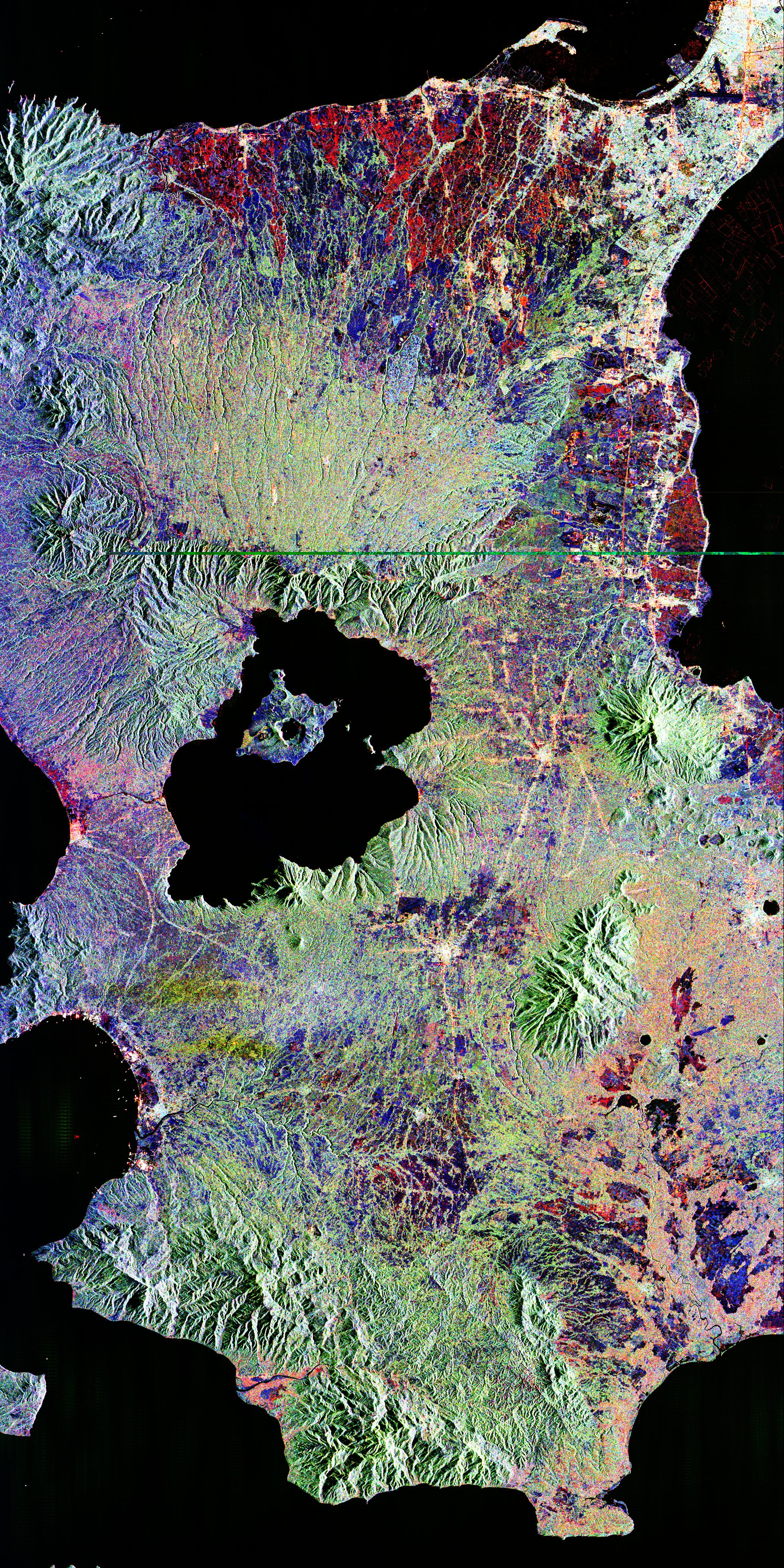
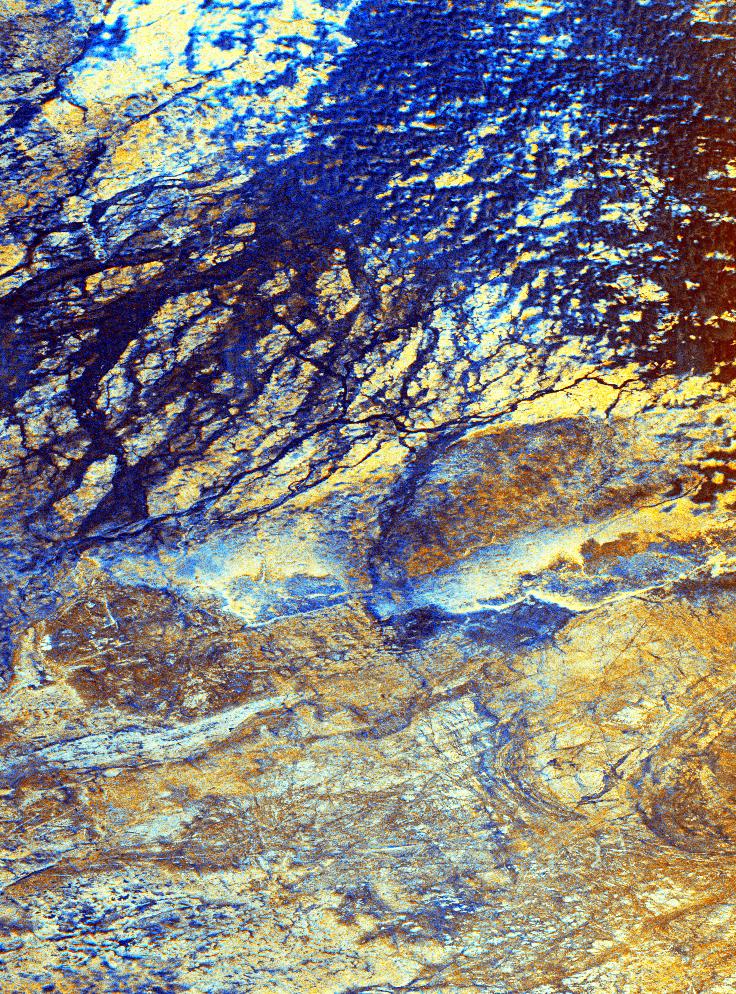
PIA03794:
-
Reuyl Crater Dust Avalanches
Full Resolution:
TIFF
(1.696 MB)
JPEG
(346.3 kB)
|
|
|
2001-07-21 |
Jupiter
|
Hubble Space Telescope
|
WFPC2
|
752x417x3 |

|
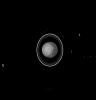
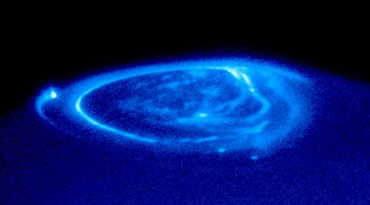
-
PIA03155:
-
Satellite Footprints Seen in Jupiter Aurora
Full Resolution:
TIFF
(202.4 kB)
JPEG
(34.06 kB)
|
|
|
2000-10-16 |
Mars
|
Mars Global Surveyor (MGS)
|
Mars Orbiter Camera (MOC)
|
672x2603x1 |
|
-
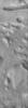
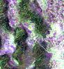
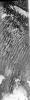
PIA02813:
-
Groovy Terrain in Mangala Valles
Full Resolution:
TIFF
(1.84 MB)
JPEG
(368 kB)
|
|
|
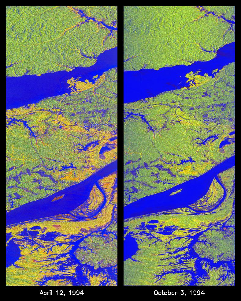
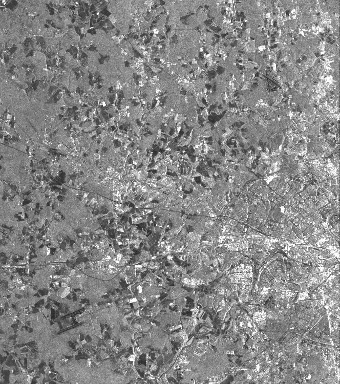
2000-09-20 |
Earth
|
RadarSat
|
Imaging Radar
|
1406x472x1 |
|
-
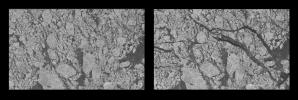
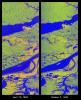
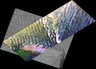
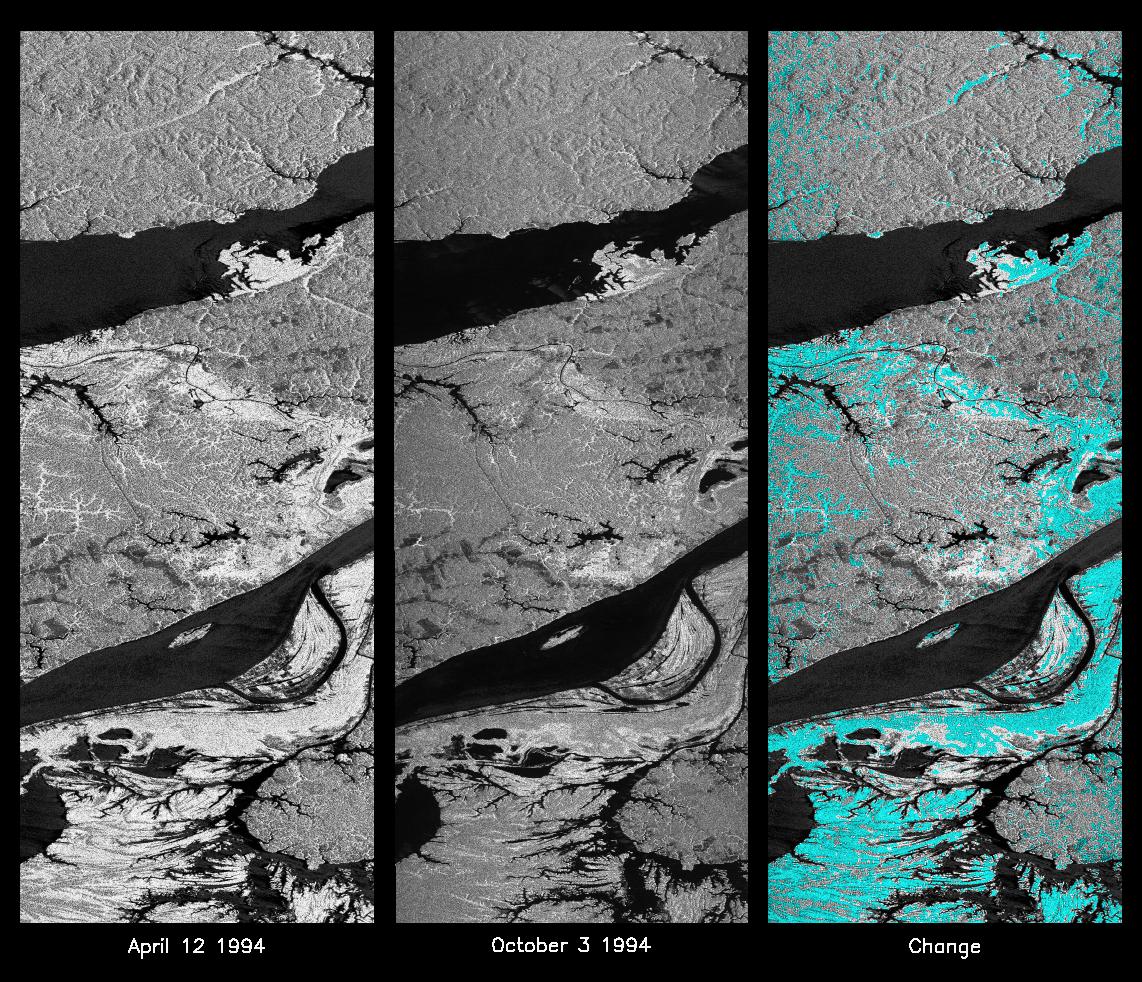
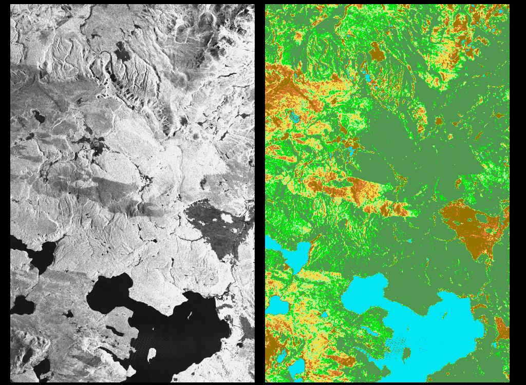
PIA02971:
-
Comparative Views of Arctic Sea Ice Growth
Full Resolution:
TIFF
(664.6 kB)
JPEG
(167.4 kB)
|
|
|
2000-09-20 |
Earth
|
RadarSat
|
Imaging Radar
|
720x520x3 |

|
-
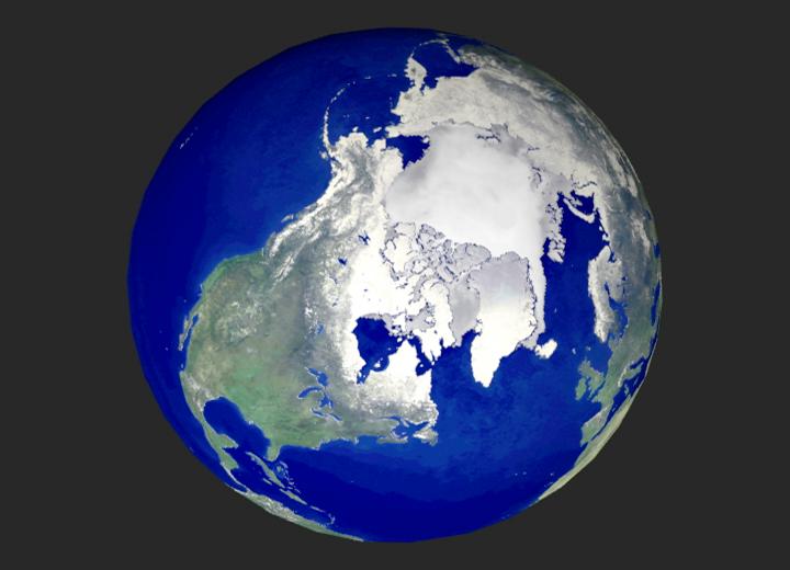
PIA02970:
-
Global View of the Arctic Ocean
Full Resolution:
TIFF
(624.4 kB)
JPEG
(35.77 kB)
|
|
|
2000-09-07 |
Mars
|
Mars Global Surveyor (MGS)
|
MOLA
|
524x462x1 |
|
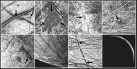
-
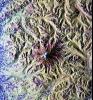
PIA02803:
-
Major Martian Volcanoes from MOLA - Alba Patera
Full Resolution:
TIFF
(239.9 kB)
JPEG
(52.87 kB)
|
|
|
2000-07-10 |
Europa
|
Galileo
|
Near Infrared Mapping Spectrometer
|
950x650x3 |
|
-
PIA02561:
-
Europa Impact Crater
Full Resolution:
TIFF
(904.6 kB)
JPEG
(55.73 kB)
|
|
|
2000-05-08 |
Earth
|
QuikScat
|
SeaWinds Scatterometer
|
1452x1280x3 |
|
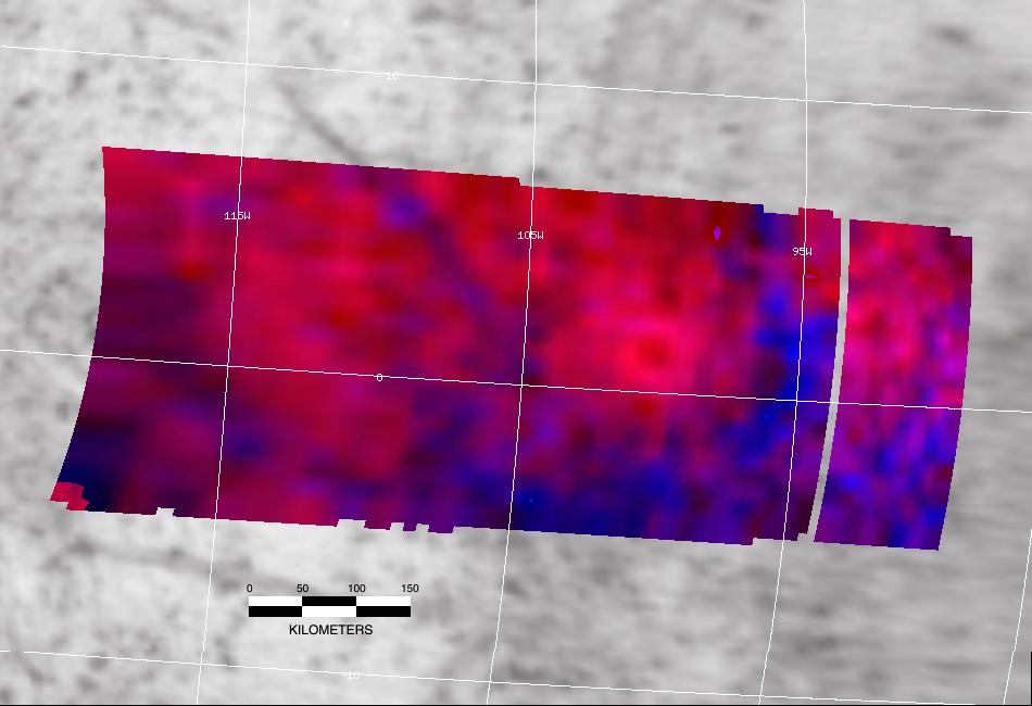
-
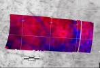
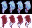
PIA02459:
-
SeaWinds - Greenland
Full Resolution:
TIFF
(765.6 kB)
JPEG
(205.7 kB)
|
|
|
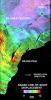
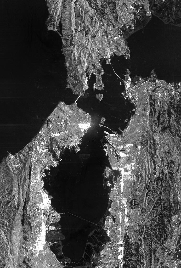
2000-02-21 |
Earth
|
Shuttle Radar Topography Mission (SRTM)
|
C-Band Interferometric Radar
|
1252x2352x1 |
|
-
PIA02730:
-
Radar image San Francisco Bay Area, California
Full Resolution:
TIFF
(3.475 MB)
JPEG
(874.5 kB)
|
|
|
2000-02-19 |
Earth
|
Shuttle Radar Topography Mission (SRTM)
|
C-Band Interferometric Radar
|
1793x1314x1 |
|
-
PIA02722:
-
C-Band Radar Imagery, Dallas-Fort Worth, Texas
Full Resolution:
TIFF
(2.885 MB)
JPEG
(804.4 kB)
|
|
|
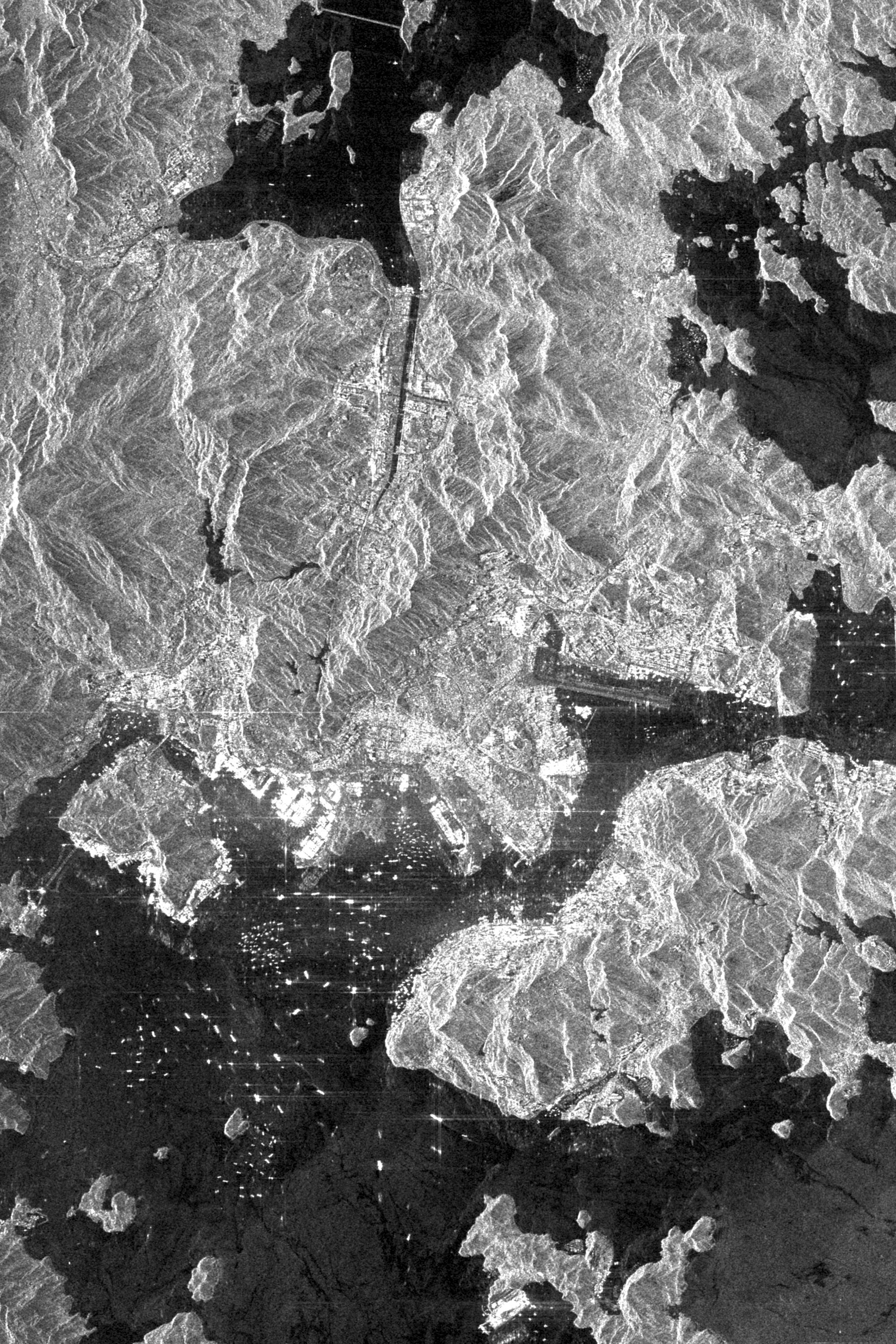
2000-02-14 |
Earth
|
Shuttle Radar Topography Mission (SRTM)
|
C-Band Interferometric Radar
|
1890x2270x1 |
|
-
PIA02701:
-
Radar Image of Rio Sao Francisco, Brazil
Full Resolution:
TIFF
(4.91 MB)
JPEG
(828.3 kB)
|
|
|
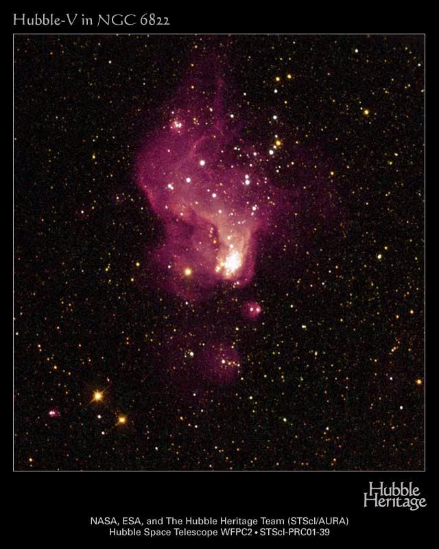
1999-12-10 |
Hubble -V
|
Hubble Space Telescope
|
WFPC2
|
640x800x3 |
|
-
PIA04222:
-
Hubble-V
Full Resolution:
TIFF
(1.065 MB)
JPEG
(77.99 kB)
|
|
|
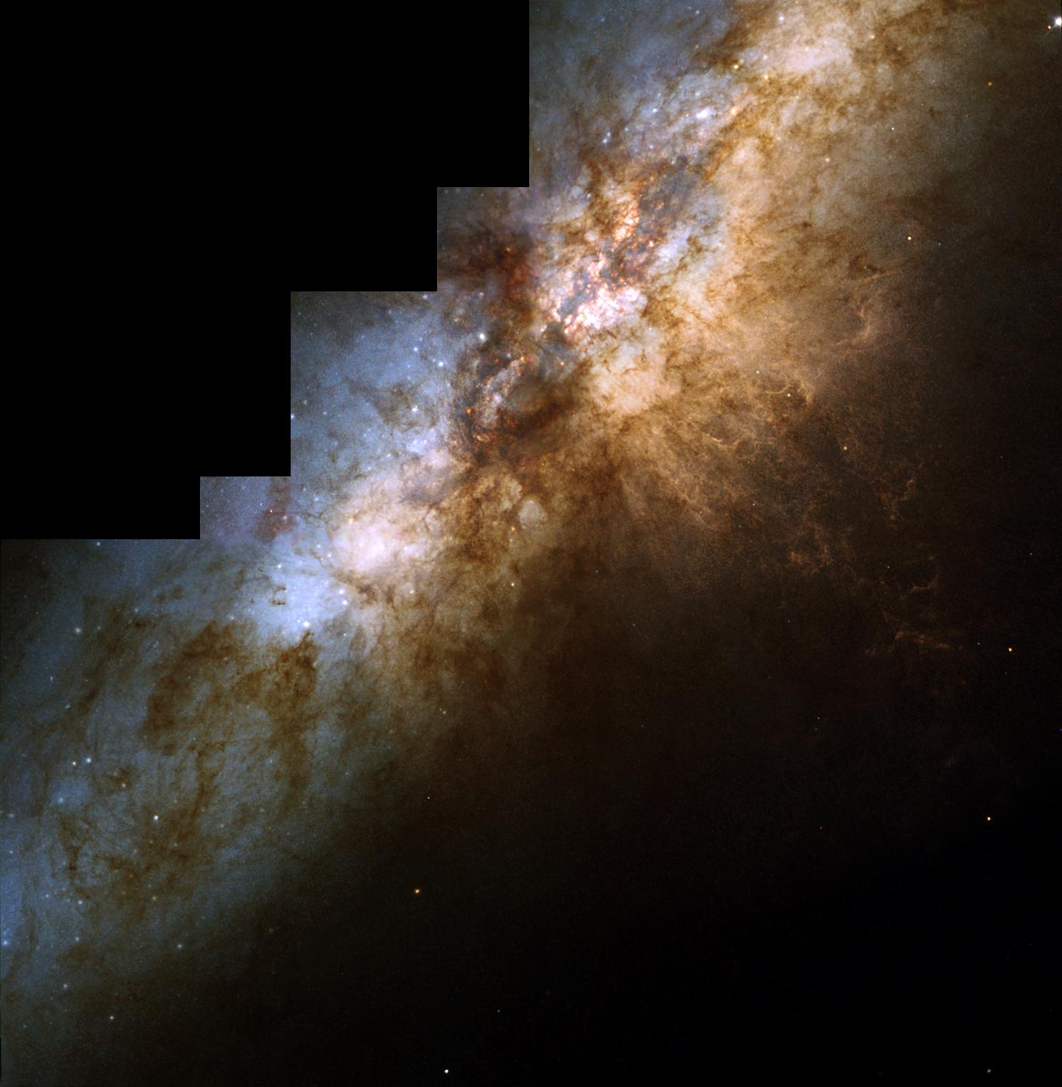
1999-12-02 |
M82 Galaxy
|
Hubble Space Telescope
|
WFPC2
|
1487x1522x3 |
|
-
PIA04218:
-
Galaxy M82
Full Resolution:
TIFF
(5.39 MB)
JPEG
(187.4 kB)
|
|
|
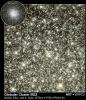
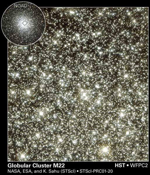
1999-12-01 |
Globular cluster M22
|
Hubble Space Telescope
|
WFPC2
|
514x600x3 |
|
-
PIA04202:
-
Globular Cluster M22
Full Resolution:
TIFF
(926.4 kB)
JPEG
(94.12 kB)
|
|
|
1999-09-27 |
Earth
|
Spaceborne Imaging Radar-C/X-Band Synthetic Aperture Radar
|
L-Band Imaging Radar
|
1200x2501x3 |

|
-
PIA01349:
-
Color Image of Death Valley, California from SIR-C
Full Resolution:
TIFF
(9.941 MB)
JPEG
(684.4 kB)
|
|
|
1999-06-25 |
Earth
|
Spaceborne Imaging Radar-C/X-Band Synthetic Aperture Radar
|
|
1536x1024x3 |
|
-
PIA01747:
-
Space Radar Image of Kennedy Space Center, Florida
Full Resolution:
TIFF
(1.15 MB)
JPEG
(307.3 kB)
|
|
|
1999-05-21 |
Neptune
|
Hubble Space Telescope
|
WFPC2
|
720x730x3 |
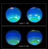
|
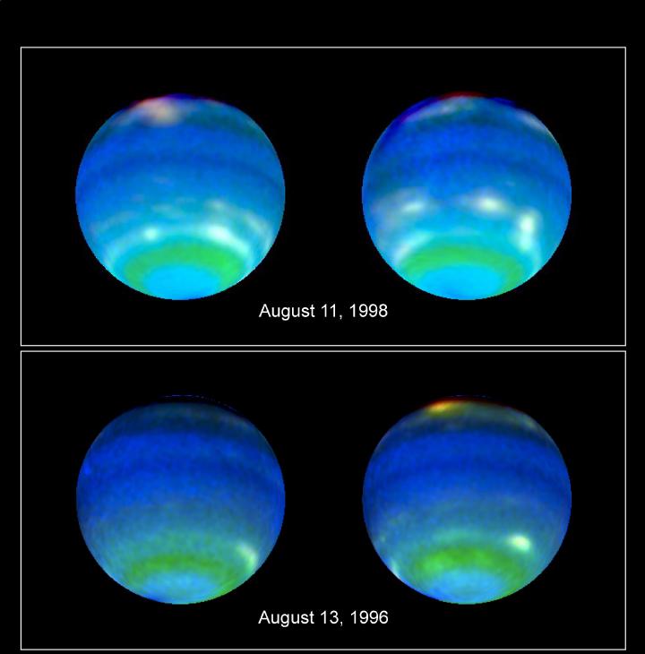
-
PIA01542:
-
Neptune's Stormy Disposition
Full Resolution:
TIFF
(610.8 kB)
JPEG
(37.55 kB)
|
|
|
1999-05-01 |
Earth
|
Spaceborne Imaging Radar-C/X-Band Synthetic Aperture Radar
|
|
2250x4500x3 |
|
-
PIA01768:
-
Space Radar Image of Taal Volcano, Philippines
Full Resolution:
TIFF
(32.45 MB)
JPEG
(3.934 MB)
|
|
|
1999-05-01 |
Earth
|
Spaceborne Imaging Radar-C/X-Band Synthetic Aperture Radar
|
|
1142x982x3 |
|
-
PIA01740:
-
Space Radar Image of Manaus Region of Brazil
Full Resolution:
TIFF
(1.705 MB)
JPEG
(359.3 kB)
|
|
|
1999-05-01 |
Earth
|
Spaceborne Imaging Radar-C/X-Band Synthetic Aperture Radar
|
|
952x1000x3 |
|
-
PIA01739:
-
Space Radar Image of Colima Volcano, Jalisco, Mexico
Full Resolution:
TIFF
(3.012 MB)
JPEG
(502.5 kB)
|
|
|
1999-05-01 |
Earth
|
Spaceborne Imaging Radar-C/X-Band Synthetic Aperture Radar
|
|
692x1326x1 |
|
-
PIA01738:
-
Space Radar Image of Los Angeles, California
Full Resolution:
TIFF
(1.092 MB)
JPEG
(315.9 kB)
|
|
|
1999-05-01 |
Earth
|
Spaceborne Imaging Radar-C/X-Band Synthetic Aperture Radar
|
|
756x2688x3 |

|
-
PIA01737:
-
Space Radar Image of Weddell Sea, Antarctica
Full Resolution:
TIFF
(8.193 MB)
JPEG
(1.143 MB)
|
|
|
1999-05-01 |
Earth
|
Spaceborne Imaging Radar-C/X-Band Synthetic Aperture Radar
|
|
916x807x3 |
|
-
PIA01736:
-
Space Radar Image of Karisoke & Virunga Volcanoes
Full Resolution:
TIFF
(2.857 MB)
JPEG
(375 kB)
|
|
|
1999-05-01 |
Earth
|
Spaceborne Imaging Radar-C/X-Band Synthetic Aperture Radar
|
|
788x983x3 |
|
-
PIA01735:
-
Space Radar Image of Manaus, Brazil
Full Resolution:
TIFF
(2.568 MB)
JPEG
(245.6 kB)
|
|
|
1999-05-01 |
Earth
|
Spaceborne Imaging Radar-C/X-Band Synthetic Aperture Radar
|
|
406x1000x3 |

|
-
PIA01755:
-
Space Radar Image of Lozere Department, Mende, France
Full Resolution:
TIFF
(1.565 MB)
JPEG
(161.6 kB)
|
|
|
1999-05-01 |
Earth
|
Spaceborne Imaging Radar-C/X-Band Synthetic Aperture Radar
|
X-Band Radar
|
1024x1024x1 |

|
-
PIA01763:
-
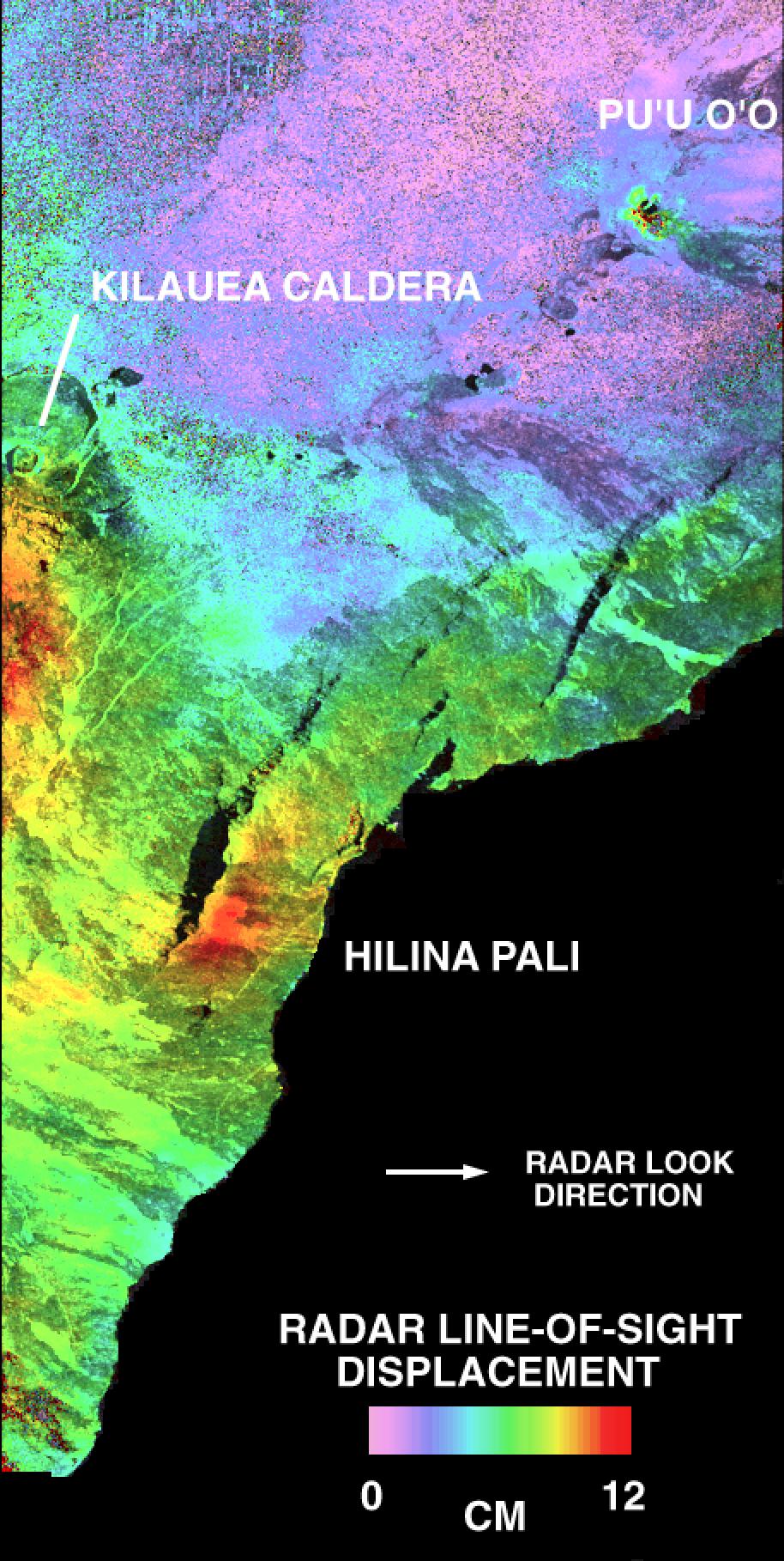
Space Radar Image of Kilauea, Hawaii - Interferometry 1
Full Resolution:
TIFF
(804.8 kB)
JPEG
(400 kB)
|
|
|
1999-05-01 |
Earth
|
Spaceborne Imaging Radar-C/X-Band Synthetic Aperture Radar
|
X-Band Radar
|
1840x2760x1 |
|
-
PIA01756:
-
Space Radar Image of Kennedy Space Center, Florida
Full Resolution:
TIFF
(5.548 MB)
JPEG
(1.394 MB)
|
|
|
1999-05-01 |
Earth
|
Spaceborne Imaging Radar-C/X-Band Synthetic Aperture Radar
|
|
664x750x1 |
|
-
PIA01752:
-
Space Radar Image of Moscow, Russia
Full Resolution:
TIFF
(597.2 kB)
JPEG
(164.4 kB)
|
|
|
1999-05-01 |
Earth
|
Spaceborne Imaging Radar-C/X-Band Synthetic Aperture Radar
|
|
692x1024x1 |
|
-
PIA01751:
-
Space Radar Image of San Francisco, California
Full Resolution:
TIFF
(732.2 kB)
JPEG
(182.2 kB)
|
|
|
1999-05-01 |
Earth
|
Spaceborne Imaging Radar-C/X-Band Synthetic Aperture Radar
|
|
2000x3000x1 |
|
-
PIA01750:
-
Space Radar Image of Hong Kong, China
Full Resolution:
TIFF
(6.07 MB)
JPEG
(1.256 MB)
|
|
|
1999-05-01 |
Earth
|
Spaceborne Imaging Radar-C/X-Band Synthetic Aperture Radar
|
|
1840x2750x1 |
|
-
PIA01748:
-
Space Radar Image of North Sea, Germany
Full Resolution:
TIFF
(5.621 MB)
JPEG
(2.262 MB)
|
|
|
1999-05-01 |
Earth
|
Spaceborne Imaging Radar-C/X-Band Synthetic Aperture Radar
|
|
1020x1020x1 |
|
-
PIA01745:
-
Space Radar Image of Glascow, Missouri
Full Resolution:
TIFF
(1.311 MB)
JPEG
(408.7 kB)
|
|
|
1999-05-01 |
Earth
|
Spaceborne Imaging Radar-C/X-Band Synthetic Aperture Radar
|
|
1375x892x1 |

|
-
PIA01729:
-
Space Radar Image of Chernobyl
Full Resolution:
TIFF
(1.478 MB)
JPEG
(399 kB)
|
|
|
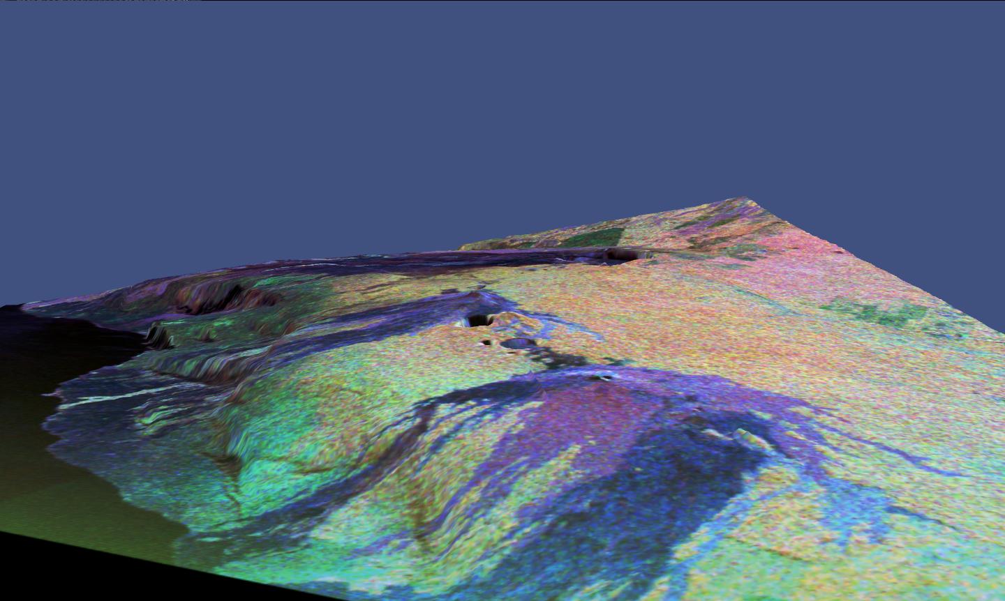
1999-05-01 |
Earth
|
Spaceborne Imaging Radar-C/X-Band Synthetic Aperture Radar
|
|
3300x2550x3 |
|
-
PIA01770:
-
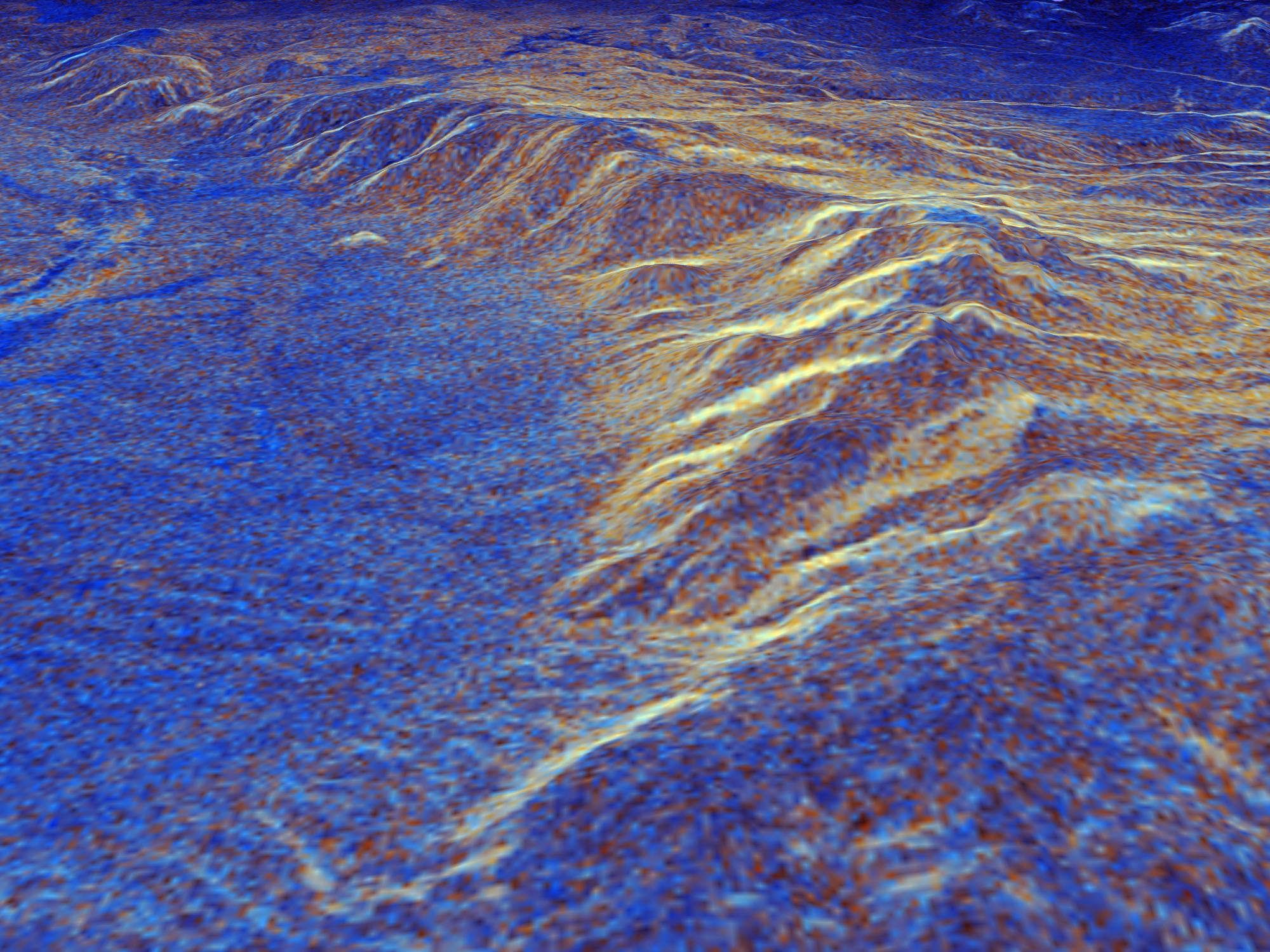
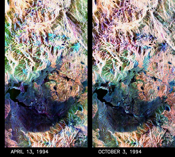
Space Radar Image of Long Valley, California - Interferometry/Topography
Full Resolution:
TIFF
(18.96 MB)
JPEG
(1.504 MB)
|
|
|
1999-05-01 |
Earth
|
Spaceborne Imaging Radar-C/X-Band Synthetic Aperture Radar
|
|
2000x1500x3 |

|
-
PIA01769:
-
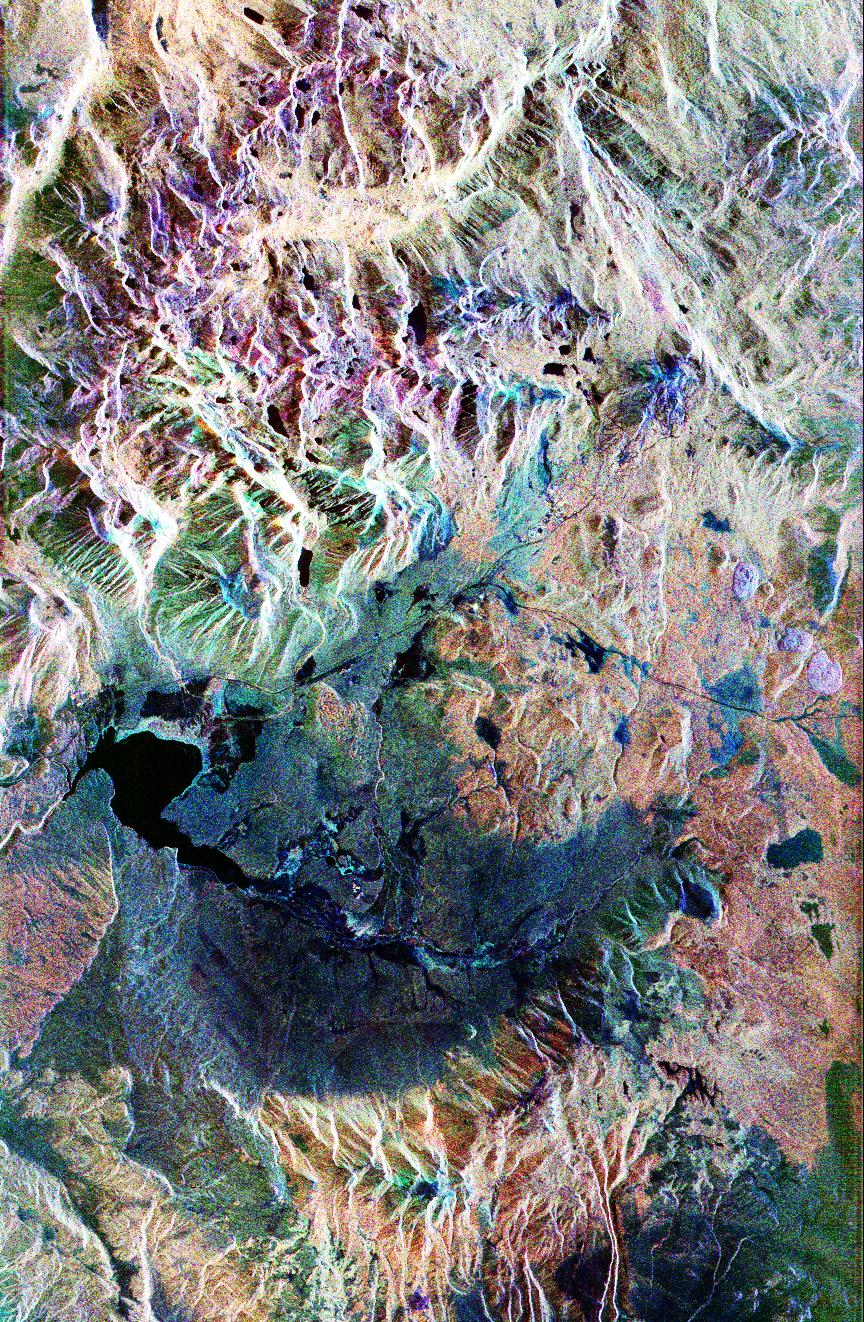
Space Radar Image of Long Valley, California in 3-D
Full Resolution:
TIFF
(9.892 MB)
JPEG
(525.5 kB)
|
|
|
1999-05-01 |
Earth
|
Spaceborne Imaging Radar-C/X-Band Synthetic Aperture Radar
|
|
853x993x3 |
|
-
PIA01767:
-
Space Radar Image of Rabaul Volcano, New Guinea
Full Resolution:
TIFF
(2.166 MB)
JPEG
(198.8 kB)
|
|
|
1999-05-01 |
Earth
|
Spaceborne Imaging Radar-C/X-Band Synthetic Aperture Radar
|
|
1202x835x3 |

|
-
PIA01765:
-
Space Radar Image of Kiluchevskoi, Volcano, Russia
Full Resolution:
TIFF
(3.894 MB)
JPEG
(401.4 kB)
|
|
|
1999-05-01 |
Earth
|
Spaceborne Imaging Radar-C/X-Band Synthetic Aperture Radar
|
|
740x2035x3 |

|
-
PIA01764:
-
Space Radar Image of Bahia
Full Resolution:
TIFF
(3.214 MB)
JPEG
(689 kB)
|
|
|
1999-05-01 |
Earth
|
Spaceborne Imaging Radar-C/X-Band Synthetic Aperture Radar
|
|
1024x1024x3 |
|
-
PIA01762:
-
Space Radar Image of Kilauea, Hawaii
Full Resolution:
TIFF
(2.69 MB)
JPEG
(520.1 kB)
|
|
|
1999-05-01 |
Earth
|
Spaceborne Imaging Radar-C/X-Band Synthetic Aperture Radar
|
|
1024x1024x3 |
|
-
PIA01761:
-
Space Radar Image of Kilauea Volcano, Hawaii
Full Resolution:
TIFF
(512.9 kB)
JPEG
(92.05 kB)
|
|
|
1999-05-01 |
Earth
|
Spaceborne Imaging Radar-C/X-Band Synthetic Aperture Radar
|
|
2290x1727x3 |
|
-
PIA01760:
-
Space Radar Image of Oetzal, Austria
Full Resolution:
TIFF
(13.96 MB)
JPEG
(1.09 MB)
|
|
|
1999-05-01 |
Earth
|
Spaceborne Imaging Radar-C/X-Band Synthetic Aperture Radar
|
|
1101x900x3 |
|
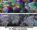
-
PIA01759:
-
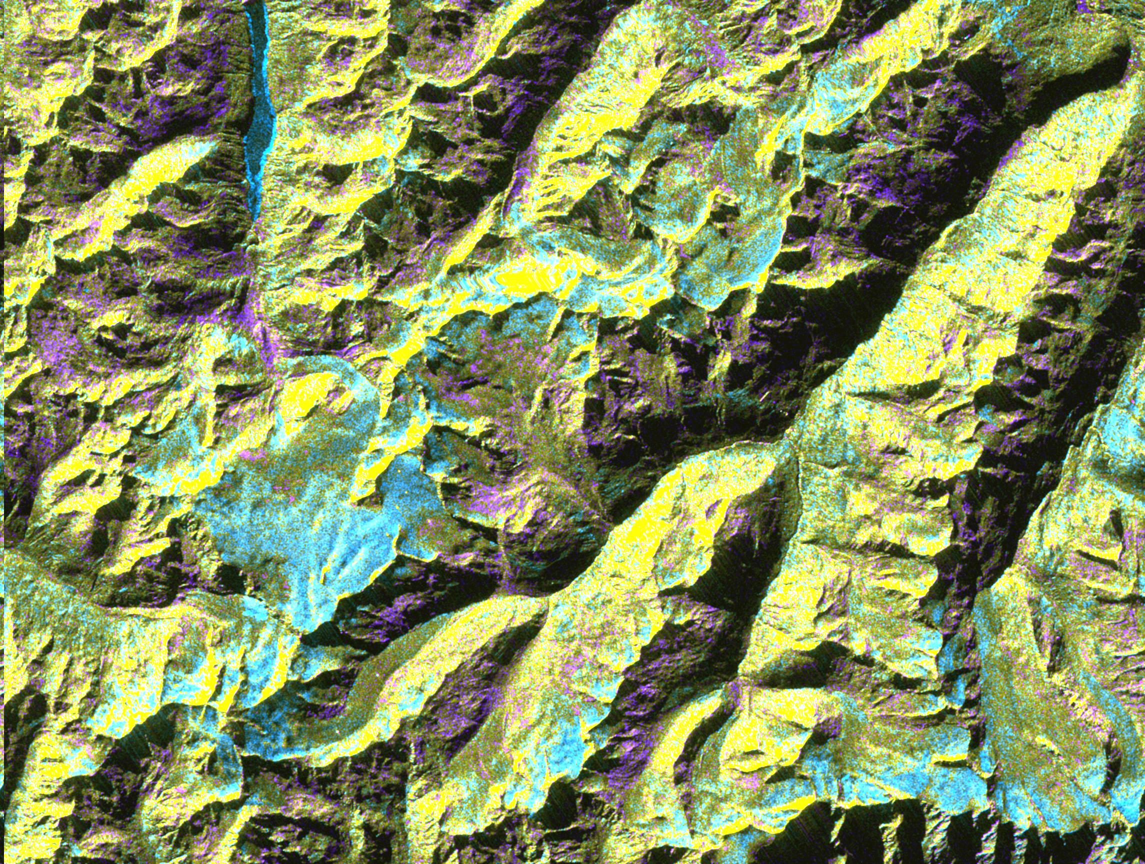
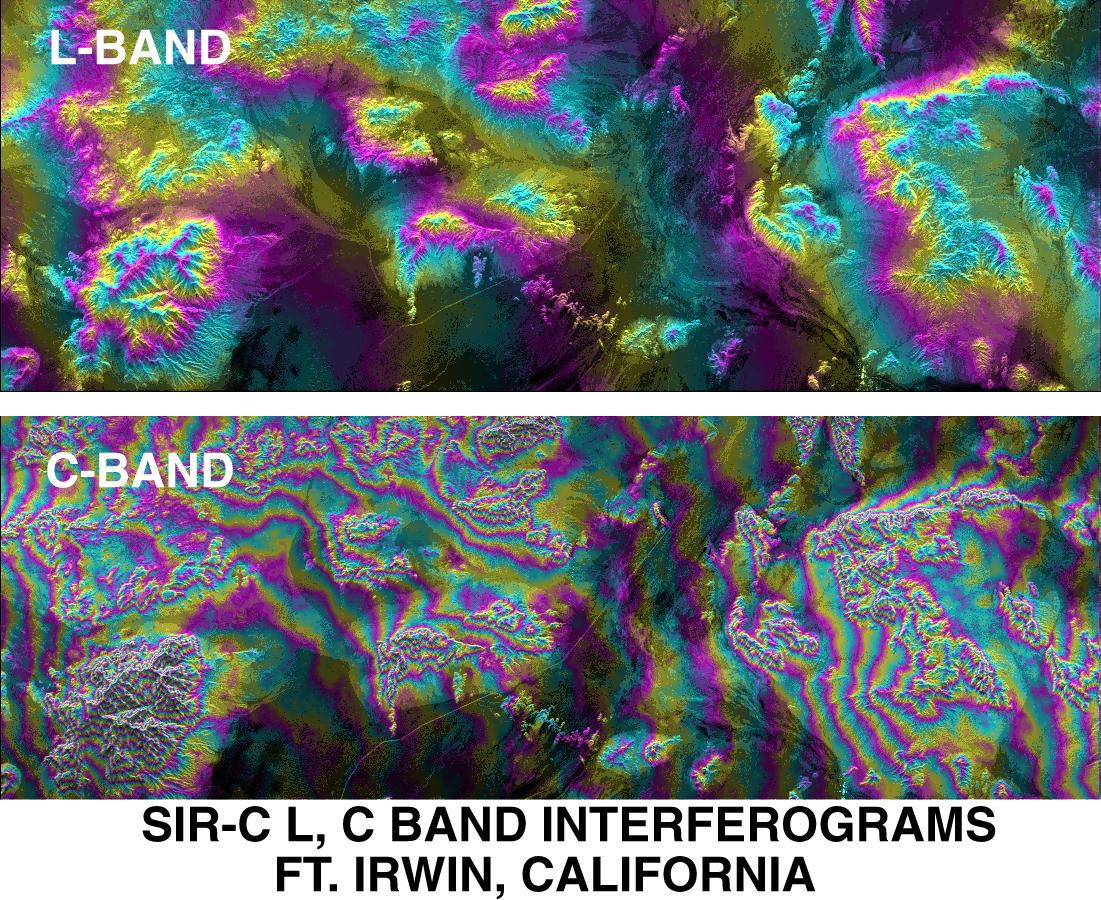
SPace Radar Image of Fort Irwin, California
Full Resolution:
TIFF
(1.509 MB)
JPEG
(296.8 kB)
|
|
|
1999-05-01 |
Earth
|
Spaceborne Imaging Radar-C/X-Band Synthetic Aperture Radar
|
|
914x1818x3 |
|
-
PIA01758:
-
Space Radar Image of Kilauea Volcano, Hawaii
Full Resolution:
TIFF
(2.381 MB)
JPEG
(321 kB)
|
|
|
1999-05-01 |
Earth
|
Spaceborne Imaging Radar-C/X-Band Synthetic Aperture Radar
|
|
2000x1500x3 |

|
-
PIA01757:
-
Space Radar Image of Long Valley, California - 3-D view
Full Resolution:
TIFF
(11.24 MB)
JPEG
(448.6 kB)
|
|
|
1999-05-01 |
Earth
|
Spaceborne Imaging Radar-C/X-Band Synthetic Aperture Radar
|
|
726x651x3 |
|
-
PIA01753:
-
Space Radar Image of Mammoth Mountain, California
Full Resolution:
TIFF
(1.476 MB)
JPEG
(190.3 kB)
|
|
|
1999-05-01 |
Earth
|
Spaceborne Imaging Radar-C/X-Band Synthetic Aperture Radar
|
|
1383x1540x3 |
|
-
PIA01749:
-
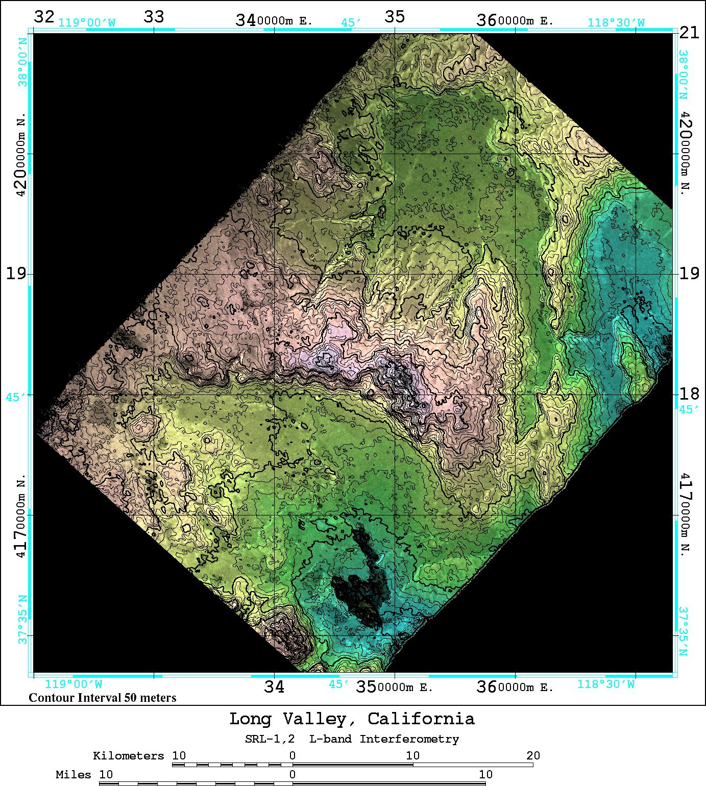
space Radar Image of Long Valley, California
Full Resolution:
TIFF
(1.895 MB)
JPEG
(566.1 kB)
|
|
|
1999-05-01 |
Earth
|
Spaceborne Imaging Radar-C/X-Band Synthetic Aperture Radar
|
|
864x1322x3 |
|
-
PIA01746:
-
Space Radar Image of Mammoth Mountain, California
Full Resolution:
TIFF
(4.439 MB)
JPEG
(532.5 kB)
|
|
|
1999-05-01 |
Earth
|
Spaceborne Imaging Radar-C/X-Band Synthetic Aperture Radar
|
|
1020x1020x3 |
|
-
PIA01744:
-
Space Radar Image of Missouri River, Glasgow, Missouri
Full Resolution:
TIFF
(4.106 MB)
JPEG
(495.2 kB)
|
|
|
1999-05-01 |
Earth
|
Spaceborne Imaging Radar-C/X-Band Synthetic Aperture Radar
|
|
1392x1152x3 |
|
-
PIA01743:
-
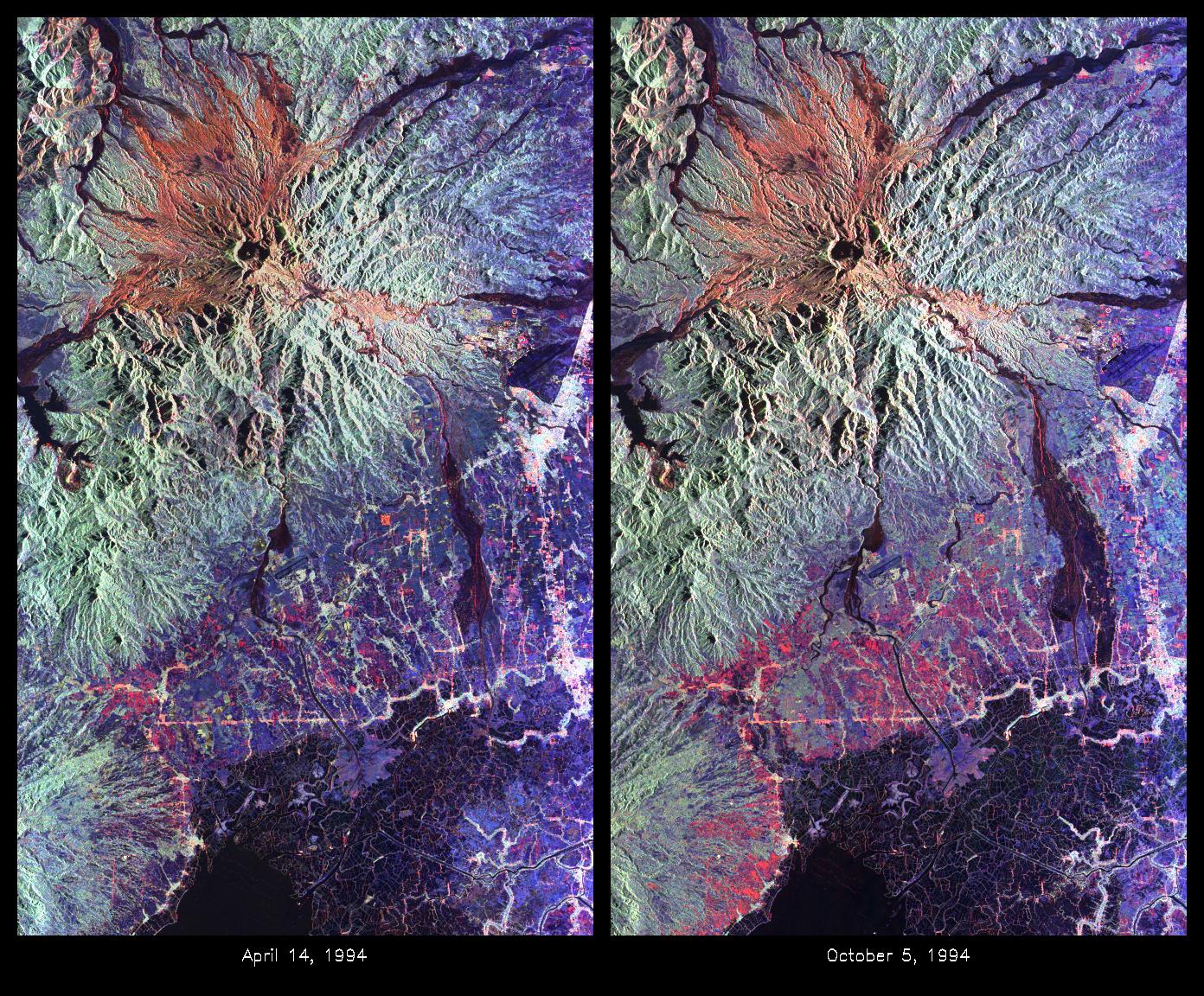
Space Radar Image of Mount Pinatubo Volcano, Philippines
Full Resolution:
TIFF
(5.52 MB)
JPEG
(557.3 kB)
|
|
|
1999-05-01 |
Earth
|
Spaceborne Imaging Radar-C/X-Band Synthetic Aperture Radar
|
|
1361x2890x3 |
|
-
PIA01742:
-
Space Radar Image of Altona, Manitoba, Canada
Full Resolution:
TIFF
(15.66 MB)
JPEG
(1.866 MB)
|
|
|
1999-05-01 |
Earth
|
Spaceborne Imaging Radar-C/X-Band Synthetic Aperture Radar
|
|
1024x750x3 |
|
-
PIA01741:
-
Space Radar Image of Yellowstone Park, Wyoming
Full Resolution:
TIFF
(971 kB)
JPEG
(238.3 kB)
|
|
|
1999-05-01 |
Earth
|
Spaceborne Imaging Radar-C/X-Band Synthetic Aperture Radar
|
|
911x2119x3 |

|
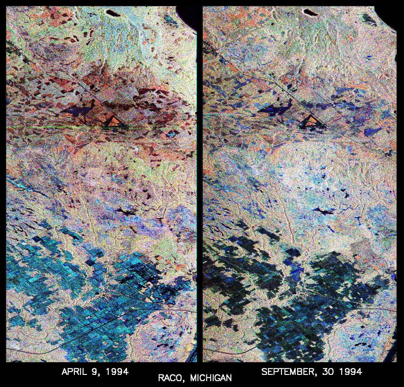
-
PIA01734:
-
Space Radar Image of Raco, Michigan, Ecological Test Site
Full Resolution:
TIFF
(7.256 MB)
JPEG
(711.6 kB)
|
|
|
1999-05-01 |
Earth
|
Spaceborne Imaging Radar-C/X-Band Synthetic Aperture Radar
|
|
1251x2734x3 |

|
-
PIA01733:
-
Space Radar Image of Bebedauro, Brazil, Seasonal
Full Resolution:
TIFF
(13.31 MB)
JPEG
(1.278 MB)
|
|
|
1999-05-01 |
Earth
|
Spaceborne Imaging Radar-C/X-Band Synthetic Aperture Radar
|
|
1211x1025x3 |
|
-
PIA01732:
-
Space Radar Image of Prince Albert, Canada, Seasonal
Full Resolution:
TIFF
(3.306 MB)
JPEG
(655.6 kB)
|
|
|
1999-05-01 |
Earth
|
Spaceborne Imaging Radar-C/X-Band Synthetic Aperture Radar
|
|
1280x924x3 |
|
-
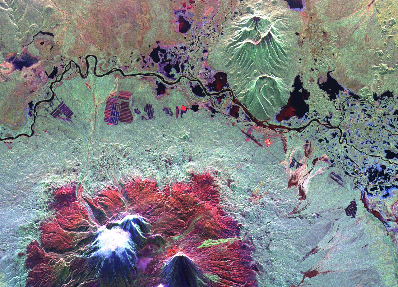
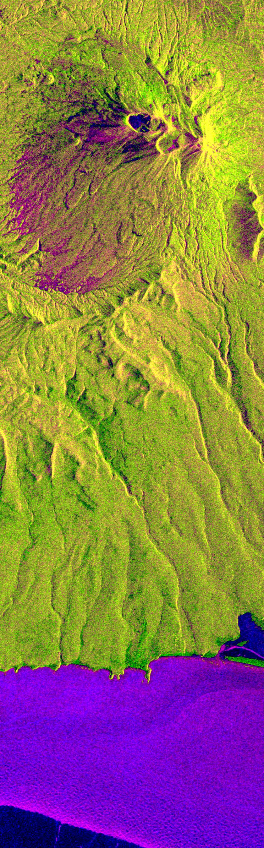
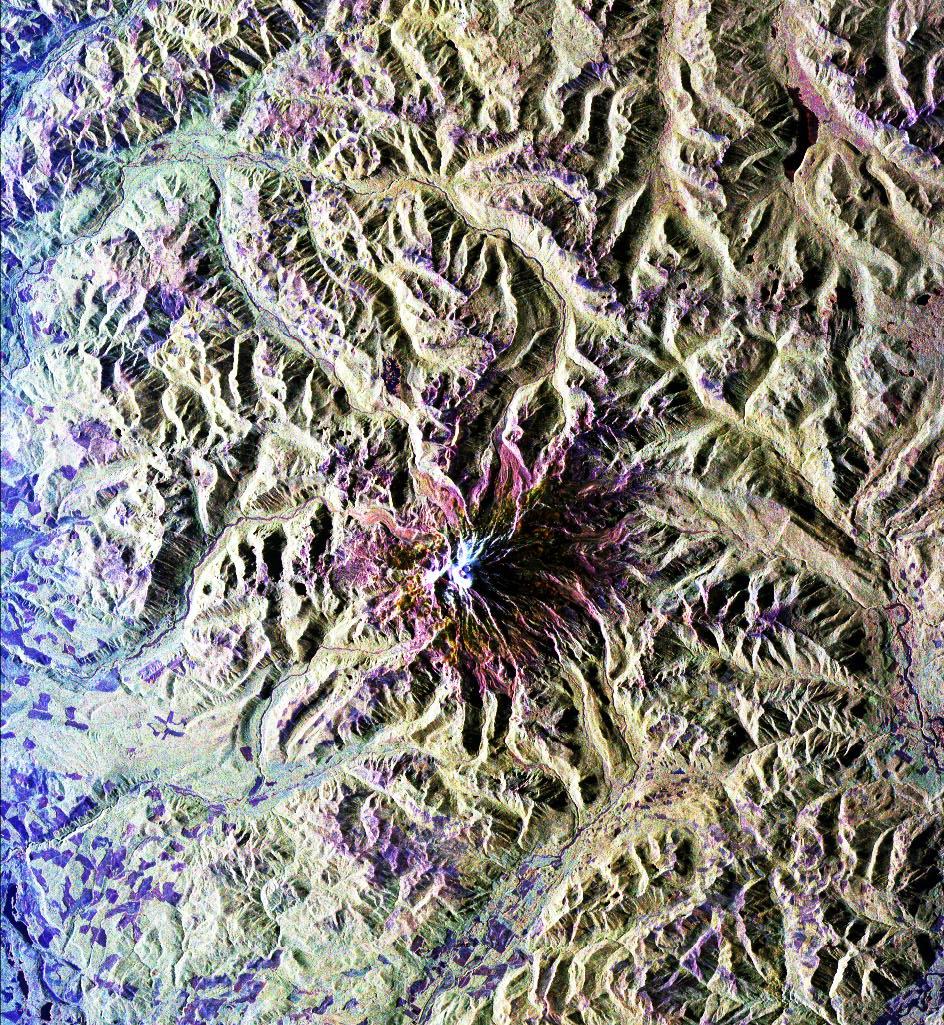
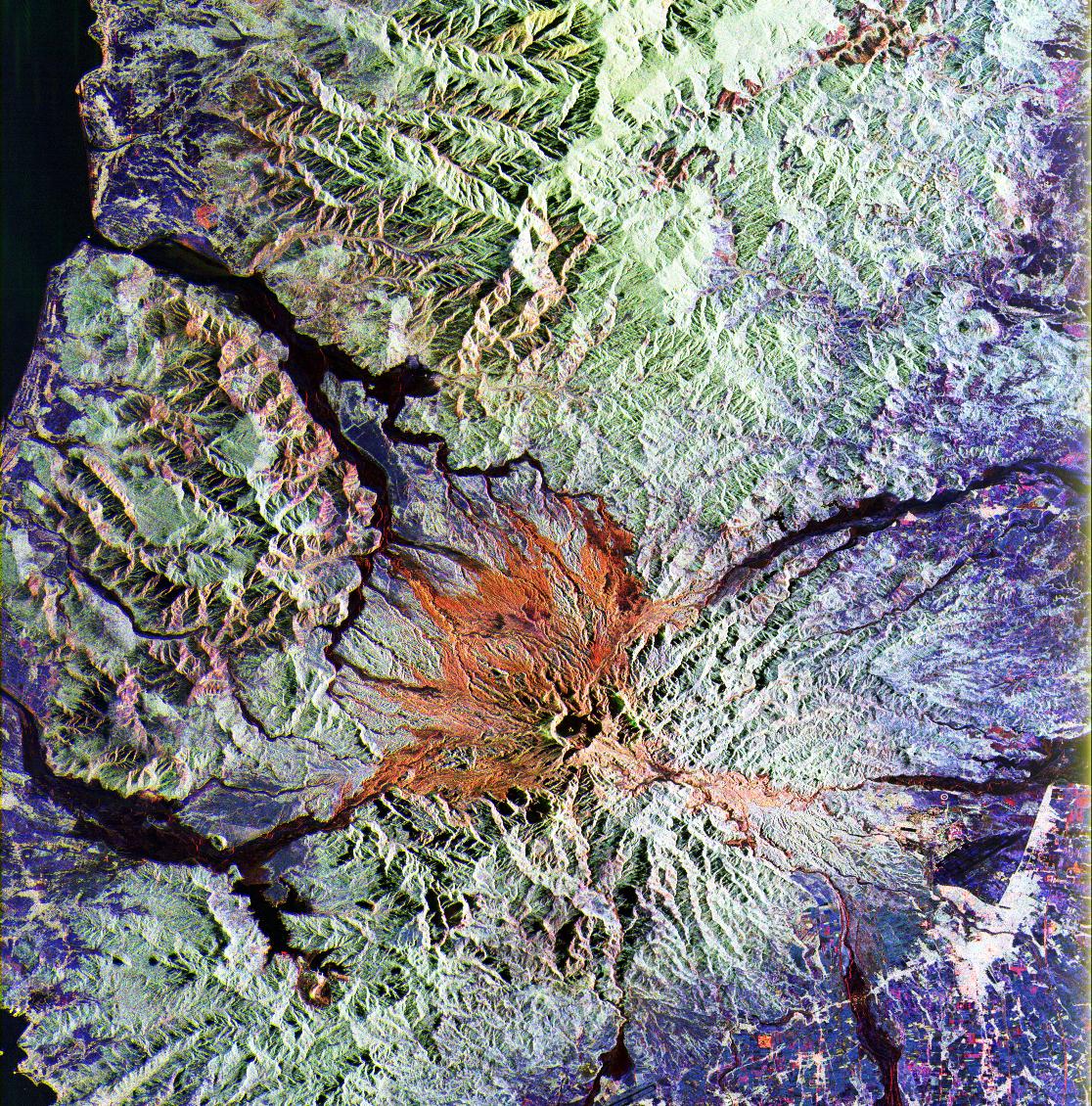
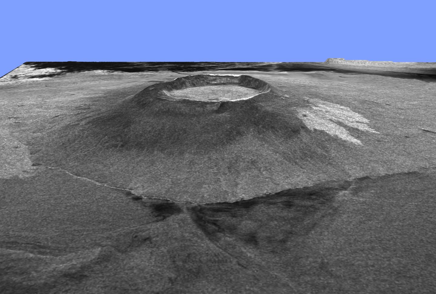
PIA01731:
-
Space Radar Image of Kliuchevskoi Volcano, Russia
Full Resolution:
TIFF
(4.456 MB)
JPEG
(376.7 kB)
|
|
|
1999-05-01 |
Earth
|
Spaceborne Imaging Radar-C/X-Band Synthetic Aperture Radar
|
|
1301x1247x3 |
|
-
PIA01730:
-
Space Radar Image of Raco, Michigan
Full Resolution:
TIFF
(5.543 MB)
JPEG
(823.6 kB)
|
|
|
1999-05-01 |
Earth
|
Spaceborne Imaging Radar-C/X-Band Synthetic Aperture Radar
|
|
840x2700x3 |

|
-
PIA01728:
-
Space Radar Image of Kliuchevskoi, Russia
Full Resolution:
TIFF
(7.941 MB)
JPEG
(639.3 kB)
|
|
|
1999-05-01 |
Earth
|
Spaceborne Imaging Radar-C/X-Band Synthetic Aperture Radar
|
|
944x1025x3 |
|
-
PIA01727:
-
Space Radar Image of Mt. Rainer, Washington
Full Resolution:
TIFF
(3.674 MB)
JPEG
(417 kB)
|
|
|
1999-05-01 |
Earth
|
Spaceborne Imaging Radar-C/X-Band Synthetic Aperture Radar
|
|
939x681x3 |
|
-
PIA01726:
-
Space Radar Image of the Silk route in Niya, Taklamak, China
Full Resolution:
TIFF
(1.161 MB)
JPEG
(154.4 kB)
|
|
|
1999-05-01 |
Earth
|
Spaceborne Imaging Radar-C/X-Band Synthetic Aperture Radar
|
|
639x697x3 |
|
-
PIA01725:
-
Space Radar Image of Niya ruins, Taklamakan Desert
Full Resolution:
TIFF
(1.656 MB)
JPEG
(152.1 kB)
|
|
|
1999-04-15 |
Earth
|
Spaceborne Imaging Radar-C/X-Band Synthetic Aperture Radar
|
|
6000x3852x3 |
|
-
PIA01851:
-
Space Radar Image of Barstow, California
Full Resolution:
TIFF
(79.47 MB)
JPEG
(9.271 MB)
|
|
|
1999-04-15 |
Earth
|
Spaceborne Imaging Radar-C/X-Band Synthetic Aperture Radar
|
|
3500x1436x3 |
|
-
PIA01786:
-
Space Radar Image of Weddell Sea Ice
Full Resolution:
TIFF
(19.79 MB)
JPEG
(2.057 MB)
|
|
|
1999-04-15 |
Earth
|
Spaceborne Imaging Radar-C/X-Band Synthetic Aperture Radar
|
|
2749x4938x3 |

|
-
PIA01784:
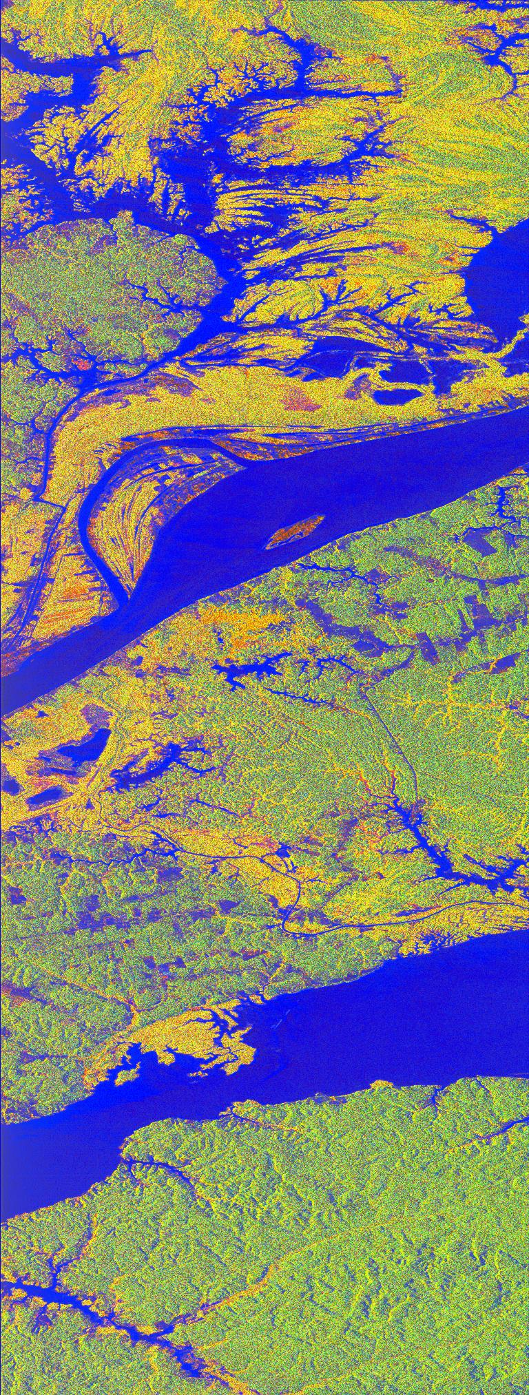
-
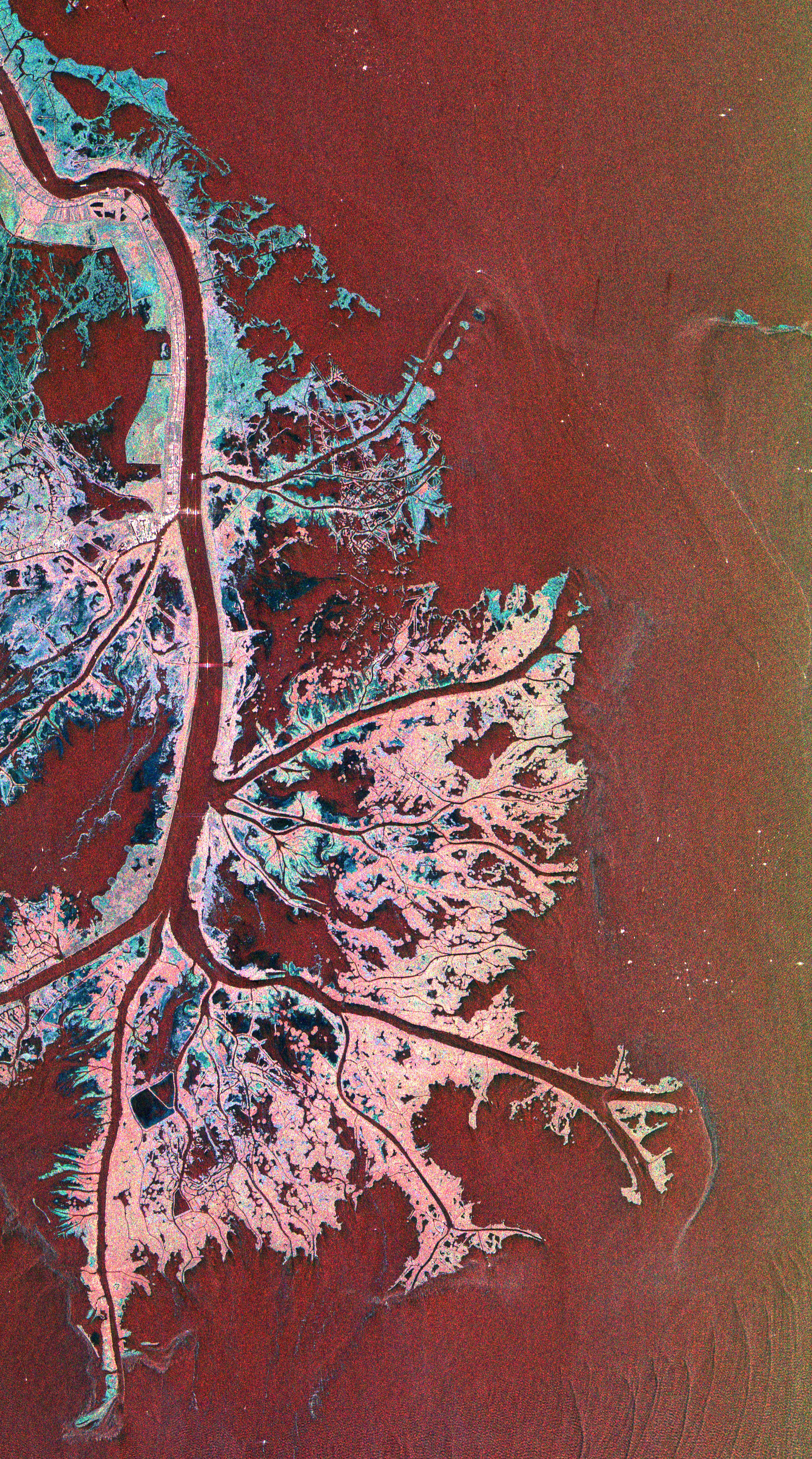
Space Radar Image of Mississippi Delta
Full Resolution:
TIFF
(49.58 MB)
JPEG
(4.041 MB)
|
|
|
1999-04-15 |
Earth
|
Spaceborne Imaging Radar-C/X-Band Synthetic Aperture Radar
|
|
1494x2665x3 |
|
-
PIA01783:
-
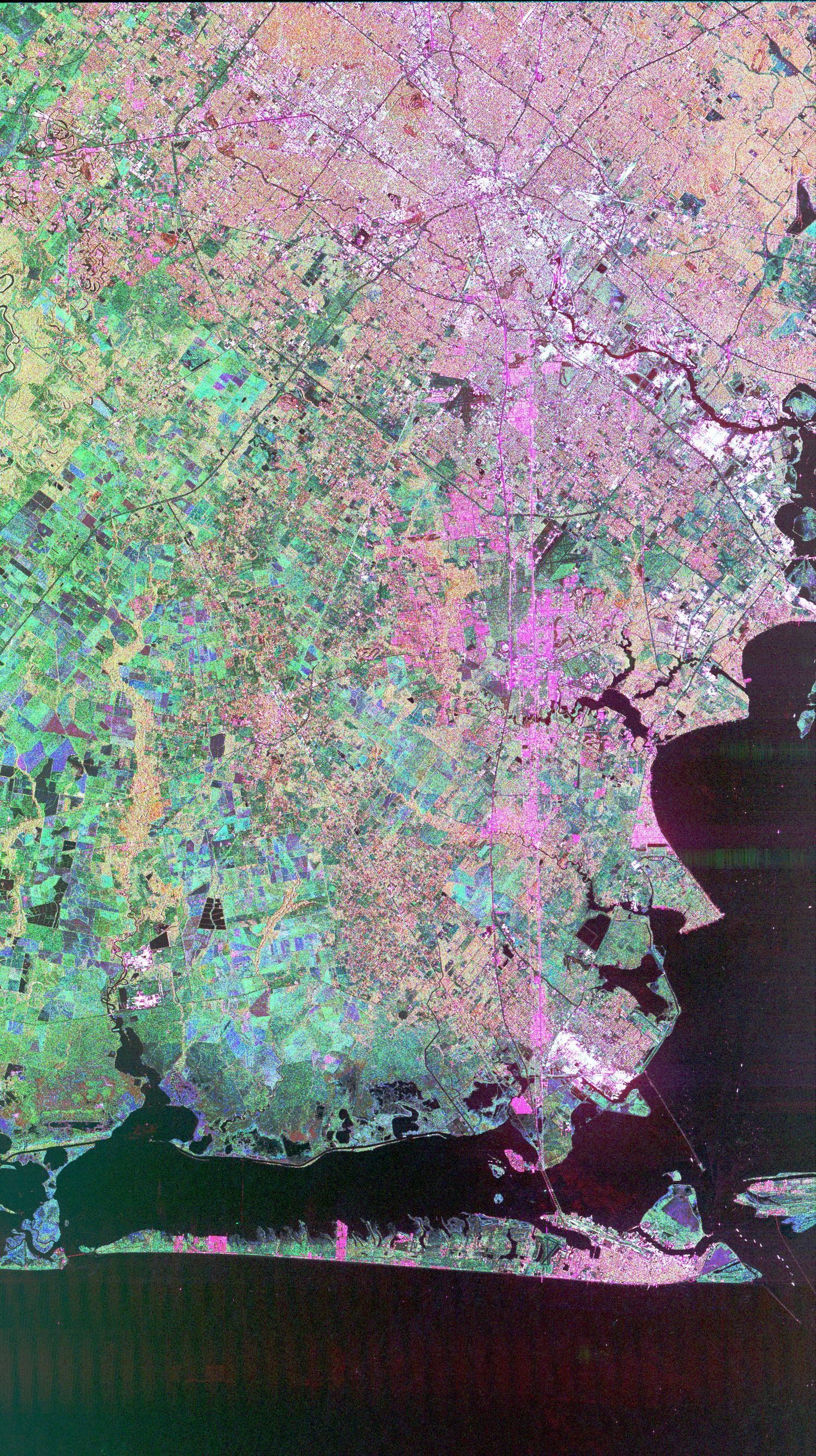
Space Radar Image of Houston, Texas
Full Resolution:
TIFF
(13.73 MB)
JPEG
(1.529 MB)
|
|
|
1999-04-15 |
Earth
|
Spaceborne Imaging Radar-C/X-Band Synthetic Aperture Radar
|
|
1550x2096x3 |
|
-
PIA01781:
-
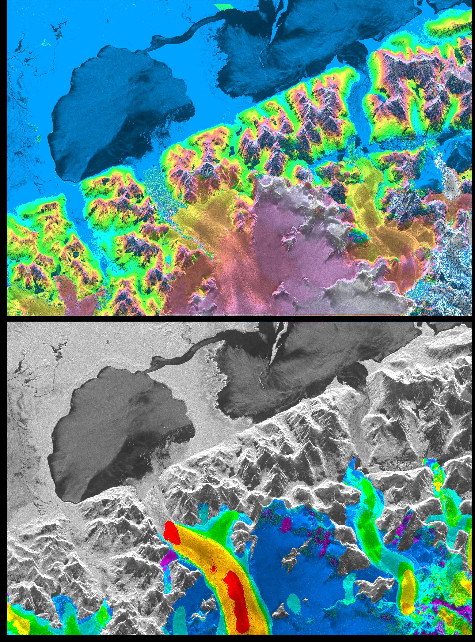
Space Radar Image of San Rafael Glacier, Chile
Full Resolution:
TIFF
(6.016 MB)
JPEG
(908.4 kB)
|
|
|
1999-04-15 |
Earth
|
Spaceborne Imaging Radar-C/X-Band Synthetic Aperture Radar
|
|
1999x2327x3 |

|
-
PIA01778:
-
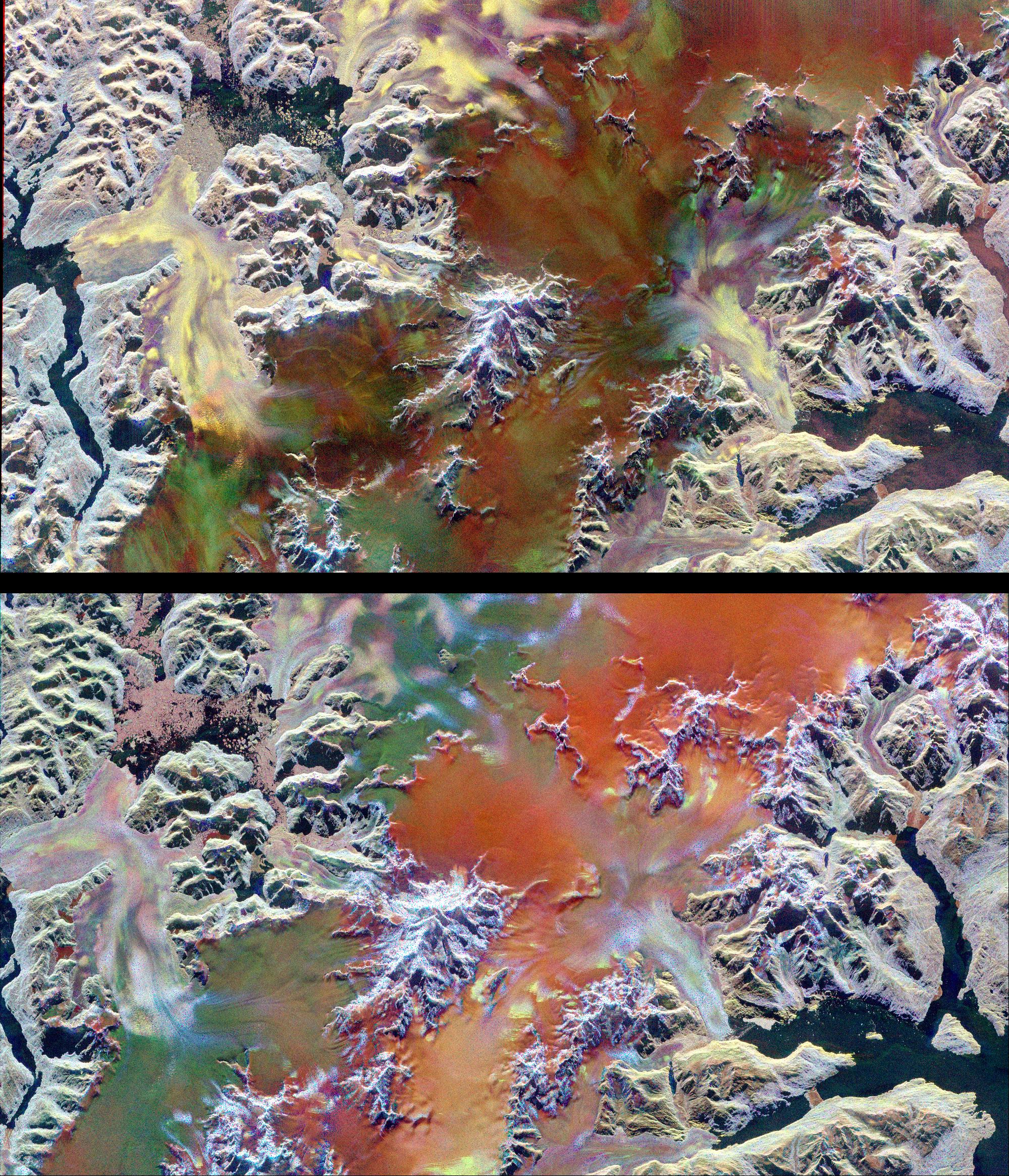
Space Radar Image of Patagonian Ice Fields
Full Resolution:
TIFF
(16.9 MB)
JPEG
(1.593 MB)
|
|
|
1999-04-15 |
Earth
|
Spaceborne Imaging Radar-C/X-Band Synthetic Aperture Radar
|
|
1480x1480x1 |
|
-
PIA01787:
-
Space Radar Image of West Texas - SAR Scan
Full Resolution:
TIFF
(1.434 MB)
JPEG
(452.8 kB)
|
|
|
1999-01-27 |
Earth
|
Spaceborne Imaging Radar-C/X-Band Synthetic Aperture Radar
|
|
376x828x3 |
|
-
PIA01723:
-
Space Radar Image of the Yucatan Impact Crater Site
Full Resolution:
TIFF
(727.4 kB)
JPEG
(179.2 kB)
|
|
|
1999-01-27 |
Earth
|
Spaceborne Imaging Radar-C/X-Band Synthetic Aperture Radar
|
|
798x585x1 |
|
-
PIA01722:
-
Space Radar Image of Colombian Volcano
Full Resolution:
TIFF
(568.7 kB)
JPEG
(181.8 kB)
|
|
|
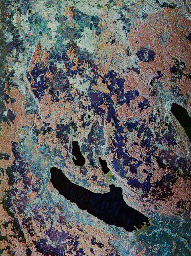
1999-01-27 |
Earth
|
Spaceborne Imaging Radar-C/X-Band Synthetic Aperture Radar
|
|
1075x2000x3 |

|
-
PIA01721:
-
Space Radar Image of the Lost City of Ubar
Full Resolution:
TIFF
(8.57 MB)
JPEG
(952.1 kB)
|
|
|
1999-01-27 |
Earth
|
Spaceborne Imaging Radar-C/X-Band Synthetic Aperture Radar
|
|
690x2309x1 |
|
-
PIA01720:
-
Space Radar Image of Namib Desert in Southern Namib
Full Resolution:
TIFF
(1.742 MB)
JPEG
(721.2 kB)
|
|
|
1999-01-27 |
Earth
|
Spaceborne Imaging Radar-C/X-Band Synthetic Aperture Radar
|
|
1114x1295x3 |

|
-
PIA01719:
-
Space Radar Image of Flevoland, Netherlands
Full Resolution:
TIFF
(5.552 MB)
JPEG
(713.3 kB)
|
|
|
1999-01-27 |
Earth
|
Spaceborne Imaging Radar-C/X-Band Synthetic Aperture Radar
|
|
1440x961x3 |
|
-
PIA01718:
-
Space Radar Image of Mammoth, California in 3-D
Full Resolution:
TIFF
(3.938 MB)
JPEG
(259.6 kB)
|
|
|
1999-01-27 |
Earth
|
Spaceborne Imaging Radar-C/X-Band Synthetic Aperture Radar
|
|
1440x862x3 |
|
-
PIA01717:
-
Space Radar Image of Kilauea, Hawaii in 3-D
Full Resolution:
TIFF
(2.615 MB)
JPEG
(140.6 kB)
|
|
|
1999-01-27 |
Earth
|
Spaceborne Imaging Radar-C/X-Band Synthetic Aperture Radar
|
|
670x900x3 |
|
-
PIA01716:
-
Space Radar Image of Oberpfaffenhofen, Germany
Full Resolution:
TIFF
(2.316 MB)
JPEG
(228.1 kB)
|
|
|
1999-01-27 |
Earth
|
Spaceborne Imaging Radar-C/X-Band Synthetic Aperture Radar
|
|
1280x1024x3 |
|
-
PIA01715:
-
Space Radar Image of Mammoth, California
Full Resolution:
TIFF
(1.8 MB)
JPEG
(315 kB)
|
|
|
1999-01-27 |
Earth
|
Spaceborne Imaging Radar-C/X-Band Synthetic Aperture Radar
|
|
1700x2200x3 |
|
-
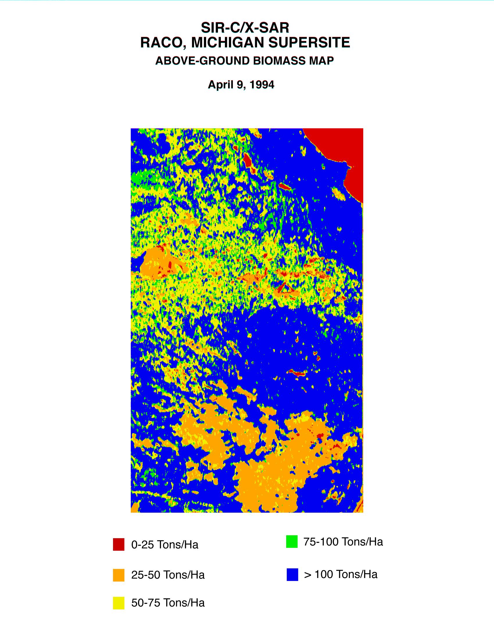
PIA01714:
-
Space Radar Image of Raco Biomass Map
Full Resolution:
TIFF
(628.7 kB)
JPEG
(457.8 kB)
|
|
|
1999-01-27 |
Earth
|
Spaceborne Imaging Radar-C/X-Band Synthetic Aperture Radar
|
|
1700x2200x3 |
|
-
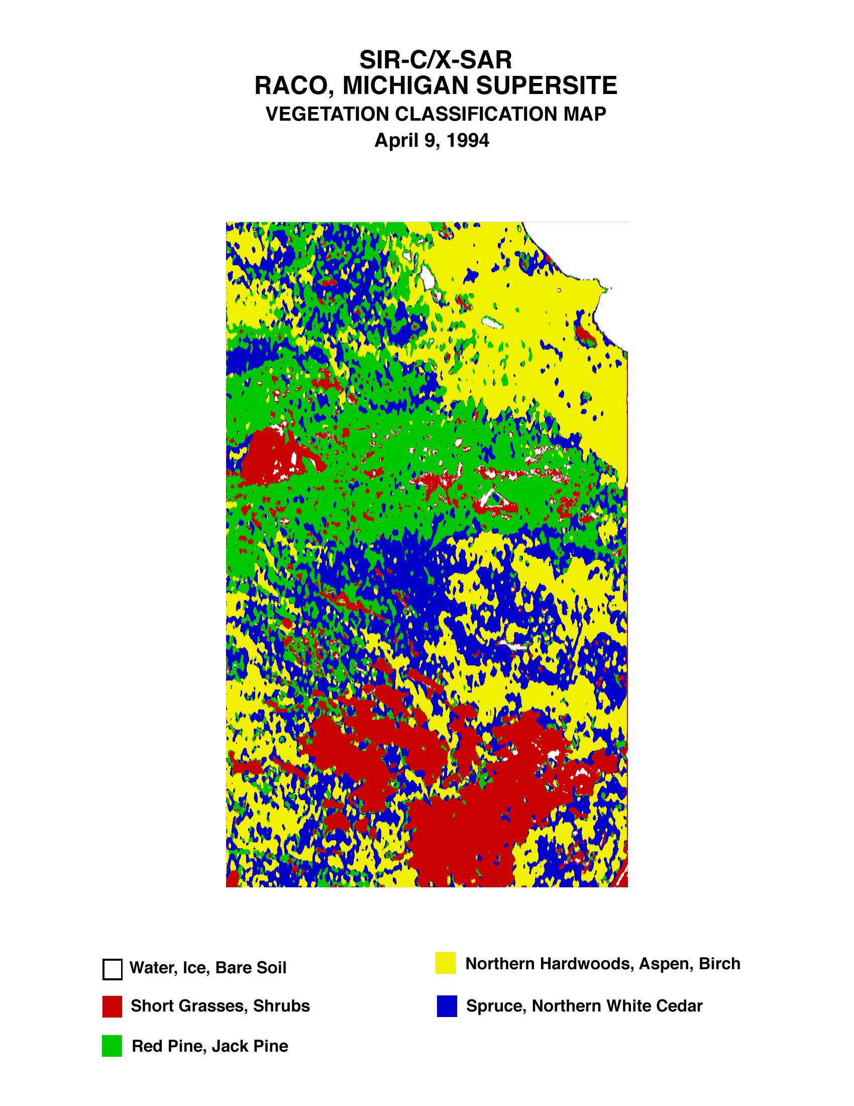
PIA01713:
-
Space Radar Image of Raco Vegetation Map
Full Resolution:
TIFF
(511.3 kB)
JPEG
(447.6 kB)
|
|
|
1999-01-27 |
Earth
|
Spaceborne Imaging Radar-C/X-Band Synthetic Aperture Radar
|
|
1280x1024x3 |
|
-
PIA01712:
-
Space Radar Image of Manaus, Brazil
Full Resolution:
TIFF
(1.531 MB)
JPEG
(300.6 kB)
|
|
|
1999-01-27 |
Earth
|
Spaceborne Imaging Radar-C/X-Band Synthetic Aperture Radar
|
|
736x994x3 |
|
-
PIA01711:
-
Space Radar Image of Safsaf, North Africa
Full Resolution:
TIFF
(2.76 MB)
JPEG
(328.7 kB)
|
|
|
1999-01-27 |
Earth
|
Spaceborne Imaging Radar-C/X-Band Synthetic Aperture Radar
|
|
1042x1433x3 |

|
-
PIA01710:
-
Space Radar Image of Kilauea, Hawaii
Full Resolution:
TIFF
(5.636 MB)
JPEG
(549.3 kB)
|
|
|
1999-01-27 |
Earth
|
Spaceborne Imaging Radar-C/X-Band Synthetic Aperture Radar
|
|
1116x1130x3 |
|
-
PIA01709:
-
SPace Radar Image of Mt. Pinatubo, Philippines
Full Resolution:
TIFF
(4.975 MB)
JPEG
(576.1 kB)
|
|
|
1999-01-27 |
Earth
|
Spaceborne Imaging Radar-C/X-Band Synthetic Aperture Radar
|
|
1440x972x3 |

|
-
PIA01708:
-
Space Radar Image Isla Isabela in 3-D
Full Resolution:
TIFF
(1.477 MB)
JPEG
(173.6 kB)
|
|
|
1999-01-27 |
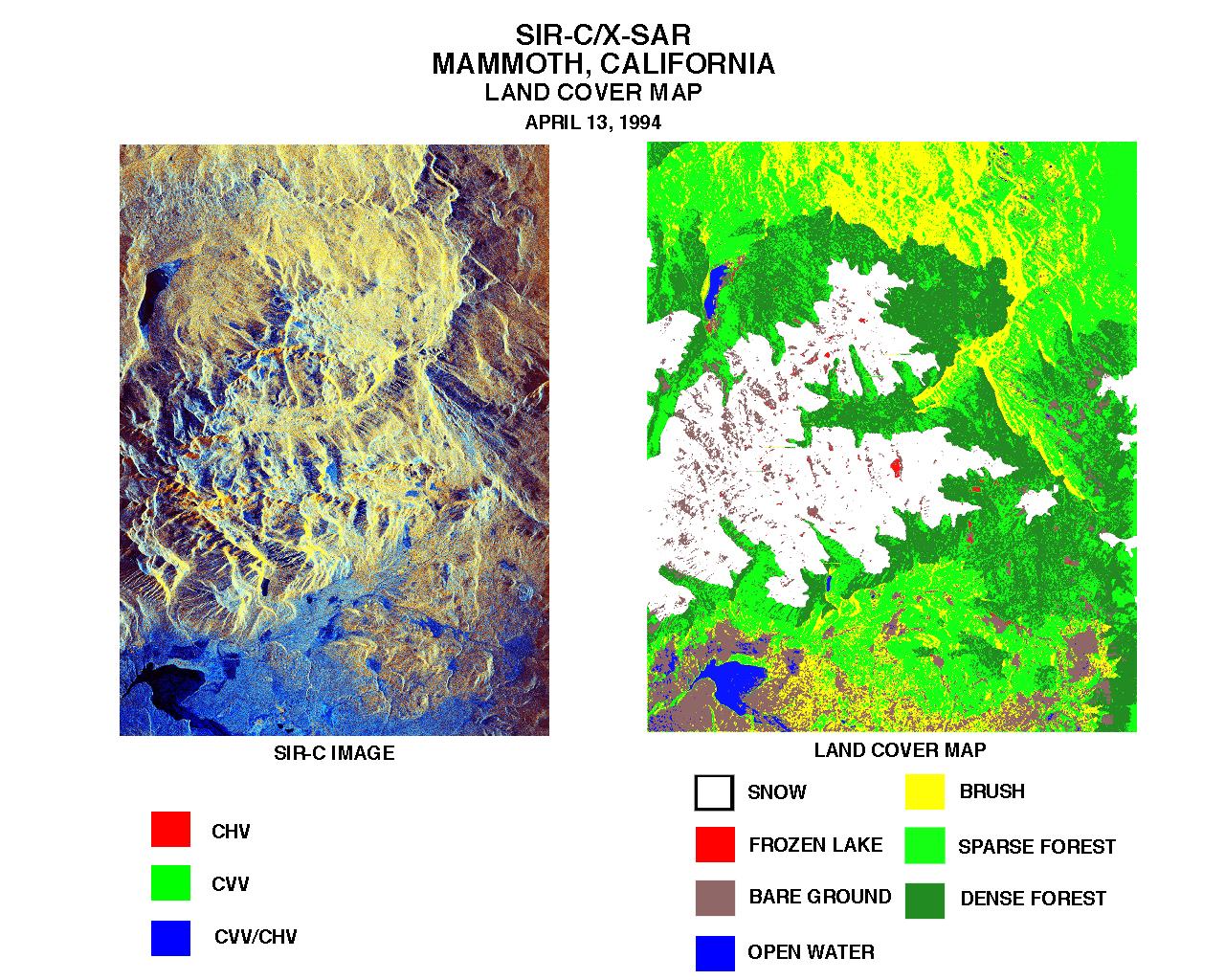
Earth
|
Spaceborne Imaging Radar-C/X-Band Synthetic Aperture Radar
|
|
768x2026x3 |
|
-
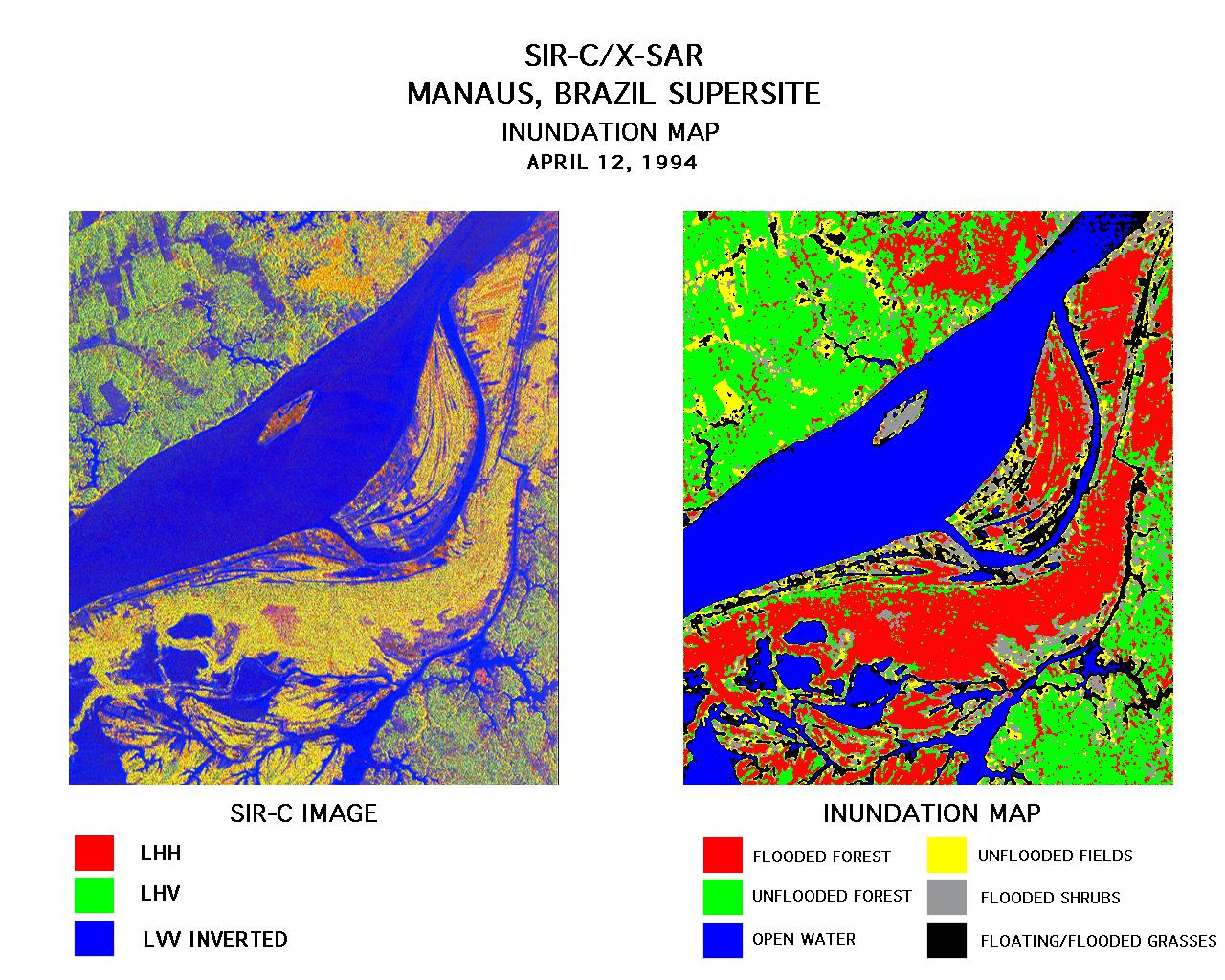
PIA01706:
-
Space Radar Image of Manaus, Brazil
Full Resolution:
TIFF
(6.189 MB)
JPEG
(710.6 kB)
|
|
|
1999-01-27 |
Earth
|
Spaceborne Imaging Radar-C/X-Band Synthetic Aperture Radar
|
|
866x1813x3 |
|
-
PIA01705:
-
Space Radar Image of Mammoth, California
Full Resolution:
TIFF
(5.759 MB)
JPEG
(635.4 kB)
|
|
|
1999-01-27 |
Earth
|
Spaceborne Imaging Radar-C/X-Band Synthetic Aperture Radar
|
|
698x2299x3 |

|
-
PIA01704:
-
Space Radar Image of Oetzal, Austria
Full Resolution:
TIFF
(5.334 MB)
JPEG
(639.8 kB)
|
|
|
1999-01-27 |
Earth
|
Spaceborne Imaging Radar-C/X-Band Synthetic Aperture Radar
|
|
1536x972x3 |
|
-
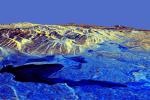
PIA01703:
-
Space Radar Image of Death Valley in 3-D
Full Resolution:
TIFF
(1.41 MB)
JPEG
(167.8 kB)
|
|
|
1999-01-27 |
Earth
|
Spaceborne Imaging Radar-C/X-Band Synthetic Aperture Radar
|
|
788x1838x3 |
|
-
PIA01702:
-
Space Radar Image of Prince Albert, Canada
Full Resolution:
TIFF
(3.205 MB)
JPEG
(705.9 kB)
|
|
|
1999-01-27 |
Earth
|
Spaceborne Imaging Radar-C/X-Band Synthetic Aperture Radar
|
|
784x1765x1 |
|
-
PIA01701:
-
Space Radar Image of Death Valley, California
Full Resolution:
TIFF
(1.602 MB)
JPEG
(565.3 kB)
|
|
|
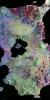
1998-10-13 |
Callisto
|
Galileo
|
Solid-State Imaging
|
6490x13101x1 |

|
-
PIA01634:
-
Asgard Multi-Ring Structure on Callisto
Full Resolution:
TIFF
(51.5 MB)
JPEG
(5.352 MB)
|
|
|
1998-08-02 |
Uranus
|
Hubble Space Telescope
|
WFPC2
|
490x512x1 |
|
-
PIA01281:
-
Hubble Observes the Moons and Rings of Uranus
Full Resolution:
TIFF
(15.63 kB)
JPEG
(9.077 kB)
|
|
|
1998-05-21 |
Europa
|
Galileo
|
Solid-State Imaging
|
4000x2024x1 |
|
-
PIA01407:
-
Europa Imaging Highlights During GEM
Full Resolution:
TIFF
(6.84 MB)
JPEG
(791.3 kB)
|
|
|
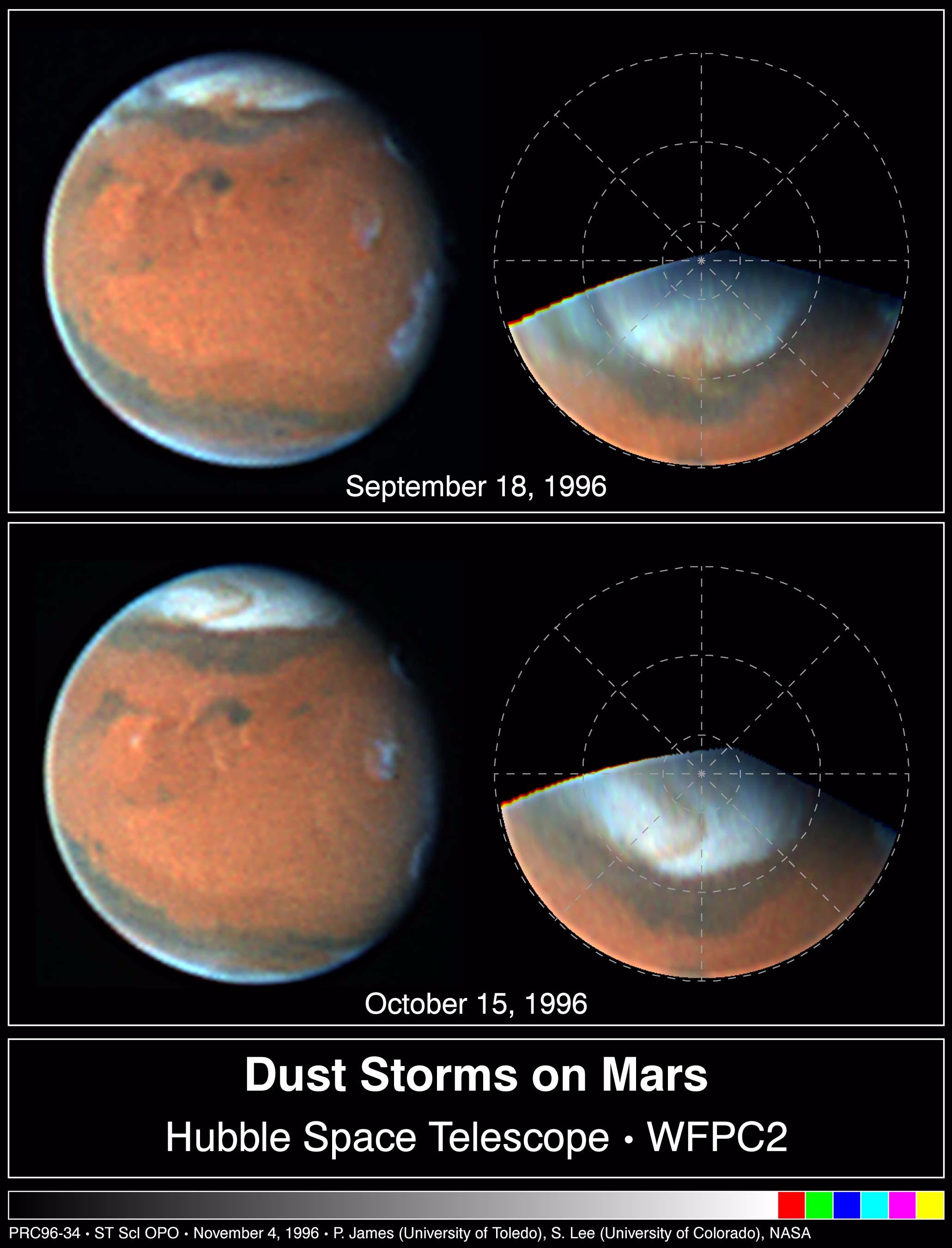
1998-05-02 |
Mars
|
Hubble Space Telescope
|
WFPC2
|
2061x2701x3 |
|
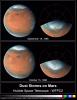
-
PIA01251:
-
Springtime Dust Storm Swirls at Martian North Pole
Full Resolution:
TIFF
(6.992 MB)
JPEG
(317.1 kB)
|
|
|
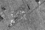
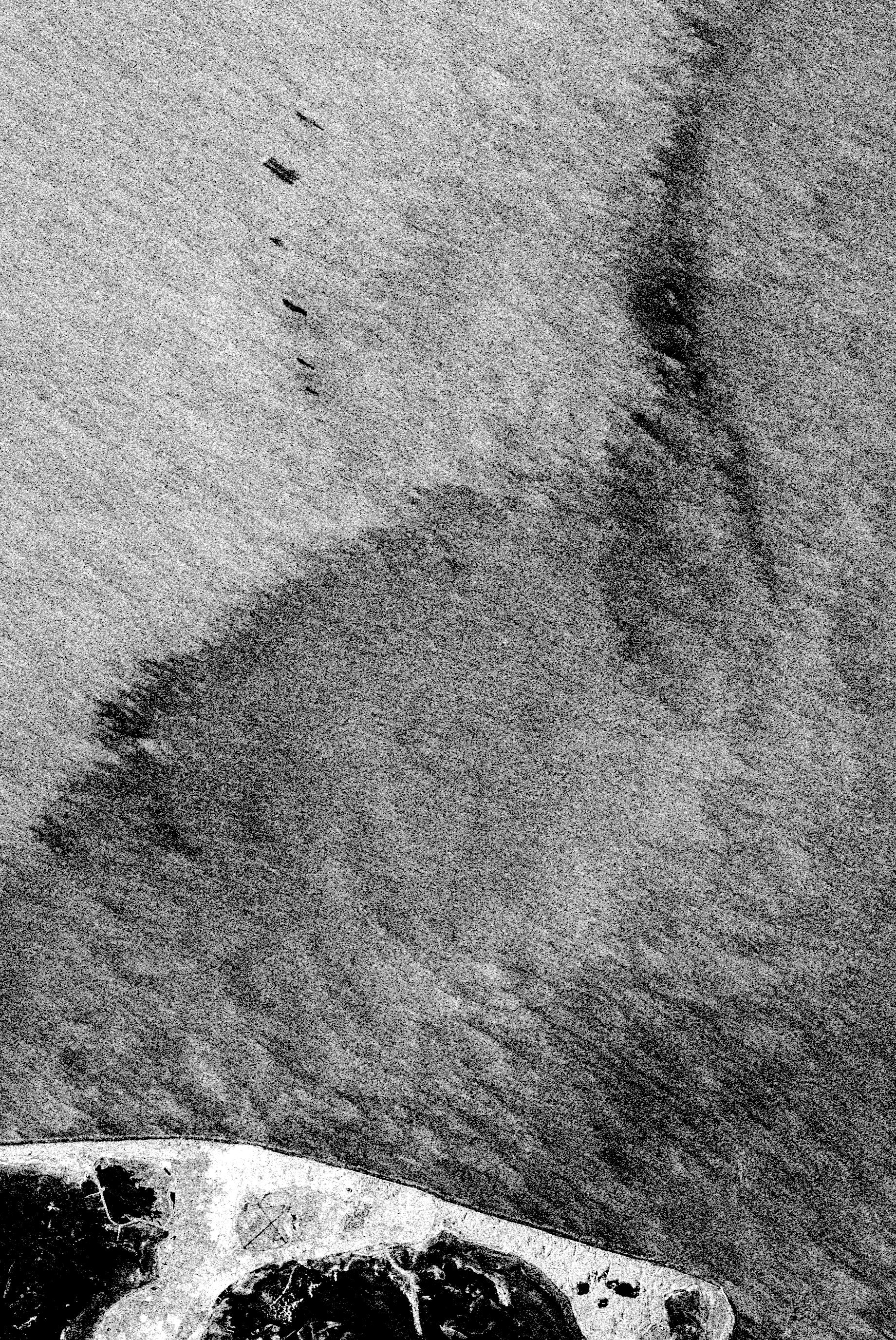
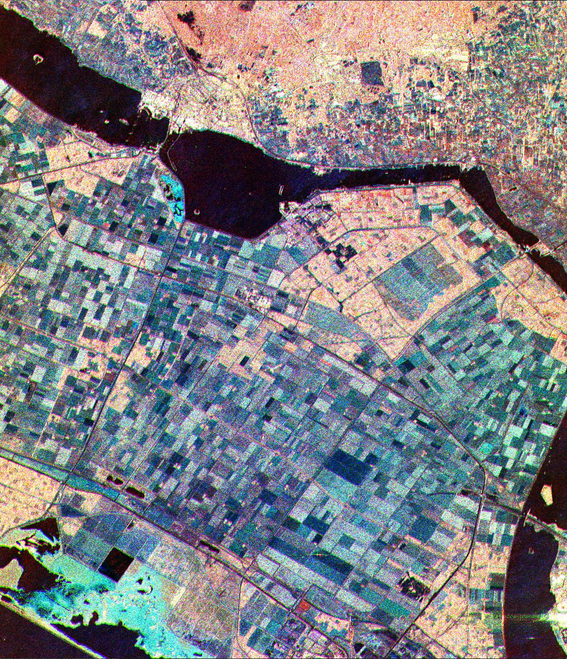
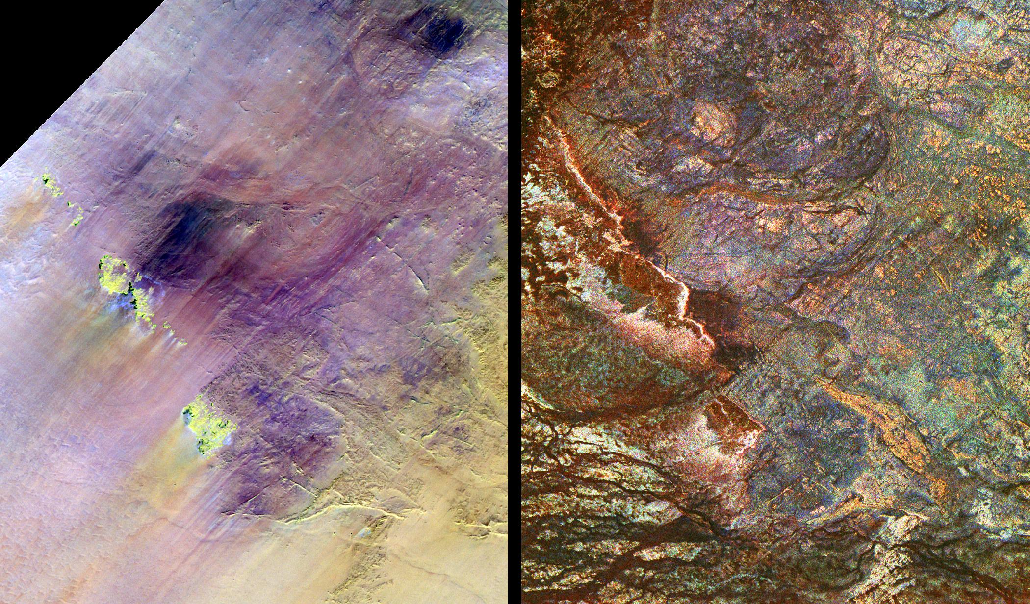
1998-04-06 |
Earth
|
Spaceborne Imaging Radar-C/X-Band Synthetic Aperture Radar
|
L-Band Imaging Radar
|
2100x1232x3 |
|
-
PIA00737:
-
Safsaf Oasis, Egypt
Full Resolution:
TIFF
(7.751 MB)
JPEG
(722.3 kB)
|
|
|
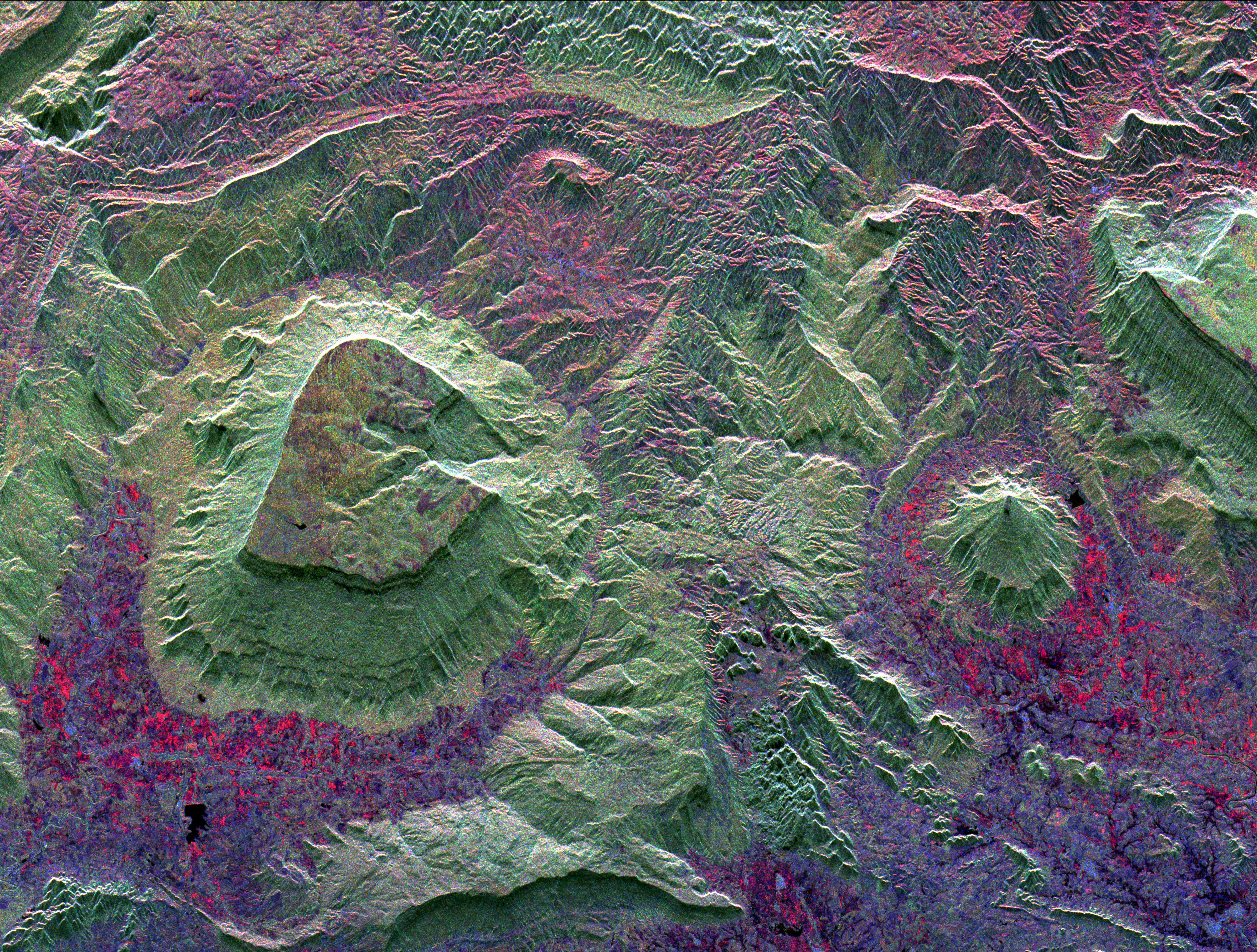
1998-04-06 |
Earth
|
Spaceborne Imaging Radar-C/X-Band Synthetic Aperture Radar
|
L-Band Imaging Radar
|
4001x3032x3 |
|
-
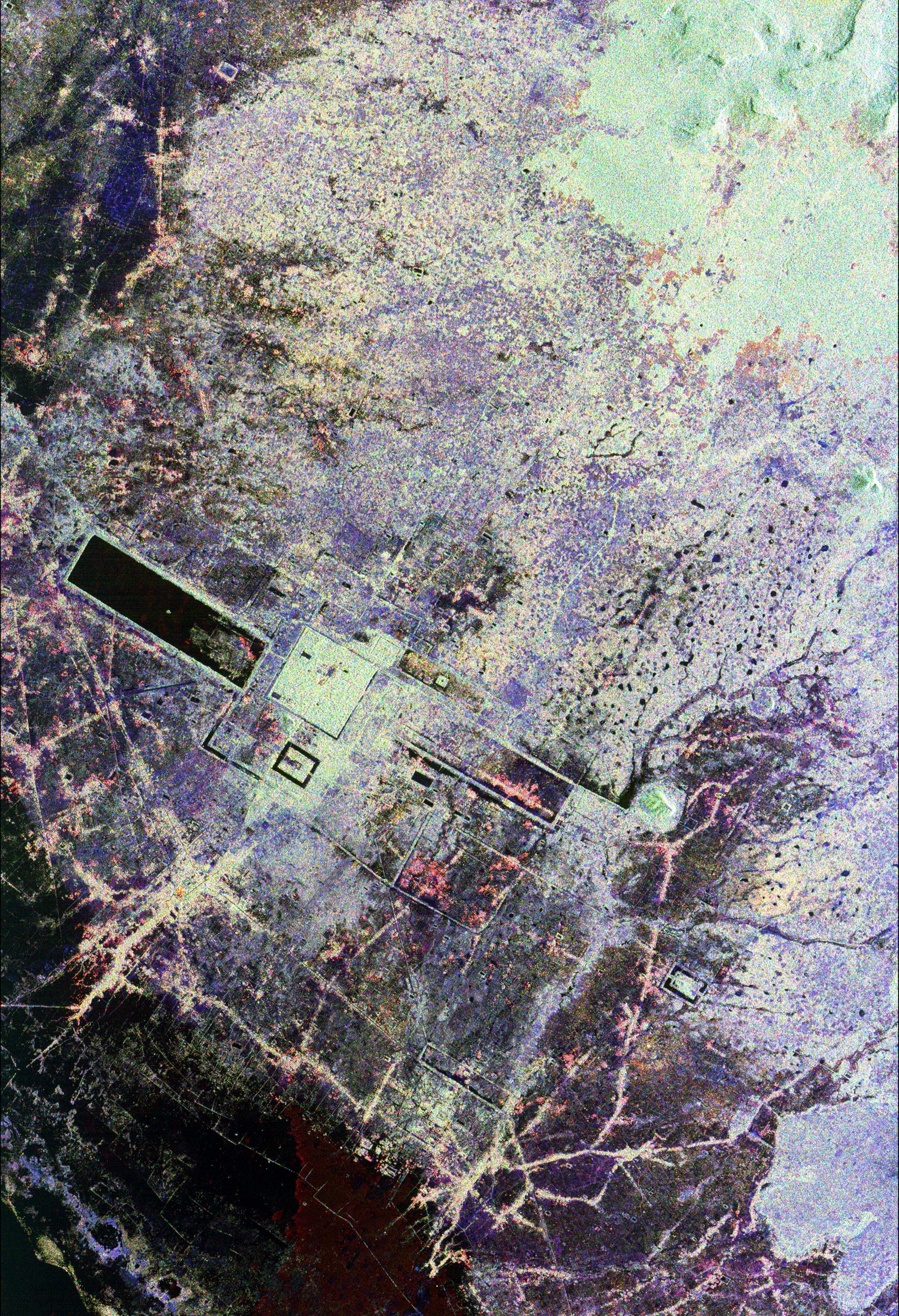
PIA01235:
-
North Central Thailand
Full Resolution:
TIFF
(44.97 MB)
JPEG
(3.526 MB)
|
|
|
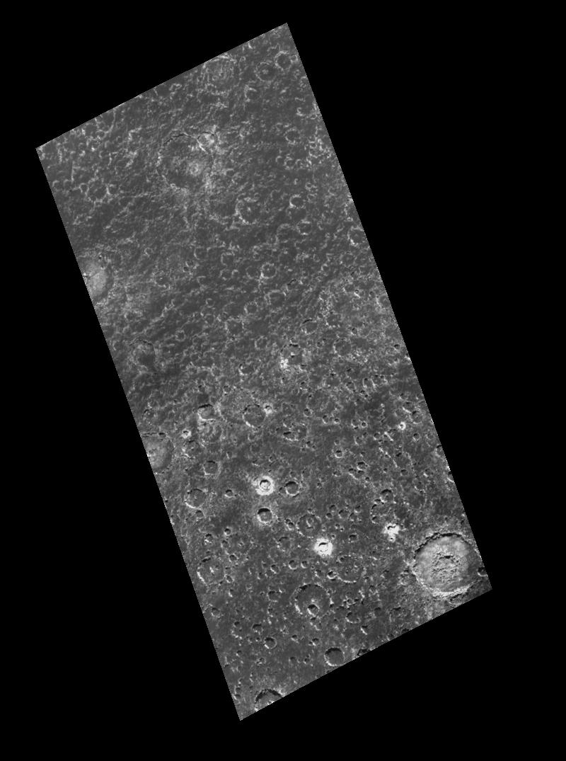
1998-03-26 |
Callisto
|
Galileo
|
Solid-State Imaging
|
800x1075x1 |
|
-
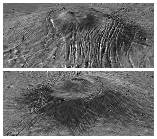
PIA01221:
-
Heavy Cratering near Callisto's South Pole
Full Resolution:
TIFF
(300.4 kB)
JPEG
(83.2 kB)
|
|
|
1997-07-13 |
Mars
|
Mars Pathfinder (MPF)
|
Imager for Mars Pathfinder
|
640x480x3 |
|
-
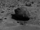
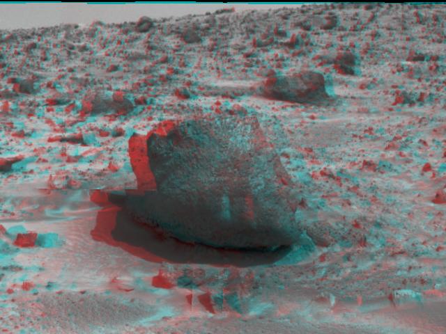
PIA00688:
-
'Yogi' the Rock - 3-D
Full Resolution:
TIFF
(812.5 kB)
JPEG
(52.49 kB)
|
|
|
1997-07-07 |
Mars
|
Mars Pathfinder (MPF)
|
Imager for Mars Pathfinder
|
640x480x1 |
|
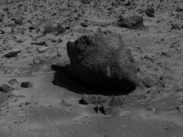
-
PIA00639:
-
"Yogi" the Rock
Full Resolution:
TIFF
(254.7 kB)
JPEG
(41 kB)
|
|
|
1996-11-13 |
Earth
|
Spaceborne Imaging Radar-C/X-Band Synthetic Aperture Radar
|
Imaging Radar
|
2732x4000x3 |
|
-
PIA00505:
-
Angkor, Cambodia
Full Resolution:
TIFF
(41.23 MB)
JPEG
(3.655 MB)
|


