- Original Caption Released with Image:
-
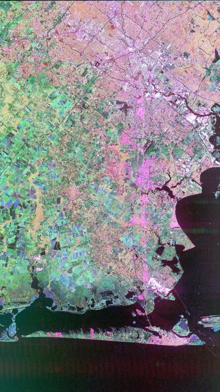
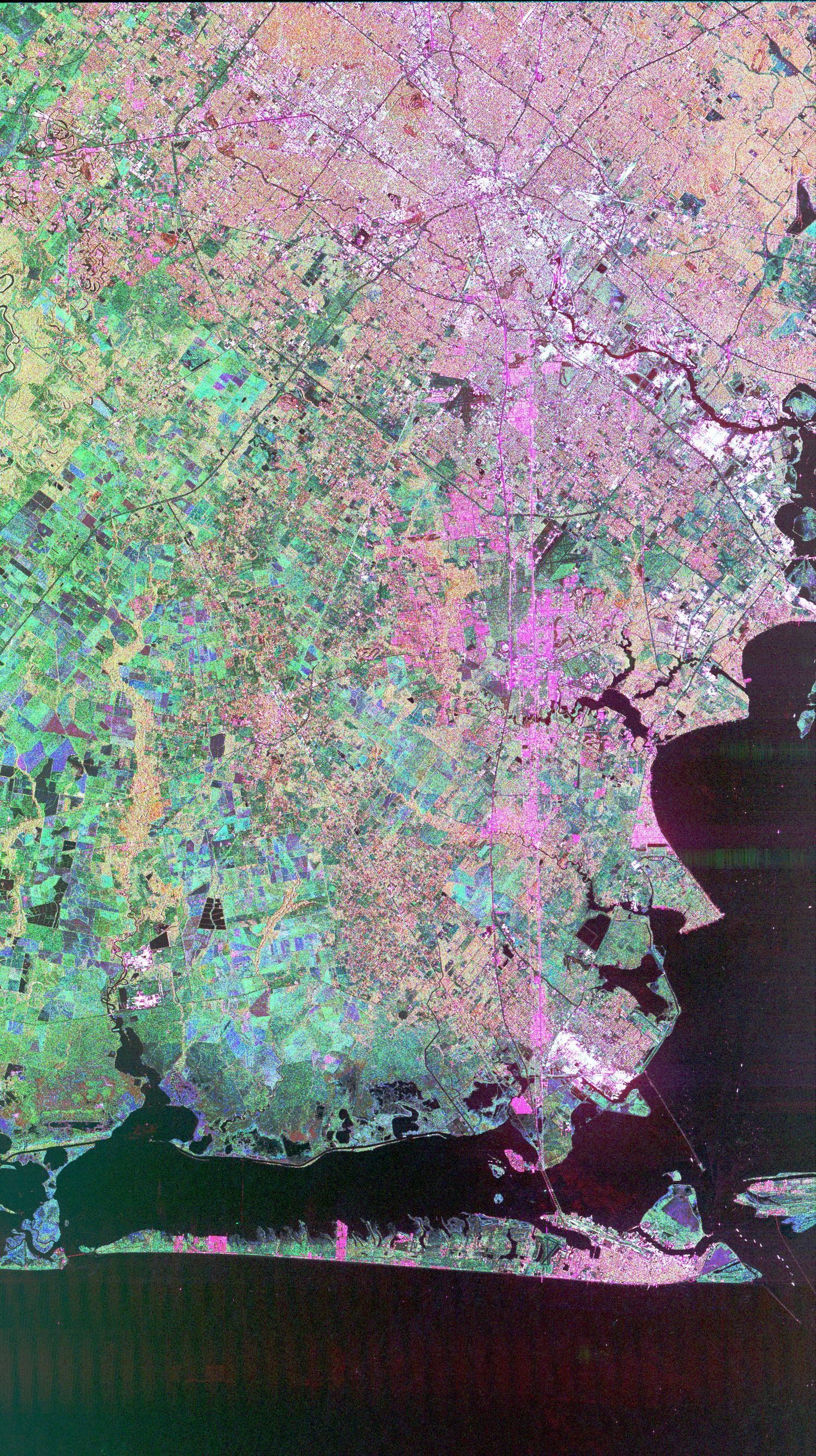
This image of Houston, Texas, shows the amount of detail that is possible to obtain using spaceborne radar imaging. Images such as this -- obtained by the Spaceborne Imaging Radar-C/X-band Synthetic Aperture Radar (SIR-C/X-SAR) flying aboard the space shuttle Endeavor last fall -- can become an effective tool for urban planners who map and monitor land use patterns in urban, agricultural and wetland areas. Central Houston appears pink and white in the upper portion of the image, outlined and crisscrossed by freeways. The image was obtained on October 10, 1994, during the space shuttle's 167th orbit. The area shown is 100 kilometers by 60 kilometers (62 miles by 38 miles) and is centered at 29.38 degrees north latitude, 95.1 degrees west longitude. North is toward the upper left. The pink areas designate urban development while the green-and blue-patterned areas are agricultural fields. Black areas are bodies of water, including Galveston Bay along the right edge and the Gulf of Mexico at the bottom of the image. Interstate 45 runs from top to bottom through the image. The narrow island at the bottom of the image is Galveston Island, with the city of Galveston at its northeast (right) end. The dark cross in the upper center of the image is Hobby Airport. Ellington Air Force Base is visible below Hobby on the other side of Interstate 45. Clear Lake is the dark body of water in the middle right of the image. The green square just north of Clear Lake is Johnson Space Center, home of Mission Control and the astronaut training facilities. The black rectangle with a white center that appears to the left of the city center is the Houston Astrodome. The colors in this image were obtained using the follow radar channels: red represents the L-band (horizontally transmitted, vertically received); green represents the C-band (horizontally transmitted, vertically received); blue represents the C-band (horizontally transmitted and received).
Spaceborne Imaging Radar-C/X-band Synthetic Aperture Radar (SIR-C/X-SAR) is part of NASA's Mission to Planet Earth. The radars illuminate Earth with microwaves, allowing detailed observations at any time, regardless of weather or sunlight conditions. SIR-C/X-SAR uses three microwave wavelengths: L-band (24 cm), C-band (6 cm) and X-band (3 cm). The multi-frequency data will be used by the international scientific community to better understand the global environment and how it is changing. The SIR-C/X-SAR data, complemented by aircraft and ground studies, will give scientists clearer insights into those environmental changes which are caused by nature and those changes which are induced by human activity.
SIR-C was developed by NASA's Jet Propulsion Laboratory. X-SAR was developed by the Dornier and Alenia Spazio companies for the German space agency, Deutsche Agentur fuer Raumfahrtangelegenheiten (DARA), and the Italian space agency, Agenzia Spaziale Italiana (ASI) with the Deutsche Forschungsanstalt fuer luft und Raumfahrt e.V.(DLR), the major partner in science, operations and data processing of X-SAR.
- Image Credit:
-
NASA/JPL
Image Addition Date: -
1999-04-15
|