Planetary Data System
PDS Information
Find a Node - Use these links to navigate to any of the 8 publicly accessible PDS Nodes.

This bar indicates that you are within the PDS enterprise which includes 6 science discipline nodes and 2 support nodes which are overseen by the Project Management Office at NASA's Goddard Space Flight Center (GSFC). Each node is led by an expert in the subject discipline, supported by an advisory group of other practitioners of that discipline, and subject to selection and approval under a regular NASA Research Announcement.
Click here to return to the Photojournal Home Page Click here to view a list of Photojournal Image Galleries Photojournal_inner_header
Latest Images  |  Spacecraft & Technology  |  Animations  |  Space Images App  |  Feedback  |  Photojournal Search  
Your search criteria found 509 images
Feature Name
Go to PIAxxxxx:
Refine this list of images by:
Target:
Mission:
Spacecraft:
Instrument:
Click on an image for detailed information
Click on a column heading to sort in ascending or descending order
My
List
Addition DateSort Ascending Target Mission Instrument Size
Add Image to Favorite List 1998-04-06 Earth Spaceborne Imaging Radar-C/X-Band Synthetic Aperture Radar
L-Band Imaging Radar
2100x1232x3
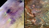
These images show two views of a region of south-central Egypt. On the left is an optical image from NASA's Landsat Thematic Mapper, and on the right is a radar image from NASA's Spaceborne Imaging Radar-C/X-band Synthetic Aperture Radar (SIR-C/X-SAR).
PIA00737:
Safsaf Oasis, Egypt
Full Resolution:     TIFF (7.751 MB)     JPEG (722.3 kB)
Add Image to Favorite List 1998-04-06 Earth Spaceborne Imaging Radar-C/X-Band Synthetic Aperture Radar
L-Band Imaging Radar
4001x3032x3
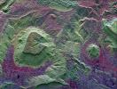
This radar image shows the dramatic landscape in the Phang Hoei Range of north central Thailand, about 40 kilometers (25 miles) northeast of the city of Lom Sak.
PIA01235:
North Central Thailand
Full Resolution:     TIFF (44.97 MB)     JPEG (3.526 MB)
Add Image to Favorite List 1998-03-26 Callisto Galileo
Solid-State Imaging
800x1075x1
Images from NASA's Galileo spacecraft provide new insights into this region near Callisto's south pole. This two frame mosaic shows a heavily cratered surface with smooth plains in the areas between craters.
PIA01221:
Heavy Cratering near Callisto's South Pole
Full Resolution:     TIFF (300.4 kB)     JPEG (83.2 kB)
Add Image to Favorite List 1997-07-13 Mars Mars Pathfinder (MPF)
Imager for Mars Pathfinder
640x480x3
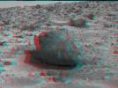
'Yogi,' a rock taller than NASA's rover Sojourner taken in stereo by NASA's Mars Pathfinder. 3D glasses are necessary to identify surface detail.
PIA00688:
'Yogi' the Rock - 3-D
Full Resolution:     TIFF (812.5 kB)     JPEG (52.49 kB)
Add Image to Favorite List 1997-07-07 Mars Mars Pathfinder (MPF)
Imager for Mars Pathfinder
640x480x1
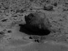
'Yogi,' a rock taller than rover Sojourner, is the subject of this image, taken by NASA's deployed Imager for Mars Pathfinder (IMP) on July 7, 1997.
PIA00639:
"Yogi" the Rock
Full Resolution:     TIFF (254.7 kB)     JPEG (41 kB)
Add Image to Favorite List 1996-11-13 Earth Spaceborne Imaging Radar-C/X-Band Synthetic Aperture Radar
Imaging Radar
2732x4000x3
This is an image of the area around the city of Angkor, Cambodia. The city houses an ancient complex of more than 60 temples dating back to the 9th century.
PIA00505:
Angkor, Cambodia
Full Resolution:     TIFF (41.23 MB)     JPEG (3.655 MB)
Add Image to Favorite List 1996-11-13 Earth Spaceborne Imaging Radar-C/X-Band Synthetic Aperture Radar
Imaging Radar
2620x3320x3
This is a space radar image of the area around the Unzen volcano, on the west coast of Kyushu Island in southwestern Japan.
PIA00504:
Unzen Volcano, Japan
Full Resolution:     TIFF (14.37 MB)     JPEG (1.832 MB)
Add Image to Favorite List 1996-11-13 Earth Spaceborne Imaging Radar-C/X-Band Synthetic Aperture Radar
Imaging Radar
2910x2040x3
This space radar image shows the Roter Kamm impact crater in southwest Namibia. The crater rim is seen in the lower center of the image as a radar-bright, circular feature.
PIA00503:
Roter Kamm Impact Crater in Namibia
Full Resolution:     TIFF (20.03 MB)     JPEG (1.839 MB)
Add Image to Favorite List 1996-10-23 Earth Spaceborne Imaging Radar-C/X-Band Synthetic Aperture Radar
L-Band Imaging Radar
1427x976x1
This is an image showing part of Isla Isabella in the western Galapagos Islands. It was taken by the L-band radar in HH polarization from the Spaceborne Imaging Radar C/X-Band Synthetic Aperture Radar on the 40th orbit of NASA's space shuttle Endeavour.
PIA00499:
Radar Image of Galapagos Island
Full Resolution:     TIFF (1.63 MB)     JPEG (407.5 kB)
Retrieve Previous Set  Jump to a Previous Set   Jump to a Previous Set   Jump to a Previous Set   Jump to a Previous Set   Jump to a Previous Set   Current Set 
 1-100   101-200   201-300   301-400   401-500   501-600 
Currently displaying images: 501 - 509 of 509