Your search criteria found
1671
images
Target is Mars (and available satellites)
Go to PIAxxxxx:
Refine this list of images by:
Target:
Deimos
Mars
Phobos
Spacecraft:
Curiosity
Mars Reconnaissance Orbiter (MRO)
Mars Science Laboratory (MSL)
Opportunity
Phoenix Lander
Instrument:
Compact Reconnaissance Imaging Spectrometer for Mars (CRISM)
Context Camera (CTX)
High Resolution Imaging Science Experiment (HiRISE)
Mars Climate Sounder (MCS)
Mars Color Imager (MARCI)
Mars Orbiter Laser Altimeter
Optical Navigation Camera
Shallow Subsurface Radar (SHARAD)
Click on an image for detailed information
Click on a column heading to sort in ascending or descending order
My
List
Addition Date
Target
Mission
Instrument
Size
2017-03-06
Mars
Mars Reconnaissance Orbiter (MRO)
HiRISE
2880x1800x3
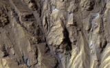
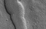
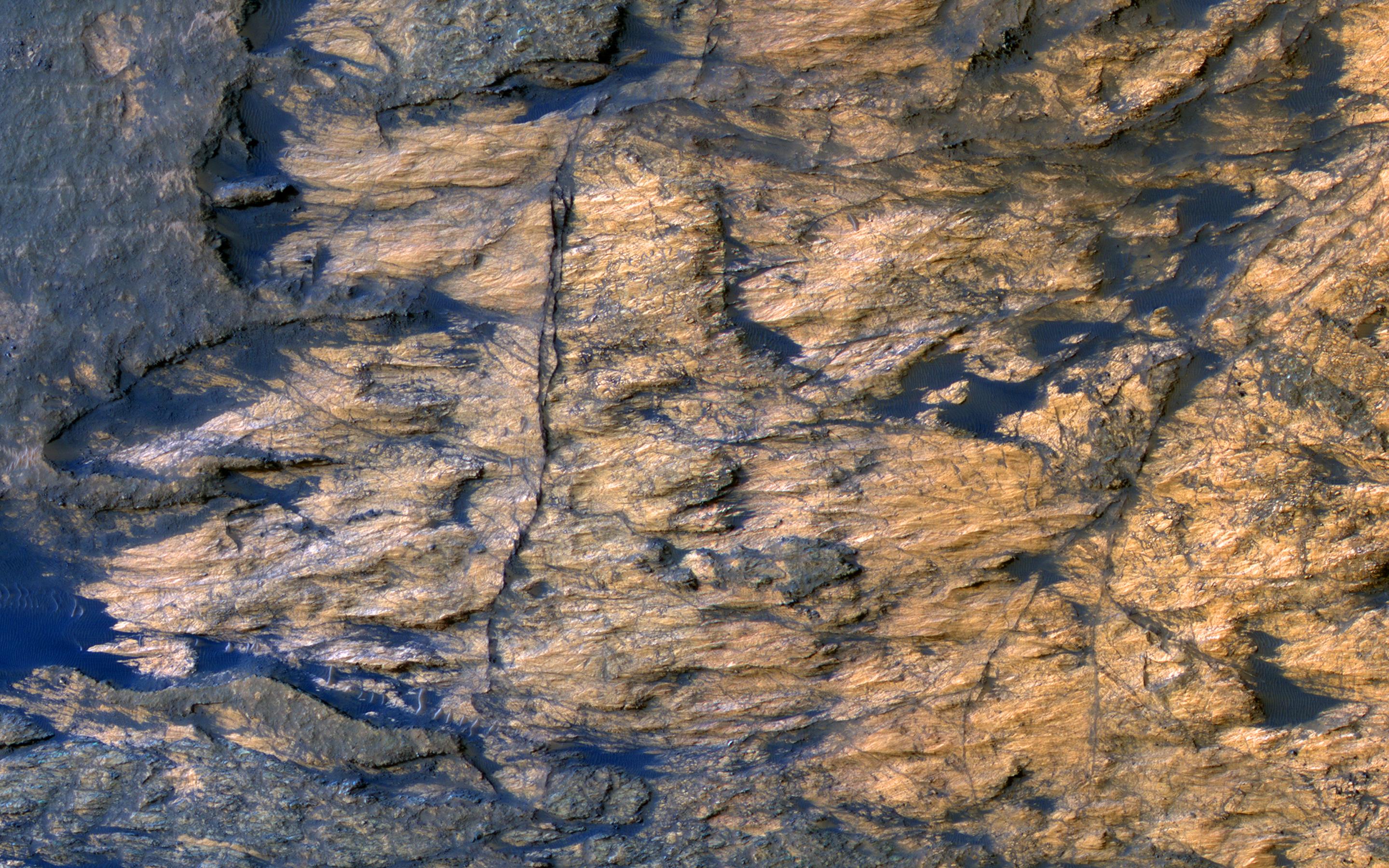
PIA21554:
A Mass of Viscous Flow Features
Full Resolution:
TIFF
(15.56 MB)
JPEG
(924.8 kB)
2017-03-07
Mars
Mars Reconnaissance Orbiter (MRO)
HiRISE
2880x1800x3
PIA21555:
The Entrance to Mawrth Vallis
Full Resolution:
TIFF
(15.56 MB)
JPEG
(597.1 kB)
2017-03-08
Mars
Mars Reconnaissance Orbiter (MRO)
HiRISE
2880x1800x3
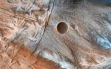
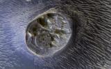
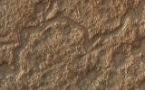
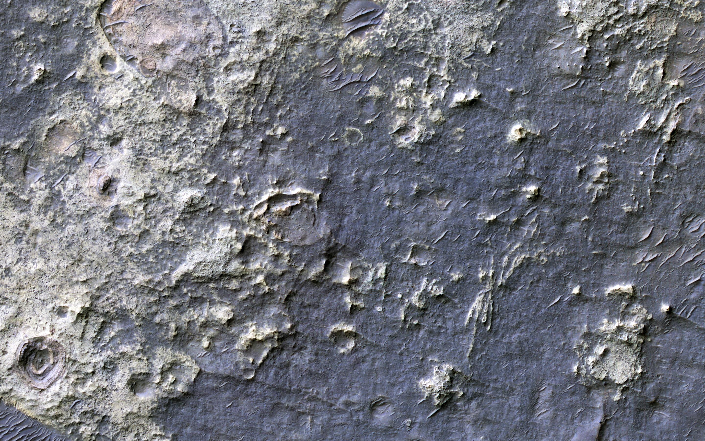
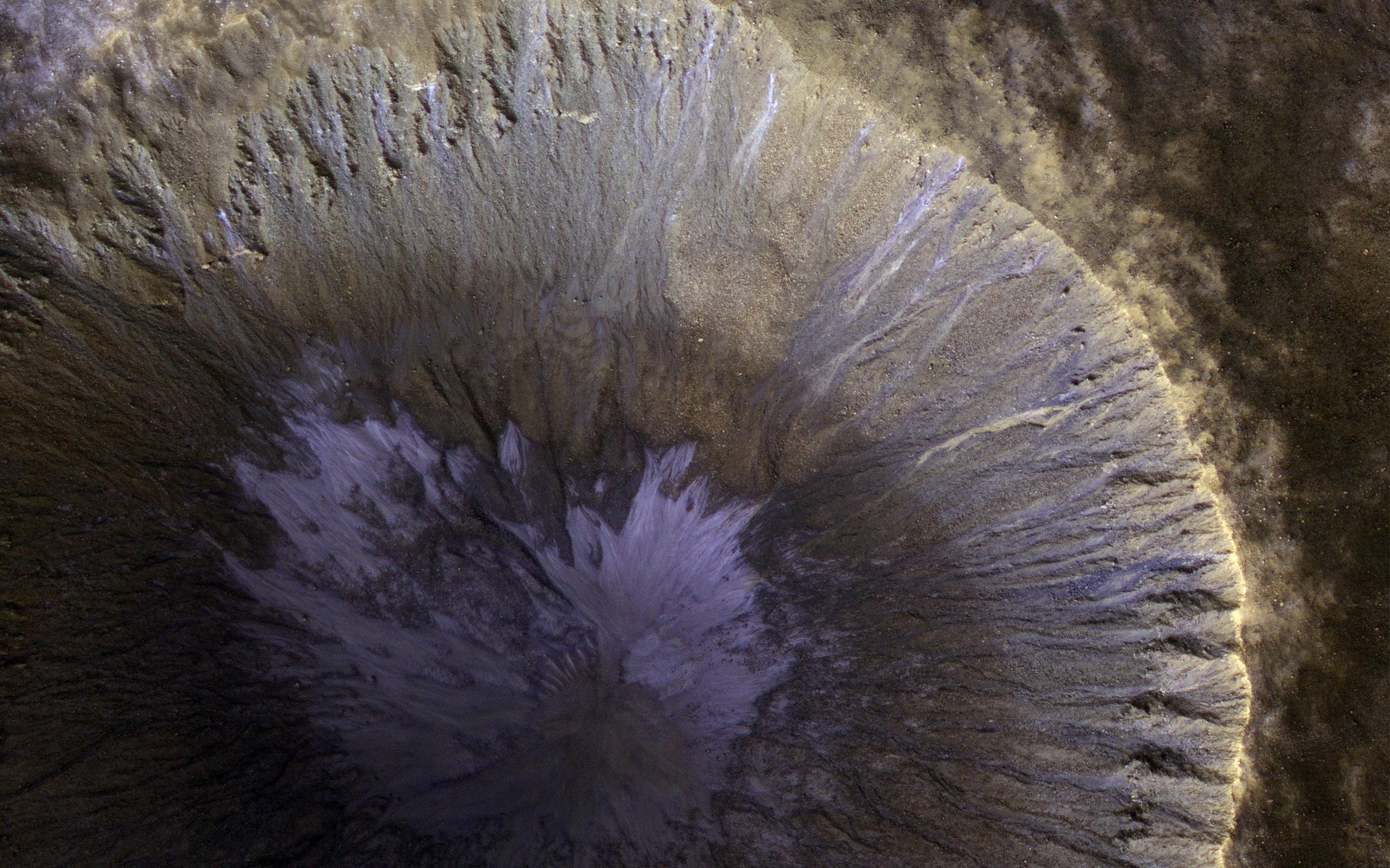
PIA21556:
Icy Flow in a Crater
Full Resolution:
TIFF
(15.13 MB)
JPEG
(567.3 kB)
2017-03-09
Mars
Mars Reconnaissance Orbiter (MRO)
HiRISE
2880x1800x3
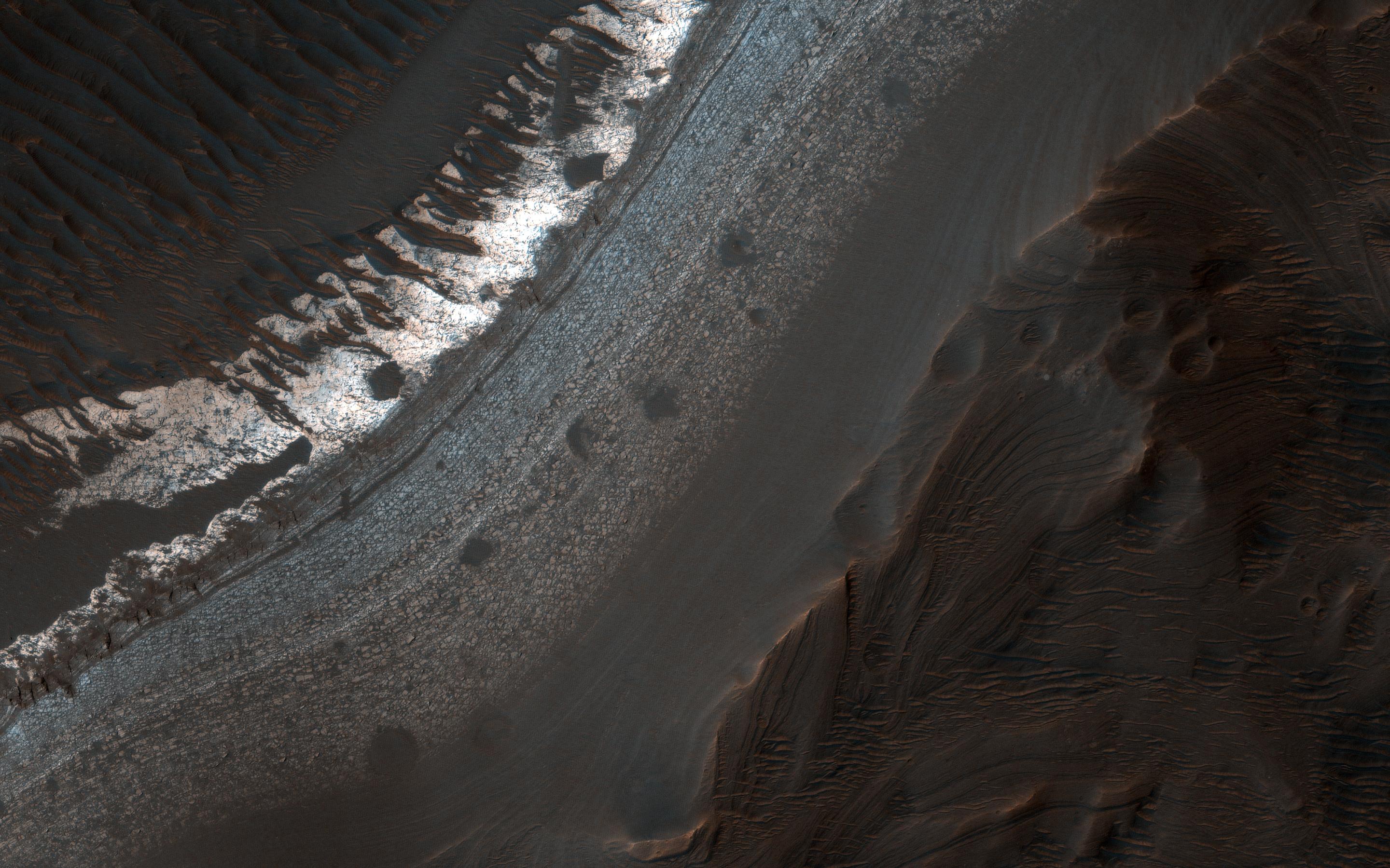
PIA21558:
Seasonal Flows on Warm Slopes
Full Resolution:
TIFF
(15.01 MB)
JPEG
(627.9 kB)
2017-03-13
Mars
Mars Reconnaissance Orbiter (MRO)
HiRISE
2880x1800x3
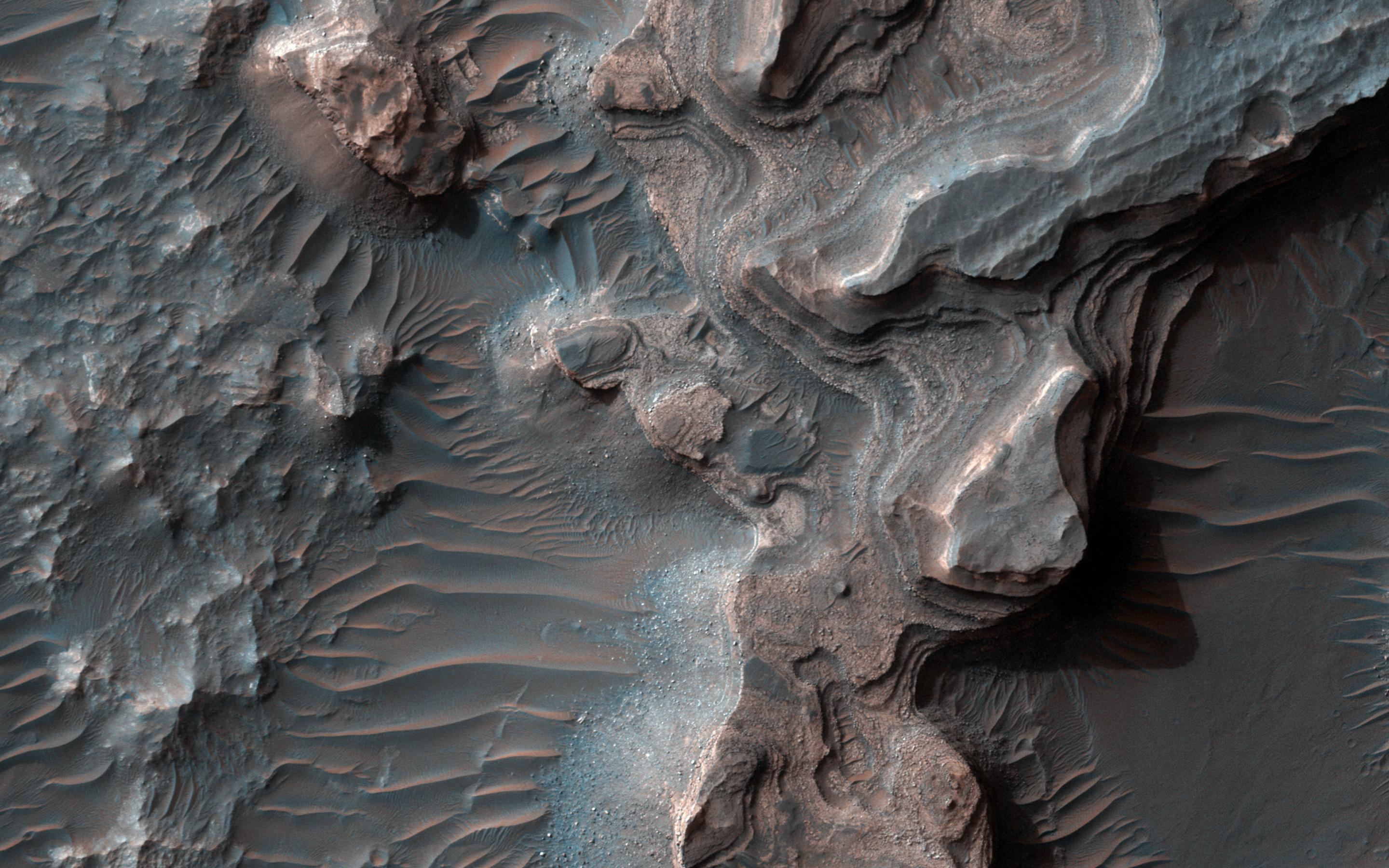
PIA21559:
Bedrock Outcrops in Kaiser Crater
Full Resolution:
TIFF
(15.56 MB)
JPEG
(1.028 MB)
2017-03-14
Mars
Mars Reconnaissance Orbiter (MRO)
HiRISE
2880x1800x3
PIA21560:
Fans and Crater Floor Deposits Southeast of Vinogradov Crater
Full Resolution:
TIFF
(15.56 MB)
JPEG
(1.17 MB)
2017-03-15
Mars
Mars Reconnaissance Orbiter (MRO)
HiRISE
2880x1800x3
PIA21561:
A Closer Look at Holden Crater
Full Resolution:
TIFF
(13.84 MB)
JPEG
(739.5 kB)
2017-03-16
Mars
Mars Reconnaissance Orbiter (MRO)
HiRISE
2880x1800x3
PIA21563:
Layered Deposits in Uzboi Vallis
Full Resolution:
TIFF
(15.56 MB)
JPEG
(662.6 kB)
2017-03-20
Mars
Mars Reconnaissance Orbiter (MRO)
HiRISE
2880x1800x3
PIA21567:
The Hills are Colorful in Juventae Chasma
Full Resolution:
TIFF
(15.56 MB)
JPEG
(624.7 kB)
2017-03-21
Mars
Mars Reconnaissance Orbiter (MRO)
HiRISE
2880x1880x3
PIA21568:
Gullies in Winter Shadow
Full Resolution:
TIFF
(16.05 MB)
JPEG
(946.9 kB)
2017-03-22
Mars
Mars Reconnaissance Orbiter (MRO)
HiRISE
2880x1800x3
PIA21570:
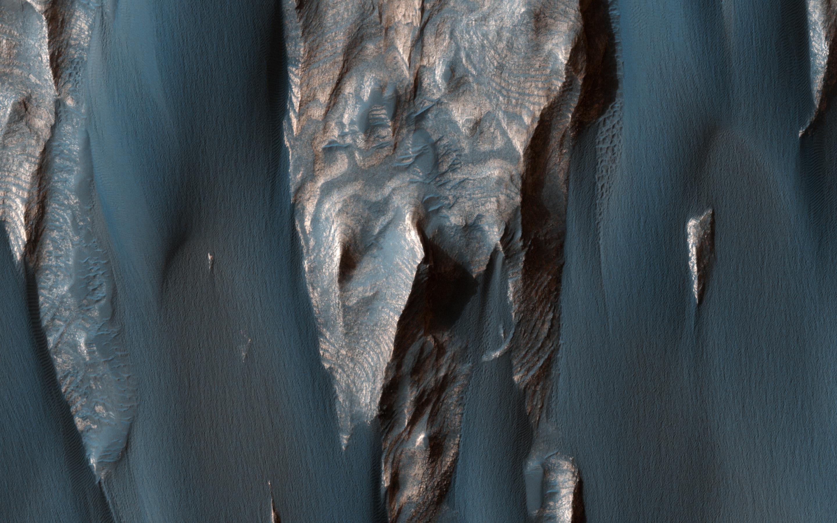
To Great Depths
Full Resolution:
TIFF
(15.56 MB)
JPEG
(901 kB)
2017-03-23
Mars
Mars Reconnaissance Orbiter (MRO)
HiRISE
2880x1800x1
PIA21571:
Dunes of the Southern Highlands
Full Resolution:
TIFF
(4.335 MB)
JPEG
(728.2 kB)
2017-03-27
Mars
Mars Reconnaissance Orbiter (MRO)
HiRISE
2880x1800x3
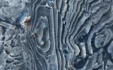
PIA21572:
The Splitting of the Dunes
Full Resolution:
TIFF
(15.56 MB)
JPEG
(902 kB)
2017-03-29
Mars
Mars Reconnaissance Orbiter (MRO)
HiRISE
1650x1275x3
PIA21489:
Advance Inspection of NASA's Next Mars Landing Site
Full Resolution:
TIFF
(2.287 MB)
JPEG
(273.9 kB)
2017-03-28
Mars
Mars Reconnaissance Orbiter (MRO)
HiRISE
2880x1800x3
PIA21573:
Plains South of Valles Marineris
Full Resolution:
TIFF
(15.56 MB)
JPEG
(1.032 MB)
2017-03-30
Mars
Mars Reconnaissance Orbiter (MRO)
HiRISE
2880x1800x3
PIA21574:
Distinctive Brightness
Full Resolution:
TIFF
(13.99 MB)
JPEG
(694.8 kB)
2017-03-31
Mars
Mars Reconnaissance Orbiter (MRO)
HiRISE
2880x1800x3
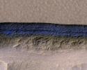
PIA21575:
Layers in Galle Crater
Full Resolution:
TIFF
(15.56 MB)
JPEG
(1.236 MB)
2017-04-04
Mars
Mars Reconnaissance Orbiter (MRO)
HiRISE
2880x1800x1
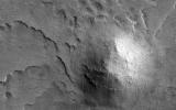
PIA21576:
Is that an Impact Crater?
Full Resolution:
TIFF
(5.191 MB)
JPEG
(1.411 MB)
2017-04-13
Mars
Mars Reconnaissance Orbiter (MRO)
HiRISE
3459x2024x3
PIA21587:
Lakebeds in Holden Crater
Full Resolution:
TIFF
(21.01 MB)
JPEG
(1.306 MB)
2017-04-12
Mars
Mars Reconnaissance Orbiter (MRO)
HiRISE
2880x1800x3
PIA21586:
Sources of Gullies in Hale Crater
Full Resolution:
TIFF
(15.56 MB)
JPEG
(765.4 kB)
2017-04-11
Mars
Mars Reconnaissance Orbiter (MRO)
HiRISE
2880x1800x3
PIA21585:
A Mesa in Noctis Labyrinthus
Full Resolution:
TIFF
(15.56 MB)
JPEG
(798 kB)
2017-04-10
Mars
Mars Reconnaissance Orbiter (MRO)
HiRISE
2880x1800x3
PIA21580:
Clinoforms in Melas Chasma
Full Resolution:
TIFF
(15.56 MB)
JPEG
(1.148 MB)
2017-04-06
Mars
Mars Reconnaissance Orbiter (MRO)
HiRISE
2880x1800x1
PIA21579:
South Polar Spiral
Full Resolution:
TIFF
(5.191 MB)
JPEG
(1.259 MB)
2017-04-05
Mars
Mars Reconnaissance Orbiter (MRO)
HiRISE
2880x1800x3
PIA21578:
A New Impact Site in the Southern Middle Latitudes
Full Resolution:
TIFF
(14.35 MB)
JPEG
(694.7 kB)
2017-04-04
Mars
Mars Reconnaissance Orbiter (MRO)
HiRISE
2880x1800x3
PIA21577:
A Sneak Peek into Saheki's Secret Layers
Full Resolution:
TIFF
(15.56 MB)
JPEG
(1.07 MB)
2017-06-14
Mars
Mars Reconnaissance Orbiter (MRO)
HiRISE
2880x1800x3
PIA21759:
Decoding a Geological Message
Full Resolution:
TIFF
(15.52 MB)
JPEG
(923.7 kB)
2017-04-25
Mars
Mars Reconnaissance Orbiter (MRO)
HiRISE
2880x1800x3
PIA21600:
Windblown Sand in Ganges Chasma
Full Resolution:
TIFF
(15.56 MB)
JPEG
(687.6 kB)
2017-04-17
Mars
Mars Reconnaissance Orbiter (MRO)
HiRISE
2048x1256x1
PIA21591:
Secondary Craters in Bas Relief
Full Resolution:
TIFF
(2.575 MB)
JPEG
(570.4 kB)
2017-04-18
Mars
Mars Reconnaissance Orbiter (MRO)
HiRISE
2880x1800x3
PIA21593:
A Winter's View of a Gullied Crater
Full Resolution:
TIFF
(15.56 MB)
JPEG
(883.3 kB)
2017-04-19
Mars
Mars Reconnaissance Orbiter (MRO)
HiRISE
2880x1800x1
PIA21595:
Dune Transition in the High Southern Latitudes
Full Resolution:
TIFF
(4.262 MB)
JPEG
(712.3 kB)
2017-04-20
Mars
Mars Reconnaissance Orbiter (MRO)
HiRISE
2880x1800x1
PIA21596:
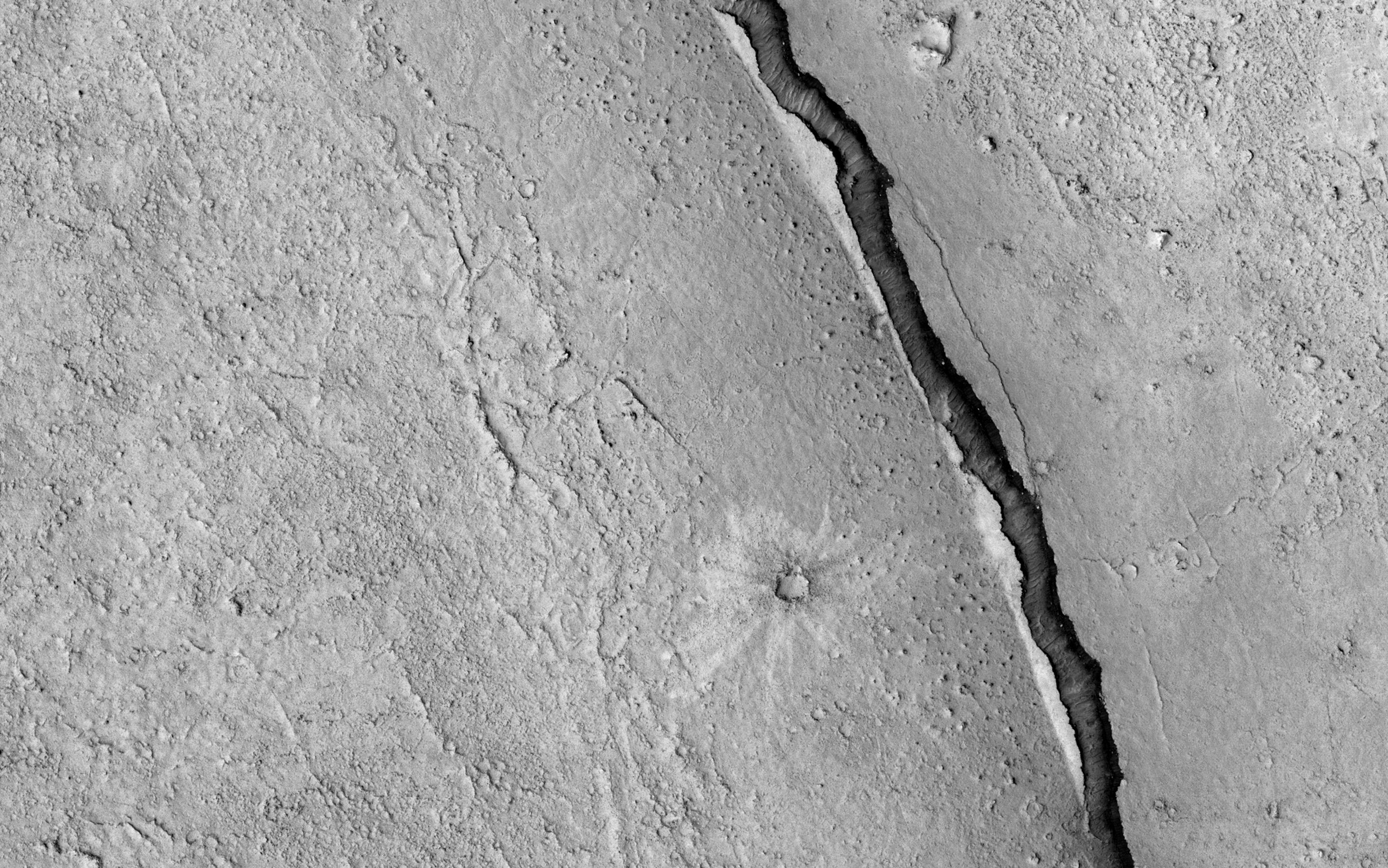
It Shrinks! It Cracks!
Full Resolution:
TIFF
(5.191 MB)
JPEG
(984.4 kB)
2017-04-21
Mars
Mars Exploration Rover (MER)
Mars Reconnaissance Orbiter (MRO)
HiRISE
2558x2014x3
PIA21494:
Rover's Landing Hardware at Eagle Crater, Mars
Full Resolution:
TIFF
(11.9 MB)
JPEG
(733.9 kB)
2017-04-24
Mars
Mars Reconnaissance Orbiter (MRO)
HiRISE
2880x1800x3
PIA21599:
How Old are Martian Gullies?
Full Resolution:
TIFF
(15.56 MB)
JPEG
(839.3 kB)
2017-04-26
Mars
Mars Reconnaissance Orbiter (MRO)
HiRISE
2880x1800x3
PIA21601:
A Volcanic Fissure
Full Resolution:
TIFF
(12.62 MB)
JPEG
(494.3 kB)
2017-04-27
Mars
Mars Reconnaissance Orbiter (MRO)
HiRISE
3543x2024x3
PIA21602:
Gullies with Color Anomalies
Full Resolution:
TIFF
(21.52 MB)
JPEG
(1.557 MB)
2017-05-01
Mars
Mars Reconnaissance Orbiter (MRO)
HiRISE
2880x1800x1
PIA21603:
Aging with Impacts
Full Resolution:
TIFF
(5.191 MB)
JPEG
(945 kB)
2017-05-02
Mars
Mars Reconnaissance Orbiter (MRO)
HiRISE
2880x1800x3
PIA21605:
Colorful Equatorial Gullies in Krupac Crater
Full Resolution:
TIFF
(15.56 MB)
JPEG
(934.8 kB)
2017-05-03
Mars
Mars Reconnaissance Orbiter (MRO)
HiRISE
2880x1800x3
PIA21606:
Colorful Bedrock
Full Resolution:
TIFF
(15.56 MB)
JPEG
(846.8 kB)
2017-05-04
Mars
Mars Reconnaissance Orbiter (MRO)
HiRISE
2880x1800x3
PIA21608:
Seasonal Flows in Valles Marineris
Full Resolution:
TIFF
(14.57 MB)
JPEG
(466 kB)
2017-05-08
Mars
Mars Reconnaissance Orbiter (MRO)
HiRISE
2880x1800x3
PIA21609:
Colorful Impact Ejecta from Hargraves Crater
Full Resolution:
TIFF
(15.56 MB)
JPEG
(918.7 kB)
2017-05-09
Mars
Mars Reconnaissance Orbiter (MRO)
HiRISE
2880x1800x3
PIA21630:
An Ancient Valley Network
Full Resolution:
TIFF
(15.56 MB)
JPEG
(747.3 kB)
2017-05-10
Mars
Mars Reconnaissance Orbiter (MRO)
HiRISE
2880x1800x3
PIA21631:
Stratigraphy Exposed by an Impact Crater
Full Resolution:
TIFF
(15.56 MB)
JPEG
(551.3 kB)
2017-05-12
Mars
Mars Reconnaissance Orbiter (MRO)
HiRISE
2880x1800x3
PIA21633:
Landslide!
Full Resolution:
TIFF
(15.56 MB)
JPEG
(1.122 MB)
2017-05-22
Mars
Mars Reconnaissance Orbiter (MRO)
HiRISE
2699x2024x3
PIA21637:
Erosion of the Edge of the South Polar Layered Deposits
Full Resolution:
TIFF
(16.39 MB)
JPEG
(985.1 kB)
2017-05-23
Mars
Mars Reconnaissance Orbiter (MRO)
HiRISE
2880x1800x3
PIA21639:
Erosion of the Edge of the South Polar Layered Deposits
Full Resolution:
TIFF
(15.56 MB)
JPEG
(705.3 kB)
2017-05-24
Mars
Mars Reconnaissance Orbiter (MRO)
HiRISE
2880x1800x3
PIA21640:
An Oblique View of Uplifted Rocks
Full Resolution:
TIFF
(15.56 MB)
JPEG
(820.7 kB)
2017-05-25
Mars
Mars Reconnaissance Orbiter (MRO)
HiRISE
2880x1800x3
PIA21648:
Flow on the Rim of Tooting Crater
Full Resolution:
TIFF
(15.36 MB)
JPEG
(815.9 kB)
2017-05-30
Mars
Mars Reconnaissance Orbiter (MRO)
HiRISE
2880x1800x3
PIA21636:
A South Polar Pit or an Impact Crater?
Full Resolution:
TIFF
(12.79 MB)
JPEG
(515.3 kB)
2017-05-31
Mars
Mars Reconnaissance Orbiter (MRO)
HiRISE
2880x1800x3
PIA21651:
Active Flows on Steep Slopes in Ganges Chasma
Full Resolution:
TIFF
(15.56 MB)
JPEG
(752 kB)
2017-06-01
Mars
Mars Reconnaissance Orbiter (MRO)
HiRISE
2880x1800x1
PIA21652:
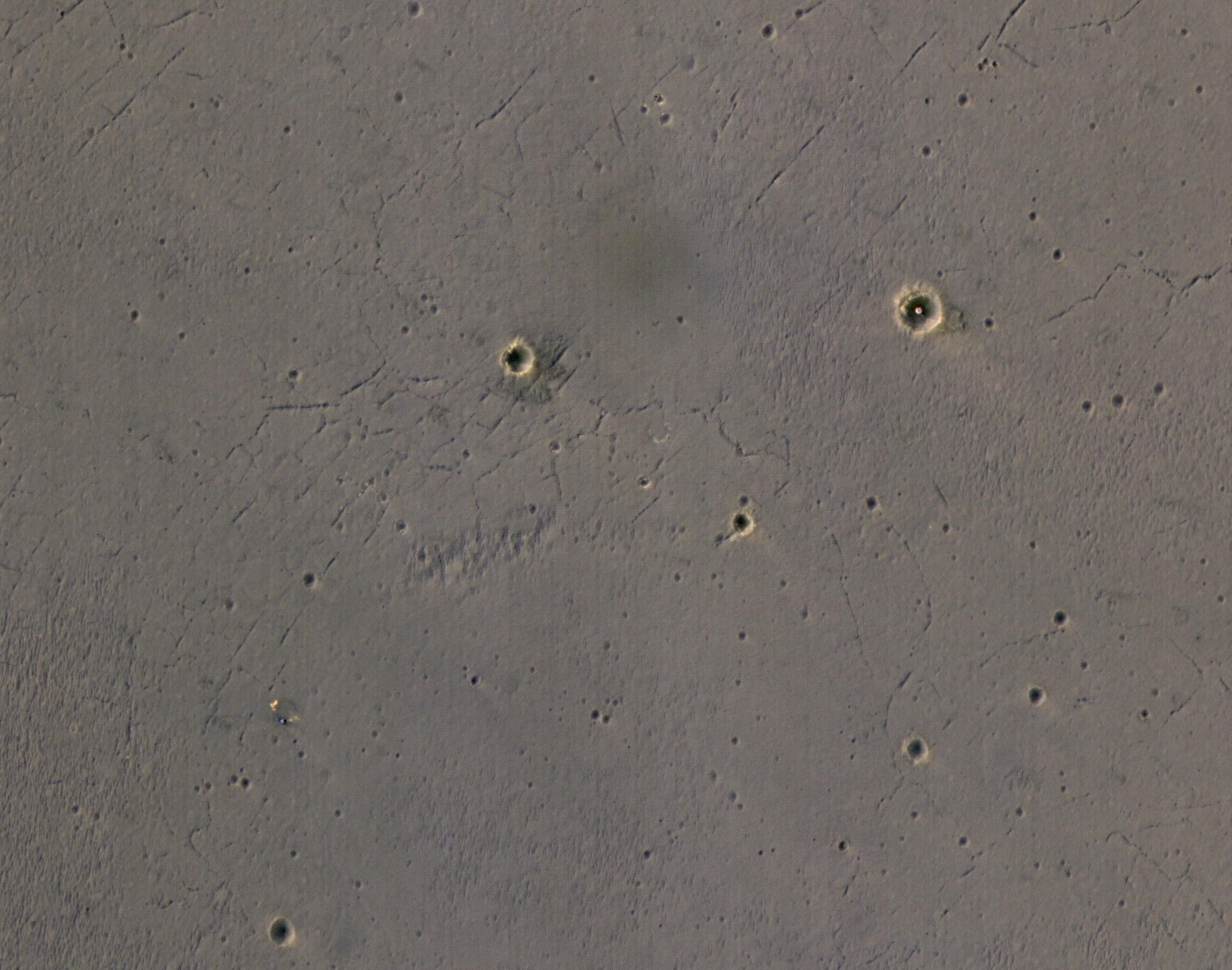
A Triple Crater
Full Resolution:
TIFF
(5.191 MB)
JPEG
(768.3 kB)
2017-06-02
Mars
Mars Reconnaissance Orbiter (MRO)
HiRISE
2880x1800x3
PIA21654:
Gullies and Craters and Dunes, Oh My!
Full Resolution:
TIFF
(15.56 MB)
JPEG
(1.217 MB)
2017-06-12
Mars
Mars Reconnaissance Orbiter (MRO)
HiRISE
4500x3000x1
PIA21757:
Monitoring Sand Sheets and Dunes
Full Resolution:
TIFF
(12.37 MB)
JPEG
(1.989 MB)
2017-06-13
Mars
Mars Reconnaissance Orbiter (MRO)
HiRISE
2880x1800x3
PIA21758:
A Crater on a Crater Wall
Full Resolution:
TIFF
(15.56 MB)
JPEG
(832.9 kB)
2017-06-15
Mars
Mars Reconnaissance Orbiter (MRO)
HiRISE
2880x1800x3
PIA21760:
The White Cliffs of "Rover"
Full Resolution:
TIFF
(15.56 MB)
JPEG
(694 kB)
2017-06-20
Mars
Mars Reconnaissance Orbiter (MRO)
Mars Science Laboratory (MSL)
HiRISE
1403x789x3
PIA21710:
Curiosity Rover on Mount Sharp, Seen from Mars Orbit
Full Resolution:
TIFF
(3.322 MB)
JPEG
(215.9 kB)
2017-06-26
Mars
Mars Reconnaissance Orbiter (MRO)
HiRISE
12000x7500x1
PIA21763:
The Niagara Falls of Mars
Full Resolution:
TIFF
(65.87 MB)
JPEG
(6.103 MB)
2017-06-27
Mars
Mars Reconnaissance Orbiter (MRO)
HiRISE
12000x7500x3
PIA21765:
Exposed Bedrock in the Koval'sky Impact Basin
Full Resolution:
TIFF
(269.9 MB)
JPEG
(7.371 MB)
2017-06-28
Mars
Mars Reconnaissance Orbiter (MRO)
HiRISE
2880x1800x3
PIA21766:
"Elementary, My Dear Deposit..."
Full Resolution:
TIFF
(14.2 MB)
JPEG
(470.8 kB)
2017-06-30
Mars
Mars Reconnaissance Orbiter (MRO)
HiRISE
2880x1800x3
PIA21767:
Light-toned Mounds in Gorgonum Basin
Full Resolution:
TIFF
(15.19 MB)
JPEG
(613.8 kB)
2017-07-10
Mars
Mars Reconnaissance Orbiter (MRO)
HiRISE
2880x1800x3
PIA21769:
Escape from Mars
Full Resolution:
TIFF
(15.56 MB)
JPEG
(757.8 kB)
2017-07-11
Mars
Mars Reconnaissance Orbiter (MRO)
HiRISE
2880x1800x3
PIA21781:
Dragon Scales of Mars
Full Resolution:
TIFF
(15.56 MB)
JPEG
(686.8 kB)
2017-07-12
Mars
Mars Reconnaissance Orbiter (MRO)
HiRISE
4500x3000x3
PIA21782:
Mars and the Amazing Technicolor Ejecta Blanket
Full Resolution:
TIFF
(40.52 MB)
JPEG
(2.49 MB)
2017-07-13
Mars
Mars Reconnaissance Orbiter (MRO)
HiRISE
2880x1800x1
PIA21784:
The Specters of Mars
Full Resolution:
TIFF
(5.191 MB)
JPEG
(1.101 MB)
2017-08-08
Mars
Mars Reconnaissance Orbiter (MRO)
HiRISE
2880x1800x3
PIA21869:
Cataracts in Kasei Valles
Full Resolution:
TIFF
(15.56 MB)
JPEG
(1.048 MB)
2017-08-08
Mars
Mars Reconnaissance Orbiter (MRO)
HiRISE
2880x1800x3
PIA21870:
Crater Rim Layers, Rubble, and Gullies
Full Resolution:
TIFF
(15.56 MB)
JPEG
(1.15 MB)
2017-08-08
Mars
Mars Reconnaissance Orbiter (MRO)
HiRISE
2880x1800x3
PIA21871:
A View of the Painted Desert Near Mawrth Vallis
Full Resolution:
TIFF
(15.56 MB)
JPEG
(1.08 MB)
2017-08-08
Mars
Mars Reconnaissance Orbiter (MRO)
HiRISE
2880x1800x3
PIA21872:
Along the Floor of Coprates Chasma
Full Resolution:
TIFF
(14.37 MB)
JPEG
(644 kB)
2017-08-21
Mars
Mars Reconnaissance Orbiter (MRO)
HiRISE
2880x1800x3
PIA21880:
Patterns Unique, Yet Familiar
Full Resolution:
TIFF
(15 MB)
JPEG
(835.4 kB)
2017-08-21
Mars
Mars Reconnaissance Orbiter (MRO)
HiRISE
2880x1800x3
PIA21881:
The Case of the Missing Crater Rim
Full Resolution:
TIFF
(15.56 MB)
JPEG
(716.4 kB)
2017-08-21
Mars
Mars Reconnaissance Orbiter (MRO)
HiRISE
2880x1800x3
PIA21882:
A World of Snowy Dunes
Full Resolution:
TIFF
(15.56 MB)
JPEG
(898.3 kB)
2017-08-21
Mars
Mars Reconnaissance Orbiter (MRO)
HiRISE
2880x1800x3
PIA21883:
The Hoodoos of Mars
Full Resolution:
TIFF
(15.56 MB)
JPEG
(882.2 kB)
2017-09-04
Mars
Mars Reconnaissance Orbiter (MRO)
HiRISE
2880x1800x3
PIA21933:
Exploring the Sandy Province of Herschel Crater
Full Resolution:
TIFF
(15.14 MB)
JPEG
(861.5 kB)
2017-09-04
Mars
Mars Reconnaissance Orbiter (MRO)
HiRISE
2880x1800x3
PIA21934:
Opposing Dunes, Opposing Winds
Full Resolution:
TIFF
(14.99 MB)
JPEG
(780.7 kB)
2017-09-04
Mars
Mars Reconnaissance Orbiter (MRO)
HiRISE
2880x1800x3
PIA21935:
Mixtures of Sulfates in Melas Chasma
Full Resolution:
TIFF
(15.56 MB)
JPEG
(1.154 MB)
2017-09-04
Mars
Mars Reconnaissance Orbiter (MRO)
HiRISE
2880x1800x3
PIA21936:
Prospecting from Orbit
Full Resolution:
TIFF
(15.56 MB)
JPEG
(685.8 kB)
2017-09-18
Mars
Mars Reconnaissance Orbiter (MRO)
HiRISE
2880x1800x3
PIA21952:
A Sequence of Beauty in Terby Crater
Full Resolution:
TIFF
(15.56 MB)
JPEG
(958.8 kB)
2017-09-18
Mars
Mars Reconnaissance Orbiter (MRO)
HiRISE
2880x1800x3
PIA21953:
Go with the (Bright) Flow
Full Resolution:
TIFF
(15.56 MB)
JPEG
(974.7 kB)
2017-09-18
Mars
Mars Reconnaissance Orbiter (MRO)
HiRISE
2880x1800x3
PIA21954:
North Polar Layers: Streaking and Unconformity
Full Resolution:
TIFF
(15.56 MB)
JPEG
(1.298 MB)
2017-09-18
Mars
Mars Reconnaissance Orbiter (MRO)
HiRISE
2880x1800x3
PIA21955:
Textures in Deuteronilus Mensae
Full Resolution:
TIFF
(15.56 MB)
JPEG
(889.7 kB)
2017-10-09
Mars
Mars Reconnaissance Orbiter (MRO)
HiRISE
2880x1800x3
PIA22040:
Ripples and Dunes in Proctor Crater
Full Resolution:
TIFF
(15.56 MB)
JPEG
(563.2 kB)
2017-10-09
Mars
Mars Reconnaissance Orbiter (MRO)
HiRISE
2880x1800x1
PIA22041:
A Highly Disrupted Crater
Full Resolution:
TIFF
(5.191 MB)
JPEG
(999.4 kB)
2017-10-09
Mars
Mars Reconnaissance Orbiter (MRO)
HiRISE
2880x1800x3
PIA22042:
Decoding a Dark Splotch
Full Resolution:
TIFF
(15.56 MB)
JPEG
(735.1 kB)
2017-10-09
Mars
Mars Reconnaissance Orbiter (MRO)
HiRISE
2880x1800x3
PIA22043:
Where Does the Sand Come From?
Full Resolution:
TIFF
(13.98 MB)
JPEG
(492.1 kB)
2017-10-23
Mars
Mars Reconnaissance Orbiter (MRO)
HiRISE
2880x1800x3
PIA22051:
A Window into the Past
Full Resolution:
TIFF
(15.41 MB)
JPEG
(891.8 kB)
2017-10-23
Mars
Mars Reconnaissance Orbiter (MRO)
HiRISE
2880x1800x3
PIA22052:
Squiggles in Hellas Planitia
Full Resolution:
TIFF
(15.56 MB)
JPEG
(1.15 MB)
2017-10-23
Mars
Mars Reconnaissance Orbiter (MRO)
HiRISE
2880x1800x3
PIA22053:
Defrosting Dunes within Chasma Boreale
Full Resolution:
TIFF
(14.4 MB)
JPEG
(610.2 kB)
2017-10-23
Mars
Mars Reconnaissance Orbiter (MRO)
HiRISE
2880x1800x3
PIA22054:
The Evolution of Gully Features in Acidalia Planitia
Full Resolution:
TIFF
(15.56 MB)
JPEG
(1.309 MB)
2017-11-20
Mars
Mars Reconnaissance Orbiter (MRO)
HiRISE
1201x900x3
PIA22070:
Seasonal Dark Streaks in Tivat Crater, Mars
Full Resolution:
TIFF
(3.007 MB)
JPEG
(128.9 kB)
2017-11-28
Mars
Mars Reconnaissance Orbiter (MRO)
HiRISE
2880x1800x1
PIA22116:
A Collapsed Crater Rim
Full Resolution:
TIFF
(5.169 MB)
JPEG
(659.3 kB)
2017-11-28
Mars
Mars Reconnaissance Orbiter (MRO)
HiRISE
2880x1800x3
PIA22117:
An Inverted Crater West of Mawrth Vallis
Full Resolution:
TIFF
(14.9 MB)
JPEG
(717.3 kB)
2017-11-28
Mars
Mars Reconnaissance Orbiter (MRO)
HiRISE
2880x1800x3
PIA22118:
Honeycomb-Textured Landforms in Northwestern Hellas Planitia
Full Resolution:
TIFF
(13.17 MB)
JPEG
(673 kB)
2017-11-28
Mars
Mars Reconnaissance Orbiter (MRO)
HiRISE
2880x1800x1
PIA22119:
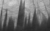
Yardangs: Nature's Weathervanes
Full Resolution:
TIFF
(5.191 MB)
JPEG
(935.1 kB)
2017-11-20
Mars
Mars Reconnaissance Orbiter (MRO)
HiRISE
2880x1800x3
PIA22114:
Transient Slope Lineae Formation in a Well-Preserved Crater
Full Resolution:
TIFF
(15.56 MB)
JPEG
(1.073 MB)
2017-11-20
Mars
Mars Reconnaissance Orbiter (MRO)
HiRISE
2880x1800x1
PIA22115:
Fifty Years of Mars Imaging: from Mariner 4 to HiRISE
Full Resolution:
TIFF
(5.191 MB)
JPEG
(1.309 MB)
2017-12-12
Mars
Mars Reconnaissance Orbiter (MRO)
HiRISE
2880x1800x1
PIA22124:
A Valley Near the Northern Lowlands
Full Resolution:
TIFF
(5.191 MB)
JPEG
(990 kB)
2017-12-12
Mars
Mars Reconnaissance Orbiter (MRO)
HiRISE
2880x1800x1
PIA22125:
Layered Ice Near the South Pole of Mars
Full Resolution:
TIFF
(5.191 MB)
JPEG
(987.7 kB)
2017-12-12
Mars
Mars Reconnaissance Orbiter (MRO)
HiRISE
2880x1800x3
PIA22186:
Depressions and Channels on the Floor of Lyot Crater
Full Resolution:
TIFF
(15.56 MB)
JPEG
(1.13 MB)
2017-12-12
Mars
Mars Reconnaissance Orbiter (MRO)
HiRISE
2880x1800x3
PIA22187:
The Fault in Our Mars
Full Resolution:
TIFF
(15.56 MB)
JPEG
(616.1 kB)
2018-01-11
Mars
Mars Reconnaissance Orbiter (MRO)
HiRISE
1001x801x3
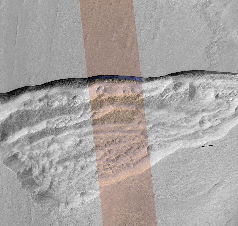
PIA22077:
Underground Martian Ice Deposit Exposed at Scarp
Full Resolution:
TIFF
(2.406 MB)
JPEG
(146.9 kB)
2018-01-11
Mars
Mars Reconnaissance Orbiter (MRO)
HiRISE
951x900x3
PIA22078:
Pit Where a Scarp Exposes an Underground Deposit of Martian Ice
Full Resolution:
TIFF
(1.746 MB)
JPEG
(189.9 kB)
1-100
101-200
201-300
301-400
401-500
501-600
601-700
701-800
801-900
901-1000
Currently displaying images:
1101 - 1200
of 1671


