Map Projected Browse Image
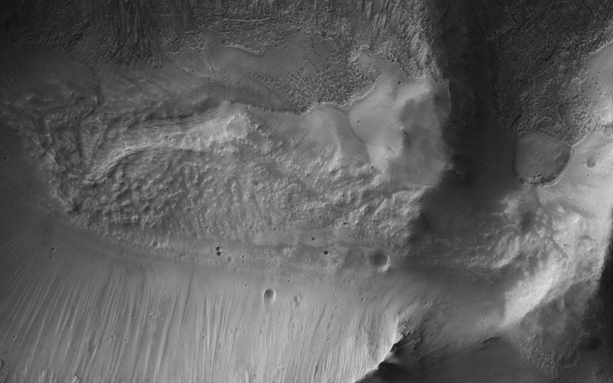
Click on the image for larger versionThis image from NASA's Mars Reconnaissance Orbiter (MRO) shows the eastern rim of a small 3.5-kilometer crater which appears to have collapsed into a much larger crater (about 14-kilometers wide). The larger crater has a large ice flow around its central peak, and is non-circular, with large blocks further suggesting structural collapse of the terrain due to what are called periglacial processes.
Understanding the composition of this small crater may inform us of the ice content of the surrounding terrain.
The map is projected here at a scale of 50 centimeters (19.7 inches) per pixel. [The original image scale is 50.8 centimeters (20 inches) per pixel (with 2 x 2 binning); objects on the order of 152 centimeters (59.8 inches) across are resolved.] North is up.
The University of Arizona, Tucson, operates HiRISE, which was built by Ball Aerospace & Technologies Corp., Boulder, Colorado. NASA's Jet Propulsion Laboratory, a division of Caltech in Pasadena, California, manages the Mars Reconnaissance Orbiter Project for NASA's Science Mission Directorate, Washington.
