Map Projected Browse Image
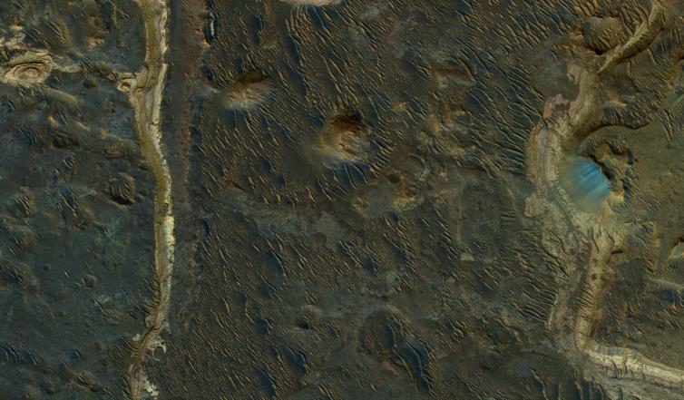
Click on the image for larger versionHolden Crater was once filled by at least two different lakes. The sediments deposited in those lakes are relatively light-toned where exposed, as seen in this observation from NASA's Mars Reconnaissance Orbiter.
Each layer represents a different point in time and perhaps a changing environment for Martian life, if it existed. The elongated ridges with sharp crests are sand dunes.
The map is projected here at a scale of 25 centimeters (9.8 inches) per pixel. [The original image scale is 25.9 centimeters (10.2 inches) per pixel (with 1 x 1 binning); objects on the order of 78 centimeters (30.7 inches) across are resolved.] North is up.
The University of Arizona, Tucson, operates HiRISE, which was built by Ball Aerospace & Technologies Corp., Boulder, Colo. NASA's Jet Propulsion Laboratory, a division of Caltech in Pasadena, California, manages the Mars Reconnaissance Orbiter Project for NASA's Science Mission Directorate, Washington.
