Map Projected Browse Image
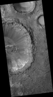
Click on the image for larger versionGeologists love roadcuts because they reveal the bedrock stratigraphy (layering). Until we have highways on Mars, we can get the same information from fresh impact craters as shown in this image from NASA's Mars Reconnaissance Orbiter.
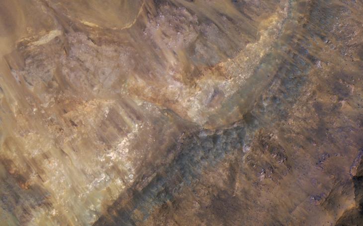
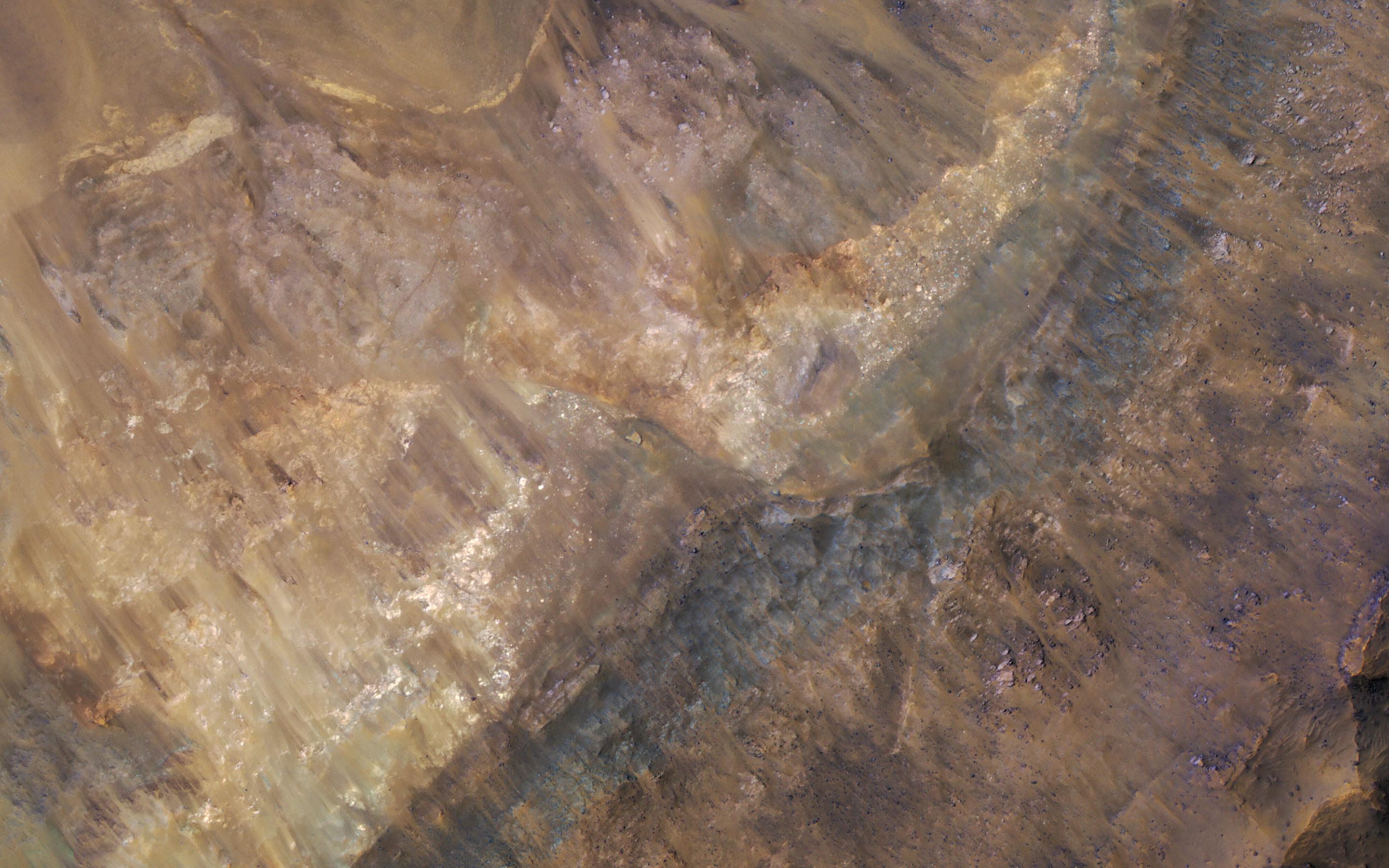
An enhanced color closeup reveals these layers filling a larger crater, perhaps a combination of lava, impact ejecta, and sediments.
The map is projected here at a scale of 50 centimeters (19.7 inches) per pixel. [The original image scale is 52.1 centimeters (22.4 inches) per pixel (with 2 x 2 binning); objects on the order of 156 centimeters (61.4 inches) across are resolved.] North is up.
The University of Arizona, Tucson, operates HiRISE, which was built by Ball Aerospace & Technologies Corp., Boulder, Colo. NASA's Jet Propulsion Laboratory, a division of Caltech in Pasadena, California, manages the Mars Reconnaissance Orbiter Project for NASA's Science Mission Directorate, Washington.
