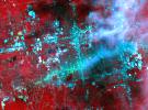
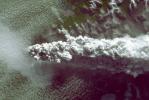
Your search criteria found 2612 images
Target is Earth (and available satellites)
Go to PIAxxxxx:
Refine this list of images by:
Target:
Mission:
Spacecraft:
Instrument:
Click on an image for detailed information
Click on a column heading to sort in ascending or descending order
My
List
Addition Date Target MissionSort Ascending Instrument Size
Add Image to Favorite List 2010-04-05 Earth Terra
ASTER
2500x3000x3
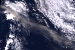
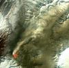
Sheveluch Volcano in Kamchatka, Siberia, is one of the frequently active volcanoes located in eastern Siberia. In this image from NASA's Terra spacecraft, brownish ash covers the southern part of the mountain, under an ash-laden vertical eruption plume.
PIA13010:
Sheveluch Volcano, Kamchatka, Russia
Full Resolution:     TIFF (22.52 MB)     JPEG (1.502 MB)
Add Image to Favorite List 2010-04-09 Earth Terra
ASTER
4000x4200x3
This image from NASA's Terra spacecraft shows where a magnitude 7.2 earthquake struck in Mexico's Baja, California at shallow depth along the principal plate boundary between the North American and Pacific plates on April 4, 2010.
PIA13027:
NASA Satellite Imagery Shows Sparse Population of Region Near Baja, California Earthquake
Full Resolution:     TIFF (50.4 MB)     JPEG (2.788 MB)
Add Image to Favorite List 2010-04-16 Earth Terra
MODIS
3780x2328x3
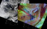
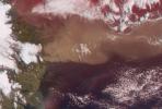
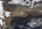
On April 15, 2010, NASA's Terra spacecraft captured these images of the ongoing eruption of Iceland's Eyjafjallajökull Volcano, which continues to spew ash into the atmosphere and impact air travel worldwide.
PIA13046:
NASA Satellite Images Provide Insights Into Iceland Volcanic Plume
Full Resolution:     TIFF (26.4 MB)     JPEG (1.262 MB)
Add Image to Favorite List 2010-04-16 Earth Terra
ASTER
2066x1788x3
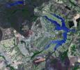
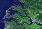
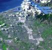
This image from NASA's Terra spacecraft shows the planned city of Brasilia, the capital of Brazil, with a population of about 3.6 million for its metropolitan area.
PIA13045:
Brasilia, Brazil
Full Resolution:     TIFF (11.1 MB)     JPEG (802.9 kB)
Add Image to Favorite List 2010-04-18 Earth Terra
MISR
1126x1024x3
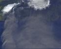
This image from NASA's Terra spacecraft shows ash plumes from Eyjafjallajökull Volcano, Iceland stretching over the North Atlantic; the volcano erupted on April 14, 2010 bringing closure to major airports in Europe.
PIA13047:
Ash from Eyjafjallajökull Volcano, Iceland Stretches over the North Atlantic
Full Resolution:     TIFF (3.463 MB)     JPEG (127.5 kB)
Add Image to Favorite List 2010-04-19 Earth Terra
ASTER
3908x3132x3
On Monday, April 19, 2010, the Advanced Spaceborne Thermal Emission and Reflection Radiometer (ASTER) instrument onboard NASA's Terra spacecraft obtained this image of the continuing eruption of Iceland's Eyjafjallajökull volcano.
PIA13049:
NASA Satellite Tracks Continued Eruption of Iceland Volcano
Full Resolution:     TIFF (17.84 MB)     JPEG (669 kB)
Add Image to Favorite List 2010-04-20 Earth Terra
MISR
1500x1015x3
NASA's Terra satellite flew directly over Iceland on April 19, 2010, to capture this stereo anaglyph generated from the nadir and 46-degree forward-viewing cameras of the Eyjafjallajökull volcano and its erupting ash plume. 3D glasses are necessary to vie
PIA13051:
Heights of the Eyjafjallajökull Eruption Plume - April 19, 2010 (Anaglyph)
Full Resolution:     TIFF (4.576 MB)     JPEG (188.7 kB)
Add Image to Favorite List 2010-04-20 Earth Terra
MISR
1500x1015x3
NASA's Terra satellite flew directly over Iceland on April 19, 2010 and captured this image of the Eyjafjallajökull volcano and its erupting ash plume. 3D glasses are necessary to view this image.
PIA13052:
Heights of the Eyjafjallajökull Eruption Plume - April 19, 2010
Full Resolution:     TIFF (4.576 MB)     JPEG (192.9 kB)
Add Image to Favorite List 2010-04-21 Earth Terra
MISR
5814x2778x3
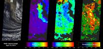
As NASA's Terra satellite flew over Iceland's erupting Eyjafjallajökull volcano, its Multi-angle Imaging SpectroRadiometer instrument acquired 36 near-simultaneous images of the ash plume, covering nine view angles in each of four wavelengths.
PIA13060:
Eyjafjallajökull Ash Plume Particle Properties
Full Resolution:     TIFF (48.45 MB)     JPEG (871.2 kB)
Add Image to Favorite List 2010-04-23 Earth Terra
ASTER
1530x700x3
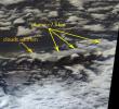
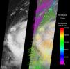
This image from NASA's Terra spacecraft shows the ash plume of Iceland's Eyjafyallajökull Volcano on April 19, 2010. The eruption plume and drifting veil of ash appear to be homogeneous.
PIA13062:
NASA's ASTER Instrument Analyzes Ash Plume of Iceland's Eyjafyallajökull Volcano
Full Resolution:     TIFF (3.219 MB)     JPEG (142.2 kB)
Add Image to Favorite List 2010-05-03 Earth Terra
ASTER
5275x6928x3
This image, from NASA's Terra spacecraft, was acquired May 1, 2010. An explosion destroyed the Deepwater Horizon oil platform operating in the offshore in Gulf of Mexico on April 20, 2010.
PIA13085:
ASTER Images Gulf of Mexico Oil Spill
Full Resolution:     TIFF (109.6 MB)     JPEG (7.882 MB)
Add Image to Favorite List 2010-05-03 Earth Terra
ASTER
2664x2108x3
This image from NASA's Terra spacecraft shows the Kuk Early Agricultural Site in the western highlands of New Guinea. It is an excellent example of transformation of agricultural practices over time.
PIA13090:
Kuk, New Guinea
Full Resolution:     TIFF (16.86 MB)     JPEG (1.336 MB)
Add Image to Favorite List 2010-05-04 Earth Terra
ASTER
940x607x1
NASA's Terra spacecraft captured this image of the growing oil spill in the Gulf of Mexico on May 1, 2010. On April 20, 2010, an explosion destroyed the Deepwater Horizon oil platform operating offshore in the Gulf of Mexico.
PIA13091:
ASTER Views the Gulf of Mexico Oil Spill in Infrared (May 1)
Full Resolution:     TIFF (571.4 kB)     JPEG (116.6 kB)
Add Image to Favorite List 2010-05-05 Earth Terra
ASTER
950x486x3
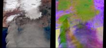
NASA's Terra spacecraft captured this pair of images of Iceland's Eyjafyallajökull volcano on May 3, 2010. On this day, Ireland closed its airspace for several hours due to presence of ash over the country.
PIA13093:
ASTER Images Iceland's Eyjafyallajökull Volcano
Full Resolution:     TIFF (1.387 MB)     JPEG (69.67 kB)
Add Image to Favorite List 2010-05-06 Earth Terra
MISR
947x754x1
This image from NASA's Terra satellite was acquired on May 1, 2010. The red symbol indicates the approximate position of the Deepwater Horizon platform and the source of the oil slick which resulted in a significant oil spill in the Gulf of Mexico.
PIA13099:
NASA's MISR Images Gulf of Mexico Oil Slick
Full Resolution:     TIFF (715 kB)     JPEG (39.16 kB)
Add Image to Favorite List 2010-05-07 Earth Terra
ASTER
1368x2791x1
NASA's Terra spacecraft captured this image of the growing oil spill in the Gulf of Mexico on May 7, 2010. The thickest parts of the oil spill appear as dark grey, filamentous masses in the southern part of the image, extending off of the bottom.
PIA13107:
ASTER Views the Gulf of Mexico Oil Spill in Infrared (May 7)
Full Resolution:     TIFF (3.823 MB)     JPEG (292 kB)
Add Image to Favorite List 2010-05-14 Earth Terra
MISR
1734x2020x3
Iceland's Eyjafjallajökull volcano produced its second major ash plume beginning on May 7, 2010. NASA's Terra satellite passed just east of the volcano mid-morning and captured this image the same day.
PIA13139:
NASA MISR Image Shows Eyjafjallajökull Volcano Plume Heights
Full Resolution:     TIFF (10.52 MB)     JPEG (213.9 kB)
Add Image to Favorite List 2010-05-18 Earth Terra
MISR
2295x2673x3
This image captured by NASA's Terra spacecraft is an enhanced 'true color' image of the Gulf of Mexico as it passed over the Deepwater Horizon oil slick on May 10, 2010.
PIA13143:
NASA's MISR Images Continued Spread of Gulf of Mexico Oil Slick
Full Resolution:     TIFF (18.43 MB)     JPEG (815.6 kB)
Add Image to Favorite List 2010-05-18 Earth Terra
MISR
1000x676x3
Ash from Iceland's Eyjafjallajökull volcano, viewed here in imagery from NASA's Terra spacecraft on May 16, 2010, once again disrupted air traffic over Europe with the closure of major airports in the United Kingdom and the Netherlands.
PIA13144:
Eyjafjallajökull Ash Continues to Disrupt Air Traffic
Full Resolution:     TIFF (2.031 MB)     JPEG (108.2 kB)
Add Image to Favorite List 2010-05-20 Earth Terra
MISR
1257x1406x3
This false-color image, obtained by NASA's Terra spacecraft on May 17, 2020, indicates the former location of the drilling platform (red symbol) and pointing to a plume of smoke (white arrow).
PIA13150:
NASA's MISR Provides Unique Views of Gulf Oil Slick
Full Resolution:     TIFF (5.308 MB)     JPEG (193.2 kB)
Add Image to Favorite List 2010-05-26 Earth Terra
ASTER
2800x2100x3
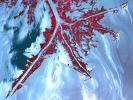
Oil from the Deepwater Horizon spill laps around the mouth of the Mississippi River Delta in this May 24, 2010, image from NASA's Terra spacecraft. The oil appears silver, while vegetation is red.
PIA13165:
NASA Satellite Spots Oil at Mississippi Delta's Mouth
Full Resolution:     TIFF (17.64 MB)     JPEG (1.013 MB)
Add Image to Favorite List 2010-06-02 Earth Terra
MISR
801x866x3
This image acquired on May 24, 2010 by NASA's Terra spacecraft shows oil from the former Deepwater Horizon rig encroaching upon several of Louisiana's wildlife habitats.
PIA13174:
Leaking Oil Invades Louisiana Wildlife Habitats
Full Resolution:     TIFF (2.084 MB)     JPEG (54.74 kB)
Add Image to Favorite List 2010-07-07 Earth Terra
MISR
1656x1182x3
This view of Hurricane Alex in the western Gulf of Mexico was acquired by the Multi-angle Imaging SpectroRadiometer instrument aboard NASA's Terra satellite just after noon Central Daylight Time on June 30, 2010. 3D glasses are necessary.
PIA13242:
Hurricane Alex Disrupts Gulf Cleanup
Full Resolution:     TIFF (5.882 MB)     JPEG (120.5 kB)
Add Image to Favorite List 2010-09-02 Earth Terra
ASTER
2361x2746x3
Oslo, the capital and largest city in Norway, as seen by the Advanced Spaceborne Thermal Emission and Reflection Radiometer instrument aboard NASA's Terra spacecraft.
PIA13364:
Oslo, Norway
Full Resolution:     TIFF (19.47 MB)     JPEG (1.282 MB)
Add Image to Favorite List 2010-07-24 Earth Terra
AIRS
900x695x3
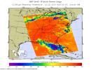
Tropical Storm Bonnie, now a depression, rakes South Florida in this infrared image from NASA's Atmospheric Infrared Sounder, en route to a weekend run-in with the Gulf of Mexico and the Gulf oil spill.
PIA13296:
Bonnie Takes Aim at an Oily Gulf
Full Resolution:     TIFF (1.879 MB)     JPEG (129.6 kB)
Add Image to Favorite List 2010-08-03 Earth Terra
ASTER
1452x1200x3
NASA's Terra spacecraft captured this image of the wildfire near Palmdale, Calif. on August 1, 2010 called the Crown fire. The burned areas appear in shades of gray in this simulated natural color image.
PIA13312:
ASTER Views California's Crown Fire
Full Resolution:     TIFF (5.237 MB)     JPEG (470.4 kB)
Add Image to Favorite List 2010-08-07 Earth Terra
AIRS
3200x4800x3
NASA's Aqua spacecraft tracked the concentration and transport of carbon monoxide from Russian fires in 2010, during which time some 558 fires were burning.
PIA13317:
NASA's AIRS Instrument Tracks Pollution from Russian Wildfires
Full Resolution:     TIFF (46.08 MB)     JPEG (2.118 MB)
Add Image to Favorite List 2010-08-12 Earth Terra
ASTER
1548x1000x3
This image of Petermann Glacier and the new iceberg was acquired from NASA's Terra spacecraft on Aug. 12, 2010. On Aug. 5, 2010, an enormous chunk of ice broke off the Petermann Glacier along the northwestern coast of Greenland.
PIA13319:
ASTER Views Large Calving Event at Petermann Glacier, Greenland
Full Resolution:     TIFF (4.652 MB)     JPEG (216.1 kB)
Add Image to Favorite List 2010-08-18 Earth Terra
MISR
2200x1544x3
In late July 2010, flooding caused by heavy monsoon rains began in several regions of Pakistan, including the Khyber Pakhtunkhwa, Sindh, Punjab and parts of Baluchistan. This image was acquired by NASA's Terra spacecraft on August 11, 2010.
PIA13337:
NASA's MISR Tracks Massive Flooding in Pakistan
Full Resolution:     TIFF (10.2 MB)     JPEG (706.9 kB)
Add Image to Favorite List 2010-08-19 Earth Terra
AIRS
2000x987x3
In late July 2010, flooding caused by heavy monsoon rains began in several regions of Pakistan. These images taken by NASA's Aqua spacecraft show were taken before and after the flooding.
PIA13341:
NASA's AIRS Instrument Captures Before/After Views of Pakistan Flooding
Full Resolution:     TIFF (5.93 MB)     JPEG (210.3 kB)
Add Image to Favorite List 2010-08-20 Earth Terra
ASTER
4159x5176x3
NASA's Terra spacecraft captured this cloud-free image over the city of Sukkur, Pakistan, on Aug. 18, 2010. Sukkur, located in southeastern Pakistan's Sindh Province, is visible as the grey, urbanized area in the lower left center of the image.
PIA13343:
ASTER Captures New Image of Pakistan Flooding
Full Resolution:     TIFF (64.58 MB)     JPEG (4.916 MB)
Add Image to Favorite List 2010-09-02 Earth Terra
MISR
2268x2244x3
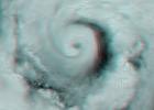
NASA's Multi-angle Imaging SpectroRadiometer instrument captured this image of Hurricane Earl Aug. 30, 2010. At this time, Hurricane Earl was a Category 3 storm. The hurricane's eye is just visible on the right edge of the MISR image swath.
PIA13363:
Hurricane Earl Multi-level Winds
Full Resolution:     TIFF (15.29 MB)     JPEG (505.1 kB)
Add Image to Favorite List 2010-09-02 Earth Terra
ASTER
2908x2936x3
The Advanced Spaceborne Thermal Emission and Reflection Radiometer instrument aboard NASA's Terra spacecraft captured this image of the Rio Tinto river in southwestern Spain which originates in the Sierra Morena mountains of Andalusia.
PIA13365:
Rio Tinto, Spain
Full Resolution:     TIFF (25.61 MB)     JPEG (2.167 MB)
Add Image to Favorite List 2010-09-07 Earth Terra
ASTER
4003x11340x3
On Sept. 3, 2010, NASA's Terra spacecraft captured this image strip over the Indus River, Pakistan, where severe flooding caused a major humanitarian crisis.
PIA13368:
ASTER Maps Continued Pakistan Flooding (False Color)
Full Resolution:     TIFF (136.2 MB)     JPEG (7.985 MB)
Add Image to Favorite List 2010-09-07 Earth Terra
ASTER
4003x11340x3
On Sept. 3, 2010, when NASA's Terra spacecraft captured this image strip over the Indus River in Pakistan, severe flooding was still causing a major humanitarian crisis in Pakistan. The city of Hyderabad is near the middle of the image.
PIA13369:
ASTER Maps Continued Pakistan Flooding
Full Resolution:     TIFF (136.2 MB)     JPEG (7.149 MB)
Add Image to Favorite List 2010-09-13 Earth Terra
ASTER
1757x1777x3
Folds in the lower reaches of valley glaciers can be caused by powerful surges of tributary ice streams. This phenomenon is spectacularly displayed by the Sustina Glacier in the Alaska Range as seen by NASA's Terra spacecraft.
PIA13382:
Susitna Glacier, Alaska
Full Resolution:     TIFF (9.381 MB)     JPEG (530.7 kB)
Add Image to Favorite List 2010-09-17 Earth Terra
ASTER
1604x1120x3
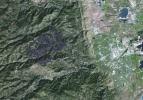
The Advanced Spaceborne Thermal Emission and Reflection Radiometer (ASTER) instrument aboard NASA's Terra spacecraft captured this image of the Fourmile Canyon fire west of Boulder Colo., on Sept. 17, 2010; it was 100 percent contained.
PIA13393:
ASTER Maps Fourmile Canyon Fire Near Boulder, Colo.
Full Resolution:     TIFF (5.399 MB)     JPEG (405.6 kB)
Add Image to Favorite List 2010-09-29 Earth Terra
ASTER
2316x3288x3
NASA's Terra spacecraft captured this image of the Twitchell Canyon fire, a lightning-caused blaze burning in Utah, which has consumed more than 40,000 acres since it began on July 20, 2010.
PIA13432:
ASTER Views Twitchell Canyon Fire, Utah
Full Resolution:     TIFF (22.87 MB)     JPEG (1.164 MB)
Add Image to Favorite List 2010-10-05 Earth Terra
ASTER
1400x1556x3
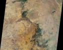
NASA's Terra spacecraft captured this image north of the present town of Al Hillal, Iraq, in the fertile plain between the Tigris and the Euphrates Rivers, where the site of the legendary city of Babylon lies.
PIA13436:
Babylon, Iraq
Full Resolution:     TIFF (6.548 MB)     JPEG (625.3 kB)
Add Image to Favorite List 2010-10-06 Earth Terra
MISR
2278x1826x3
This nadir camera view was captured by NASA's Terra spacecraft around Kruger National Park in NE South Africa. The bright white feature is the Palabora Copper Mine, and the water body near upper right is Lake Massingir in Mozambique.
PIA13460:
NASA's MISR Views Kruger National Park
Full Resolution:     TIFF (12.49 MB)     JPEG (578.8 kB)
Add Image to Favorite List 2010-10-11 Earth Terra
ASTER
3196x3372x3
NASA's Terra spacecraft captured this image of the Ouachita Mountains in southeast Oklahoma. The Ouachitas are fold mountains, formed about 300 million years ago when the South American Plate drifted northward, colliding with the North American Plate.
PIA13466:
Ouachita Mtns., Oklahoma
Full Resolution:     TIFF (32.33 MB)     JPEG (2.699 MB)
Add Image to Favorite List 2010-10-11 Earth Terra
ASTER
2256x958x3
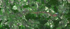
The ASTER instrument onboard Terra's spacecraft imaged the toxic sludge spill in Hungary on Oct. 11, 2010. A million cubic meters (35 million cubic feet) of red sludge spilled from a reservoir at an alumina plant in Ajka in western Hungary.
PIA13467:
ASTER Images Hungary Toxic Sludge Spill
Full Resolution:     TIFF (6.492 MB)     JPEG (438.1 kB)
Add Image to Favorite List 2010-11-03 Earth Terra
MISR
1339x1356x3
This image of the Shandong Province, China was acquired by the Multi-angle Imaging SpectroRadiometer instrument aboard NASA's Terra spacecraft. This image is from the MISR Where on Earth...? Mystery Quiz #24.
PIA13565:
Where on Earth...? MISR Mystery Image Quiz #24: Shandong Province, China
Full Resolution:     TIFF (5.453 MB)     JPEG (311.5 kB)
Add Image to Favorite List 2010-11-03 Earth Terra
ASTER
1725x1440x3
The ASTER instrument onboard NASA's Terra's spacecraft imaged the hot volcanic flow that resulted from collapse of the summit lava dome from the Merapi volcano in Indonesia that erupted on Oct. 26, 2010.
PIA13567:
Merapi Volcano, Indonesia
Full Resolution:     TIFF (7.464 MB)     JPEG (506.3 kB)
Add Image to Favorite List 2010-11-08 Earth Terra
ASTER
1536x1497x3
The ASTER instrument onboard NASA's Terra's spacecraft imaged the Khyber Pass, a mountain pass that links Afghanistan and Pakistan. Throughout its history it has been an important trade route between Central Asia and South Asia.
PIA13605:
Khyber Pass, Afghanistan-Pakistan
Full Resolution:     TIFF (6.91 MB)     JPEG (605.7 kB)
Add Image to Favorite List 2010-11-10 Earth Terra
ASTER
2700x2214x3
On Nov. 8, 2010, the ASTER instrument onboard NASA's Terra spacecraft captured an image of the hot volcanic flows from Merapi volcano that resulted from continued collapse of the summit lava dome, and the ensuing release of ash plumes.
PIA13607:
Merapi Volcano Continues its Destructive Eruption
Full Resolution:     TIFF (17.95 MB)     JPEG (545 kB)
Add Image to Favorite List 2010-11-18 Earth Terra
ASTER
4320x2645x3
This thermal infrared image from NASA's Terra spacecraft of Merapi's continuing eruption has been processed to reveal the dominant presence of volcanic ash in the eruption plume and clouds, displayed in dark red. The warm volcanic flow appears bright.
PIA13634:
ASTER Images Merapi's Continuing Eruption
Full Resolution:     TIFF (34.28 MB)     JPEG (1.574 MB)
Add Image to Favorite List 2010-12-01 Earth Terra
ASTER
1460x1480x3
This perspective view from the Advanced Spaceborne Thermal Emission and Reflection Radiometer instrument aboard NASA's Terra spacecraft shows the magnificent natural landscape of Salzkammergut, Austria.
PIA13640:
Hallstatt, Austria
Full Resolution:     TIFF (6.494 MB)     JPEG (468.3 kB)
Add Image to Favorite List 2010-12-14 Earth Terra
ASTER
529x686x3
SP Crater, a volcanic cone and flow in Arizona, is visible in this image obtained by the Advanced Spaceborne Thermal Emission and Reflection Radiometer (ASTER) instrument on NASA's Terra spacecraft.
PIA13700:
SP Crater, Arizona
Full Resolution:     TIFF (1.09 MB)     JPEG (64.08 kB)
Add Image to Favorite List 2010-12-16 Earth Terra
ASTER
3816x3808x3
This image from NASA's Terra spacecraft shows a northwest area of Saudi Arabia, Harrat Lunayyir, that reveals that the area is unexpectedly volcanically active.
PIA13722:
Harrat Lunayyir, Saudi Arabia
Full Resolution:     TIFF (43.59 MB)     JPEG (2.168 MB)
Add Image to Favorite List 2010-12-17 Earth Terra
ASTER
1230x1107x3
This image from NASA's Terra spacecraft was acquired on Dec. 9, 2010 and shows Israel's Carmel region near the city of Haifa where a deadly forest fire raged from Dec.3 to Dec.6, 2010; the burned areas appear in dark gray.
PIA13732:
Fire in Haifu, Israel
Full Resolution:     TIFF (4.089 MB)     JPEG (317.2 kB)
Add Image to Favorite List 2011-01-07 Earth Terra
ASTER
1024x801x3
On Jan. 7, 2011, NASA's Terra spacecraft captured this image of the inundated city of Rockhampton, Queensland, Australia. Torrential rains in NE Australia caused the Fitzroy River to overflow its banks and flood much of the city.
PIA13775:
Flooding in Rockhampton, Queensland, Australia
Full Resolution:     TIFF (2.464 MB)     JPEG (160.1 kB)
Add Image to Favorite List 2011-01-10 Earth Terra
ASTER
3375x3069x3
This image captured by NASA's Terra spacecraft is of the Jizzax Province in eastern Uzbekistan, one of the main agricultural regions of the country. Uzbekistan is the world's sixth largest producer and second-largest exporter of cotton.
PIA13777:
Jizzax Province, Uzbekistan
Full Resolution:     TIFF (31.07 MB)     JPEG (2.648 MB)
Add Image to Favorite List 2011-01-15 Earth Terra
ASTER
1289x1127x3
On Jan. 14, 2011, NASA's Terra spacecraft captured this image of the inundated city of St. George, Queensland, Australia. Torrential rains in northeastern Australia caused the Balonne River to overflow its banks and flood much of the city.
PIA13785:
ASTER Images Continuing Flooding in Australia
Full Resolution:     TIFF (4.363 MB)     JPEG (192.6 kB)
Add Image to Favorite List 2011-01-18 Earth Terra
ASTER
2118x1917x3
On January 17, 2011, the Advanced Spaceborne Thermal Emission and Reflection Radiometer (ASTER) instrument on NASA's Terra spacecraft captured this image of the inundation west of Brisbane, Queensland, Australia.
PIA13810:
NASA Satellite Images Flooding Near Brisbane, Australia
Full Resolution:     TIFF (12.2 MB)     JPEG (876.1 kB)
Add Image to Favorite List 2011-01-19 Earth Terra
ASTER
1549x1523x3
On Jan. 18, 2011, NASA's Terra spacecraft captured this 3-D perspective image of the city of Nova Friburgo, Brazil. A week of torrential rains triggered a series of deadly mudslides and floods. More details about this image at the Photojournal.
PIA13815:
NASA Spacecraft Captures Image of Brazil Flooding
Full Resolution:     TIFF (7.09 MB)     JPEG (373.1 kB)
Add Image to Favorite List 2011-01-24 Earth Terra
ASTER
1188x1015x3
On Jan. 21, 2011, the NASA's Terra spacecraft captured this image of the flooding along the Balonne River and the town of Surat in southeastern Queensland, Australia.
PIA13812:
NASA Images Illustrate Extent of Australia's Flooding Woes
Full Resolution:     TIFF (3.622 MB)     JPEG (236.3 kB)
Add Image to Favorite List 2011-01-26 Earth Terra
ASTER
3540x2489x3
NASA's Terra spacecraft captured this image of the city of Arkhangelsk (or Archangel in English) and administrative capital of Archangelsk Oblast, Russia. It is situated on both banks of the Dvina River near where it flows into the White Sea.
PIA13824:
Arkhangelsk, Russia
Full Resolution:     TIFF (26.43 MB)     JPEG (1.328 MB)
Add Image to Favorite List 2011-01-27 Earth Terra
ASTER
445x435x1
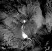
This nighttime thermal infrared image from NASA's Terra spacecraft shows Shiveluch volcano, one of the largest and most active volcanoes in Russia's Kamchatka Peninsula; the bright, hot summit lava dome is evident in the center of the image.
PIA13827:
NASA Spacecraft Captures Fury of Russian Volcano
Full Resolution:     TIFF (194 kB)     JPEG (37.76 kB)
Add Image to Favorite List 2011-02-14 Earth Terra
ASTER
1409x1455x3
This image from NASA's Terra spacecraft shows an area outside of Bogota, Colombia, one of the country's two major flower growing areas.
PIA13852:
Bogota, Colombia
Full Resolution:     TIFF (6.162 MB)     JPEG (516.8 kB)
Add Image to Favorite List 2011-02-24 Earth Terra
ASTER
1533x1484x3
On Feb. 23, 2011, NASA's Terra spacecraft imaged the Christchurch region on New Zealand's South Island; this region was rocked by a powerful magnitude 6.3 earthquake.
PIA13882:
NASA Spacecraft Images Region Devastated by New Zealand Quake
Full Resolution:     TIFF (6.837 MB)     JPEG (529.1 kB)
Add Image to Favorite List 2011-03-03 Earth Terra
ASTER
2829x2796x3
On Feb. 25, 2011, NASA's Terra spacecraft captured this image of a large ash-laden eruption plume drifting towards the northeast from Kizimen volcano, an isolated stratovolcano, in Kamchatka, Russia.
PIA13888:
Kizimen Volcano, Kamchatka
Full Resolution:     TIFF (23.73 MB)     JPEG (1.049 MB)
Add Image to Favorite List 2011-03-12 Earth Terra
MISR
600x400x3
The extent of inundation from the destructive and deadly tsunami triggered by the March 11, 2011, magnitude 8.9 earthquake centered off Japan's northeastern coast east of the city of Sendai is revealed in this image pair from NASA's Terra spacecraft.
PIA13913:
NASA's MISR Images Tsunami Inundation Along Japan's Eastern Coast
Full Resolution:     TIFF (721 kB)     JPEG (55.74 kB)
Add Image to Favorite List 2011-03-13 Earth Terra
MISR
1245x835x3
This images, acquired on March 12, 2011 by NASA's Terra spacecraft, shows a large smoke plume that appears to be associated either with the Shiogama incident or Sendai port fires. 3D glasses are necessary to view this image.
PIA13914:
Large Smoke Plume from Industrial Fires in Miyagi Prefecture, Japan
Full Resolution:     TIFF (3.122 MB)     JPEG (132 kB)
Add Image to Favorite List 2011-03-15 Earth Terra
ASTER
3790x3122x3
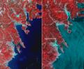
This before-and-after image pair acquired by NASA's Terra spacecraft of the Japan coastal cities of Ofunato and Kesennuma reveals changes to the landscape that are likely due to the effects of the tsunami on March 11, 2011. The new image is on the left.
PIA13915:
NASA's ASTER Images More Effects of Japan Tsunami
Full Resolution:     TIFF (35.5 MB)     JPEG (2.11 MB)
Add Image to Favorite List 2011-03-20 Earth Terra
MISR
613x646x3
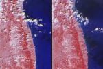
This image pair from NASA's Terra spacecraft includes the area around the damaged Fukushima Dai-ichi nuclear power facility and extends northward along the coast.
PIA13937:
MISR Images Lingering Floods from Tohoku-oki Earthquake Tsunami
Full Resolution:     TIFF (1.19 MB)     JPEG (80.19 kB)
Add Image to Favorite List 2011-03-24 Earth Terra
ASTER
1506x1486x3
Located 600 km south of Algiers, Algeria in the heart of the Sahara Desert, the five ksour (fortified villages) of the M'Zab Valley form an extraordinarily homogenous ensemble in this image captured by NASA's Terra spacecraft.
PIA13945:
M'zab Valley, Algeria
Full Resolution:     TIFF (6.726 MB)     JPEG (579.9 kB)
Add Image to Favorite List 2011-04-06 Earth Terra
ASTER
1472x1483x3
This image of the Mountain Pass rare open-pit earth mine was acquired by NASA's Terra spacecraft in southeastern California near the Nevada border.
PIA13979:
Mountain Pass Mine, California
Full Resolution:     TIFF (6.561 MB)     JPEG (505.8 kB)
Add Image to Favorite List 2011-04-12 Earth Terra
ASTER
1106x707x3
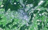
NASA's Terra spacecraft acquired this image of the City of Luxembourg, one of Europe's greatest fortified states. With a population of about 90,000, the city is the capital of the Grand Duchy of Luxembourg.
PIA14035:
Luxembourg
Full Resolution:     TIFF (2.349 MB)     JPEG (233.3 kB)
Add Image to Favorite List 2011-04-21 Earth Terra
ASTER
1534x2421x3
NASA's Terra spacecraft shows the annual spring thaw in the upper Midwest is underway. Snow-covered ground contrasts with the dark tones of water under broken cloud cover. Along the Red River in North Dakota, floodwaters are moving northward into Canada.
PIA14045:
NASA Satellite Images Annual Spring Thaw, Red River, North Dakota
Full Resolution:     TIFF (3.718 MB)     JPEG (475.5 kB)
Add Image to Favorite List 2011-04-27 Earth Terra
ASTER
3735x3648x3
This image, acquired by NASA's Terra spacecraft, is of the Aaland archipelago at the mouth of the Gulf of Bothnia which belongs to Finland, though it enjoys autonomy from Helsinki and locals speak Swedish.
PIA14088:
Aaland Archipelago, Finland
Full Resolution:     TIFF (40.88 MB)     JPEG (2.018 MB)
Add Image to Favorite List 2011-05-04 Earth Terra
ASTER
747x1140x3
This image, acquired by NASA's Terra spacecraft on May 1, 2011, shows more than 314,000 acres burned in west Texas. The 2011 fire season in Texas is of historic proportions.
PIA14136:
ASTER Images Record Texas Wildfire
Full Resolution:     TIFF (2.558 MB)     JPEG (188.2 kB)
Add Image to Favorite List 2011-05-04 Earth Terra
ASTER
645x1077x3
NASA's Terra spacecraft acquired this image on April 30, 2011, showing flooding along the Mississippi River at its junction with the Des Moines River near Keokuk, Iowa.
PIA14137:
ASTER Images Midwest Flooding
Full Resolution:     TIFF (2.086 MB)     JPEG (182.1 kB)
Add Image to Favorite List 2011-05-06 Earth Terra
ASTER
2433x4120x3
From April 25-28, 2011, one of the largest outbreaks of tornadoes ever recorded ripped across the Southern, Midwestern and Eastern United States. NASA's Terra spacecraft shows the scar the tornado left across Birmingham, Alabama.
PIA14143:
ASTER Images Aftermath of U.S. Tornado Outbreak
Full Resolution:     TIFF (30.11 MB)     JPEG (2.444 MB)
Add Image to Favorite List 2011-05-10 Earth Terra
ASTER
2037x1270x3
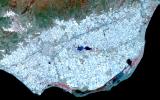
Surrounding the town of El Ejido, Almeria Province, southern Spain is a sea of greenhouses, stretching for tens of kilometers as shown in this image from NASA's Terra spacecraft.
PIA14146:
Almeria, Spain
Full Resolution:     TIFF (7.771 MB)     JPEG (539.6 kB)
Add Image to Favorite List 2011-05-10 Earth Terra
ASTER
3311x4200x3
NASA's Terra spacecraft shows the resultant flooding of farmland west of the Mississippi 20 miles south of the Mississippi River levee breach. U.S. Army Corps of Engineers detonated explosives at the Birds Point levee near Wyatt, Missouri, on May 2, 2011.
PIA14147:
ASTER Images Flooding from Mississippi River Levee Breach
Full Resolution:     TIFF (41.72 MB)     JPEG (1.362 MB)
Add Image to Favorite List 2011-05-16 Earth Terra
ASTER
709x800x3
At the time NASA's Terra spacecraft acquired this image, the Mississippi River had reached a level of 53 feet (16.2 meters), 3 feet (1 meter) above the major flood stage. Flood water had already inundated parts of Vicksburg, Mississippi.
PIA14151:
NASA Spacecraft Eyes Mississippi Flooding
Full Resolution:     TIFF (1.704 MB)     JPEG (149 kB)
Add Image to Favorite List 2011-05-19 Earth Terra
ASTER
1728x2512x3
NASA's Terra spacecraft shows the water flow after the U.S. Army Corps of Engineers opened the Morganza Spillway, a flood control structure along the western bank of the Mississippi River in Louisiana, to ease flooding along levee systems on May 14, 2011.
PIA14155:
NASA Images Mississippi River Flooding in Louisiana
Full Resolution:     TIFF (13.04 MB)     JPEG (836.2 kB)
Add Image to Favorite List 2011-05-24 Earth Terra
MISR
1025x1100x3
NASA's Terra spacecraft captured this image of Grímsvötn, the most active of Iceland's volcanoes, which began erupting around 5:30 p.m. local time (1730 UTC) on Saturday, May 21, 2011, east of the capital city of Reykjavik.
PIA14161:
Grímsvötn Volcano Injects Ash into the Stratosphere
Full Resolution:     TIFF (3.387 MB)     JPEG (115.3 kB)
Add Image to Favorite List 2011-05-26 Earth Terra
ASTER
2817x2325x3
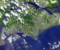
This image from NASA's Terra spacecraft is of the Republic of Singapore, a city-state off the southern tip of the Malay Peninsula. An island country made up of 63 islands, the country is largely urbanized with very little rain forest left.
PIA14167:
Singapore
Full Resolution:     TIFF (19.65 MB)     JPEG (1.129 MB)
Add Image to Favorite List 2011-05-31 Earth Terra
ASTER
753x557x3
On May 30, 2011, a week after an EF-5 tornado swept through the city of Joplin, Mo, NASA's Terra spacecraft captured this image showing the track of the deadly tornado through the city (shown horizontally in green-blue).
PIA14174:
ASTER Sees Path of Destruction from Joplin, Mo. Tornado
Full Resolution:     TIFF (1.26 MB)     JPEG (106.6 kB)
Add Image to Favorite List 2011-11-14 Earth Terra
ASTER
1243x1121x3
This image from NASA's Terra spacecraft shows the city of Tequila, Mexico. Its red volcanic soil surrounding Tequila is particularly well suited to the growing of blue agave, and more than 300 million plants are harvested each year.
PIA15073:
Tequila, Mexico
Full Resolution:     TIFF (4.185 MB)     JPEG (192.7 kB)
Add Image to Favorite List 2011-06-09 Earth Terra
MISR
1205x1545x3
This image from NASA's Terra spacecraft shows the Wallow and Horseshoe 2 Fires burning in Arizona. The data were acquired mid-morning on June 7, 2011. Nearly 10 distinct bluish-colored smoke plumes can be seen blowing toward the upper right (northeast).
PIA14270:
Arizona Wildfires Burn Out of Control
Full Resolution:     TIFF (5.592 MB)     JPEG (322.2 kB)
Add Image to Favorite List 2011-06-14 Earth Terra
ASTER
1984x2840x3
The Mar. 11, 2011, Tohoku, Japan earthquake and tsunami devastated a large extent of the northeastern Japan coast, and virtually erased many villages and cities from the map. NASA's Terra spacecraft acquired this image of Sendai on Mar. 14, 2011.
PIA14271:
Tohoku Tsunami Debris, Japan
Full Resolution:     TIFF (16.93 MB)     JPEG (640.7 kB)
Add Image to Favorite List 2011-06-14 Earth Terra
ASTER
2745x1842x3
Southern Chile's Puyehue volcano came to life on June 4, 2011, after decades of dormancy. Winds spread the ash column eastward over neighboring Argentina, leading to the evacuation of thousands of residents. This image is from NASA's Terra spacecraft.
PIA14272:
NASA Spacecraft Spots Fury of Disruptive Chilean Volcano
Full Resolution:     TIFF (15.17 MB)     JPEG (521 kB)
Add Image to Favorite List 2011-06-16 Earth Terra
ASTER
1811x1321x3
The Espanola wildfire had consumed more than 4,300 acres when the Advanced Spaceborne Thermal Emission and Reflection Radiometer (ASTER) instrument aboard NASA's Terra spacecraft acquired this image on June 16, 2011, over Flagler County, Fla.
PIA14277:
NASA Spacecraft Spots Florida Wildfire
Full Resolution:     TIFF (7.188 MB)     JPEG (262 kB)
Add Image to Favorite List 2011-06-20 Earth Terra
ASTER
416x413x3
Nabro volcano, Eritrea, in the Horn of Africa, began erupting June 12, 2011, the first-ever recorded eruption of this stratovolcano. This image was acquired by NASA's Terra spacecraft on June 19, 2011.
PIA14280:
NASA Spacecraft Captures First Recorded Eruption of Volcano in Africa's Horn
Full Resolution:     TIFF (516.2 kB)     JPEG (13.51 kB)
Add Image to Favorite List 2011-06-22 Earth Terra
ASTER
3450x4200x3
NASA's Terra spacecraft acquired this image of the Wallow fire in Arizona on June 21, 2011; vegetation appears in red, bare ground in shades of tan, burned areas in black and very-dark red; and smoke from the active fire front appears gray.
PIA14285:
NASA Spacecraft Monitors Continuing Burn of Arizona's Largest-Ever Wildfire
Full Resolution:     TIFF (43.47 MB)     JPEG (2.663 MB)
Add Image to Favorite List 2011-06-28 Earth Terra
ASTER
3624x4475x3
NASA's Terra spacecraft acquired this image of the Republic of Seychelles, an island country with an archipelago of 115 islands in the Indian Ocean.
PIA14289:
Republic of Seychelles
Full Resolution:     TIFF (48.65 MB)     JPEG (2.095 MB)
Add Image to Favorite List 2011-07-06 Earth Terra
ASTER
1606x1263x3
Nabro volcano in the African nation of Eritrea began erupting June 12, 2011, the first-ever recorded eruption of this stratovolcano. This image was acquired by NASA's Terra spacecraft on July 5, 2011.
PIA14382:
NASA Spacecraft Capture's Nabro Volcano's Continuing Eruption
Full Resolution:     TIFF (6.095 MB)     JPEG (409.8 kB)
Add Image to Favorite List 2011-07-07 Earth Terra
ASTER
2682x2481x3
This image of Africa's Nabro volcano in Eritrea was acquired by NASA's Terra spacecraft on July 6, 2011. Ash plumes sent into the stratosphere disrupted air traffic in Sudan, Djibouti, Ethiopia and Sudan.
PIA14390:
Africa's Nabro Volcano Spews a Fiery Brew in NASA Spacecraft Image
Full Resolution:     TIFF (19.98 MB)     JPEG (511.6 kB)
Add Image to Favorite List 2011-07-12 Earth Terra
ASTER
1460x1464x3
This image acquired by NASA's Terra spacecraft is of the Valley of Ten Thousand Smokes. Located in Katmai National Park, Alaska, the park is filled with ash flows from the 1912 eruption of Novarupta.
PIA14391:
Valley of Ten Thousand Smokes, Alaska
Full Resolution:     TIFF (6.424 MB)     JPEG (428 kB)
Add Image to Favorite List 2011-08-03 Earth Terra
MISR
952x727x3
This image of Western Cape, South Africa was acquired by the Multi-angle Imaging SpectroRadiometer (MISR) instrument aboard NASA's Terra spacecraft. This image is from the MISR Mystery Image Quiz #25.
PIA14489:
Where on Earth...? MISR Mystery Image Quiz #25: Western Cape, South Africa
Full Resolution:     TIFF (2.079 MB)     JPEG (146.7 kB)
Add Image to Favorite List 2011-08-02 Earth Terra
ASTER
1237x1841x3
This image acquired by NASA's Terra spacecraft is of the Principality of Liechtenstein, a landlocked alpine country between Austria and Switzerland.
PIA14514:
Principality of Liechtenstein
Full Resolution:     TIFF (6.84 MB)     JPEG (505.6 kB)
Add Image to Favorite List 2012-04-24 Earth Terra
ASTER
5800x2000x3
NASA's Terra spacecraft shows Mexico's active Popocatepetl volcano, located about 40 miles southeast of Mexico City, spewing water vapor, gas, ashes and glowing rocks since its most recent eruption period began in April 2012.
PIA14409:
NASA Spacecraft Images Mexican Volcanic Eruption
Full Resolution:     TIFF (34.8 MB)     JPEG (1.819 MB)
Add Image to Favorite List 2011-08-16 Earth Terra
ASTER
3750x2235x3
This image acquired by NASA's Terra spacecraft shows the Carrizo Plain, located northwest of Los Angeles, CA. It is one of the easiest places to see surface fractures of the San Andreas Fault, evident as it crosses the image from lower right to upper left
PIA14555:
Carrizo Plain, California
Full Resolution:     TIFF (25.14 MB)     JPEG (1.607 MB)
Add Image to Favorite List 2011-08-27 Earth Terra
MISR
1479x1029x3
NASA's Terra spacecraft passed over Hurricane Irene while it was just north of the Bahamas on Aug. 25, 2011. At the time, Irene was a category three hurricane making landfall in North Carolina on the morning of Aug. 27 as a category one hurricane.
PIA14741:
NASA's MISR Sees Cloud Heights at Top of Hurricane Irene
Full Resolution:     TIFF (4.574 MB)     JPEG (286.1 kB)
Add Image to Favorite List 2011-08-29 Earth Terra
ASTER
6600x4000x3
This image acquired by NASA's Terra spacecraft shows unusually heavy rains over the upper Mekong River in Laos and Thailand that led to severe flooding in Cambodia in mid-August 2011. The city of Phnom Penh is at the bottom center of the image.
PIA14765:
NASA Spacecraft Images Cambodian Flooding
Full Resolution:     TIFF (79.2 MB)     JPEG (5.303 MB)
Add Image to Favorite List 2011-09-06 Earth Terra
ASTER
704x782x3
This image acquired by NASA's Terra spacecraft is of La Chaux-de-Fonds, a Swiss city in the Jura Mountains, founded in 1656.
PIA14767:
La Chaux-de-Fonds, Switzerland
Full Resolution:     TIFF (1.654 MB)     JPEG (180.3 kB)
Add Image to Favorite List 2011-09-07 Earth Terra
MISR
1164x1607x3
As the remains of Tropical Storm Lee passed over Louisiana on Monday, Sept. 5, 2011, strong, gusty winds on the western side of the storm stoked fires throughout eastern Texas as seen in this image from NASA's Terra spacecraft.
PIA14769:
NASA's MISR Sees Wind-Whipped Fires in East Texas
Full Resolution:     TIFF (5.618 MB)     JPEG (415.1 kB)
Retrieve Previous Set  Jump to a Previous Set   Jump to a Previous Set   Jump to a Previous Set   Jump to a Previous Set   Jump to a Previous Set   Current Set   Jump to a Following Set   Jump to a Following Set   Jump to a Following Set   Jump to a Following Set   Retrieve Next Set 
 1-100   101-200   201-300   301-400   401-500   501-600   601-700   701-800   801-900   901-1000 
Currently displaying images: 501 - 600 of 2612