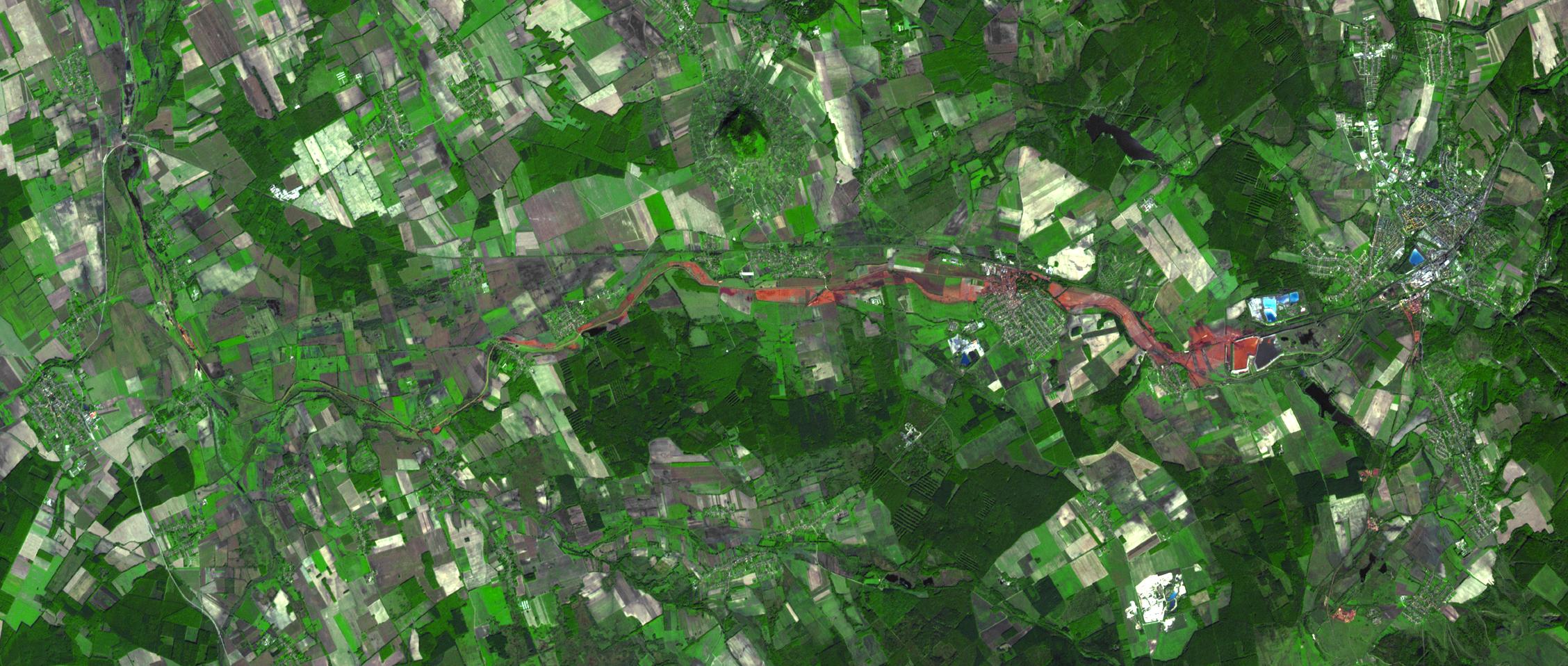
On Oct. 4, 2010, a million cubic meters (35 million cubic feet) of red sludge spilled from a reservoir at an alumina plant in Ajka in western Hungary. Four people were killed and about 100 injured. The sludge entered the Marcal River and has reached the Danube. Aquatic life in the Marcal was severely harmed; the mud also caused significant damage in nearby villages and towns, as well as adjacent farmland.
On Oct. 11, when the Advanced Spaceborne Thermal Emission and Reflection Radiometer (ASTER) instrument on NASA's Terra spacecraft captured this image, the reservoir breach and downstream flow of the red sludge were still prominently visible. The ASTER image is located at 47.1 degrees north latitude, 17.5 degrees east longitude. The image covers an area of 14 by 34 kilometers (8.9 by 21 miles).
With its 14 spectral bands from the visible to the thermal infrared wavelength region and its high spatial resolution of 15 to 90 meters (about 50 to 300 feet), ASTER images Earth to map and monitor the changing surface of our planet. ASTER is one of five Earth-observing instruments launched Dec. 18, 1999, on Terra. The instrument was built by Japan's Ministry of Economy, Trade and Industry. A joint U.S./Japan science team is responsible for validation and calibration of the instrument and data products.
The broad spectral coverage and high spectral resolution of ASTER provides scientists in numerous disciplines with critical information for surface mapping and monitoring of dynamic conditions and temporal change. Example applications are: monitoring glacial advances and retreats; monitoring potentially active volcanoes; identifying crop stress; determining cloud morphology and physical properties; wetlands evaluation; thermal pollution monitoring; coral reef degradation; surface temperature mapping of soils and geology; and measuring surface heat balance.
The U.S. science team is located at NASA's Jet Propulsion Laboratory, Pasadena, Calif. The Terra mission is part of NASA's Science Mission Directorate, Washington, D.C.
More information about ASTER is available at http://asterweb.jpl.nasa.gov/.
