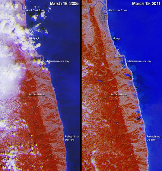
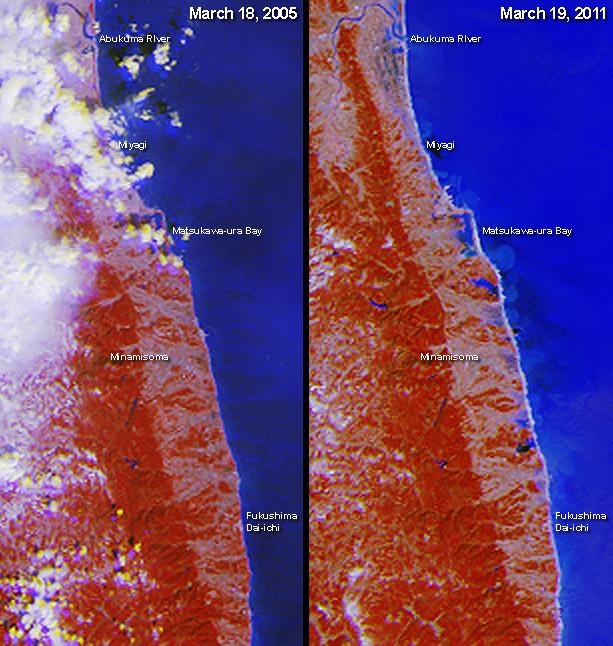
The March 11, 2011 Tohoku-oki earthquake triggered a deadly and destructive tsunami whose impacts were felt along a wide portion of Japan's northeastern coast. This image pair from the Multi-angle Imaging SpectroRadiometer (MISR) instrument on NASA's Terra spacecraft includes the area around the damaged Fukushima Dai-ichi nuclear power facility and extends northward along the coast. The post-earthquake image, shown on the right, was acquired mid-morning on March 19, 2011 during Terra orbit 59833. For comparison, a pre-earthquake image from March 18, 2005, acquired under nearly identical illumination conditions during Terra orbit 27912, is shown on the left.
Each image extends from just north of the Abukuma River to south of the Fukushima Dai-ichi nuclear power facility, and covers an area of 41 kilometers (25 miles) by 89 kilometers (55 miles). Flooding extending about 2 kilometers (1.2 miles) inland is visible just north of the nuclear power plant. Further up the coast, to the south of Matsukawa-ura Bay, the extent of inundation increases to nearly 5 kilometers (3.1 miles) from the coast.
These unique, false-color images enhance the presence of water in two ways. First, their near-infrared observations cause vegetated areas to appear red, which contrasts strongly with water. Second, by combining nadir (vertical-viewing) imagery with observations acquired at a view angle of 26 degrees, reflected sunglint enhances the brightness of water, which is shown in shades of blue. This use of observations at different view angles causes a stereoscopic effect, where elevated clouds have a yellow tinge at their top edges and blue tinge at their bottom edges.
MISR was built and is managed by NASA's Jet Propulsion Laboratory, Pasadena, Calif., for NASA's Science Mission Directorate, Washington, D.C. The Terra satellite is managed by NASA's Goddard Space Flight Center, Greenbelt, Md. The MISR data were obtained from the NASA Langley Research Center Atmospheric Science Data Center. JPL is a division of the California Institute of Technology.