NASA's Terra spacecraft passed over Hurricane Irene while it was just north of the Bahamas on Aug. 25, 2011, at 11:45 a.m. EDT. At the time, Irene was a category three hurricane on the Saffir-Simpson scale, with maximum sustained winds of 115 mph (185 kph), and a minimum central pressure of 951 hPa, according to NOAA's National Hurricane Center. The storm made landfall in North Carolina on the morning of Aug. 27 as a category one hurricane.
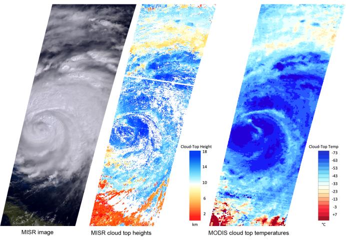
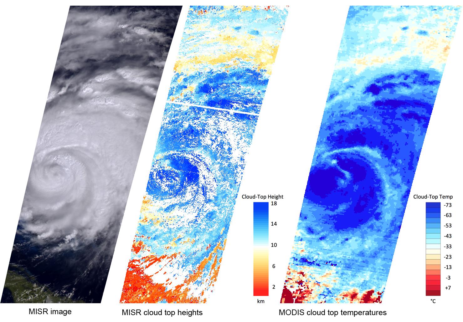
This set of images, acquired by the Multi-angle Imaging SpectroRadiometer (MISR) instrument on Terra on Aug. 25, highlights geophysical parameters important to scientists studying these storms.
MISR uses nine cameras to capture images of the hurricane from different angles. The leftmost image is taken from an angle of 46 degrees. The storm is visible to the north of Cuba, which is located in the lower left of the image. Irene's eye is covered with clouds. Strong storms in the eyewall and the outer rain bands appear as bright, textured regions.
The multiple angles of MISR's cameras provide a stereographic view of Hurricane Irene. This information can be used to determine the height of the storm's cloud tops. As shown in the center image, these heights exceed 11 miles (18 kilometers) in the center of the storm, and in the outer rain bands, where the vertical motion is strongest. Lower clouds, at an altitude of about 5 miles (8 kilometers), are visible along the storm's northern edge.
The Moderate Resolution Imaging Spectroradiometer (MODIS) instrument also flies on Terra and measures cloud top temperatures. Higher clouds are colder, and the highest clouds in Hurricane Irene on Aug. 25 had temperatures less than minus 100 degrees Fahrenheit (minus 73 degrees Celsius).
While there is good correspondence between the MISR cloud top heights and the MODIS cloud top temperatures, these two observations provide different insights into the behavior of clouds near the core of the storm. Researchers are studying how the two measurements can be used in combination to estimate hurricane intensity.
These images cover more than 800 miles (1,300 kilometers) in the north-south direction, and are centered near 27 degrees North latitude, 75.5 degrees West longitude.
MISR was built and is managed by NASA's Jet Propulsion Laboratory, Pasadena, Calif., for NASA's Science Mission Directorate, Washington, D.C. The Terra spacecraft is managed by NASA's Goddard Space Flight Center, Greenbelt, Md. The MISR data were obtained from the NASA Langley Research Center Atmospheric Science Data Center, Hampton, Va. The MODIS data were obtained from the Goddard Space Flight Center Level 1 and Atmosphere Archive and Distribution System. JPL is a division of the California Institute of Technology in Pasadena.