My
List |
Addition Date
|
Target
|
Mission
|
Instrument
|
Size
|

|
2002-07-15 |
Mars
|
2001 Mars Odyssey
|
THEMIS
|
1238x3025x1 |
|
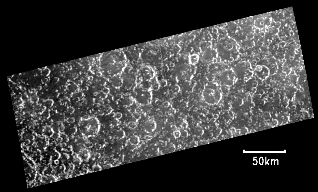
-
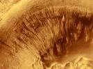
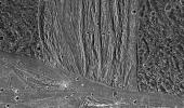
PIA03845:
-
Amenthes Crater
Full Resolution:
TIFF
(1.708 MB)
JPEG
(401.1 kB)
|
|
|
2002-07-10 |
Earth
|
Terra
|
MISR
|
1960x1600x3 |
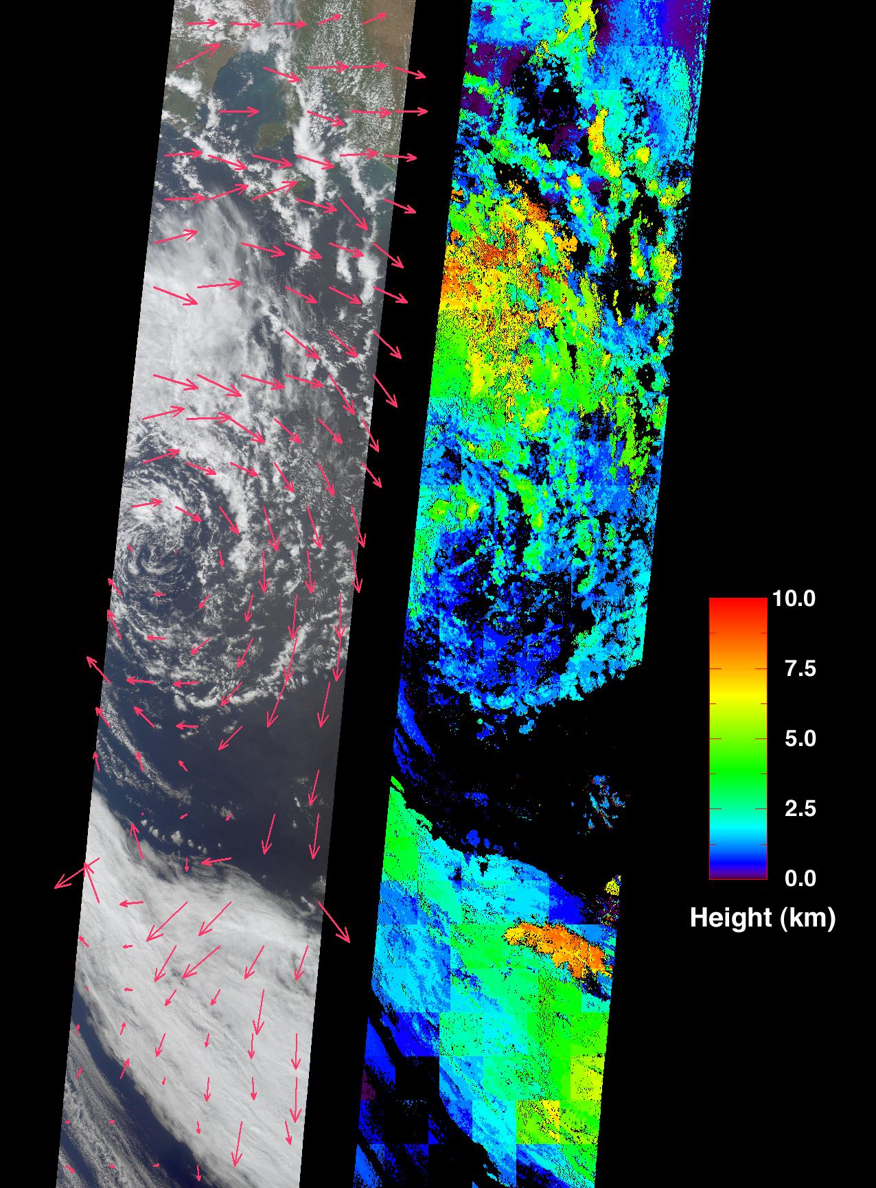
|
-
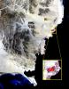
PIA03715:
-
Where on Earth...? MISR Mystery Image Quiz #9:
Bouvet Island, Norway
Full Resolution:
TIFF
(6.148 MB)
JPEG
(350.8 kB)
|
|
|
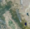
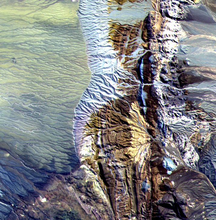
2002-06-12 |
Earth
|
Terra
|
MISR
|
1660x933x3 |
|
-
PIA03711:
-
Spectacular Mountain Views of Northwest Colorado
Full Resolution:
TIFF
(5.47 MB)
JPEG
(442.1 kB)
|
|
|
2002-04-03 |
Earth
|
Terra
|
MISR
|
1152x1500x3 |
|
-
PIA03701:
-
Where on Earth...? MISR Mystery Image Quiz #7:
Torey Lakes, Central Asia
Full Resolution:
TIFF
(5.454 MB)
JPEG
(303.4 kB)
|
|
|
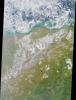
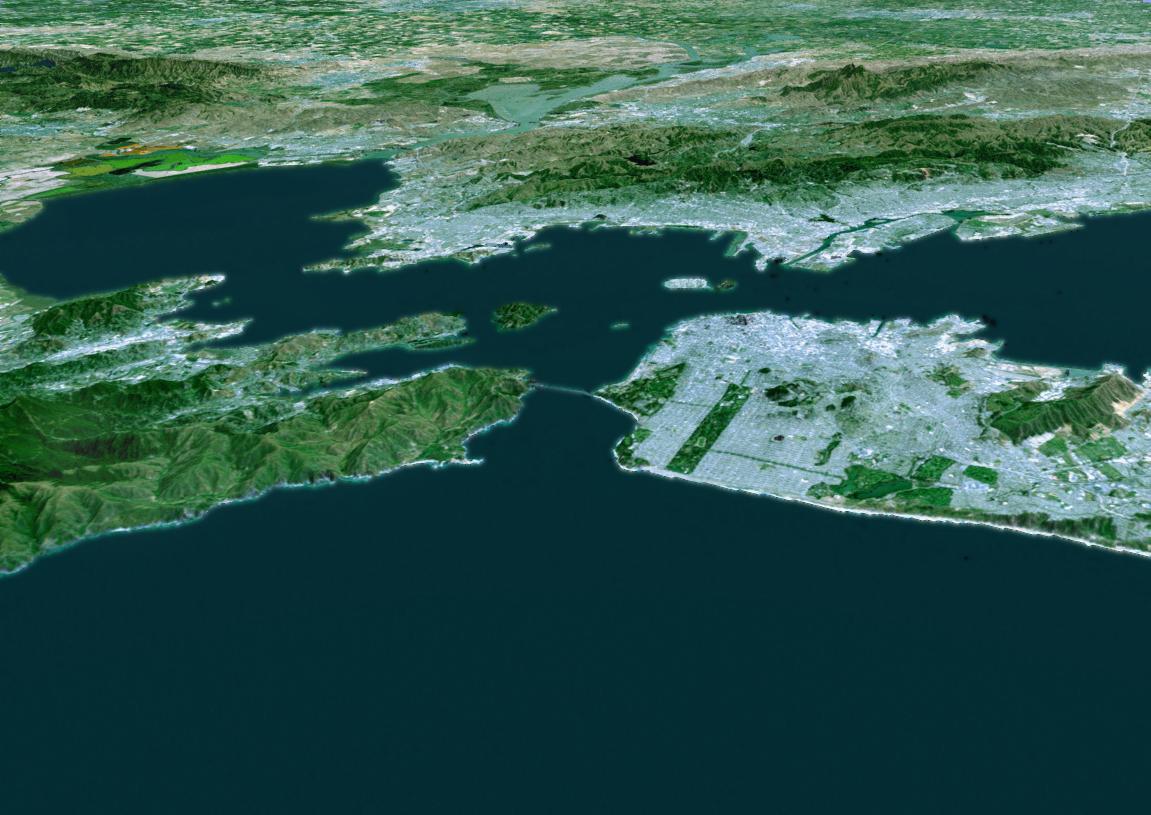
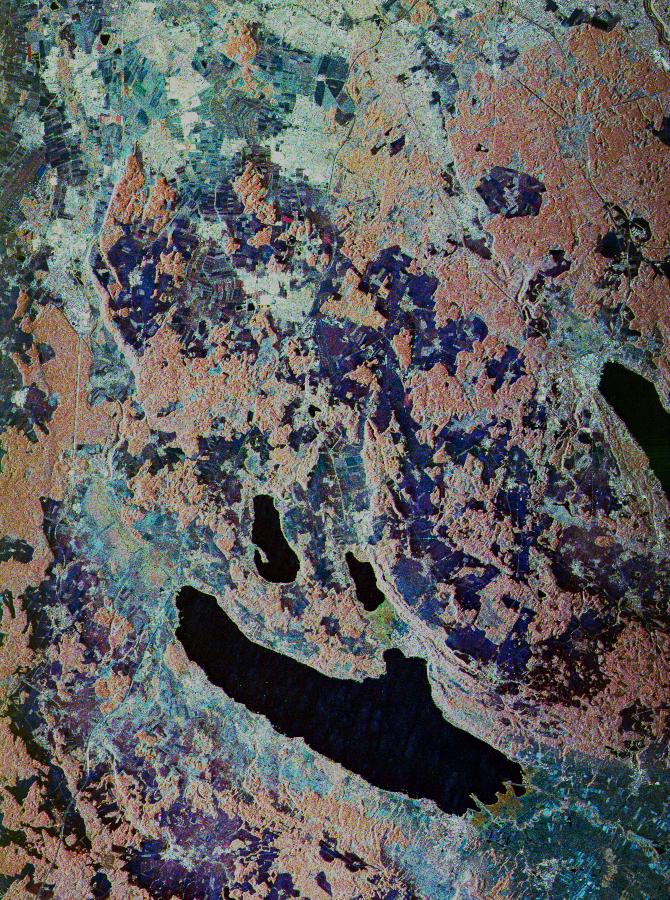
2002-01-31 |
Earth
|
Landsat
Shuttle Radar Topography Mission (SRTM)
|
C-Band Interferometric Radar
Thematic Mapper
|
1151x815x3 |
|
-
PIA03335:
-
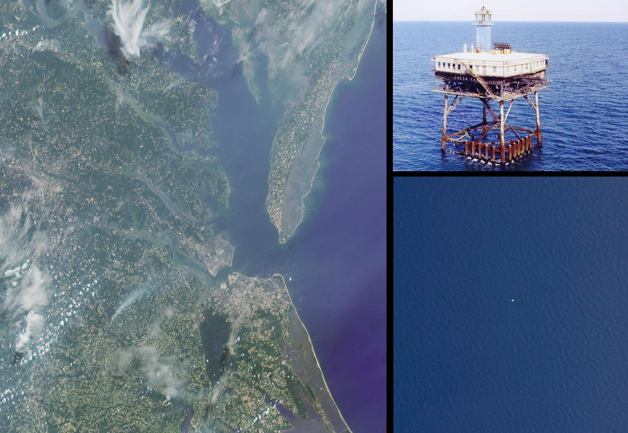
Perspective View with Landsat Overlay, San Francisco Bay Area, Calif.
Full Resolution:
TIFF
(1.999 MB)
JPEG
(127.7 kB)
|
|
|
2002-01-02 |
Earth
|
Terra
|
MISR
|
1484x1159x3 |
|
-
PIA03437:
-
Penguins in Peril
Full Resolution:
TIFF
(4.34 MB)
JPEG
(249.5 kB)
|
|
|
2001-11-29 |
Callisto
|
Galileo
|
Solid-State Imaging
|
1280x774x1 |
|
-
PIA02593:
-
Opposite Side of Callisto from Valhalla Impact
Full Resolution:
TIFF
(609.1 kB)
JPEG
(121.2 kB)
|
|
|
2001-11-27 |
Io
|
Galileo
|
Near Infrared Mapping Spectrometer
|
468x620x3 |
|
-
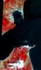
PIA02594:
-
Io's Tvashtar Area in Infrared: Multiple Lava Flows
Full Resolution:
TIFF
(441.1 kB)
JPEG
(31.68 kB)
|
|
|
2001-11-07 |
Earth
|
Terra
|
MISR
|
1276x1731x3 |
|
-
PIA03430:
-
Extratropical Cyclone in the Southern Ocean
Full Resolution:
TIFF
(2.402 MB)
JPEG
(450.5 kB)
|
|
|
2001-11-04 |
Borrelly
|
Deep Space 1 (DS1)
|
Miniature Integrated Camera Spectrometer
|
500x500x1 |

|
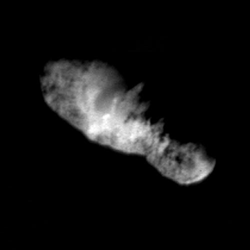
-
PIA03500:
-
Highest Resolution Comet Picture Ever Reveals Rugged Terrain - Deep Space 1
Full Resolution:
TIFF
(53.18 kB)
JPEG
(8.527 kB)
|
|
|
2001-11-03 |
Borrelly
|
Deep Space 1 (DS1)
|
Miniature Integrated Camera Spectrometer
|
500x500x1 |
|
-
PIA03501:
-
Several Jets and a Crater on Comet Borrelly
Full Resolution:
TIFF
(85.19 kB)
JPEG
(14.36 kB)
|
|
|
2001-10-22 |
Earth
|
Terra
|
ASTER
|
2280x3887x3 |

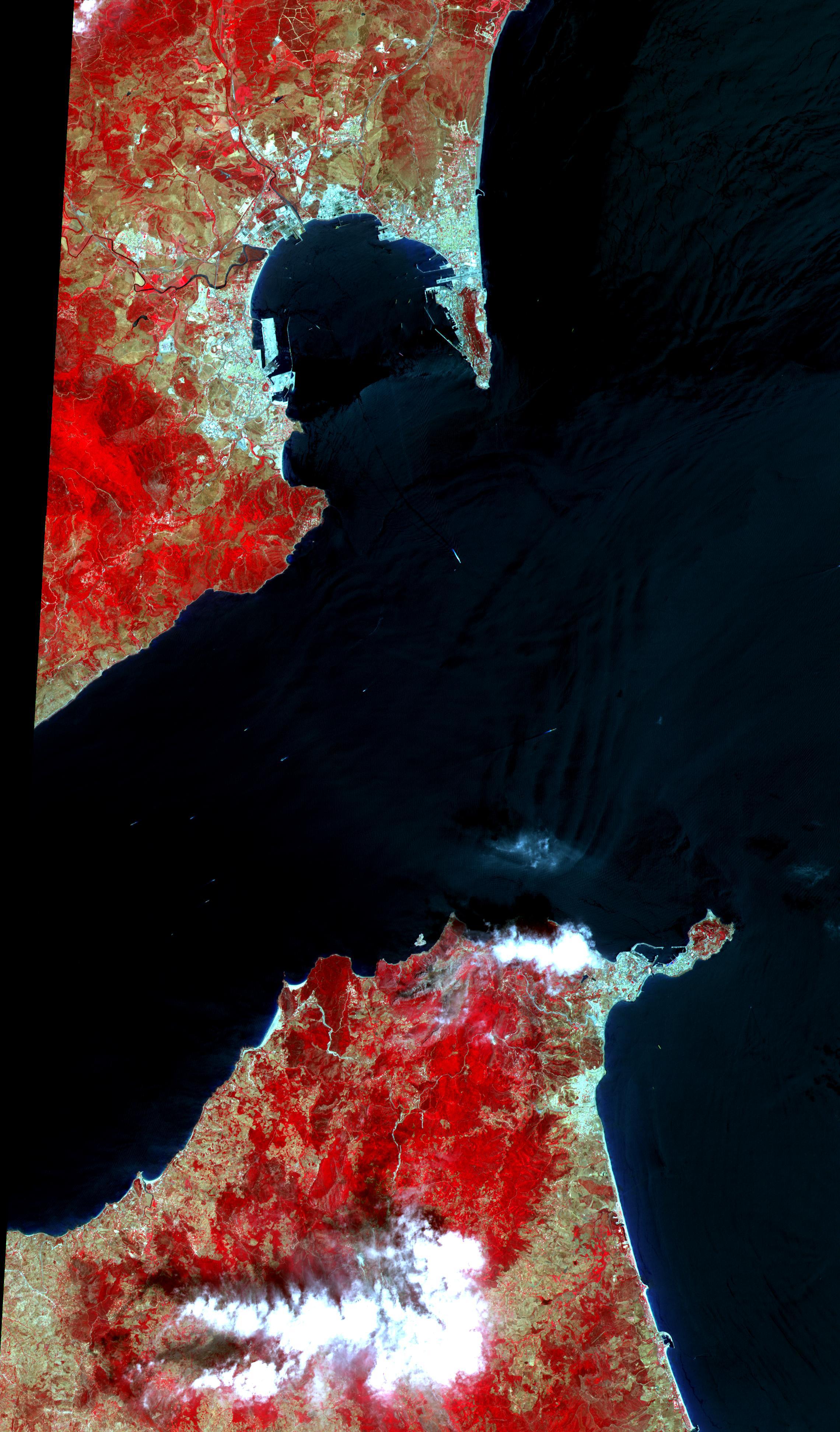
|
-
PIA11167:
-
Strait of Gibraltar
Full Resolution:
TIFF
(26.62 MB)
JPEG
(1.024 MB)
|
|
|
2001-10-22 |
Earth
|
Terra
|
ASTER
|
713x729x3 |
|
-
PIA11159:
-
Chile Altiplano Unconformity
Full Resolution:
TIFF
(1.562 MB)
JPEG
(147.2 kB)
|
|
|
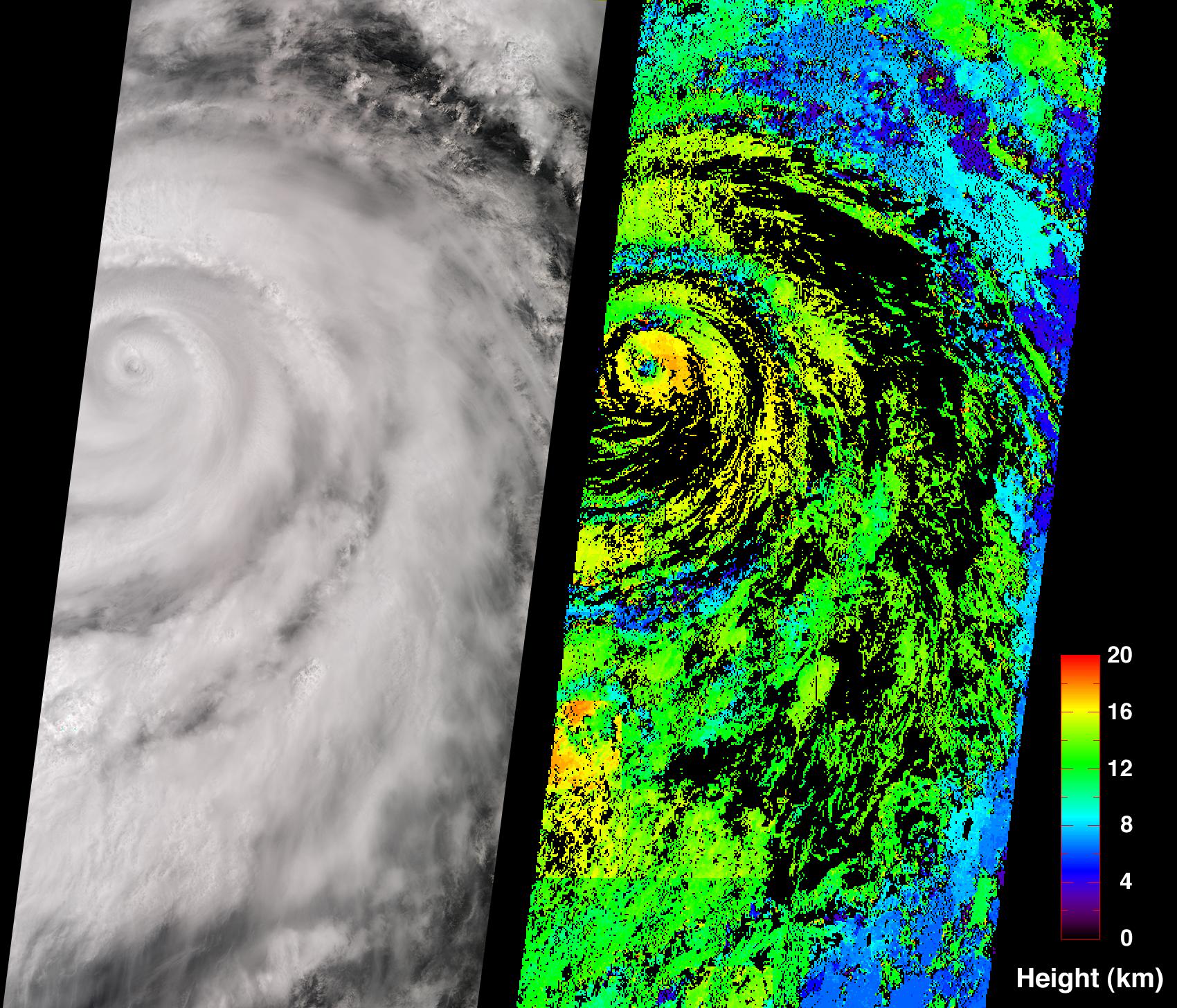
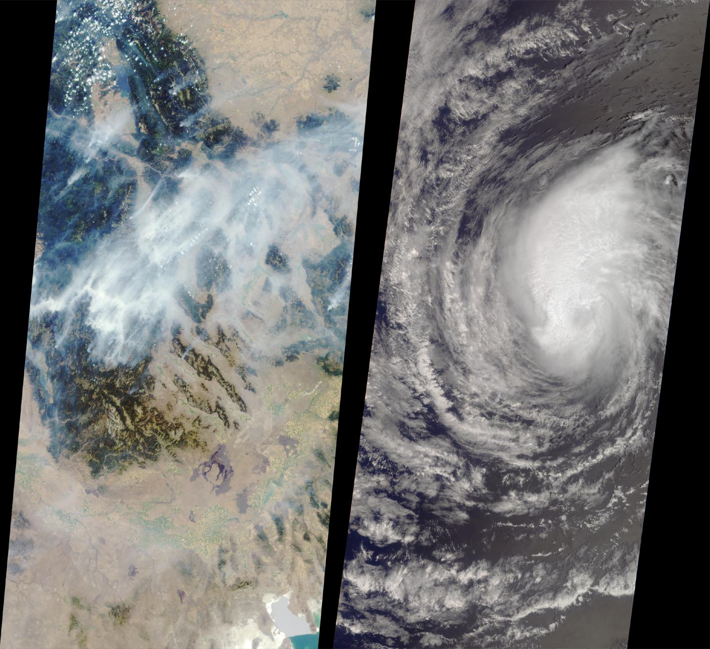
2001-10-04 |
Earth
|
Terra
|
MISR
|
1700x1456x3 |
|
-
PIA03425:
-
Hurricane Juliette
Full Resolution:
TIFF
(3.694 MB)
JPEG
(651.3 kB)
|
|
|
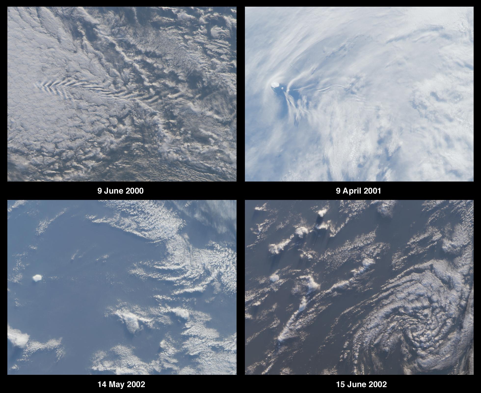
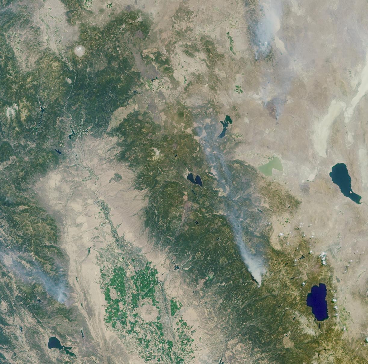
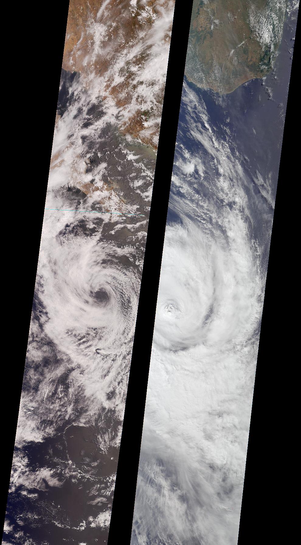
2001-09-05 |
Earth
|
Terra
|
MISR
|
1223x1208x3 |
|
-
PIA03421:
-
A Panoramic View of the Emigrant Gap Fire, California
Full Resolution:
TIFF
(5.087 MB)
JPEG
(270.8 kB)
|
|
|
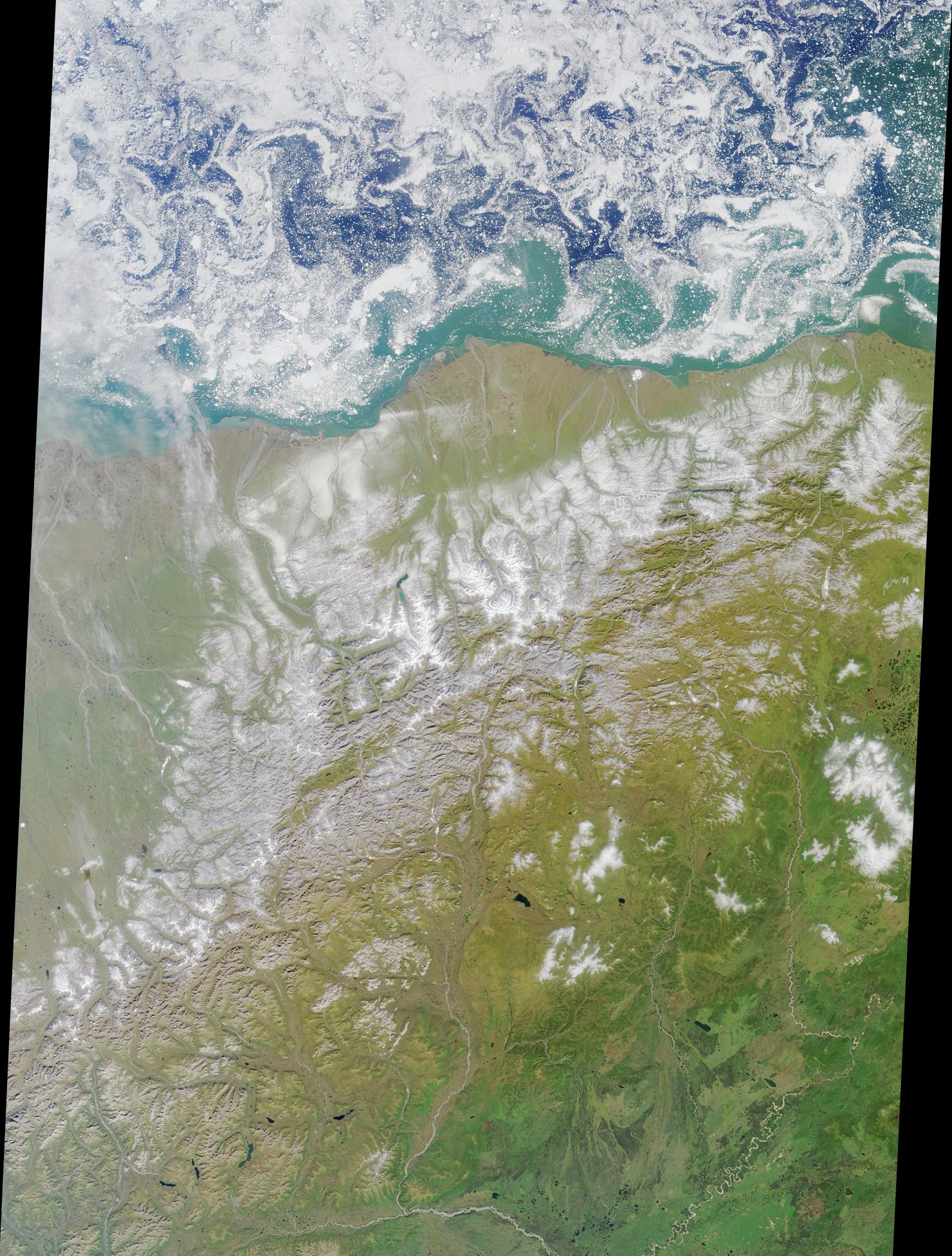
2001-08-22 |
Earth
|
Terra
|
MISR
|
1480x1952x3 |
|
-
PIA03419:
-
Summer in the Arctic National Wildlife Refuge
Full Resolution:
TIFF
(9.157 MB)
JPEG
(601.5 kB)
|
|
|
2001-08-15 |
Earth
|
Terra
|
MISR
|
1290x890x3 |
|
-
PIA03418:
-
A CLAMS-Eye View of Earth
Full Resolution:
TIFF
(3.185 MB)
JPEG
(183.3 kB)
|
|
|
2001-08-03 |
Earth
|
Terra
|
ASTER
|
576x720x3 |
|
-
PIA02678:
-
Sulfur Dioxide Plume During the Continuing Eruption of Mt. Etna, Italy
Full Resolution:
TIFF
(1.463 MB)
JPEG
(140 kB)
|
|
|
2001-07-18 |
Earth
|
Terra
|
MISR
|
1712x1204x3 |
|
-
PIA03414:
-
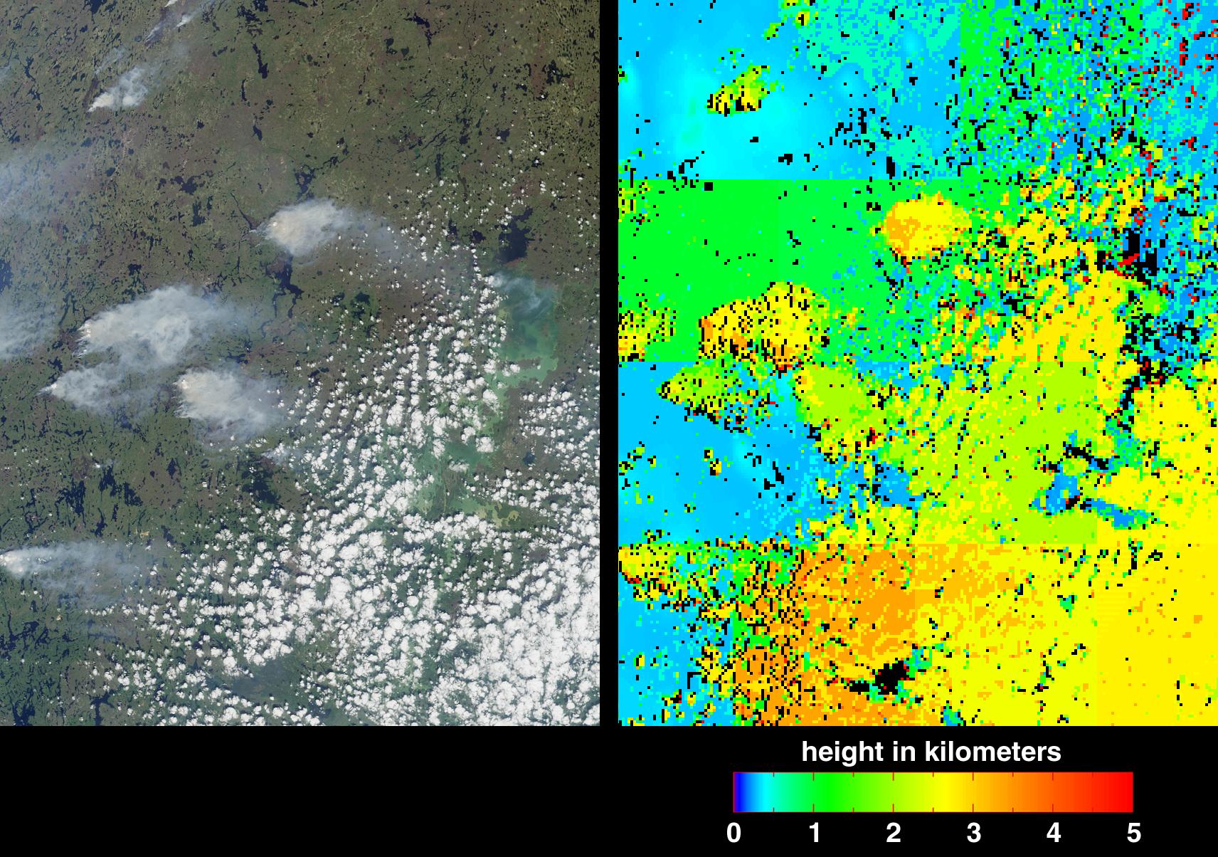
Fire in the Land of 100,000 Lakes
Full Resolution:
TIFF
(3.75 MB)
JPEG
(478.8 kB)
|
|
|
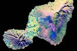
2001-06-20 |
Earth
|
Terra
|
MISR
|
1356x1932x3 |
|
-
PIA03410:
-
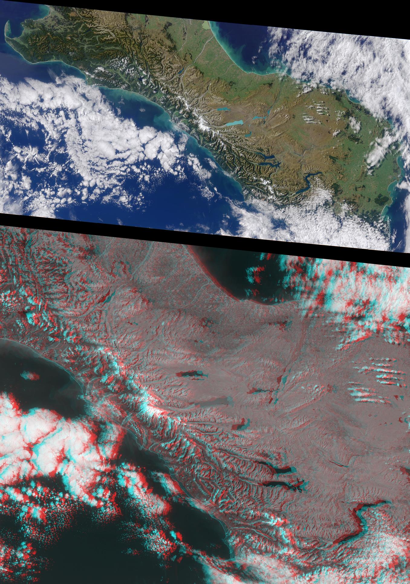
New Zealand's Southern Alps
Full Resolution:
TIFF
(7.269 MB)
JPEG
(518.5 kB)
|
|
|
2001-04-25 |
Earth
|
Terra
|
MISR
|
2023x1621x3 |
|
-
PIA03403:
-
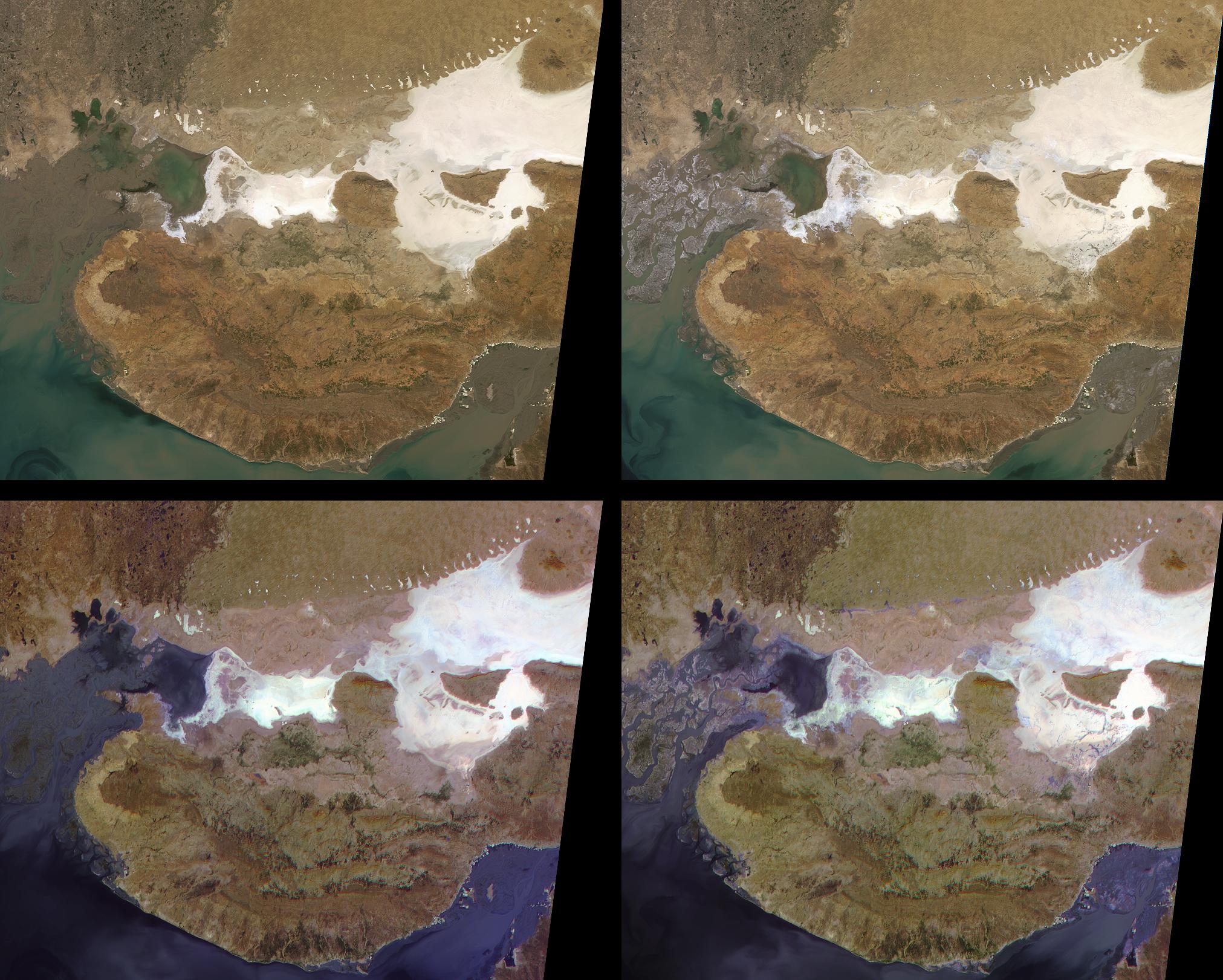
Liquefaction Effects from the Bhuj earthquake
Full Resolution:
TIFF
(10.05 MB)
JPEG
(512.5 kB)
|
|
|
2001-04-04 |
Earth
|
Terra
|
MISR
|
990x1792x3 |
|
-
PIA03400:
-
Tropical Storms Bud and Dera
Full Resolution:
TIFF
(3.685 MB)
JPEG
(304 kB)
|
|
|
2001-03-14 |
Earth
|
Terra
|
MISR
|
1349x1277x3 |
|
-
PIA02648:
-
Swirls of Lace
Full Resolution:
TIFF
(5.691 MB)
JPEG
(379.8 kB)
|
|
|
2001-02-21 |
Earth
|
Terra
|
MISR
|
1500x867x3 |
|
-
PIA02645:
-
Green Summer and Icy Winter in James Bay
Full Resolution:
TIFF
(4.594 MB)
JPEG
(315.5 kB)
|
|
|
2001-02-17 |
Eros
|
NEAR Shoemaker
|
Multi-Spectral Imager
|
1100x825x1 |
|
-
PIA03143:
-
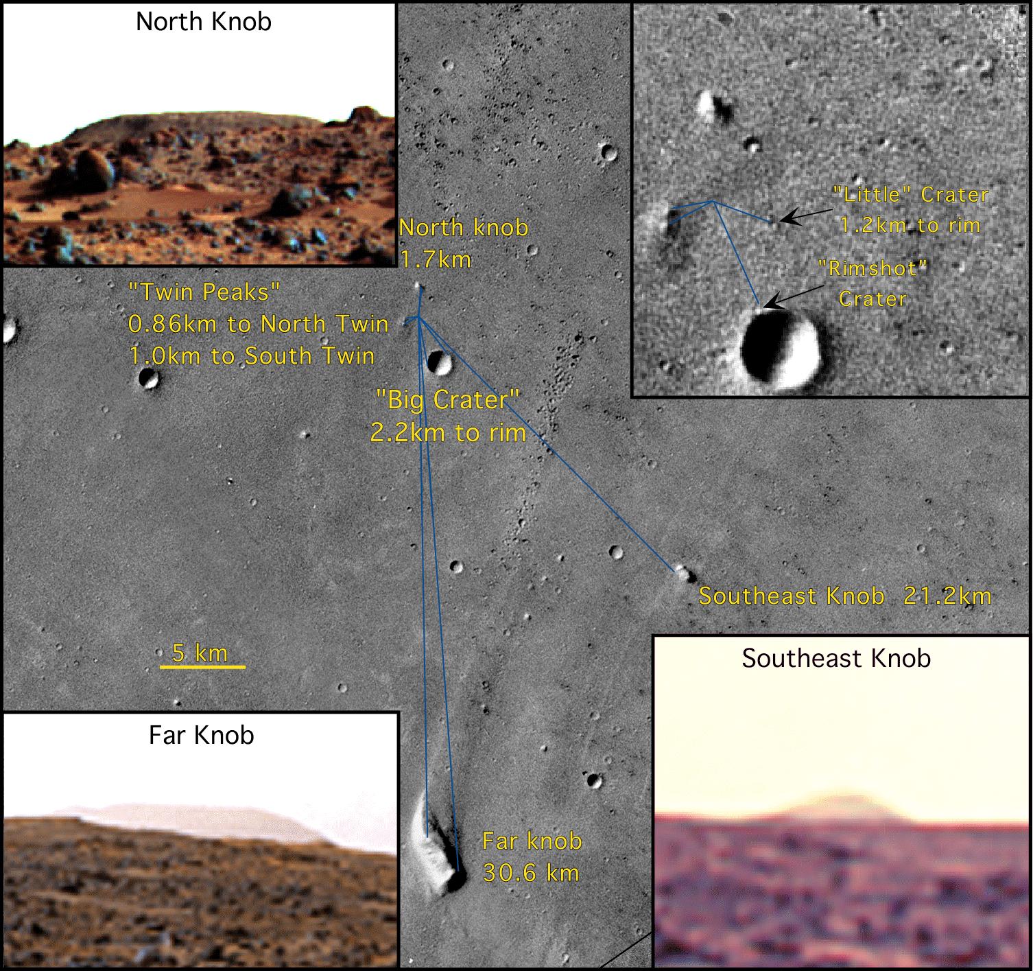
Location of the NEAR Shoemaker Landing Site
Full Resolution:
TIFF
(168.2 kB)
JPEG
(31.66 kB)
|
|
|
2001-02-17 |
Eros
|
NEAR Shoemaker
|
Multi-Spectral Imager
|
337x472x1 |
|
-
PIA03126:
-
Multiple Horizons
Full Resolution:
TIFF
(55.78 kB)
JPEG
(12.95 kB)
|
|
|
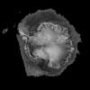
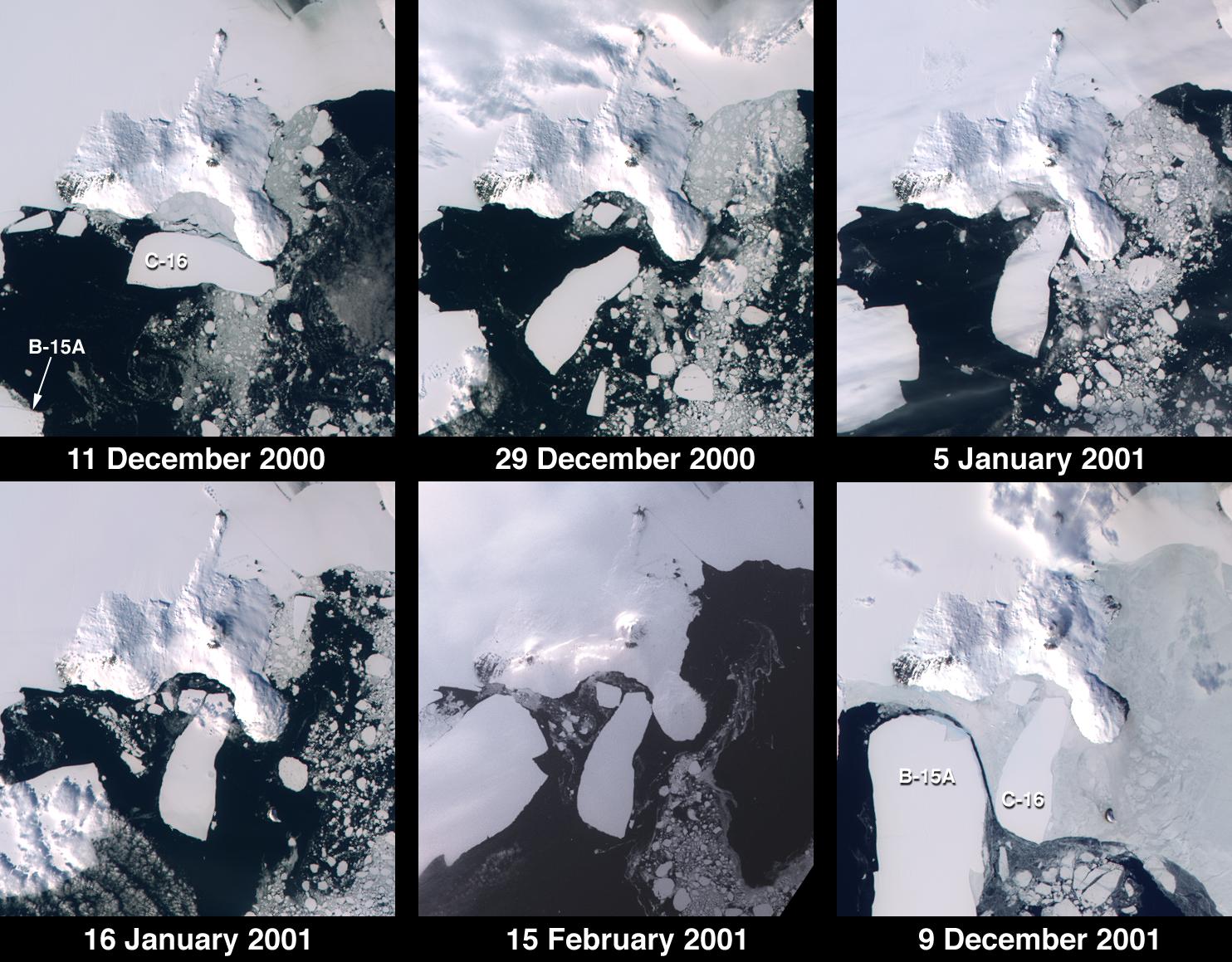
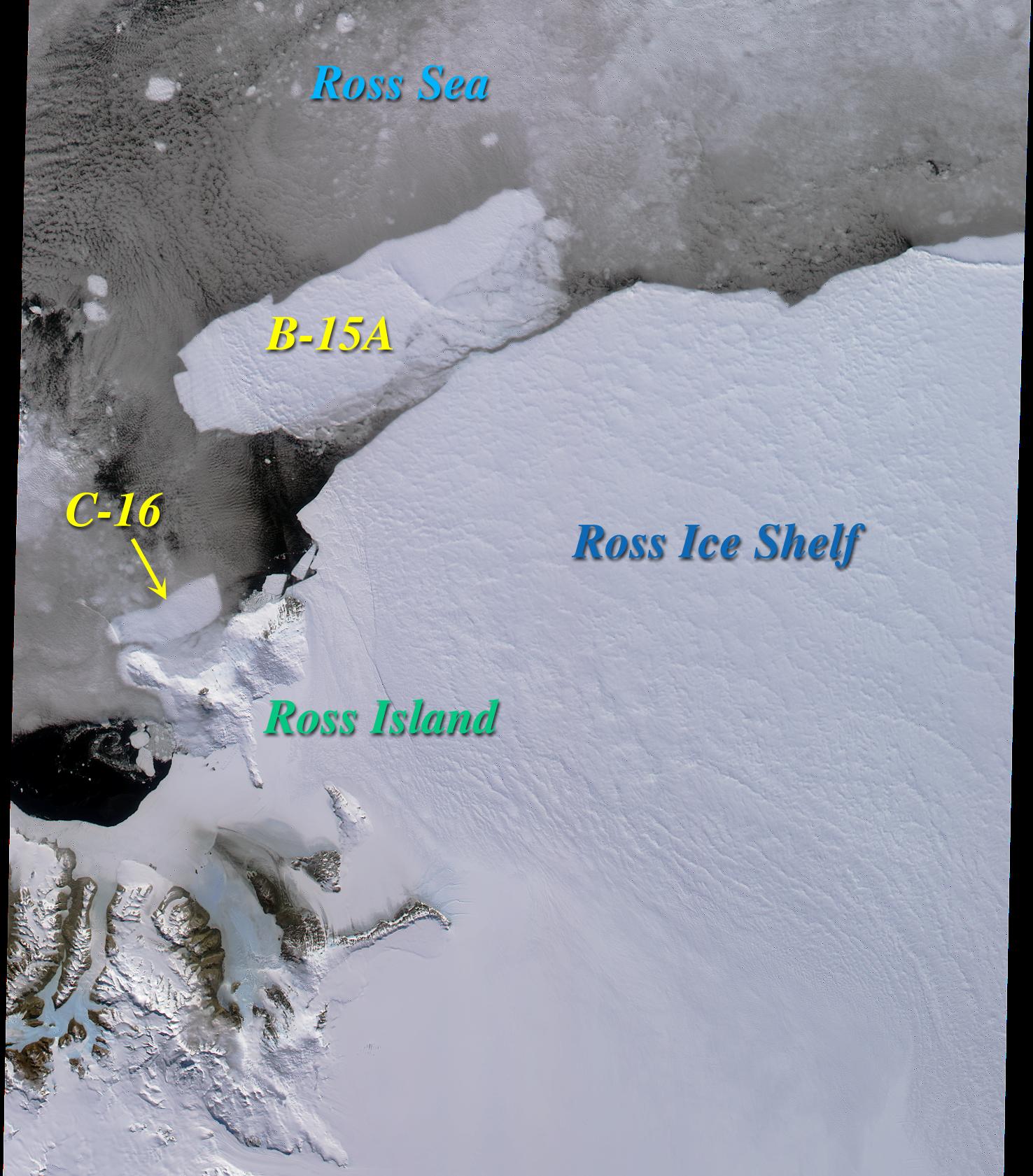
2001-01-03 |
Earth
|
Terra
|
MISR
|
1476x1681x3 |
|
-
PIA02639:
-
Icebergs in the Ross Sea, Antarctica
Full Resolution:
TIFF
(5.694 MB)
JPEG
(303.6 kB)
|
|
|
2000-11-22 |
Mars
|
Mariner Mars 1971 (Mariner 9)
|
|
5360x4419x1 |
|
-
PIA02999:
-
Mariner 9 views Ascraeus Mons standing above the Martian Dust Storm
Full Resolution:
TIFF
(23.15 MB)
JPEG
(3.465 MB)
|
|
|
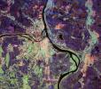
2000-11-22 |
Earth
|
Terra
|
MISR
|
670x1005x3 |
|
-
PIA02633:
-
MISR Looks at Cape Cod
Full Resolution:
TIFF
(2.138 MB)
JPEG
(125.3 kB)
|
|
|
2000-11-10 |
Mars
|
Viking
|
Visual Imaging Subsystem - Camera A
|
11649x5721x3 |
|
-
PIA02992:
-
Mars Digital Image Mosaic Globe
Full Resolution:
TIFF
(120 MB)
JPEG
(8.664 MB)
|
|
|
2000-11-01 |
Mars
|
Mars Global Surveyor (MGS)
|
Mars Orbiter Camera (MOC)
|
3047x2279x3 |
|
-
PIA02824:
-
Evidence for Recent Liquid Water on Mars: Channeled Aprons in a Small Crater within Newton Crater
Full Resolution:
TIFF
(5.505 MB)
JPEG
(1.132 MB)
|
|
|
2000-10-20 |
Earth
|
Terra
|
ASTER
|
2138x2738x3 |
|
-
PIA02667:
-
ASTER View of Sharm El Sheik, Egypt
Full Resolution:
TIFF
(10.1 MB)
JPEG
(1.06 MB)
|
|
|
2000-10-06 |
Earth
|
Terra
|
ASTER
|
2280x3887x3 |
|
-
PIA02657:
-
ASTER Gibraltar
Full Resolution:
TIFF
(15.58 MB)
JPEG
(1.026 MB)
|
|
|
2000-10-04 |
Earth
|
Terra
|
MISR
|
1149x750x3 |
|
-
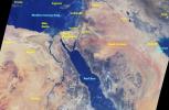
PIA02626:
-
MISR Views the Middle East
Full Resolution:
TIFF
(2.67 MB)
JPEG
(145.1 kB)
|
|
|
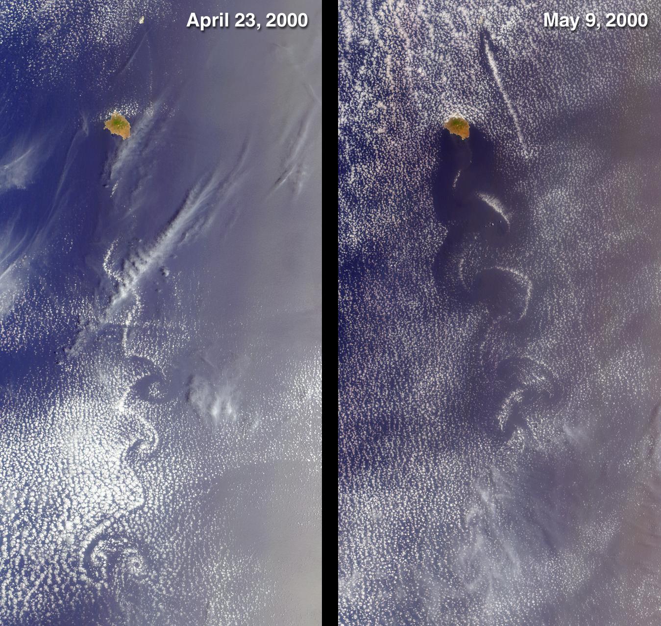
2000-09-20 |
Earth
|
Terra
|
MISR
|
826x560x3 |

|
-
PIA02624:
-
MISR and AirMISR Simultaneously Observe African Grassland Fires
Full Resolution:
TIFF
(1.505 MB)
JPEG
(86.42 kB)
|
|
|
2000-09-18 |
Mars
|
Mars Global Surveyor (MGS)
|
Mars Orbiter Camera (MOC)
|
512x512x1 |
|
-
PIA01460:
-
Candor Chasma - Massive (non-layered) Material Expos
Full Resolution:
TIFF
(247.5 kB)
JPEG
(46.76 kB)
|
|
|
2000-09-18 |
Mars
|
Mars Global Surveyor (MGS)
|
Mars Orbiter Camera (MOC)
|
512x512x1 |
|
-
PIA01459:
-
Western Candor Chasma - Layers Exposed near the Middle
Full Resolution:
TIFF
(275.5 kB)
JPEG
(60.23 kB)
|
|
|
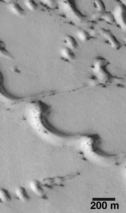
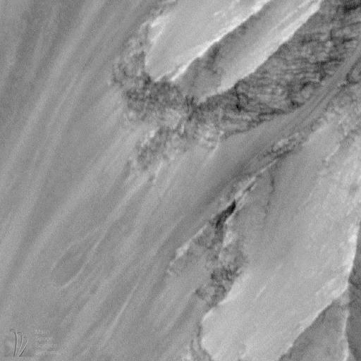
2000-09-16 |
Mars
|
Mars Global Surveyor (MGS)
|
Mars Orbiter Camera (MOC)
|
443x746x1 |
|
-
PIA01495:
-
Evidence for Recent Wind Action on Martian Sand Dunes
Full Resolution:
TIFF
(257.5 kB)
JPEG
(39.56 kB)
|
|
|
2000-09-16 |
Mars
|
Mars Global Surveyor (MGS)
|
Mars Orbiter Camera (MOC)
|
512x512x1 |

|
-
PIA01458:
-
Western Candor Chasma, Valles Marineris
Full Resolution:
TIFF
(139.4 kB)
JPEG
(33.9 kB)
|
|
|
2000-08-18 |
Earth
|
Terra
|
MISR
|
1436x1311x3 |
|
-
PIA02619:
-
MISR Images Forest Fires and Hurricane
Full Resolution:
TIFF
(5.22 MB)
JPEG
(263.7 kB)
|
|
|
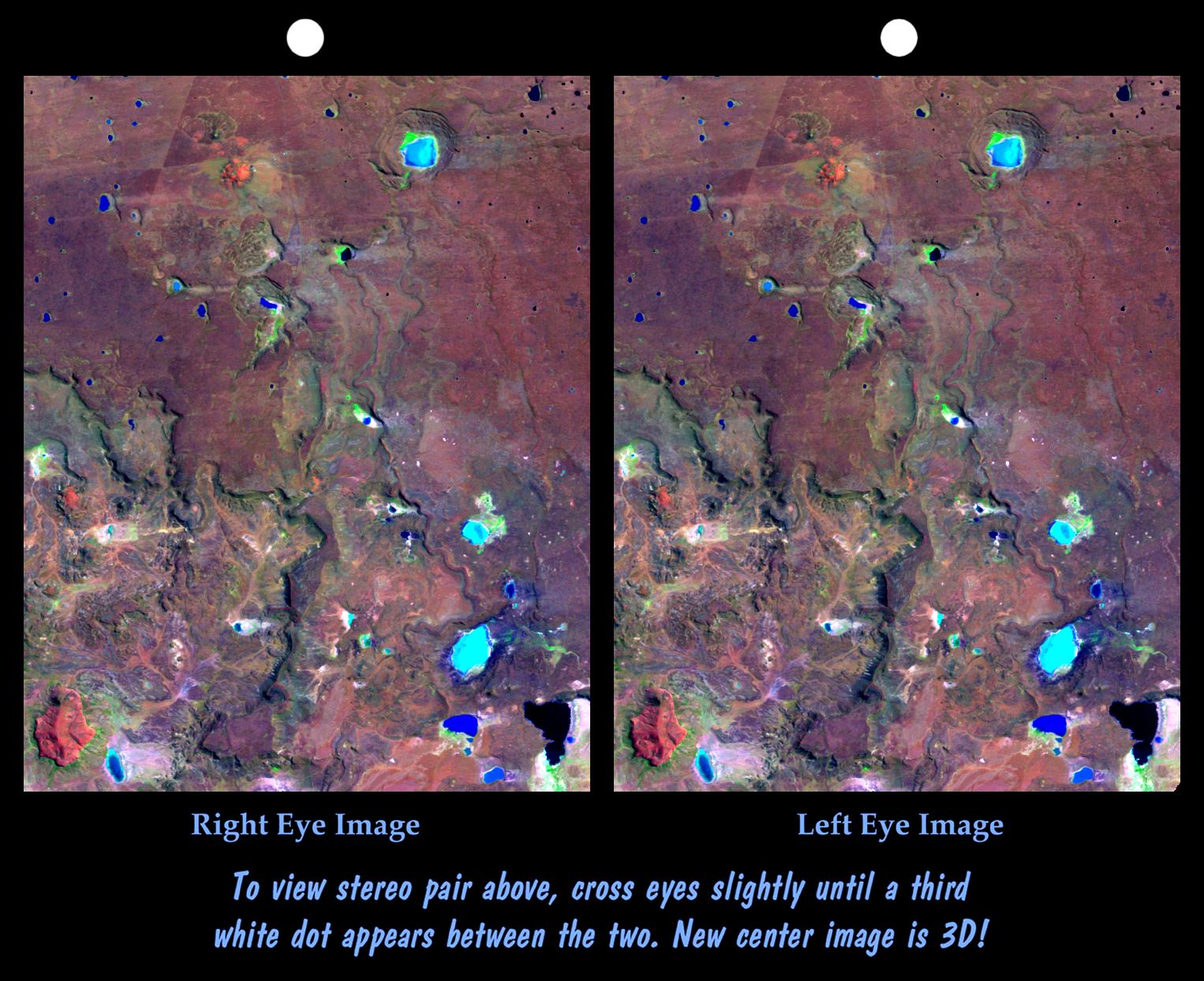
2000-07-20 |
Earth
|
Landsat
Shuttle Radar Topography Mission (SRTM)
|
C-Band Interferometric Radar
Thematic Mapper
|
1526x1243x3 |
|
-
PIA02765:
-
Stereo Pair: Inverted Topography, Patagonia, Argentina
Full Resolution:
TIFF
(3.087 MB)
JPEG
(286.3 kB)
|
|
|
2000-07-20 |
Earth
|
Landsat
Shuttle Radar Topography Mission (SRTM)
|
C-Band Interferometric Radar
Thematic Mapper
|
718x907x3 |
|
-
PIA02764:
-
SRTM Anaglyph: Inverted Topography, Patagonia, Argentina
Full Resolution:
TIFF
(1.025 MB)
JPEG
(149.5 kB)
|
|
|
2000-06-22 |
Mars
|
Mars Global Surveyor (MGS)
|
Mars Orbiter Camera (MOC)
|
2133x1593x1 |

|
-
PIA01039:
-
Evidence for Recent Liquid Water on Mars: Channeled Aprons in a Small Crater within Newton Crater
Full Resolution:
TIFF
(3.16 MB)
JPEG
(523.8 kB)
|
|
|
2000-06-10 |
Eros
|
NEAR Shoemaker
|
Multi-Spectral Imager
|
426x329x1 |
|
-
PIA02497:
-
Eros' Aging Craters
Full Resolution:
TIFF
(77.53 kB)
JPEG
(10.96 kB)
|
|
|
2000-05-23 |
Rhea
|
Voyager
|
VG ISS - Narrow Angle
|
796x796x1 |

|
-
PIA02270:
-
Rhea - Multiple Impact Craters
Full Resolution:
TIFF
(527.9 kB)
JPEG
(129 kB)
|
|
|
2000-05-18 |
Io
|
Galileo
|
Solid-State Imaging
|
900x689x3 |

|
-
PIA02535:
-
Culann Patera, Io, in False Color
Full Resolution:
TIFF
(2.192 MB)
JPEG
(105.6 kB)
|
|
|
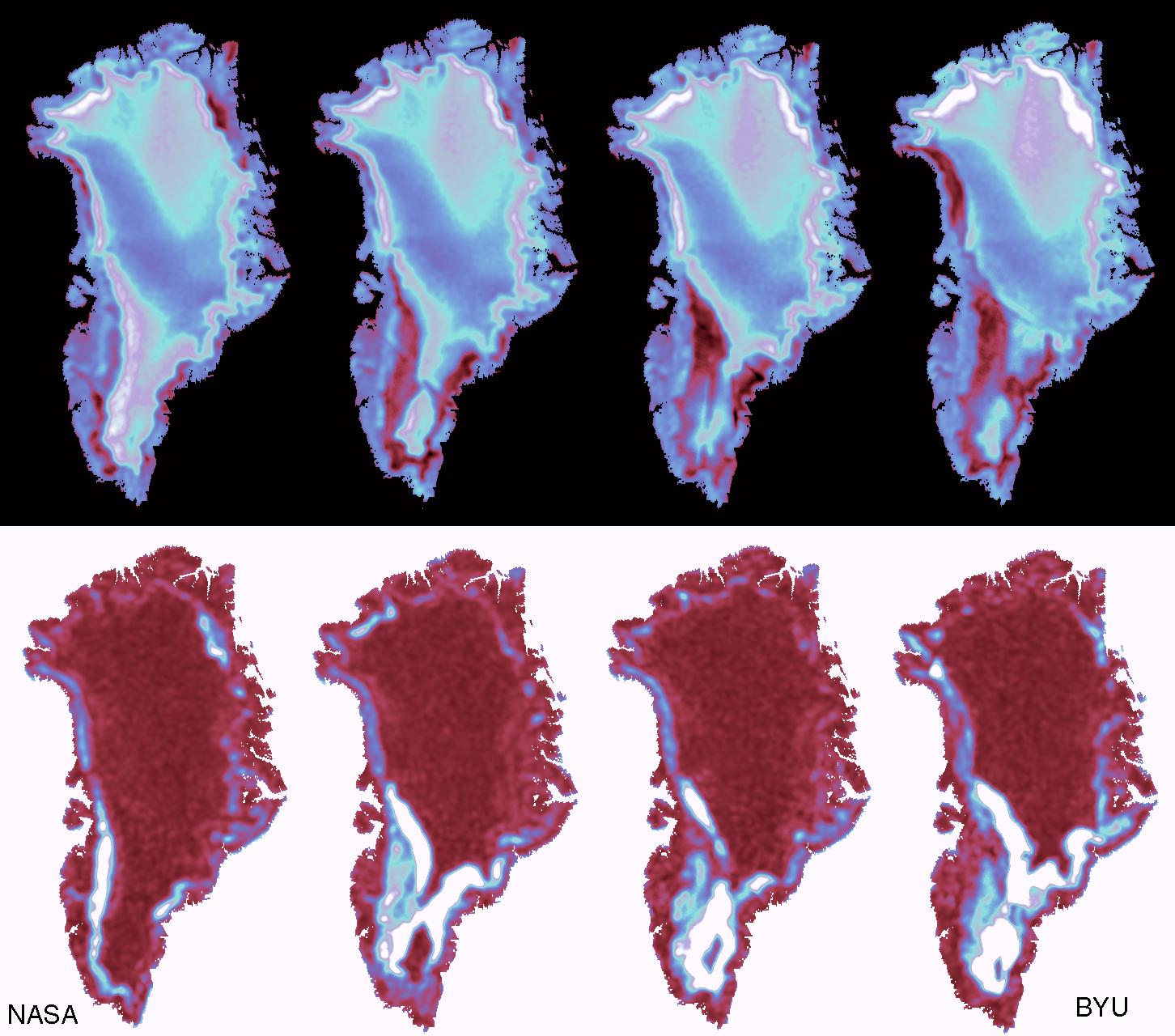
2000-05-08 |
Earth
|
QuikScat
|
SeaWinds Scatterometer
|
1452x1280x3 |
|
-
PIA02459:
-
SeaWinds - Greenland
Full Resolution:
TIFF
(765.6 kB)
JPEG
(205.7 kB)
|
|
|
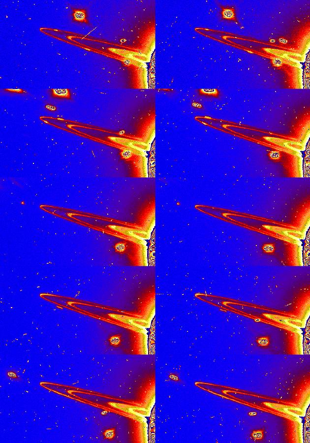
2000-03-23 |
J Rings
|
Voyager
|
VG ISS - Narrow Angle
|
621x672x1 |
|
-
PIA02251:
-
Jupiter's Ring
Full Resolution:
TIFF
(231.5 kB)
JPEG
(51.08 kB)
|
|
|
2000-02-19 |
Earth
|
Shuttle Radar Topography Mission (SRTM)
|
C-Band Interferometric Radar
|
1319x1062x3 |

|
-
PIA02724:
-
Perspective View, Radar Image, Color as Height, Molokai, Lanai and Maui, Hawaii
Full Resolution:
TIFF
(1.541 MB)
JPEG
(141.2 kB)
|
|
|
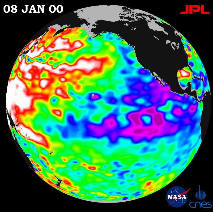
2000-01-21 |
Earth
|
TOPEX/Poseidon
|
Altimeter
|
902x900x3 |
|
-
PIA02448:
-
TOPEX/El Niño Watch - La Niña Persistence May be Part of Larger Climate Pattern, January 8, 2000
Full Resolution:
TIFF
(744.7 kB)
JPEG
(115.1 kB)
|
|
|
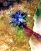
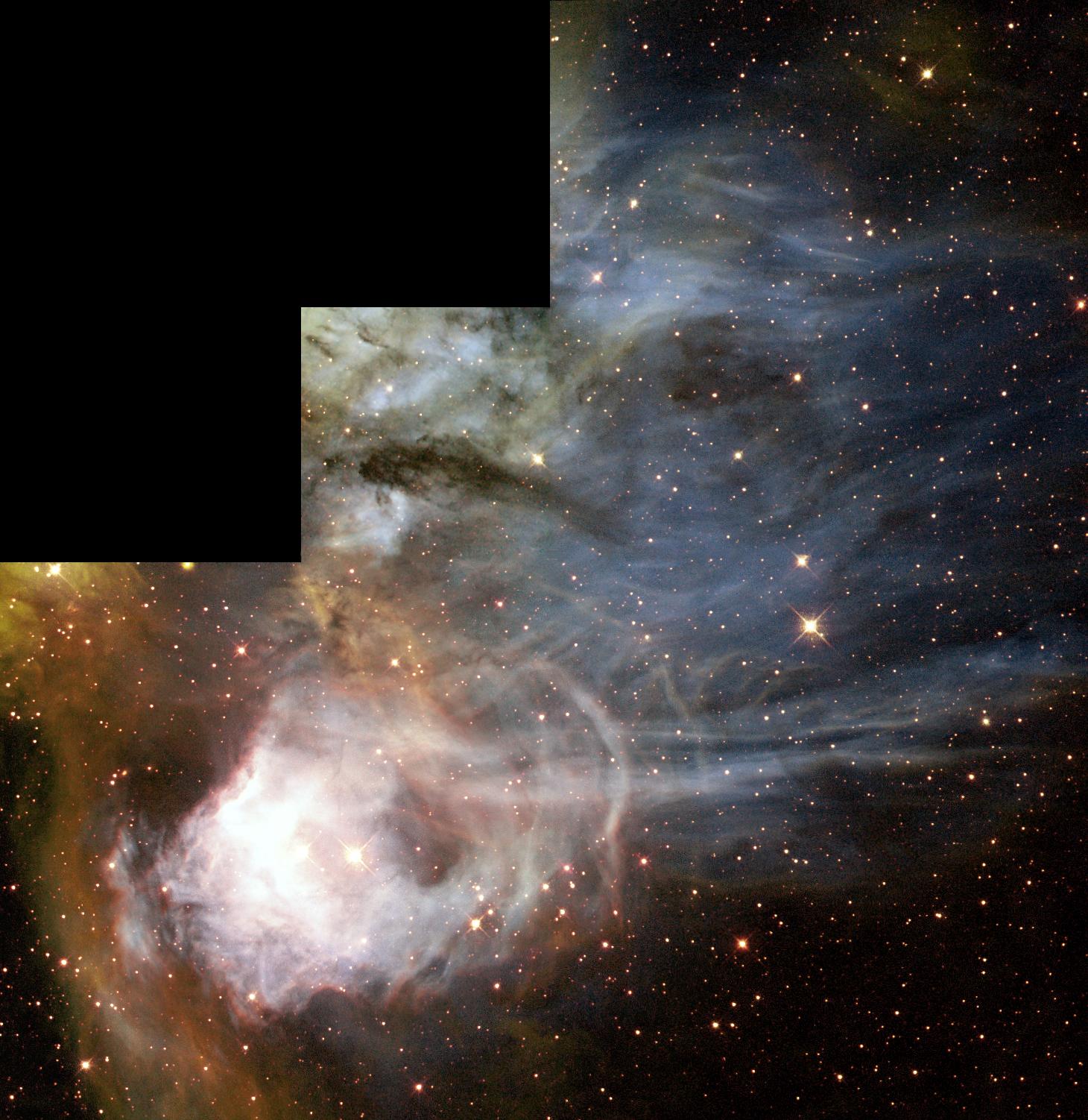
1999-12-03 |
N44C nebula
|
Hubble Space Telescope
|
WFPC2
|
1460x1502x3 |
|
-
PIA04225:
-
N44C Nebula
Full Resolution:
TIFF
(6.034 MB)
JPEG
(275.2 kB)
|
|
|
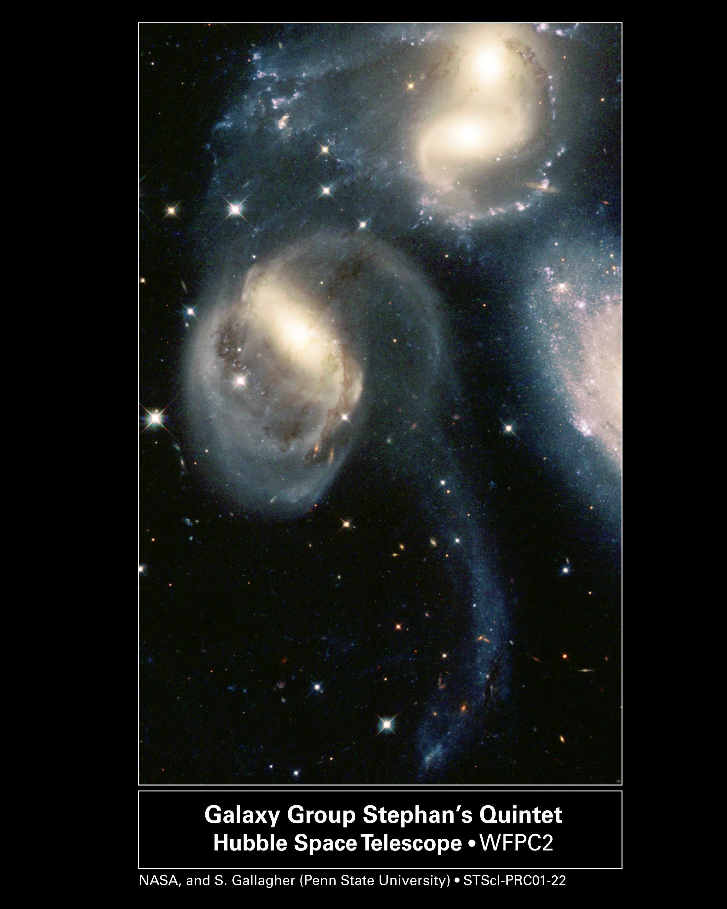
1999-12-02 |
Stephan's Quintet,NGC 7319, NGC 7318B, NGC 7318A
|
Hubble Space Telescope
|
WFPC2
|
2400x3000x3 |
|
-
PIA04201:
-
Stephan's Quintet
Full Resolution:
TIFF
(12.15 MB)
JPEG
(521 kB)
|
|
|
1999-12-01 |
Altair
|
Palomar Testbed Interferometer
|
Palomar Testbed Interferometer
|
512x511x1 |
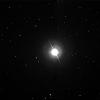
|
-
PIA04204:
-
Altair
Full Resolution:
TIFF
(177.1 kB)
JPEG
(12.78 kB)
|
|
|
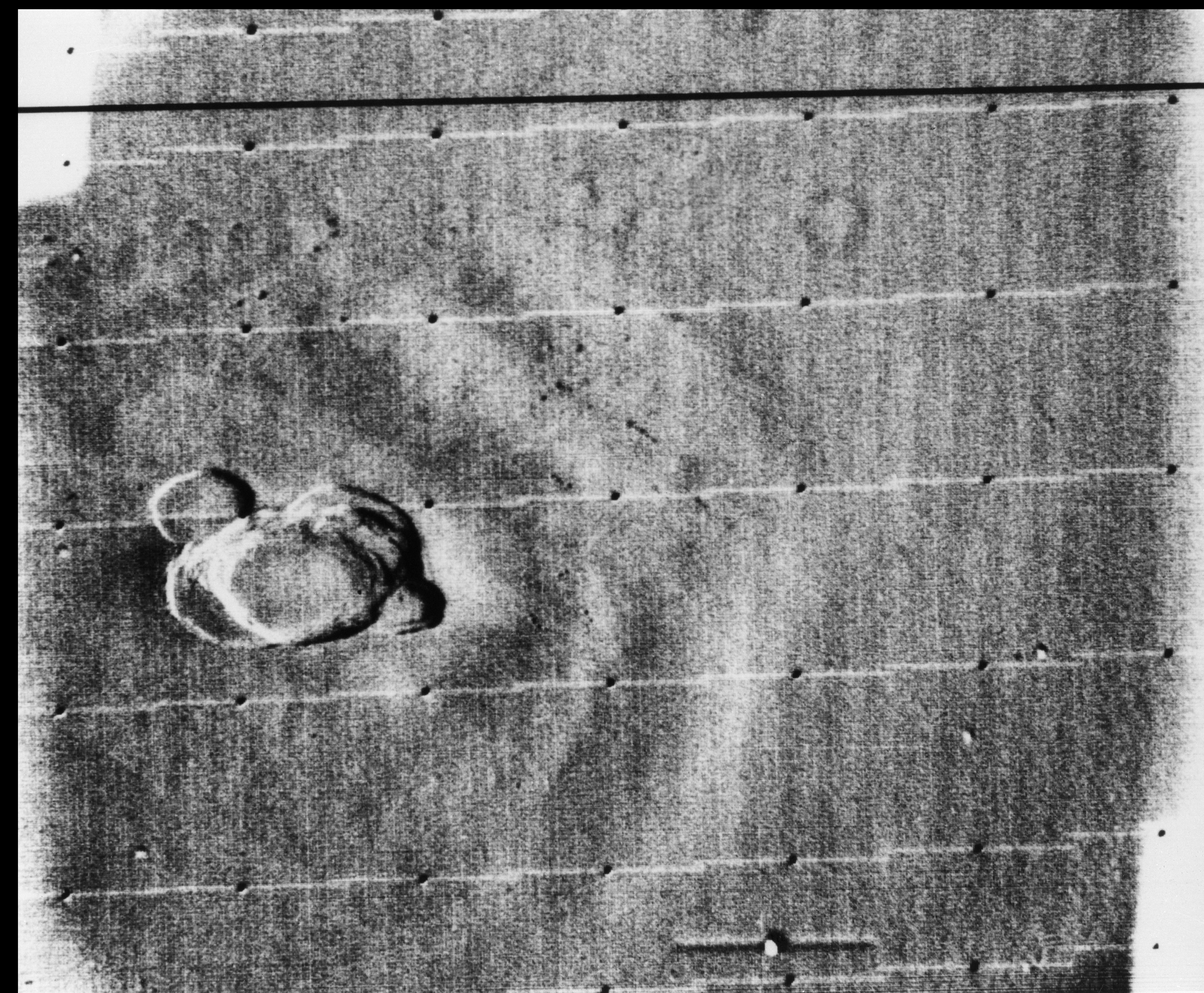
1999-09-08 |
Earth
|
QuikScat
|
SeaWinds Scatterometer
|
900x900x1 |
|
-
PIA02329:
-
SeaWinds Watches for Breakup of Giant Iceberg
Full Resolution:
TIFF
(132.8 kB)
JPEG
(49.24 kB)
|
|
|
1999-08-19 |
Triton
|
Voyager
|
VG ISS - Narrow Angle
|
795x795x3 |
|
-
PIA02211:
-
Triton
Full Resolution:
TIFF
(238.3 kB)
JPEG
(15.21 kB)
|
|
|
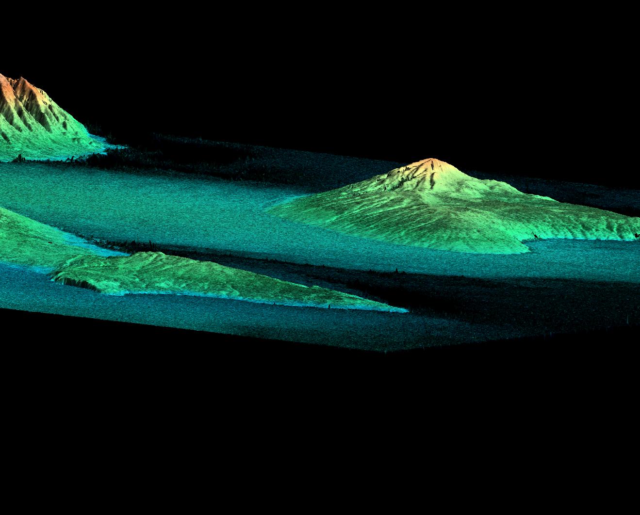
1999-05-01 |
Earth
|
Spaceborne Imaging Radar-C/X-Band Synthetic Aperture Radar
|
|
756x2688x3 |
|
-
PIA01737:
-
Space Radar Image of Weddell Sea, Antarctica
Full Resolution:
TIFF
(8.193 MB)
JPEG
(1.143 MB)
|
|
|
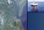
1999-05-01 |
Earth
|
Spaceborne Imaging Radar-C/X-Band Synthetic Aperture Radar
|
|
1101x900x3 |
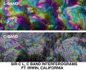
|
-
PIA01759:
-
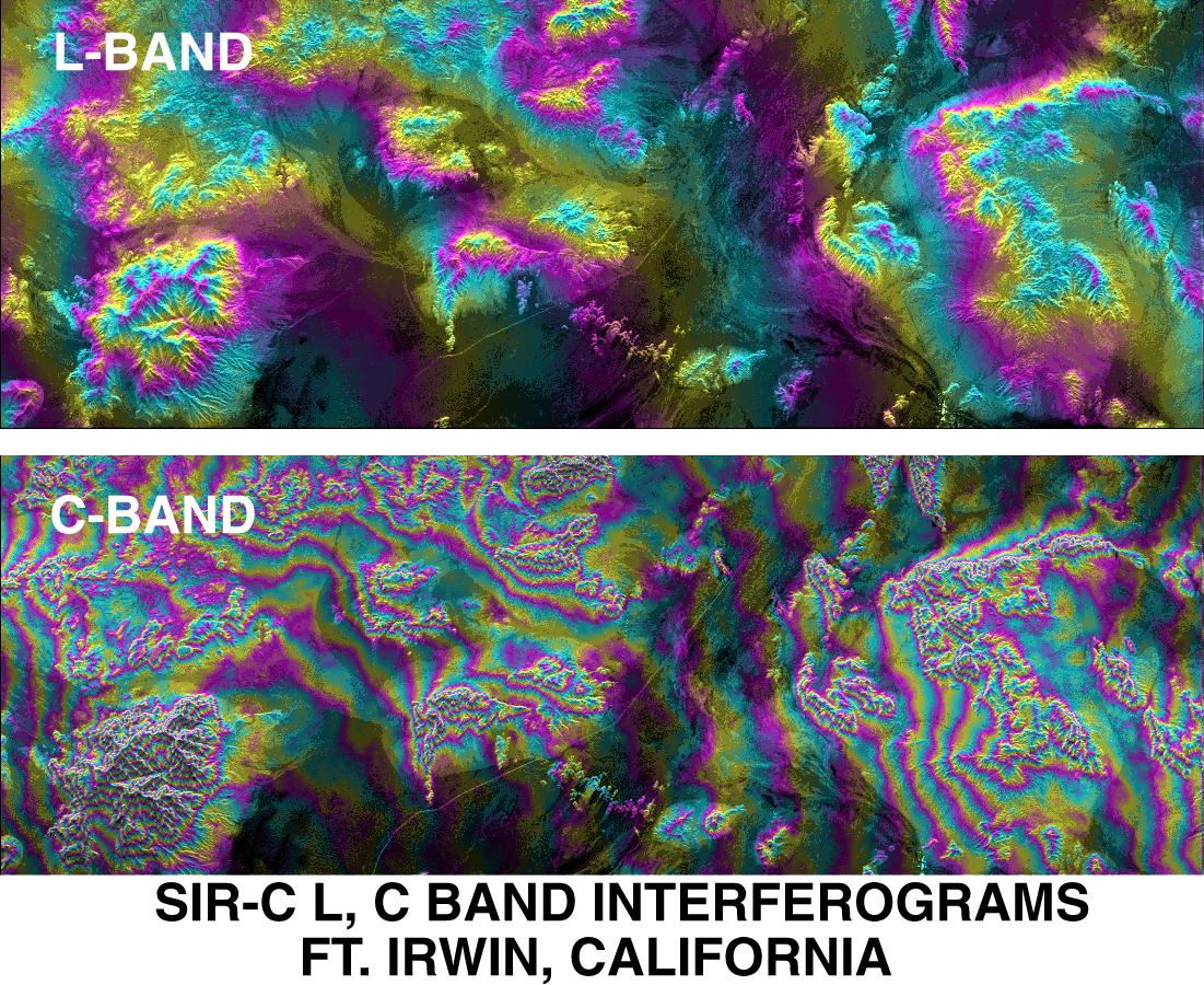
SPace Radar Image of Fort Irwin, California
Full Resolution:
TIFF
(1.509 MB)
JPEG
(296.8 kB)
|
|
|
1999-05-01 |
Earth
|
Spaceborne Imaging Radar-C/X-Band Synthetic Aperture Radar
|
|
726x651x3 |
|
-
PIA01753:
-
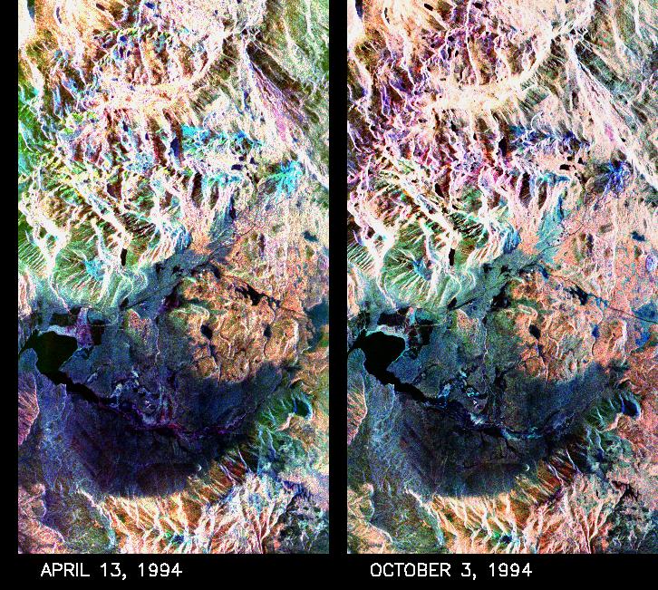
Space Radar Image of Mammoth Mountain, California
Full Resolution:
TIFF
(1.476 MB)
JPEG
(190.3 kB)
|
|
|
1999-04-15 |
Earth
|
Spaceborne Imaging Radar-C/X-Band Synthetic Aperture Radar
|
|
2949x1949x3 |
|
-
PIA01858:
-
Space Radar Image of Maui, Hawaii
Full Resolution:
TIFF
(11.52 MB)
JPEG
(1.26 MB)
|
|
|
1999-04-15 |
Earth
|
Spaceborne Imaging Radar-C/X-Band Synthetic Aperture Radar
|
|
6539x3444x3 |

|
-
PIA01857:
-
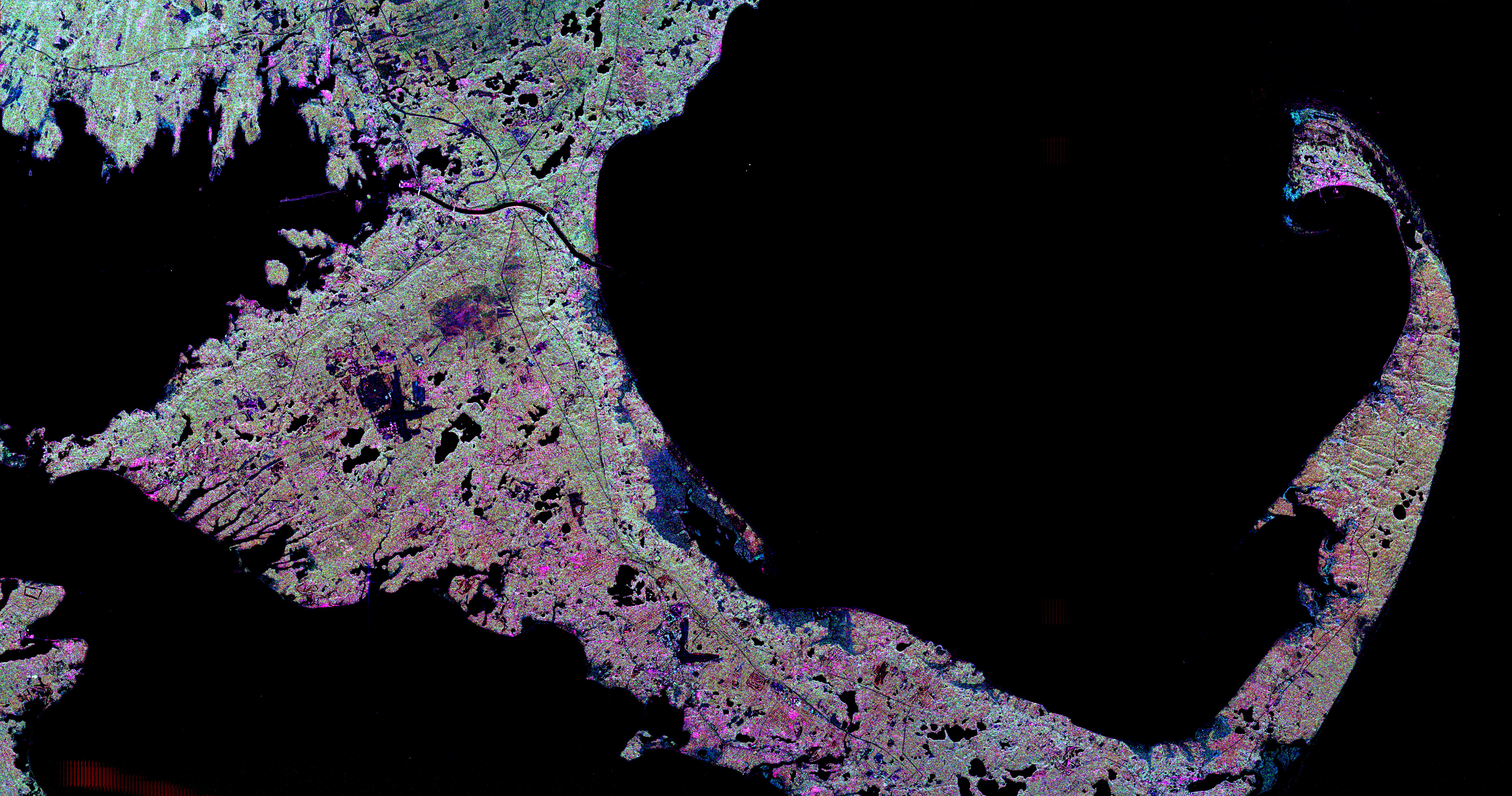
Space Radar Image of Cape Cod, Massachusetts
Full Resolution:
TIFF
(25.1 MB)
JPEG
(3.779 MB)
|
|
|
1999-04-15 |
Earth
|
Spaceborne Imaging Radar-C/X-Band Synthetic Aperture Radar
|
|
2805x2472x3 |
|
-
PIA01839:
-
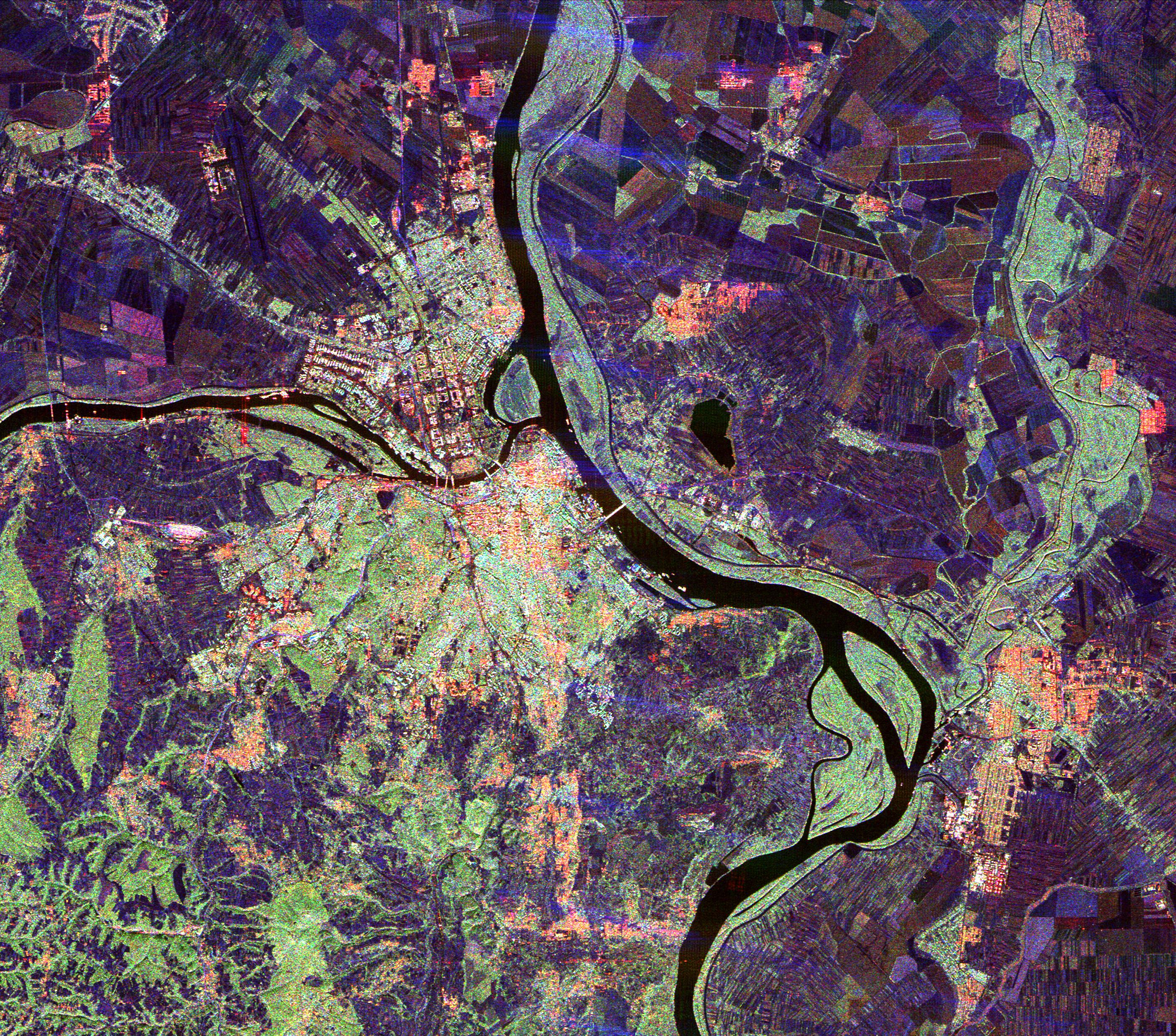
Space Radar Image of Belgrade, Serbia
Full Resolution:
TIFF
(26.23 MB)
JPEG
(2.34 MB)
|
|
|
1999-04-15 |
Earth
|
Spaceborne Imaging Radar-C/X-Band Synthetic Aperture Radar
|
|
2206x1758x3 |
|
-
PIA01833:
-
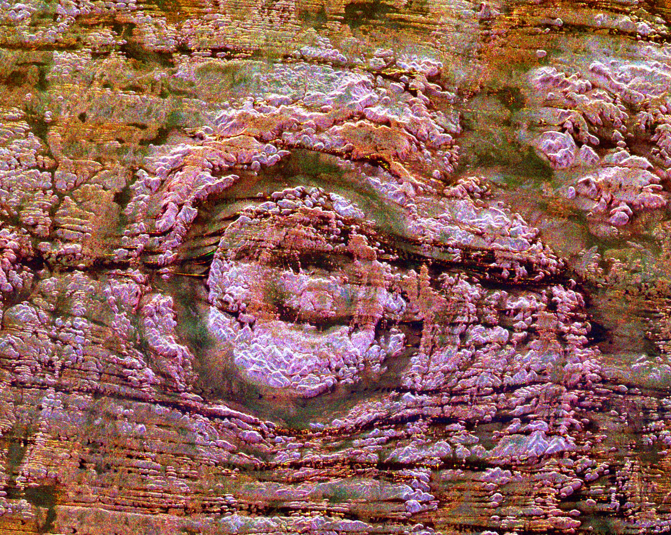
Space Radar of Image Aorounga Impact Crater, Chad
Full Resolution:
TIFF
(14.7 MB)
JPEG
(1.28 MB)
|
|
|
1999-04-15 |
Earth
|
Spaceborne Imaging Radar-C/X-Band Synthetic Aperture Radar
|
|
2447x1789x3 |
|
-
PIA01831:
-
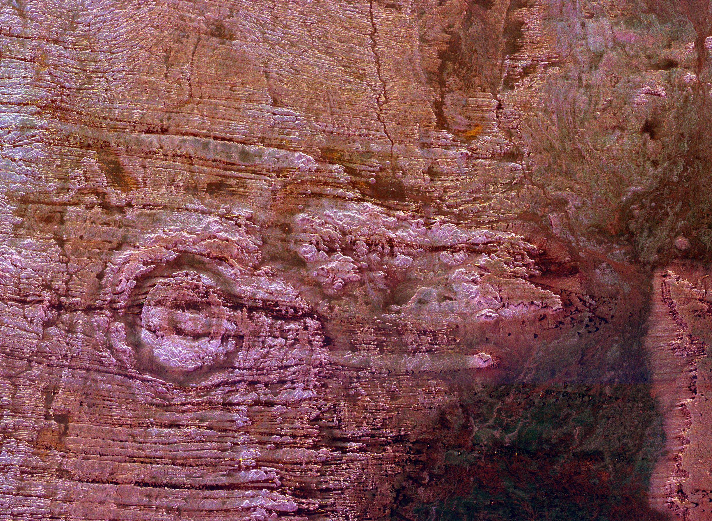
Space Radar Image of Possible String of Impact Creaters
Full Resolution:
TIFF
(16.99 MB)
JPEG
(1.246 MB)
|
|
|
1999-04-15 |
Earth
|
Spaceborne Imaging Radar-C/X-Band Synthetic Aperture Radar
|
|
2840x1243x3 |
|
-
PIA01813:
-
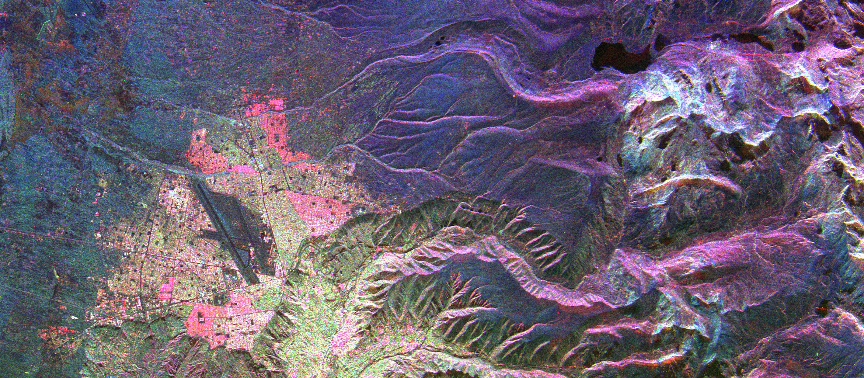
Space Radar Image of La Paz, Bolivia
Full Resolution:
TIFF
(13.04 MB)
JPEG
(1.023 MB)
|
|
|
1999-04-11 |
S Rings
|
Voyager
|
VG ISS - Narrow Angle
|
520x350x1 |
|
-
PIA01951:
-
Saturn's F-ring and Inner Satellite
Full Resolution:
TIFF
(50.71 kB)
JPEG
(74.72 kB)
|
|
|
1999-01-27 |
Earth
|
Spaceborne Imaging Radar-C/X-Band Synthetic Aperture Radar
|
|
670x900x3 |
|
-
PIA01716:
-
Space Radar Image of Oberpfaffenhofen, Germany
Full Resolution:
TIFF
(2.316 MB)
JPEG
(228.1 kB)
|
|
|
1998-10-30 |
J Rings
|
Voyager
|
|
1715x1706x1 |
|
-
PIA01484:
-
First Evidence of Jupiter Ring
Full Resolution:
TIFF
(1.205 MB)
JPEG
(187.5 kB)
|
|
|
1998-10-13 |
Jupiter
|
Galileo
|
Solid-State Imaging
|
1152x855x1 |
|
-
PIA01638:
-
Jovian Lightning and the Daytime Storm
Full Resolution:
TIFF
(188.1 kB)
JPEG
(89.44 kB)
|
|
|
1998-10-13 |
Jupiter
|
Galileo
|
Solid-State Imaging
|
880x620x3 |
|
-
PIA01636:
-
Changing Lightning Storms on Jupiter
Full Resolution:
TIFF
(84.96 kB)
JPEG
(37.34 kB)
|
|
|
1998-09-15 |
J Rings
|
Galileo
|
Solid-State Imaging
|
2016x1529x3 |
|
-
PIA01623:
-
Jupiter's Gossamer Ring Structure
Full Resolution:
TIFF
(942.3 kB)
JPEG
(176.7 kB)
|
|
|
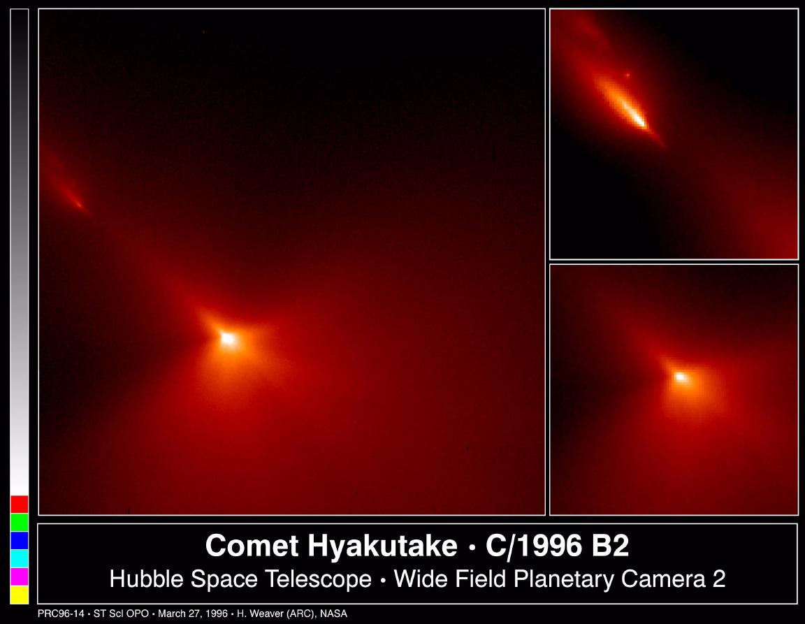
1998-08-03 |
Hyakutake
|
Hubble Space Telescope
|
WFPC2
|
1152x893x3 |
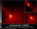
|
-
PIA01290:
-
Hubble Probes Inner Region of Comet Hyakutake
Full Resolution:
TIFF
(1.269 MB)
JPEG
(77.61 kB)
|
|
|
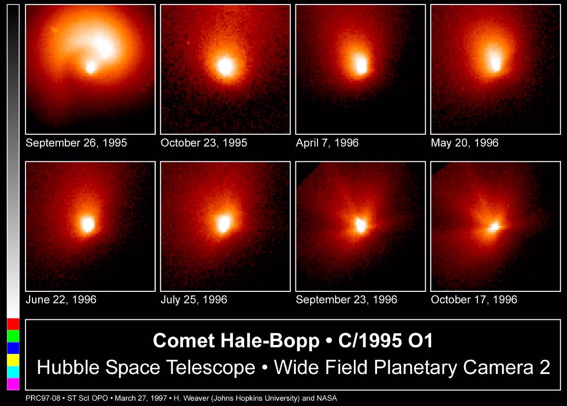
1998-08-02 |
Hale-Bopp
|
Hubble Space Telescope
|
WFPC2
|
1152x825x3 |
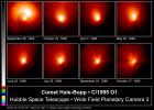
|
-
PIA01289:
-
Hubble Images of Comet Hale-Bopp
Full Resolution:
TIFF
(1.289 MB)
JPEG
(124.7 kB)
|
|
|
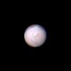
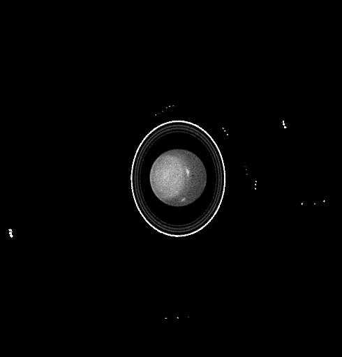
1998-08-02 |
Uranus
|
Hubble Space Telescope
|
WFPC2
|
600x800x1 |
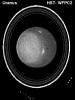
|
-
PIA01282:
-
Hubble Observes the Planet Uranus
Full Resolution:
TIFF
(192.2 kB)
JPEG
(49.21 kB)
|
|
|
1998-08-02 |
Uranus
|
Hubble Space Telescope
|
WFPC2
|
490x512x1 |
|
-
PIA01281:
-
Hubble Observes the Moons and Rings of Uranus
Full Resolution:
TIFF
(15.63 kB)
JPEG
(9.077 kB)
|
|
|
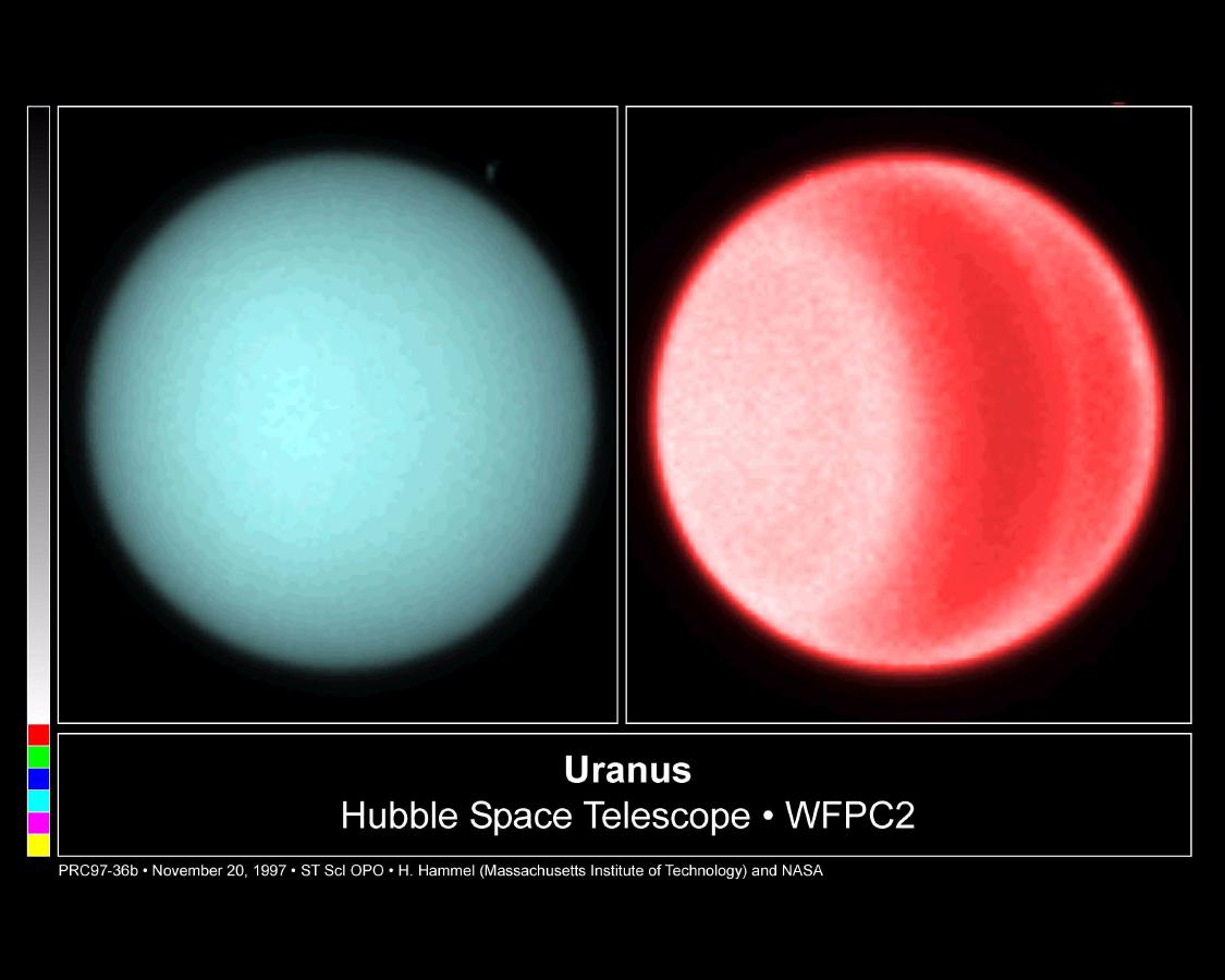
1998-08-02 |
Uranus
|
Hubble Space Telescope
|
WFPC2
|
1125x900x3 |

|
-
PIA01279:
-
Hubble Spots Northern Hemispheric Clouds on Uranus
Full Resolution:
TIFF
(1.128 MB)
JPEG
(72.31 kB)
|
|
|
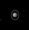
1998-08-02 |
Saturn
|
Hubble Space Telescope
|
WFPC2
|
600x800x1 |
|
-
PIA01277:
-
Hubble Views Saturn Ring-Plane Crossing (Satellites Labeled)
Full Resolution:
TIFF
(153.2 kB)
JPEG
(39 kB)
|
|
|
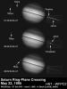
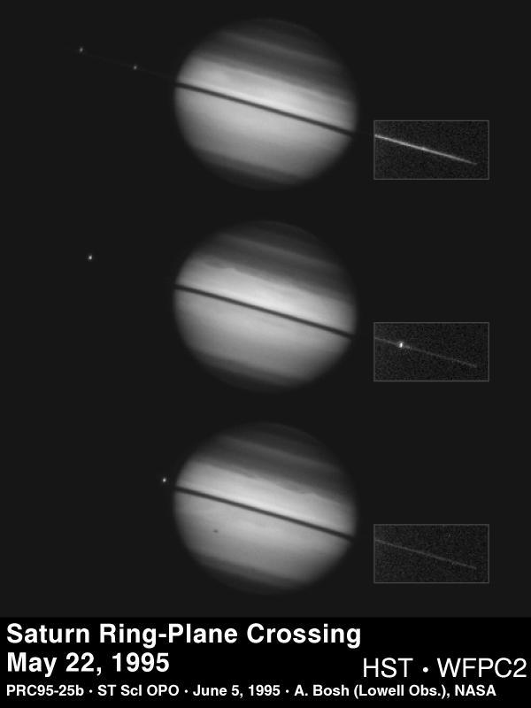
1998-08-02 |
Saturn
|
Hubble Space Telescope
|
WFPC2
|
600x800x1 |
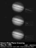
|
-
PIA01276:
-
Hubble Views Saturn Ring-Plane Crossing
Full Resolution:
TIFF
(129.6 kB)
JPEG
(30.62 kB)
|
|
|
1998-08-02 |
Saturn
|
Hubble Space Telescope
|
WFPC2
|
630x900x3 |
|
-
PIA01271:
-
Moons Around Saturn
Full Resolution:
TIFF
(806.3 kB)
JPEG
(113.5 kB)
|
|
|
1998-07-15 |
Ganymede
|
Galileo
|
Solid-State Imaging
|
506x360x1 |

|
-
PIA01616:
-
Highly Fractured Dark and Bright Terrain
Full Resolution:
TIFF
(172.8 kB)
JPEG
(56.59 kB)
|
|
|
1998-07-15 |
Ganymede
|
Galileo
|
Solid-State Imaging
|
949x559x1 |
|
-
PIA01615:
-
Swaths of Grooved Terrain on Ganymede
Full Resolution:
TIFF
(499.9 kB)
JPEG
(160.6 kB)
|
|
|
1998-07-03 |
Mars
|
Mars Pathfinder (MPF)
|
Imager for Mars Pathfinder
|
644x442x3 |
|
-
PIA01421:
-
Hippo in Super Resolution from Super Panorama
Full Resolution:
TIFF
(865.4 kB)
JPEG
(37.68 kB)
|
|
|
1998-06-08 |
Mars
|
Viking
|
|
8292x6485x3 |

|
-
PIA00416:
-
Hellas Planitia
Full Resolution:
TIFF
(104.5 MB)
JPEG
(6.709 MB)
|
|
|
1998-06-04 |
Triton
|
Voyager
|
|
1300x1280x3 |
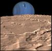
|
-
PIA00344:
-
Neptune on Triton's Horizon
Full Resolution:
TIFF
(2.164 MB)
JPEG
(143.2 kB)
|
|
|
1998-05-21 |
Europa
|
Galileo
|
Solid-State Imaging
|
3500x2220x1 |
|
-
PIA01403:
-
A Closer Look at Chaos on Europa
Full Resolution:
TIFF
(7.139 MB)
JPEG
(1.036 MB)
|
|
|
1998-05-21 |
Europa
|
Galileo
|
Solid-State Imaging
|
4000x2024x1 |
|
-
PIA01407:
-
Europa Imaging Highlights During GEM
Full Resolution:
TIFF
(6.84 MB)
JPEG
(791.3 kB)
|
|
|
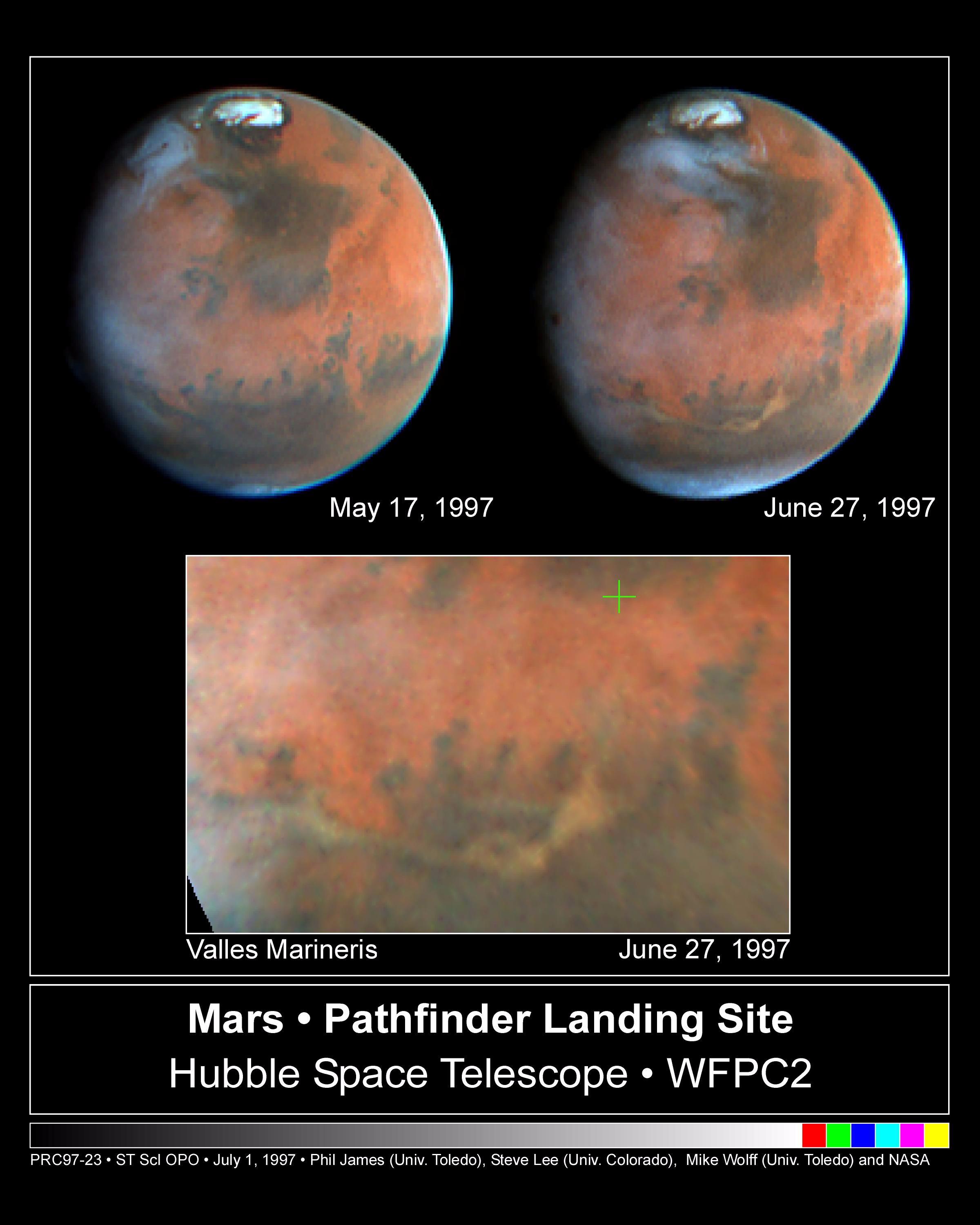
1998-05-02 |
Mars
|
Hubble Space Telescope
|
WFPC2
|
2400x3000x3 |
|
-
PIA01245:
-
Hubble's Look at Mars Shows Canyon Dust Storm, Cloudy Conditions for Pathfinder Landing
Full Resolution:
TIFF
(9.466 MB)
JPEG
(377.4 kB)
|
|
|
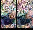
1998-04-23 |
Mars
|
Mars Global Surveyor (MGS)
|
Mars Orbiter Camera (MOC)
|
1356x2034x3 |
|
-
PIA01239:
-
Coprates Catena
Full Resolution:
TIFF
(6.104 MB)
JPEG
(290 kB)
|
|
|
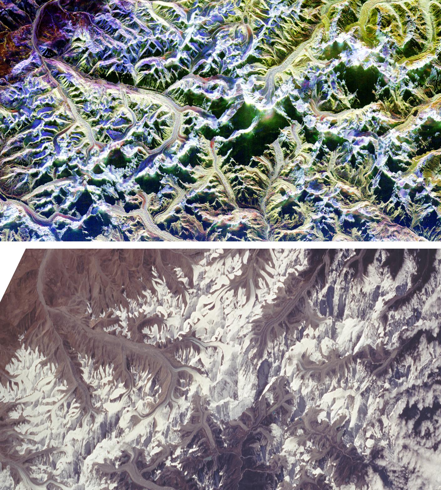
1998-04-09 |
Earth
|
Spaceborne Imaging Radar-C/X-Band Synthetic Aperture Radar
|
Imaging Radar
|
1409x1567x3 |
|
-
PIA01301:
-
Space Radar Image of Mount Everest
Full Resolution:
TIFF
(7.613 MB)
JPEG
(577.3 kB)
|
|
|
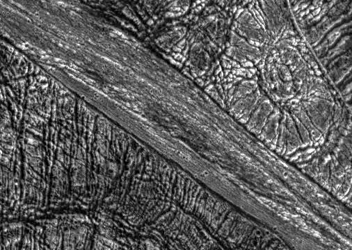
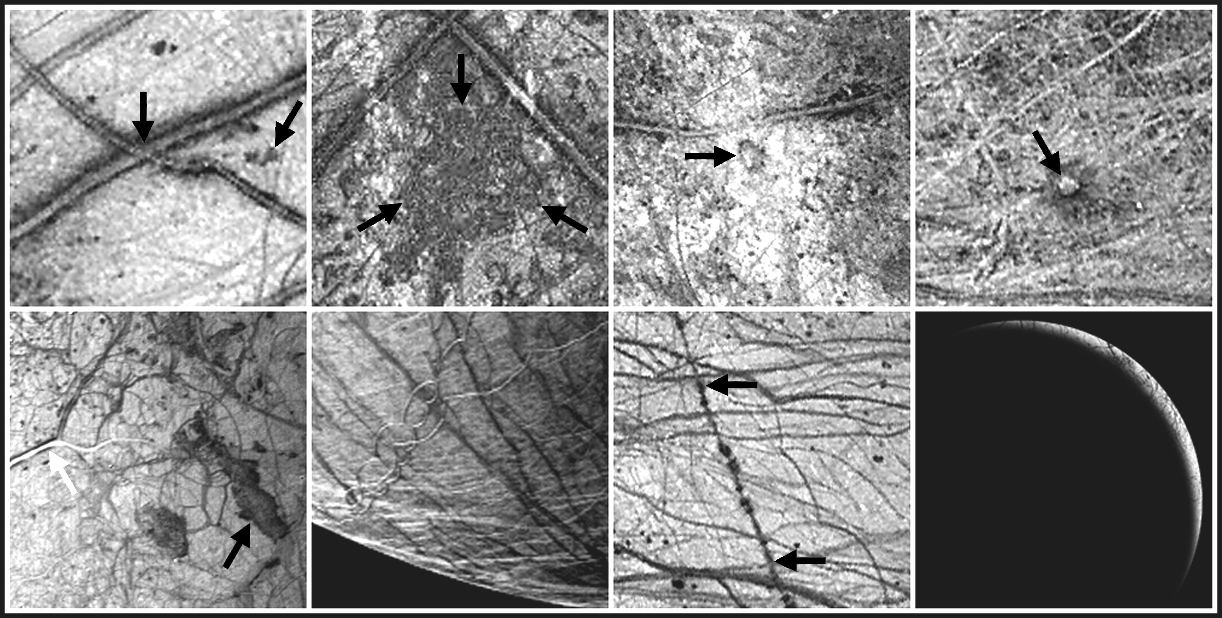
1998-03-26 |
Europa
|
Galileo
|
Solid-State Imaging
|
1000x800x1 |
|
-
PIA00849:
-
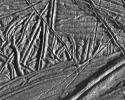
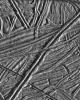
Ridges and Fractures on Europa
Full Resolution:
TIFF
(830.4 kB)
JPEG
(125.8 kB)
|
|
|
1998-03-26 |
Europa
|
Galileo
|
Solid-State Imaging
|
800x1000x1 |
|
-
PIA00850:
-
Europa Under Stress
Full Resolution:
TIFF
(841.3 kB)
JPEG
(129.7 kB)
|
|
|
1998-02-12 |
Mars
|
Mars Global Surveyor (MGS)
|
Mars Orbiter Camera (MOC)
|
2048x3591x1 |
|
-
PIA01168:
-
Layers within the Valles Marineris: Clues to the Ancient Crust of Mars - High Resolution Image
Full Resolution:
TIFF
(8.157 MB)
JPEG
(1.694 MB)
|
|
|
1998-02-12 |
Mars
|
Mars Global Surveyor (MGS)
|
Mars Orbiter Camera (MOC)
|
3500x2000x1 |
|
-
PIA01167:
-
Layers within the Valles Marineris: Clues to the Ancient Crust of Mars
Full Resolution:
TIFF
(4.837 MB)
JPEG
(953.8 kB)
|
|
|
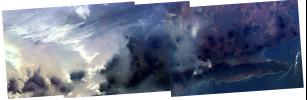
1997-12-18 |
Jupiter
|
Galileo
|
Solid-State Imaging
|
518x368x3 |
|
-
PIA01118:
-
Jovian Lightning
Full Resolution:
TIFF
(256.1 kB)
JPEG
(48.1 kB)
|
|
|
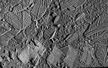
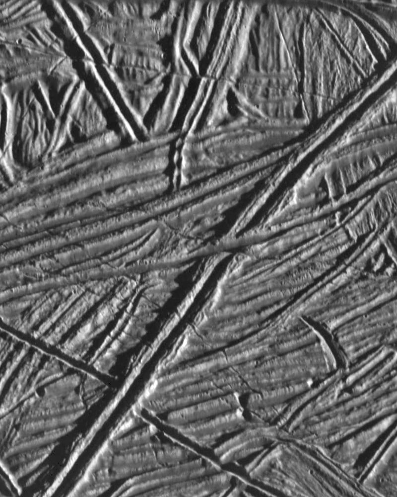
1997-12-16 |
Europa
|
Galileo
|
Solid-State Imaging
|
1623x1940x1 |
|
-
PIA01126:
-
High Resolution Mosaic of Ridges, Plains, and Mountains on Europa
Full Resolution:
TIFF
(3.465 MB)
JPEG
(766.7 kB)
|
|
|
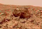
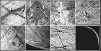
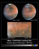
1997-12-12 |
Mars
|
Mars Pathfinder (MPF)
|
Imager for Mars Pathfinder
|
1506x1415x3 |
|
-
PIA01124:
-
Mars Pathfinder Landing Site
Full Resolution:
TIFF
(2.072 MB)
JPEG
(435.4 kB)
|
|
|
1997-12-10 |
Jupiter
|
Galileo
|
Solid-State Imaging
|
1700x900x3 |
|
-
PIA01096:
-
Jovian Lightning and Moonlit Clouds
Full Resolution:
TIFF
(1.839 MB)
JPEG
(116.3 kB)
|
|
|
1997-11-20 |
Ganymede
|
Galileo
|
Solid-State Imaging
|
648x471x1 |
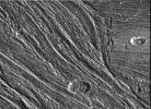
|
-
PIA01086:
-
Grooved Terrain in Nippur Sulcus on Ganymede
Full Resolution:
TIFF
(362 kB)
JPEG
(91.54 kB)
|
|
|
1997-10-14 |
Mars
|
Mars Pathfinder (MPF)
|
Rover Cameras
|
413x399x1 |
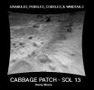
|
-
PIA00984:
-
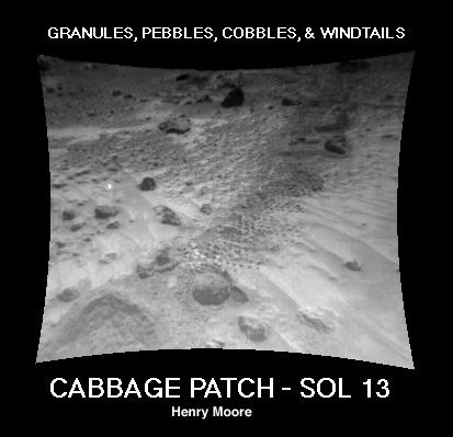
"Cabbage Patch"
Full Resolution:
TIFF
(90.68 kB)
JPEG
(24 kB)
|
|
|
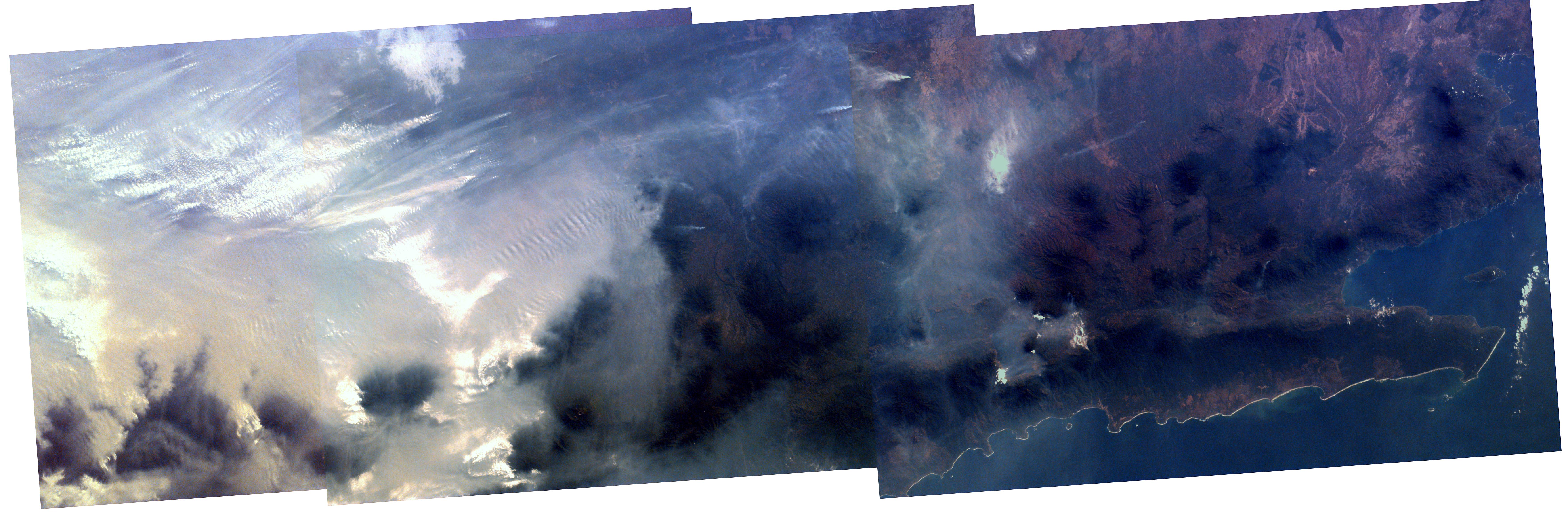
1997-10-03 |
Earth
|
KidSat
|
Electronic Still Camera
|
7019x2290x3 |
|
-
PIA00950:
-
Mosaic image of fires in Indonesia
Full Resolution:
TIFF
(49.22 MB)
JPEG
(1.846 MB)
|
|
|
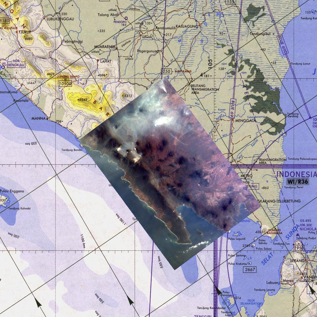
1997-10-03 |
Earth
|
KidSat
|
Electronic Still Camera
|
1024x1024x3 |
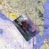
|
-
PIA00956:
-
Kidsat image of Sumatra, Indonesia & map
Full Resolution:
TIFF
(1.7 MB)
JPEG
(281.6 kB)
|
 Planetary Data System


