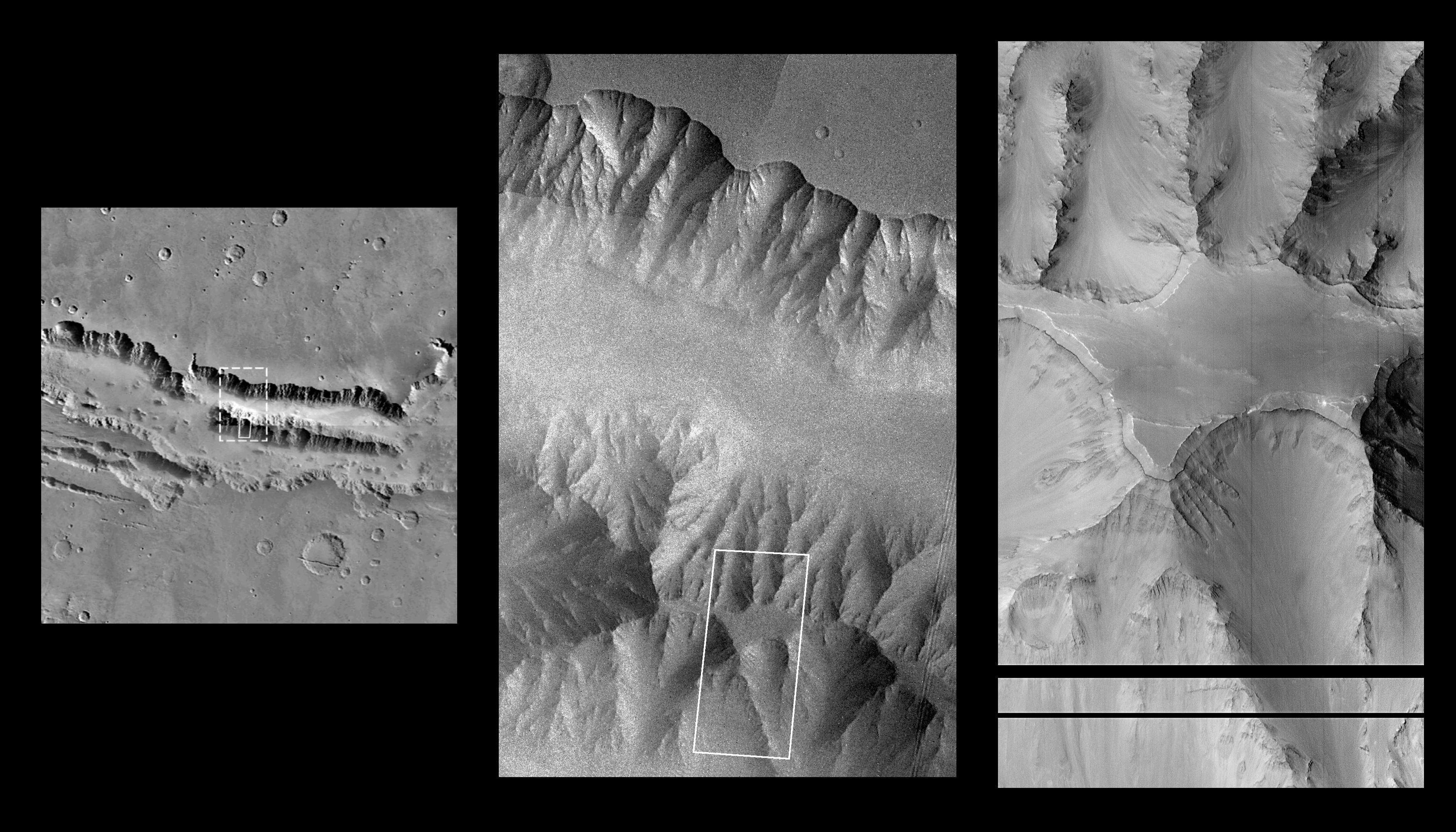
This high resolution picture (right) of the Martian surface was obtained in the early evening of January 1, 1998 by the Mars Orbiter Camera (MOC), shortly after the Mars Global Surveyor spacecraft began it's 80th orbit. Seen in this view are a plateau and surrounding steep slopes within the Valles Marineris, the large system of canyons that stretches 4000 km (2500 mi) along the equator of Mars. The image covers a tiny fraction of the canyons at very high resolution: it extends only 9.8 km by 17.3 km (6.1 mi by 10.7 mi) but captures features as small as 6 m (20 ft) across. The highest terrain in the image is the relatively smooth plateau near the center. Slopes descend to the north and south (upper and lower part of image, respectively) in broad, debris-filled gullies with intervening rocky spurs. Multiple rock layers, varying from a few to a few tens of meters thick, are visible in the steep slopes on the spurs and gullies. Layered rocks on Earth form from sedimentary processes (such as those that formed the layered rocks now seen in Arizona's Grand Canyon) and volcanic processes (such as layering seen in the Waimea Canyon on the island of Kauai). Both origins are possible for the Martian layered rocks seen in this image. In either case, the total thickness of the layered rocks seen in this image implies a complex and extremely active early history for geologic processes on Mars.
The left and center "context" images are Viking mosaics reproduced at scales of 230 meters/pixel and 80 meters/pixel respectively. Outlines in these two images represent the location of the higher resolution image(s).
Malin Space Science Systems (MSSS) and the California Institute of Technology built the MOC using spare hardware from the Mars Observer mission. MSSS operates the camera from its facilities in San Diego, CA. The Jet Propulsion Laboratory's Mars Surveyor Operations Project operates the Mars Global Surveyor spacecraft with its industrial partner, Lockheed Martin Astronautics, from facilities in Pasadena, CA and Denver, CO.
 Planetary Data System


