My
List |
Addition Date
|
Target
|
Mission
|
Instrument
|
Size
|

|
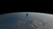
2025-07-22 |
|
NISAR
|
|
8256x5504x3 |

|
-
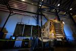
PIA26611:
-
NISAR Encapsulated in Payload Fairing at ISRO Launch Site
Full Resolution:
TIFF
(93.02 MB)
JPEG
(4.346 MB)
|
|
|
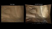
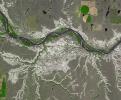
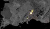
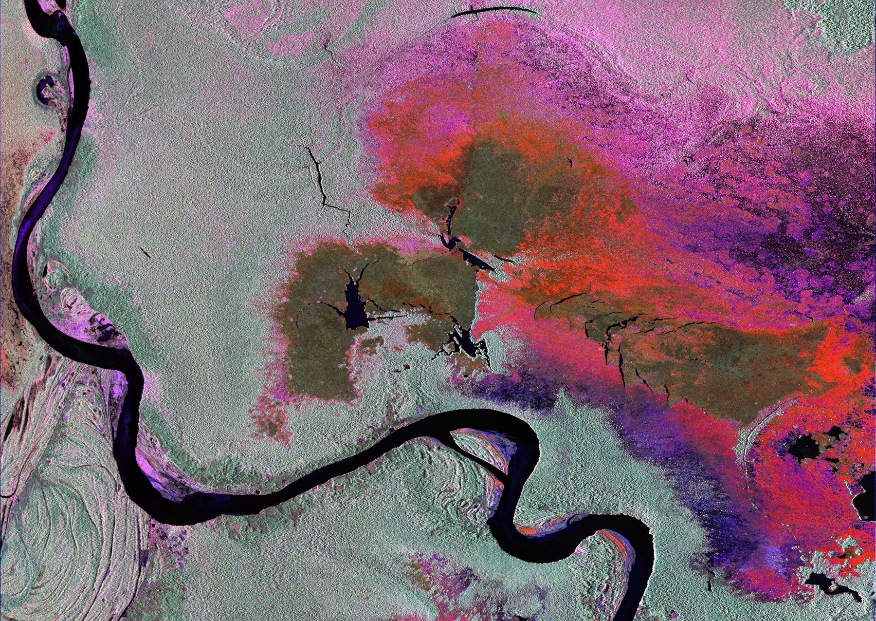
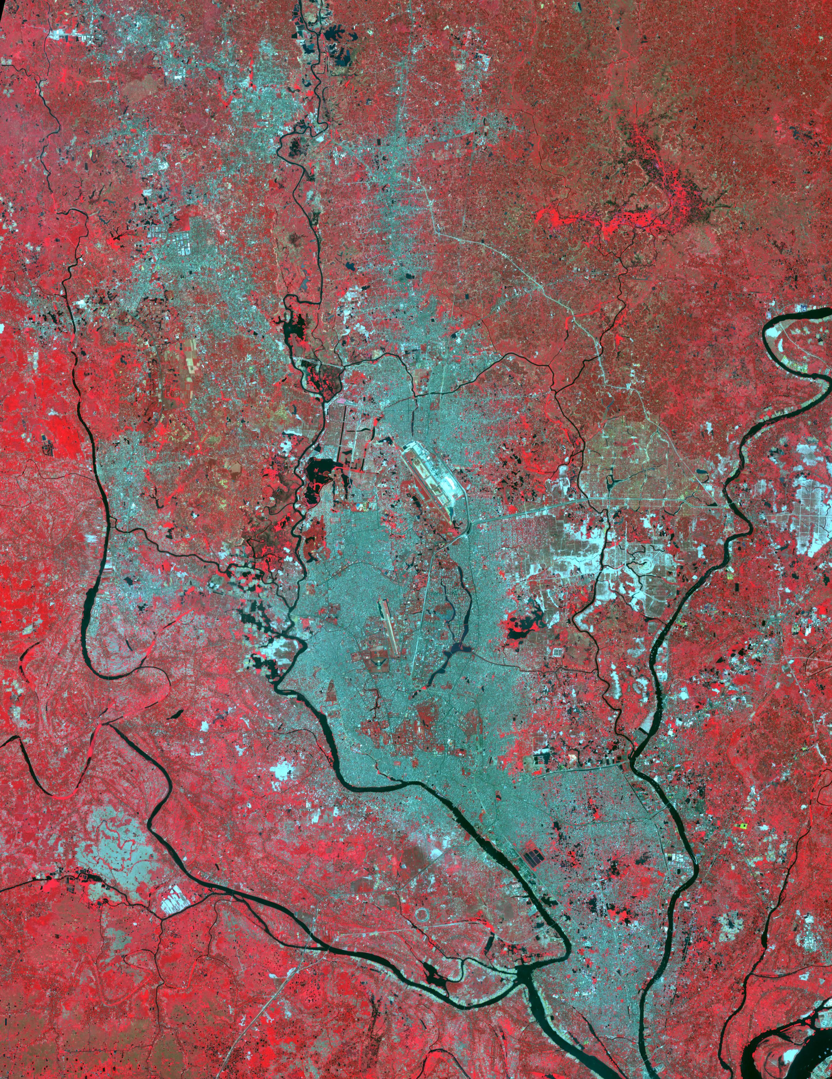
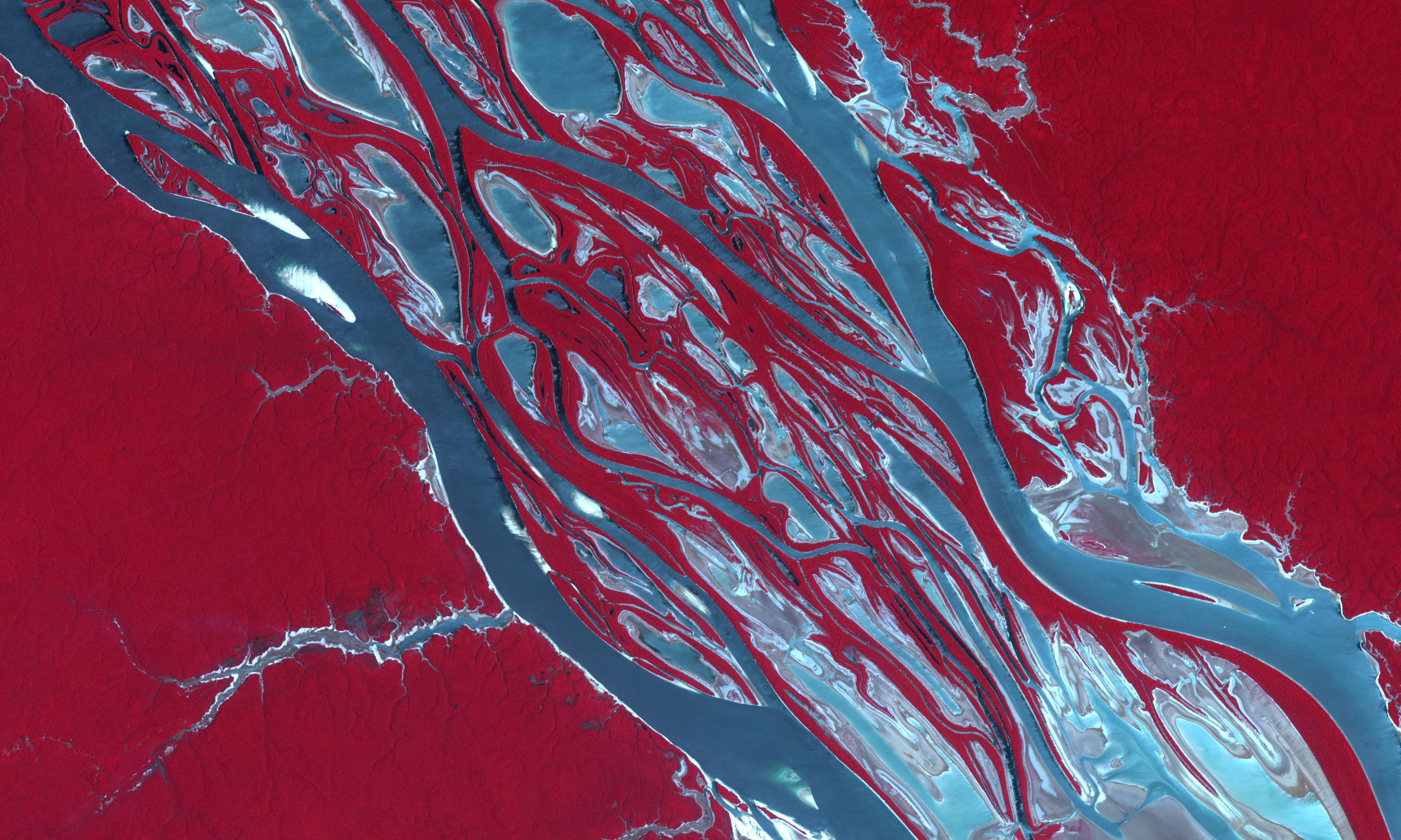
2025-07-03 |
Earth
|
NISAR
|
|
1800x1275x3 |
|
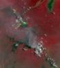
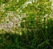
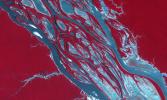
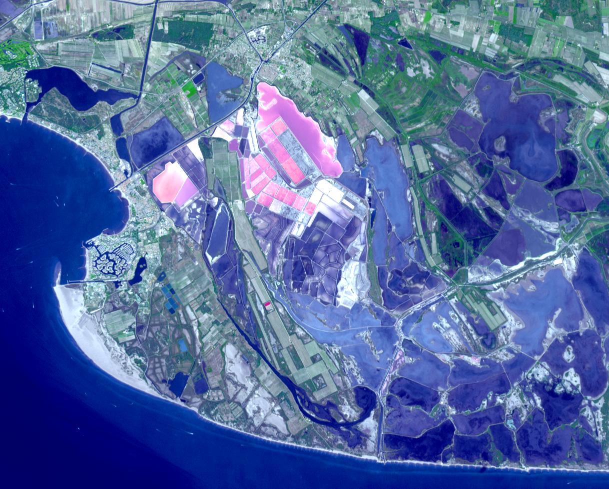
-
PIA26112:
-
Radar Image of Amazonian Flooding Similar to Future NISAR Imagery
Full Resolution:
TIFF
(6.888 MB)
JPEG
(808.4 kB)
|
|
|
2025-06-12 |
|
NISAR
|
|
5760x3840x3 |

|
-
PIA26500:
-
NISAR Arrives at Indian Launch Site
Full Resolution:
TIFF
(53.84 MB)
JPEG
(1.768 MB)
|
|
|
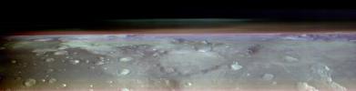
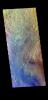
2025-06-06 |
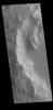
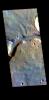
Mars
|
2001 Mars Odyssey
|
THEMIS
|
6400x1280x3 |

|
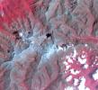
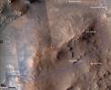
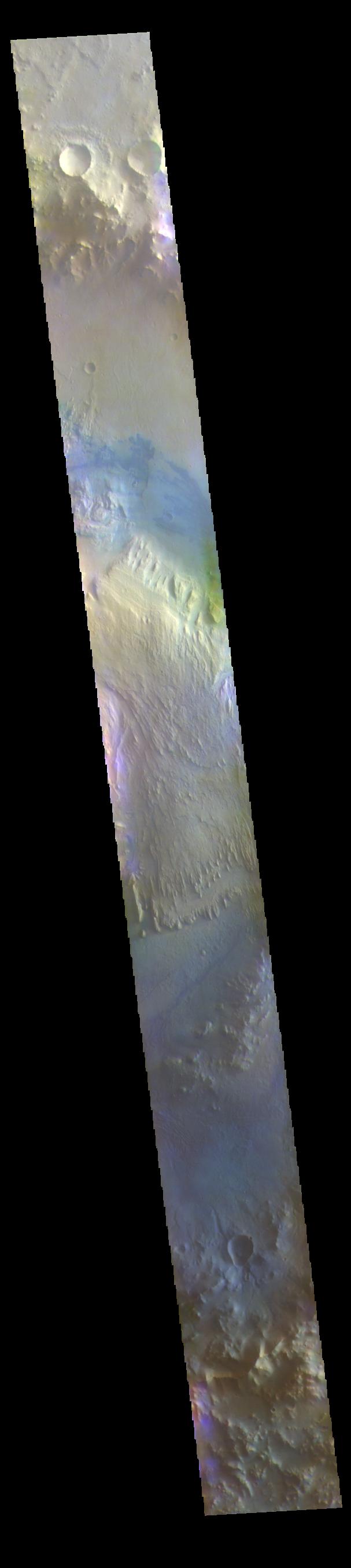
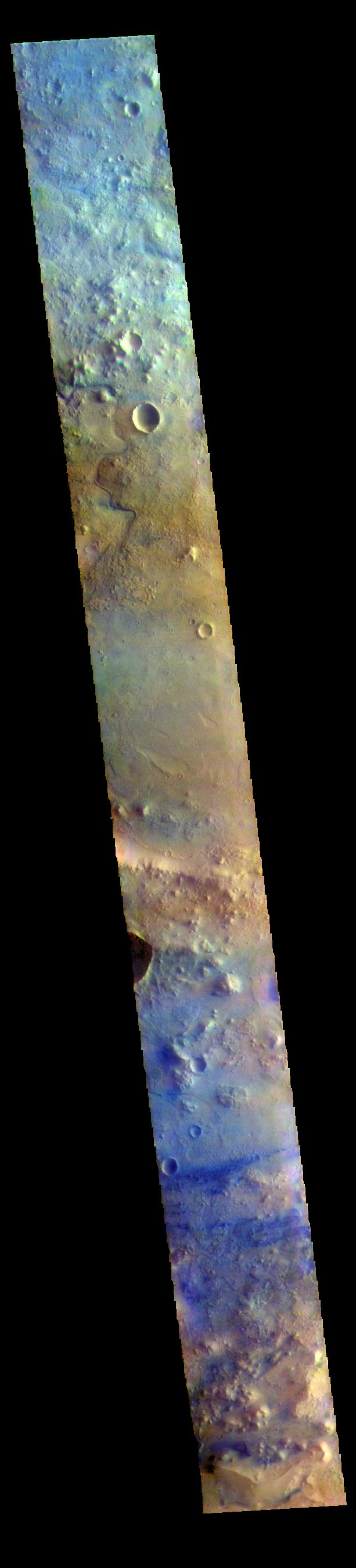
-
PIA26557:
THEMIS Views Mars' Arsia Mons Volcano
Full Resolution:
TIFF
(17.93 MB)
JPEG
(623.2 kB)
|
|
|
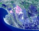
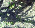
2025-05-30 |
Earth
|
Terra
|
ASTER
|
1157x924x3 |

|
-
PIA26622:
-
Magee Marsh Wildlife Area, Ohio
Full Resolution:
TIFF
(3.208 MB)
JPEG
(172.1 kB)
|
|
|
2025-05-12 |
Earth
|
Terra
|
ASTER
|
1289x833x3 |

|
-
PIA26621:
-
Mackinac Island, Michigan
Full Resolution:
TIFF
(1.651 MB)
JPEG
(69.86 kB)
|
|
|
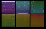
2025-05-01 |
Sky
|
SPHEREx
|
Spectro-Photometer
|
960x537x3 |

|
-
PIA26351:
-
SPHEREx Scans the Sky
Full Resolution:
TIFF
(934.8 kB)
JPEG
(63.32 kB)
|
|
|
2025-04-29 |
Earth
|
Terra
|
ASTER
|
1222x1096x3 |

|
-
PIA26510:
-
Hutt Lagoon, Australia
Full Resolution:
TIFF
(3.908 MB)
JPEG
(216.6 kB)
|
|
|
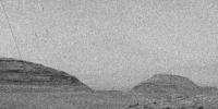
2025-04-24 |
Mars
|
Mars Science Laboratory (MSL)
|
Mastcam
|
19506x3191x3 |

|
-
PIA26551:
Curiosity Looks Downslope From the Sulfate Unit
Full Resolution:
TIFF
(151 MB)
JPEG
(10.7 MB)
|
|
|
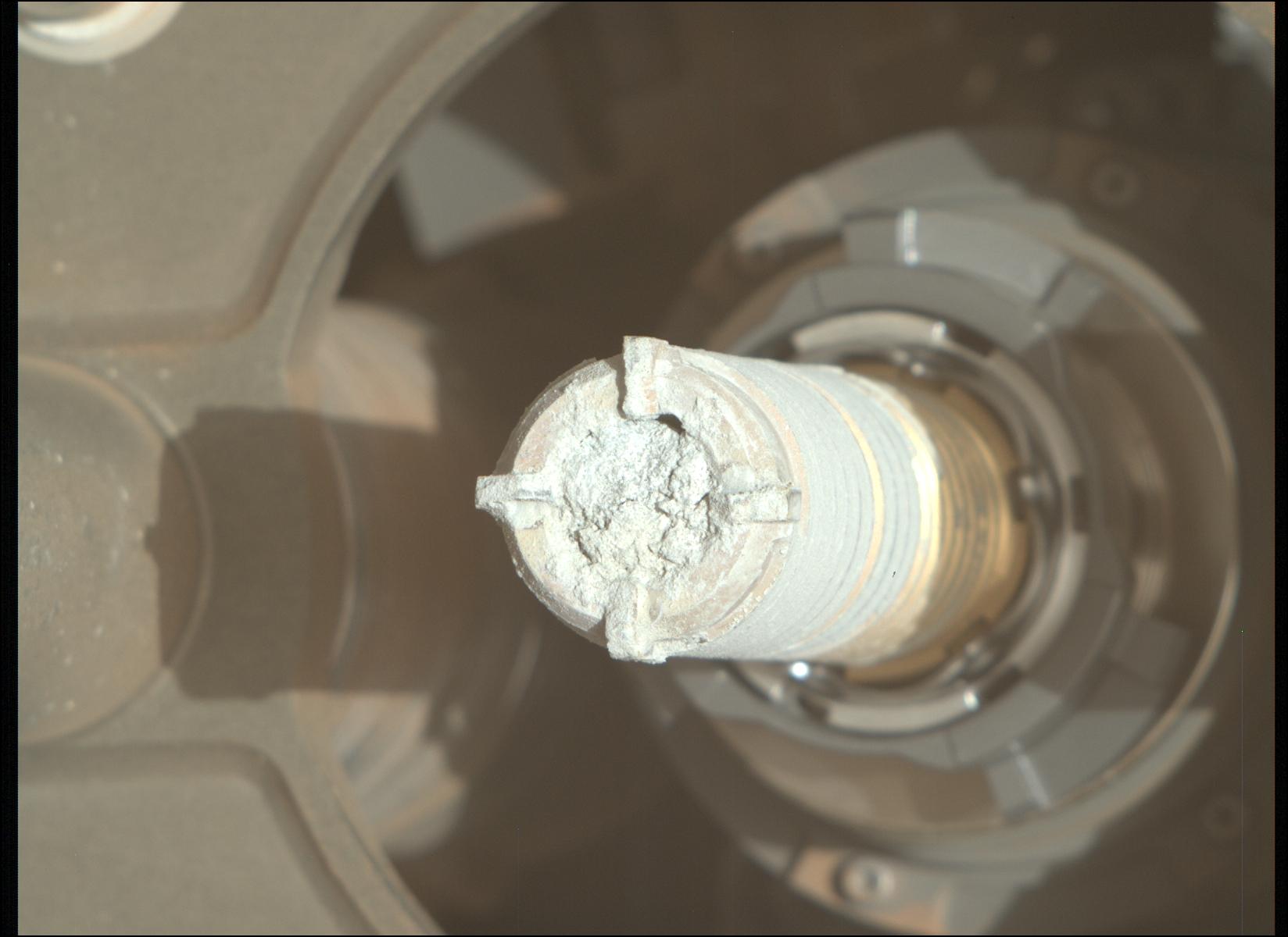
2025-04-10 |
Mars
|
Mars 2020 Rover
|
Mastcam-Z
|
1648x1200x3 |

|
-
PIA26529:
-
'Green Gardens' Sample in Tube
Full Resolution:
TIFF
(5.134 MB)
JPEG
(109.1 kB)
|
|
|
2025-04-07 |
Earth
|
Terra
|
ASTER
|
2358x2315x3 |

|
-
PIA26509:
-
Heard Volcano, Australia
Full Resolution:
TIFF
(12.73 MB)
JPEG
(471.7 kB)
|
|
|
2025-04-01 |
Sky
|
SPHEREx
|
Spectro-Photometer
|
2708x1754x3 |
|
-
PIA26280:
-
First Images From NASA's SPHEREx
Full Resolution:
TIFF
(6.303 MB)
JPEG
(1.066 MB)
|
|
|
2025-03-24 |
Earth
|
Terra
|
ASTER
|
534x506x3 |

|
-
PIA26508:
-
JFK Memorial, Runnymede Meadow, England
Full Resolution:
TIFF
(811.1 kB)
JPEG
(64.29 kB)
|
|
|
2025-03-12 |
|
NISAR
|
|
2558x937x3 |

|
-
PIA26496:
-
NISAR in Orbit Over Northeastern India (Artist's Concept)
Full Resolution:
TIFF
(5.843 MB)
JPEG
(265.6 kB)
|
|
|
2025-03-11 |
Earth
|
Terra
|
ASTER
|
1206x1240x3 |

|
-
PIA26507:
-
Charleston, SC
Full Resolution:
TIFF
(4.488 MB)
JPEG
(333.9 kB)
|
|
|
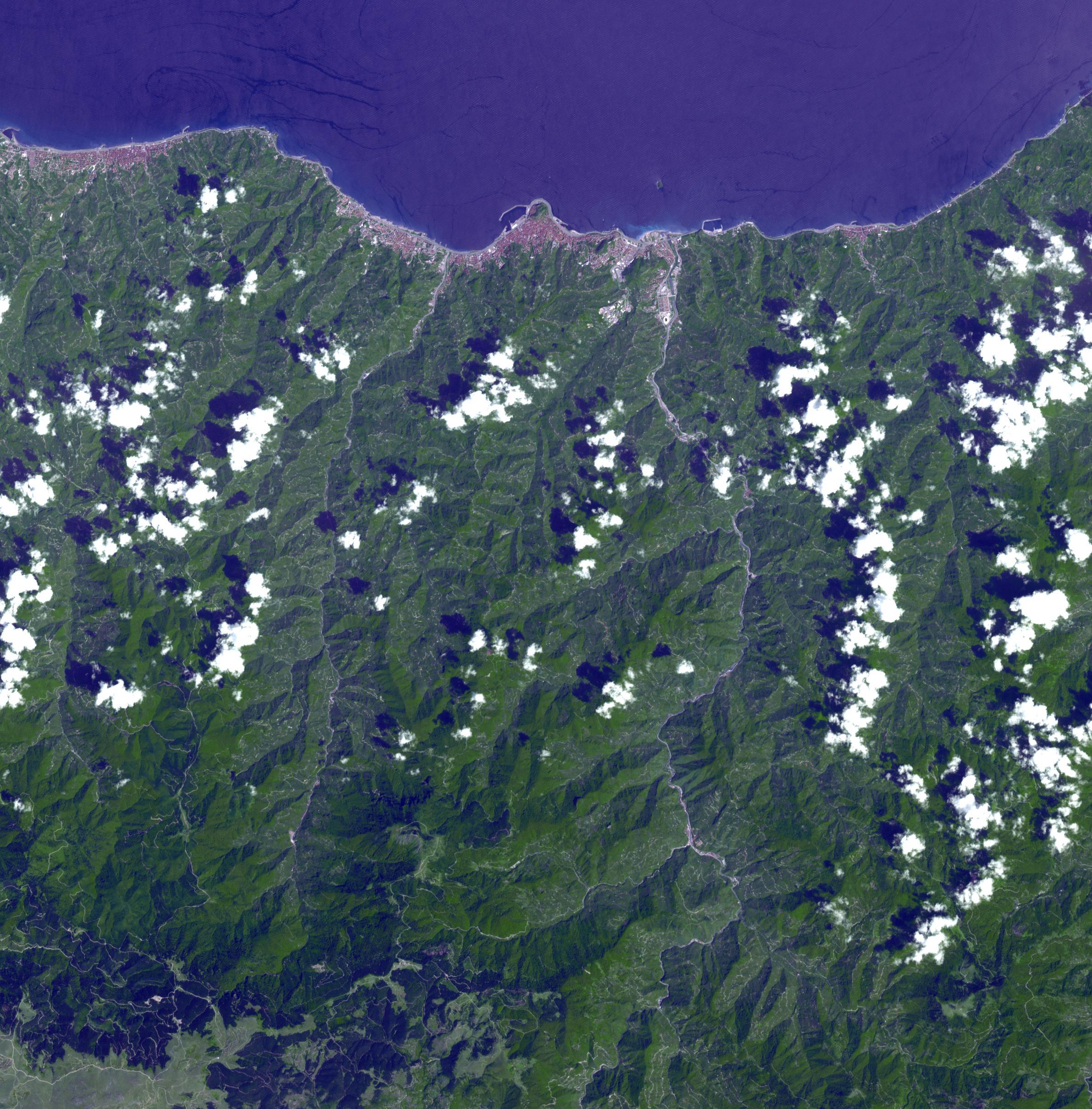
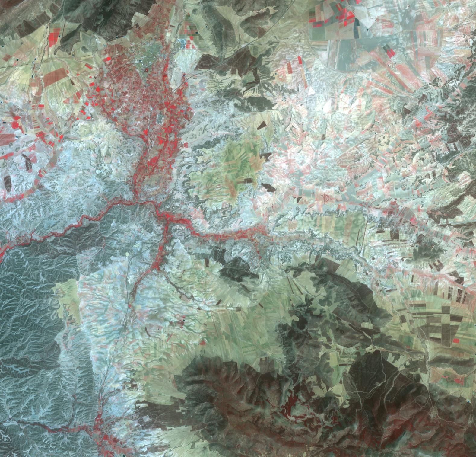
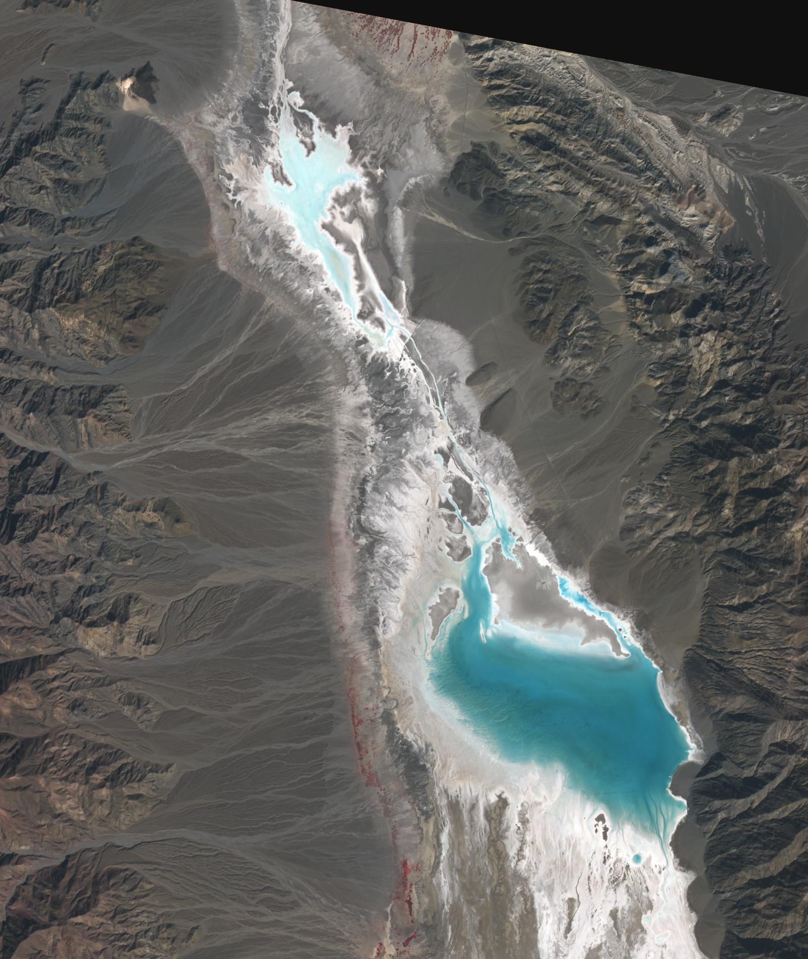
2025-02-24 |
Earth
|
Terra
|
ASTER
|
2202x6214x3 |

|
-
PIA26506:
-
Taal Volcano, Philippines
Full Resolution:
TIFF
(38.24 MB)
JPEG
(1.914 MB)
|
|
|
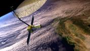
2025-02-13 |
|
Lunar Trailblazer
|
|
1500x844x3 |
|
-
PIA26457:
-
NASA's Lunar Trailblazer in Moon's Orbit (Artist's Concept)
Full Resolution:
TIFF
(966.8 kB)
JPEG
(125.3 kB)
|
|
|
2025-02-11 |
Earth
|
Terra
|
ASTER
|
1435x1918x3 |

|
-
PIA26505:
-
Clayton Valley, NV
Full Resolution:
TIFF
(7.679 MB)
JPEG
(378.5 kB)
|
|
|
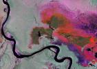
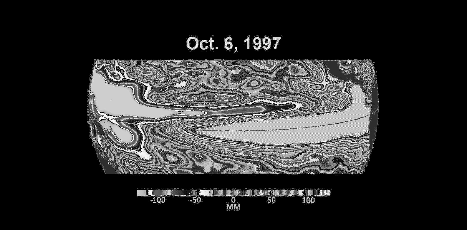
2025-02-10 |
Earth
|
|
InSAR
|
1440x1800x3 |
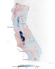
|
-
PIA25530:
-
Map of California Subsidence and Uplift
Full Resolution:
TIFF
(3.216 MB)
JPEG
(222.6 kB)
|
|
|
2025-01-30 |
Earth
|
Terra
|
ASTER
|
1922x2378x3 |

|
-
PIA26504:
-
Halemaumau, Kilauea Hawaii
Full Resolution:
TIFF
(12.55 MB)
JPEG
(395.5 kB)
|
|
|
2025-01-28 |
Io
|
Juno
|
JunoCam
|
3300x1200x3 |

|
-
PIA26526:
-
Three Views of Io's Southern Hemisphere
Full Resolution:
TIFF
(6.352 MB)
JPEG
(182.9 kB)
|
|
|
2025-01-21 |
|
NISAR
|
|
2560x1044x3 |

|
-
PIA26493:
-
NISAR in Orbit Over Antarctica (Artist's Concept)
Full Resolution:
TIFF
(3.11 MB)
JPEG
(161.3 kB)
|
|
|
2025-01-06 |
|
NISAR
|
|
2963x1098x3 |

|
-
PIA26492:
-
NISAR in Orbit Over Antarctica (Artist's Concept)
Full Resolution:
TIFF
(2.265 MB)
JPEG
(154.8 kB)
|
|
|
2025-01-06 |
Earth
|
Terra
|
ASTER
|
2805x3876x3 |

|
-
PIA26503:
-
French Overseas Territory of Mayotte, Indian Ocean
Full Resolution:
TIFF
(20.02 MB)
JPEG
(840.2 kB)
|
|
|
2024-12-20 |
Earth
|
Terra
|
ASTER
|
1271x1616x3 |
|
-
PIA26502:
-
Barra Airport, Outer Hebrides, U.K.
Full Resolution:
TIFF
(3.589 MB)
JPEG
(132.3 kB)
|
|
|
2024-12-19 |
Mars
|
Mars Science Laboratory (MSL)
|
MARDI
|
2200x1238x3 |
|
-
PIA26516:
-
MARDI Peeks Under Curiosity
Full Resolution:
TIFF
(4.406 MB)
JPEG
(247.9 kB)
|
|
|
2024-12-17 |
Earth
|
SWOT
|
KaRIn
|
1440x1330x3 |

|
-
PIA26188:
-
Ohio Basin Lakes Water Levels
Full Resolution:
TIFF
(3.095 MB)
JPEG
(259.9 kB)
|
|
|
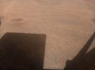
2024-12-16 |
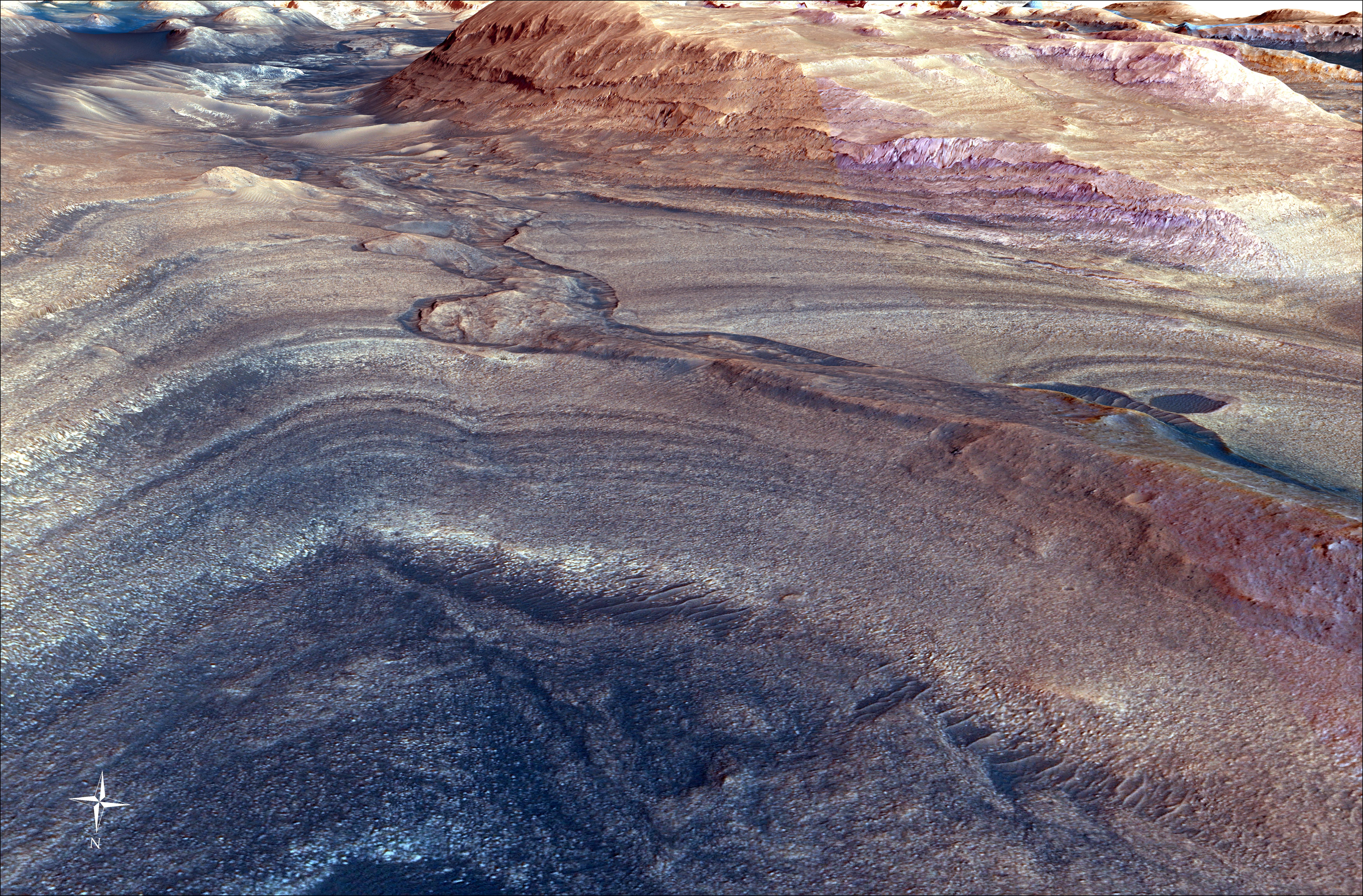
Mars
|
Mars Reconnaissance Orbiter (MRO)
|
HiRISE
|
1106x977x3 |
|
-
PIA26515:
-
HiRISE Studies the Dust on InSight
Full Resolution:
TIFF
(2.767 MB)
JPEG
(148.6 kB)
|
|
|
2024-12-12 |
Io
|
Juno
|
Stellar Reference Unit (SRU)
|
2638x1988x3 |

|
-
PIA26524:
-
NASA's Juno Sees Changes at Masubi
Full Resolution:
TIFF
(4.832 MB)
JPEG
(227.1 kB)
|
|
|
2024-12-12 |
Io
|
Juno
|
JunoCam
|
3584x2240x3 |

|
-
PIA26488:
-
Surface Changes at Nusku Captured by NASA's Juno
Full Resolution:
TIFF
(15.28 MB)
JPEG
(454 kB)
|
|
|
2024-12-12 |
Io
|
Juno
|
JunoCam
|
3372x1889x3 |

|
-
PIA26486:
-
Surface Changes on Io
Full Resolution:
TIFF
(12.5 MB)
JPEG
(631.7 kB)
|
|
|
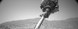
2024-12-11 |
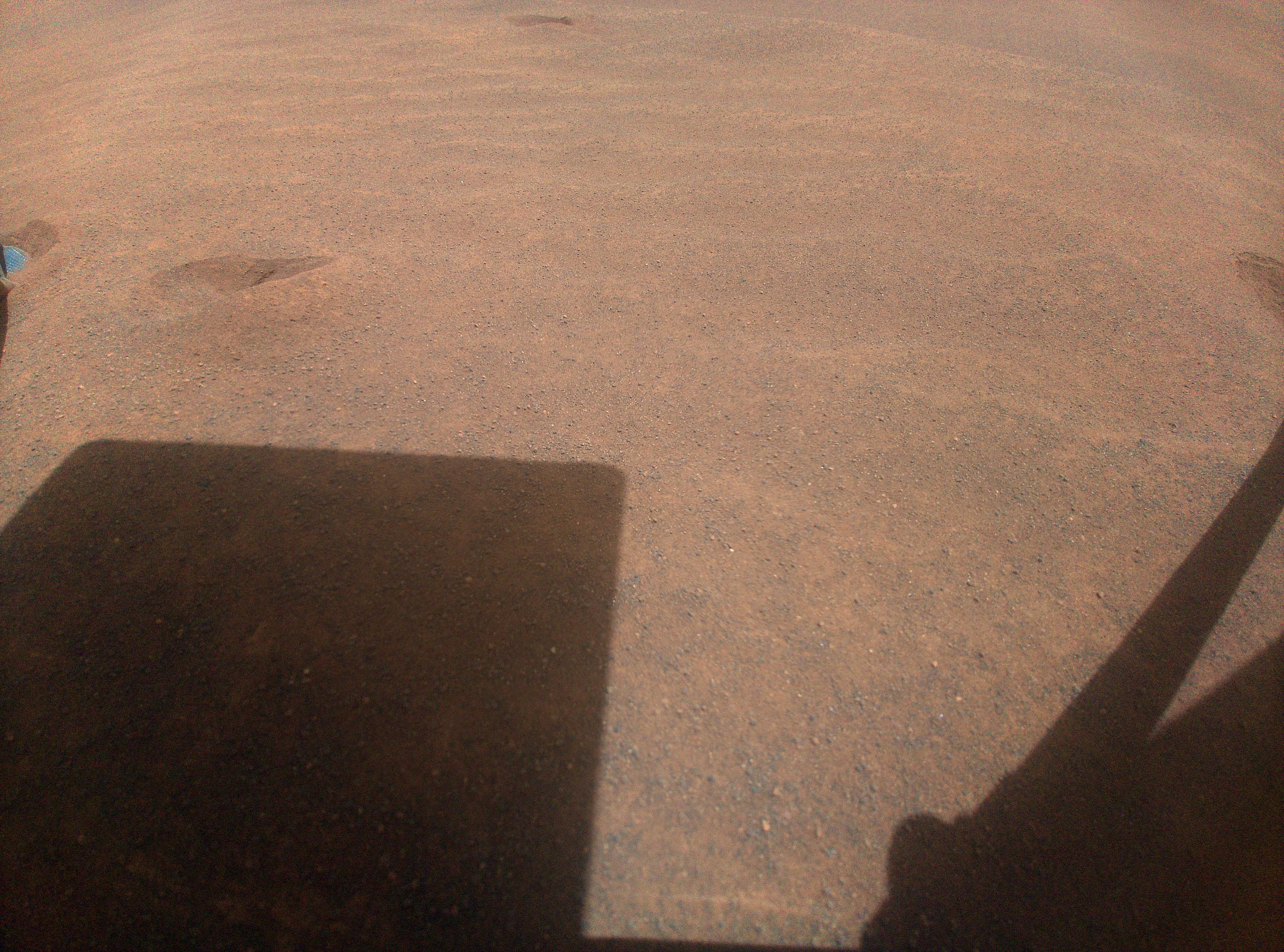
Mars
|
Mars Helicopter
|
|
2674x1556x3 |

|
-
PIA26482:
-
Ingenuity's Hard Landing
Full Resolution:
TIFF
(2.415 MB)
JPEG
(221.8 kB)
|
|
|
2024-11-29 |
Earth
|
Terra
|
ASTER
|
4345x5032x3 |
|
-
PIA26501:
-
Craters of the Moon National Monument, Idaho
Full Resolution:
TIFF
(62.01 MB)
JPEG
(3.164 MB)
|
|
|
2024-11-15 |
Earth
|
Terra
|
ASTER
|
2381x2419x3 |

|
-
PIA26450:
-
Pontic Range, Turkey
Full Resolution:
TIFF
(17.25 MB)
JPEG
(921.4 kB)
|
|
|
2024-10-31 |
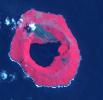
Earth
|
Terra
|
ASTER
|
1807x2042x3 |
|
-
PIA26449:
-
Nyamulagira Volcano, Democratic Republic Congo
Full Resolution:
TIFF
(9.954 MB)
JPEG
(282.2 kB)
|
|
|
2024-10-25 |
Earth
|
Terra
|
ASTER
|
1500x1100x3 |
|
-
PIA26448:
-
Klamath River, OR and CA
Full Resolution:
TIFF
(4.952 MB)
JPEG
(377.9 kB)
|
|
|
2024-10-25 |
Earth
|
Terra
|
ASTER
|
1025x937x3 |
|
-
PIA26447:
-
Humboldt Glacier, Venezuela
Full Resolution:
TIFF
(2.883 MB)
JPEG
(164 kB)
|
|
|
2024-10-23 |
|
NISAR
|
|
8272x6200x3 |

|
-
PIA26419:
-
NISAR Radar Antenna Reflector Loaded for Return to India
Full Resolution:
TIFF
(104.6 MB)
JPEG
(4.395 MB)
|
|
|
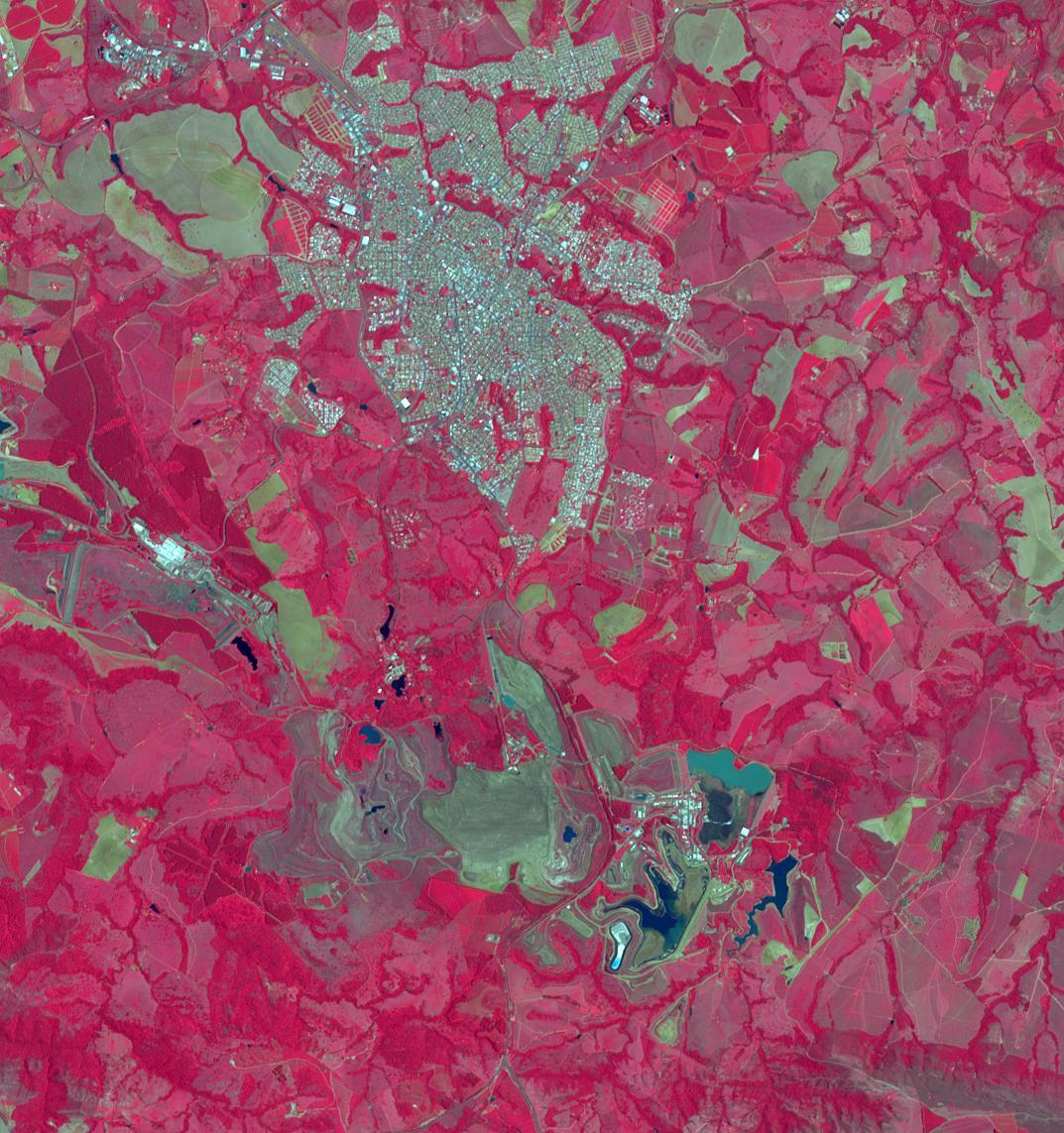
2024-09-27 |
Earth
|
Terra
|
ASTER
|
1073x1143x3 |
|
-
PIA26395:
-
Araxa Mine, Brazil
Full Resolution:
TIFF
(3.681 MB)
JPEG
(251.1 kB)
|
|
|
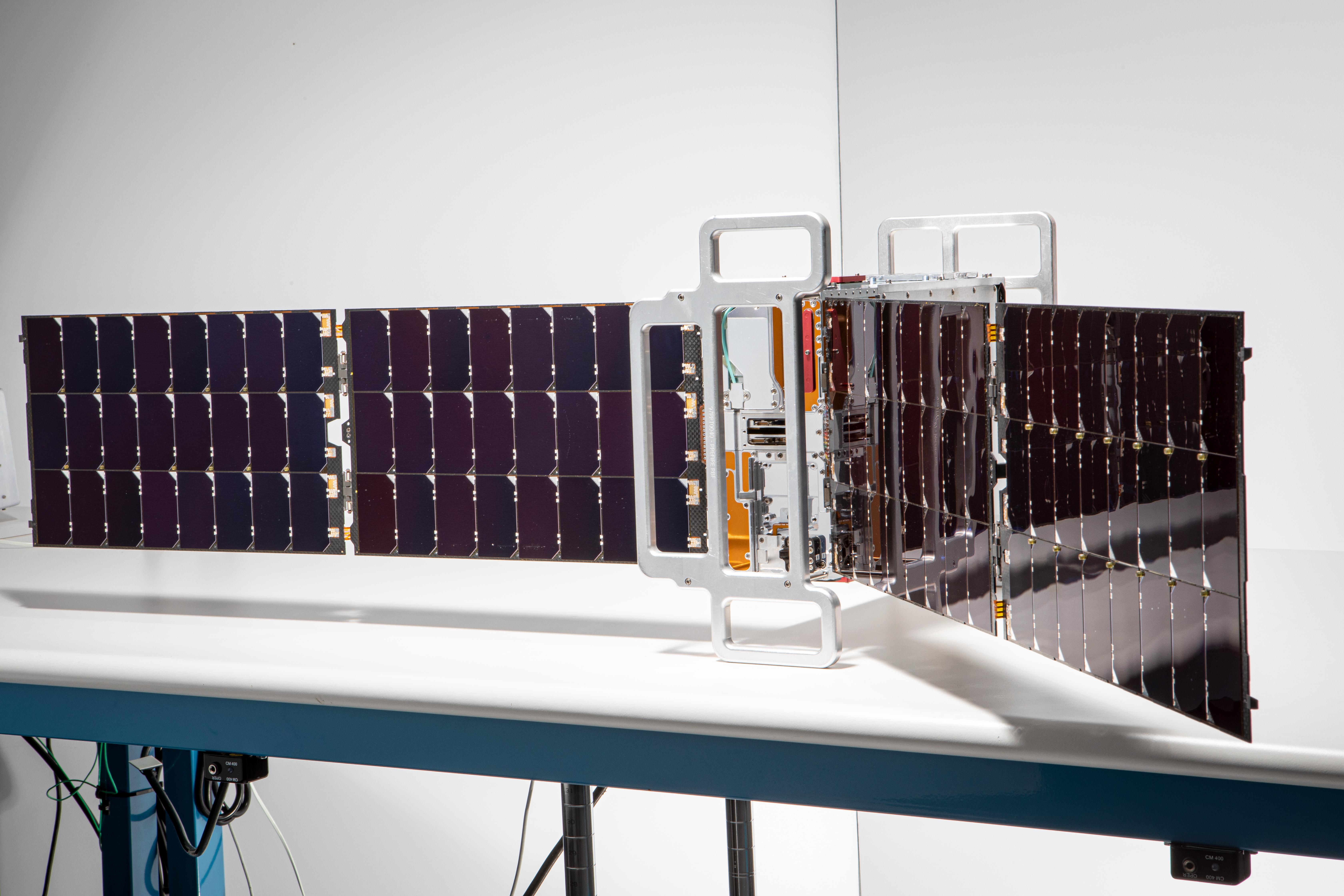
2024-09-11 |
|
Lunar Trailblazer
|
|
4000x2667x3 |
|
-
PIA26390:
-
NASA's Lunar Trailblazer Deploys Its Solar Arrays After Testing
Full Resolution:
TIFF
(23.8 MB)
JPEG
(891.2 kB)
|
|
|
2024-08-30 |
Earth
|
Terra
|
ASTER
|
613x565x3 |
|
-
PIA26394:
-
Terra Cotta Army, China
Full Resolution:
TIFF
(1.04 MB)
JPEG
(103 kB)
|
|
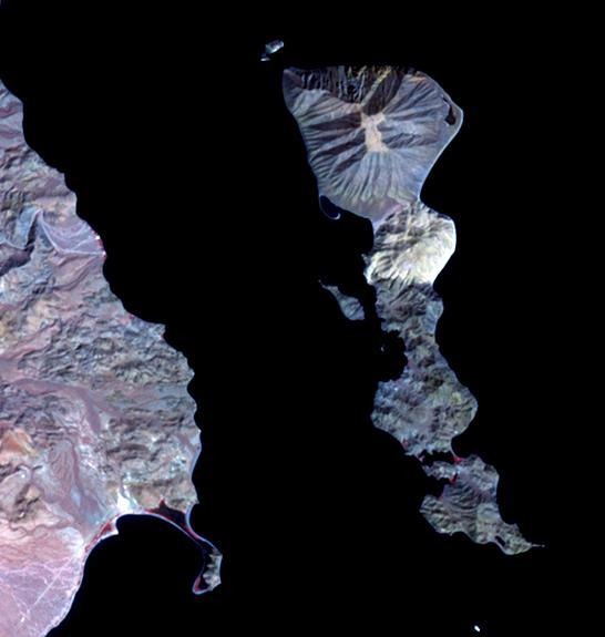
|
2024-08-14 |
Mars
|
Mars Reconnaissance Orbiter (MRO)
|
HiRISE
|
1129x929x3 |
|
-
PIA26374:
-
Perseverance's Climb to 'Witch Hazel Hill'
Full Resolution:
TIFF
(3.148 MB)
JPEG
(155.5 kB)
|
|
|
2024-08-07 |
Earth
|
Terra
|
ASTER
|
799x773x3 |
|
-
PIA26393:
-
Tofua Island, Tonga Islands
Full Resolution:
TIFF
(1.49 MB)
JPEG
(59.23 kB)
|
|
|
2024-07-19 |
Earth
|
Terra
|
ASTER
|
1777x1921x3 |
|
-
PIA26392:
-
Mount Mabu, Mozambique
Full Resolution:
TIFF
(10.24 MB)
JPEG
(796.9 kB)
|
|
|
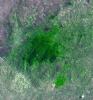
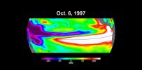
2024-07-19 |
Earth
|
|
|
1654x1578x3 |
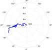
|
-
PIA26120:
-
Meandering Path of Earth's Spin Axis
Full Resolution:
TIFF
(362.3 kB)
JPEG
(108.7 kB)
|
|
|
2024-07-18 |
Mars
|
Mars Science Laboratory (MSL)
|
Mastcam
|
22115x5629x3 |
|
-
PIA26366:
Curiosity Views Rocks With 'Halos'
Full Resolution:
TIFF
(170 MB)
JPEG
(17.1 MB)
|
|
|
2024-06-27 |
Earth
|
Terra
|
ASTER
|
1129x1013x3 |
|
-
PIA26391:
-
Handa Island, Scotland
Full Resolution:
TIFF
(3.026 MB)
JPEG
(189 kB)
|
|
|
2024-06-27 |
Mars
|
2001 Mars Odyssey
|
THEMIS
|
14152x1600x3 |

|
-
PIA26305:
Odyssey's THEMIS Views Olympus Mons
Full Resolution:
TIFF
(37.75 MB)
JPEG
(1.634 MB)
|
|
|
2024-06-26 |
Mars
|
Mars 2020 Rover
|
Navigation Camera (M2020)
|
1280x480x3 |
|
-
PIA26339:
-
Checking the Cover on Perseverance's SHERLOC
Full Resolution:
TIFF
(523.6 kB)
JPEG
(53.46 kB)
|
|
|
2024-06-21 |
Earth
|
Terra
|
ASTER
|
419x380x3 |

|
-
PIA26326:
-
Fernandina Volcano, Galapagos
Full Resolution:
TIFF
(357.3 kB)
JPEG
(20.66 kB)
|
|
|
2024-06-10 |
Mars
|
Mars Science Laboratory (MSL)
|
Navcam (MSL)
|
1024x512x3 |
|
-
PIA26302:
-
Curiosity Sees Streaks and Specks During 2024 Solar Storm
Full Resolution:
TIFF
(525 kB)
JPEG
(114.3 kB)
|
|
|
2024-05-30 |
Earth
|
Terra
|
ASTER
|
1219x978x3 |
|
-
PIA26325:
-
Salin-de-Giraud, France
Full Resolution:
TIFF
(3.578 MB)
JPEG
(225.7 kB)
|
|
|
2024-05-21 |
Earth
|
Polar Radiant Energy in the Far-InfraRed Experiment (PREFIRE)
|
|
6720x4480x3 |

|
-
PIA26186:
-
PREFIRE CubeSat Image
Full Resolution:
TIFF
(56.6 MB)
JPEG
(2.543 MB)
|
|
|
2024-05-21 |
|
Nancy Grace Roman Space Telescope
|
Roman Coronagraph
|
3000x1000x3 |
|
-
PIA26279:
-
Roman Coronagraph Digging the Dark Hole
Full Resolution:
TIFF
(3.204 MB)
JPEG
(171 kB)
|
|
|
2024-05-15 |
Earth
|
Polar Radiant Energy in the Far-InfraRed Experiment (PREFIRE)
|
|
1583x891x3 |
|
-
PIA26185:
-
PREFIRE CubeSat in Earth Orbit (Artist's Concept)
Full Resolution:
TIFF
(1.666 MB)
JPEG
(47.7 kB)
|
|
|
2024-04-30 |
Earth
|
Terra
|
ASTER
|
882x726x3 |
|
-
PIA26290:
-
Dinosaur Provincial Park, Canada
Full Resolution:
TIFF
(1.922 MB)
JPEG
(144.4 kB)
|
|
|
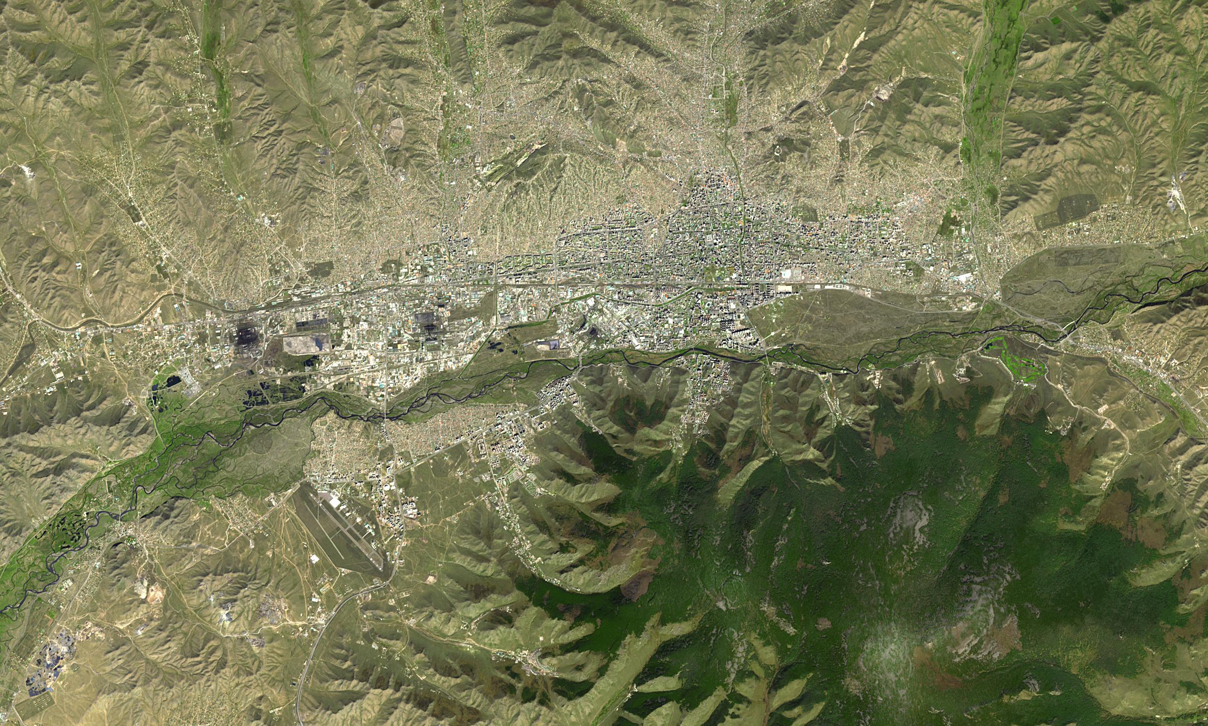
2024-04-26 |
Earth
|
Terra
|
ASTER
|
2441x1468x3 |

|
-
PIA26289:
-
Ulaanbaatar, Mongolia
Full Resolution:
TIFF
(10.75 MB)
JPEG
(854.9 kB)
|
|
|
2024-03-29 |
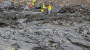
Mars
|
Mars Science Laboratory (MSL)
|
Navcam (MSL)
|
3432x1503x1 |
|
-
PIA26247:
-
Curiosity Looks Back Down the Slope
Full Resolution:
TIFF
(3.619 MB)
JPEG
(569.4 kB)
|
|
|
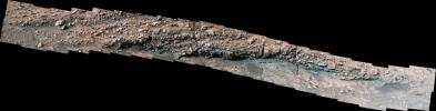
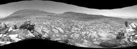
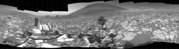
2024-03-29 |
Mars
|
Mars Science Laboratory (MSL)
|
Navcam (MSL)
|
7696x2774x1 |
|
-
PIA26246:
-
Curiosity Arrives at Gediz Vallis Channel
Full Resolution:
TIFF
(14.07 MB)
JPEG
(2.033 MB)
|
|
|
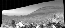
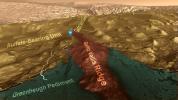
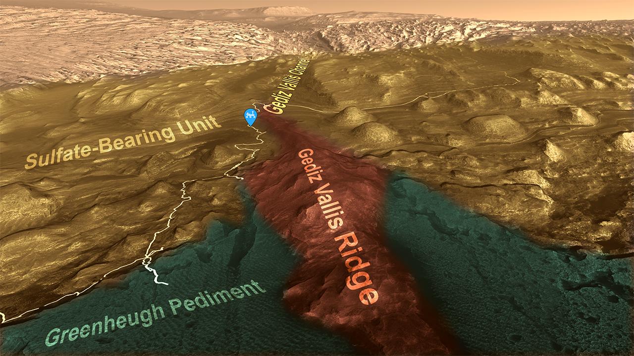
2024-03-29 |
Mars
|
Mars Reconnaissance Orbiter (MRO)
|
HiRISE
|
7003x4603x3 |

|
-
PIA26241:
-
Curiosity's Route to Gediz Vallis Channel (Rendering)
Full Resolution:
TIFF
(96.74 MB)
JPEG
(5.638 MB)
|
|
|
2024-03-29 |
Earth
|
Terra
|
ASTER
|
800x600x3 |
|
-
PIA26288:
-
March 2024 Iceland Eruption
Full Resolution:
TIFF
(958.1 kB)
JPEG
(31.88 kB)
|
|
|
2024-03-26 |
Earth
|
Terra
|
ASTER
|
1639x1333x3 |

|
-
PIA26287:
-
Star Dunes, Morocco
Full Resolution:
TIFF
(6.557 MB)
JPEG
(367.1 kB)
|
|
|
2024-03-21 |
Earth
|
Terra
|
ASTER
|
1578x1514x3 |

|
-
PIA26286:
-
Orce, Spain
Full Resolution:
TIFF
(7.17 MB)
JPEG
(425.4 kB)
|
|
|
2024-02-27 |
Earth
|
Terra
|
ASTER
|
546x575x3 |
|
-
PIA26284:
-
Smith Island, Gulf of California
Full Resolution:
TIFF
(393.5 kB)
JPEG
(29.75 kB)
|
|
|
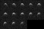
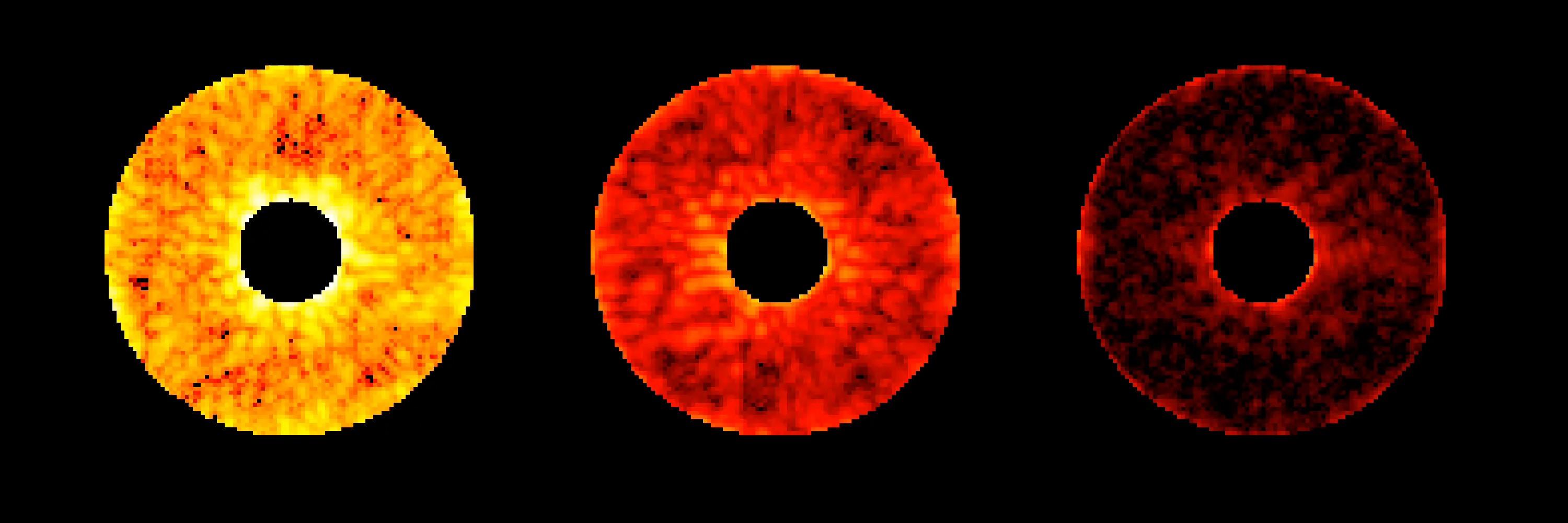
2024-02-26 |
Asteroid
|
Deep Space Network (DSN)
|
Deep Space Network
|
3410x2222x1 |
|
-
PIA26149:
-
NASA's Planetary Radar Images Slow-Spinning Asteroid 2008 OS7
Full Resolution:
TIFF
(1.567 MB)
JPEG
(725.4 kB)
|
|
|
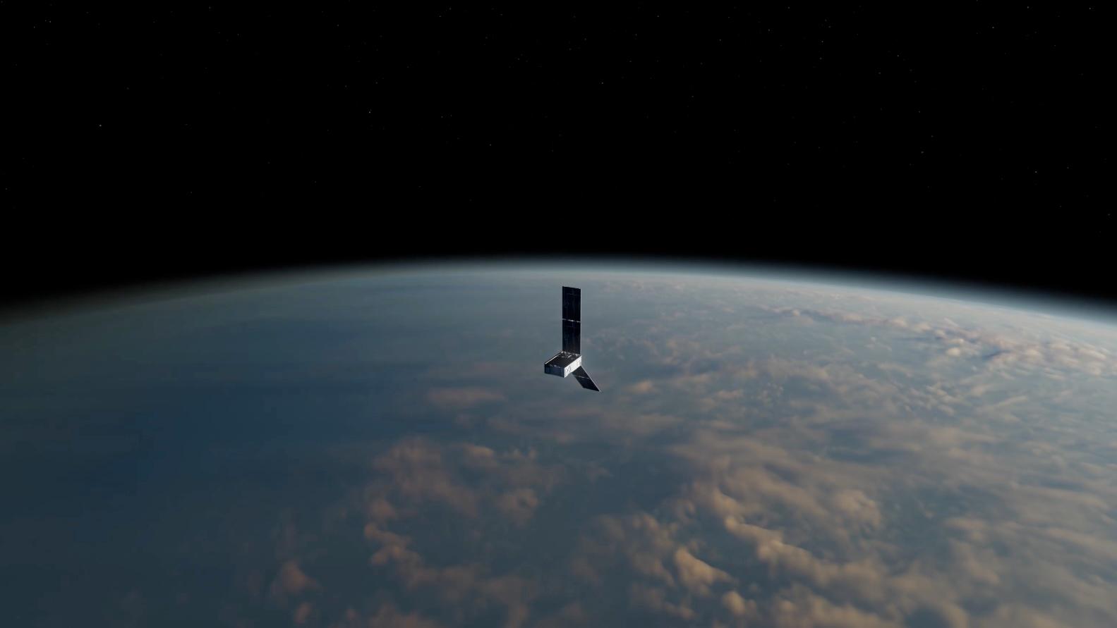
2024-02-20 |
|
NISAR
|
|
3840x2160x3 |
|
-
PIA26285:
-
NISAR Satellite in Earth Orbit (Artist's Concept)
Full Resolution:
TIFF
(24.89 MB)
JPEG
(1.18 MB)
|
|
|
2024-02-15 |
Earth
|
Terra
|
ASTER
|
2016x1184x3 |
|
-
PIA26283:
-
Grindavik, Iceland Eruption
Full Resolution:
TIFF
(3.026 MB)
JPEG
(243.4 kB)
|
|
|
2024-01-29 |
Earth
|
Terra
|
ASTER
|
2700x3500x3 |

|
-
PIA26282:
-
Rupganj, Bangladesh
Full Resolution:
TIFF
(28.36 MB)
JPEG
(2.267 MB)
|
|
|
2024-01-11 |
Earth
|
Terra
|
ASTER
|
1348x1320x3 |

|
-
PIA26281:
-
Rinjani Caldera, Indonesia
Full Resolution:
TIFF
(5.34 MB)
JPEG
(286.4 kB)
|
|
|
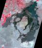
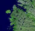
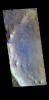
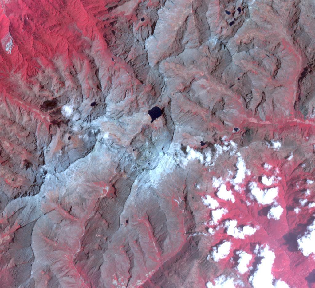
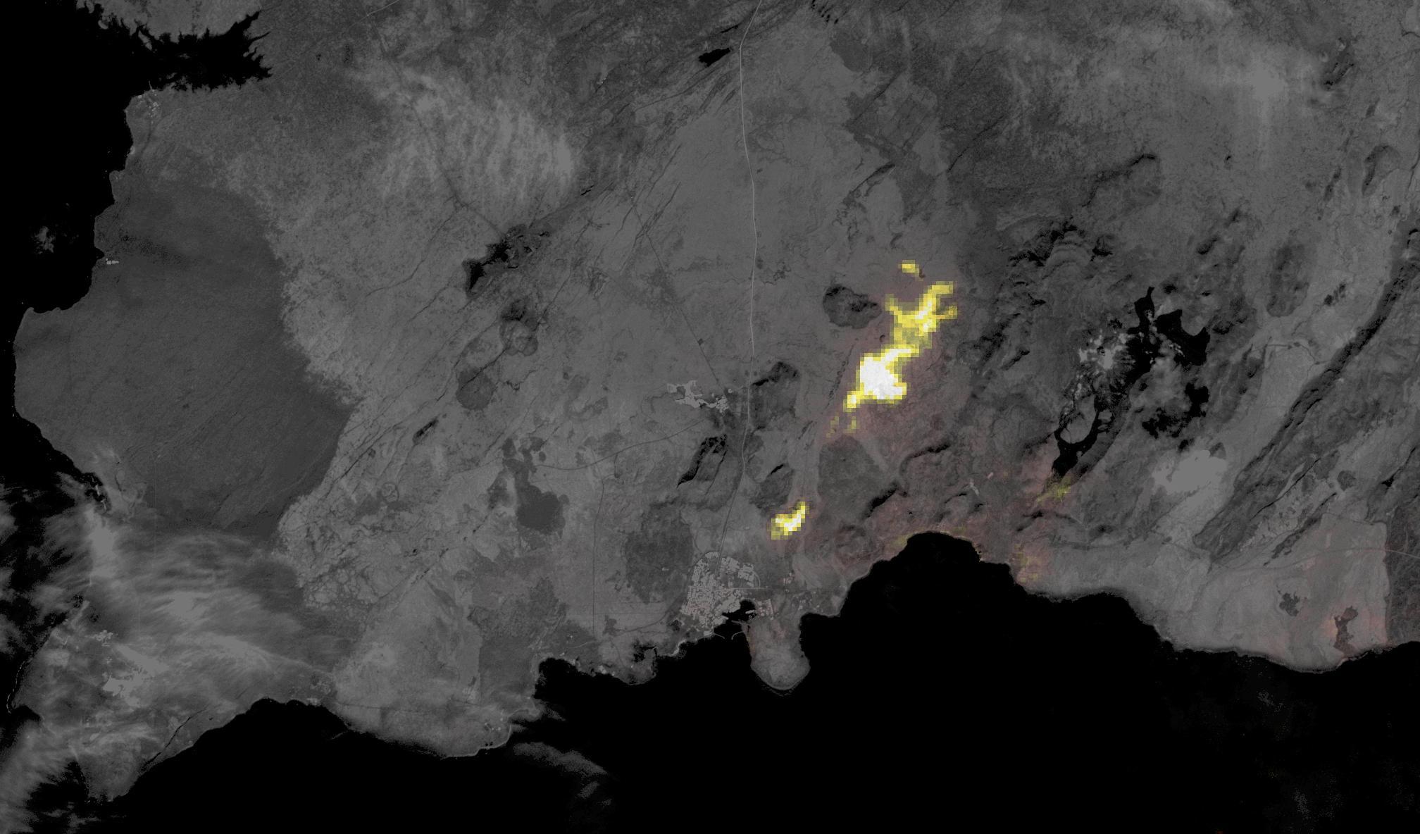
2023-12-14 |
Earth
|
Terra
|
ASTER
|
1600x1900x3 |

|
-
PIA26197:
-
Badwater, Death Valley
Full Resolution:
TIFF
(7.76 MB)
JPEG
(376.6 kB)
|
|
|
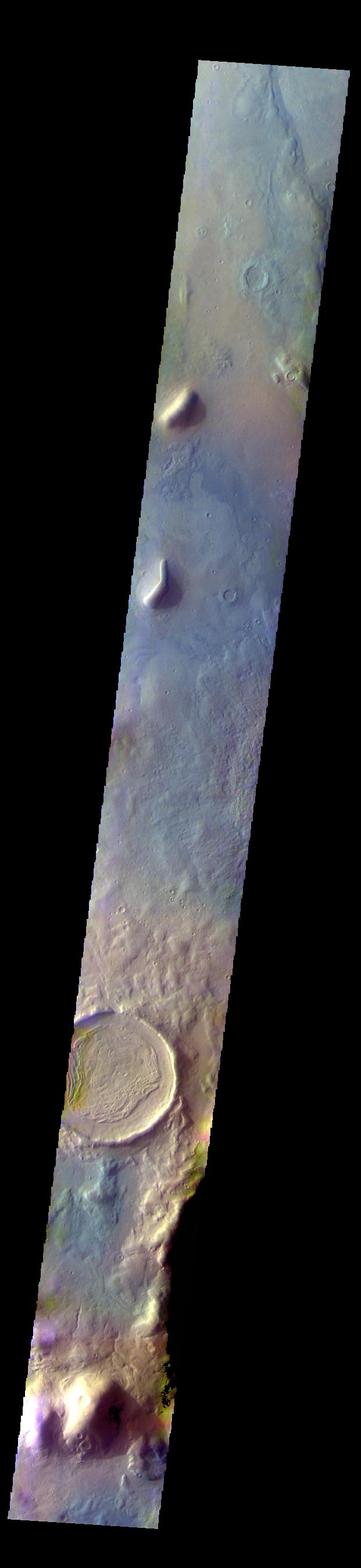
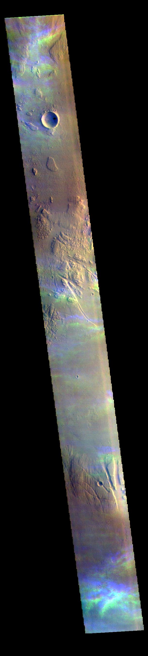
2023-11-28 |
Mars
|
2001 Mars Odyssey
|
THEMIS
|
5000x1280x3 |
|
-
PIA26203:
Odyssey's THEMIS Views the Horizon of Mars
Full Resolution:
TIFF
(11.37 MB)
JPEG
(565.8 kB)
|
|
|
2023-11-10 |
Mars
|
Mars Helicopter
|
|
4208x3120x3 |
|
-
PIA26050:
-
Ingenuity's View of Sand Going Into Conjunction
Full Resolution:
TIFF
(39.41 MB)
JPEG
(2.59 MB)
|
|
|
2023-11-06 |
Mars
|
Mars Science Laboratory (MSL)
|
Navcam (MSL)
|
7665x2111x1 |
|
-
PIA26047:
Curiosity's Navcams View the Area Around 'Sequoia'
Full Resolution:
TIFF
(12.18 MB)
JPEG
(1.953 MB)
|
|
|
2023-11-03 |
Earth
|
Terra
|
ASTER
|
3000x1800x3 |
|
-
PIA26196:
-
Amazon Drought
Full Resolution:
TIFF
(16.21 MB)
JPEG
(799.4 kB)
|
|
|
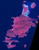
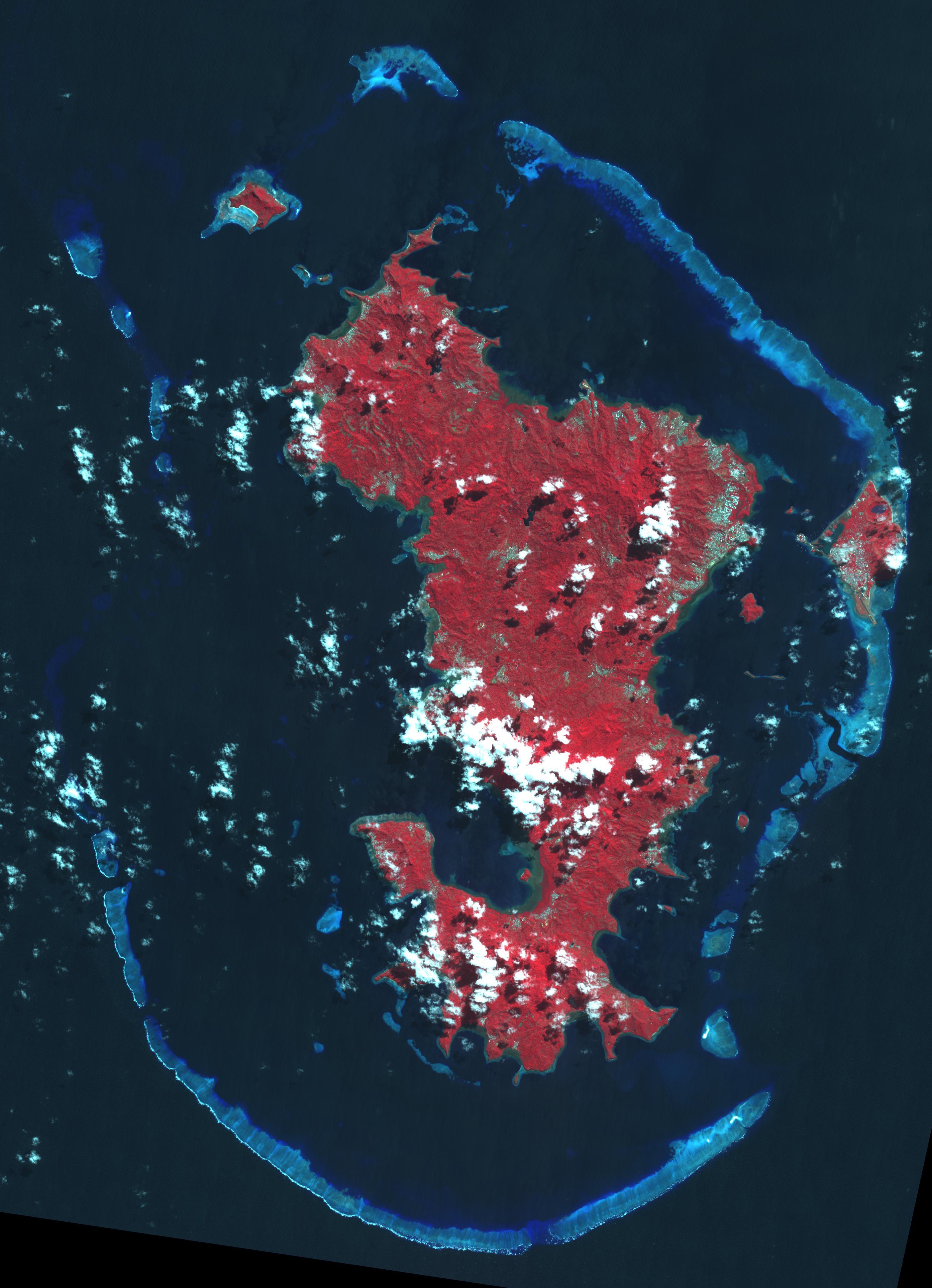
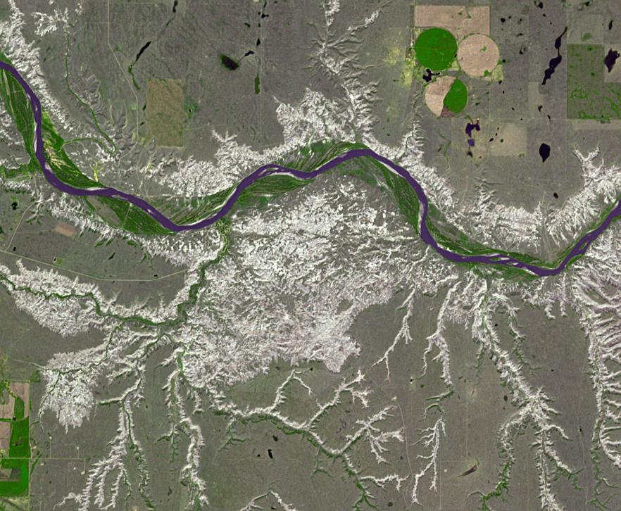
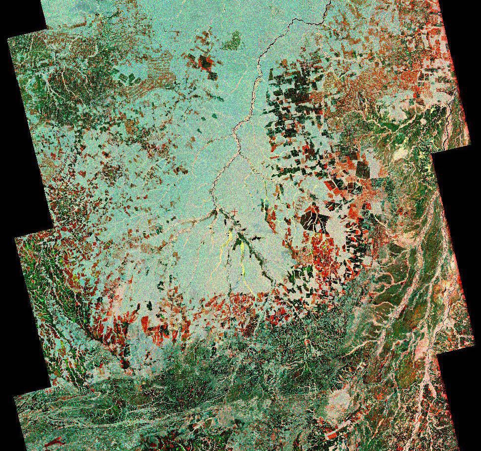
2023-10-27 |
Earth
|
NISAR
|
|
973x913x3 |
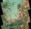
|
-
PIA26111:
-
Composite of Brazil's 'Arc of Deforestation' Shows Imagery NISAR Will Produce
Full Resolution:
TIFF
(2.666 MB)
JPEG
(396.6 kB)
|
|
|
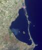
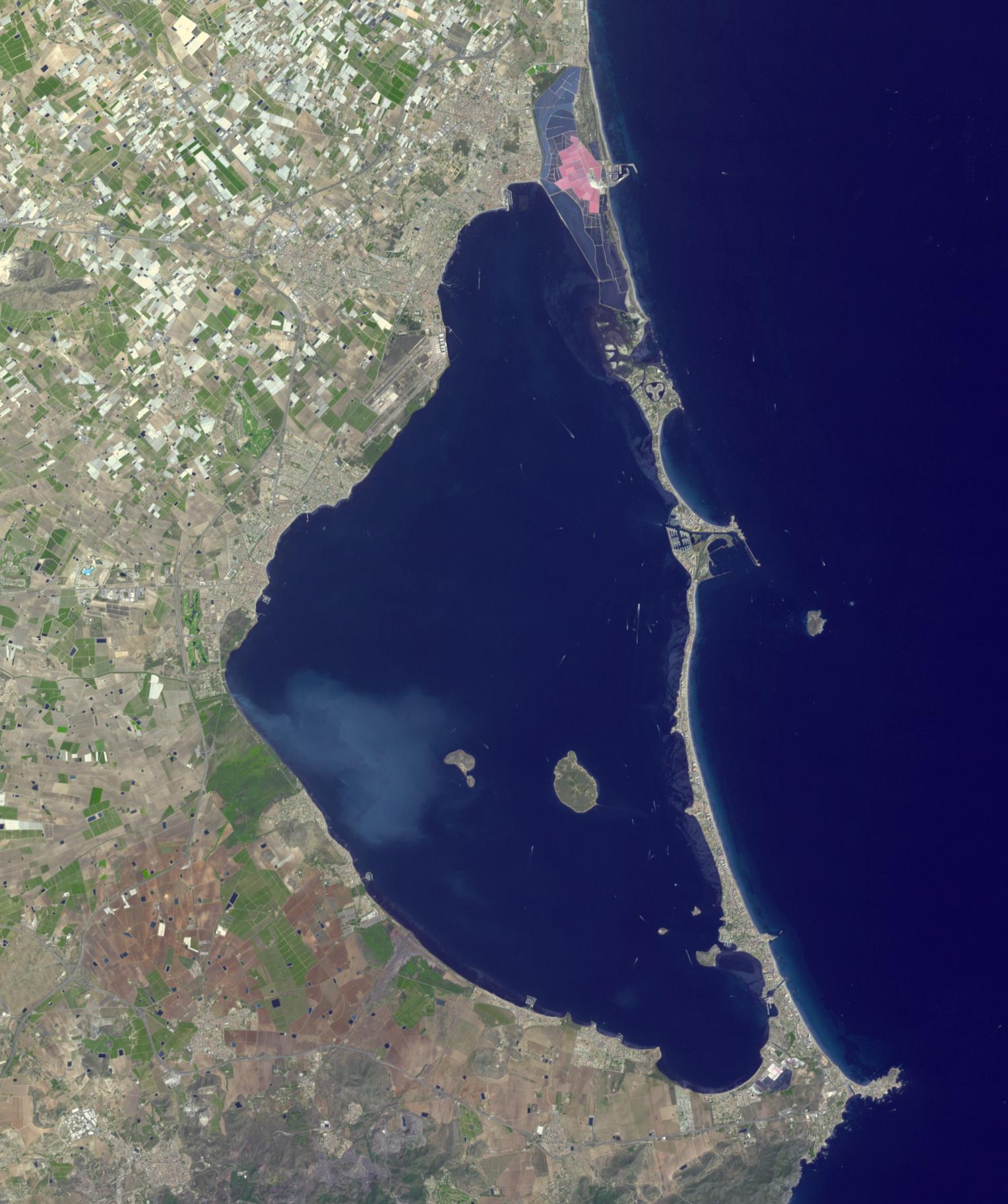
2023-10-18 |
Earth
|
Sentinel-6/Jason-CS
|
|
1586x783x3 |
|
-
PIA26099:
-
Comparing Sea Level During El Niño Events
Full Resolution:
TIFF
(303.4 kB)
JPEG
(200.3 kB)
|
|
|
2023-10-18 |
Earth
|
Terra
|
ASTER
|
1528x1825x3 |
|
-
PIA26009:
-
Mar Menor, Spain
Full Resolution:
TIFF
(6.95 MB)
JPEG
(304.1 kB)
|
|
|
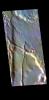
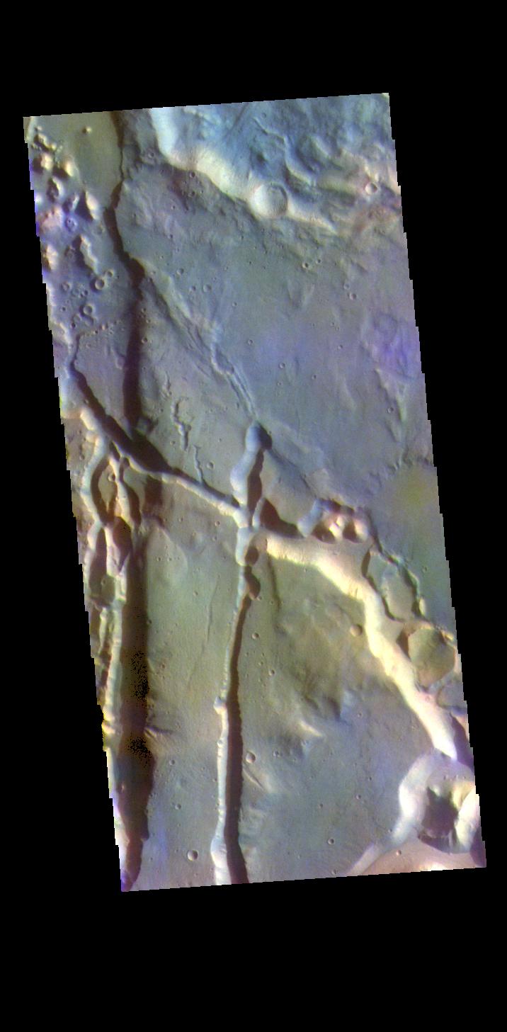
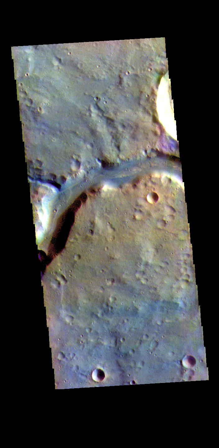
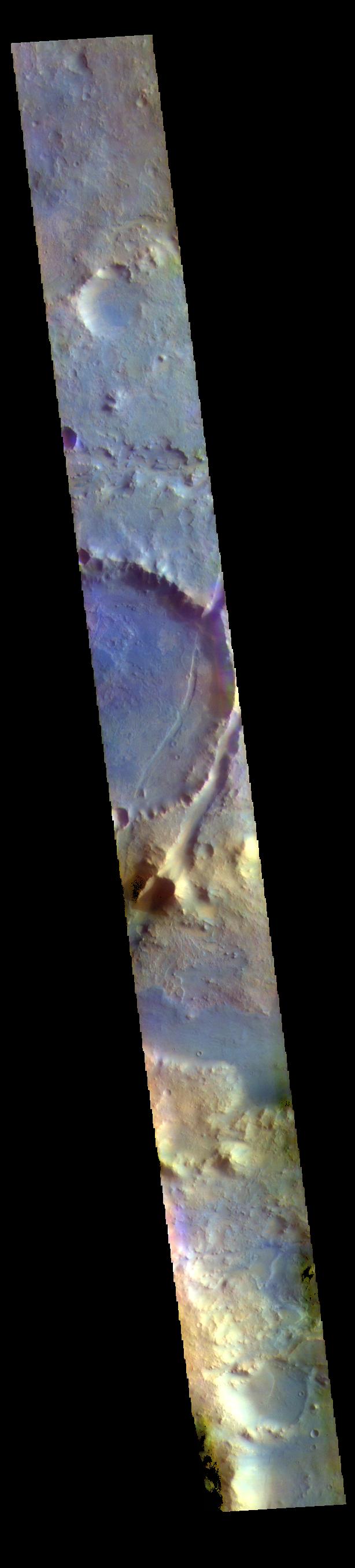
2023-10-13 |
Mars
|
2001 Mars Odyssey
|
THEMIS
|
698x1433x1 |
|
-
PIA26160:
-
Dark Slope Streaks
Full Resolution:
TIFF
(661.9 kB)
JPEG
(54.27 kB)
|
|
|
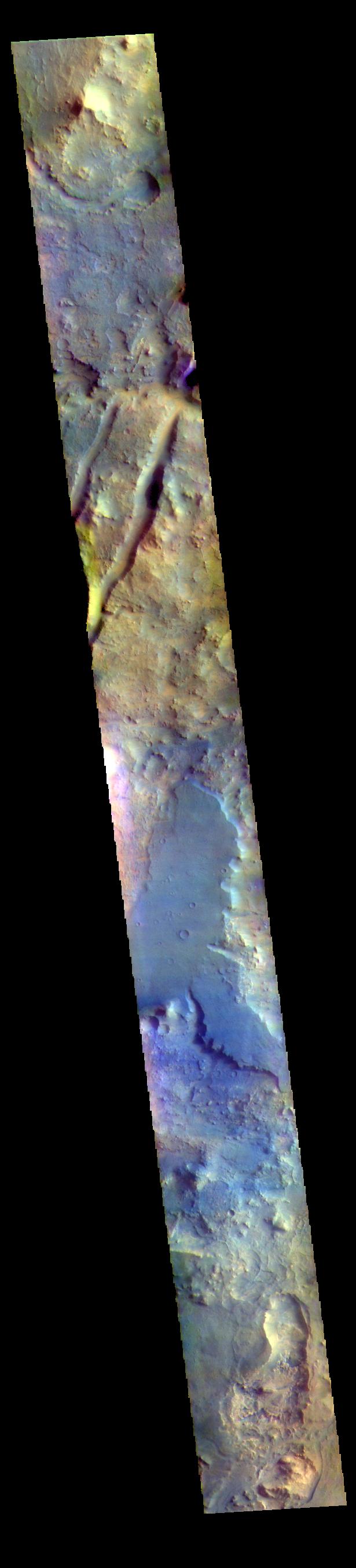
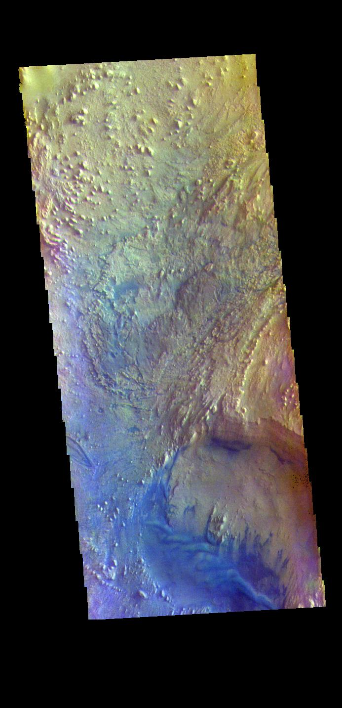
2023-10-03 |
Mars
|
2001 Mars Odyssey
|
THEMIS
|
716x1457x3 |
|
-
PIA26152:
-
Cydonia Mensae - False Color
Full Resolution:
TIFF
(2.049 MB)
JPEG
(87.58 kB)
|
|
|
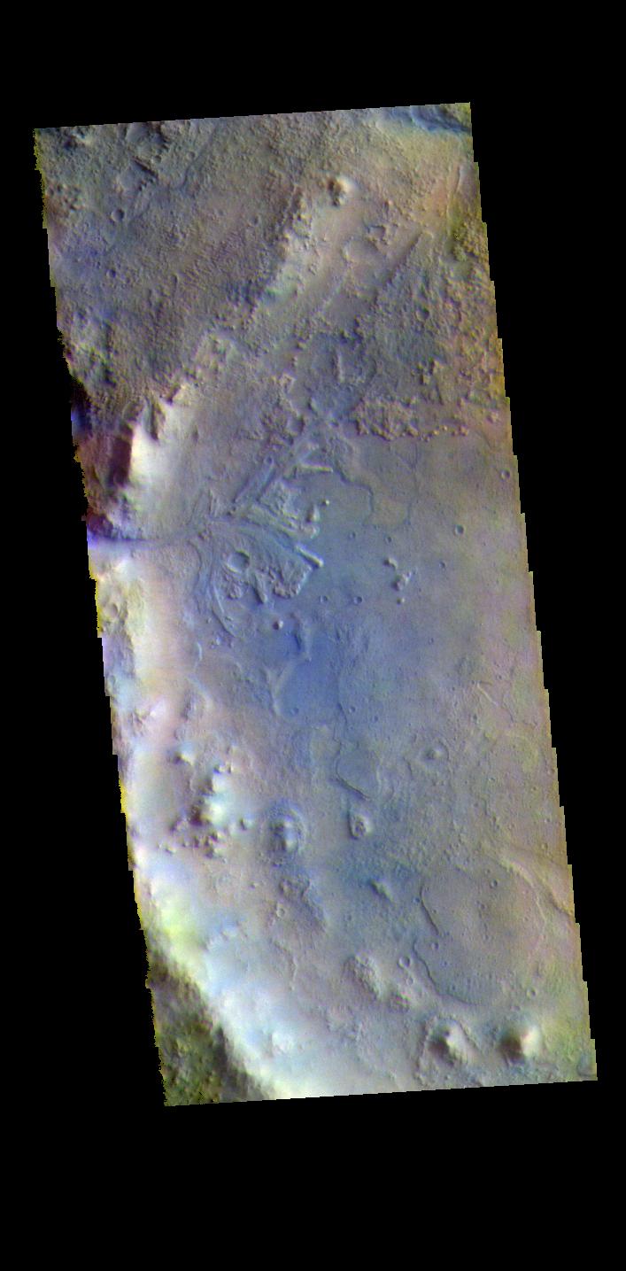
2023-10-02 |
Mars
|
2001 Mars Odyssey
|
THEMIS
|
615x2709x3 |
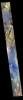
|
-
PIA26151:
-
Nili Fossae - False Color
Full Resolution:
TIFF
(2.347 MB)
JPEG
(127.5 kB)
|
|
|
2023-09-29 |
Mars
|
2001 Mars Odyssey
|
THEMIS
|
707x1435x3 |
|
-
PIA26140:
-
Jezero Crater - False Color
Full Resolution:
TIFF
(1.996 MB)
JPEG
(95.29 kB)
|
|
|
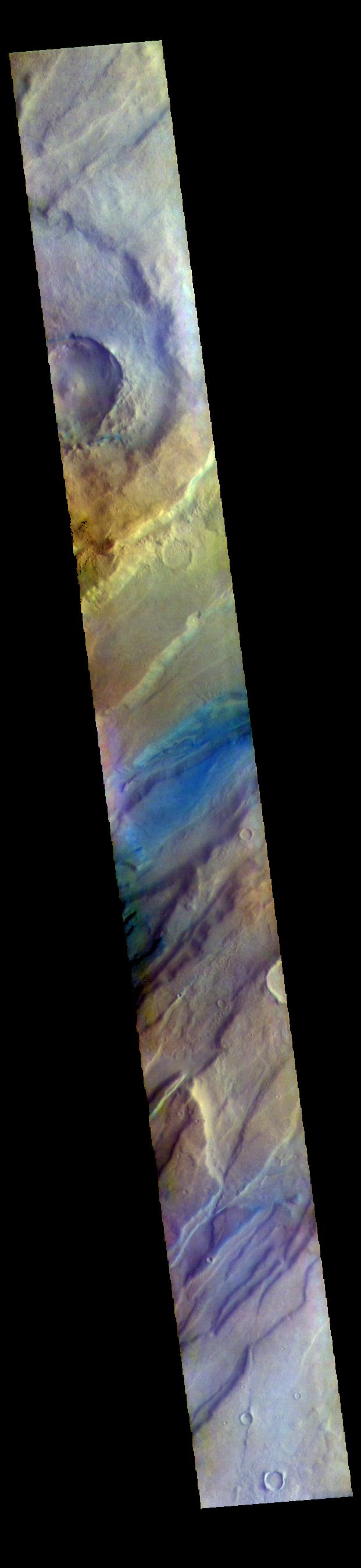
2023-09-28 |
Mars
|
2001 Mars Odyssey
|
THEMIS
|
607x2709x3 |
|
-
PIA26139:
-
Gale Crater - False Color
Full Resolution:
TIFF
(2.036 MB)
JPEG
(86.32 kB)
|
|
|
2023-09-27 |
Mars
|
2001 Mars Odyssey
|
THEMIS
|
706x1437x3 |
|
-
PIA26138:
-
Terra Sabaea - False Color
Full Resolution:
TIFF
(2.066 MB)
JPEG
(111.5 kB)
|
|
|
2023-09-26 |
Mars
|
2001 Mars Odyssey
|
THEMIS
|
613x2703x3 |
|
-
PIA26137:
-
Lunae Planum - False Color
Full Resolution:
TIFF
(2.292 MB)
JPEG
(126.9 kB)
|
|
|
2023-09-25 |
Mars
|
2001 Mars Odyssey
|
THEMIS
|
701x1437x3 |
|
-
PIA26136:
-
Nili Fossae - False Color
Full Resolution:
TIFF
(2.014 MB)
JPEG
(91.99 kB)
|
|
|
2023-09-22 |
Mars
|
2001 Mars Odyssey
|
THEMIS
|
704x1439x3 |
|
-
PIA26135:
-
Bahram Vallis - False Color
Full Resolution:
TIFF
(1.952 MB)
JPEG
(99.74 kB)
|
|
|
2023-09-21 |
Mars
|
2001 Mars Odyssey
|
THEMIS
|
693x1432x3 |
|
-
PIA26134:
-
Firsoff Crater - False Color
Full Resolution:
TIFF
(2.048 MB)
JPEG
(117.8 kB)
|
|
|
2023-09-20 |
Mars
|
2001 Mars Odyssey
|
THEMIS
|
621x2696x3 |
|
-
PIA26133:
-
Terra Sabaea - False Color
Full Resolution:
TIFF
(2.274 MB)
JPEG
(105.8 kB)
|
|
|
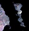
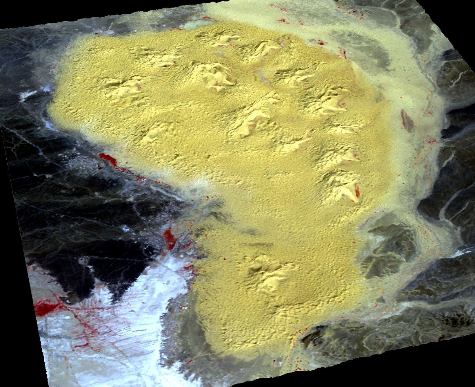
2023-09-19 |
|
VERITAS
|
|
3000x1688x3 |
|
-
PIA25839:
-
VERITAS Scientists Study Rocky Terrain in Iceland
Full Resolution:
TIFF
(15.2 MB)
JPEG
(1.609 MB)
|
|
|
2023-09-19 |
|
VERITAS
|
|
3000x1688x3 |
|
-
PIA25838:
-
VERITAS Mission Uses Iceland as Venus Stand-in
Full Resolution:
TIFF
(15.2 MB)
JPEG
(1.336 MB)
|
|
|
2023-09-19 |
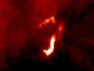
Mars
|
2001 Mars Odyssey
|
THEMIS
|
614x2706x3 |
|
-
PIA26132:
-
Nili Fossae - False Color
Full Resolution:
TIFF
(2.254 MB)
JPEG
(109.5 kB)
|
|
|
2023-09-18 |
Mars
|
Mars Science Laboratory (MSL)
|
|
1280x720x3 |
|
-
PIA26042:
-
Curiosity's Path to Gediz Vallis Ridge and Beyond
Full Resolution:
TIFF
(2.571 MB)
JPEG
(183.2 kB)
|
|
|
2023-09-18 |
Mars
|
2001 Mars Odyssey
|
THEMIS
|
701x1437x3 |
|
-
PIA26131:
-
Terra Sabaea - False Color
Full Resolution:
TIFF
(2.061 MB)
JPEG
(119.1 kB)
|
|
|
2023-09-15 |
Mars
|
2001 Mars Odyssey
|
THEMIS
|
602x2705x3 |
|
-
PIA26130:
-
Pavonis Mons Summit - False Color
Full Resolution:
TIFF
(2.117 MB)
JPEG
(109.3 kB)
|
|
|
2023-09-14 |
Mars
|
2001 Mars Odyssey
|
THEMIS
|
600x2707x3 |
|
-
PIA26129:
-
Arsia Mons Flank - False Color
Full Resolution:
TIFF
(2.182 MB)
JPEG
(131.2 kB)
|
|
|
2023-09-13 |
Mars
|
2001 Mars Odyssey
|
THEMIS
|
611x2705x3 |
|
-
PIA26128:
-
Oyama Crater - False Color
Full Resolution:
TIFF
(2.366 MB)
JPEG
(125.3 kB)
|
|
|
2023-09-12 |
Mars
|
2001 Mars Odyssey
|
THEMIS
|
613x2701x3 |
|
-
PIA26127:
-
Terra Sabae - False Color
Full Resolution:
TIFF
(2.361 MB)
JPEG
(129.2 kB)
|
|
|
2023-09-11 |
Earth
|
Terra
|
ASTER
|
3257x2677x3 |
|
-
PIA26008:
-
Channeled Scablands, Washington
Full Resolution:
TIFF
(26.17 MB)
JPEG
(1.811 MB)
|
|
|
2023-09-11 |
Mars
|
2001 Mars Odyssey
|
THEMIS
|
612x2701x3 |

|
-
PIA26126:
-
Ice Clouds - False Color
Full Resolution:
TIFF
(2.301 MB)
JPEG
(120.5 kB)
|
|
|
2023-09-08 |
Mars
|
2001 Mars Odyssey
|
THEMIS
|
621x2697x3 |
|
-
PIA26125:
-
Tempe Fossae - False Color
Full Resolution:
TIFF
(2.44 MB)
JPEG
(115.1 kB)
|
 Planetary Data System


