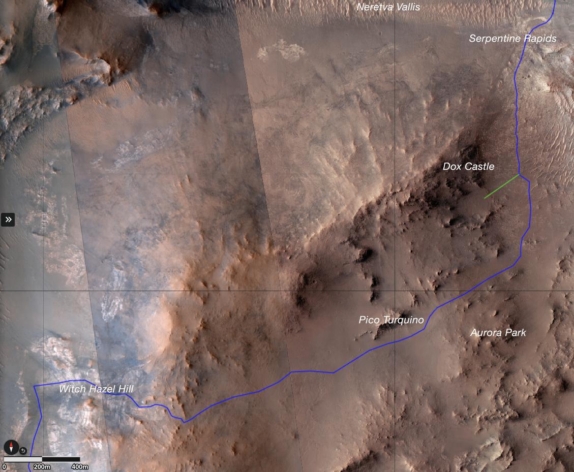
The route (shown in blue) that the agency's Perseverance Mars rover is expected to take as it climbs up the western rim of Jezero Crater is superimposed on this image taken by the HiRISE camera aboard NASA's Mars Reconnaissance Orbiter.
At upper right is "Serpentine Rapids," the final geologic location of interest for the Perseverance science team before the rover begins its ascent. "Dox Castle" is a region the science team would like to explore during the rover's ascent. Two of the first regions the science team wants study at the top of the crater are "Pico Turquino" and "Witch Hazel Hill."
Imagery from NASA's Mars orbiters indicates that Pico Turquino contains ancient fractures that may have been caused by hydrothermal activity in the distant past. Orbital views of Witch Hazel show layered materials that likely date from a time when Mars had a very different climate than today. Those views have revealed light-toned bedrock similar to what was found at "Bright Angel," the area where Perseverance recently discovered and sampled the "Cheyava Falls" rock, which exhibits chemical signatures and structures that could possibly have been formed by life billions of years ago when the area contained running water.
The distance the rover will drive to get from Serpentine Rapids to the Aurora Park/Pico Turquino area is about 1.1 miles (1.8 kilometers); the change in elevation between the two locations is about 980 feet (300 meters). The distance covered to go from Aurora Park/Pico Turquino to Witch Hazel Hill is about 1.2 miles (2,000 meters) and the change in elevation is about 820 feet (250 meters).
The University of Arizona, in Tucson, operates HiRISE, which was built by BAE Systems, in Boulder, Colorado. JPL manages the Mars Reconnaissance Orbiter Project for NASA's Science Mission Directorate, Washington.
A key objective for Perseverance's mission on Mars is astrobiology, including the search for signs of ancient microbial life. The rover will characterize the planet's geology and past climate, pave the way for human exploration of the Red Planet, and be the first mission to collect and cache Martian rock and regolith (broken rock and dust).
For more about Perseverance: https://science.nasa.gov/mission/mars-2020-perseverance/
 Planetary Data System


