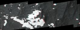
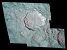
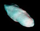
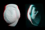
Your search criteria found 560 images
Feature Name
Go to PIAxxxxx:
Refine this list of images by:
Target:
Mission:
Spacecraft:
Instrument:
Click on an image for detailed information
Click on a column heading to sort in ascending or descending order
My
List
Addition Date Target MissionSort Descending Instrument Size
Add Image to Favorite List 2003-10-28 Mars 2001 Mars Odyssey
6000x5000x3
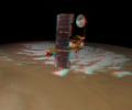
NASA's Mars Odyssey spacecraft passes above Mars' south pole in this artist's concept illustration. 3D glasses are necessary to view this image.
PIA04817:
Odyssey over Mars' South Pole in 3-D (Artist Concept)
Full Resolution:     TIFF (45.22 MB)     JPEG (1.589 MB)
Add Image to Favorite List 2003-10-28 Mars 2001 Mars Odyssey
4000x4000x3
NASA's Mars Odyssey spacecraft passes above a portion of the planet that is rotating into the sunlight in this artist's concept illustration. 3D glasses are necessary to view this image.
PIA04819:
Odyssey over Martian Sunrise, 3-D (Artist Concept)
Full Resolution:     TIFF (7.902 MB)     JPEG (398 kB)
Add Image to Favorite List 2005-05-19 2001 Mars Odyssey
Mars Global Surveyor (MGS)
Mars Orbiter Camera (MOC)
350x350x3
This stereoscopic picture of NASA's Mars Odyssey spacecraft was created from two views of that spacecraft taken by the Mars Orbiter Camera on NASA's Mars Global Surveyor. 3D glasses are necessary to view this image.
PIA07943:
Mars Odyssey Seen by Mars Global Surveyor (3-D)
Full Resolution:     TIFF (368.1 kB)     JPEG (8.865 kB)
Add Image to Favorite List 2004-09-02 Phoebe Cassini-Huygens
ISS - Narrow Angle
804x974x3
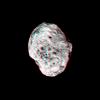
Phoebe's violent, cratered past is evident in this 3D image of the tiny moon captured by NASA's Cassini spacecraft. 3D glasses are necessary to view this image.
PIA06426:
Phoebe in 3-D
Full Resolution:     TIFF (2.146 MB)     JPEG (84.25 kB)
Add Image to Favorite List 2005-01-07 Iapetus Cassini-Huygens
ISS - Narrow Angle
749x748x3
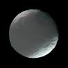
This stereo view of Iapetus was created by combining two NASA Cassini images, which were taken one day apart. The view serves mainly to show the spherical shape of Iapetus and some of the moon's topography. 3D glasses are necessary to view this image.
PIA06169:
Iapetus in 3-D
Full Resolution:     TIFF (630.1 kB)     JPEG (31.69 kB)
Add Image to Favorite List 2005-02-18 Enceladus Cassini-Huygens
ISS - Narrow Angle
774x1020x3
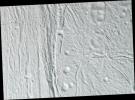
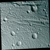
NASA's Cassini spacecraft took images of the ropy, taffy-like topography of Saturn's moon Enceladus from many different angles as the spacecraft flew by on Feb. 17, 2005. 3D glasses are necessary to view this image.
PIA06189:
Cassini Views Enceladus in Stereo
Full Resolution:     TIFF (2.217 MB)     JPEG (184 kB)
Add Image to Favorite List 2005-03-24 Enceladus Cassini-Huygens
ISS - Narrow Angle
1357x1370x3
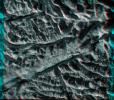
This high-resolution stereo anaglyph captured by NASA's Cassini spacecraft of Saturn's moon Enceladus shows a region of craters softened by time and torn apart by tectonic stresses. 3D glasses are necessary to view this image.
PIA06212:
Stressed-out Enceladus (3-D)
Full Resolution:     TIFF (2.728 MB)     JPEG (140.8 kB)
Add Image to Favorite List 2005-03-24 Enceladus Cassini-Huygens
ISS - Narrow Angle
1037x767x3
This stereo anaglyph from NASA's Cassini spacecraft is of Saturn's moon Enceladus. 3D glasses are necessary to view this image.
PIA06214:
Transition on Enceladus (3-D)
Full Resolution:     TIFF (1.83 MB)     JPEG (105.7 kB)
Add Image to Favorite List 2005-03-24 Enceladus Cassini-Huygens
ISS - Narrow Angle
1095x1087x3
During its very close flyby of Enceladus on March 9, 2005, NASA's Cassini spacecraft took images of parts of the icy moon. This scene is an icy landscape that has been scored by tectonic forces. 3D glasses are necessary to view this image.
PIA06216:
Sliced-up Craters (3-D)
Full Resolution:     TIFF (3 MB)     JPEG (173.8 kB)
Add Image to Favorite List 2010-02-23 Enceladus Cassini-Huygens
Imaging Science Subsystem
1145x1001x3
This anaglyph from images captured by NASA's Cassini spacecraft shows a dramatic, 3-D view of one of the deep fractures nicknamed 'tiger stripes' on Saturn's moon Enceladus which are located near the moon's south pole, spray jets of water ice.
PIA11687:
Baghdad Sulcus in 3-D
Full Resolution:     TIFF (3.443 MB)     JPEG (200.3 kB)
Add Image to Favorite List 2005-07-11 Hyperion Cassini-Huygens
ISS - Narrow Angle
1000x1000x3
Saturn's moon Hyperion pops into view in this stereo anaglyph created from NASA's Cassini images; differing views are helpful in interpreting the moon's irregular shape. 3D glasses are necessary to view this image.
PIA06244:
Pop-Up Moon
Full Resolution:     TIFF (3.004 MB)     JPEG (54.07 kB)
Add Image to Favorite List 2006-12-29 Dione Cassini-Huygens
ISS - Narrow Angle
1000x1000x3
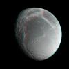
Saturn's moon Dione floats in the dark sky before NASA's Cassini spacecraft. Images taken from slightly different directions allow construction of stereo views, helpful in interpreting the complex topography of Saturn's moons. 3D glasses are necessary.
PIA08338:
Dione Anaglyph
Full Resolution:     TIFF (3.004 MB)     JPEG (101 kB)
Add Image to Favorite List 2006-12-29 Pandora Cassini-Huygens
ISS - Narrow Angle
334x384x3
Craters on Saturn's moon Pandora exhibit clarity and depth in this anaglyph from NASA's Cassini spacecraft. 3D glasses are necessary to view this image.
PIA08339:
Pandora Anaglyph
Full Resolution:     TIFF (385.4 kB)     JPEG (8.982 kB)
Add Image to Favorite List 2007-10-09 Iapetus Cassini-Huygens
ISS - Narrow Angle
4082x1546x3
This anaglyph, shows huge mountains on Saturn's moon Iapetus, imaged by NASA's Cassini spacecraft during its very close flyby in Sept. 2007. 3D glasses are necessary to view this image.
PIA08379:
Towering Peaks of Iapetus
Full Resolution:     TIFF (18.93 MB)     JPEG (346.2 kB)
Add Image to Favorite List 2007-10-15 Rhea Cassini-Huygens
ISS - Narrow Angle
3524x2680x3
The hummocky floor of a crater on Saturn's moon Rhea possesses a central peak and clusters of small craters as seen in this anaglyph from NASA's Cassini spacecraft.
PIA08402:
Rhea's Pop-up Crater
Full Resolution:     TIFF (28.33 MB)     JPEG (907.4 kB)
Add Image to Favorite List 2010-02-19 Prometheus Cassini-Huygens
ISS - Narrow Angle
470x364x3
Saturn's potato-shaped moon Prometheus is rendered in three dimensions in this close-up from NASA's Cassini spacecraft. You will need 3-D glasses to view this image.
PIA12548:
Prometheus Popping in 3-D
Full Resolution:     TIFF (514.1 kB)     JPEG (12.37 kB)
Add Image to Favorite List 2010-03-29 Mimas Cassini-Huygens
ISS - Narrow Angle
3891x4179x3
NASA's Cassini spacecraft captured a three-dimensional view of the large Herschel Crater on Saturn's moon Mimas during its closest-ever flyby of the moon. 3D glasses are needed to view this image.
PIA12573:
Herschel Crater in 3-D
Full Resolution:     TIFF (48.78 MB)     JPEG (1.081 MB)
Add Image to Favorite List 2010-12-21 Rhea Cassini-Huygens
ISS - Narrow Angle
2069x3757x3
Wispy fractures cut through cratered terrain on Saturn's moon Rhea in this high resolution, 3-D image from NASA's Cassini spacecraft. 3D glasses are necessary to identify surface detail.
PIA12807:
Rhea's Fractured Terrain in 3-D
Full Resolution:     TIFF (23.35 MB)     JPEG (810.1 kB)
Add Image to Favorite List 2017-03-16 Pan Cassini-Huygens
ISS - Narrow Angle
900x600x3
These stereo views, or anaglyphs, highlight the unusual, quirky shape of Saturn's moon Pan.This image is from NASA's Cassini spacecraft.
PIA21435:
Pan Anaglyph (3-D)
Full Resolution:     TIFF (909.9 kB)     JPEG (38.4 kB)
Add Image to Favorite List 2011-10-11 Vesta Dawn
Framing Camera
1260x1450x3
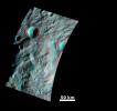
The broad morphology of asteroid Vesta's mountain/central complex is clear in this image from NASA's Dawn spacecraft; it is a roughly circular topographic mound, which is approximately 200km in diameter and has approximately 20km of relief from its base.
PIA14891:
Anaglyph Image of the Mountain-Central Complex in Vesta's South Polar Region
Full Resolution:     TIFF (5.487 MB)     JPEG (220.5 kB)
Add Image to Favorite List 2011-03-10 Vesta Dawn
800x800x3
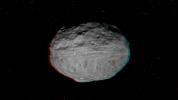
This anaglyph shows a 3-D model of the protoplanet Vesta, using scientists' best guess to date of what the surface of the protoplanet might look like. It was created as part of an exercise for NASA's Dawn mission. 3D glasses are necessary.
PIA13890:
Anaglyph of Vesta Model
Full Resolution:     TIFF (1.922 MB)     JPEG (26.14 kB)
Add Image to Favorite List 2011-07-18 Vesta Dawn
Framing Camera
550x537x3
This 3D image of the asteroid Vesta was taken on July 9, 2011 by the framing camera instrument aboard NASA's Dawn spacecraft. You need 3D glasses to view this image.
PIA14314:
Anaglyph Image of Vesta's South Polar Region
Full Resolution:     TIFF (887.4 kB)     JPEG (32.98 kB)
Add Image to Favorite List 2011-08-16 Vesta Dawn
Framing Camera
1186x1180x3
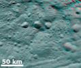
This 3D image of asteroid Vesta from NASA's Dawn spacecraft shows hills, troughs, ridges and steep craters. You need 3D glasses to view this image.
PIA14327:
3-D Image of Vesta's Equatorial Region
Full Resolution:     TIFF (4.203 MB)     JPEG (129.4 kB)
Add Image to Favorite List 2011-08-18 Vesta Dawn
Framing Camera
1128x1413x3
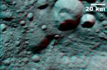
This 3D image shows the topography of Vesta's densely cratered terrain obtained by the framing camera instrument aboard NASA's Dawn spacecraft on August 6, 2011. You need 3D glasses to view this image.
PIA14674:
Topography of Densely Cratered Deformed Terrain
Full Resolution:     TIFF (4.787 MB)     JPEG (129.8 kB)
Add Image to Favorite List 2011-08-20 Vesta Dawn
Framing Camera
1222x1350x3
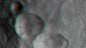
This 3D image shows the topography of Vesta's three craters, informally named the 'Snowman,' obtained by the framing camera instrument aboard NASA's Dawn spacecraft on August 6, 2011. You need 3D glasses to view this image.
PIA14676:
Anaglyph of the 'Snowman' Crater
Full Resolution:     TIFF (4.955 MB)     JPEG (144.6 kB)
Add Image to Favorite List 2011-09-12 Vesta Dawn
Framing Camera
1260x1400x3
This 3D image shows the topography of craters and grooves of asteroid Vesta's south polar region obtained by the framing camera instrument aboard NASA's Dawn spacecraft on Aug. 23 and 28, 2011. You need 3D glasses to view this image.
PIA14699:
Anaglyph of Craters in the South Polar Region
Full Resolution:     TIFF (5.298 MB)     JPEG (124.5 kB)
Add Image to Favorite List 2011-09-16 Vesta Dawn
Framing Camera
2520x2900x3
When NASA's Dawn spacecraft sent the first images of the giant asteroid Vesta to the ground, scientists were fascinated by an enormous mound inside a big circular depression at the south pole. You need 3D glasses to view this image.
PIA14705:
Vesta's Surface in 3-D: A Big Mountain at the Asteroid's South Pole
Full Resolution:     TIFF (21.95 MB)     JPEG (663.1 kB)
Add Image to Favorite List 2011-09-16 Vesta Dawn
Framing Camera
2810x2968x3
In this image, obtained by NASA's Dawn spacecraft from above the surface of the giant asteroid Vesta, topography in the area surrounding the south pole area shows impact craters, ridges and grooves. You need 3D glasses to view this image.
PIA14706:
Vesta's Surface in 3-D: Details of Wave-Like Terrain in the South Pole
Full Resolution:     TIFF (25.02 MB)     JPEG (505.5 kB)
Add Image to Favorite List 2011-09-16 Vesta Dawn
Framing Camera
2372x2360x3
This image of the giant asteroid Vesta obtained by NASA's Dawn spacecraft shows numerous impact craters illustrate the asteroid's violent youth. You need 3D glasses to view this image.
PIA14707:
Vesta's Surface in 3-D: An Ancient, Cratered Surface
Full Resolution:     TIFF (16.81 MB)     JPEG (399.9 kB)
Add Image to Favorite List 2011-09-27 Vesta Dawn
Framing Camera
1072x1155x3
NASA's Dawn spacecraft obtained this 3-D image of asteroid Vesta with its framing camera on Aug. 23 and 28, 2011 at a distance of 1,700 miles (2,740 kilometers). You will need 3D glasses to view this image.
PIA14790:
3-D Image of Grooves and Wrinkles in the South Polar Region
Full Resolution:     TIFF (3.719 MB)     JPEG (111.4 kB)
Add Image to Favorite List 2011-10-03 Vesta Dawn
Framing Camera
1407x841x3
This anaglyph from NASA's Dawn spacecraft image shows the topography of asteroid Vesta's southeastern region. You need 3D glasses to view this image.
PIA14797:
Anaglyph Image of Vesta's Southeastern Latitudes
Full Resolution:     TIFF (3.557 MB)     JPEG (66.82 kB)
Add Image to Favorite List 2011-10-04 Vesta Dawn
Framing Camera
1808x1140x3
This anaglyph image shows the topography of part of Vesta's equatorial region. These craters are classed as ruin eroded craters and are most clear in the center of the image, above the troughs. You need 3D glasses to view this image.
PIA14798:
Anaglyph Image of Vesta's Equatorial Region (I)
Full Resolution:     TIFF (6.193 MB)     JPEG (151.1 kB)
Add Image to Favorite List 2011-10-05 Vesta Dawn
Framing Camera
1066x668x3
This anaglyph image shows the topography of part of Vesta's equatorial region; this uneven topography is mostly due to large, ancient, rather degraded ruin eroded craters. You need 3D glasses to view this image.
PIA14825:
Anaglyph Image of Vesta's Equatorial Region (II)
Full Resolution:     TIFF (2.139 MB)     JPEG (64.7 kB)
Add Image to Favorite List 2011-10-06 Vesta Dawn
Framing Camera
2000x1500x3
This anaglyph image shows the topography of asteroid Vesta's southwestern region. The large, heavily degraded subdued rimmed crater in the top right becomes clearer in this anaglyph image. You need 3D glasses to view this image.
PIA14826:
Anaglyph Image of Vesta's Southwestern Latitudes
Full Resolution:     TIFF (9.012 MB)     JPEG (148.7 kB)
Add Image to Favorite List 2011-10-07 Vesta Dawn
Framing Camera
1344x1380x3
This anaglyph image shows the topography of the mountain-central complex in asteroid Vesta's south polar region. You need 3D glasses to view this image.
PIA14827:
Anaglyph Image of the Mountain/Central Complex in the South Polar Region
Full Resolution:     TIFF (5.57 MB)     JPEG (182.1 kB)
Add Image to Favorite List 2011-10-10 Vesta Dawn
Framing Camera
1150x1373x3
This anaglyph image from NASA's Dawn spacecraft shows the topography of asteroid Vesta's south polar region. The material at the base of the scarp (right side) is probably due to landsliding.
PIA14868:
Anaglyph Image of a Large Scarp in Vesta's South Polar Region
Full Resolution:     TIFF (4.743 MB)     JPEG (120.9 kB)
Add Image to Favorite List 2011-10-31 Vesta Dawn
Framing Camera
1461x1378x3
This anaglyph image from NASA's Dawn spacecraft shows the topography of the mountain-central complex in asteroid Vesta's south polar region. You need 3D glasses to view this image.
PIA14978:
Impact Crater and Mountain-central Complex in Vesta's South Polar Region (Anaglyph)
Full Resolution:     TIFF (6.051 MB)     JPEG (122.9 kB)
Add Image to Favorite List 2012-01-23 Vesta Dawn
Framing Camera
1920x1080x3
This anaglyph shows the topography of Vesta's eastern hemisphere; equatorial troughs are visible around asteroid Vesta's equator and north of these troughs there are a number of highly degraded, old, large craters. You need 3-D glasses to view this image.
PIA15320:
3-D Image of Vesta's Eastern Hemisphere
Full Resolution:     TIFF (6.23 MB)     JPEG (112.4 kB)
Add Image to Favorite List 2012-01-24 Vesta Dawn
Framing Camera
1920x1080x3
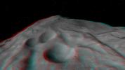
This anaglyph shows the topography of Vesta's 'Snowman' craters on asteroid Vesta. The bottom crater is named Marcia, the middle crater, Calpurnia, and the top crater, Minucia. You need 3-D glasses to view this image.
PIA15321:
3-D Image of Vesta's "Snowman" Craters
Full Resolution:     TIFF (6.23 MB)     JPEG (121.2 kB)
Add Image to Favorite List 2012-01-25 Vesta Dawn
Framing Camera
1920x1080x3
This anaglyph shows the central complex in asteroid Vesta's Rheasilvia impact basin. The central complex about two and a half times taller than Mt. Everest. You need 3-D glasses to view this image.
PIA15322:
3-D Image of the Central Complex in Vesta's Rheasilvia Impact Basin
Full Resolution:     TIFF (6.23 MB)     JPEG (101.3 kB)
Add Image to Favorite List 2012-03-05 Vesta Dawn
Framing Camera
634x419x3
This anaglpyh from NASA's Dawn spacecraft shows Caparronia crater on asteroid Vesta. The 3-D effect of the anaglyph highlights the large ridge running across the base of Caparronia crater. You will need 3-D glasses to view this image.
PIA15407:
3-D Image of Caparronia
Full Resolution:     TIFF (798 kB)     JPEG (53.83 kB)
Add Image to Favorite List 2012-03-06 Vesta Dawn
Framing Camera
388x325x3
This anaglyph from NASA's Dawn spacecraft shows degraded craters in asteroid Vesta's northern hemisphere. You need 3D glasses to view this image.
PIA15451:
3-D Image of Degraded Craters
Full Resolution:     TIFF (378.9 kB)     JPEG (23.37 kB)
Add Image to Favorite List 2012-03-07 Vesta Dawn
Framing Camera
550x570x3
This anaglyph from NASA's Dawn spacecraft shows degraded craters shows partially degraded craters and ridges in asteroid Vesta's Pinaria quadrangle. You need 3D glasses to view this image.
PIA15452:
3-D Image of Partially Degraded Craters
Full Resolution:     TIFF (941.9 kB)     JPEG (43.64 kB)
Add Image to Favorite List 2012-03-08 Vesta Dawn
Framing Camera
552x576x3
This anaglyph from NASA's Dawn spacecraft shows three fresh craters on asteroid Vesta, which have been nicknamed the 'Snowman' craters. You need 3D glasses to view this image.
PIA15453:
3-D Image of Fresh Craters
Full Resolution:     TIFF (955.2 kB)     JPEG (49.22 kB)
Add Image to Favorite List 2012-05-10 Vesta Dawn
Framing Camera
1280x720x3
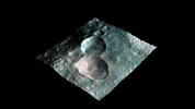
This image from NASA's Dawn mission shows a 3-D rendering of the craters that make up the 'snowman' feature on the giant asteroid Vesta. From left to right, the craters are named Marcia, Calpurnia, and Minucia.
PIA15662:
Views of the Snowman Animation Icon
Full Resolution:     TIFF (2.768 MB)     JPEG (56.52 kB)
Add Image to Favorite List 2015-04-29 Ceres Dawn
Framing Camera
866x616x1
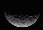
This image of Ceres is part of a sequence taken by NASA's Dawn spacecraft April 24 to 26, 2015, from a distance of 8,500 miles (13,500 kilometers).
PIA19319:
Dawn RC3 Image 1
Full Resolution:     TIFF (534.2 kB)     JPEG (35.34 kB)
Add Image to Favorite List 2015-04-29 Ceres Dawn
Framing Camera
1024x1024x3
This anaglyph of Ceres is part of a sequence of images taken by NASA's Dawn spacecraft April 24 to 26, 2015, from a distance of 8,500 miles (13,500 kilometers). 3-D glasses are needed to view this image.
PIA19320:
Dawn RC3 Image 1 Anaglyph
Full Resolution:     TIFF (3.147 MB)     JPEG (44.53 kB)
Add Image to Favorite List 2015-05-05 Ceres Dawn
Framing Camera
1024x1024x3
This image of Ceres is part of a sequence taken by NASA's Dawn spacecraft April 24 to 26, 2015, from a distance of 8,500 miles (13,500 kilometers). You need 3-D glasses to view this image.
PIA19537:
Dawn RC3 Image 5 Anaglyph
Full Resolution:     TIFF (3.147 MB)     JPEG (44.16 kB)
Add Image to Favorite List 2015-05-06 Ceres Dawn
Framing Camera
1024x1024x3
This anaglyph of Ceres is part of a sequence taken by NASA's Dawn spacecraft April 24 to 26, 2015, from a distance of 8,500 miles (13,500 kilometers).
PIA19539:
Dawn RC3 Image 6 Anaglyph
Full Resolution:     TIFF (3.147 MB)     JPEG (42.74 kB)
Add Image to Favorite List 2015-05-07 Ceres Dawn
Framing Camera
1024x1024x3
This anaglyph of Ceres is part of a sequence of images taken by NASA's Dawn spacecraft April 24 to 26, 2015, from a distance of 8,500 miles (13,500 kilometers).
PIA19541:
Dawn RC3 Image 7 Anaglyph
Full Resolution:     TIFF (3.147 MB)     JPEG (42.07 kB)
Add Image to Favorite List 2015-12-22 Ceres Dawn
Framing Camera
1024x1024x1
These views of Ceres, taken by NASA's Dawn spacecraft on December 10, 2015, shows an area in the southern mid-latitudes of the dwarf planet. They are located around a crater chain called Gerber Catena.
PIA20186:
Dawn LAMO View Around Gerber Catena, Ceres
Full Resolution:     TIFF (848.8 kB)     JPEG (136.4 kB)
Add Image to Favorite List 2015-12-22 Ceres Dawn
Framing Camera
1024x1024x1
These views of Ceres, taken by NASA's Dawn spacecraft on December 10, show an area in the southern part of the southern hemisphere of the dwarf planet.
PIA20187:
Dawn's LAMO View of Ceres
Full Resolution:     TIFF (728 kB)     JPEG (131.8 kB)
Add Image to Favorite List 2016-03-07 Ceres Dawn
Framing Camera
3840x2160x1
This side-perspective view of Ceres' mysterious mountain Ahuna Mons was made with images from NASA's Dawn spacecraft. Dawn took these images in December 2015.
PIA20349:
Ahuna Mons Perspective View
Full Resolution:     TIFF (2.548 MB)     JPEG (482.1 kB)
Add Image to Favorite List 2017-03-09 Ceres Dawn
Framing Camera
1019x816x3
This 3-D image, or anaglyph, shows the center of Occator Crater, the brightest area on dwarf planet Ceres, using data from NASA's Dawn mission. The bright central area, including a dome that is 0.25 miles (400 meters) high, is called Cerealia Facula.
PIA21398:
Occator's Bright Spots in 3-D
Full Resolution:     TIFF (1.468 MB)     JPEG (66.08 kB)
Add Image to Favorite List 2018-11-15 Ceres Dawn
Framing Camera
1261x1391x3
This stereo view, called an anaglyph, of Occator Crater's 'Mesa' on Ceres was obtained by NASA's Dawn spacecraft from an altitude of about 21 miles (34 kilometers).
PIA22862:
Occator's "Mesa" in 3-D
Full Resolution:     TIFF (1.947 MB)     JPEG (108.9 kB)
Add Image to Favorite List 2018-11-15 Ceres Dawn
Framing Camera
1308x1493x3
This stereo view, called an anaglyph, of cracks in the floor of Occator Crater on Ceres was obtained by NASA's Dawn spacecraft from an altitude of about 22 miles (35 kilometers).
PIA22864:
Cracks in the Floor of Occator Crater (3-D)
Full Resolution:     TIFF (2.522 MB)     JPEG (152.7 kB)
Add Image to Favorite List 2018-11-15 Ceres Dawn
Framing Camera
1384x1541x3
This stereo view, called an anaglyph, of Occator Crater's floor on Ceres was obtained by NASA's Dawn spacecraft from an altitude of about 21 miles (34 kilometers).
PIA22863:
Bright and Dark Pattern on Occator Crater's Floor (3-D)
Full Resolution:     TIFF (2.027 MB)     JPEG (114.1 kB)
Add Image to Favorite List 2018-11-15 Ceres Dawn
Framing Camera
2644x2317x3
This stereo view, called an anaglyph, of lava flows on the floor of Occator Crater on Ceres was obtained by NASA's Dawn spacecraft from an altitude of about 38 miles (61 kilometers).
PIA22865:
Lava Flows on the Floor of Occator Crater (3-D)
Full Resolution:     TIFF (6.905 MB)     JPEG (392.7 kB)
Add Image to Favorite List 2018-11-15 Ceres Dawn
Framing Camera
1315x1512x3
This stereo view, called an anaglyph, of Cerealia Facula Pit and Dome on Ceres was obtained by NASA's Dawn spacecraft from an altitude of about 21 miles (34 kilometers).
PIA22866:
Cerealia Facula Pit and Dome in 3-D
Full Resolution:     TIFF (2.941 MB)     JPEG (142.2 kB)
Add Image to Favorite List 2020-08-10 Ceres Dawn
Framing Camera
13248x4826x3
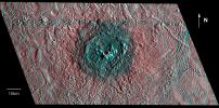
This Dawn stereo anaglyph of Occator Crater on Ceres shows impact melt deposits in the southeastern part of the 57-mile (92-kilometer) diameter crater.
PIA24061:
Dawn Stereo Anaglyph of Southeast Floor and Rim of Occator Crater, Ceres
Full Resolution:     TIFF (99.25 MB)     JPEG (5.568 MB)
Add Image to Favorite List 2020-08-10 Ceres Dawn
Framing Camera
2413x1488x3
This Dawn stereo anaglyph of Occator Crater on Ceres shows mounds and pits on the lobate impact melt deposits that cover southeastern Occator.
PIA24062:
Dawn Stereo Anaglyph of Hydrothermal Pits and Domes in Occator Crater, Ceres
Full Resolution:     TIFF (10.78 MB)     JPEG (469.6 kB)
Add Image to Favorite List 2020-08-10 Ceres Dawn
Framing Camera
1920x1674x3
This Dawn stereo anaglyph of Occator Crater on Ceres shows bright carbonate deposits draped on ridged impact melt deposits in the eastern section of the 57-mile (92-kilometer) crater.
PIA24063:
Dawn Stereo Anaglyph of Hydrothermal Deposits at Occator Crater, Ceres
Full Resolution:     TIFF (5.052 MB)     JPEG (273.1 kB)
Add Image to Favorite List 2020-08-10 Ceres Dawn
Framing Camera
1234x1065x3
This Dawn stereo anaglyph of Occator Crater on Ceres shows impact melt deposits draped on faulted blocks on the northeastern rim of the 57-mile (92-kilometer) diameter crater.
PIA24064:
Dawn Stereo Anaglyph of Impact Melt Deposits at Occator Crater, Ceres
Full Resolution:     TIFF (2.989 MB)     JPEG (116.3 kB)
Add Image to Favorite List 2010-11-18 Hartley 2 EPOXI
Medium Resolution Instrument (MRI)
456x722x3
This 3-D image shows the region where NASA's Deep Impact mission sent a probe into the surface of comet Tempel 1 in 2005. This picture was taken six years after the Deep Impact collision. 3D glasses are necessary to view this image.
PIA13627:
Hartley 2 in 3-D
Full Resolution:     TIFF (989.1 kB)     JPEG (25.46 kB)
Add Image to Favorite List 1998-05-21 Europa Galileo
Solid-State Imaging
856x407x3
This three dimensional effect is created by superimposing images of Jupiter's icy moon, Europa, taken by NASA's Galileo Orbiter. 3D glasses are necessary to identify surface detail.
PIA01406:
Topography within Europa's Mannann'an Crater
Full Resolution:     TIFF (405.7 kB)     JPEG (51.08 kB)
Add Image to Favorite List 1998-12-07 Europa Galileo
Solid-State Imaging
1152x626x3
This three dimensional effect is created by superimposing images of Jupiter's moon, Europa, which were taken from two slightly different perspectives. The images were taken by the Solid State Imaging (SSI) system on NASA's Galileo spacecraft.
PIA01654:
Rugged Terrain on Europa in 3-D Stereo
Full Resolution:     TIFF (1.106 MB)     JPEG (117.9 kB)
Add Image to Favorite List 1999-01-18 Europa Galileo
Solid-State Imaging
1050x520x3
The anaglyph shows Pwyll crater on Jupiter's icy satellite Europa, captured by NASA's Galileo Orbiter. 3D glasses are necessary to identify surface detail.
PIA01665:
Red-Blue Three Dimensional View of Pwyll crater
Full Resolution:     TIFF (1.248 MB)     JPEG (152 kB)
Add Image to Favorite List 2000-02-16 Earth Landsat
Shuttle Radar Topography Mission (SRTM)
C-Band Interferometric Radar
Thematic Mapper
1412x1588x3
This 3-D anaglyph shows an area on the western side of the volcanically active Kamchatka Peninsula, Russia as seen by the instrument onboard NASA's Shuttle Radar Topography Mission. 3D glasses are necessary to view this image.
PIA02709:
Anaglyph with Landsat Overlay, Kamchatka Peninsula, Russia
Full Resolution:     TIFF (6.288 MB)     JPEG (309.4 kB)
Add Image to Favorite List 2000-02-20 Earth Landsat
Shuttle Radar Topography Mission (SRTM)
C-Band Interferometric Radar
Thematic Mapper
940x658x3
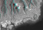
This anaglyph, from NASA's Shuttle Radar Topography Mission, is of Honolulu, on the island of Oahu .3D glasses are necessary to view this image.
PIA02728:
Anaglyph, Landsat overlay Honolulu, Hawaii
Full Resolution:     TIFF (1.436 MB)     JPEG (112.3 kB)
Add Image to Favorite List 2000-03-10 Earth Landsat
Shuttle Radar Topography Mission (SRTM)
C-Band Interferometric Radar
Thematic Mapper
1218x1366x3
This anaglyph, from NASA's Shuttle Radar Topography Mission, is of the coastal area in southernmost Oman; the Arabian Sea is on the right. 3D glasses are necessary to view this image.
PIA02736:
Anaglyph, Landsat overlay, Southernmost Coastal Oman
Full Resolution:     TIFF (4.27 MB)     JPEG (312.1 kB)
Add Image to Favorite List 2000-04-13 Earth Landsat
Shuttle Radar Topography Mission (SRTM)
C-Band Interferometric Radar
Thematic Mapper
839x651x3
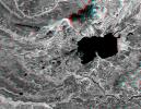
This anaglyph, from NASA's Shuttle Radar Topography Mission, is of Lake Palanskoye in northern Kamchatka. 3D glasses are necessary to view this image.
PIA02744:
Anaglyph, Lake Palanskoye Landslide, Kamchatka Peninsula, Russia
Full Resolution:     TIFF (1.501 MB)     JPEG (180.1 kB)
Add Image to Favorite List 2000-05-11 Earth Landsat
Shuttle Radar Topography Mission (SRTM)
C-Band Interferometric Radar
Thematic Mapper
2158x1540x3
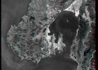
This anaglyph, from NASA's Shuttle Radar Topography Mission, is of Wellington, the capital city of New Zealand, located on the shores of Port Nicholson, a natural harbor. 3D glasses are necessary to view this image.
PIA02750:
Anaglyph, Landsat Overlay: Wellington, New Zealand
Full Resolution:     TIFF (7.542 MB)     JPEG (613.9 kB)
Add Image to Favorite List 2000-06-22 Earth Landsat
Shuttle Radar Topography Mission (SRTM)
C-Band Interferometric Radar
Thematic Mapper
2920x4236x3
This anaglyph, from NASA's Shuttle Radar Topography Mission, shows elatively young volcanoes in northern Patagonia, at Los Menucos, Argentina. 3D glasses are necessary to view this image.
PIA02755:
Anaglyph, Patagonia, Argentina
Full Resolution:     TIFF (19.93 MB)     JPEG (2.452 MB)
Add Image to Favorite List 2000-06-29 Earth Landsat
Shuttle Radar Topography Mission (SRTM)
C-Band Interferometric Radar
Thematic Mapper
506x798x3
This anaglyph, from NASA's Shuttle Radar Topography Mission, shows complexly eroded volcanic terrain in northern Patagonia, near El Cain, Argentina. 3D glasses are necessary to view this image.
PIA02761:
Anaglyph: Patagonia, Argentina
Full Resolution:     TIFF (1.101 MB)     JPEG (79.37 kB)
Add Image to Favorite List 2000-07-13 Earth Landsat
Shuttle Radar Topography Mission (SRTM)
C-Band Interferometric Radar
Thematic Mapper
1631x956x3
This anaglyph, from NASA's Shuttle Radar Topography Mission, shows basalt cliffs along the northwest edge of the Meseta de Somuncura plateau near Sierra Colorada, Argentina. 3D glasses are necessary to view this image.
PIA02762:
Anaglyph: Basalt Cliffs, Patagonia, Argentina
Full Resolution:     TIFF (2.516 MB)     JPEG (296.4 kB)
Add Image to Favorite List 2000-07-20 Earth Landsat
Shuttle Radar Topography Mission (SRTM)
C-Band Interferometric Radar
Thematic Mapper
718x907x3
This anaglyph, from NASA's Shuttle Radar Topography Mission, shows Meseta de Somuncura, a broad plateau capped by basalt. Near its western edge is evidence of multiple volcanic events. 3D glasses are necessary to view this image.
PIA02764:
SRTM Anaglyph: Inverted Topography, Patagonia, Argentina
Full Resolution:     TIFF (1.025 MB)     JPEG (149.5 kB)
Add Image to Favorite List 2000-07-27 Earth Landsat
Shuttle Radar Topography Mission (SRTM)
C-Band Interferometric Radar
Thematic Mapper
999x1335x3
This anaglyph, from NASA's Shuttle Radar Topography Mission, shows Meseta de Somuncura, a semi-arid basalt plateau in northern Patagonia. 3D glasses are necessary to view this image.
PIA02766:
SRTM Anaglyph: Meseta de Somuncura, Patagonia, Argentina (Near Los Menucos)
Full Resolution:     TIFF (3.633 MB)     JPEG (273.4 kB)
Add Image to Favorite List 2000-08-31 Earth Landsat
Shuttle Radar Topography Mission (SRTM)
C-Band Interferometric Radar
Thematic Mapper
499x801x3
This anaglyph, from NASA's Shuttle Radar Topography Mission, shows Wheeler Ridge and vicinity, California, a site of major tectonic activity. 3D glasses are necessary to view this image.
PIA02772:
SRTM Anaglyph: Wheeler Ridge, California
Full Resolution:     TIFF (1.069 MB)     JPEG (109.4 kB)
Add Image to Favorite List 2000-09-21 Earth Landsat
Shuttle Radar Topography Mission (SRTM)
C-Band Interferometric Radar
Thematic Mapper
1786x2356x3
This anaglyph, from NASA's Shuttle Radar Topography Mission, shows rugged terrain between Los Angeles and California's central valley. 3D glasses are necessary to view this image.
PIA02777:
SRTM Anaglyph with Landsat Overlay: Los Angeles to San Joaquin Valley, California
Full Resolution:     TIFF (12.92 MB)     JPEG (1.054 MB)
Add Image to Favorite List 2000-10-20 Earth Landsat
Shuttle Radar Topography Mission (SRTM)
C-Band Interferometric Radar
Thematic Mapper
1212x1518x3
This anaglyph, from NASA's Shuttle Radar Topography Mission, shows Miquelon and Saint Pierre Islands, located south of Newfoundland, Canada. 3D glasses are necessary to view this image.
PIA02781:
SRTM Anaglyph with Landsat Overlay: Miquelon and Saint Pierre Islands
Full Resolution:     TIFF (3.237 MB)     JPEG (324.2 kB)
Add Image to Favorite List 2001-04-05 Earth Landsat
Shuttle Radar Topography Mission (SRTM)
C-Band Interferometric Radar
Thematic Mapper
451x691x3
This anaglyph, from NASA's Shuttle Radar Topography Mission, shows the city of Bhuj, India. 3D glasses are necessary to view this image.
PIA02797:
SRTM Anaglyph: Bhuj, India, Two Weeks After Earthquake
Full Resolution:     TIFF (870.6 kB)     JPEG (98.48 kB)
Add Image to Favorite List 2001-05-02 Earth Landsat
Shuttle Radar Topography Mission (SRTM)
C-Band Interferometric Radar
Thematic Mapper
477x745x3
This anaglyph NASA's Shuttle Radar Topography Mission, shows the Haro and Kas Hills of the Kachchh region in western India. 3D glasses are necessary to view this image.
PIA03303:
SRTM Anaglyph: Haro and Kas Hills
Full Resolution:     TIFF (989 kB)     JPEG (108.1 kB)
Add Image to Favorite List 2001-05-24 Earth Landsat
Shuttle Radar Topography Mission (SRTM)
C-Band Interferometric Radar
Thematic Mapper
941x1304x3
This anaglyph NASA's Shuttle Radar Topography Mission, shows the city of Bhuj, India. 3D glasses are necessary to view this image.
PIA03307:
SRTM Anaglyph: Roads versus Dikes near Bhuj, India
Full Resolution:     TIFF (2.534 MB)     JPEG (344.1 kB)
Add Image to Favorite List 2001-05-31 Earth Landsat
Shuttle Radar Topography Mission (SRTM)
C-Band Interferometric Radar
Thematic Mapper
398x710x3
This anaglyph NASA's Shuttle Radar Topography Mission, shows the city of Bhuj, India. 3D glasses are necessary to view this image.
PIA03309:
SRTM Anaglyph: Northwest of Bhuj, India
Full Resolution:     TIFF (802.2 kB)     JPEG (84.41 kB)
Add Image to Favorite List 2002-02-01 Earth Landsat
Shuttle Radar Topography Mission (SRTM)
C-Band Interferometric Radar
Thematic Mapper
1384x2022x3
This anaglyph, from NASA's Shuttle Radar Topography Mission, is of the Nyiragongo volcano in the Congo. 3D glasses are necessary to view this image.
PIA03340:
Nyiragongo volcano, Congo, Anaglyph, SRTM / Landsat
Full Resolution:     TIFF (7.001 MB)     JPEG (499 kB)
Add Image to Favorite List 2002-02-06 Earth Landsat
Shuttle Radar Topography Mission (SRTM)
C-Band Interferometric Radar
Thematic Mapper
925x2385x3
This anaglyph, from NASA's Shuttle Radar Topography Mission, is of Salt Lake City, Utah. 3D glasses are necessary to view this image.
PIA03343:
Anaglyph, Salt Lake City, Utah
Full Resolution:     TIFF (6.158 MB)     JPEG (683.6 kB)
Add Image to Favorite List 2002-02-28 Earth Landsat
Shuttle Radar Topography Mission (SRTM)
C-Band Interferometric Radar
Thematic Mapper
1958x799x3
Mount San Antonio (more commonly known as Mount Baldy) crowns the San Gabriel Mountains northeast of Los Angeles, Calif., in this anaglyph from NASA's Shuttle Radar Topography Mission. 3D glasses are necessary to view this image.
PIA03345:
Anaglyph, Metro Los Angeles, Calif.: Malibu to Mount Baldy
Full Resolution:     TIFF (3.198 MB)     JPEG (298.8 kB)
Add Image to Favorite List 2002-09-12 Earth Landsat
Shuttle Radar Topography Mission (SRTM)
C-Band Interferometric Radar
Thematic Mapper
339x620x3
This anaglyph, from NASA's Shuttle Radar Topography Mission, is of Mount Meru, an active volcano located just 70 kilometers (44 miles) west of Mount Kilimanjaro. 3D glasses are necessary to view this image.
PIA03358:
Anaglyph with Landsat Overlay, Mount Meru, Tanzania
Full Resolution:     TIFF (602.1 kB)     JPEG (56.43 kB)
Add Image to Favorite List 2002-09-19 Earth Landsat
Shuttle Radar Topography Mission (SRTM)
C-Band Interferometric Radar
Thematic Mapper
1009x1600x3
This anaglyph, from NASA's Shuttle Radar Topography Mission, is of Mount St Helens, Washington. 3D glasses are necessary to view this image.
PIA03360:
Anaglyph, Mount St Helens, Washington State
Full Resolution:     TIFF (4.217 MB)     JPEG (309 kB)
Add Image to Favorite List 2003-05-01 Earth Landsat
Shuttle Radar Topography Mission (SRTM)
C-Band Interferometric Radar
Thematic Mapper
3262x3162x3
This anaglyph, from NASA's Shuttle Radar Topography Mission, is of Malaspina Glacier in southeastern Alaska. 3D glasses are necessary to view this image.
PIA03387:
Malaspina Glacier, Alaska, Anaglyph with Landsat Overlay
Full Resolution:     TIFF (26.8 MB)     JPEG (2.079 MB)
Add Image to Favorite List 2003-07-03 Earth Landsat
Shuttle Radar Topography Mission (SRTM)
C-Band Interferometric Radar
2805x1705x3
St. Thomas, St. John, Tortola, and Virgin Gorda are the four main islands (lower left to upper right) of this map-view anaglyph of the U.S. Virgin Islands and British Virgin Islands from NASA's Shuttle Radar Topography Mission. 3D glasses are necessary.
PIA03392:
Anaglyph with Landsat Virgin Islands, Caribbean
Full Resolution:     TIFF (7.529 MB)     JPEG (737 kB)
Add Image to Favorite List 2004-06-17 Earth Landsat
Shuttle Radar Topography Mission (SRTM)
C-Band Interferometric Radar
X-Band Radar
4463x3000x3
Cape Town and the Cape of Good Hope, South Africa, appear on the left (west) of this anaglyph from NASA's Shuttle Radar Topography Mission. 3D glasses are necessary to view this image.
PIA04960:
Cape Town, South Africa, Anaglyph, Landsat Image over SRTM Elevation
Full Resolution:     TIFF (26.41 MB)     JPEG (2.219 MB)
Add Image to Favorite List 2004-06-17 Earth Landsat
Shuttle Radar Topography Mission (SRTM)
C-Band Interferometric Radar
X-Band Radar
5657x3645x3
The prominent circular feature seen here is known as the Richat Structure, in the Sahara desert of Mauritania. This anaglyph is from NASA's Shuttle Radar Topography Mission. 3D glasses are necessary to view this image.
PIA04962:
Richat Structure, Mauritania, Anaglyph, Landsat Image over SRTM Elevation
Full Resolution:     TIFF (54.43 MB)     JPEG (3.974 MB)
Add Image to Favorite List 2004-07-03 Earth Landsat
Shuttle Radar Topography Mission (SRTM)
C-Band Radar
X-Band Radar
5000x1700x3
This elevation anaglyph of Los Angeles and adjacent mountainous terrain was created by NASA's Shuttle Radar Topography Mission. 3D glasses are necessary to view this image.
PIA04968:
Library of Congress Model, Anaglyph
Full Resolution:     TIFF (9.503 MB)     JPEG (858.8 kB)
Add Image to Favorite List 2009-07-21 Moon Lunar Reconnaissance Orbiter (LRO)
Lunar Reconnaissance Orbiter Camera (NAC)
1000x1000x3
NASA's Lunar Reconnaissance Orbiter's looks at the Moon in 3D. 3D glasses are necessary to view this image.
PIA12890:
The Moon in 3-D
Full Resolution:     TIFF (3.004 MB)     JPEG (145.4 kB)
Add Image to Favorite List 2010-05-05 Moon Lunar Reconnaissance Orbiter (LRO)
Lunar Reconnaissance Orbiter Camera (NAC)
1000x1000x3
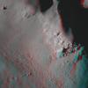
NASA's Lunar Reconnaissance Orbiter captured this anaglyph image is a close up view of Copernicus crater. 3D glasses are necessary to view this image.
PIA13094:
Central Peak of Copernicus Crater (Anaglyph)
Full Resolution:     TIFF (3.004 MB)     JPEG (107.4 kB)
Add Image to Favorite List 2021-04-06 Mars Mars 2020 Rover
Mastcam-Z
1603x1192x3
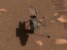
NASA's Ingenuity Mars helicopter is seen here in a close-up taken by Mastcam-Z, a pair of zoomable cameras aboard the Perseverance rover. This image was taken on April 5, the 45th Martian day, or sol, of the mission.
PIA24547:
Mastcam-Z Gives Ingenuity a Close-up
Full Resolution:     TIFF (5.734 MB)     JPEG (424.5 kB)
Add Image to Favorite List 2021-05-11 Mars Mars 2020 Rover
Mastcam-Z
11363x4204x3
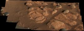
NASA's Perseverance rover viewed these rocks with its Mastcam-Z imager on April 27, 2021.
PIA24627:
Perseverance's Mastcam-Z Images Intriguing Rocks
Full Resolution:     TIFF (117.3 MB)     JPEG (7.456 MB)
Add Image to Favorite List 2021-05-12 Mars Mars 2020 Rover
Mastcam-Z
1260x638x3
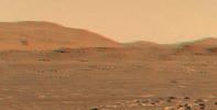
After the Mastcam-Z imager aboard NASA's Perseverance rover captured Ingenuity's third flight on April 25, the frames of the video that was stitched together were then reprojected to optimize viewing in an anaglyph.
PIA24522:
Ingenuity Flies in 3D
Full Resolution:     TIFF (1.908 MB)     JPEG (77.2 kB)
Add Image to Favorite List 2021-06-25 Mars Mars 2020 Rover
Mastcam-Z
1788x1870x3
NASA's Ingenuity Mars Helicopter is seen here in 3D using images taken June 6, 2021, by the left and right Mastcam-Z cameras aboard NASA's Perseverance Mars rover.
PIA24670:
Ingenuity Helicopter in 3D
Full Resolution:     TIFF (10.03 MB)     JPEG (598.3 kB)
 Current Set   Jump to a Following Set   Jump to a Following Set   Jump to a Following Set   Jump to a Following Set   Jump to a Following Set   Retrieve Next Set 
 1-100   101-200   201-300   301-400   401-500   501-600 
Currently displaying images: 1 - 100 of 560