Click on an image for detailed information
Click on a column heading to sort in ascending or descending order

My
List |
Addition Date
|
Target
|
Mission
|
Instrument
|
Size
|

|
2012-08-08 |
Mars
|
Mars Reconnaissance Orbiter (MRO)
Mars Science Laboratory (MSL)
|
CTX
|
1709x1193x1 |
|
-
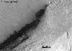
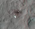
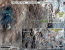
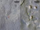
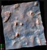
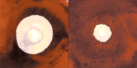
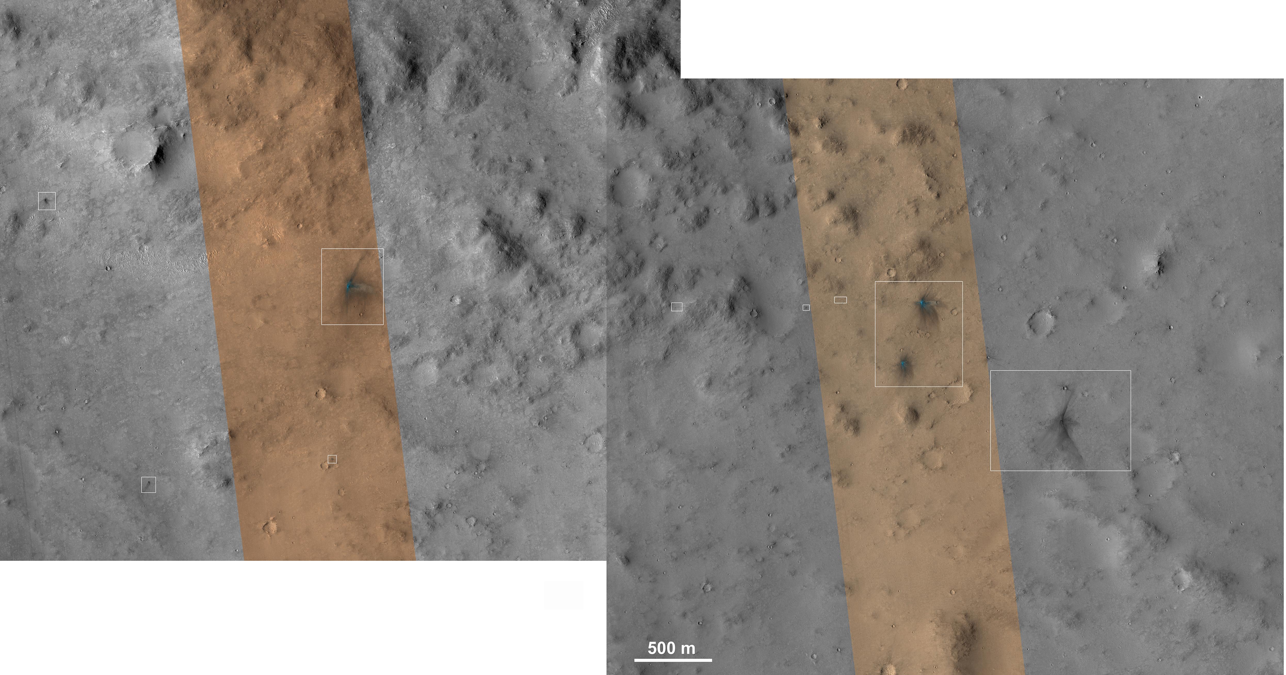
PIA16014:
-
Before and After Curiosity's Touchdown

Full Resolution:
TIFF
(2.041 MB)
JPEG
(305.4 kB)
|
|
|
2012-08-08 |
Mars
|
Mars Reconnaissance Orbiter (MRO)
Mars Science Laboratory (MSL)
|
CTX
|
758x511x1 |
|
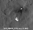
-
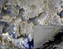
PIA16016:
-
Ballasts Hitting the Surface, Close-Up
Full Resolution:
TIFF
(388 kB)
JPEG
(58 kB)
|
|
|
2012-08-08 |
Mars
|
Mars Reconnaissance Orbiter (MRO)
Mars Science Laboratory (MSL)
|
CTX
|
758x511x1 |

|
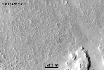
-
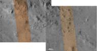
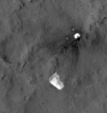
PIA16015:
-
Ballasts Hitting the Surface, Close-Up (with arrows)
Full Resolution:
TIFF
(388 kB)
JPEG
(58.05 kB)
|
|
|
2012-08-08 |
Mars
|
Mars Reconnaissance Orbiter (MRO)
Mars Science Laboratory (MSL)
|
HiRISE
MARDI
|
1665x1174x3 |
|
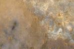
-
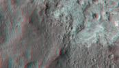
PIA16019:
-
A Better Look of the Martian Surface
Full Resolution:
TIFF
(5.867 MB)
JPEG
(153.7 kB)
|
|
|
2012-08-09 |
Mars
|
Mars Reconnaissance Orbiter (MRO)
Mars Science Laboratory (MSL)
|
HiRISE
|
724x720x1 |
|
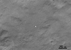
-
PIA16030:
-
Curiosity's Quad
Full Resolution:
TIFF
(522 kB)
JPEG
(63.57 kB)
|
|
|
2012-08-09 |
Mars
|
Mars Reconnaissance Orbiter (MRO)
Mars Science Laboratory (MSL)
|
HiRISE
|
862x650x3 |
|
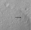
-
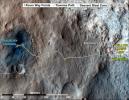
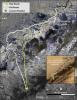
PIA16031:
-
Staking out Curiosity's Landing Site
Full Resolution:
TIFF
(1.682 MB)
JPEG
(99.91 kB)
|
|
|
2012-08-10 |
Mars
|
Mars Reconnaissance Orbiter (MRO)
Mars Science Laboratory (MSL)
|
MARCI
|
1449x1087x3 |
|
-
PIA16037:
-
Mars Weather Map, Aug. 5
Full Resolution:
TIFF
(4.727 MB)
JPEG
(123.9 kB)
|
|
|
2012-08-14 |
Mars
|
Mars Reconnaissance Orbiter (MRO)
Mars Science Laboratory (MSL)
|
HiRISE
|
1511x13401x3 |
|
-
PIA16056:
-
A Whole New World for Curiosity
Full Resolution:
TIFF
(60.77 MB)
JPEG
(2.358 MB)
|
|
|
2012-08-14 |
Mars
|
Mars Reconnaissance Orbiter (MRO)
Mars Science Laboratory (MSL)
|
HiRISE
|
3022x2515x3 |
|
-
PIA16057:
-
Curiosity in Exaggerated Color
Full Resolution:
TIFF
(22.81 MB)
JPEG
(1.151 MB)
|
|
|
2012-08-31 |
Mars
|
Mars Reconnaissance Orbiter (MRO)
Mars Science Laboratory (MSL)
|
HiRISE
|
2800x1800x1 |
|
-
PIA15696:
-
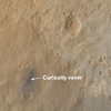
Orbiter View of Curiosity From Nearly Straight Overhead
Full Resolution:
TIFF
(5.047 MB)
JPEG
(578.1 kB)
|
|
|
2012-09-19 |
Mars
|
Mars Reconnaissance Orbiter (MRO)
Mars Science Laboratory (MSL)
|
HiRISE
|
3300x2550x3 |
|
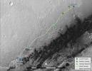
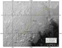
-
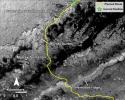
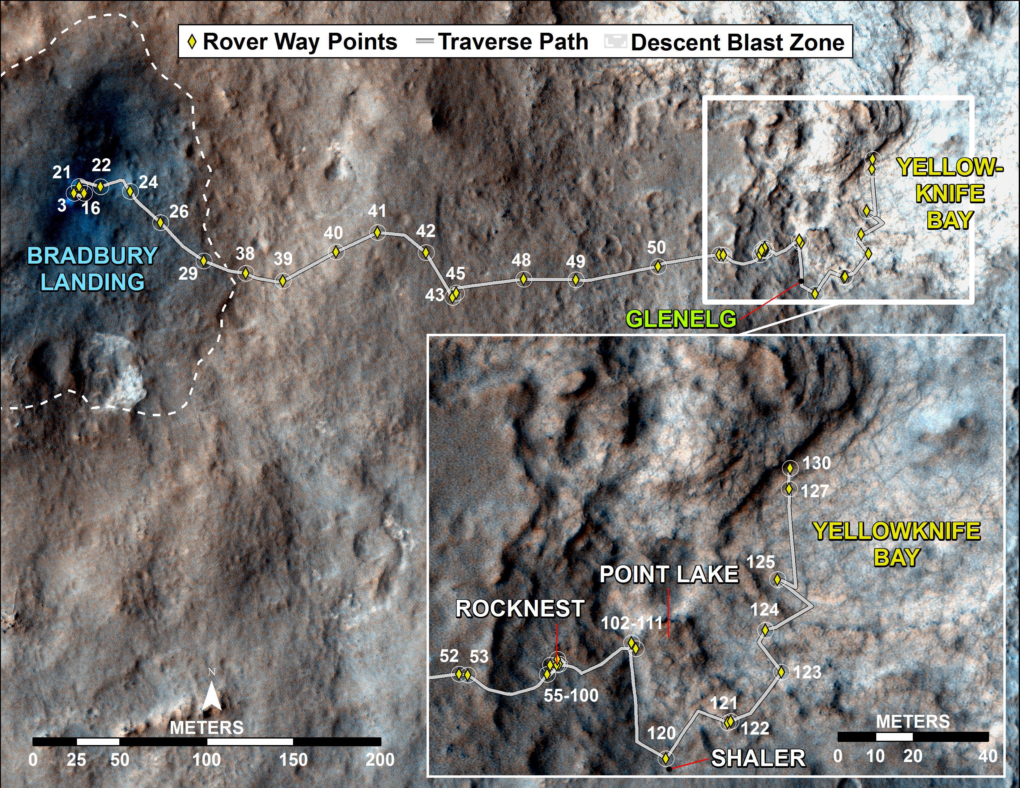
PIA16153:
-
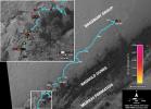
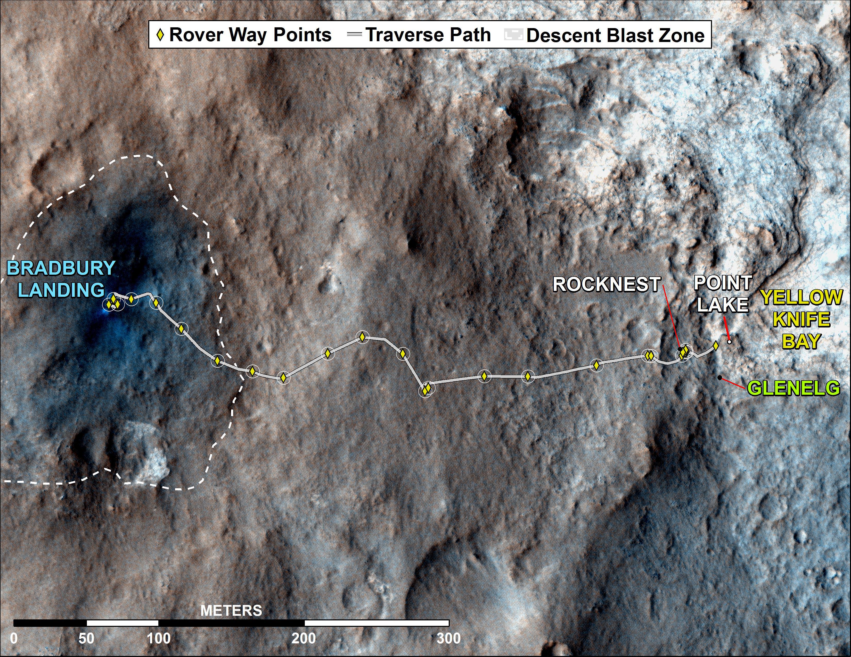
Curiosity Traverse Map Through Sol 43
Full Resolution:
TIFF
(25.26 MB)
JPEG
(1.57 MB)
|
|
|
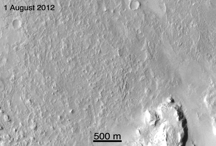
2012-09-27 |
Mars
|
Mars Reconnaissance Orbiter (MRO)
Mars Science Laboratory (MSL)
|
HiRISE
|
932x720x3 |
|
-
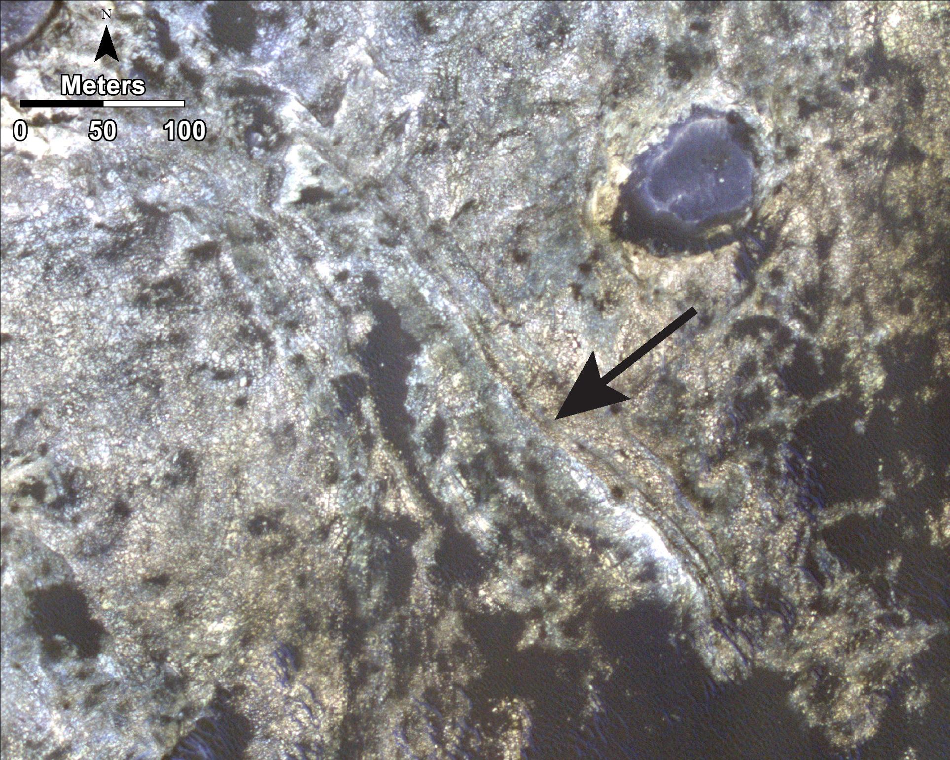
PIA16157:
-
Curiosity's Roadside Discoveries
Full Resolution:
TIFF
(2.014 MB)
JPEG
(132.4 kB)
|
|
|
2012-09-27 |
Mars
|
Mars Reconnaissance Orbiter (MRO)
Mars Science Laboratory (MSL)
|
HiRISE
|
3339x2580x3 |

|
-
PIA16158:
-
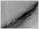
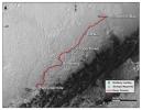
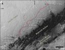
Where Water Flowed Downslope
Full Resolution:
TIFF
(25.85 MB)
JPEG
(1.87 MB)
|
|
|
2012-10-10 |
Mars
|
Mars Reconnaissance Orbiter (MRO)
Mars Science Laboratory (MSL)
|
HiRISE
|
398x408x3 |
|
-
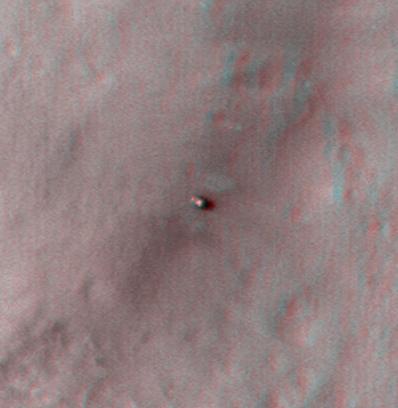
PIA16208:
-
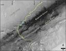
Curiosity at Bradbury Landing Site in 3-D
Full Resolution:
TIFF
(487.5 kB)
JPEG
(17.84 kB)
|
|
|
2012-10-10 |
Mars
|
Mars Reconnaissance Orbiter (MRO)
Mars Science Laboratory (MSL)
|
HiRISE
|
950x795x3 |
|
-
PIA16209:
-
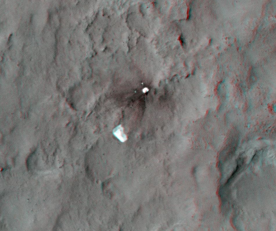
Parachute and Back Shell in 3-D
Full Resolution:
TIFF
(2.267 MB)
JPEG
(87.85 kB)
|
|
|
2012-10-10 |
Mars
|
Mars Reconnaissance Orbiter (MRO)
Mars Science Laboratory (MSL)
|
HiRISE
|
2414x1387x3 |
|
-
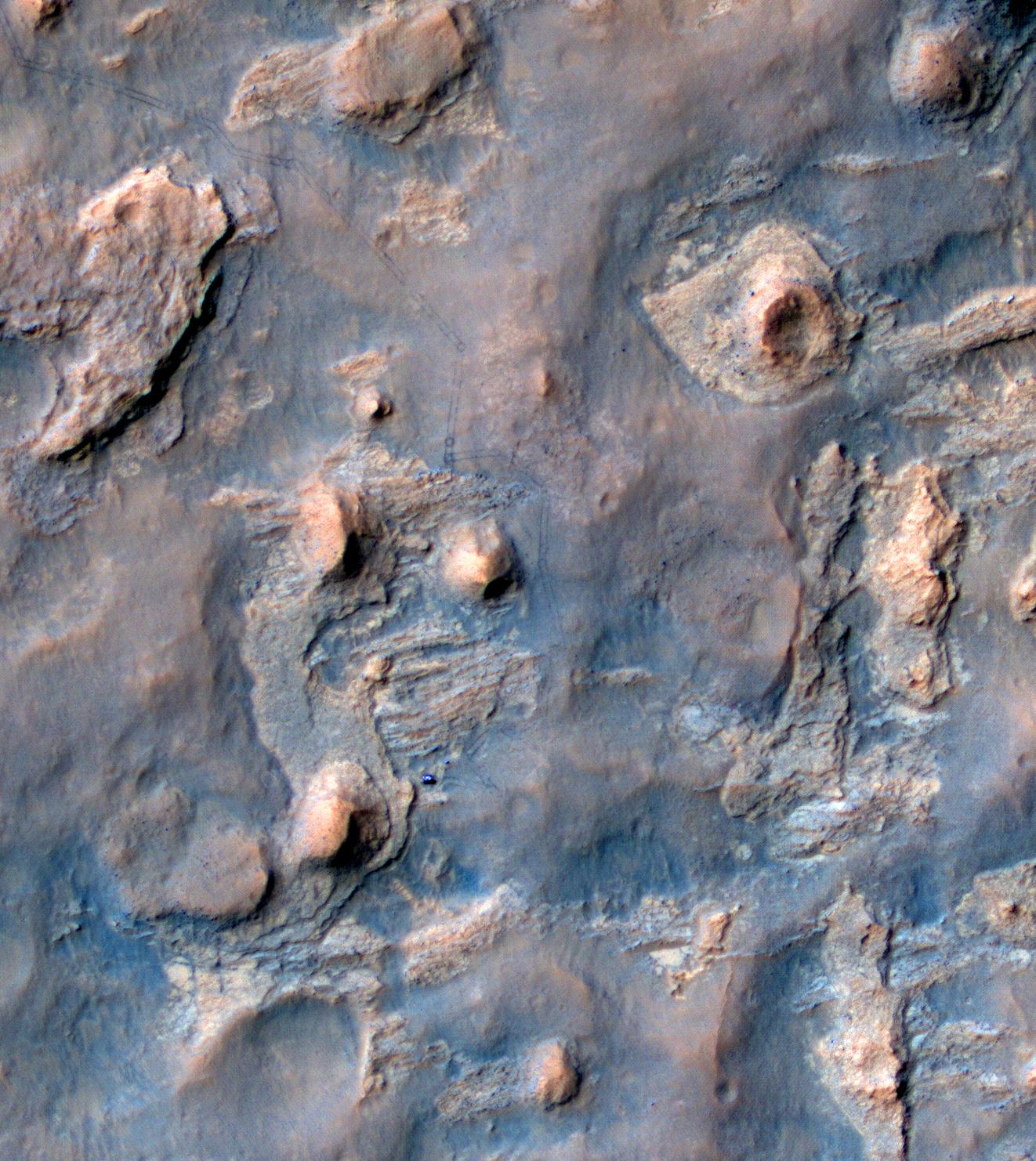
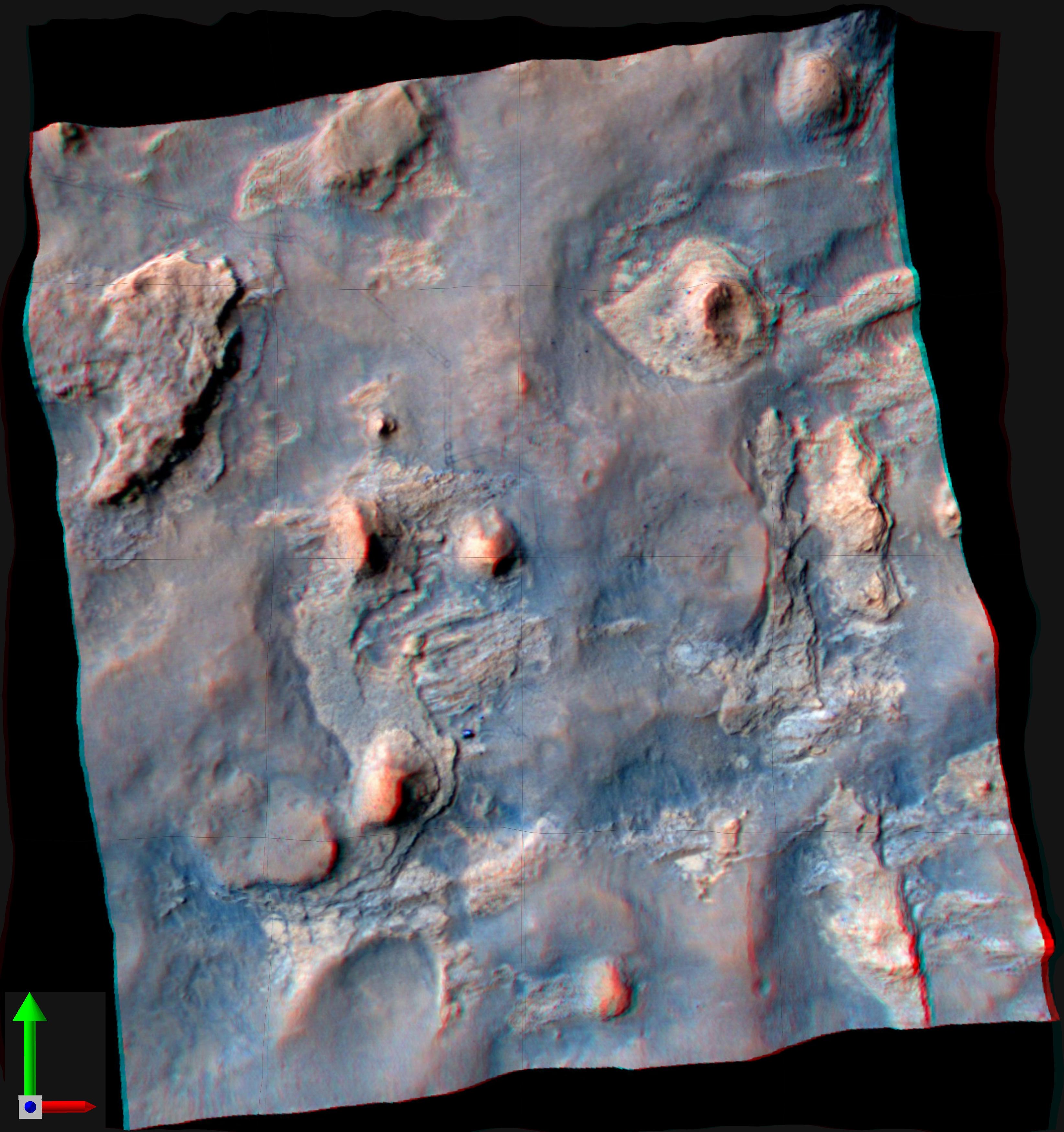
PIA16210:
-
'Glenelg' in 3-D
Full Resolution:
TIFF
(10.05 MB)
JPEG
(554.1 kB)
|
|
|
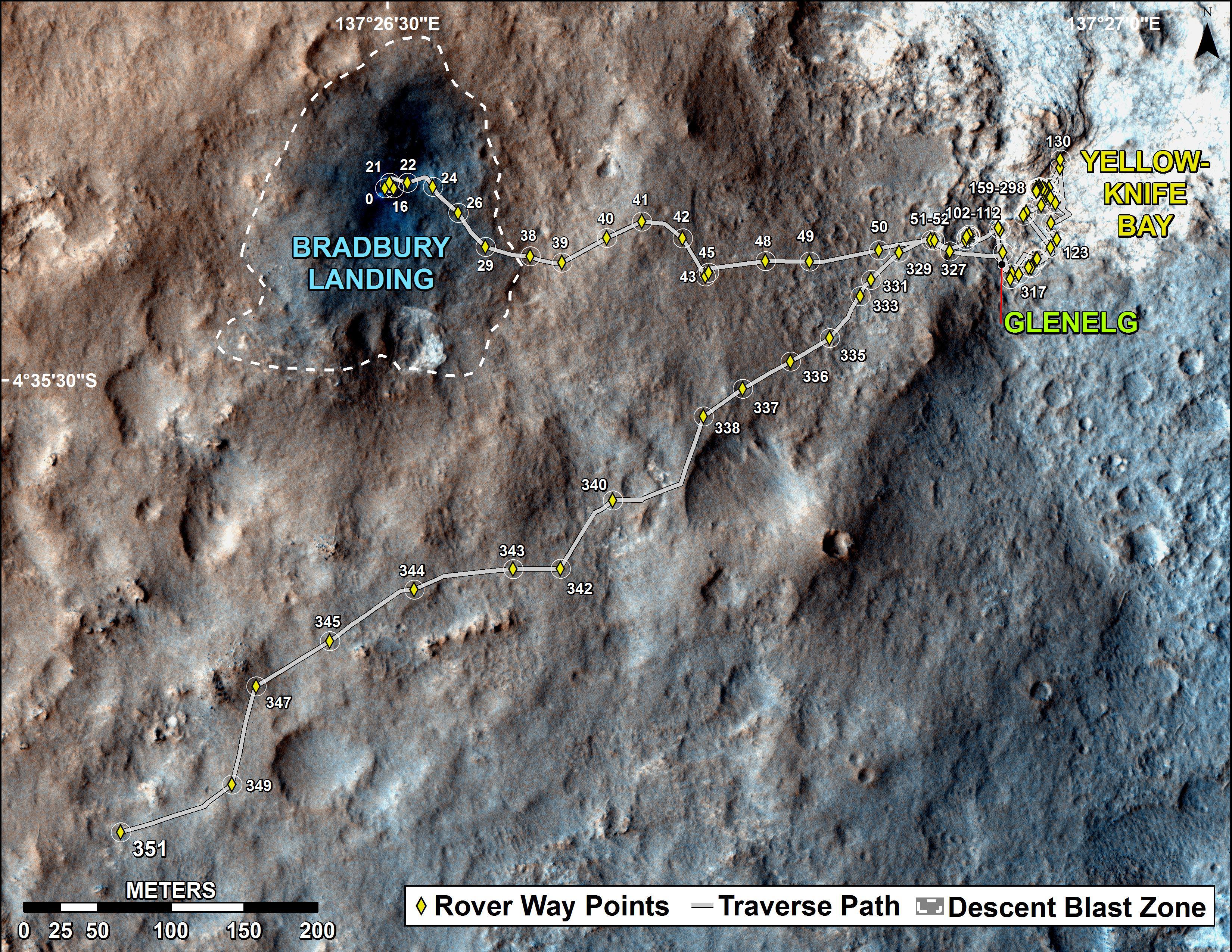
2012-12-03 |
Mars
|
Mars Reconnaissance Orbiter (MRO)
Mars Science Laboratory (MSL)
|
HiRISE
|
3300x2550x3 |
|
-
PIA16577:
-
Curiosity Rover's Traverse, August through November 2012
Full Resolution:
TIFF
(25.26 MB)
JPEG
(1.893 MB)
|
|
|
2012-12-05 |
Mars
|
Mars Reconnaissance Orbiter (MRO)
Mars Science Laboratory (MSL)
|
CTX
HiRISE
|
4985x2619x3 |
|
-
PIA16456:
-
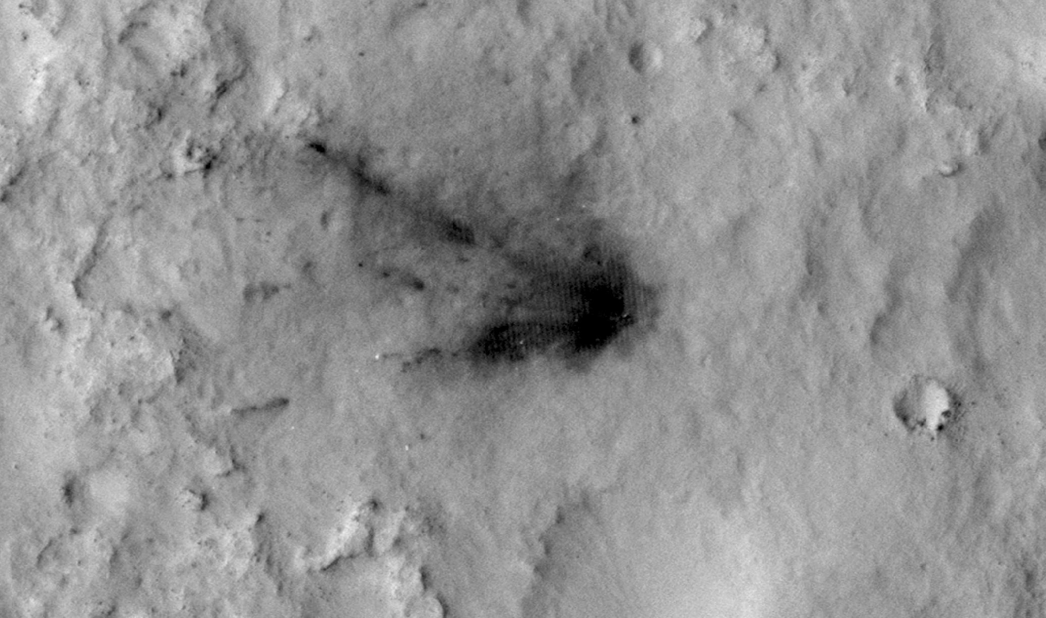
Impact Scars from MSL Cruise Stage and Two Balance Weights
Full Resolution:
TIFF
(39.19 MB)
JPEG
(1.692 MB)
|
|
|
2012-12-11 |
Mars
|
Mars Reconnaissance Orbiter (MRO)
Mars Science Laboratory (MSL)
|
HiRISE
|
3300x2550x3 |
|
-
PIA16459:
-
Curiosity Traverse Map, Sol 123
Full Resolution:
TIFF
(25.26 MB)
JPEG
(1.748 MB)
|
|
|
2012-12-18 |
Mars
|
Mars Reconnaissance Orbiter (MRO)
Mars Science Laboratory (MSL)
|
HiRISE
|
3300x2550x3 |

|
-
PIA16554:
-
Curiosity Traverse Map, Sol 130
Full Resolution:
TIFF
(25.26 MB)
JPEG
(1.761 MB)
|
|
|
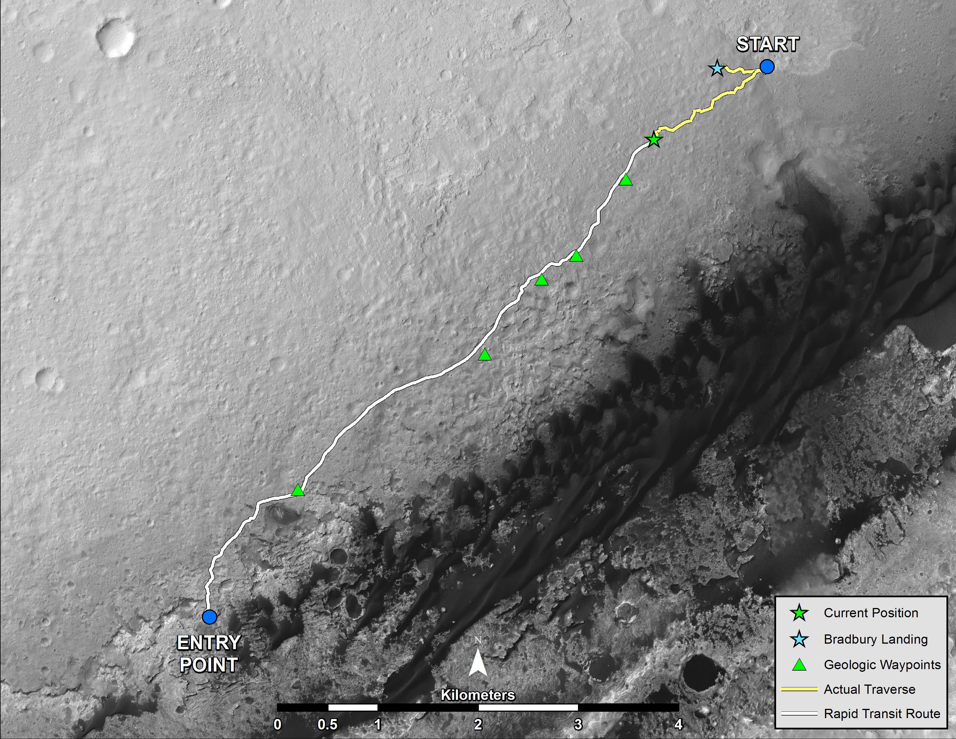
2013-04-03 |
Mars
|
Mars Reconnaissance Orbiter (MRO)
Mars Science Laboratory (MSL)
|
HiRISE
|
369x390x1 |
|
-
PIA16813:
-
MSL's Parachute Flapping in the Wind
Full Resolution:
TIFF
(144.3 kB)
JPEG
(15.5 kB)
|
|
|
2013-07-24 |
Mars
|
Mars Reconnaissance Orbiter (MRO)
Mars Science Laboratory (MSL)
|
HiRISE
|
2389x1598x3 |
|
-
PIA17080:
-
View From Mars Orbiter Showing Curiosity Rover at 'Shaler'
Full Resolution:
TIFF
(11.46 MB)
JPEG
(879.4 kB)
|
|
|
2013-08-02 |
Mars
|
Mars Reconnaissance Orbiter (MRO)
Mars Science Laboratory (MSL)
|
HiRISE
|
3300x2550x3 |

|
-
PIA17085:
-
Full Curiosity Traverse Passes One-Mile Mark
Full Resolution:
TIFF
(25.26 MB)
JPEG
(2.249 MB)
|
|
|
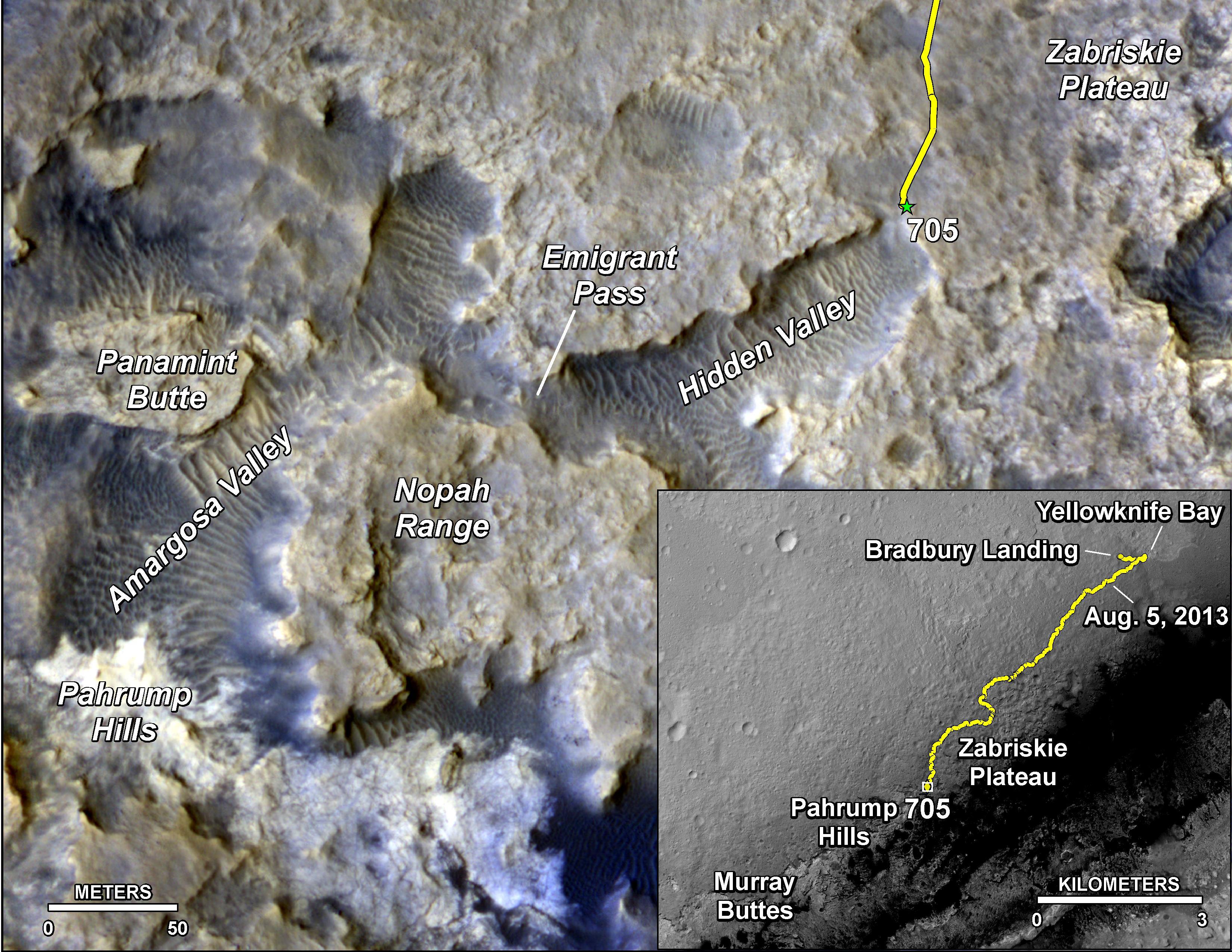
2013-08-27 |
Mars
|
Mars Reconnaissance Orbiter (MRO)
Mars Science Laboratory (MSL)
|
HiRISE
|
3300x2550x3 |
|
-
PIA17355:
-
Curiosity's Progress on Route from 'Glenelg' to Mount Sharp
Full Resolution:
TIFF
(25.26 MB)
JPEG
(1.493 MB)
|
|
|
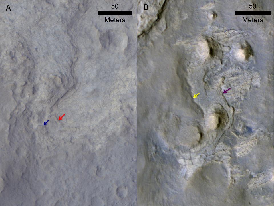
2013-12-09 |
Mars
|
Mars Reconnaissance Orbiter (MRO)
Mars Science Laboratory (MSL)
|
HiRISE
|
960x720x3 |
|
-
PIA17597:
-
Erosion Patterns May Guide Mars Rover to Rocks Recently Exposed
Full Resolution:
TIFF
(2.075 MB)
JPEG
(87.76 kB)
|
|
|
2013-12-09 |
Mars
|
Mars Reconnaissance Orbiter (MRO)
Mars Science Laboratory (MSL)
|
CTX
|
3300x2550x3 |
|
-
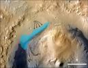
PIA17596:
-
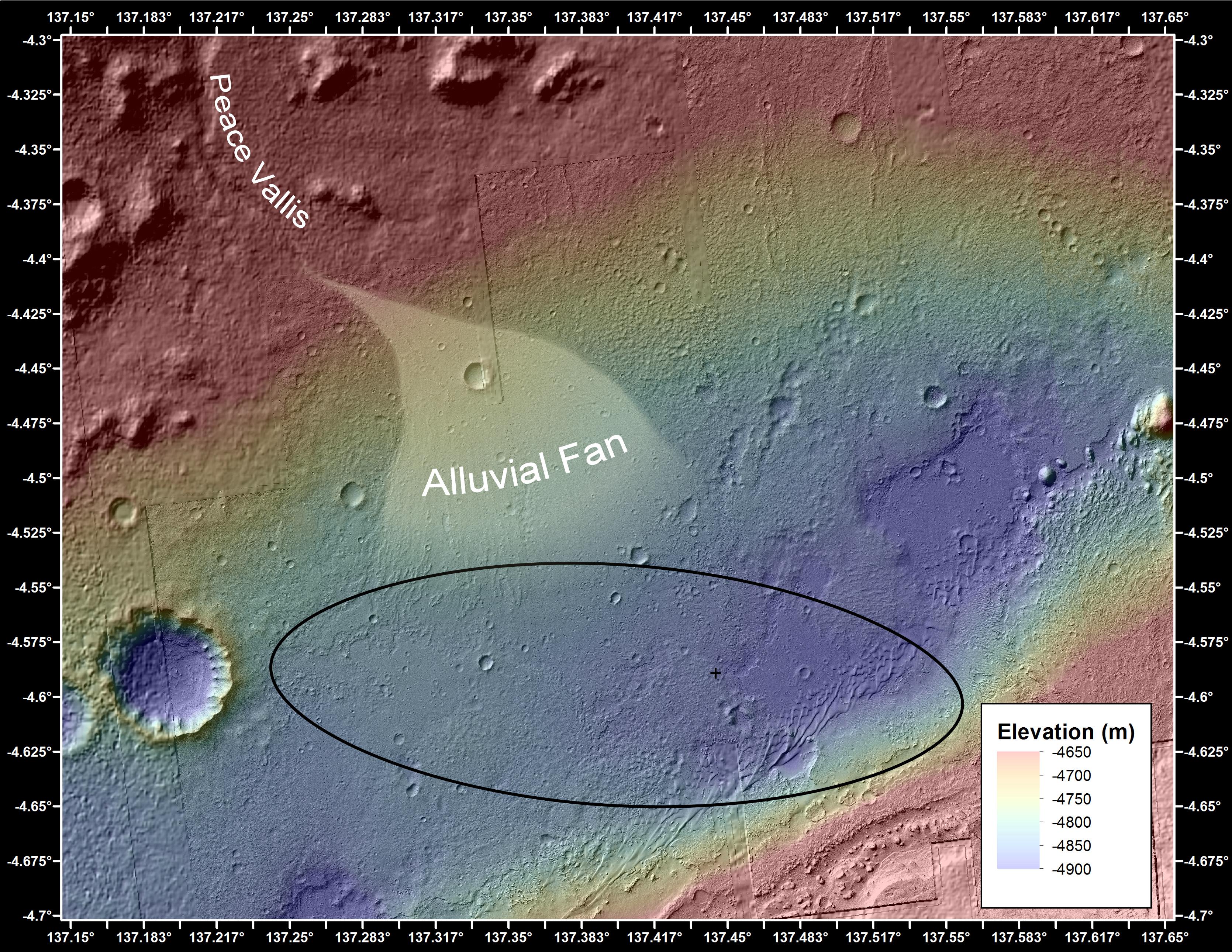
Possible Extent of Ancient Lake in Gale Crater, Mars
Full Resolution:
TIFF
(25.26 MB)
JPEG
(1.34 MB)
|
|
|
2014-01-29 |
Mars
|
Mars Reconnaissance Orbiter (MRO)
Mars Science Laboratory (MSL)
|
HiRISE
|
3300x2550x3 |
|
-
PIA17765:
-
Traverse Map for Mars Rover Curiosity as of Jan. 26, 2014
Full Resolution:
TIFF
(25.26 MB)
JPEG
(1.211 MB)
|
|
|
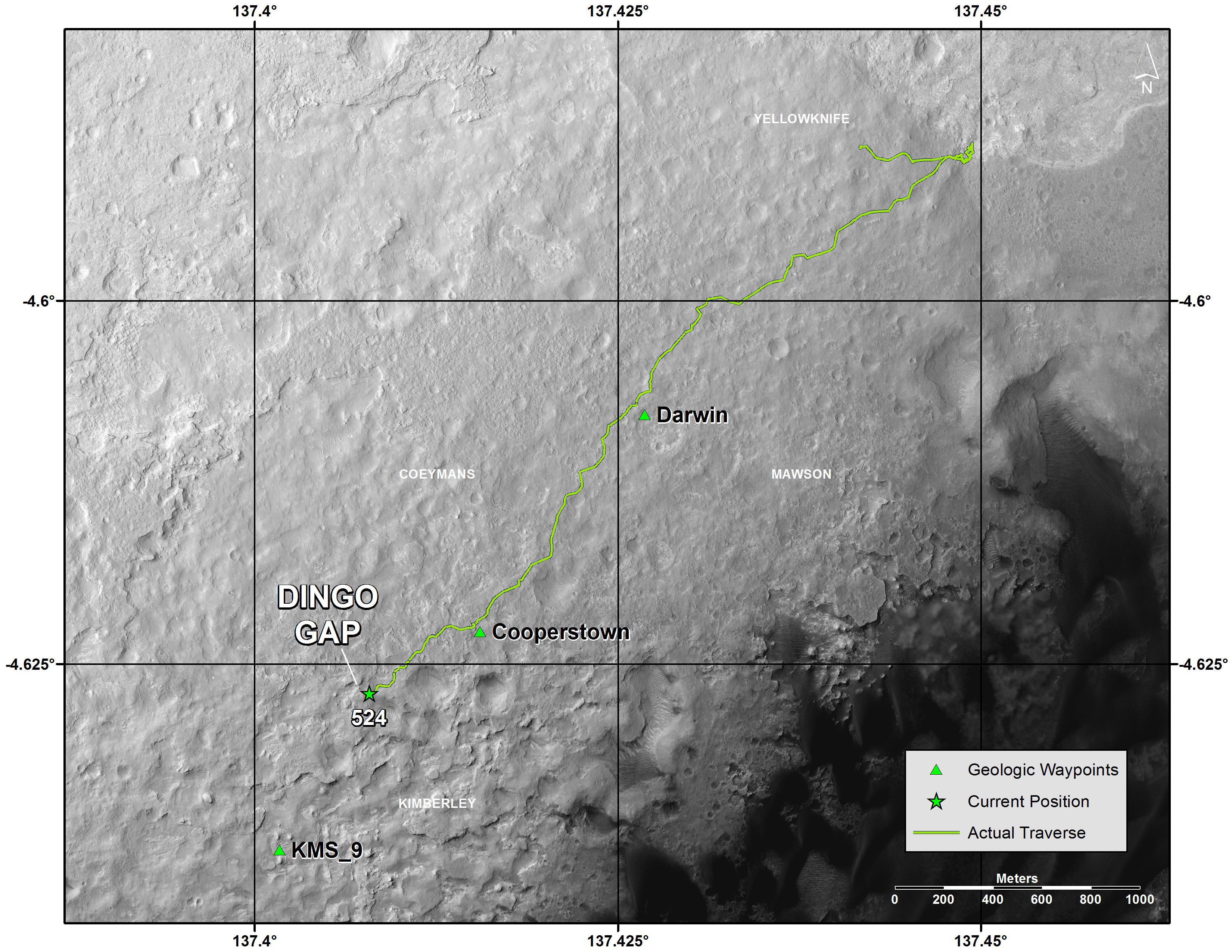
2014-04-16 |
Mars
|
Mars Reconnaissance Orbiter (MRO)
Mars Science Laboratory (MSL)
|
HiRISE
|
1322x1482x3 |
|
-
PIA18081:
-
Curiosity and Rover Tracks at 'the Kimberley,' April 2014
Full Resolution:
TIFF
(5.88 MB)
JPEG
(347.6 kB)
|
|
|
2014-04-16 |
Mars
|
Mars Reconnaissance Orbiter (MRO)
Mars Science Laboratory (MSL)
|
HiRISE
|
3287x3497x3 |
|
-
PIA18082:
-
Stereo View of Curiosity and Rover Tracks at 'the Kimberley,' April 2014
Full Resolution:
TIFF
(34.5 MB)
JPEG
(791.9 kB)
|
|
|
2014-08-01 |
Mars
|
Mars Reconnaissance Orbiter (MRO)
Mars Science Laboratory (MSL)
|
HiRISE
|
3300x2550x3 |
|
-
PIA18408:
-
Sandy Martian Valleys in Curiosity's Near Future
Full Resolution:
TIFF
(25.26 MB)
JPEG
(1.213 MB)
|
|
|
2014-09-11 |
Mars
|
Mars Reconnaissance Orbiter (MRO)
Mars Science Laboratory (MSL)
|
HiRISE
|
2550x3300x3 |
|
-
PIA18475:
-
Curiosity's Next Steps
Full Resolution:
TIFF
(25.25 MB)
JPEG
(1.735 MB)
|
|
|
2014-09-11 |
Mars
|
Mars Reconnaissance Orbiter (MRO)
Mars Science Laboratory (MSL)
|
HiRISE
|
3300x2550x3 |

|
-
PIA18474:
-
Slopes of Mount Sharp
Full Resolution:
TIFF
(25.26 MB)
JPEG
(1.023 MB)
|
|
|
2014-09-11 |
Mars
|
Mars Reconnaissance Orbiter (MRO)
Mars Science Laboratory (MSL)
|
HiRISE
|
4890x3912x3 |
|
-
PIA18780:
-
Curiosity Rover Planned Route
Full Resolution:
TIFF
(57.42 MB)
JPEG
(3.739 MB)
|
|
|
2014-09-11 |
Mars
|
Mars Reconnaissance Orbiter (MRO)
Mars Science Laboratory (MSL)
|
HiRISE
|
4173x3008x3 |
|
-
PIA18781:
-
Map of Lower Mount Sharp
Full Resolution:
TIFF
(37.68 MB)
JPEG
(1.64 MB)
|
|
|
2014-09-11 |
Mars
|
Mars Reconnaissance Orbiter (MRO)
Mars Science Laboratory (MSL)
|
HiRISE
|
1927x1542x3 |
|
-
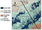
PIA18783:
-
'Murray Buttes' Mesa
Full Resolution:
TIFF
(8.918 MB)
JPEG
(471.3 kB)
|
|
|
2014-09-11 |
Mars
|
Mars Reconnaissance Orbiter (MRO)
Mars Science Laboratory (MSL)
|
HiRISE
|
1927x1542x3 |

|
-
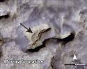
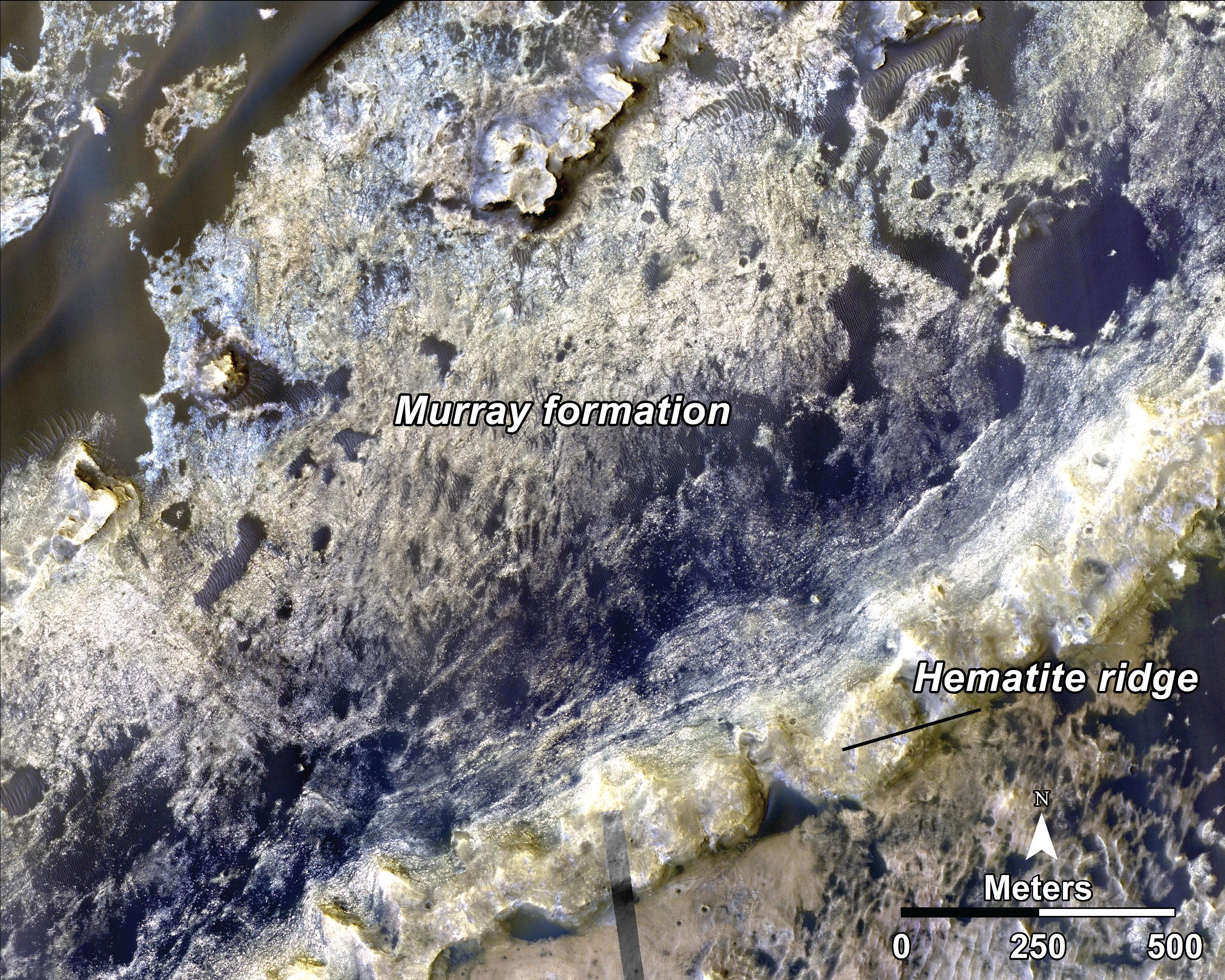
PIA18784:
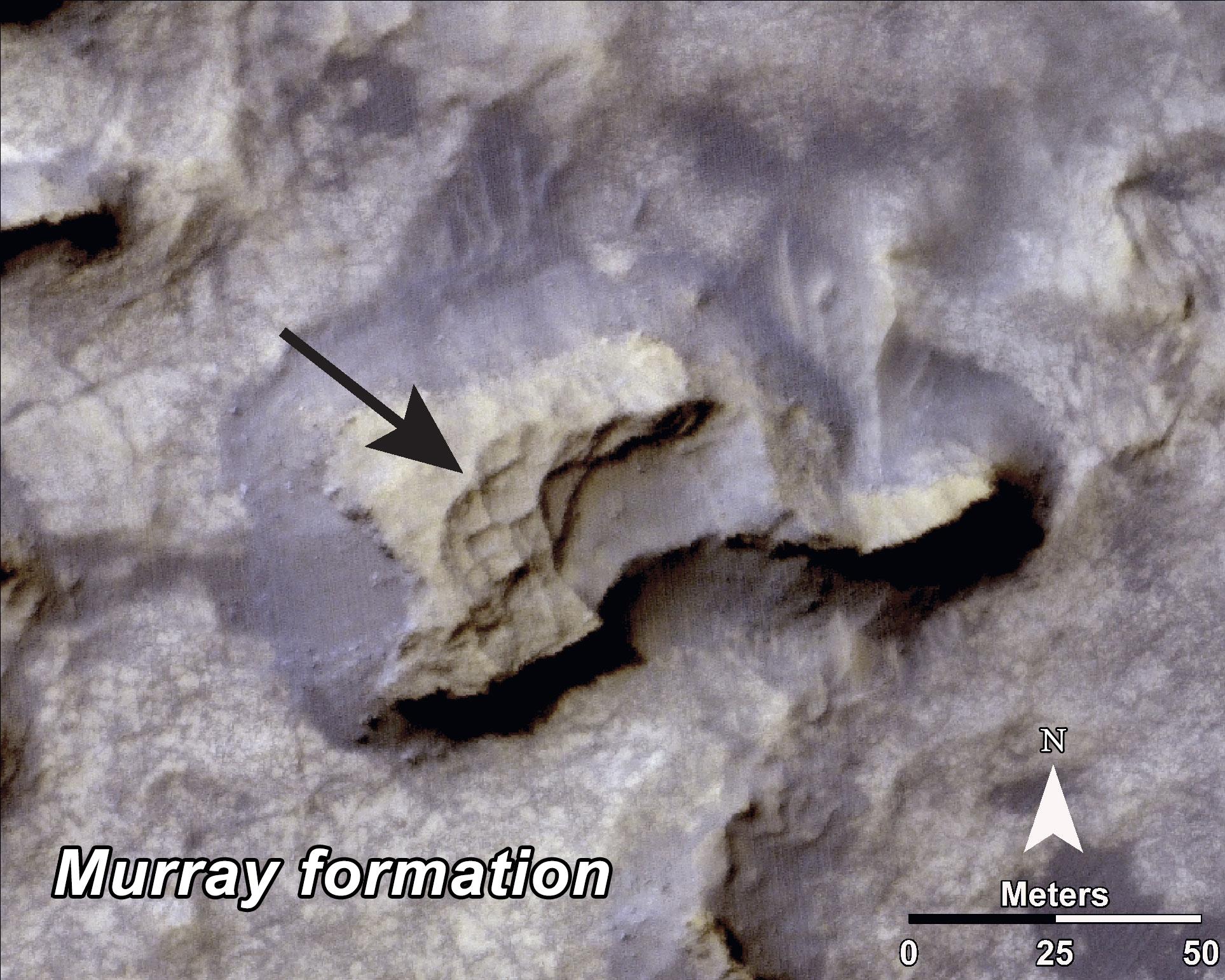
-
Bands on the 'Murray Formation'
Full Resolution:
TIFF
(8.918 MB)
JPEG
(563 kB)
|
|
|
2014-09-11 |
Mars
|
Mars Reconnaissance Orbiter (MRO)
Mars Science Laboratory (MSL)
|
HiRISE
|
3000x2400x3 |
|
-
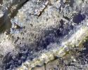
PIA18785:
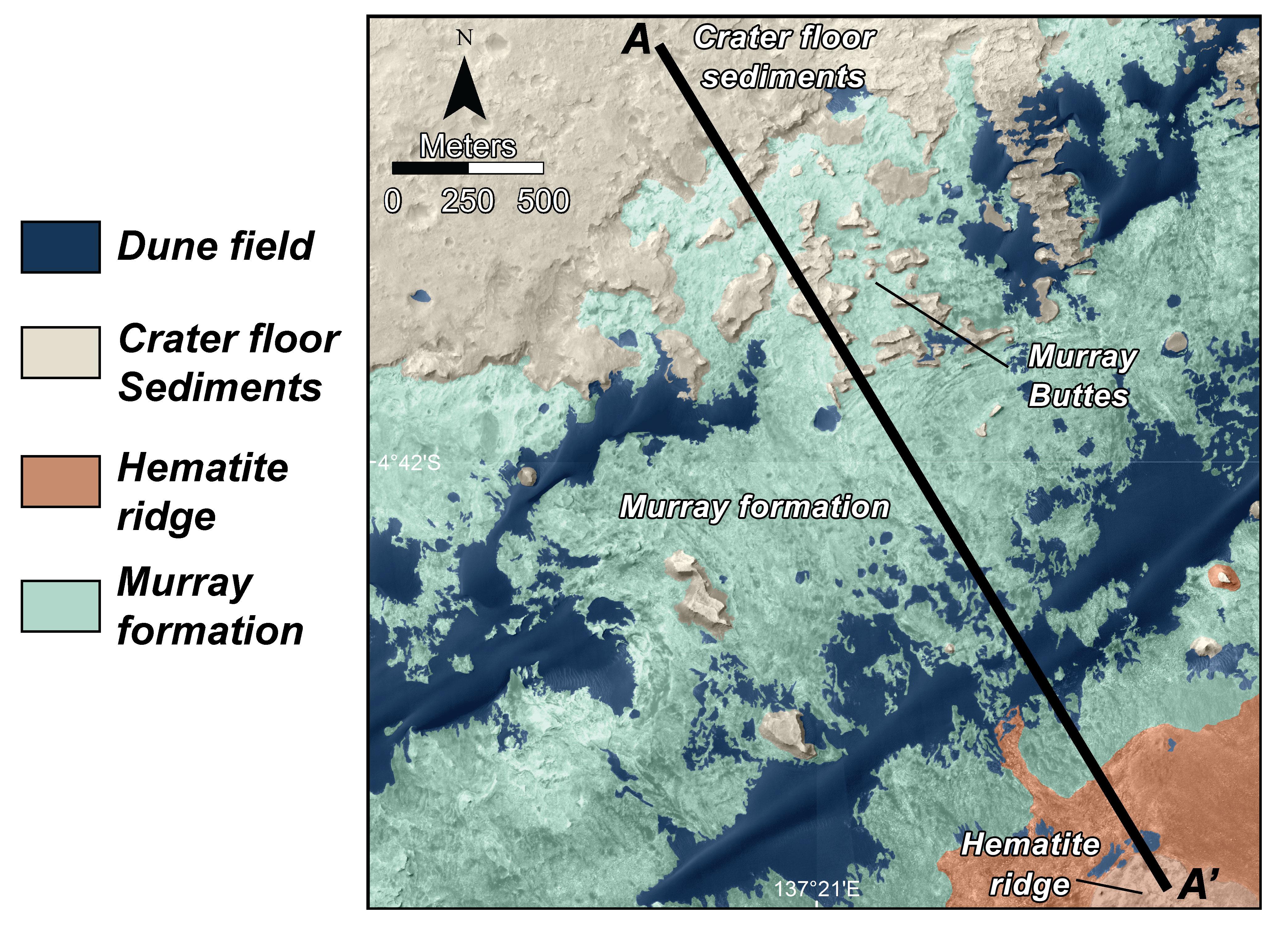
-
Geological Transition
Full Resolution:
TIFF
(21.61 MB)
JPEG
(2.032 MB)
|
|
|
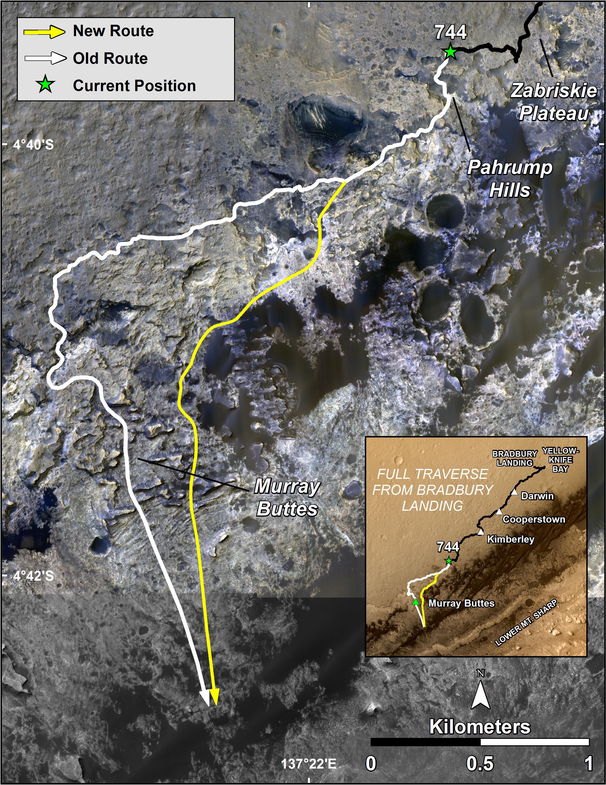
2014-09-25 |
Mars
|
Mars Reconnaissance Orbiter (MRO)
Mars Science Laboratory (MSL)
|
HiRISE
|
3300x2550x3 |
|
-
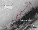
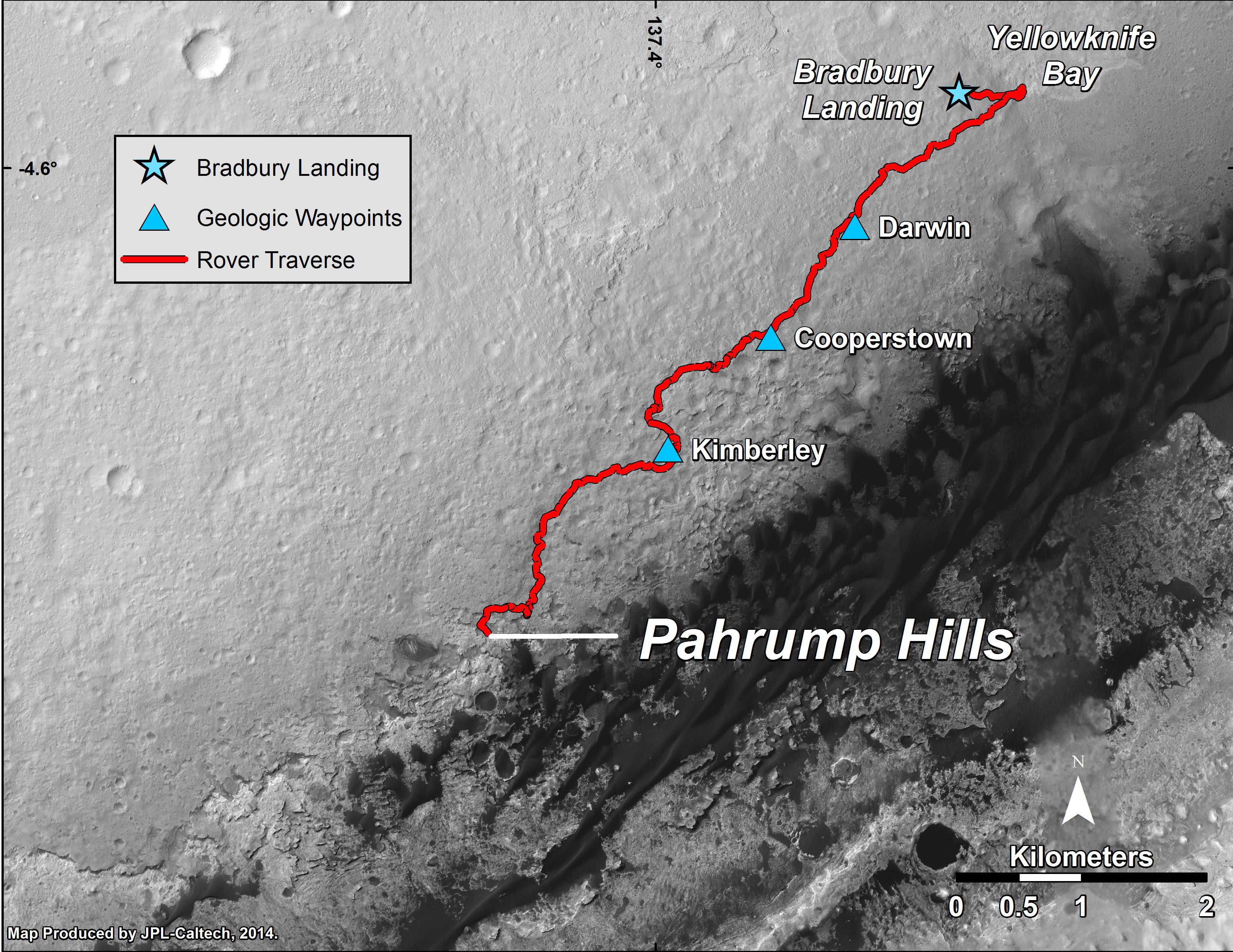
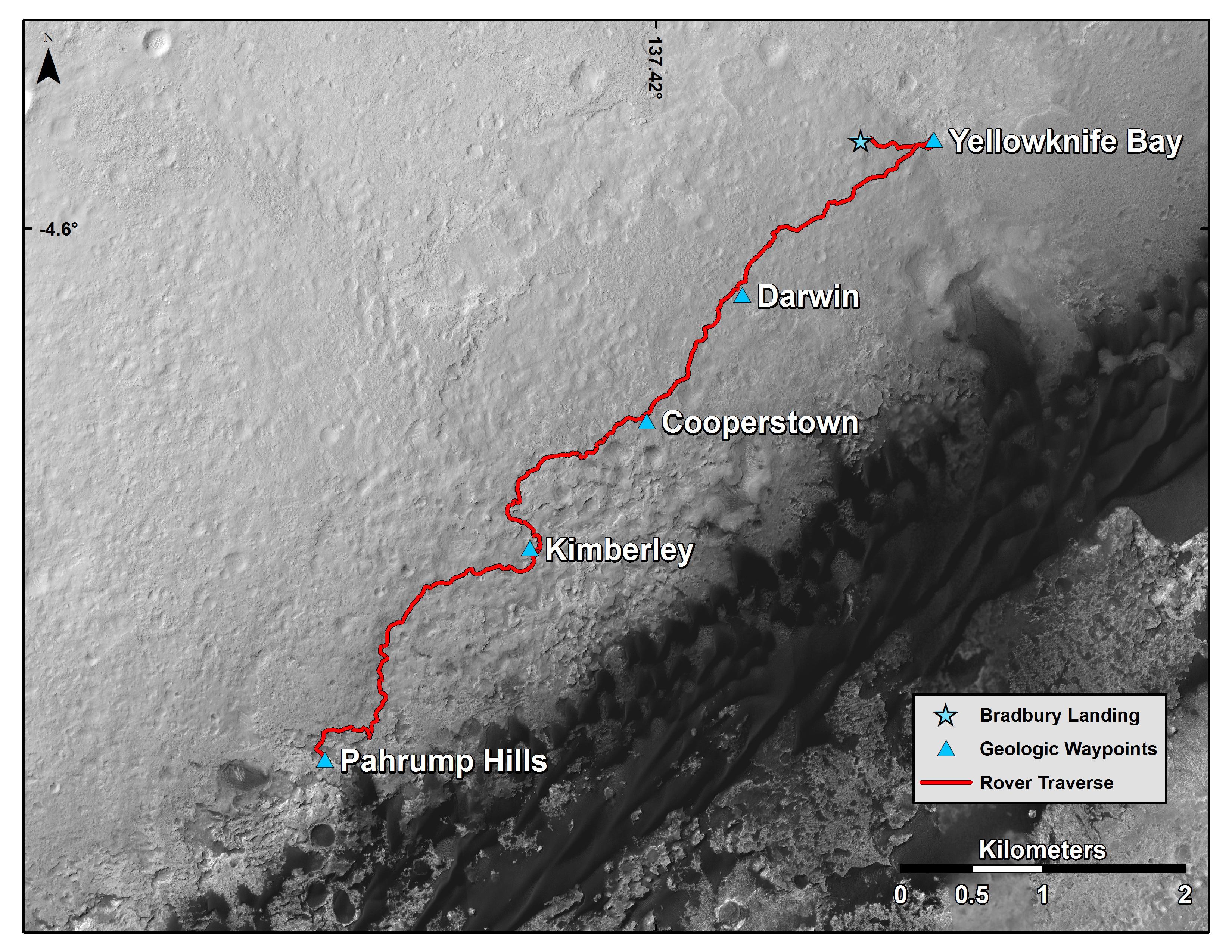
PIA18607:
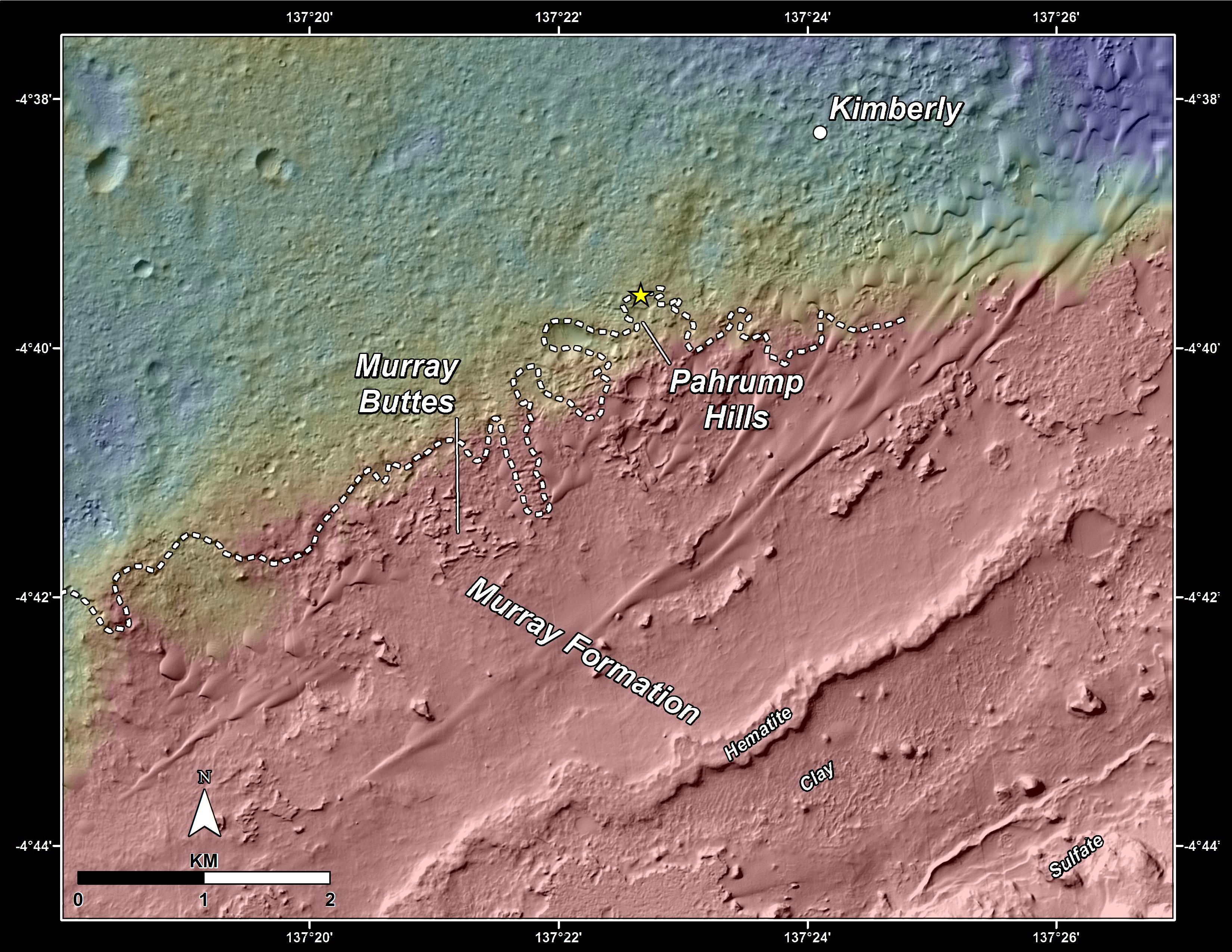
-
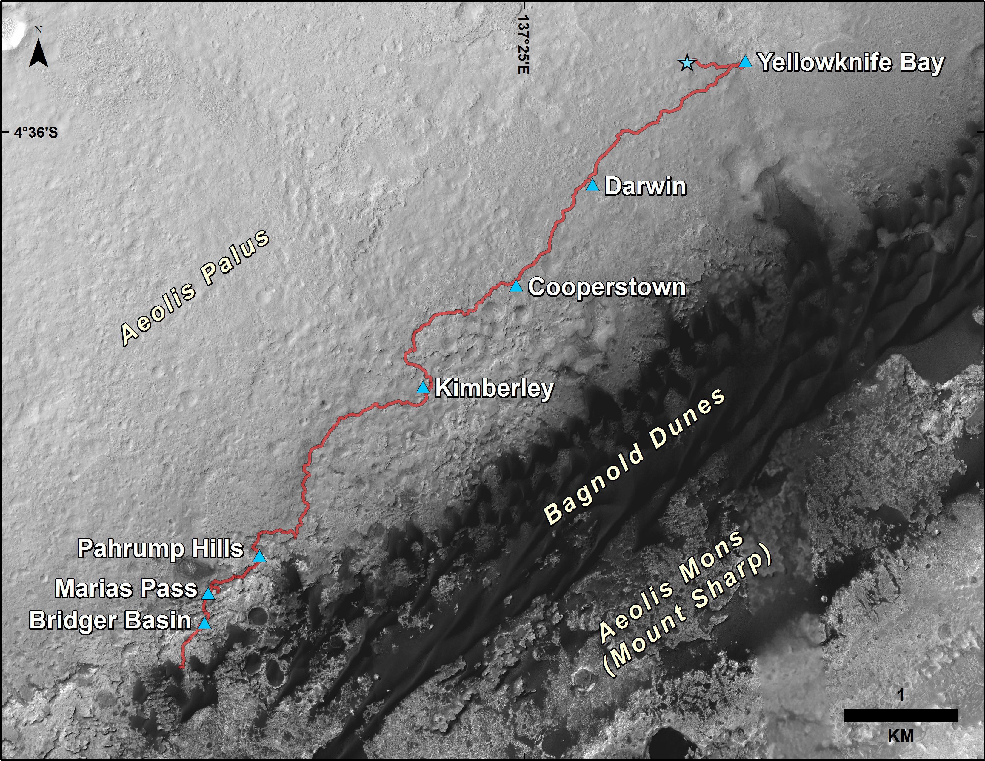
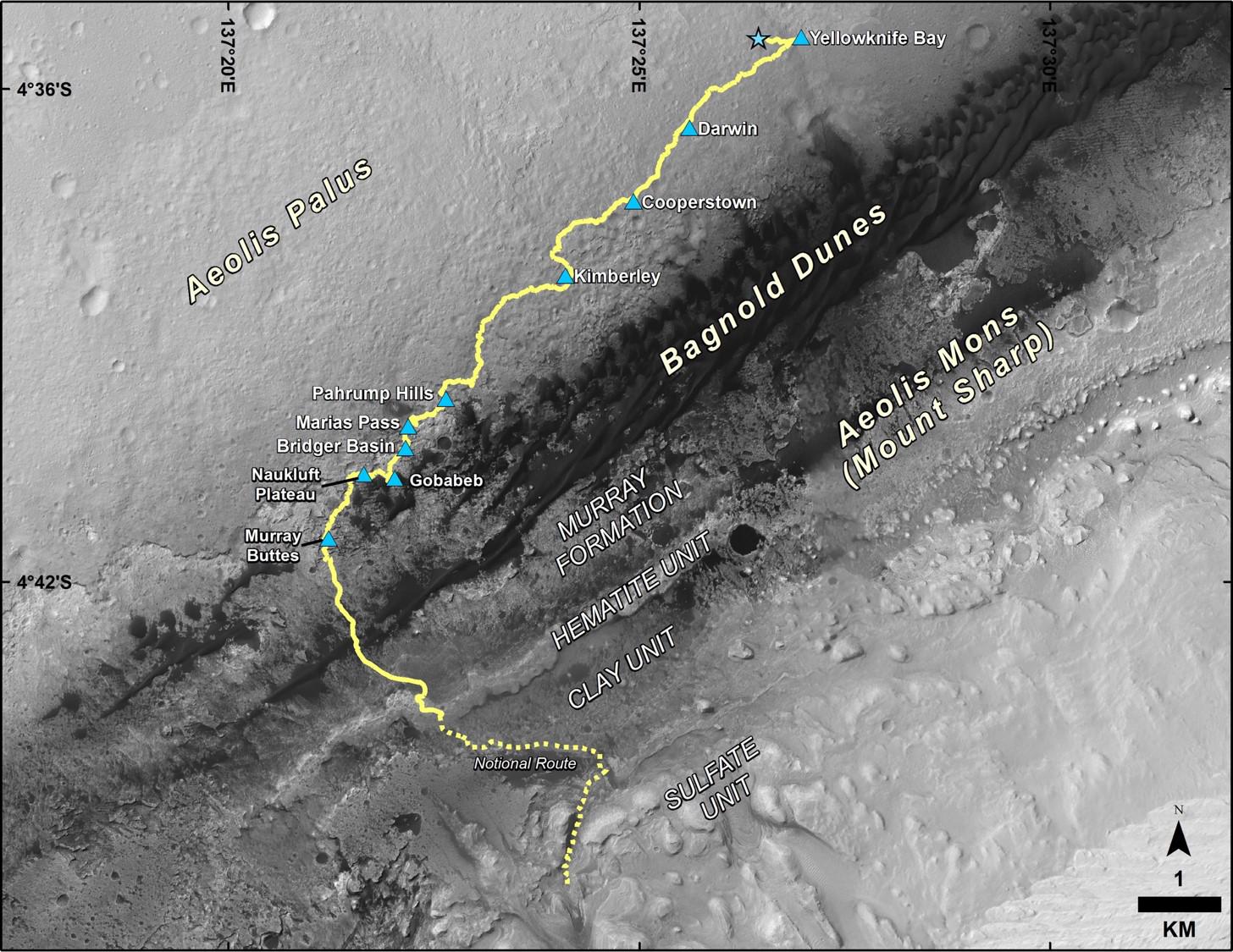
Curiosity Mars Rover's Route from Landing to 'Pahrump Hills'
Full Resolution:
TIFF
(25.26 MB)
JPEG
(1.571 MB)
|
|
|
2014-12-08 |
Mars
|
Mars Reconnaissance Orbiter (MRO)
Mars Science Laboratory (MSL)
|
HiRISE
|
3300x2550x3 |
|
-
PIA19067:
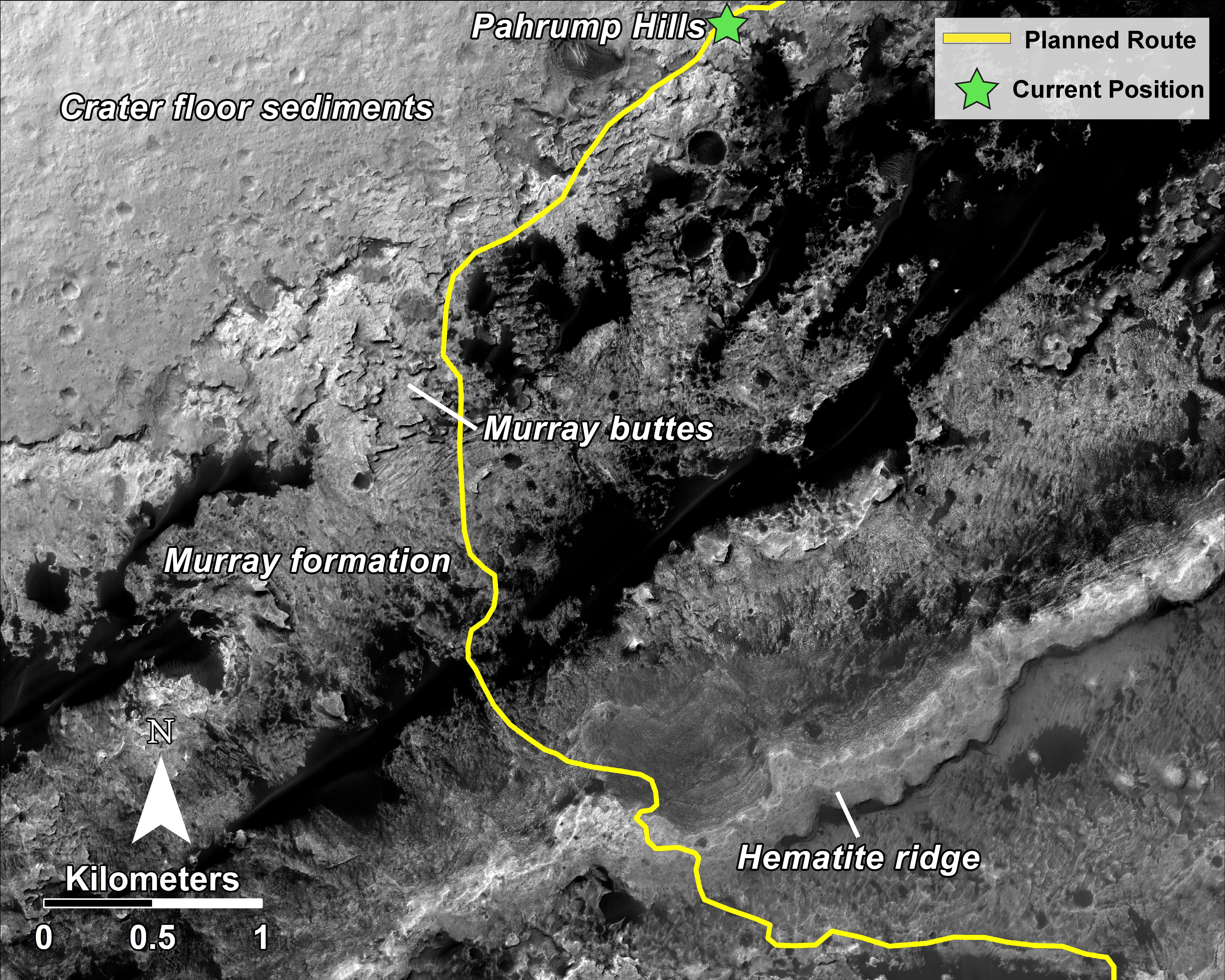
-
Curiosity Mars Rover's Route from Landing to Base of Mount Sharp
Full Resolution:
TIFF
(25.26 MB)
JPEG
(1.381 MB)
|
|
|
2015-03-27 |
Mars
|
Mars Reconnaissance Orbiter (MRO)
Mars Science Laboratory (MSL)
|
HiRISE
|
2072x1225x1 |

|
-
PIA19159:
-
Changes in Scars From 2012 Mars Landing
Full Resolution:
TIFF
(2.542 MB)
JPEG
(291.2 kB)
|
|
|
2015-04-22 |
Mars
|
Mars Reconnaissance Orbiter (MRO)
Mars Science Laboratory (MSL)
|
HiRISE
|
2286x1510x3 |
|
-
PIA19392:
-
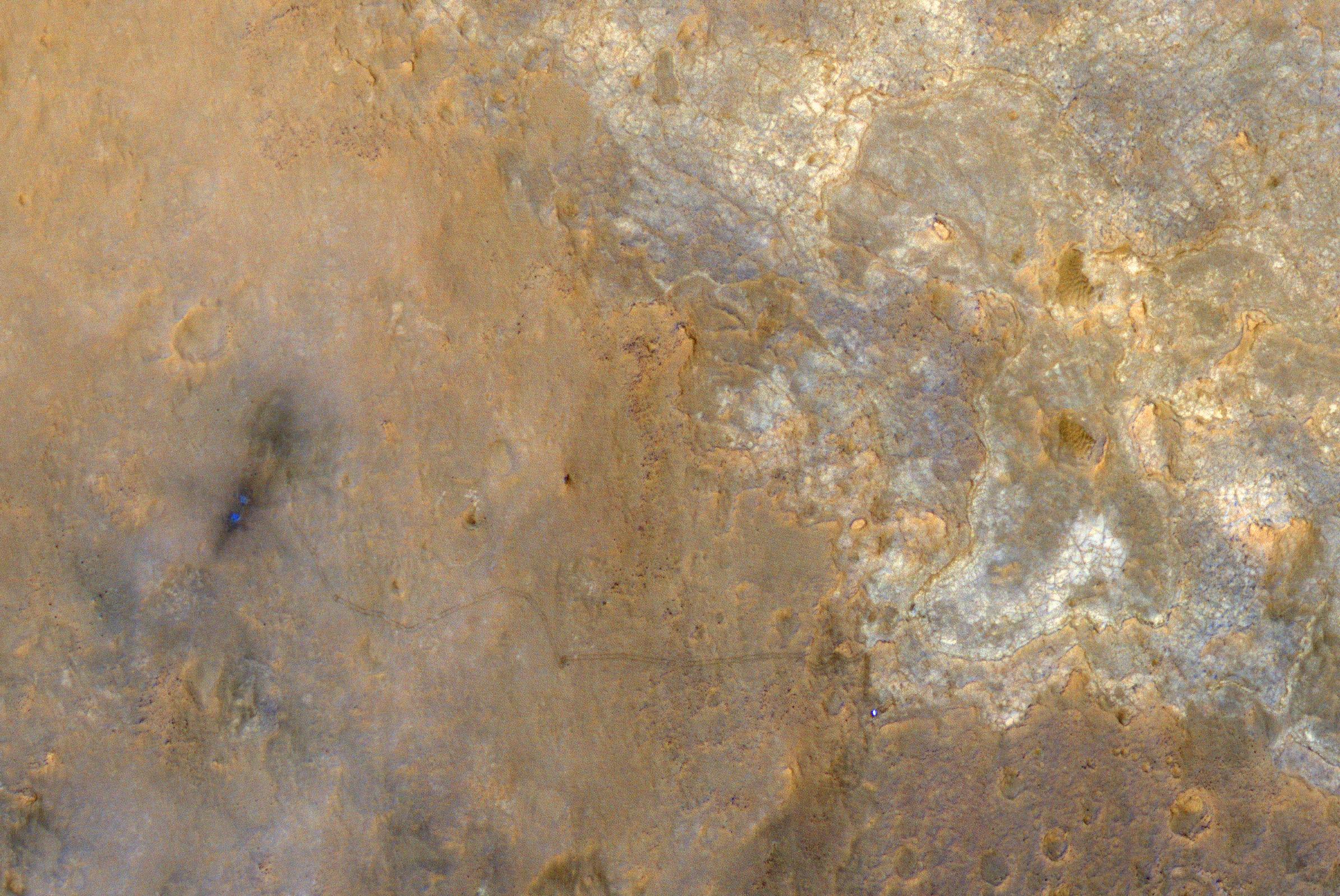
Mars Orbiter Sees Curiosity Rover in 'Artist's Drive'
Full Resolution:
TIFF
(10.36 MB)
JPEG
(527.1 kB)
|
|
|
2015-12-17 |
Mars
|
Mars Reconnaissance Orbiter (MRO)
Mars Science Laboratory (MSL)
|
HiRISE
|
3300x2550x3 |
|
-
PIA20172:
-
Curiosity Rover's Traverse, First 1,185 Sols on Mars
Full Resolution:
TIFF
(13.35 MB)
JPEG
(1.533 MB)
|
|
|
2015-12-17 |
Mars
|
Mars Reconnaissance Orbiter (MRO)
Mars Science Laboratory (MSL)
|
HiRISE
|
3300x2550x3 |
|
-
PIA20173:
-
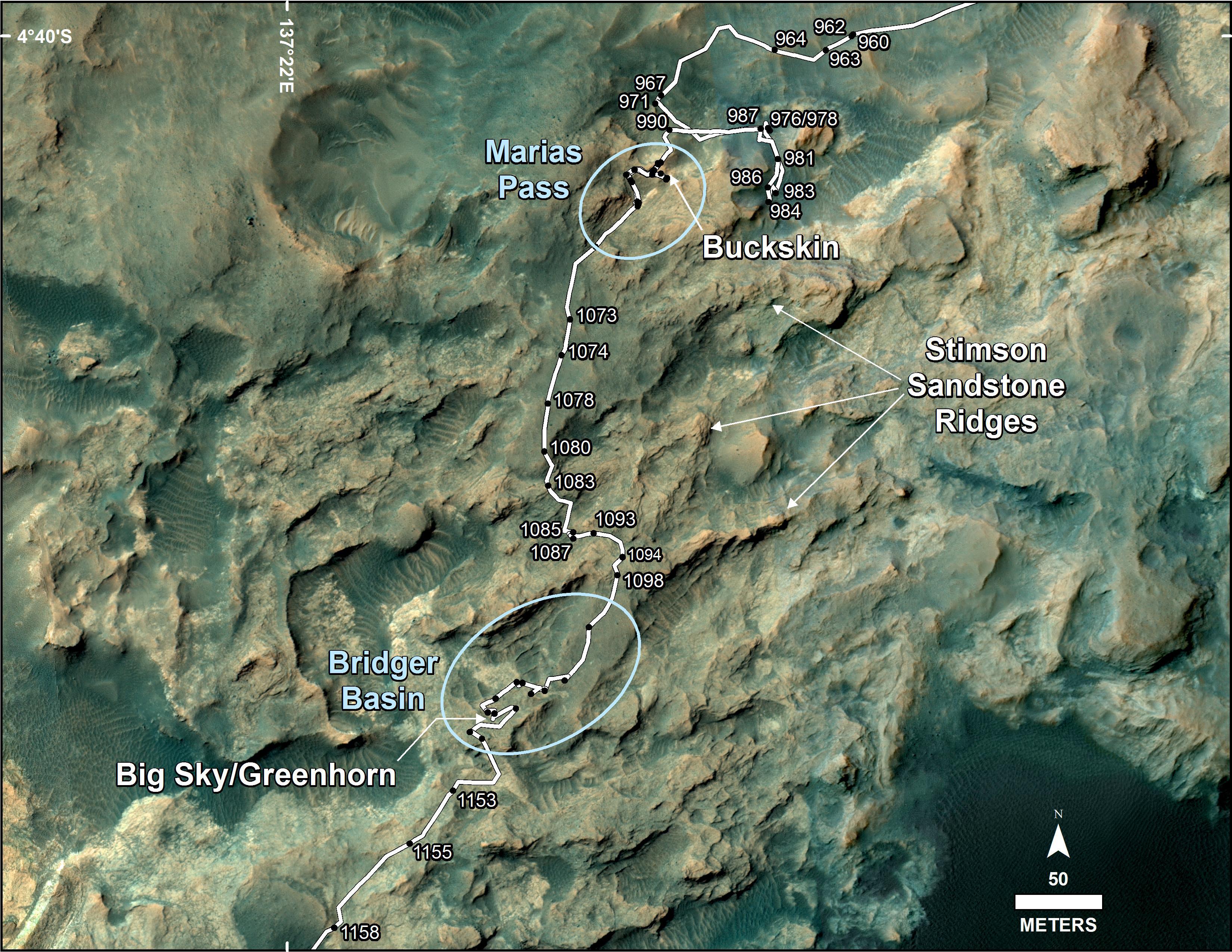
Curiosity's Path During 2015 Studies of Silica-Rich Rocks
Full Resolution:
TIFF
(25.26 MB)
JPEG
(1.372 MB)
|
|
|
2016-12-13 |
Mars
|
Mars Reconnaissance Orbiter (MRO)
Mars Science Laboratory (MSL)
|
HiRISE
|
1456x1125x3 |
|
-
PIA21144:
-
Late 2016 Map of NASA's Curiosity Mars Rover Mission
Full Resolution:
TIFF
(2.946 MB)
JPEG
(288 kB)
|
|
|
2016-12-13 |
Mars
|
Mars Reconnaissance Orbiter (MRO)
Mars Science Laboratory (MSL)
|
ChemCam
HiRISE
|
2809x2025x3 |
|
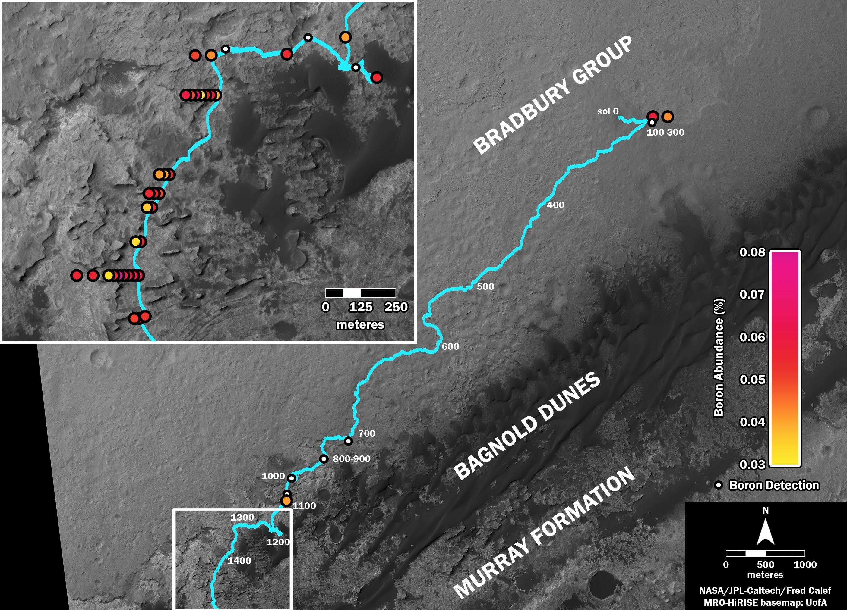
-
PIA21150:
-
Where's Boron? Mars Rover Detects It
Full Resolution:
TIFF
(7.738 MB)
JPEG
(838.4 kB)
|
|
|
2016-12-13 |
Mars
|
Mars Reconnaissance Orbiter (MRO)
Mars Science Laboratory (MSL)
|
HiRISE
MAHLI
|
3300x2550x3 |
|
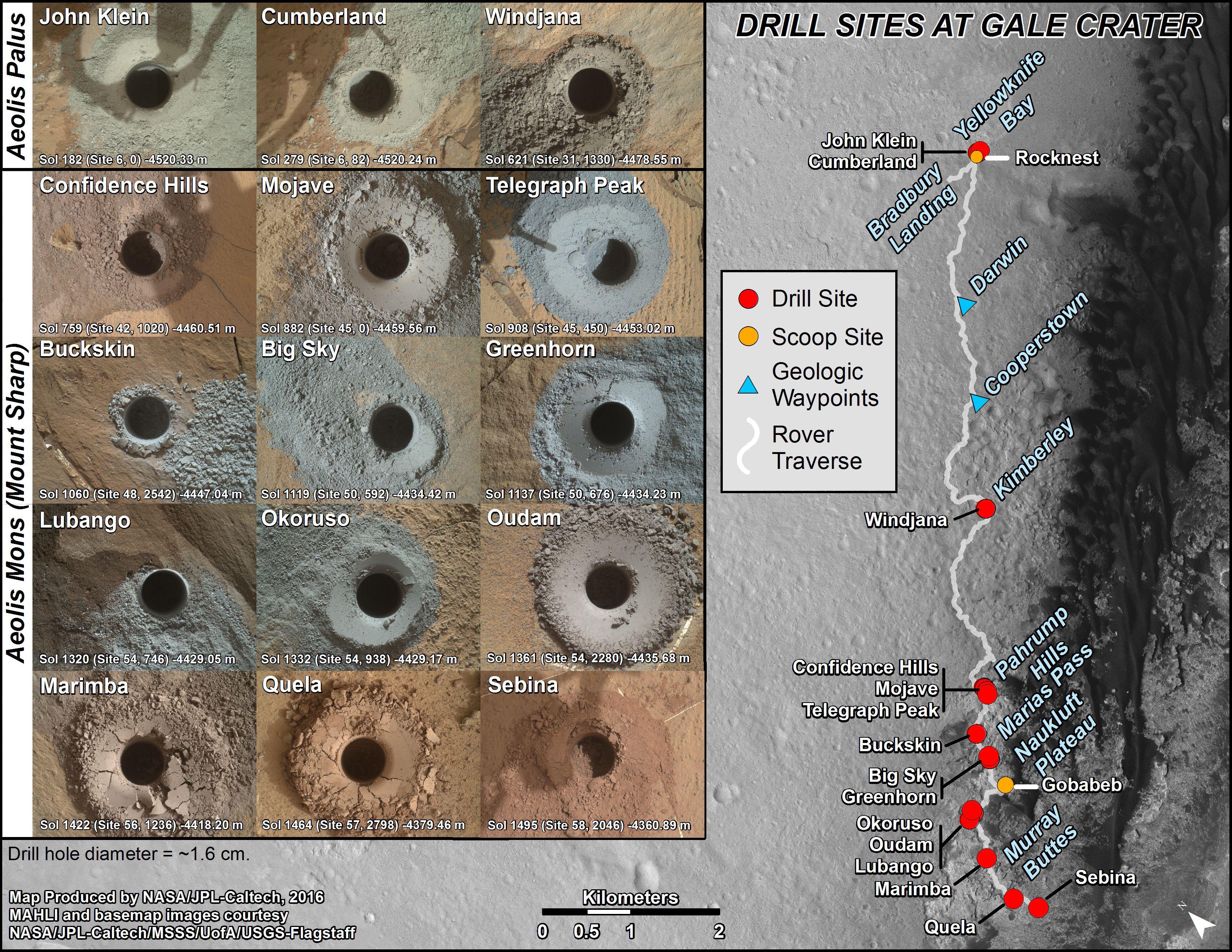
-
PIA21254:
-
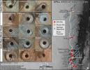
Curiosity's Rock or Soil Sampling Sites on Mars, Through November 2016
Full Resolution:
TIFF
(21.14 MB)
JPEG
(2.213 MB)
|
|
|
2017-02-27 |
Mars
|
Mars Reconnaissance Orbiter (MRO)
Mars Science Laboratory (MSL)
|
HiRISE
|
825x1118x3 |
|
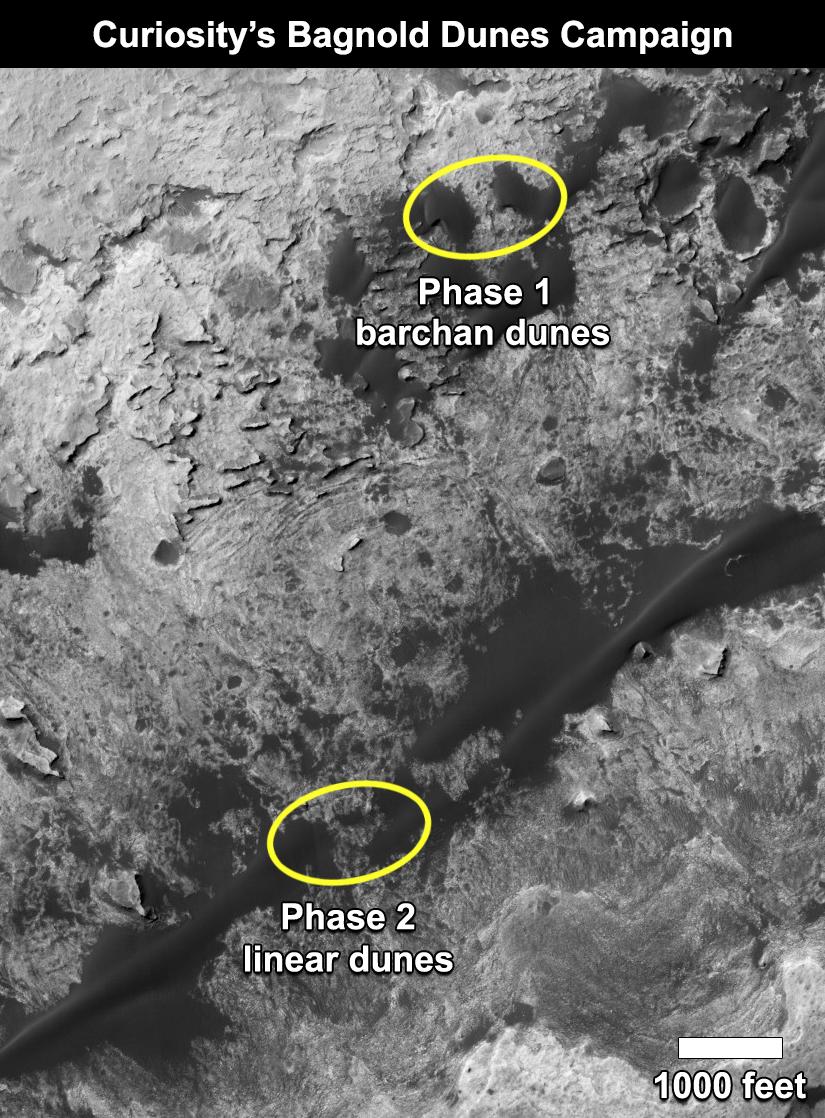
-
PIA21269:
-
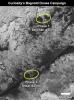
Curiosity's Bagnold Dunes Campaign: Two Types of Dunes
Full Resolution:
TIFF
(1.475 MB)
JPEG
(200.6 kB)
|
|
|
2017-06-20 |
Mars
|
Mars Reconnaissance Orbiter (MRO)
Mars Science Laboratory (MSL)
|
HiRISE
|
1403x789x3 |

|
-
PIA21710:
-
Curiosity Rover on Mount Sharp, Seen from Mars Orbit
Full Resolution:
TIFF
(3.322 MB)
JPEG
(215.9 kB)
|
|
|
2018-08-06 |
Mars
|
Mars Reconnaissance Orbiter (MRO)
Mars Global Surveyor (MGS)
|
MCS
Thermal Emission Spectrometer
|
849x423x3 |
|
-
PIA22546:
-
Growth and Retreat of the CO2 Ice at the Martian Poles
Full Resolution:
TIFF
(562.4 kB)
JPEG
(383.2 kB)
|
|
|
2019-11-12 |
Mars
|
Mars Reconnaissance Orbiter (MRO)
Mars Express (MEX)
Mars Global Surveyor (MGS)
|
CRISM
CTX
MOLA
High Resolution Stereo Camera
|
3663x2535x3 |
|
-
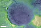
PIA23511:
-
Jezero Crater's Ancient Lakeshore
Full Resolution:
TIFF
(16.31 MB)
JPEG
(2.37 MB)
|
|
|
2018-04-02 |
Mars
|
Mars Reconnaissance Orbiter (MRO)
|
HiRISE
|
2880x1800x3 |
|
-
PIA22346:
-
The Moving Sands of Lobo Vallis
Full Resolution:
TIFF
(15.56 MB)
JPEG
(1.261 MB)
|
|
|
2003-09-25 |
Mars
|
Mars Reconnaissance Orbiter (MRO)
|
|
3201x2921x3 |
|
-
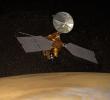
PIA04758:
-
Artist's Concept of Mars Reconnaissance Orbiter
Full Resolution:
TIFF
(15.99 MB)
JPEG
(856.5 kB)
|
|
|
2010-02-17 |
Mars
|
Mars Reconnaissance Orbiter (MRO)
|
HiRISE
|
1676x1519x1 |
|
-
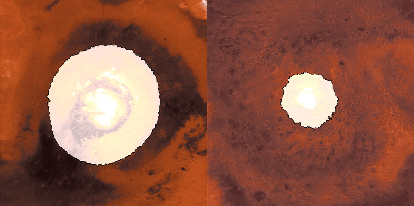
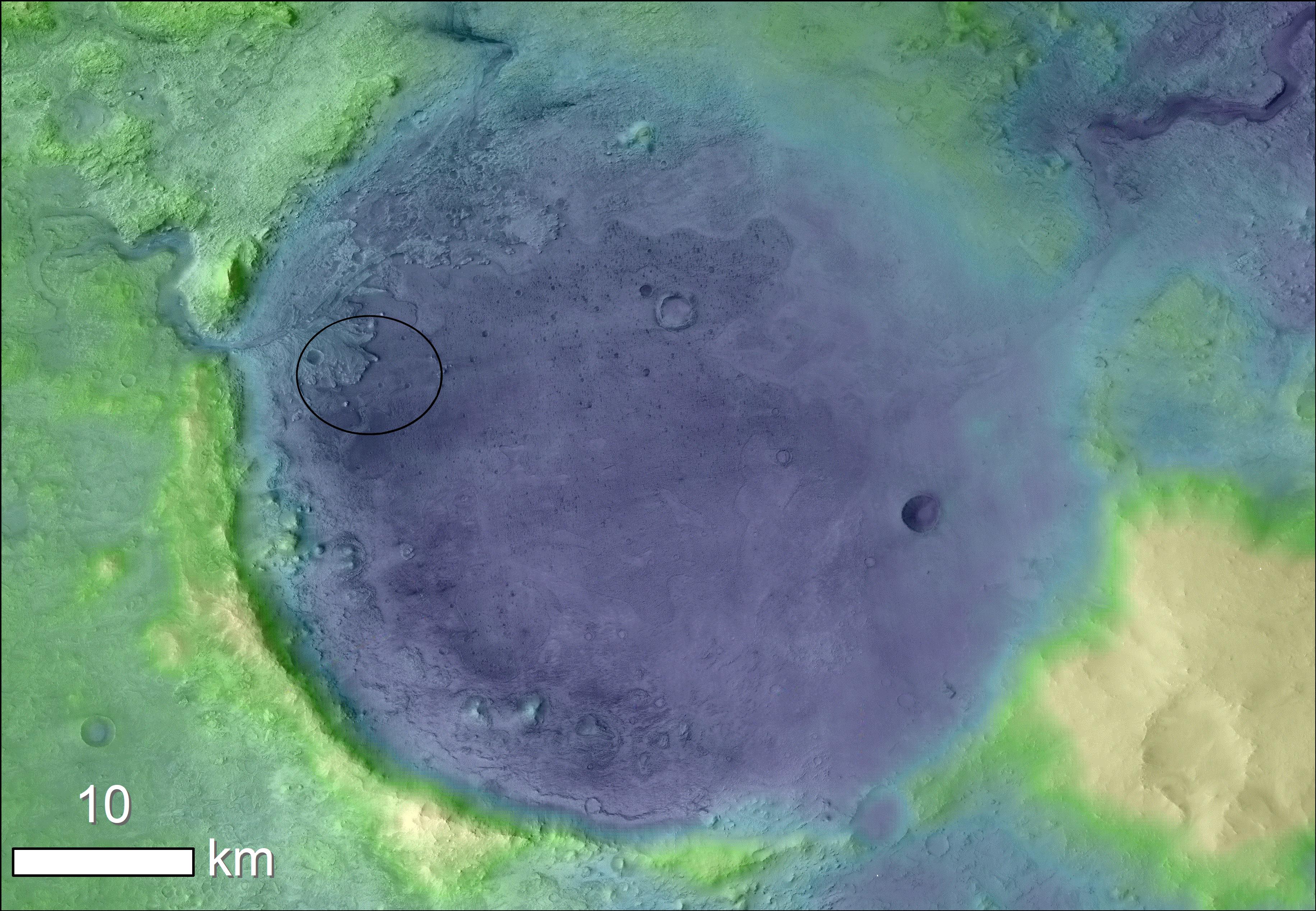
PIA12840:
-
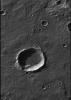
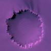
Terrain Model of Mars' Mojave Crater
Full Resolution:
TIFF
(2.549 MB)
JPEG
(380.7 kB)
|
|
|
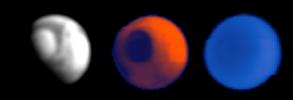
2006-03-10 |
Deimos
|
Mars Reconnaissance Orbiter (MRO)
|
Optical Navigation Camera
|
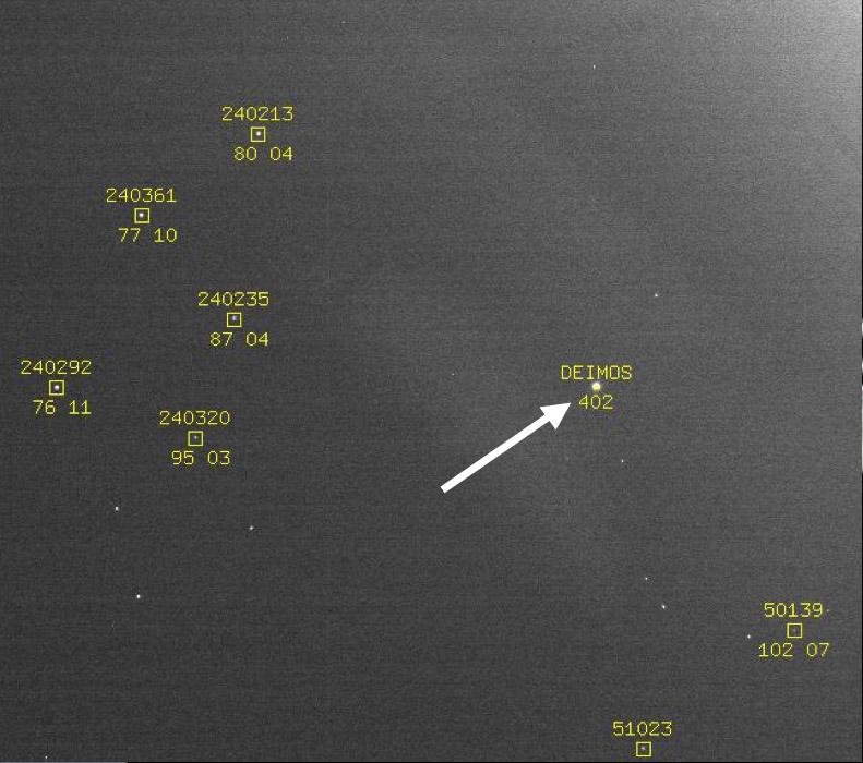
791x700x3 |
|
-
PIA02699:
-
Optical Navigation Demonstration Near Mars
Full Resolution:
TIFF
(1.663 MB)
JPEG
(71.03 kB)
|
|
|
2006-03-24 |
Mars
|
Mars Reconnaissance Orbiter (MRO)
|
HiRISE
|
1092x851x1 |

|
-
PIA08013:
-
First Mars Image from Newly Arrived Camera
Full Resolution:
TIFF
(930.5 kB)
JPEG
(146.1 kB)
|
|
|
2006-03-24 |
Mars
|
Mars Reconnaissance Orbiter (MRO)
|
HiRISE
|
20048x9500x1 |
|
-
PIA08014:
-
Detail of First Mars Image from Newly Arrived Camera
Full Resolution:
TIFF
(190.5 MB)
JPEG
(19.19 MB)
|
|
|
2006-03-31 |
Mars
|
Mars Reconnaissance Orbiter (MRO)
|
MCS
|
880x300x3 |
|
-
PIA08030:
-
First Data from Mars Climate Sounder
Full Resolution:
TIFF
(793 kB)
JPEG
(12.12 kB)
|
|
|
2006-04-07 |
Mars
|
Mars Reconnaissance Orbiter (MRO)
|
HiRISE
|
3048x9280x3 |
|
-
PIA08061:
-
First Color HiRISE Image of Mars
Full Resolution:
TIFF
(84.86 MB)
JPEG
(4.953 MB)
|
|
|
2006-04-07 |
Mars
|
Mars Reconnaissance Orbiter (MRO)
|
HiRISE
|
3000x2299x3 |
|
-
PIA08054:
-
Perspective View of HiRISE First Image
Full Resolution:
TIFF
(20.69 MB)
JPEG
(998.3 kB)
|
|
|
2006-04-07 |
Mars
|
Mars Reconnaissance Orbiter (MRO)
|
HiRISE
|
10040x26011x1 |
|
-
PIA08049:
-
Sample of the Argyre Impact Basin Rim
Full Resolution:
TIFF
(261.2 MB)
JPEG
(39.48 MB)
|
|
|
2006-04-07 |
Mars
|
Mars Reconnaissance Orbiter (MRO)
|
HiRISE
|
20081x5523x1 |
|
-
PIA08047:
Landscape West of Bosporos Rupes
Full Resolution:
TIFF
(110.9 MB)
JPEG
(17.23 MB)
|
|
|
2006-04-07 |
Mars
|
Mars Reconnaissance Orbiter (MRO)
|
HiRISE
|
20081x5164x1 |
|
-
PIA08048:
Landscape Northeast of Halley Crater
Full Resolution:
TIFF
(103.7 MB)
JPEG
(21.2 MB)
|
|
|
2006-04-07 |
Mars
|
Mars Reconnaissance Orbiter (MRO)
|
HiRISE
|
6045x23024x1 |
|
-
PIA08050:
-
Sample of Mid-latitude Southern Highlands
Full Resolution:
TIFF
(139.4 MB)
JPEG
(18.22 MB)
|
|
|
2006-04-07 |
Mars
|
Mars Reconnaissance Orbiter (MRO)
|
HiRISE
|
6045x17003x1 |
|
-
PIA08051:
-
A Myriad of Geologic Processes in Terra Cimmeria
Full Resolution:
TIFF
(102.9 MB)
JPEG
(16.25 MB)
|
|
|
2006-04-07 |
Mars
|
Mars Reconnaissance Orbiter (MRO)
|
HiRISE
|
5017x5634x1 |
|
-
PIA08052:
-
Twilight Imaging of Kepler Crater Floor
Full Resolution:
TIFF
(28.31 MB)
JPEG
(6.127 MB)
|
|
|
2006-04-07 |
Mars
|
Mars Reconnaissance Orbiter (MRO)
|
HiRISE
|
3212x1600x3 |

|
-
PIA08053:
-
First HiRISE Image of Mars: Topographic Model from Photoclinometry
Full Resolution:
TIFF
(15.42 MB)
JPEG
(1.482 MB)
|
|
|
2006-04-07 |
Mars
|
Mars Reconnaissance Orbiter (MRO)
|
HiRISE
|
20081x9523x1 |
|
-
PIA08060:
-
First HiRISE Image of Mars
Full Resolution:
TIFF
(191.2 MB)
JPEG
(16.72 MB)
|
|
|
2006-09-29 |
Mars
|
Mars Reconnaissance Orbiter (MRO)
|
CRISM
|
192x2700x3 |

|
-
PIA08788:
-
New Spectrometer Begins its Global Map of Mars
Full Resolution:
TIFF
(946.5 kB)
JPEG
(84.73 kB)
|
|
|
2006-09-29 |
Mars
|
Mars Reconnaissance Orbiter (MRO)
|
HiRISE
|
2001x1485x1 |

|
-
PIA08789:
-
New Mars Camera's First Image of Mars from Mapping Orbit
Full Resolution:
TIFF
(2.975 MB)
JPEG
(512.6 kB)
|
|
|
2006-09-30 |
Mars
|
Mars Reconnaissance Orbiter (MRO)
|
HiRISE
|
13469x13491x1 |
|
-
PIA08791:
-
North Polar Layered Deposits in Summer
Full Resolution:
TIFF
(181.7 MB)
JPEG
(8.903 MB)
|
|
|
2006-10-01 |
Mars
|
Mars Reconnaissance Orbiter (MRO)
|
HiRISE
|
23444x23377x1 |
|
-
PIA08792:
-
New Mars Camera's First Image of Mars from Mapping Orbit (Full Frame)
Full Resolution:
TIFF
(548.1 MB)
JPEG
(47.26 MB)
|
|
|
2006-10-16 |
Mars
|
Mars Reconnaissance Orbiter (MRO)
|
HiRISE
|
4613x4320x3 |
|
-
PIA01920:
-
Crater Edge in Terra Sirenum
Full Resolution:
TIFF
(59.78 MB)
JPEG
(2.617 MB)
|
|
|
2006-10-16 |
Mars
|
Mars Reconnaissance Orbiter (MRO)
|
HiRISE
|
7365x4320x3 |

|
-
PIA01921:
-
Part of Mawrth Vallis
Full Resolution:
TIFF
(95.45 MB)
JPEG
(3.572 MB)
|
|
|
2006-10-16 |
Mars
|
Mars Reconnaissance Orbiter (MRO)
|
HiRISE
|
1016x996x3 |
|
-
PIA01923:
-
Gullies in Sirenum Terra, Mars
Full Resolution:
TIFF
(3.04 MB)
JPEG
(144.3 kB)
|
|
|
2006-10-16 |
Mars
|
Mars Reconnaissance Orbiter (MRO)
|
HiRISE
|
1408x1107x3 |
|
-
PIA01924:
-
Diversity in Mawrth Region, Mars
Full Resolution:
TIFF
(4.685 MB)
JPEG
(256.7 kB)
|
|
|
2006-10-16 |
Mars
|
Mars Reconnaissance Orbiter (MRO)
|
HiRISE
|
888x1309x1 |
|
-
PIA01925:
-
North Polar Layers, Mars
Full Resolution:
TIFF
(1.164 MB)
JPEG
(203.1 kB)
|
|
|
2006-10-16 |
Mars
|
Mars Reconnaissance Orbiter (MRO)
|
HiRISE
|
9687x4320x1 |

|
-
PIA01926:
-
Head of Chasma Boreale Near Mars' North Pole
Full Resolution:
TIFF
(41.85 MB)
JPEG
(3.691 MB)
|
|
|
2006-10-16 |
Mars
|
Mars Reconnaissance Orbiter (MRO)
|
CRISM
|
1044x1340x3 |
|
-
PIA01922:
-
Chasma Boreale in the North Polar Region
Full Resolution:
TIFF
(4.202 MB)
JPEG
(79.27 kB)
|
|
|
2006-10-16 |
Mars
|
Mars Reconnaissance Orbiter (MRO)
|
CTX
|
1264x12544x1 |

|
-
PIA01930:
-
Context Camera Image of North Polar Chasma Boreale
Full Resolution:
TIFF
(15.87 MB)
JPEG
(611.2 kB)
|
|
|
2006-10-16 |
Mars
|
Mars Reconnaissance Orbiter (MRO)
|
CTX
|
5056x7168x1 |
|
-
PIA01931:
-
Crater in Terra Sirenum with Gullied Walls
Full Resolution:
TIFF
(36.3 MB)
JPEG
(5.535 MB)
|
|
|
2006-10-16 |
Mars
|
Mars Reconnaissance Orbiter (MRO)
|
CTX
|
5056x12288x1 |
|
-
PIA01932:
-
Layered Rocks Near Mawrth Vallis
Full Resolution:
TIFF
(62.23 MB)
JPEG
(6.478 MB)
|
|
|
2006-10-16 |
Mars
|
Mars Reconnaissance Orbiter (MRO)
|
CRISM
|
1550x2131x3 |
|
-
PIA01927:
-
Spectrometer Observations Near Mawrth Vallis
Full Resolution:
TIFF
(9.926 MB)
JPEG
(364.1 kB)
|
|
|
2006-12-05 |
Mars
|
Mars Reconnaissance Orbiter (MRO)
|
HiRISE
|
4088x4103x3 |
|
-
PIA01883:
-
Stereo View of Victoria Crater
Full Resolution:
TIFF
(50.32 MB)
JPEG
(978.9 kB)
|
|
|
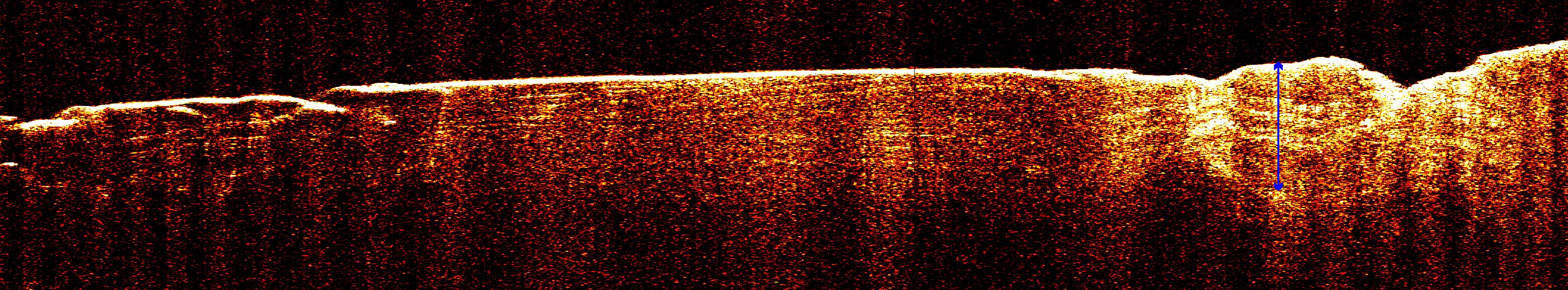
2006-12-13 |
Mars
|
Mars Reconnaissance Orbiter (MRO)
|
Shallow Subsurface Radar (SHARAD)
|
3194x591x3 |
|
-
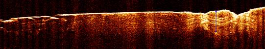
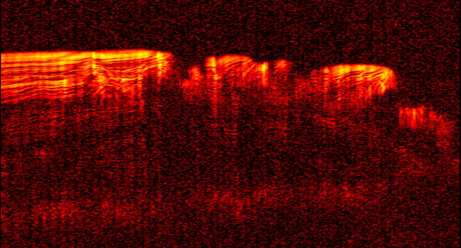
PIA09095:
Radar View of Layering near Mars' South Pole, Orbit 1360
Full Resolution:
TIFF
(5.663 MB)
JPEG
(722.7 kB)
|
|
|
2006-12-13 |
Mars
|
Mars Reconnaissance Orbiter (MRO)
|
Shallow Subsurface Radar (SHARAD)
|
3253x2415x3 |
|
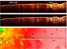
-
PIA09076:
-
Interpreting Radar View near Mars' South Pole, Orbit 1334
Full Resolution:
TIFF
(23.57 MB)
JPEG
(1.764 MB)
|
|
|
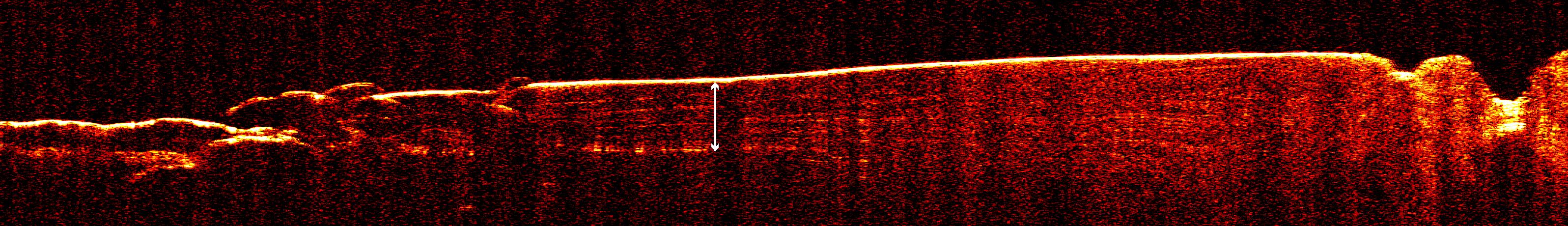
2006-12-13 |
Mars
|
Mars Reconnaissance Orbiter (MRO)
|
Shallow Subsurface Radar (SHARAD)
|
3192x460x3 |
|
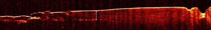
-
PIA09073:
Radar View of Layering near Mars' South Pole, Orbit 1360
Full Resolution:
TIFF
(4.405 MB)
JPEG
(446.8 kB)
|
|
|
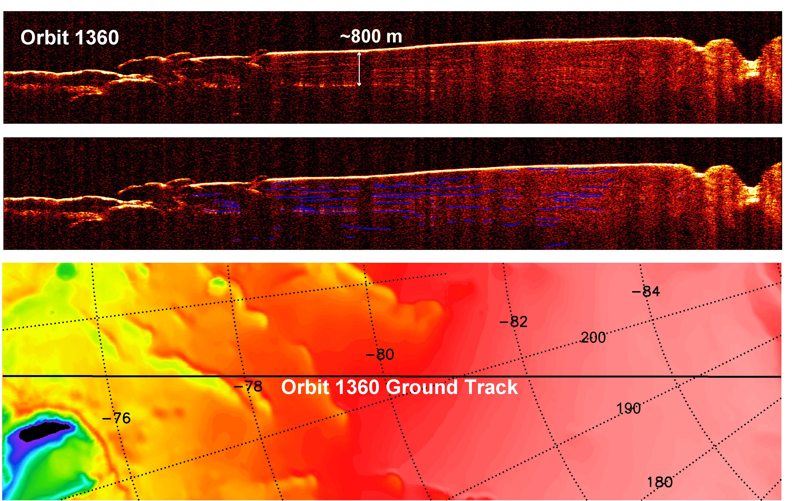
2006-12-13 |
Mars
|
Mars Reconnaissance Orbiter (MRO)
|
Shallow Subsurface Radar (SHARAD)
|
3275x2065x3 |

|
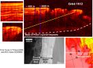
-
PIA09075:
-
Interpreting Radar View near Mars' South Pole, Orbit 1360
Full Resolution:
TIFF
(20.29 MB)
JPEG
(1.198 MB)
|
|
|
2006-12-13 |
Mars
|
Mars Reconnaissance Orbiter (MRO)
|
Shallow Subsurface Radar (SHARAD)
|
1617x870x3 |

|
-
PIA09096:
-
Interpreting Radar View near Mars' South Pole, Orbit 1334
Full Resolution:
TIFF
(1.41 MB)
JPEG
(299.9 kB)
|
|
|
2006-12-13 |
Mars
|
Mars Reconnaissance Orbiter (MRO)
|
Shallow Subsurface Radar (SHARAD)
|
2634x1934x3 |
|
-
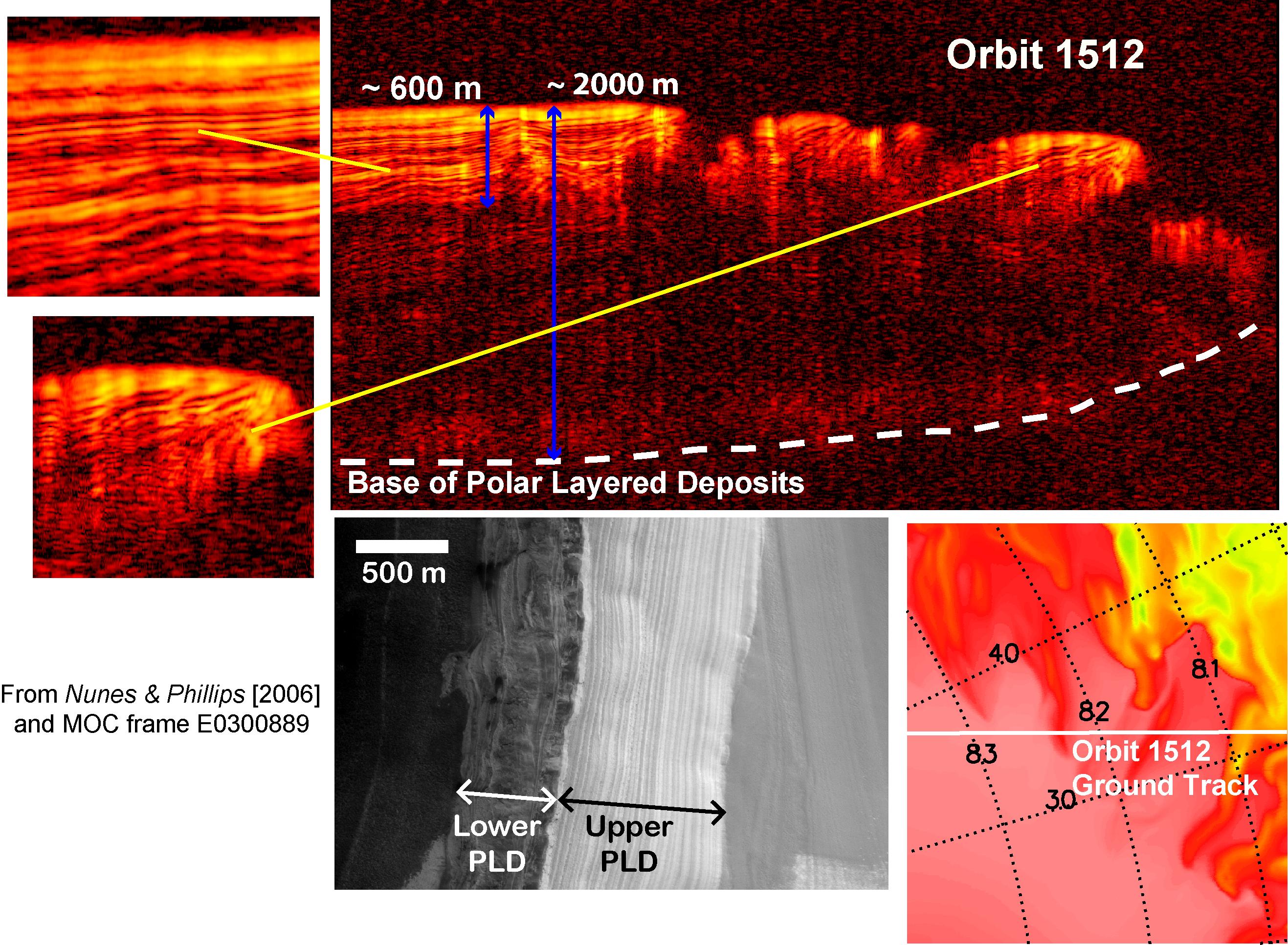
PIA09074:
-
Interpreting Radar View near Mars' North Pole, Orbit 1512
Full Resolution:
TIFF
(15.3 MB)
JPEG
(808.7 kB)
|
|
|
2006-12-13 |
Mars
|
Mars Reconnaissance Orbiter (MRO)
|
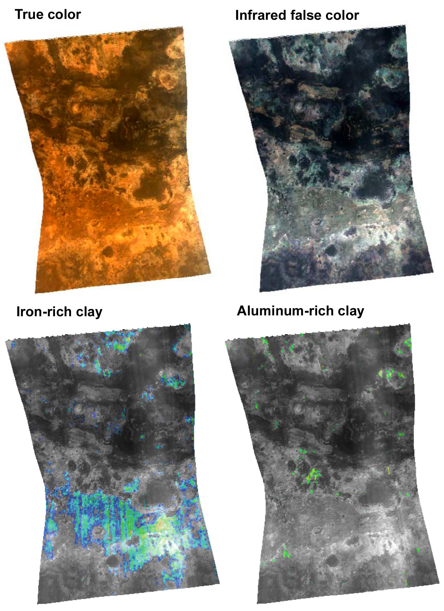
CRISM
High Resolution Imaging Science Experiment (HiRISE)
|
2614x2383x3 |
|
-
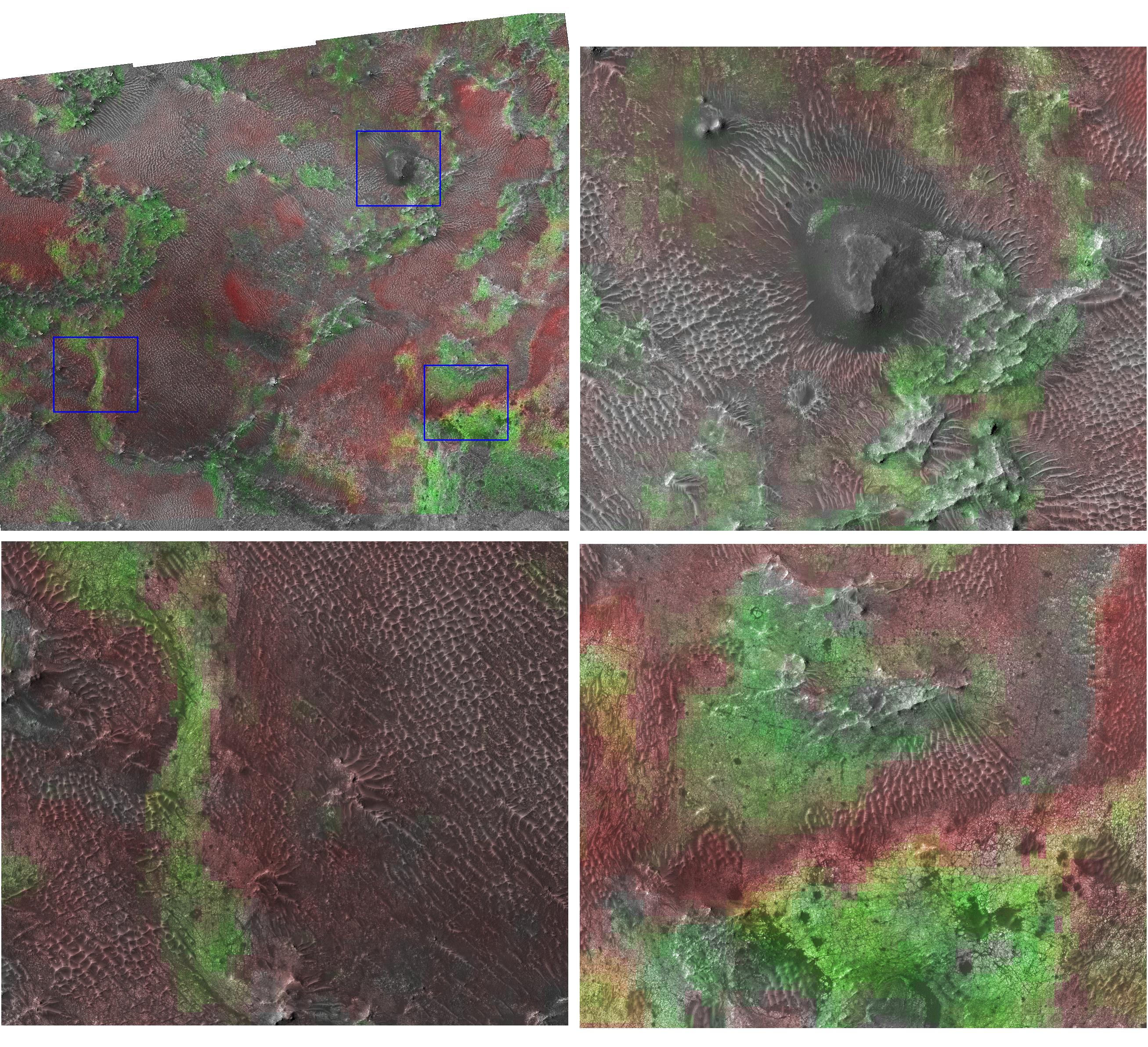
PIA09093:
-
Clay at Nili Fossae
Full Resolution:
TIFF
(18.71 MB)
JPEG
(1.42 MB)
|
|
|
2006-12-13 |
Mars
|
Mars Reconnaissance Orbiter (MRO)
|
CRISM
|
1110x996x3 |
|
-
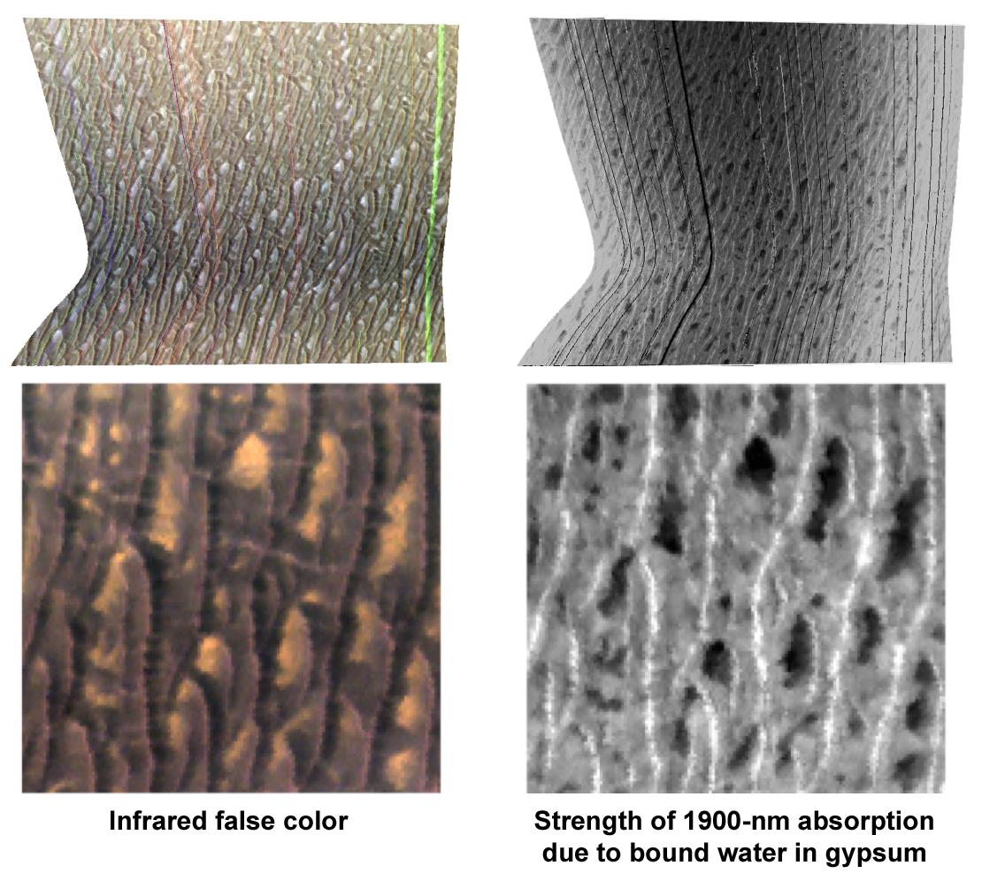
PIA09094:
-
Gypsum at Olympia Undae
Full Resolution:
TIFF
(3.321 MB)
JPEG
(163.7 kB)
|
|
|
2006-12-13 |
Mars
|
Mars Reconnaissance Orbiter (MRO)
|
HiRISE
|
4000x10119x3 |
|
-
PIA09097:
-
Layers Exposed at Polar Canyon
Full Resolution:
TIFF
(121.4 MB)
JPEG
(5.384 MB)
|
|
|
2006-12-13 |
Mars
|
Mars Reconnaissance Orbiter (MRO)
|
HiRISE
|
2048x2283x1 |
|
-
PIA09098:
-
Pits in Polar Cap
Full Resolution:
TIFF
(4.68 MB)
JPEG
(406.9 kB)
|
|
|
2006-12-22 |
Mars
|
Mars Reconnaissance Orbiter (MRO)
|
CRISM
|
1728x1728x3 |
|
-
PIA09101:
-
Seasonal Frost in Terra Sirenum
Full Resolution:
TIFF
(8.972 MB)
JPEG
(367.2 kB)
|
|
|
2007-01-11 |
Mars
|
Mars Reconnaissance Orbiter (MRO)
|
HiRISE
|
4000x4000x1 |
|
-
PIA09105:
-
Mars Pathfinder Landing Site and Surroundings
Full Resolution:
TIFF
(16.02 MB)
JPEG
(2.384 MB)
|
|
|
2007-02-13 |
Mars
|
Mars Reconnaissance Orbiter (MRO)
|
CRISM
|
758x1550x3 |
|
-
PIA09195:
-
A Fresh Crater Drills to Tharsis Bedrock
Full Resolution:
TIFF
(3.529 MB)
JPEG
(92.81 kB)
|
|
|
2007-02-15 |
Mars
|
Mars Reconnaissance Orbiter (MRO)
|
HiRISE
|
2025x2905x3 |
|
-
PIA09189:
-
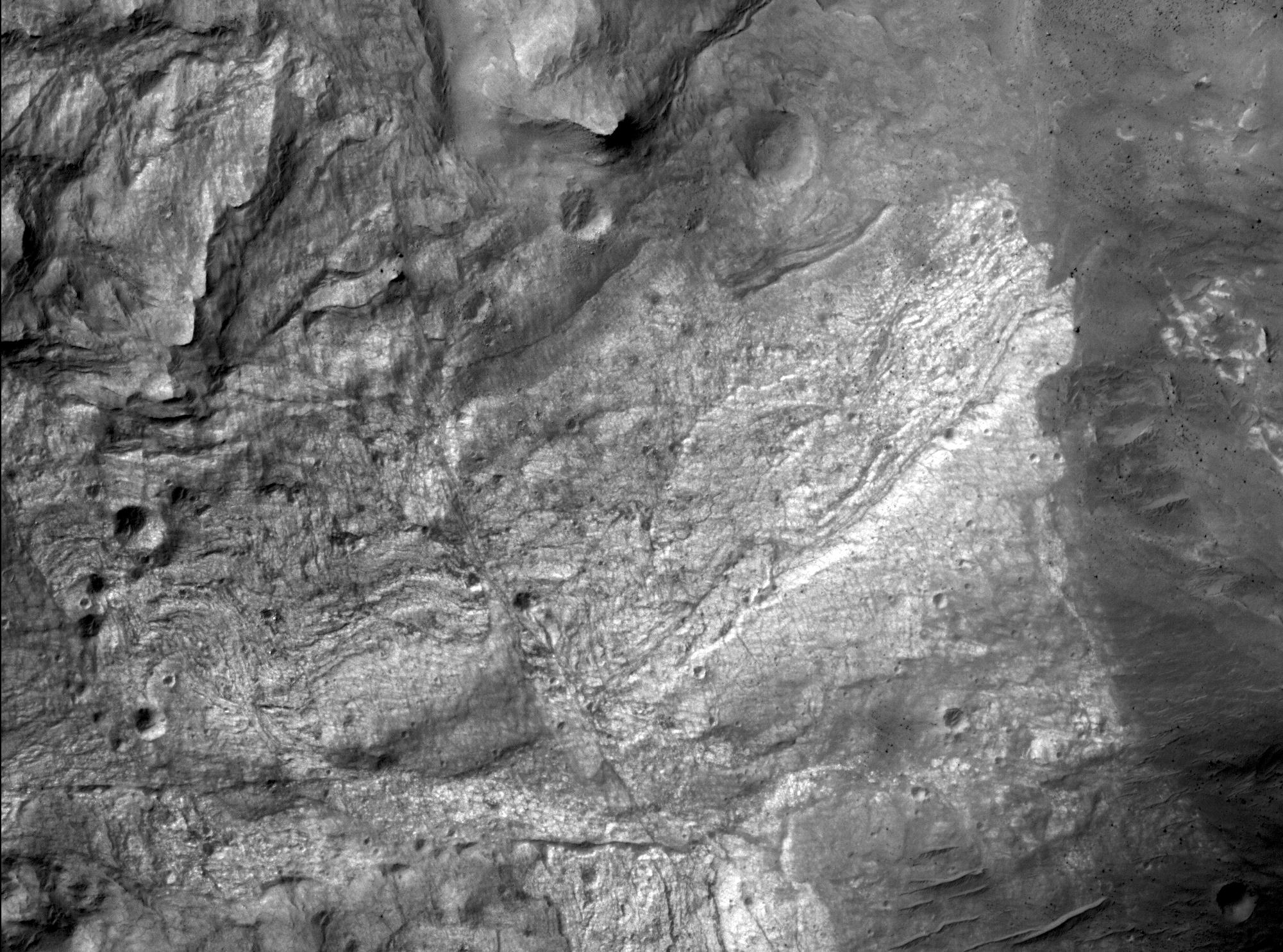
Ridges as Evidence of Fluid Alteration
Full Resolution:
TIFF
(17.67 MB)
JPEG
(1.767 MB)
|
|
|
2007-02-15 |
Mars
|
Mars Reconnaissance Orbiter (MRO)
|
HiRISE
|
2336x3672x3 |
|
-
PIA09190:
-
Light-Toned Bedrock Along Cracks as Evidence of Fluid Alteration
Full Resolution:
TIFF
(25.76 MB)
JPEG
(2.22 MB)
|
|
|
2007-02-15 |
Mars
|
Mars Reconnaissance Orbiter (MRO)
|
HiRISE
|
459x840x3 |
|
-
PIA09191:
-
Linear Ridges at 'Victoria Crater'
Full Resolution:
TIFF
(1.158 MB)
JPEG
(74.59 kB)
|
|
|
2007-02-15 |
Mars
|
Mars Reconnaissance Orbiter (MRO)
|
HiRISE
|
480x1304x3 |
|
-
PIA09192:
-
Ridges in Stereo, Candor Chasma
Full Resolution:
TIFF
(1.88 MB)
JPEG
(54.77 kB)
|


