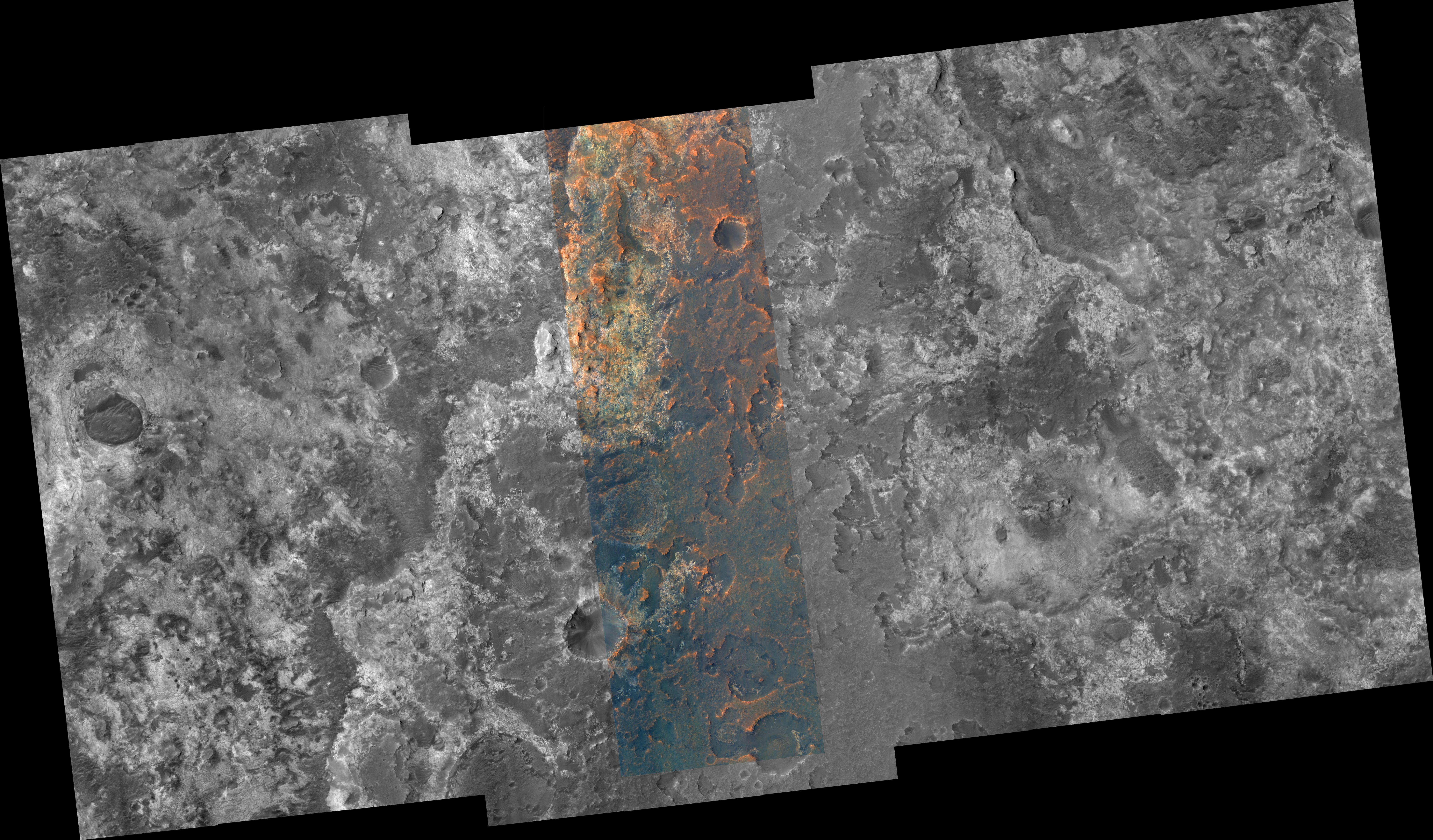
A portion of the Mawrth Vallis region of Mars is seen in this image from the High Resolution Imaging Science Experiment (HiRISE) camera on NASA's Mars Reconnaissance Orbiter. The Mawrth Vallis region holds special interest because of the presence of phyllosilicate (clay) minerals which form only if water is available, first identified in data from the OMEGA spectrometer on the European Space Agency's Mars Express orbiter. Mars Reconnaissance Orbiter's Compact Reconnaissance Imaging Spectrometer for Mars has identified aluminum-rich and iron-rich clays, each with a unique distribution. On Earth such clays occur in (among other environments) weathered volcanic rocks and hydrothermal systems, where volcanic activity and water interact.
Besides acquiring monochromatic images of 6-kilometer (3.7-mile) swath width and variable length, HiRISE can also image the central 20 percent of the swath width in color. Color images can help resolve ambiguities in image interpretation and will enable researchers to place compositional data from other experiments into more specific geologic context. HiRISE can "see" color in the visible range (the red, green, and blue portions of the spectrum) and beyond (in the near infrared).
Image TRA_000847_2055 was taken by HiRISE on Oct. 1, 2006. The image is centered at 25.3 degrees latitude, 340.7 degrees east longitude. The range to the target site was 284 kilometers (178 miles). At this distance the image scale is 28 centimeters (11 inches) per pixel (with 1 x 1 binning) so objects about 84 centimeters (33 inches) across are resolved. The image shown here has been map-projected to 25 centimeters (10 inches) per pixel and north is up. The image was taken at a local Mars time of 3:23 p.m. and the scene is illuminated from the west with a solar incidence angle of 46.2 degrees, thus the sun was about 43.8 degrees above the horizon. At a solar longitude of 114.4 degrees, the season on Mars is northern summer.
The full-resolution TIFF file (HiRISE number TRA_000847_2055) can be viewed or downloaded here PIA01921-hi-res.tif; the full-resolution JPEG can be viewed or downloaded here PIA01921-hi-res.jpg. [Photojournal note: due to the large sizes of the high-resolution TIFF and JPEG files, some systems may experience extremely slow downlink time while viewing or downloading these images; some systems may be incapable of handling the download entirely.]
 Planetary Data System


