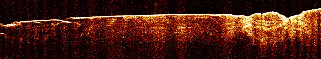
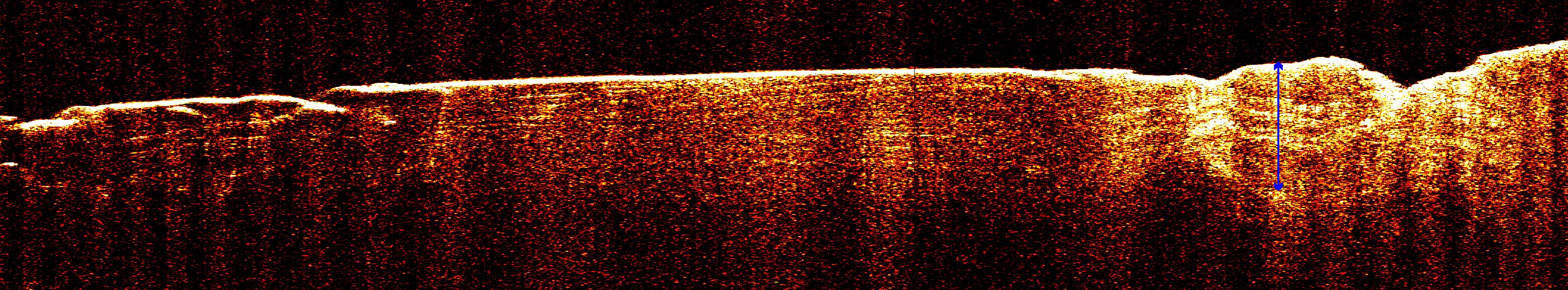
A radargram from the Shallow Subsurface Radar instrument (SHARAD) on NASA's Mars Reconnaissance Orbiter reveals detailed structure in the polar layered deposits of Mars' south pole.
The horizontal scale of the radargram is distance along the orbiter's ground track, about 650 kilometers (400 miles) from about 74 degrees south latitude on the left to about 85 degrees south latitude at right. The vertical scale is time delay of radar signals reflected back to the spacecraft from the surface and subsurface. For reference, the white double-headed arrow indicates a distance of about 800 meters (2,600 feet) between one of the strongest subsurface reflectors and ground level, based on an assumed velocity of the radar waves in the subsurface. This reflector marks the base of the polar layered deposits. The color scale varies from black for weak reflections to white for strong reflections.
The sounding radar collected the data presented here during orbit 1360 of the mission, on Nov. 10, 2006.
The Shallow Subsurface Radar was provided by the Italian Space Agency (ASI). Its operations are led by the University of Rome and its data are analyzed by a joint U.S.-Italian science team. NASA's Jet Propulsion Laboratory, a division of the California Institute of Technology, Pasadena, manages the Mars Reconnaissance Orbiter for the NASA Science Mission Directorate, Washington.