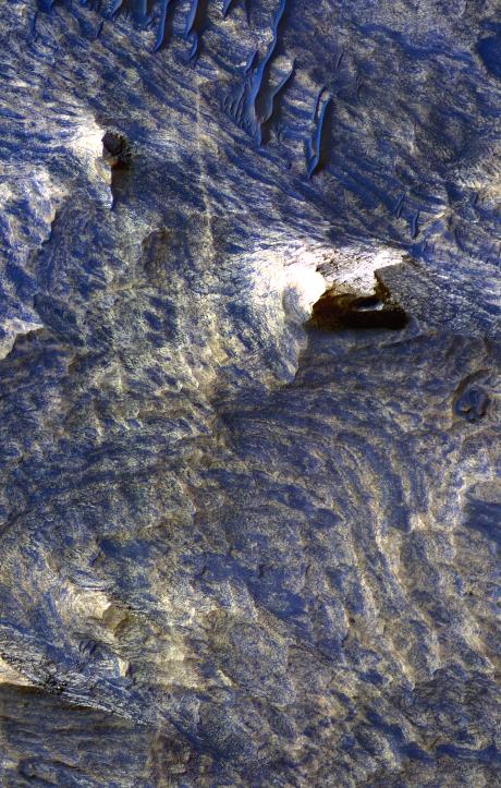
This enhanced-color image from the High Resolution Imaging Science Experiment Camera on NASA's Mars Reconnaissance Orbiter shows a landscape of sand dunes and buttes among a background of light-toned (tan-colored) bands and dark-toned (blue-colored) bands in the Candor Chasma region of Mars' Valles Marineris canyon system.
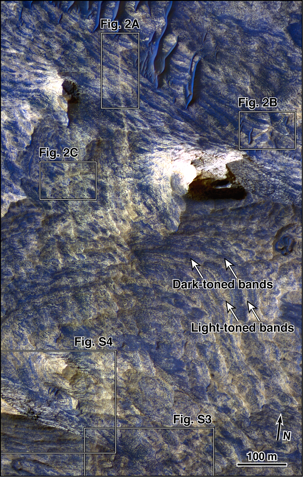
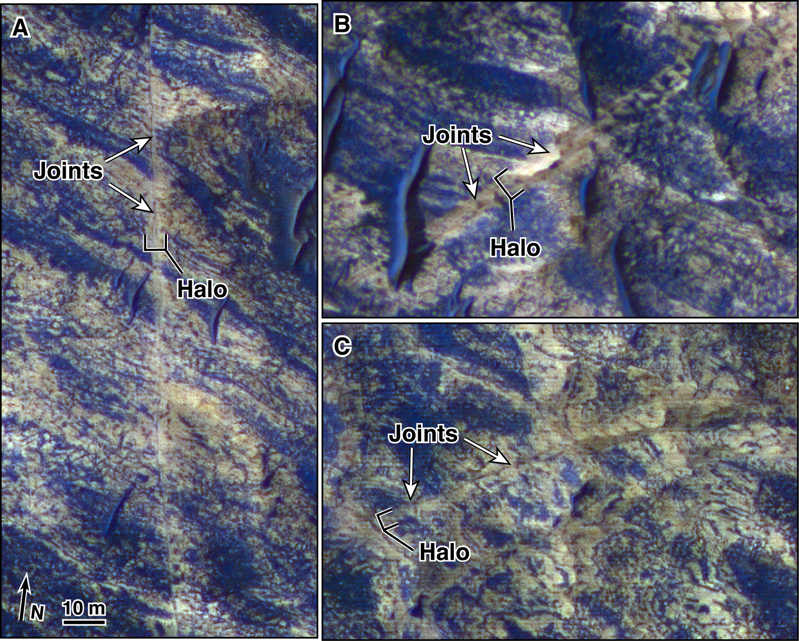
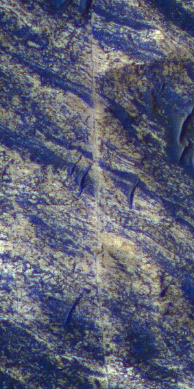
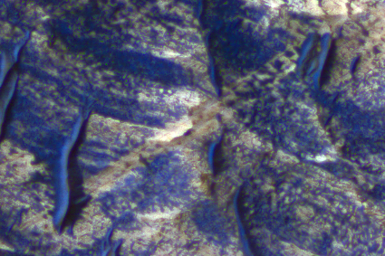
The scene includes examples of thin dark lines bordered by light-toned bedrock [Figures 2A, 2B, and 2C]. The dark lines are interpreted as fractures, called joints, that were formerly underground but have been exposed at the surface by erosion of overlying material. The light-toned material along the joints is interpreted as features called halos, resulting from mineral alteration (bleaching, cementation or both) of the walls of the fractures by fluid moving through the fractures.
The image was acquired on Sept. 30, 2006, during winter in Mars' southern hemisphere, at a local Mars time of 3:29 p.m. It combines separate band passes taken by the High Resolution Imaging Science Experiment in blue-green light, red light and near-infrared light.
The scene is illuminated from the west (left) with a solar incidence angle of 58.5 degrees. The image scale is 26 centimeters (10 inches) per pixel, the scale of the red bandpass image. The other bandpasses were acquired with two-by-two pixel binning to 52 centimeters (20 inches) per pixel.
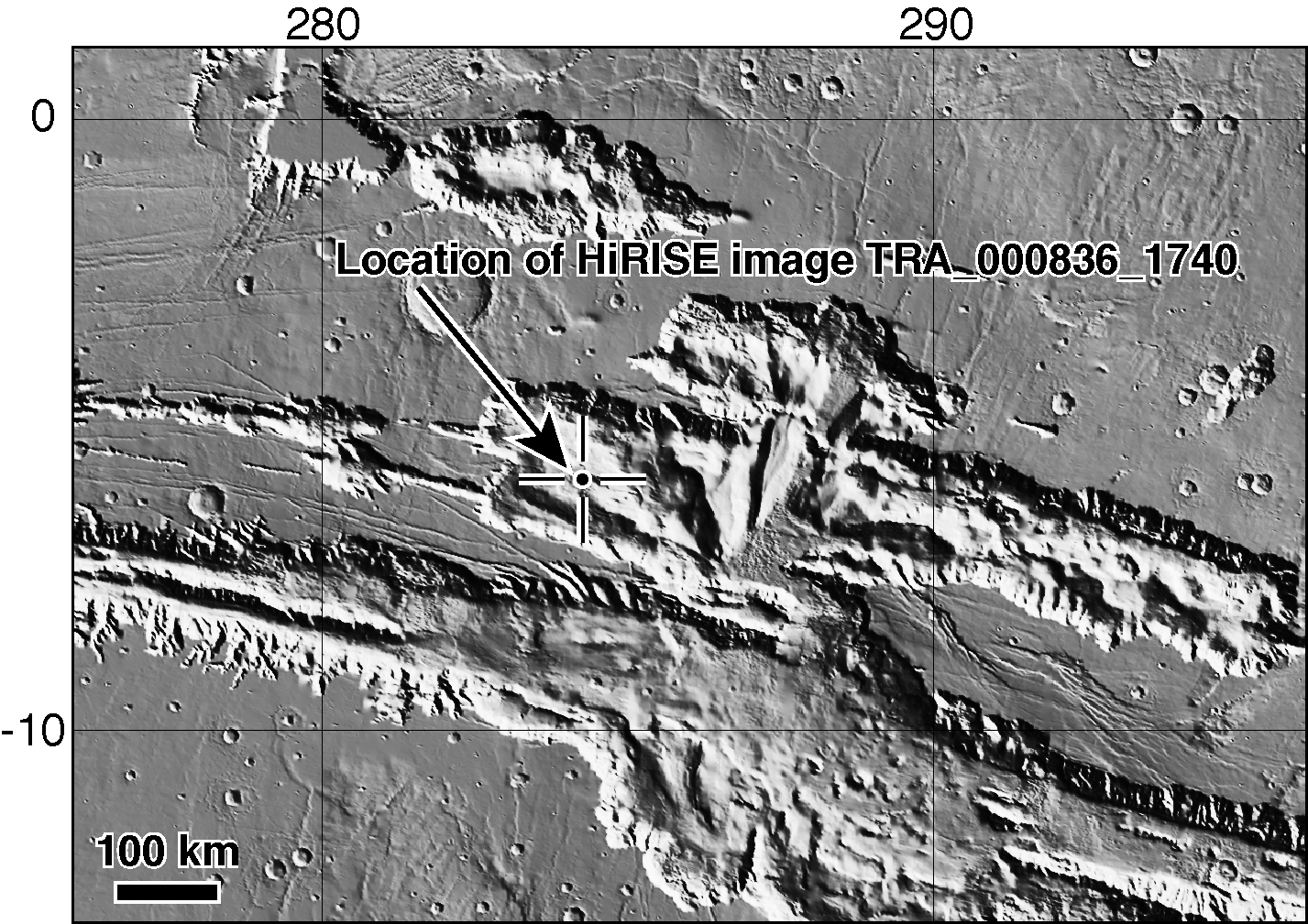
The image, in the camera's catalogue as TRA_000836_1740, is centered at 5.7 degrees south latitude, 284.6 degrees east longitude. A locator map [Supplement 2] based on elevation data from the Mars Orbiter Laser Altimeter on NASA's Mars Global Surveyor indicates this location in the context of the Candor Chasma region. A full resolution file of this image is available for download by clicking here (82 MB).
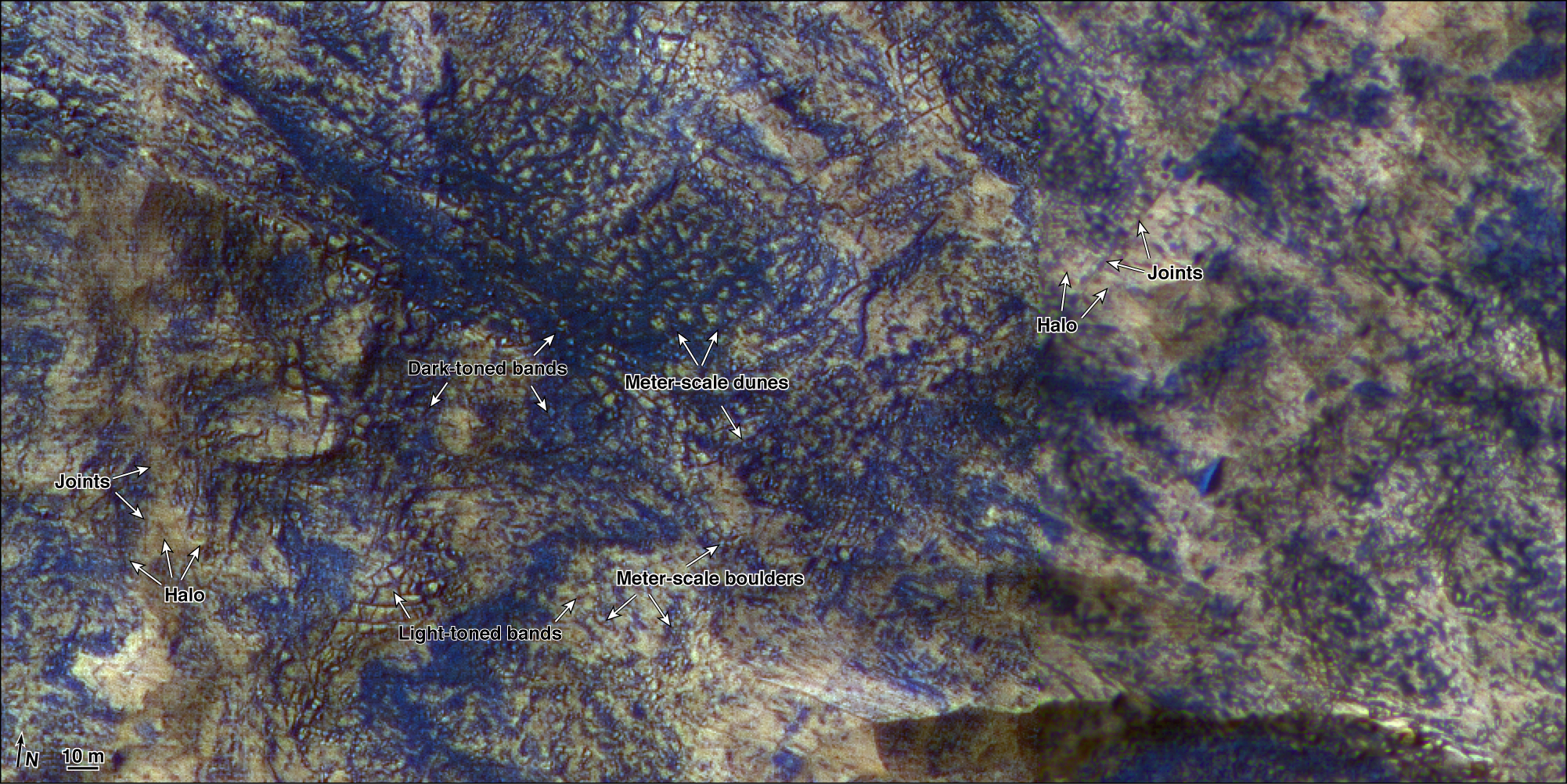
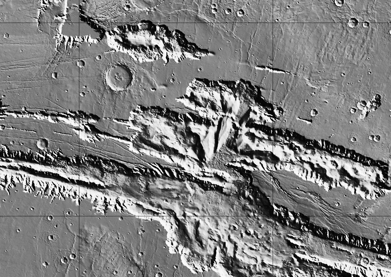
A subframe of the full image [Figure 1] shows the locations of smaller pull-outs selected for showing details of interest.
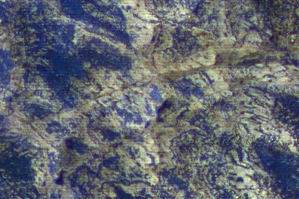
Supplement 3 shows light-toned and dark-toned layers. Meter-scale dune forms are commonly observed within the dark layers. Also shown are joints and surrounding halos. In contrast to Figure 2, the halos along these joints are laterally more extensive and less localized along the trace of the joint.
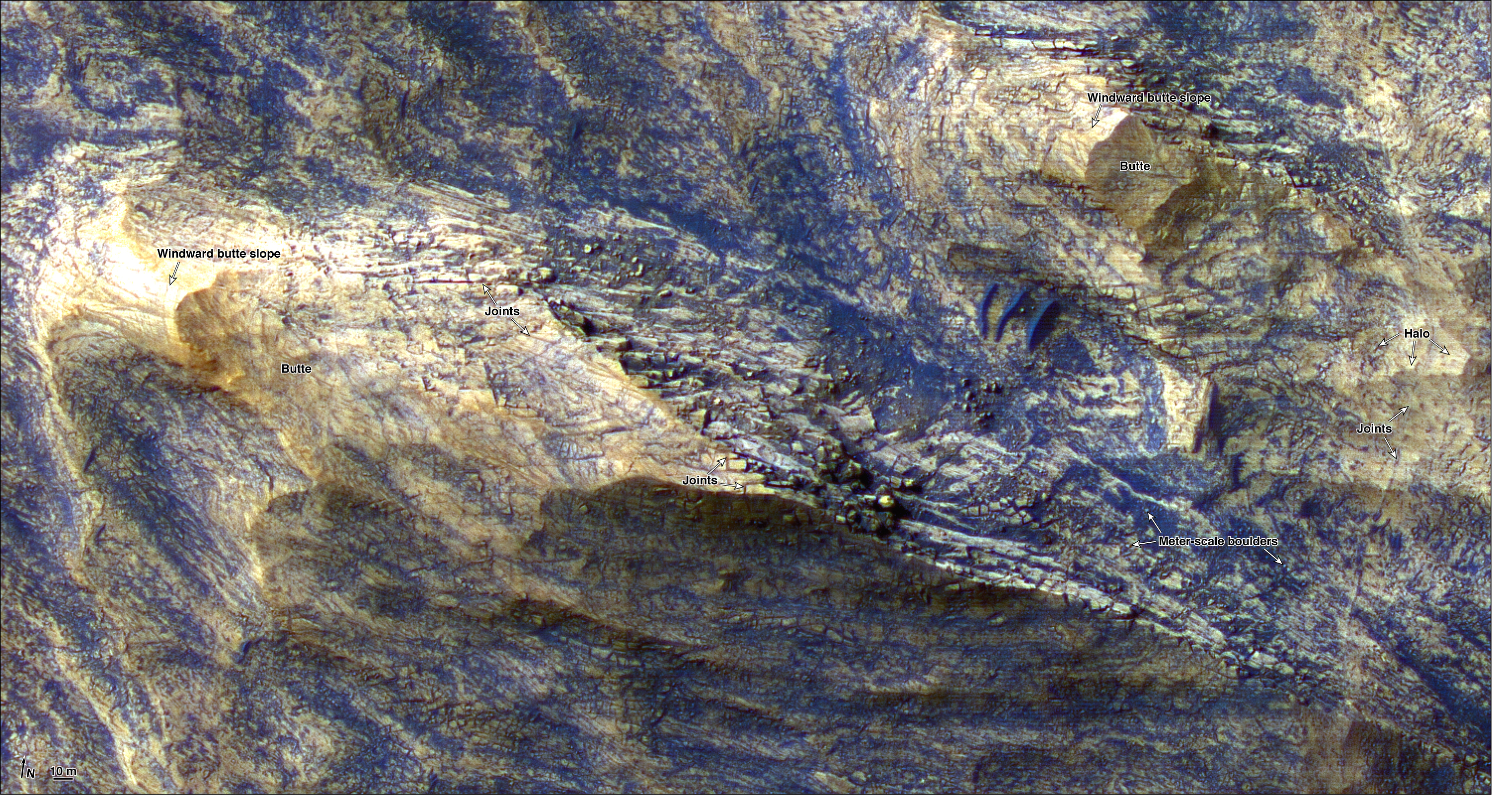
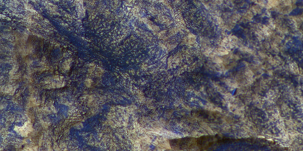
Supplement 4 shows two streamlined mesas of layered bedrock. The windward slopes of these mesas appear smooth, consistent with wind erosion. Boulders are common along the northwest slopes of the mesas. The horizontal spacing of joints appears to control the lateral dimensions of many of the largest boulders.
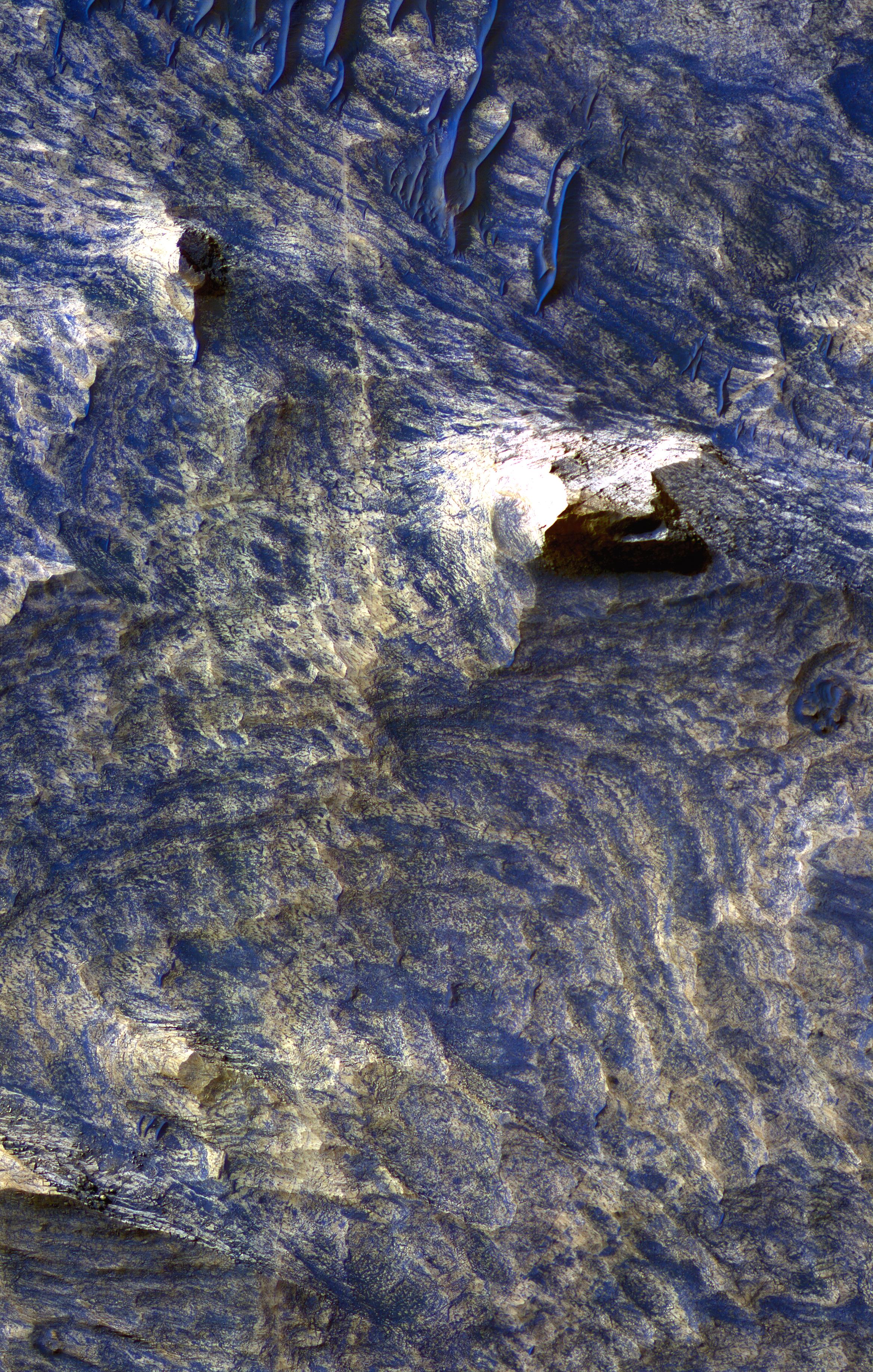
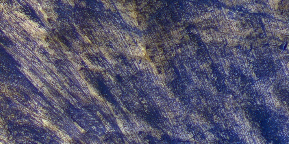
Supplement 5 shows a high-density population of joints.
NASA's Jet Propulsion Laboratory, a division of the California Institute of Technology in Pasadena, manages the Mars Reconnaissance Orbiter for NASA's Science Mission Directorate, Washington. Lockheed Martin Space Systems, Denver, is the prime contractor for the project and built the spacecraft. The High Resolution Imaging Science Experiment is operated by the University of Arizona, Tucson, and the instrument was built by Ball Aerospace and Technology Corp., Boulder, Colo.
 Planetary Data System


