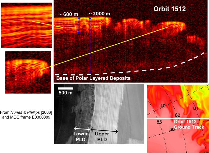
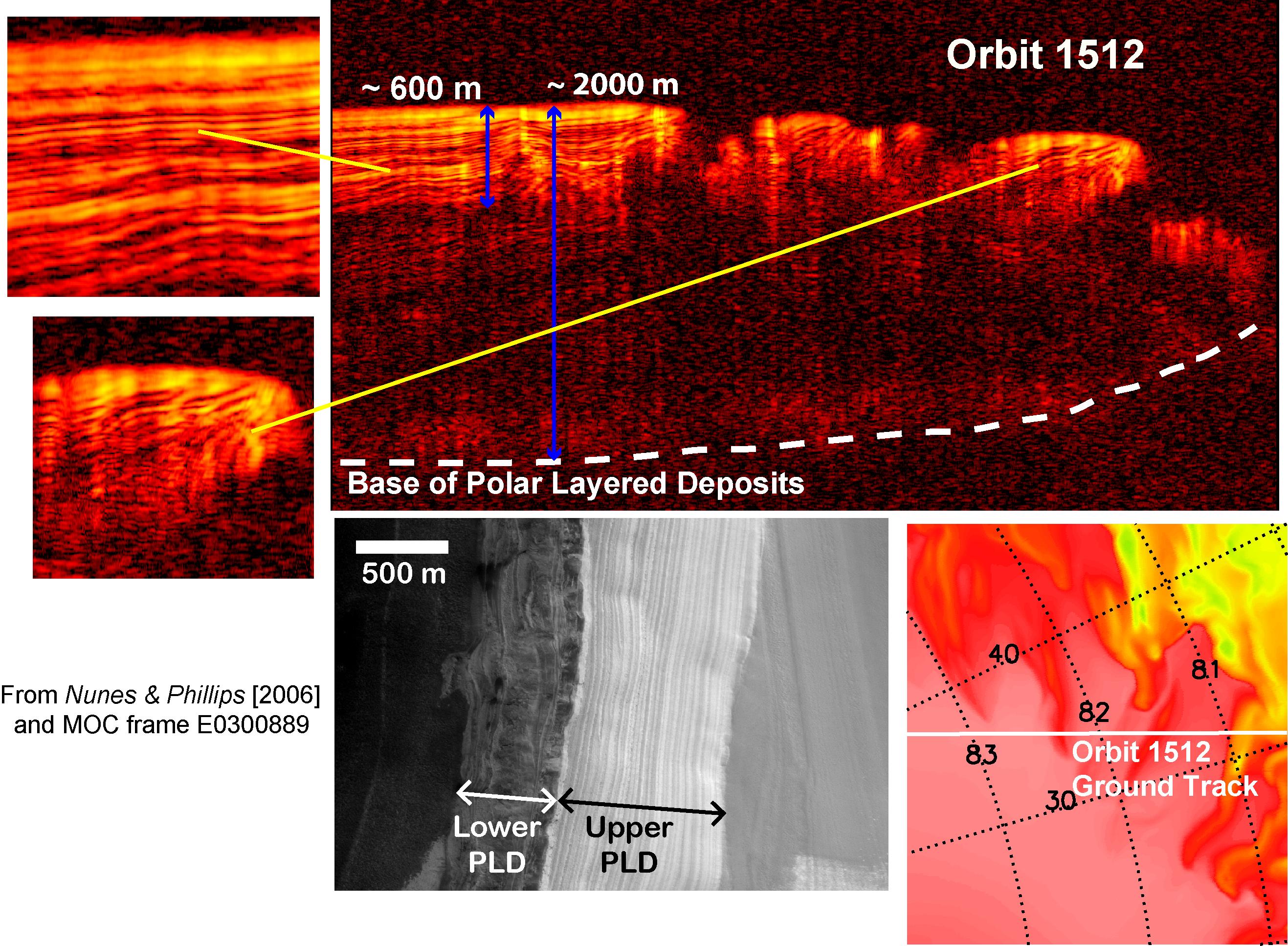
A radargram from the Shallow Subsurface Radar instrument (SHARAD) on NASA's Mars Reconnaissance Orbiter is shown in the upper-right panel and reveals detailed structure in the polar layered deposits of the north pole of Mars (with blowups shown in the upper-left panels). The sounding radar collected the data presented here during orbit 1512 of the mission, on Nov. 22, 2006.
The horizontal scale in the radargram is distance along the ground track. It can be referenced to the ground track map shown in the lower right. The radar traversed from about 83.5 degrees to 80.5 degrees north latitude, or about 180 kilometers (110 miles). The ground track map shows elevation measured by the Mars Orbiter Laser Altimeter on NASA's Mars Global Surveyor orbiter. Green indicates low elevation; reddish-white indicates higher elevation. The traverse is from the high elevation of the plateau formed by the layers to the lowlands below.
The vertical scale on the radargram is time delay of the radar signals reflected back to Mars Reconnaissance Orbiter from the surface and subsurface. For reference, using an assumed velocity of the radar waves in the subsurface, time is converted to depth below the surface in two places: about 600 meters (2,000 feet) to the lowest of an upper series of bright reflectors and about 2,000 meters (6,500 feet) to the base of the polar layered deposits. The color scale of the radargram varies from black for weak reflections to bright yellow for strong reflections.
The lower-left panel is a image from the Mars Orbiter Camera on Mars Global Surveyor showing exposed polar layering in the walls of a canyon near the north pole. The layering is divided into a finely structured upper unit (labeled "Upper PLD") and less-well-defined stratigraphy in the lower unit (labeled "Lower PLD"). The radargram clearly reveals the complexity of the layering in the upper unit, additional reflections from the lower unit, and the base of the entire stack of layered deposits. The layering manifests the recent climate history of Mars, recorded by the deposition and removal of ice and dust.
The Shallow Subsurface Radar was provided by the Italian Space Agency (ASI). Its operations are led by the University of Rome and its data are analyzed by a joint U.S.-Italian science team. NASA's Jet Propulsion Laboratory, a division of the California Institute of Technology, Pasadena, manages the Mars Reconnaissance Orbiter for the NASA Science Mission Directorate, Washington.