 |  |
| Overview 1 | Overview 2 |
 |  |  |
| Perspective Zoom 1 | Perspective Zoom 2 | Perspective Zoom 3 |
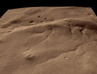
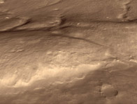
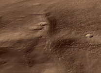
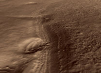
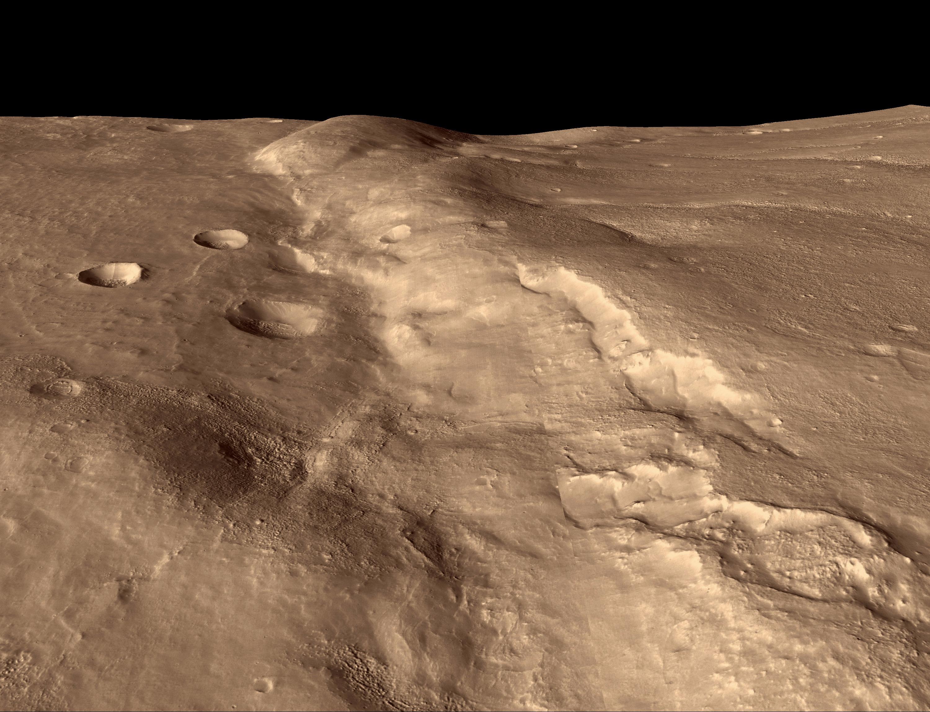
Click on each image for larger viewShown here are five different perspective views generated from digital topography (see PIA08053). All views have a field of view 55 degrees wide, and no vertical exaggeration. Three of the images show a sequence of views zooming in on a particular patch of ground showing layers, looking west. The other two images provide an overview of the region, looking east and south. The overviews illustrate how the ridge has deformed several valleys and impact craters.
These images are a subset of PIA08060, which was taken by the High Resolution Imaging Science Experiment (HiRISE) camera onboard NASA's Mars Reconnaissance Orbiter spacecraft on March 24, 2006. The image was taken at a local Mars time of 07:33 and the scene is illuminated from the upper right with a solar incidence angle of 78.1 degrees, thus the sun was about 11.9 degrees above the horizon. At an Ls of 29 degrees (with Ls an indicator of Mars' position in its orbit around the sun), the season on Mars is southern autumn.
Images from the High Resolution Imaging Science Experiment and additional information about the Mars Reconnaissance Orbiter are available online at: http://www.nasa.gov/mro or http://HiRISE.lpl.arizona.edu. For information about NASA and agency programs on the Web, visit: http://www.nasa.gov.
JPL, a division of the California Institute of Technology in Pasadena, manages the Mars Reconnaissance Orbiter for NASA's Science Mission Directorate, Washington. Lockheed Martin Space Systems is the prime contractor for the project and built the spacecraft. The HiRISE camera was built by Ball Aerospace and Technology Corporation and is operated by the University of Arizona.


