My
List |
Addition Date
|
Target
|
Mission
|
Instrument
|
Size
|

|
2014-09-24 |
Earth
|
Shuttle Radar Topography Mission (SRTM)
|
C-Band Radar
X-Band Radar
|
1074x651x1 |

|
-
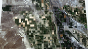
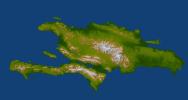
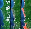
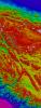
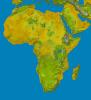
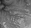
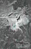
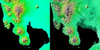
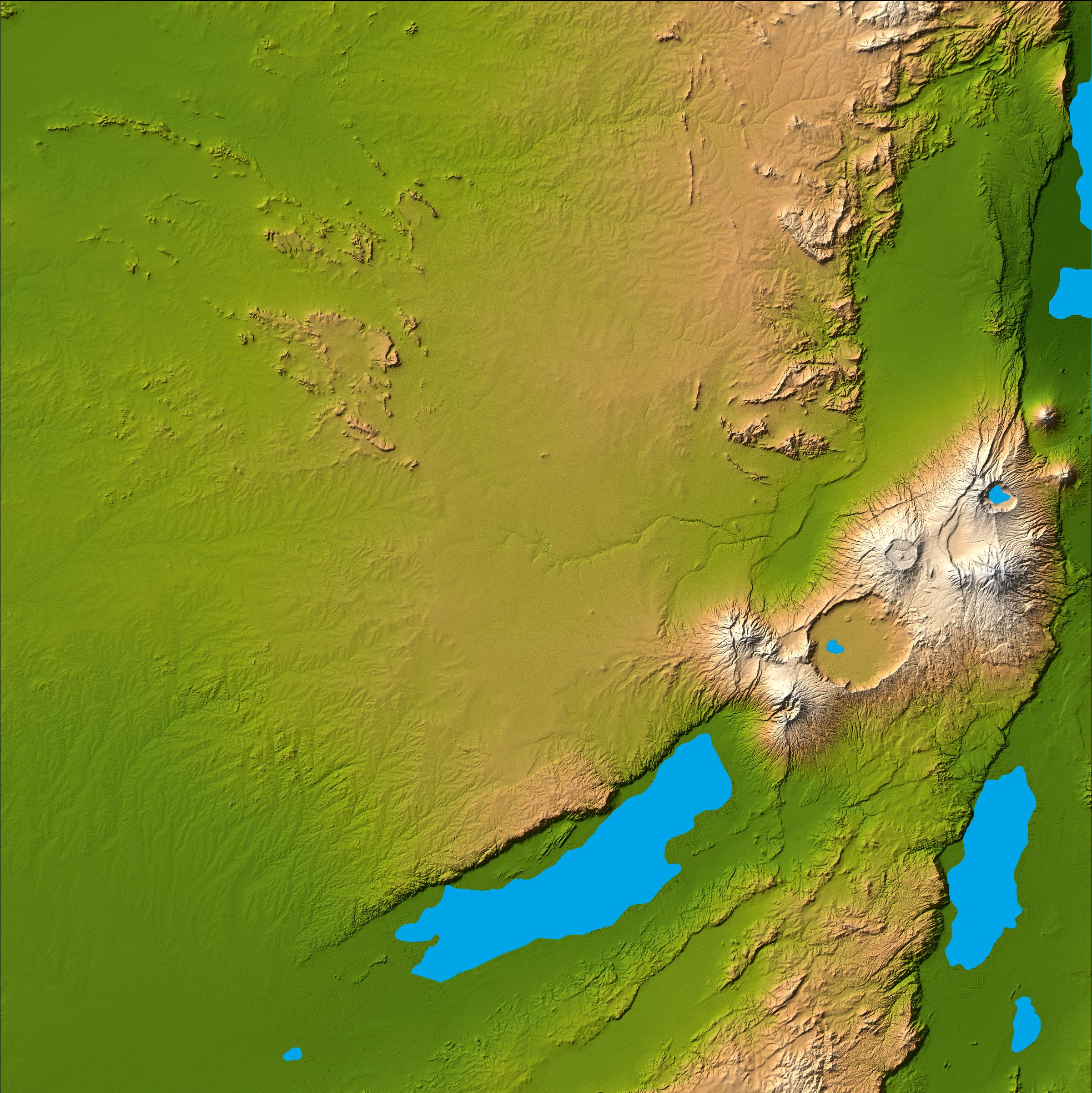
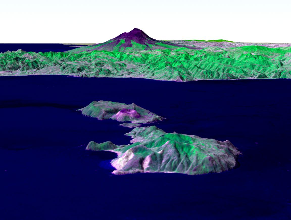
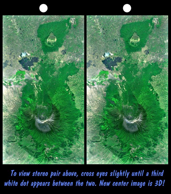
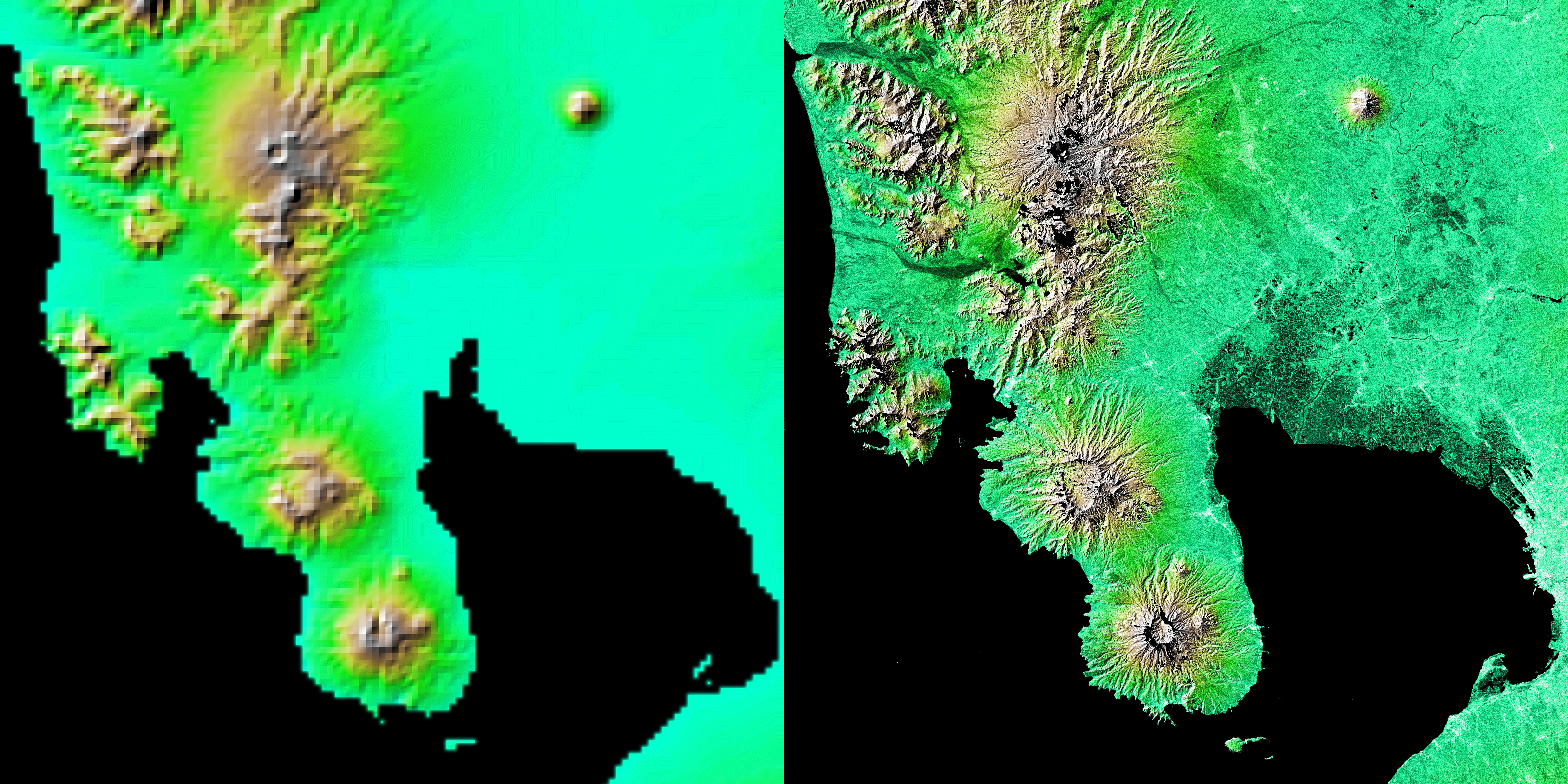
PIA18813:
-
Tanzania Images Highlight Improvements in Full-Resolution SRTM Africa Data
Full Resolution:
TIFF
(700.1 kB)
JPEG
(64.26 kB)
|
|
|
2012-02-06 |
Earth
|
Shuttle Radar Topography Mission (SRTM)
|
|
1024x576x3 |
|
-
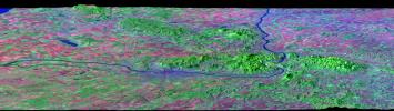
PIA13204:
-
Lost Hills Subsidence Animation

Full Resolution:
TIFF
(1.772 MB)
JPEG
(116.7 kB)
|
|
|
2011-03-11 |
Earth
|
Shuttle Radar Topography Mission (SRTM)
|
C-Band Radar
X-Band Radar
|
6330x5879x3 |
|
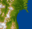
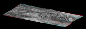
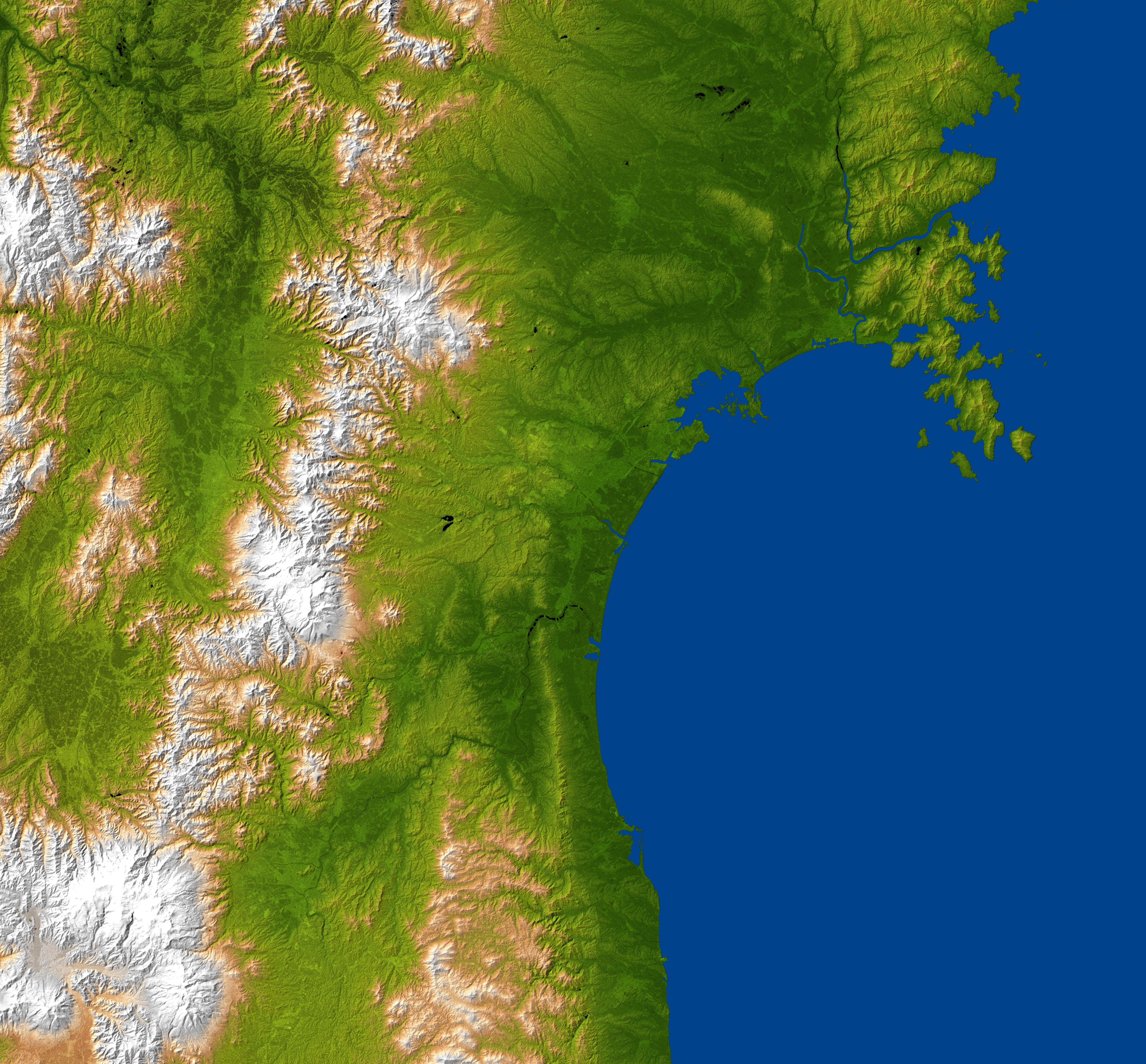
-
PIA13912:
-
NASA Radar Image Shows Topography of Sendai, Japan Region
Full Resolution:
TIFF
(111.6 MB)
JPEG
(4.919 MB)
|
|
|
2010-04-05 |
Earth
|
Shuttle Radar Topography Mission (SRTM)
|
C-Band Radar
X-Band Radar
|
5793x6796x3 |
|
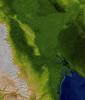
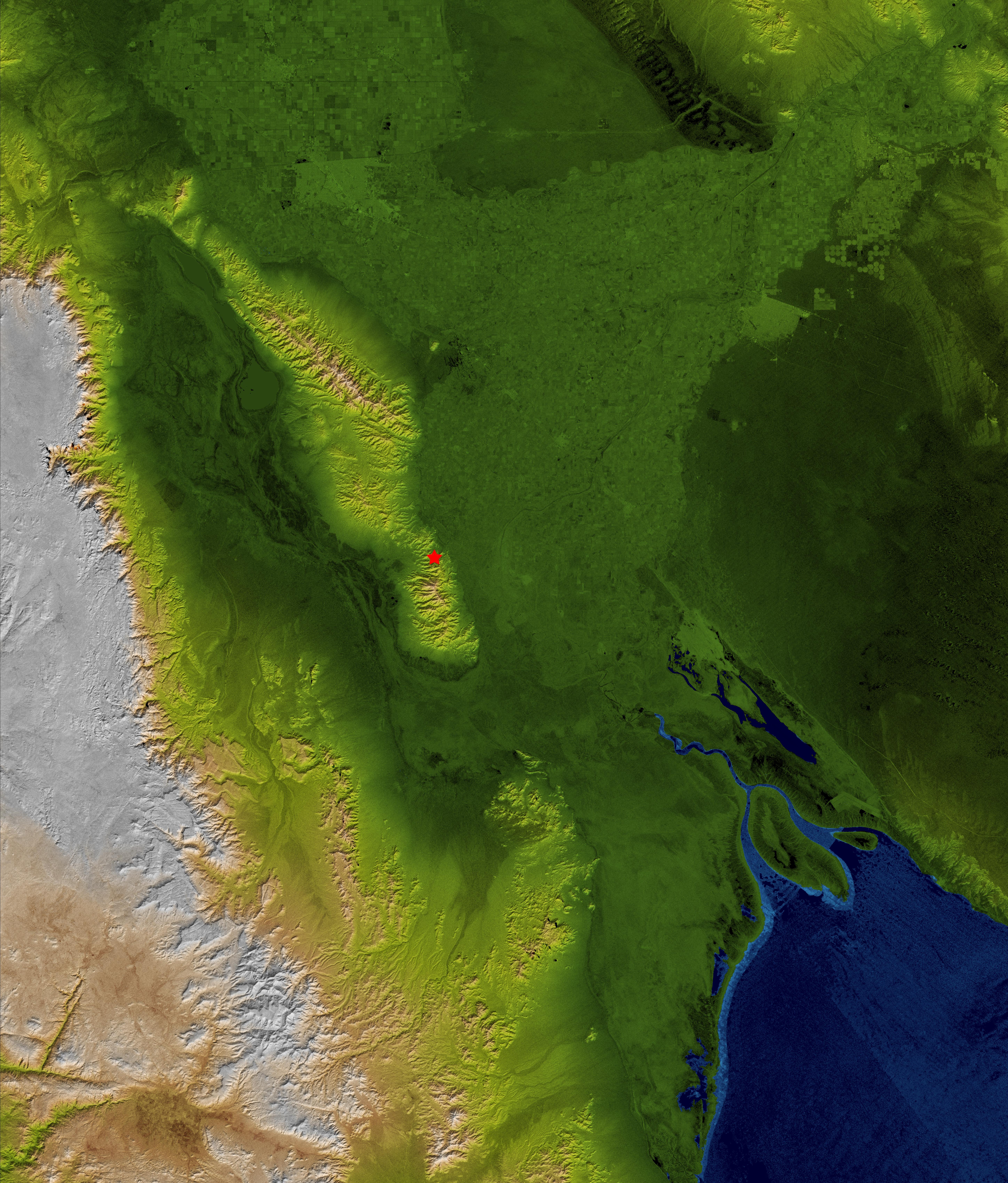
-
PIA13016:
-
Baja Earthquake, Radar Image and Colored Height
Full Resolution:
TIFF
(118.1 MB)
JPEG
(5.532 MB)
|
|
|
2010-04-05 |
Earth
|
Shuttle Radar Topography Mission (SRTM)
|
C-Band Radar
X-Band Radar
|
1152x792x3 |
|
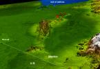
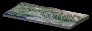
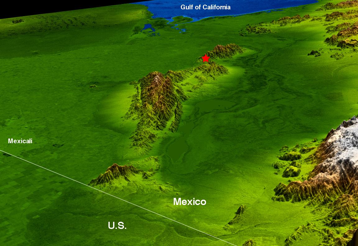
-
PIA13015:
-
Baja Earthquake Perspective View
Full Resolution:
TIFF
(2.741 MB)
JPEG
(154.3 kB)
|
|
|
2010-03-04 |
Earth
|
Shuttle Radar Topography Mission (SRTM)
|
C-Band Radar
X-Band Radar
|
1168x806x3 |
|
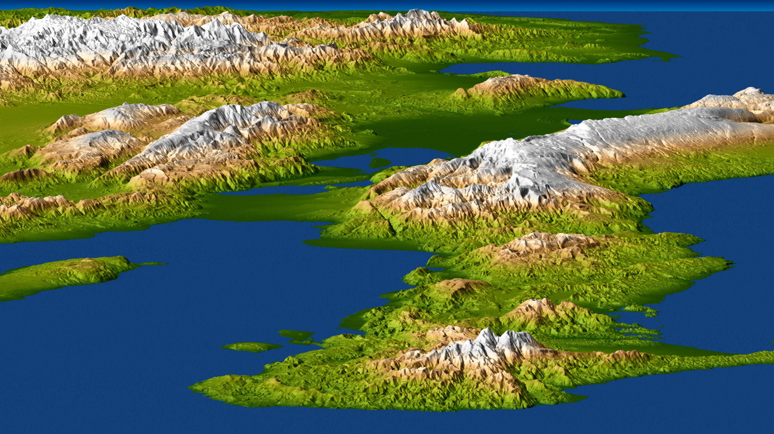
-
PIA12864:
-
Coastal Chile (Perspective View)
Full Resolution:
TIFF
(2.828 MB)
JPEG
(177.1 kB)
|
|
|
2010-03-04 |
Earth
|
Shuttle Radar Topography Mission (SRTM)
|
C-Band Radar
X-Band Radar
|
4652x5365x3 |
|
-
PIA12863:
-
Coastal Chile (Shaded Relief View)
Full Resolution:
TIFF
(74.87 MB)
JPEG
(3.126 MB)
|
|
|
2010-01-14 |
Earth
|
Shuttle Radar Topography Mission (SRTM)
|
C-Band Radar
X-Band Radar
|
2715x1522x3 |
|
-
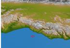
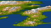
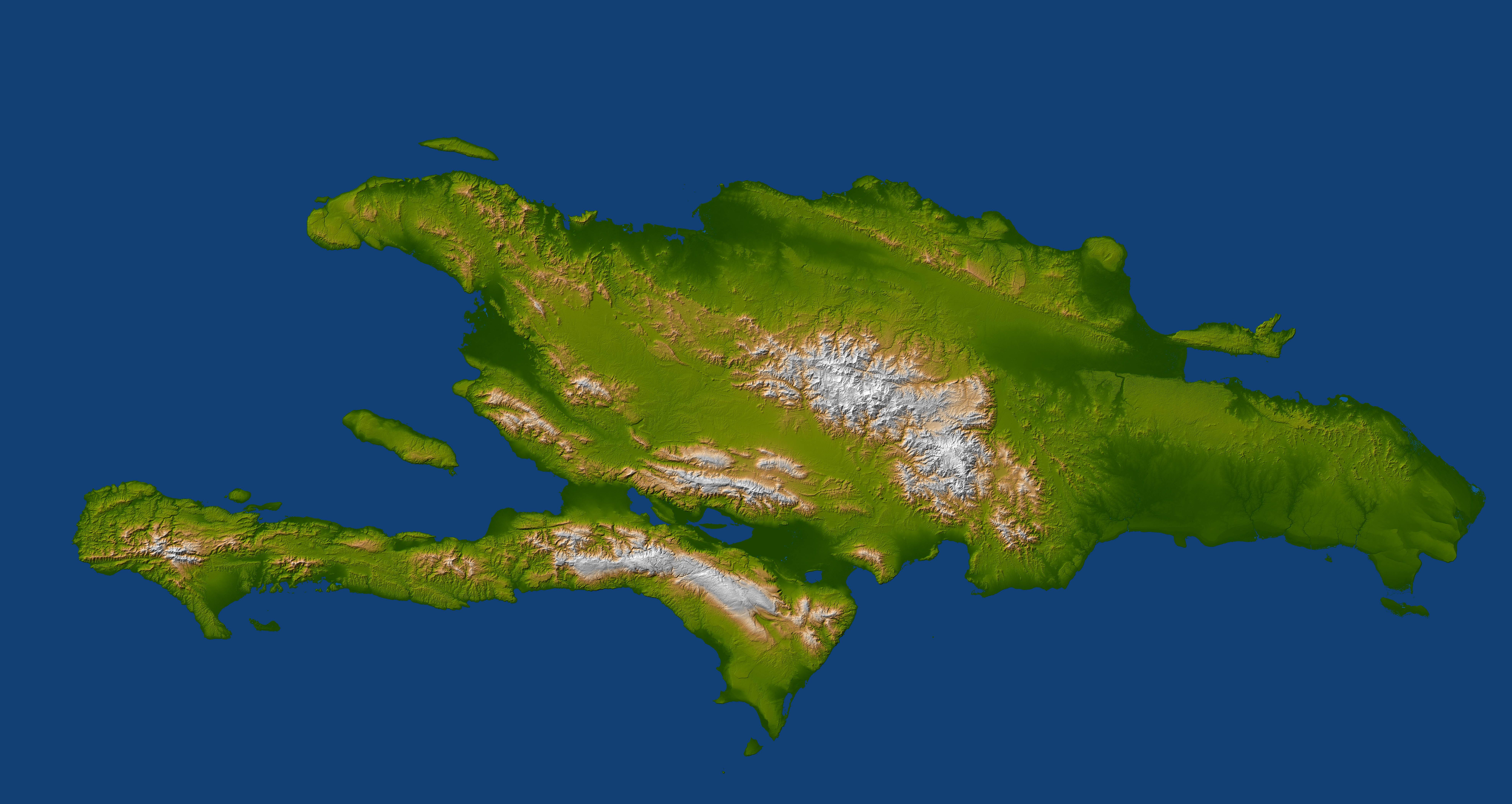
PIA12494:
-
Port-au-Prince, Haiti
Full Resolution:
TIFF
(12.41 MB)
JPEG
(599.8 kB)
|
|
|
2010-01-14 |
Earth
|
Shuttle Radar Topography Mission (SRTM)
|
C-Band Radar
X-Band Radar
|
6001x1201x3 |
|
-
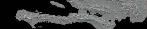
PIA12493:
Southern Haiti Anaglyph
Full Resolution:
TIFF
(21.62 MB)
JPEG
(900.4 kB)
|
|
|
2010-01-14 |
Earth
|
Shuttle Radar Topography Mission (SRTM)
|
C-Band Radar
X-Band Radar
|
7900x4200x3 |
|
-
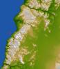
PIA12492:
-
Hispaniola
Full Resolution:
TIFF
(99.54 MB)
JPEG
(2.143 MB)
|
|
|
2009-10-01 |
Earth
|
Shuttle Radar Topography Mission (SRTM)
|
C-Band Radar
X-Band Radar
|
2304x1533x3 |
|
-
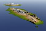
PIA11966:
-
Independent State of Samoa, Shaded Relief and Colored Height
Full Resolution:
TIFF
(10.61 MB)
JPEG
(322 kB)
|
|
|
2009-10-01 |
Earth
|
Shuttle Radar Topography Mission (SRTM)
|
C-Band Radar
X-Band Radar
|
2279x1486x3 |
|
-
PIA11965:
-
American Samoa, Shaded Relief and Colored Height
Full Resolution:
TIFF
(10.17 MB)
JPEG
(156.7 kB)
|
|
|
2009-04-01 |
Earth
|
Shuttle Radar Topography Mission (SRTM)
|
C-Band Radar
|
1250x1440x1 |
|
-
PIA11964:
-
Fargo, North Dakota, USA
Full Resolution:
TIFF
(1.802 MB)
JPEG
(353.4 kB)
|
|
|
2006-01-25 |
Earth
|
Shuttle Radar Topography Mission (SRTM)
|
C-Band Imaging Radar
X-Band Radar
|
1586x1965x3 |
|
-
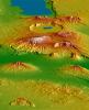
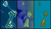
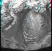
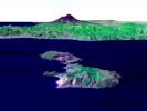
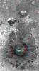
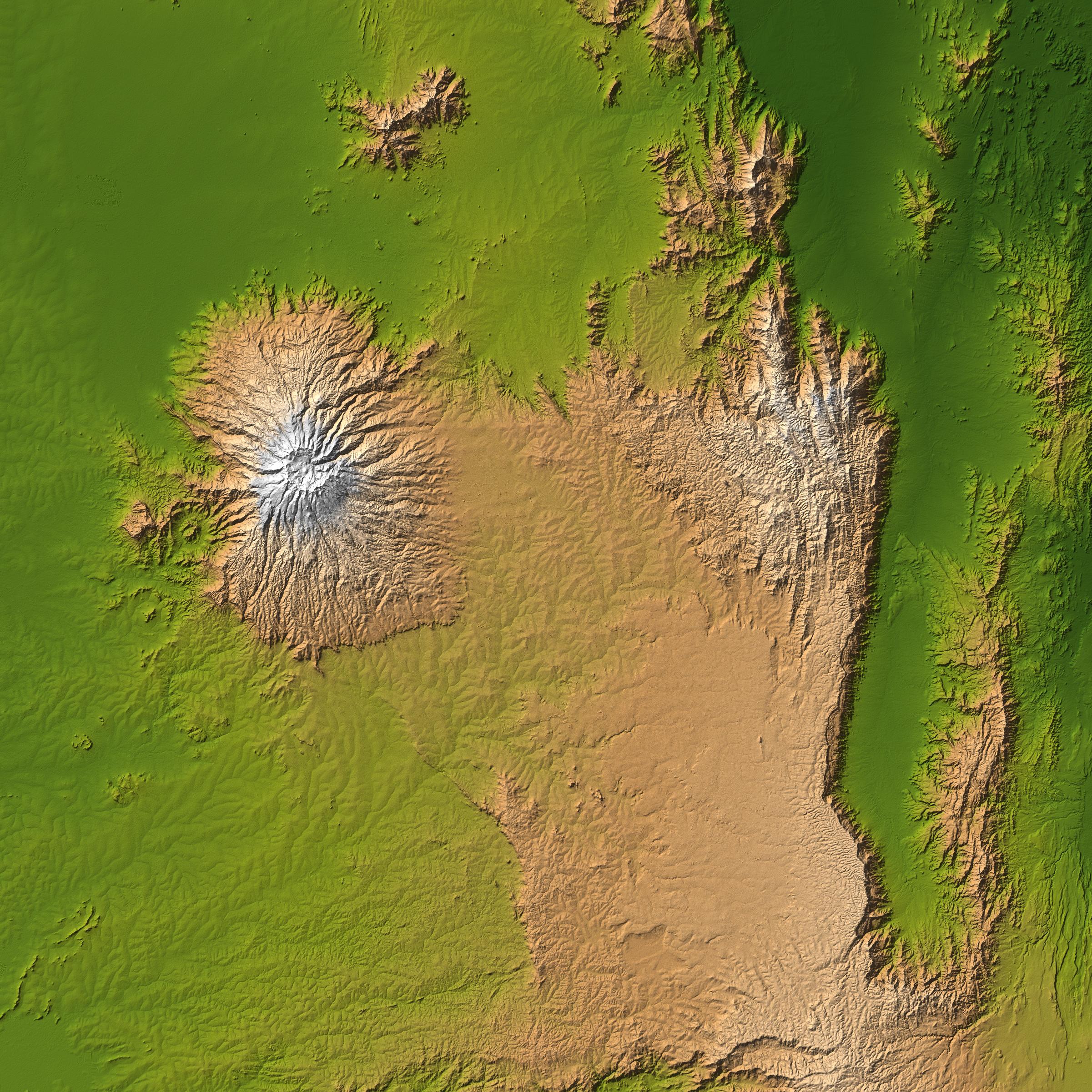
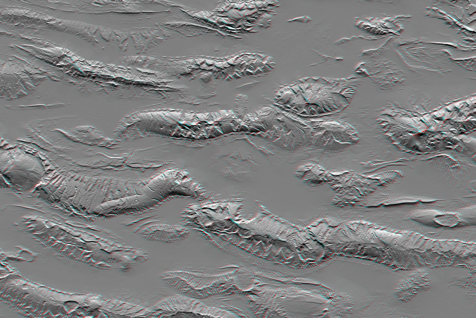
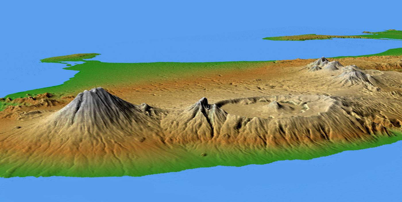
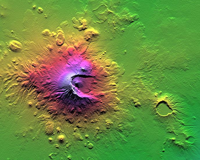
PIA06669:
-
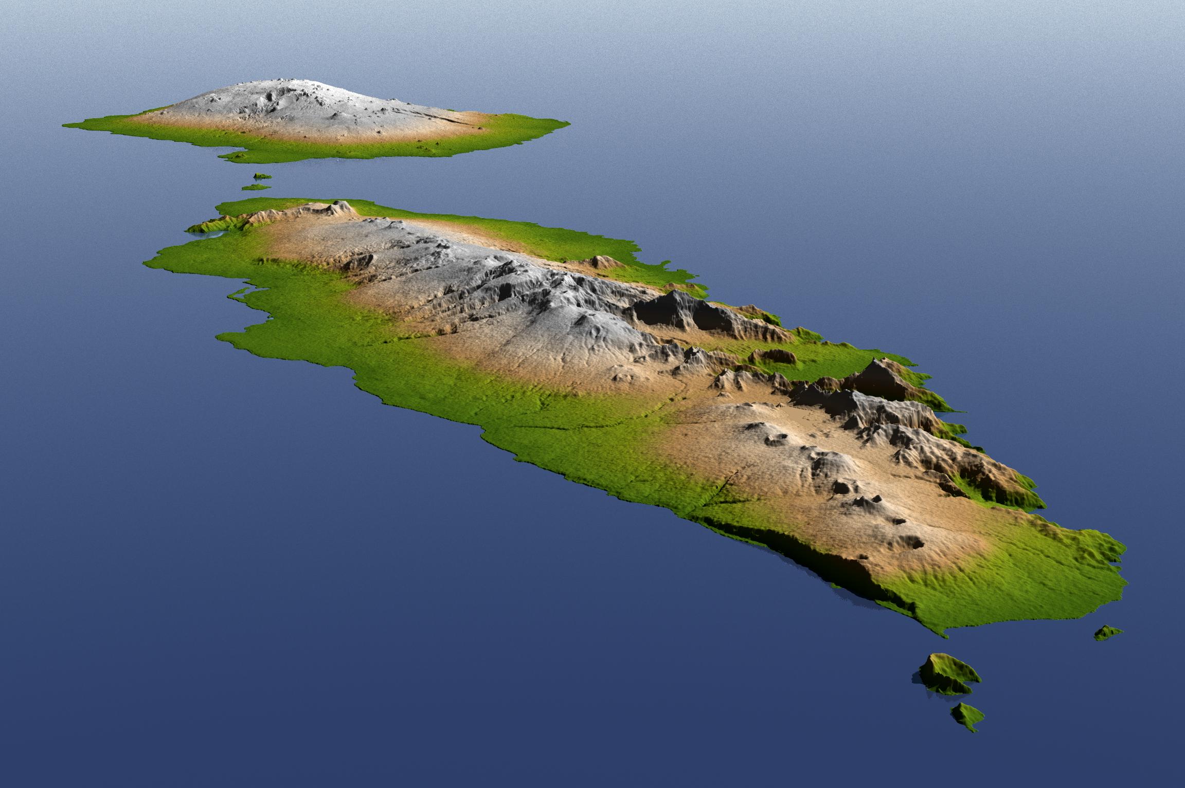
Crater Highlands, Tanzania
Full Resolution:
TIFF
(9.365 MB)
JPEG
(540.6 kB)
|
|
|
2005-12-09 |
Earth
|
Shuttle Radar Topography Mission (SRTM)
|
C-Band Radar
X-Band Radar
|
1234x899x3 |
|
-
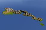
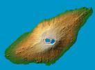
PIA06675:
-
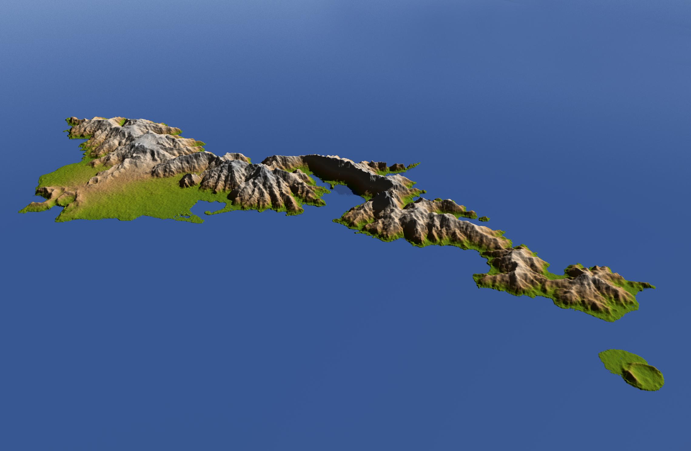
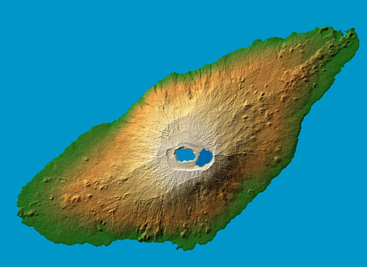
Ambae Island, Vanuatu (South Pacific)
Full Resolution:
TIFF
(3.332 MB)
JPEG
(125.8 kB)
|
|
|
2005-09-22 |
Earth
|
Shuttle Radar Topography Mission (SRTM)
|
C-Band Imaging Radar
X-Band Imaging Radar
|
3621x1525x3 |
|
-
PIA06674:
-
Hurricane Rita Track
Radar Image with Topographic Overlay
Full Resolution:
TIFF
(16.57 MB)
JPEG
(452.1 kB)
|
|
|
2005-08-29 |
Earth
|
Shuttle Radar Topography Mission (SRTM)
|
C-Band Imaging Radar
X-Band Radar
|
1800x2061x3 |
|
-
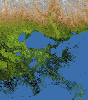
PIA04175:
-
Mississippi Delta, Radar Image with Colored Height
Full Resolution:
TIFF
(11.15 MB)
JPEG
(781.5 kB)
|
|
|
2005-08-29 |
Earth
|
Shuttle Radar Topography Mission (SRTM)
|
C-Band Imaging Radar
X-Band Radar
|
3000x2519x3 |

|
-
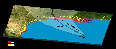
PIA04174:
-
New Orleans Topography, Radar Image with Colored Height
Full Resolution:
TIFF
(22.67 MB)
JPEG
(1.437 MB)
|
|
|
2005-03-16 |
Earth
|
Shuttle Radar Topography Mission (SRTM)
|
C-Band Imaging Radar
X-Band Radar
|
6587x8336x3 |
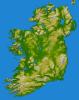
|
-
PIA06672:
-
Ireland, Shaded Relief and Colored Height
Full Resolution:
TIFF
(96.97 MB)
JPEG
(6.802 MB)
|
|
|
2005-01-14 |
Earth
|
Shuttle Radar Topography Mission (SRTM)
Terra
|
ASTER
SIR-C/X-SAR
|
1987x1840x3 |
|
-
PIA06671:
-
Tsunami Inundation, North of Phuket, Thailand
ASTER Images and SRTM Elevation Model
Full Resolution:
TIFF
(10.98 MB)
JPEG
(737.4 kB)
|
|
|
2005-01-14 |
Earth
|
Shuttle Radar Topography Mission (SRTM)
|
C-Band Interferometric Radar
|
3000x5200x3 |

|
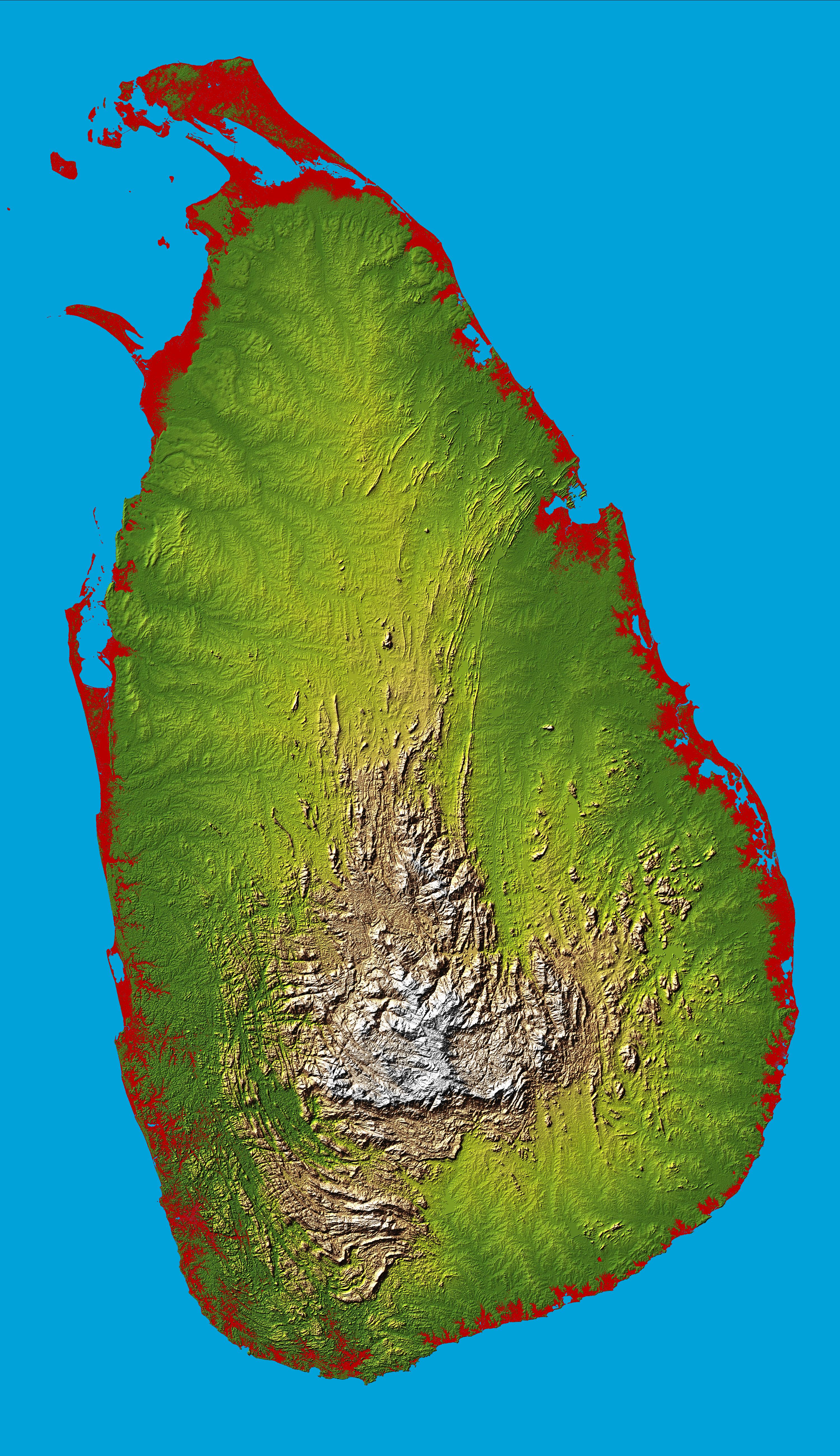
-
PIA06670:
-
Sri Lanka, Colored Height
Full Resolution:
TIFF
(28.95 MB)
JPEG
(3.425 MB)
|
|
|
2005-01-06 |
Earth
|
Shuttle Radar Topography Mission (SRTM)
|
Spaceborne Imaging Radar
C/X-Band Synthetic Aperture Radar
|
5342x1746x3 |
|
-
PIA06661:
-
Alpine Fault, New Zealand, SRTM Shaded Relief and Colored Height
Full Resolution:
TIFF
(22.84 MB)
JPEG
(1.473 MB)
|
|
|
2005-01-06 |
Earth
|
Shuttle Radar Topography Mission (SRTM)
|
Spaceborne Imaging Radar
C/X-Band Synthetic Aperture Radar
|
2919x1565x3 |

|
-
PIA06663:
-
Davenport Ranges, Northern Territory, Australia, SRTM Shaded Relief and
Colored Height
Full Resolution:
TIFF
(10.79 MB)
JPEG
(608.1 kB)
|
|
|
2005-01-06 |
Earth
|
Shuttle Radar Topography Mission (SRTM)
|
Spaceborne Imaging Radar
C/X-Band Synthetic Aperture Radar
|
1610x1100x3 |
|
-
PIA06664:
-
Tweed Extinct Volcano, Australia, Stereo Pair of SRTM Shaded Relief and
Colored Height
Full Resolution:
TIFF
(4.368 MB)
JPEG
(254.5 kB)
|
|
|
2005-01-06 |
Earth
|
Landsat
Shuttle Radar Topography Mission (SRTM)
|
Spaceborne Imaging Radar
C/X-Band Synthetic Aperture Radar
|
1414x810x3 |
|
-
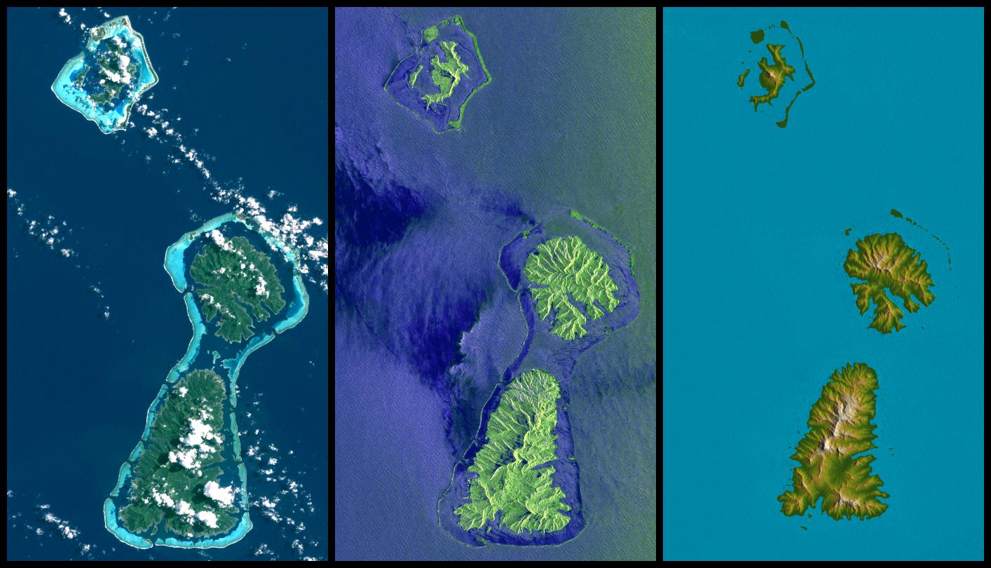
PIA06660:
-
Bora Bora, Tahaa, and Raiatea, French Polynesia, Landsat and SIR-C Images
Compared to SRTM Shaded Relief and Colored Height
Full Resolution:
TIFF
(2.921 MB)
JPEG
(158.8 kB)
|
|
|
2004-12-14 |
Earth
|
Shuttle Radar Topography Mission (SRTM)
|
C-Band Radar
X-Band Radar
|
4500x5800x3 |

|
-
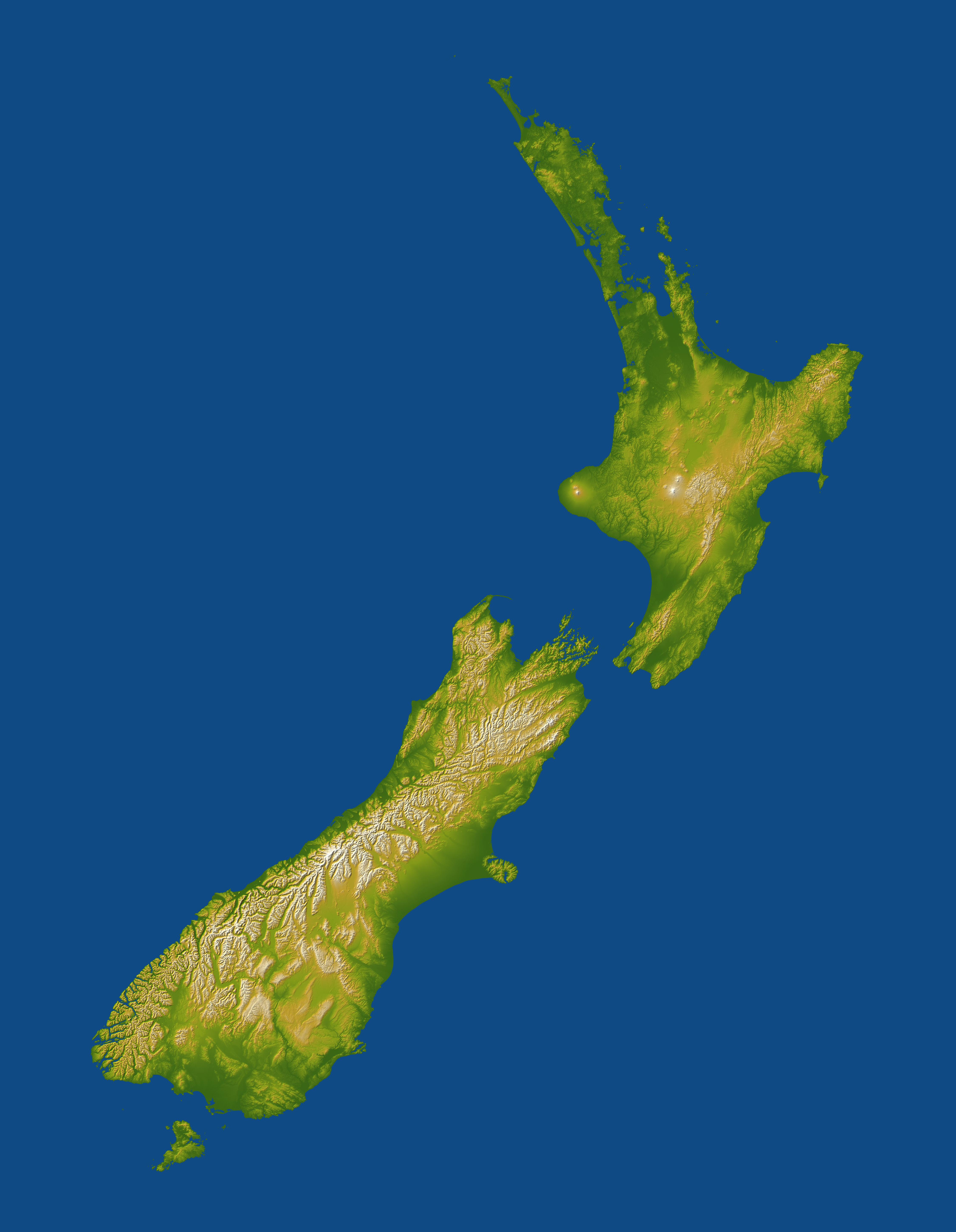
PIA06662:
-
New Zealand, SRTM Shaded Relief and Colored Height
Full Resolution:
TIFF
(13.15 MB)
JPEG
(1.272 MB)
|
|
|
2004-12-09 |
Earth
|
Shuttle Radar Topography Mission (SRTM)
|
C-Band Radar
X-Band Radar
|
5200x4858x3 |

|
-
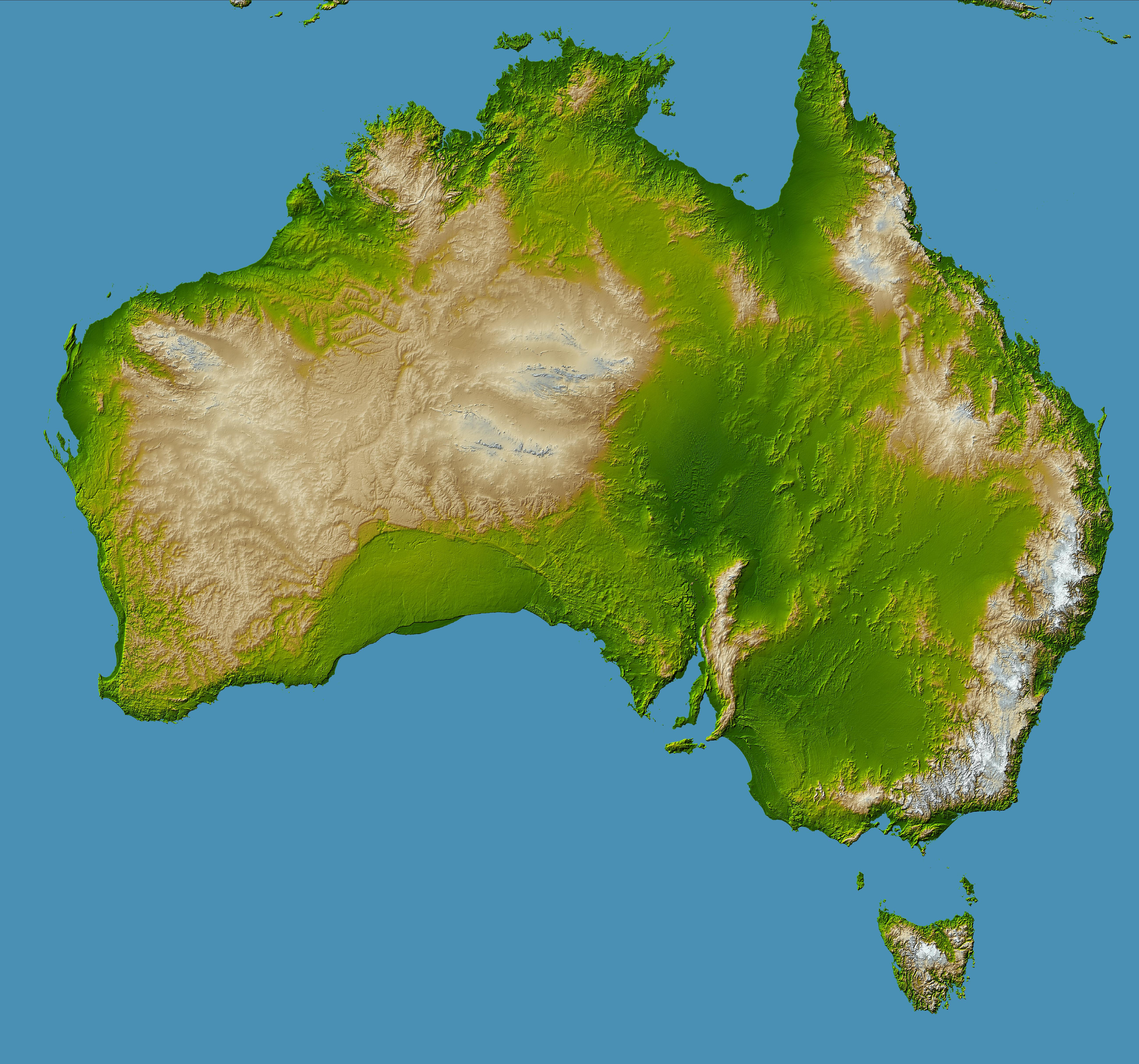
PIA06665:
-
Australia, Shaded Relief and Colored Height
Full Resolution:
TIFF
(38.46 MB)
JPEG
(3.481 MB)
|
|
|
2004-10-01 |
Earth
|
Shuttle Radar Topography Mission (SRTM)
|
C-Band Imaging Radar
X-Band Radar
|
2300x1730x3 |
|
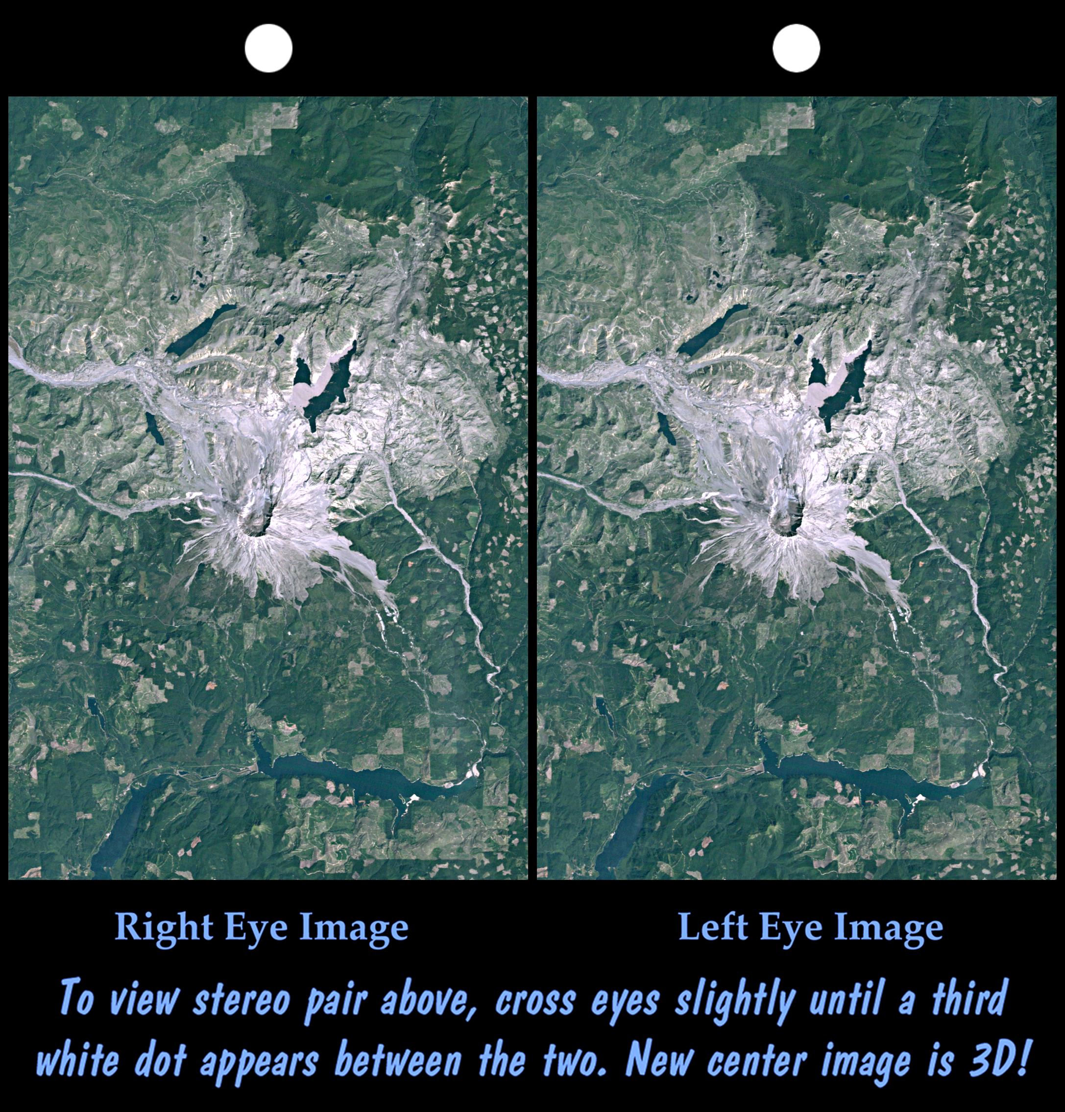
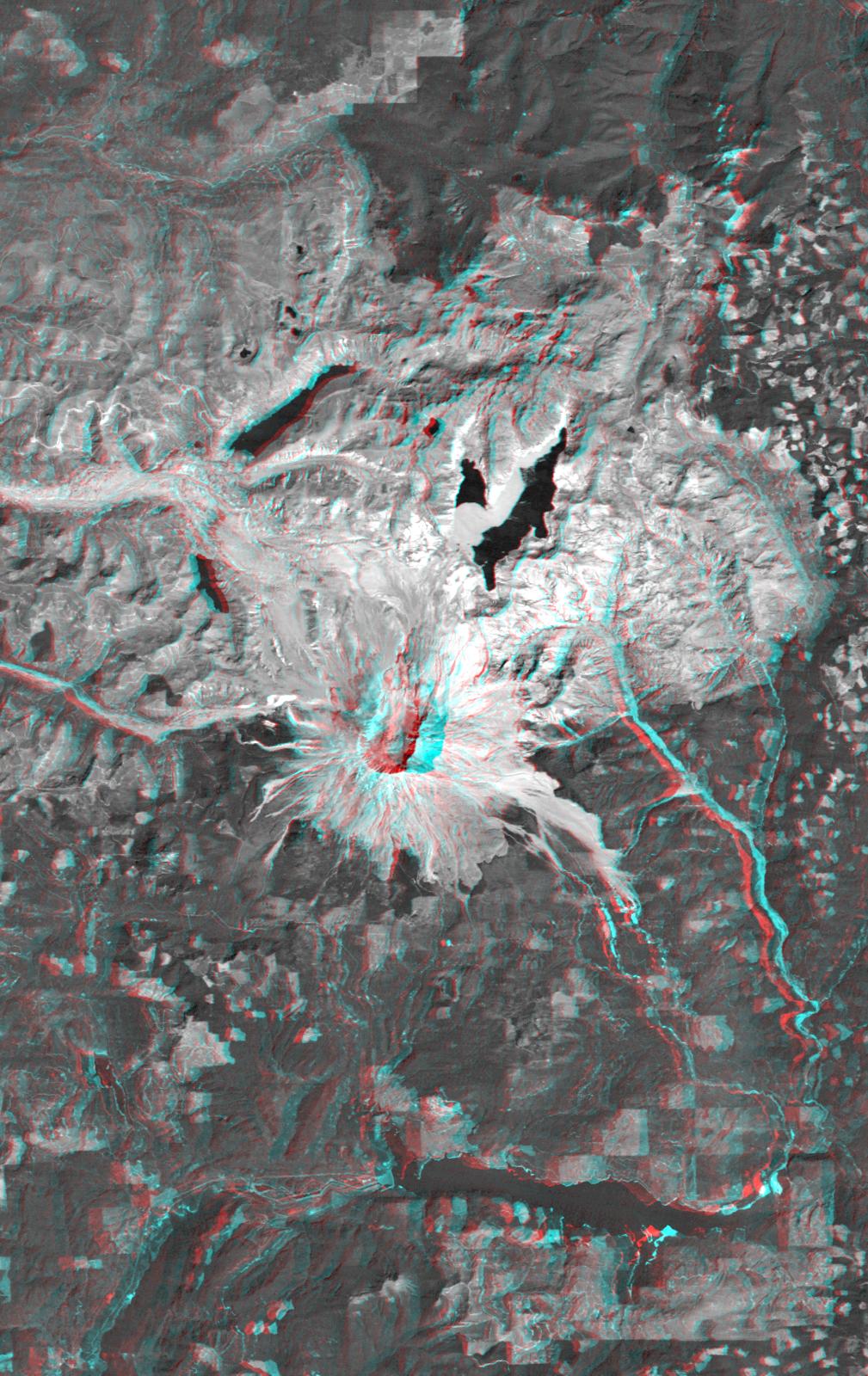
-
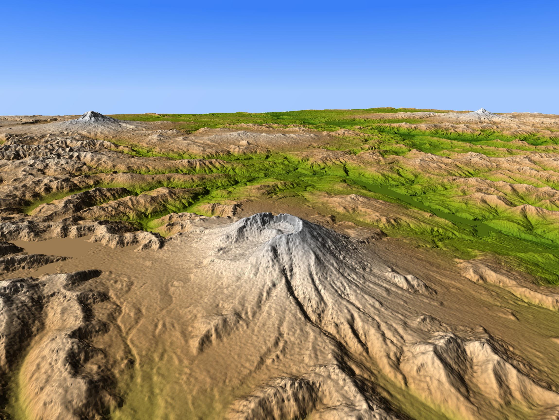
PIA06668:
-
Mount Saint Helens, Washington, USA, SRTM Perspective: Shaded Relief and Colored
Height
Full Resolution:
TIFF
(10.69 MB)
JPEG
(580.4 kB)
|
|
|
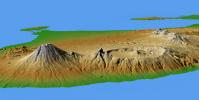
2004-09-15 |
Earth
|
Shuttle Radar Topography Mission (SRTM)
|
C-Band Radar
X-Band Radar
|
9100x11220x3 |
|
-
PIA06667:
-
Gulf Coast, Shaded Relief and Colored Height
Full Resolution:
TIFF
(236.5 MB)
JPEG
(26.54 MB)
|
|
|
2004-09-03 |
Earth
|
Shuttle Radar Topography Mission (SRTM)
|
C-Band Radar
X-Band Radar
|
8200x5389x3 |
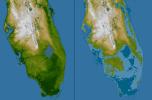
|
-
PIA06666:
-
Southern Florida, Shaded Relief and Colored Height
Full Resolution:
TIFF
(65.04 MB)
JPEG
(5.819 MB)
|
|
|
2004-07-13 |
Earth
|
Shuttle Radar Topography Mission (SRTM)
|
C-Band Radar
X-Band Radar
|
3987x10607x3 |
|
-
PIA04969:
-
Western Tibet, Shaded Relief with Color as Height
Full Resolution:
TIFF
(104.1 MB)
JPEG
(8.565 MB)
|
|
|
2004-07-03 |
Earth
|
Landsat
Shuttle Radar Topography Mission (SRTM)
|
C-Band Radar
X-Band Radar
|
5000x1700x3 |
|
-
PIA04968:
-
Library of Congress Model, Anaglyph
Full Resolution:
TIFF
(9.503 MB)
JPEG
(858.8 kB)
|
|
|
2004-07-03 |
Earth
|
Landsat
Shuttle Radar Topography Mission (SRTM)
|
C-Band Radar
X-Band Radar
|
5000x1700x3 |
|
-
PIA04967:
-
Library of Congress Model, Perspective View
Full Resolution:
TIFF
(11.27 MB)
JPEG
(895.3 kB)
|
|
|
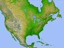
2004-06-23 |
Earth
|
Shuttle Radar Topography Mission (SRTM)
Terra
|
C-Band Interferometric Radar
Multi-angle Imaging SpectroRadiometer (MISR)
|
4149x2299x3 |
|
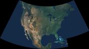
-
PIA04361:
-
Natural Color Mosaic of North America
Full Resolution:
TIFF
(10.95 MB)
JPEG
(597.3 kB)
|
|
|
2004-06-17 |
Earth
|
Shuttle Radar Topography Mission (SRTM)
|
C-Band Interferometric Radar
X-Band Radar
|
9600x10500x3 |
|
-
PIA04965:
-
SRTM Data Release for Africa, Colored Height
Full Resolution:
TIFF
(146.2 MB)
JPEG
(19.74 MB)
|
|
|
2004-06-17 |
Earth
|
Shuttle Radar Topography Mission (SRTM)
|
C-Band Interferometric Radar
X-Band Radar
|
9600x10500x3 |
|
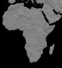
-
PIA04964:
-
Africa in SRTM 3-D, Anaglyph of Shaded Relief
Full Resolution:
TIFF
(123.1 MB)
JPEG
(13.79 MB)
|
|
|
2004-06-17 |
Earth
|
Landsat
Shuttle Radar Topography Mission (SRTM)
|
C-Band Interferometric Radar
X-Band Radar
|
2259x1244x3 |
|
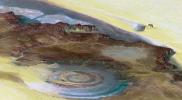
-
PIA04963:
-
Richat Structure, Mauritania
Full Resolution:
TIFF
(8.441 MB)
JPEG
(507 kB)
|
|
|
2004-06-17 |
Earth
|
Landsat
Shuttle Radar Topography Mission (SRTM)
|
C-Band Interferometric Radar
X-Band Radar
|
5657x3645x3 |
|
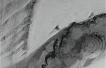
-
PIA04962:
-
Richat Structure, Mauritania, Anaglyph, Landsat Image over SRTM Elevation
Full Resolution:
TIFF
(54.43 MB)
JPEG
(3.974 MB)
|
|
|
2004-06-17 |
Earth
|
Landsat
Shuttle Radar Topography Mission (SRTM)
|
C-Band Interferometric Radar
X-Band Radar
|
2184x1377x3 |
|
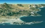
-
PIA04961:
-
Cape Town, South Africa, Perspective View, Landsat Image over SRTM
Elevation
Full Resolution:
TIFF
(8.727 MB)
JPEG
(581.8 kB)
|
|
|
2004-06-17 |
Earth
|
Landsat
Shuttle Radar Topography Mission (SRTM)
|
C-Band Interferometric Radar
X-Band Radar
|
4463x3000x3 |
|
-
PIA04960:
-
Cape Town, South Africa, Anaglyph, Landsat Image over SRTM Elevation
Full Resolution:
TIFF
(26.41 MB)
JPEG
(2.219 MB)
|
|
|
2004-06-17 |
Earth
|
Shuttle Radar Topography Mission (SRTM)
|
C-Band Interferometric Radar
X-Band Radar
|
2401x2403x3 |

|
-
PIA04959:
-
Olduvai Gorge, Shaded Relief and Colored Height
Full Resolution:
TIFF
(17.33 MB)
JPEG
(1.018 MB)
|
|
|
2004-06-17 |
Earth
|
Shuttle Radar Topography Mission (SRTM)
|
C-Band Interferometric Radar
X-Band Radar
|
2401x2401x3 |

|
-
PIA04958:
-
Mt. Elgon, Africa, Shaded Relief and Colored Height
Full Resolution:
TIFF
(17.31 MB)
JPEG
(1.24 MB)
|
|
|
2004-06-17 |
Earth
|
Shuttle Radar Topography Mission (SRTM)
|
C-Band Interferometric Radar
X-Band Radar
|
3601x6897x3 |

|
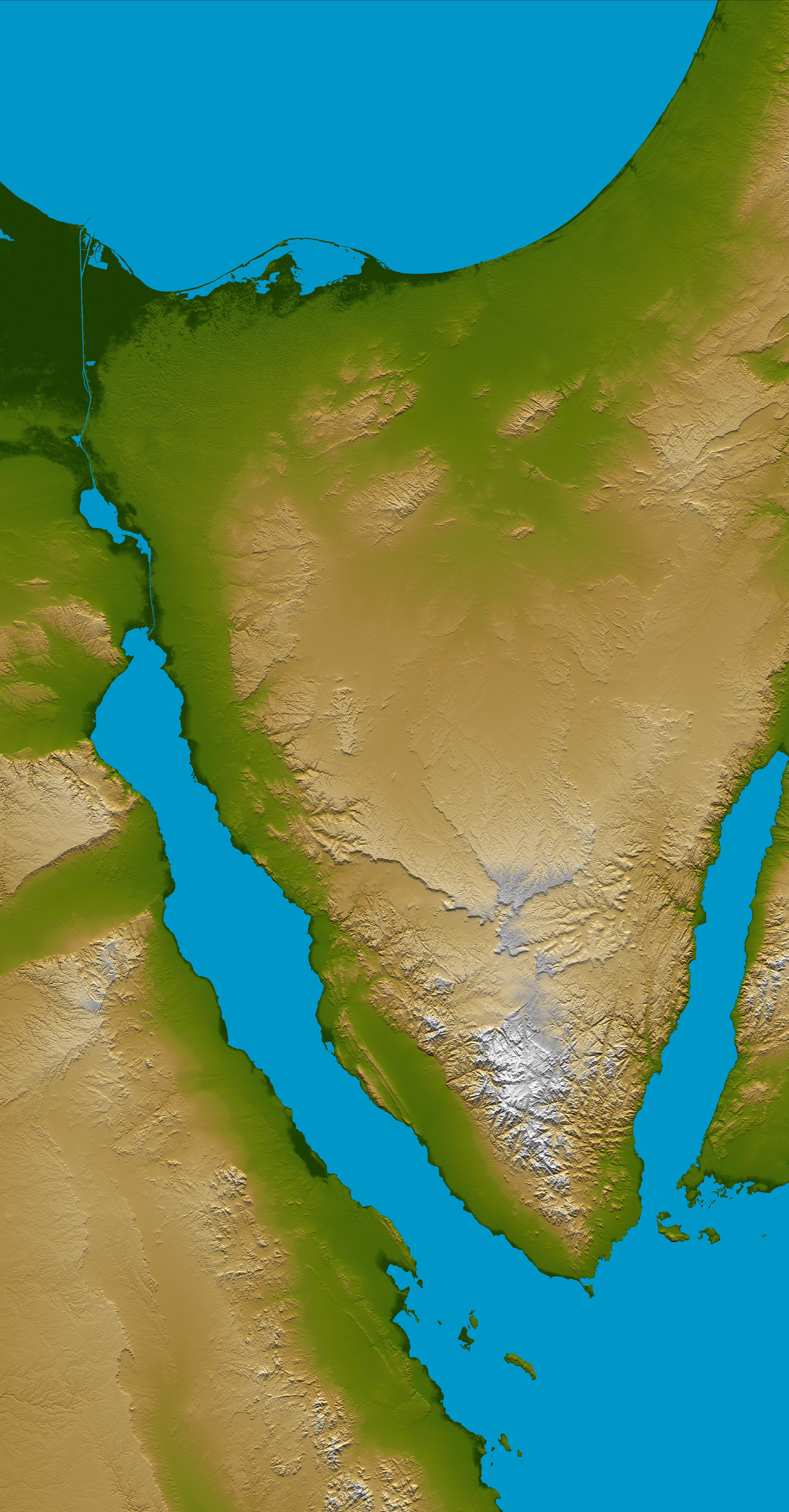
-
PIA04957:
-
Sinai Peninsula, Shaded Relief and Colored Height
Full Resolution:
TIFF
(56.53 MB)
JPEG
(3.751 MB)
|
|
|
2004-06-17 |
Earth
|
Shuttle Radar Topography Mission (SRTM)
|
C-Band Interferometric Radar
X-Band Radar
|
1600x1060x1 |
|
-
PIA04956:
-
Zagros Mountains, Iran, SRTM Shaded Relief
Full Resolution:
TIFF
(1.696 MB)
JPEG
(320.2 kB)
|
|
|
2004-06-17 |
Earth
|
Shuttle Radar Topography Mission (SRTM)
|
C-Band Interferometric Radar
X-Band Radar
|
1588x1060x3 |
|
-
PIA04955:
-
Zagros Mountains, Iran, SRTM Shaded Relief Anaglyph
Full Resolution:
TIFF
(4.247 MB)
JPEG
(318.1 kB)
|
|
|
2004-06-17 |
Earth
|
Shuttle Radar Topography Mission (SRTM)
|
C-Band Interferometric Radar
X-Band Radar
|
1182x1065x1 |
|
-
PIA04954:
-
Gotel Mountains, Nigeria and Cameroon, SRTM Shaded Relief plus Height as
Brightness
Full Resolution:
TIFF
(1.26 MB)
JPEG
(359.9 kB)
|
|
|
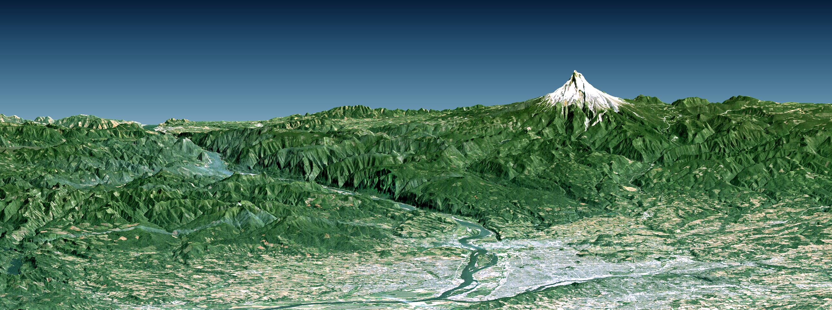
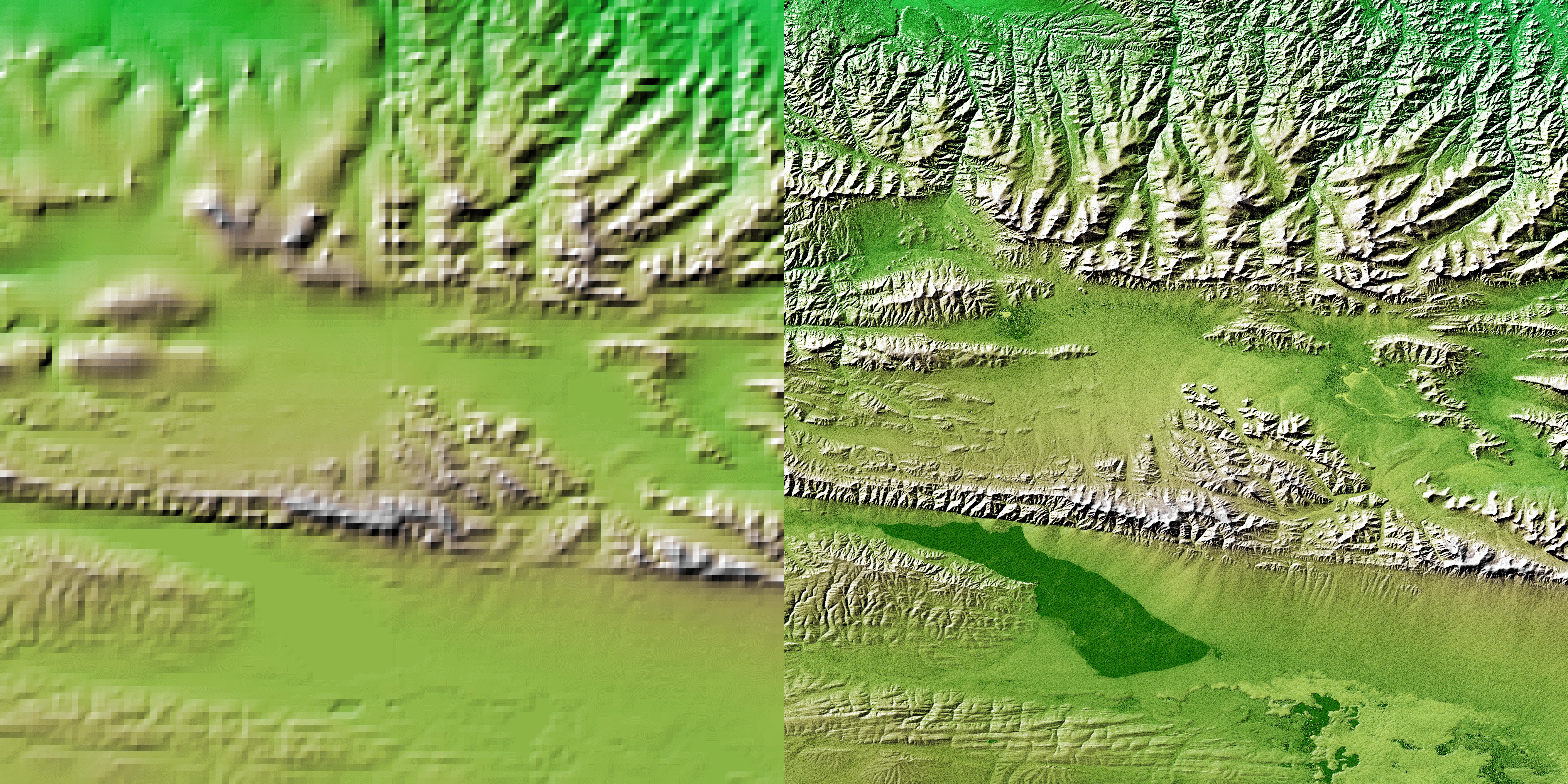
2004-06-11 |
Earth
|
Shuttle Radar Topography Mission (SRTM)
|
C-Band Radar
X-Band Radar
|
2650x990x3 |

|
-
PIA04966:
-
Portland, Mount Hood, & Columbia River Gorge, Oregon, Perspective View
Full Resolution:
TIFF
(6.389 MB)
JPEG
(573.5 kB)
|
|
|
2004-03-04 |
Earth
|
Shuttle Radar Topography Mission (SRTM)
|
C-Band Radar
X-Band Radar
|
250x380x3 |

|
-
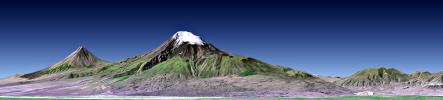
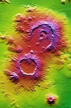
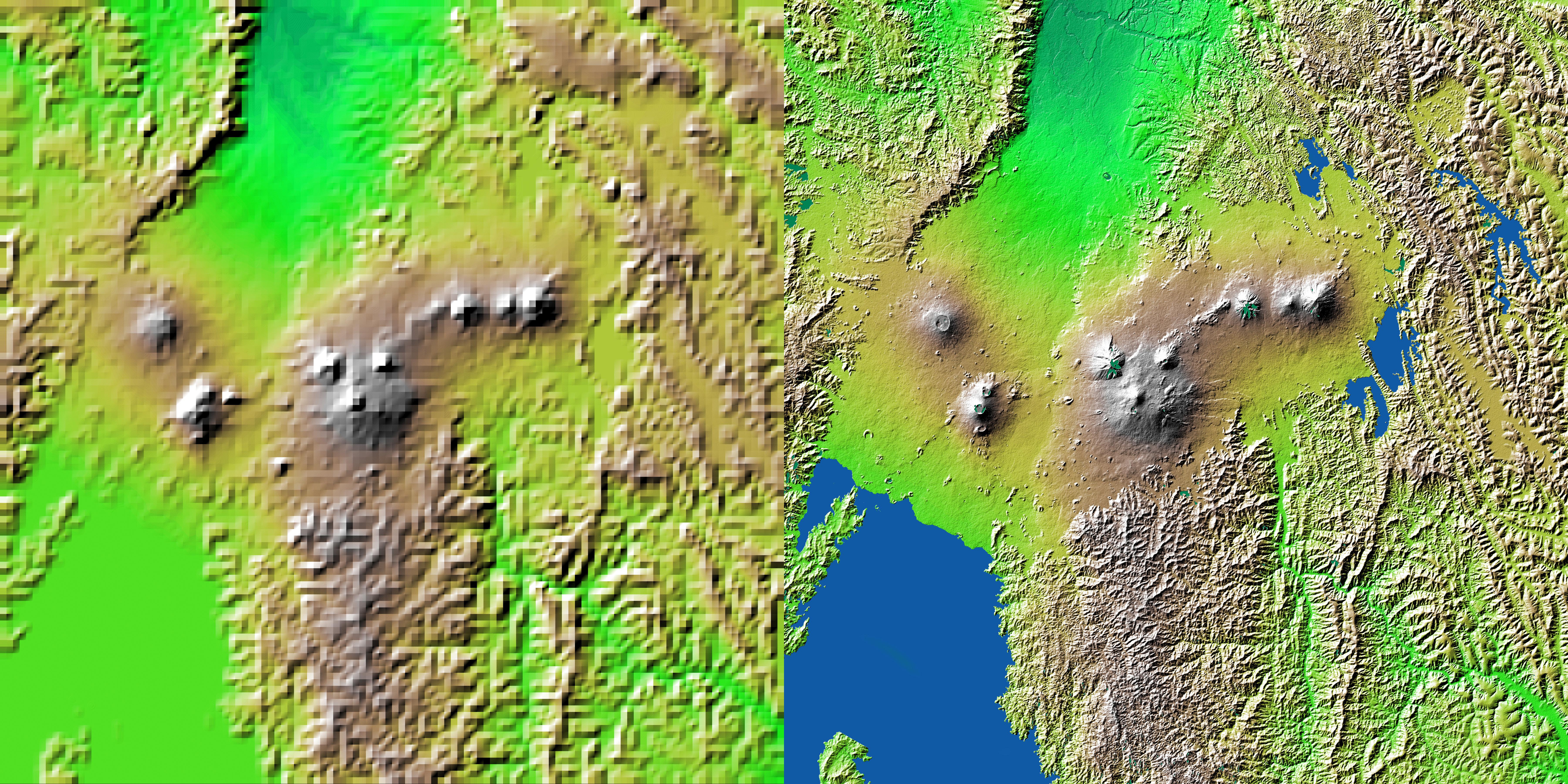
PIA04953:
-
Nabro and Mallahle Volcanoes, Eritrea and Ethiopia, SRTM Colored Height and Shaded Relief
Full Resolution:
TIFF
(285.5 kB)
JPEG
(23.34 kB)
|
|
|
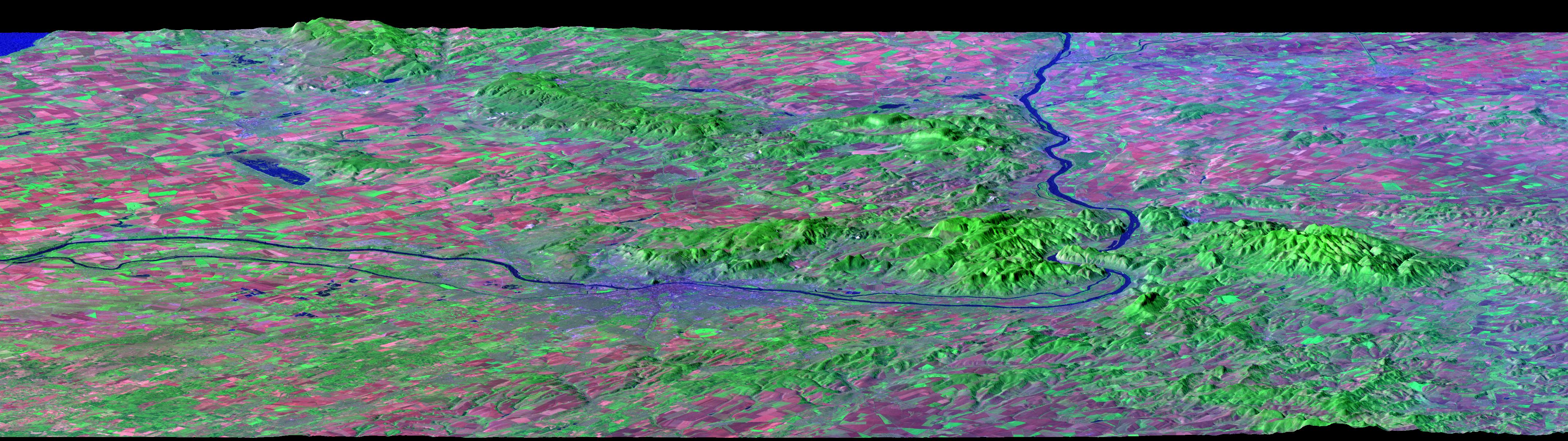
2004-02-13 |
Earth
|
Landsat
Shuttle Radar Topography Mission (SRTM)
|
C-Band Interferometric Radar
|
4300x1212x3 |
|
-
PIA04952:
Budapest, Hungary, Perspective View, SRTM Elevation Model with Landsat Overlay
Full Resolution:
TIFF
(15.64 MB)
JPEG
(1.094 MB)
|
|
|
2004-01-22 |
Earth
|
Shuttle Radar Topography Mission (SRTM)
|
C-Band Radar
X-Band Radar
|
3020x1700x3 |
|
-
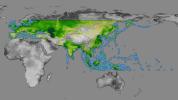
PIA03398:
-
SRTM Data Release for Eurasia, Index Map and Colored Height
Full Resolution:
TIFF
(4.646 MB)
JPEG
(509.4 kB)
|
|
|
2004-01-22 |
Earth
|
Shuttle Radar Topography Mission (SRTM)
|
C-Band Radar
X-Band Radar
|
1876x423x3 |
|
-
PIA03399:
Mount Ararat, Turkey, Perspective with Landsat Image Overlay
Full Resolution:
TIFF
(1.243 MB)
JPEG
(128.5 kB)
|
|
|
2004-01-22 |
Earth
|
Shuttle Radar Topography Mission (SRTM)
|
C-Band Radar
X-Band Radar
|
1669x1217x3 |
|
-
PIA04950:
-
Bali, Shaded Relief and Colored Height
Full Resolution:
TIFF
(2.888 MB)
JPEG
(213.7 kB)
|
|
|
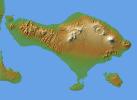
2004-01-22 |
Earth
|
Shuttle Radar Topography Mission (SRTM)
|
C-Band Radar
X-Band Radar
|
1400x704x3 |
|
-
PIA04951:
-
Mts. Agung and Batur, Bali, Shaded Relief and Colored Height
Full Resolution:
TIFF
(1.996 MB)
JPEG
(108.6 kB)
|
|
|
2003-10-24 |
Earth
|
Shuttle Radar Topography Mission (SRTM)
|
C-Band Interferometric Radar
X-Band Radar
|
1528x917x3 |

|
-
PIA03397:
-
Strait of Gibraltar, Perspective with Landsat Image Overlay
Full Resolution:
TIFF
(3.227 MB)
JPEG
(185.6 kB)
|
|
|
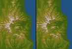
2003-08-21 |
Earth
|
Shuttle Radar Topography Mission (SRTM)
|
C-Band Interferometric Radar
|
14850x8000x3 |

|
-
PIA03394:
-
World Globes, Shaded Relief and Colored Height
Full Resolution:
TIFF
(109.4 MB)
JPEG
(35.2 MB)
|
|
|
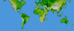
2003-08-21 |
Earth
|
Shuttle Radar Topography Mission (SRTM)
|
C-Band Interferometric Radar
|
21600x9049x3 |
|
-
PIA03395:
-
World in Mercator Projection, Shaded Relief and Colored Height
Full Resolution:
TIFF
(127.8 MB)
JPEG
(17.15 MB)
|
|
|
2003-08-21 |
Earth
|
Shuttle Radar Topography Mission (SRTM)
|
C-Band Interferometric Radar
|
1900x1070x3 |
|
-
PIA03396:
-
Guiana Highlands, Shaded Relief and Colored Height
Full Resolution:
TIFF
(5.185 MB)
JPEG
(269.5 kB)
|
|
|
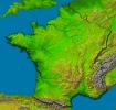
2003-07-25 |
Earth
|
Shuttle Radar Topography Mission (SRTM)
|
C-Band Interferometric Radar
|
8688x8296x3 |
|
-
PIA03393:
-
France, Shaded Relief and Colored Height
Full Resolution:
TIFF
(134.9 MB)
JPEG
(22.27 MB)
|
|
|
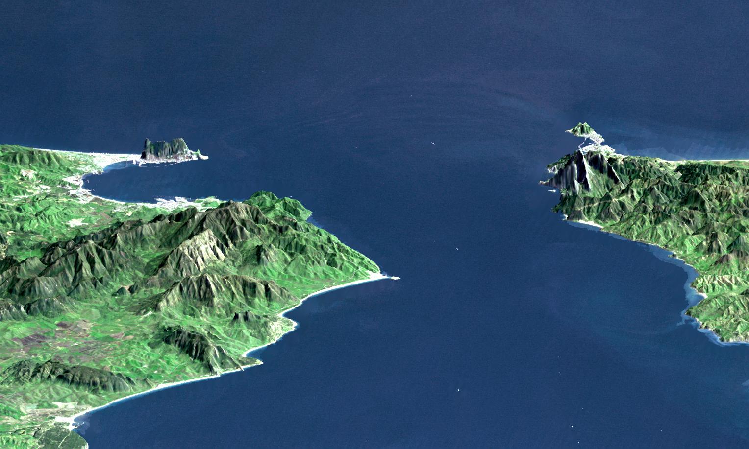
2003-07-03 |
Earth
|
Landsat
Shuttle Radar Topography Mission (SRTM)
|
C-Band Interferometric Radar
|
2805x1705x3 |
|
-
PIA03392:
-
Anaglyph with Landsat Virgin Islands, Caribbean
Full Resolution:
TIFF
(7.529 MB)
JPEG
(737 kB)
|
|
|
2003-07-03 |
Earth
|
Landsat
Shuttle Radar Topography Mission (SRTM)
|
C-Band Interferometric Radar
|
1025x577x3 |

|
-
PIA03391:
-
SRTM Perspective with Landsat Virgin Islands, Caribbean
Full Resolution:
TIFF
(1.777 MB)
JPEG
(89.61 kB)
|
|
|
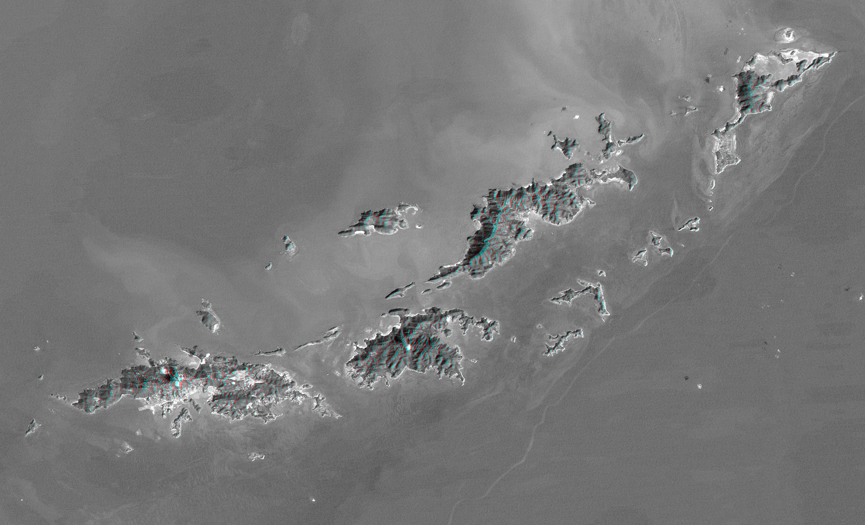
2003-06-19 |
Earth
|
Shuttle Radar Topography Mission (SRTM)
|
C-Band Interferometric Radar
|
960x725x3 |
|
-
PIA03390:
-
Pando Province, Northern Bolivia, Shaded Relief and Colored Height
Full Resolution:
TIFF
(2.091 MB)
JPEG
(172.2 kB)
|
|
|
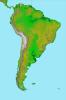
2003-06-19 |
Earth
|
Shuttle Radar Topography Mission (SRTM)
|
C-Band Interferometric Radar
|
7200x10886x3 |

|
-
PIA03389:
-
Anaglyph, South America
Full Resolution:
TIFF
(50.13 MB)
JPEG
(6.633 MB)
|
|
|
2003-06-19 |
Earth
|
Shuttle Radar Topography Mission (SRTM)
|
C-Band Interferometric Radar
|
7200x10886x3 |
|
-
PIA03388:
-
South America, Shaded Relief and Colored Height
Full Resolution:
TIFF
(69.52 MB)
JPEG
(8.202 MB)
|
|
|
2003-05-01 |
Earth
|
Landsat
Shuttle Radar Topography Mission (SRTM)
|
C-Band Interferometric Radar
Thematic Mapper
|
3262x3162x3 |
|
-
PIA03387:
-
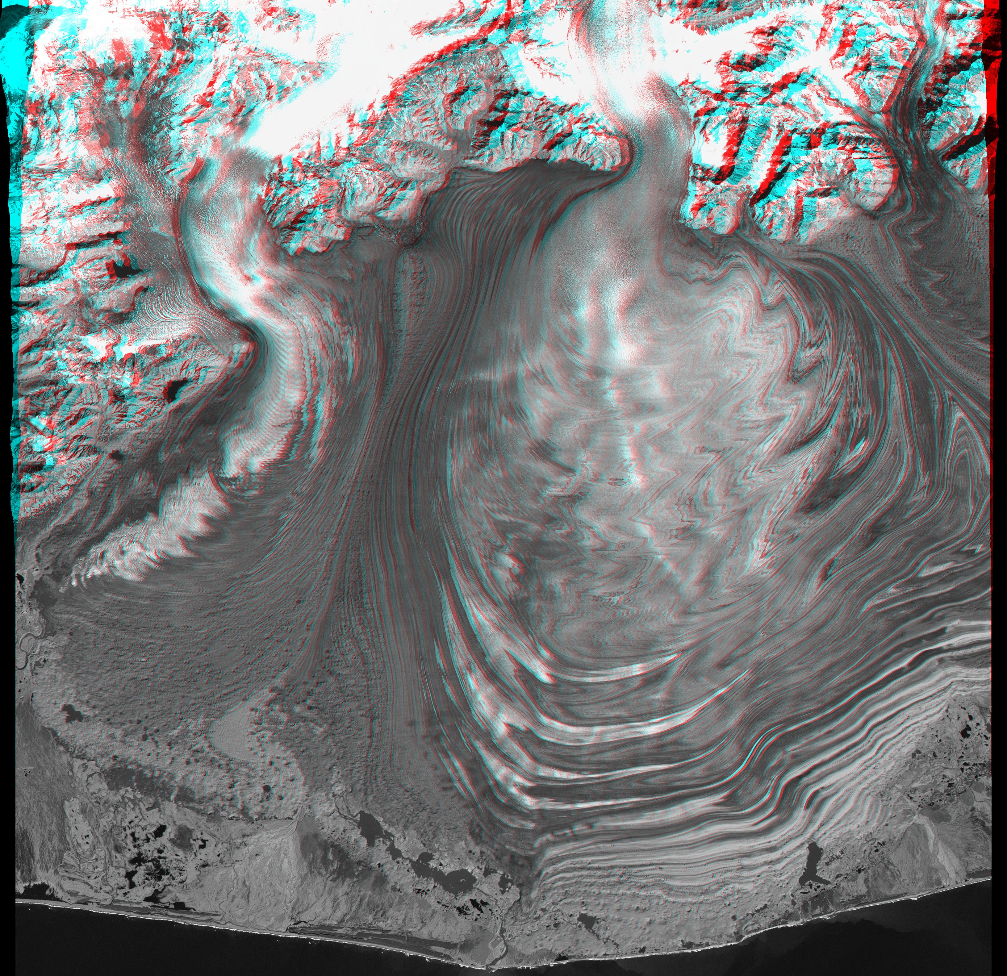
Malaspina Glacier, Alaska, Anaglyph with Landsat Overlay
Full Resolution:
TIFF
(26.8 MB)
JPEG
(2.079 MB)
|
|
|
2003-05-01 |
Earth
|
Landsat
Shuttle Radar Topography Mission (SRTM)
|
C-Band Interferometric Radar
Thematic Mapper
|
3162x1581x3 |
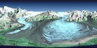
|
-
PIA03386:
-
Malaspina Glacier, Alaska
Full Resolution:
TIFF
(12.59 MB)
JPEG
(950.8 kB)
|
|
|
2003-03-27 |
Earth
|
Shuttle Radar Topography Mission (SRTM)
|
C-Band Interferometric Radar
|
1573x2401x3 |
|
-
PIA03385:
-
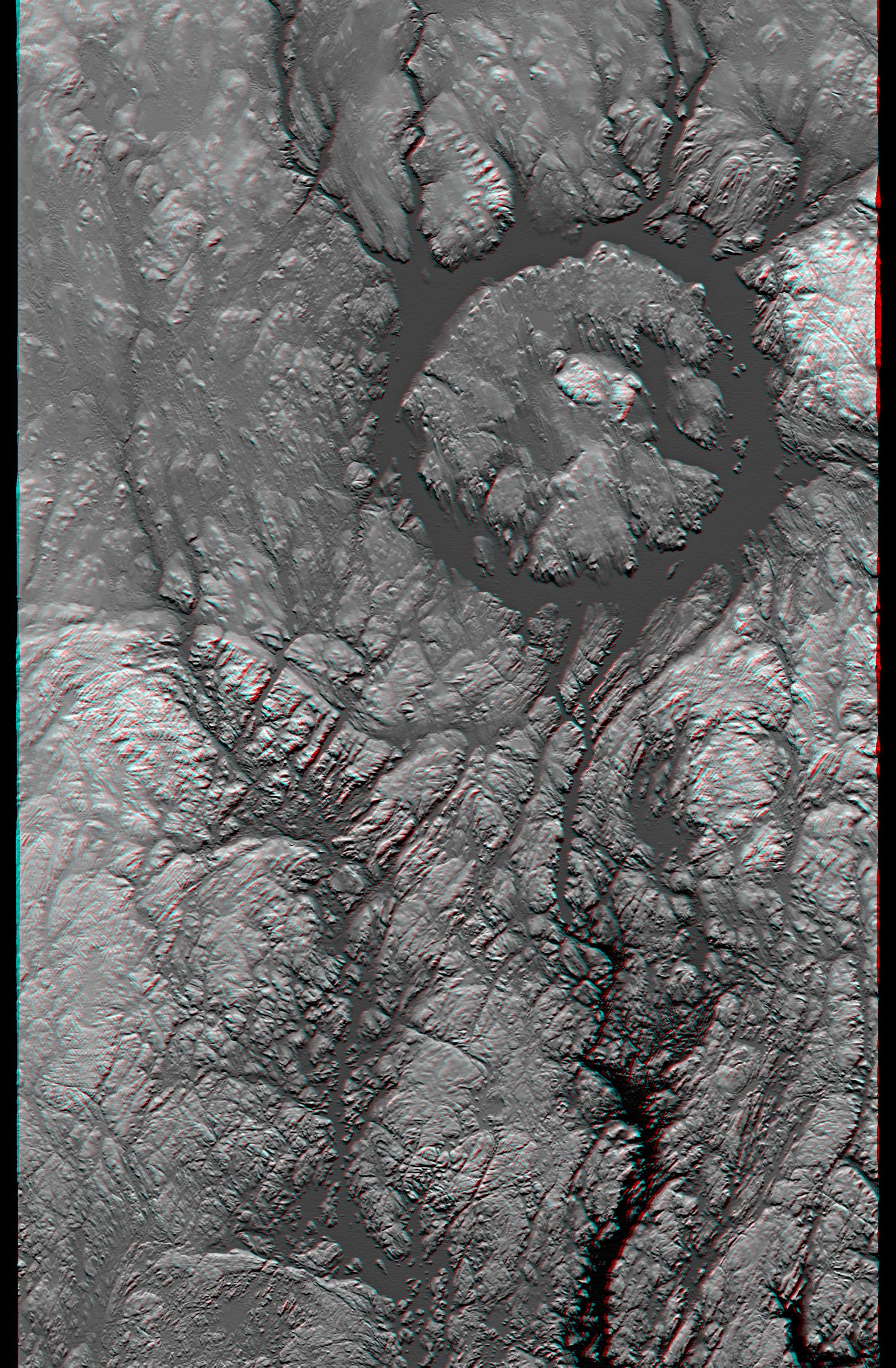
Anaglyph, Manicouagan Crater, Quebec, Canada
Full Resolution:
TIFF
(9.691 MB)
JPEG
(826 kB)
|
|
|
2003-03-27 |
Earth
|
Shuttle Radar Topography Mission (SRTM)
|
C-Band Interferometric Radar
|
3200x3400x3 |
|
-
PIA03384:
-
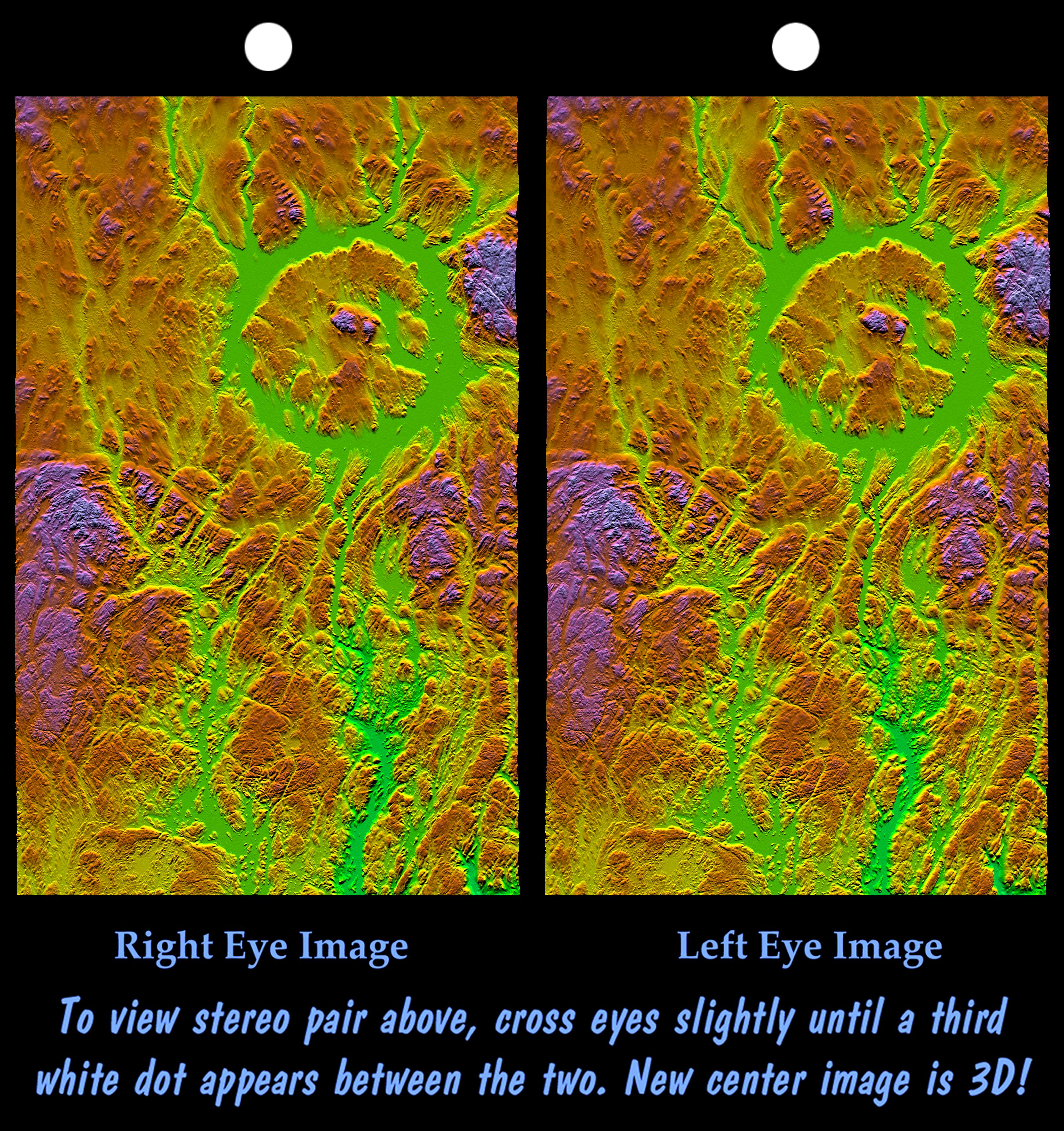
Stereo Pair, with Topographic Height as Color, Manicouagan Crater, Quebec, Canada
Full Resolution:
TIFF
(23.78 MB)
JPEG
(2.177 MB)
|
|
|
2003-03-13 |
Earth
|
Shuttle Radar Topography Mission (SRTM)
|
C-Band Interferometric Radar
|
628x801x3 |
|
-
PIA03383:
-
Shenandoah National Park, Virginia, Shaded Relief with Height as Color
Full Resolution:
TIFF
(1.511 MB)
JPEG
(152.9 kB)
|
|
|
2003-03-13 |
Earth
|
Shuttle Radar Topography Mission (SRTM)
|
C-Band Interferometric Radar
|
1587x1536x3 |
|
-
PIA03382:
-
Massanutten Mountain, Virginia, USA (Anaglyph)
Full Resolution:
TIFF
(6.914 MB)
JPEG
(527.2 kB)
|
|
|
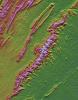
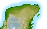
2003-03-06 |
Earth
|
Shuttle Radar Topography Mission (SRTM)
|
C-Band Interferometric Radar
|
3010x3416x3 |

|
-
PIA03381:
-
Shaded Relief with Height as Color and Landsat, Yucatan Peninsula, Mexico
Full Resolution:
TIFF
(30.85 MB)
JPEG
(2.545 MB)
|
|
|
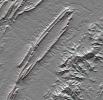
2003-03-06 |
Earth
|
Shuttle Radar Topography Mission (SRTM)
|
C-Band Interferometric Radar
|
1600x1080x3 |
|
-
PIA03380:
-
Anaglyph, Yucatan Peninsula, Mexico
Full Resolution:
TIFF
(2.651 MB)
JPEG
(362 kB)
|
|
|
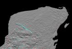
2003-03-06 |
Earth
|
Shuttle Radar Topography Mission (SRTM)
|
C-Band Interferometric Radar
|
18001x11438x3 |
|
-
PIA03379:
-
Shaded Relief with Height as Color, Yucatan Peninsula, Mexico
Full Resolution:
TIFF
(395.4 MB)
JPEG
(50.01 MB)
|
|
|
2003-03-06 |
Earth
|
Shuttle Radar Topography Mission (SRTM)
|
C-Band Interferometric Radar
|
9600x7240x3 |

|
-
PIA03378:
-
Anaglyph, North America
Full Resolution:
TIFF
(94.73 MB)
JPEG
(9.055 MB)
|
|
|
2003-03-06 |
Earth
|
Shuttle Radar Topography Mission (SRTM)
|
C-Band Interferometric Radar
|
9600x7240x3 |
|
-
PIA03377:
-
Shaded Relief with Height as Color, North America
Full Resolution:
TIFF
(130.7 MB)
JPEG
(56.09 MB)
|
|
|
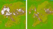
2002-12-23 |
Earth
|
Landsat
Shuttle Radar Topography Mission (SRTM)
|
C-Band Interferometric Radar
Thematic Mapper
|
4475x1896x3 |
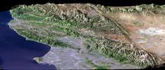
|
-
PIA03376:
-
Perspective View, SRTM / Landsat, Los Angeles, Calif
Full Resolution:
TIFF
(25.45 MB)
JPEG
(1.906 MB)
|
|
|
2002-12-12 |
Earth
|
Shuttle Radar Topography Mission (SRTM)
|
C-Band Interferometric Radar
|
2500x2000x3 |

|
-
PIA03375:
-
Shaded Relief and Radar Image with Color as Height, Madrid, Spain
Full Resolution:
TIFF
(15.02 MB)
JPEG
(1.897 MB)
|
|
|
2002-11-14 |
Earth
|
Shuttle Radar Topography Mission (SRTM)
|
C-Band Interferometric Radar
|
9000x15666x3 |

|
-
PIA03374:
-
Colored Height and Shaded Relief, Kamchatka Peninsula
Full Resolution:
TIFF
(233.5 MB)
JPEG
(9.626 MB)
|
|
|
2002-11-08 |
Earth
|
Landsat
Shuttle Radar Topography Mission (SRTM)
|
C-Band Interferometric Radar
Thematic Mapper
|
1389x682x3 |
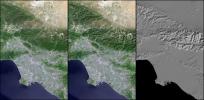
|
-
PIA03373:
-
Landsat - SRTM Shaded Relief Comparison, Los Angeles and Vicinity
Full Resolution:
TIFF
(2.663 MB)
JPEG
(243.8 kB)
|
|
|
2002-11-08 |
Earth
|
Landsat
Shuttle Radar Topography Mission (SRTM)
|
C-Band Interferometric Radar
Thematic Mapper
|
7350x10850x3 |
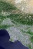
|
-
PIA03372:
-
Landsat with SRTM Shaded Relief, Los Angeles and Vicinity from Space
Full Resolution:
TIFF
(239.2 MB)
JPEG
(15.02 MB)
|
|
|
2002-11-01 |
Earth
|
Shuttle Radar Topography Mission (SRTM)
Terra
|
ASTER
C-Band Interferometric Radar
|
1152x870x3 |

|
-
PIA03371:
-
Perspective View, Mt. Etna, Italy
Full Resolution:
TIFF
(2.617 MB)
JPEG
(148.7 kB)
|
|
|
2002-11-01 |
Earth
|
Shuttle Radar Topography Mission (SRTM)
Terra
|
ASTER
C-Band Interferometric Radar
|
1152x870x3 |
|
-
PIA03370:
-
Perspective View, Mt. Etna, Italy & the Aeolian Islands
Full Resolution:
TIFF
(1.534 MB)
JPEG
(86.35 kB)
|
|
|
2002-10-25 |
Earth
|
Shuttle Radar Topography Mission (SRTM)
|
C-Band Interferometric Radar
|
1152x870x3 |

|
-
PIA03369:
-
Perspective View with Color-Coded Shaded Relief, Central Panama
Full Resolution:
TIFF
(2.588 MB)
JPEG
(192.8 kB)
|
|
|
2002-10-25 |
Earth
|
Shuttle Radar Topography Mission (SRTM)
|
C-Band Interferometric Radar
|
1152x870x3 |

|
-
PIA03368:
-
Perspective View with Color-Coded Shaded Relief, Panama Canal
Full Resolution:
TIFF
(1.584 MB)
JPEG
(141.6 kB)
|
|
|
2002-10-25 |
Earth
|
Landsat
Shuttle Radar Topography Mission (SRTM)
|
C-Band Interferometric Radar
Thematic Mapper
|
1152x870x3 |
|
-
PIA03367:
-
Perspective View with Landsat Overlay, San Jose, Costa Rica
Full Resolution:
TIFF
(3.01 MB)
JPEG
(210.8 kB)
|
|
|
2002-10-25 |
Earth
|
Landsat
Shuttle Radar Topography Mission (SRTM)
|
C-Band Interferometric Radar
Thematic Mapper
|
1152x870x3 |
|
-
PIA03366:
-
Perspective View with Landsat Overlay, Costa Rica
Full Resolution:
TIFF
(3.01 MB)
JPEG
(220.9 kB)
|
|
|
2002-10-25 |
Earth
|
Landsat
Shuttle Radar Topography Mission (SRTM)
|
C-Band Interferometric Radar
Thematic Mapper
|
1152x870x3 |
|
-
PIA03365:
-
Perspective View with Landsat Overlay, Lakes Managua and Nicaragua
Full Resolution:
TIFF
(2.87 MB)
JPEG
(172 kB)
|
|
|
2002-10-22 |
Earth
|
Shuttle Radar Topography Mission (SRTM)
|
C-Band Interferometric Radar
|
9600x9000x3 |
|
-
PIA03364:
-
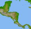
Colored Height and Shaded Relief, Central America
Full Resolution:
TIFF
(84.57 MB)
JPEG
(8.603 MB)
|
|
|
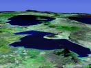
2002-09-26 |
Earth
|
Shuttle Radar Topography Mission (SRTM)
|
C-Band Interferometric Radar
|
1016x865x3 |
|
-
PIA03363:
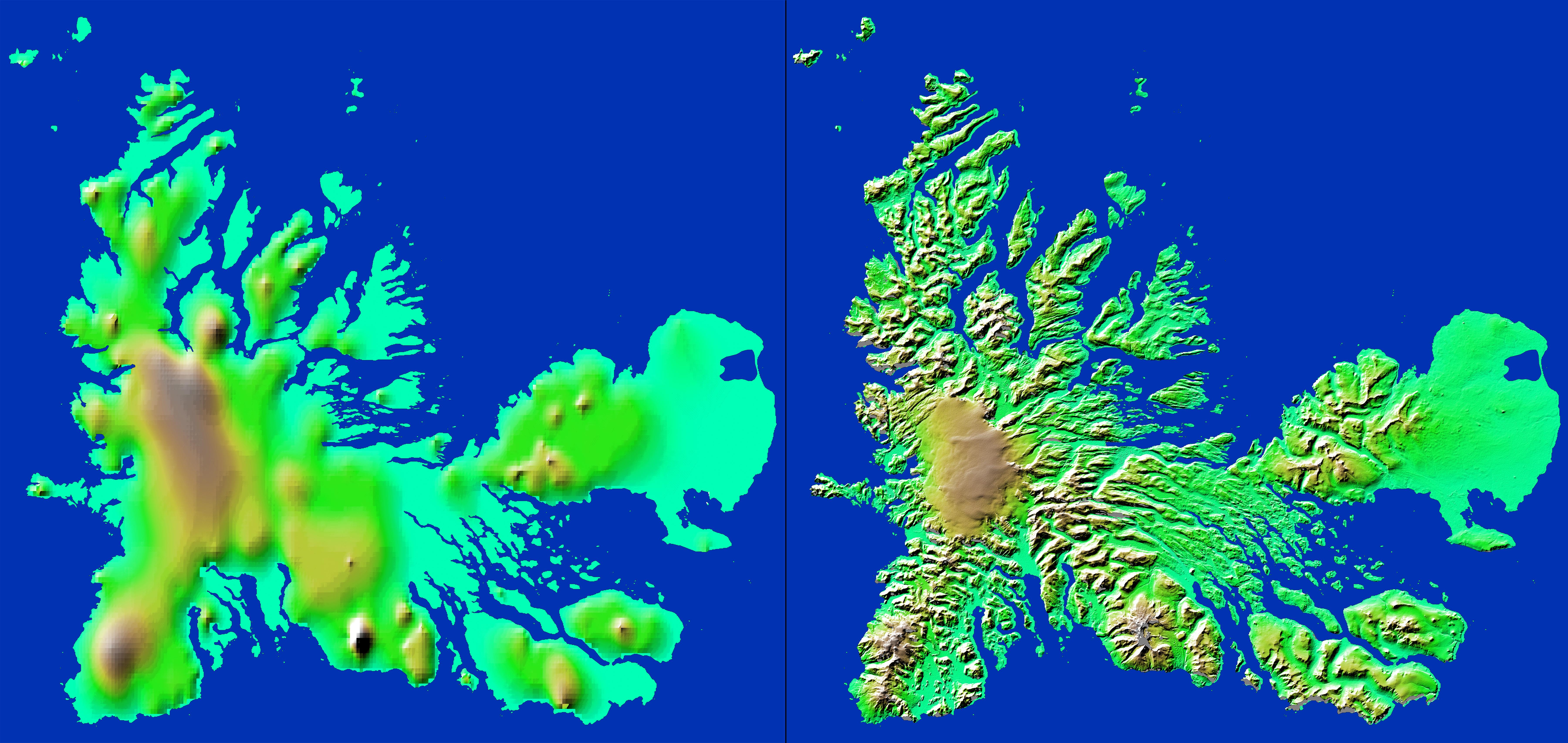
-
Stereo Pair with ASTER Image, Iturralde Structure, Bolivia
Full Resolution:
TIFF
(2.168 MB)
JPEG
(186.8 kB)
|
|
|
2002-09-26 |
Earth
|
Shuttle Radar Topography Mission (SRTM)
|
C-Band Interferometric Radar
|
1200x1200x3 |
|
-
PIA03362:
-
Anaglyph: Shaded Relief and Height as Brightness, Iturralde Structure, Bolivia
Full Resolution:
TIFF
(3.729 MB)
JPEG
(366.1 kB)
|
|
|
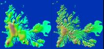
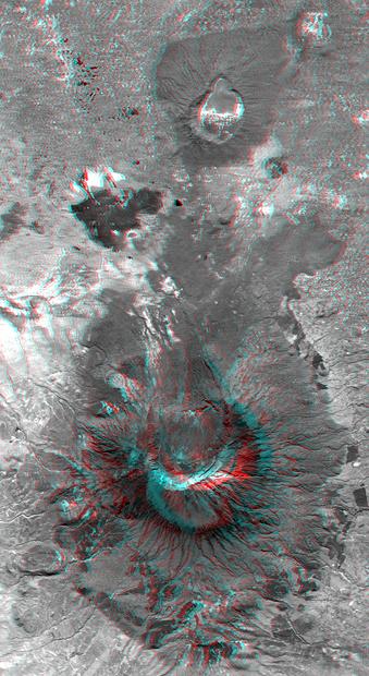
2002-09-19 |
Earth
|
Landsat
Shuttle Radar Topography Mission (SRTM)
|
C-Band Interferometric Radar
Thematic Mapper
|
2174x2271x3 |
|
-
PIA03361:
-
Stereo Pair, Mount St Helens, Washington State
Full Resolution:
TIFF
(10.66 MB)
JPEG
(779.8 kB)
|
|
|
2002-09-19 |
Earth
|
Landsat
Shuttle Radar Topography Mission (SRTM)
|
C-Band Interferometric Radar
Thematic Mapper
|
1009x1600x3 |
|
-
PIA03360:
-
Anaglyph, Mount St Helens, Washington State
Full Resolution:
TIFF
(4.217 MB)
JPEG
(309 kB)
|
|
|
2002-09-13 |
Earth
|
Shuttle Radar Topography Mission (SRTM)
|
C-Band Interferometric Radar
|
3601x3601x3 |

|
-
PIA03359:
-
Shaded Relief with Height as Color, Iturralde Structure, Bolivia
Full Resolution:
TIFF
(38.9 MB)
JPEG
(3.517 MB)
|
|
|
2002-09-12 |
Earth
|
Landsat
Shuttle Radar Topography Mission (SRTM)
|
C-Band Interferometric Radar
Thematic Mapper
|
339x620x3 |
|
-
PIA03358:
-
Anaglyph with Landsat Overlay, Mount Meru, Tanzania
Full Resolution:
TIFF
(602.1 kB)
JPEG
(56.43 kB)
|
|
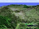
|
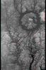
2002-09-12 |
Earth
|
Landsat
Shuttle Radar Topography Mission (SRTM)
|
C-Band Interferometric Radar
Thematic Mapper
|
712x808x3 |

|
-
PIA03357:
-
Stereo Pair with Landsat Overlay, Mount Meru, Tanzania
Full Resolution:
TIFF
(1.649 MB)
JPEG
(145.2 kB)
|
|
|
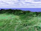
2002-08-29 |
Earth
|
Shuttle Radar Topography Mission (SRTM)
|
C-Band Interferometric Radar
|
688x550x3 |
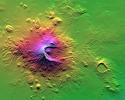
|
-
PIA03356:
-
Shaded Relief with Height as Color, Mount Meru, Tanzania
Full Resolution:
TIFF
(1.264 MB)
JPEG
(99.88 kB)
|
|
|
2002-08-22 |
Earth
|
Landsat
Shuttle Radar Topography Mission (SRTM)
|
C-Band Interferometric Radar
Thematic Mapper
|
1373x209x3 |

|
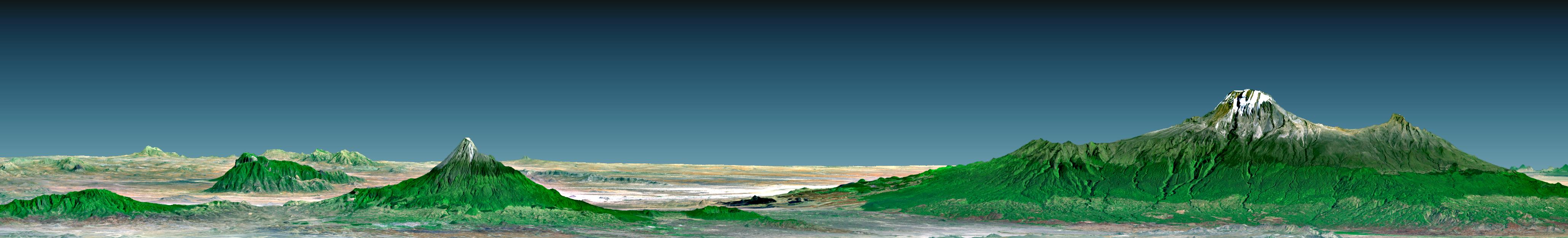
-
PIA03355:
Perspective with Landsat Overlay, Mount Kilimanjaro, Tanzania
Full Resolution:
TIFF
(2.589 MB)
JPEG
(275.5 kB)
|
|
|
2002-07-11 |
Earth
|
Shuttle Radar Topography Mission (SRTM)
|
C-Band Interferometric Radar
|
7200x3410x3 |
|
-
PIA03354:
-
Shaded Relief with Height as Color, Kerguelen Island, south Indian Ocean
Full Resolution:
TIFF
(32.41 MB)
JPEG
(2.381 MB)
|
|
|
2002-07-11 |
Earth
|
Shuttle Radar Topography Mission (SRTM)
|
C-Band Interferometric Radar
|
7200x3600x3 |
|
-
PIA03353:
-
Shaded Relief with Height as Color, Manila Bay, Philippines
Full Resolution:
TIFF
(53.59 MB)
JPEG
(4.092 MB)
|
|
|
2002-07-11 |
Earth
|
Shuttle Radar Topography Mission (SRTM)
|
C-Band Interferometric Radar
|
7200x3600x3 |

|
-
PIA03352:
-
Shaded Relief with Height as Color, Kunlun fault, east-central Tibet
Full Resolution:
TIFF
(74.87 MB)
JPEG
(5.561 MB)
|
|
|
2002-07-11 |
Earth
|
Shuttle Radar Topography Mission (SRTM)
|
C-Band Interferometric Radar
|
7200x3601x3 |
|
-
PIA03351:
-
Shaded Relief with Height as Color, Virunga and Nyiragongo Volcanoes and the East African Rift Valley
Full Resolution:
TIFF
(78.98 MB)
JPEG
(5.492 MB)
|
 Planetary Data System


