The Davenport Ranges of central Australia have been inferred to be among the oldest persisting landforms on Earth, founded on the belief that the interior of Australia has been tectonically stable for at least 700 million years. New rock age dating techniques indicate that substantial erosion has probably occurred over that time period and that the landforms are not nearly that old, but landscape evolution certainly occurs much slower here (at least now) than is typical across Earth's surface.
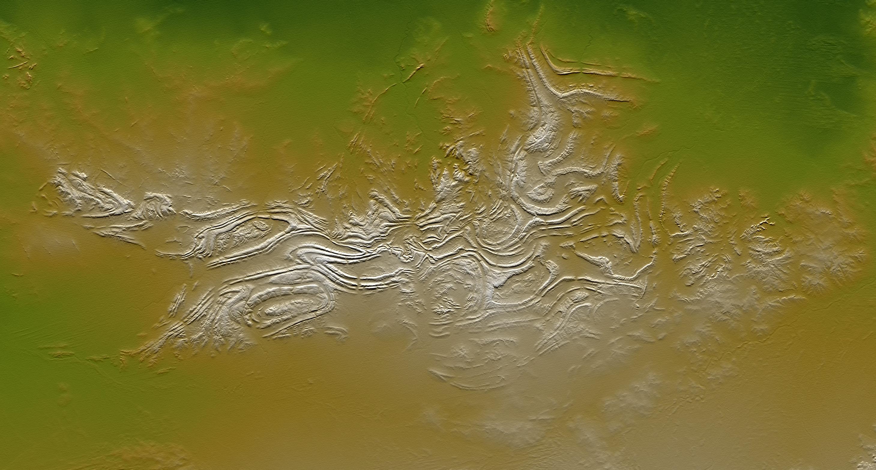
Regardless of their antiquity, the Davenport Ranges exhibit a striking landform pattern as shown in this display of elevation data from the Shuttle Radar Topography Mission (SRTM). Quartzites and other erosion resistant strata form ridges within anticlinal (arched up) and synclinal (arched down) ovals and zigzags. These structures, if not the landforms, likely date back at least hundreds of millions of years, to a time when tectonic forces were active. Maximum local relief is only about 60 meters (about 200 feet), which is enough to contrast greatly with the extremely low relief surrounding terrain.
Two visualization methods were combined to produce this image: shading and color coding of topographic height. The shade image was derived by computing topographic slope in the northeast-southwest (image top to bottom) direction, so that northeast slopes appear bright and southwest slopes appear dark. Color coding is directly related to topographic height, with green at the lower elevations, rising through yellow and tan, to white at the highest elevations.
Elevation data used in this image were acquired by the Shuttle Radar Topography Mission aboard the Space Shuttle Endeavour, launched on Feb. 11, 2000. SRTM used the same radar instrument that comprised the Spaceborne Imaging Radar-C/X-Band Synthetic Aperture Radar (SIR-C/X-SAR) that flew twice on the Space Shuttle Endeavour in 1994. SRTM was designed to collect 3-D measurements of the Earth's surface. To collect the 3-D data, engineers added a 60-meter (approximately 200-foot) mast, installed additional C-band and X-band antennas, and improved tracking and navigation devices. The mission is a cooperative project between NASA, the National Geospatial-Intelligence Agency (NGA) of the U.S. Department of Defense and the German and Italian space agencies. It is managed by NASA's Jet Propulsion Laboratory, Pasadena, Calif., for NASA's Earth Science Enterprise, Washington, D.C.
Size: 270 kilometers (168 miles) by 145 kilometers (90 miles)
Location: 20.9 degrees South latitude, 134.9 degrees East longitude
Orientation: Northeast toward the top
Image Data: Shaded and colored SRTM elevation model
Date Acquired: February 2000
