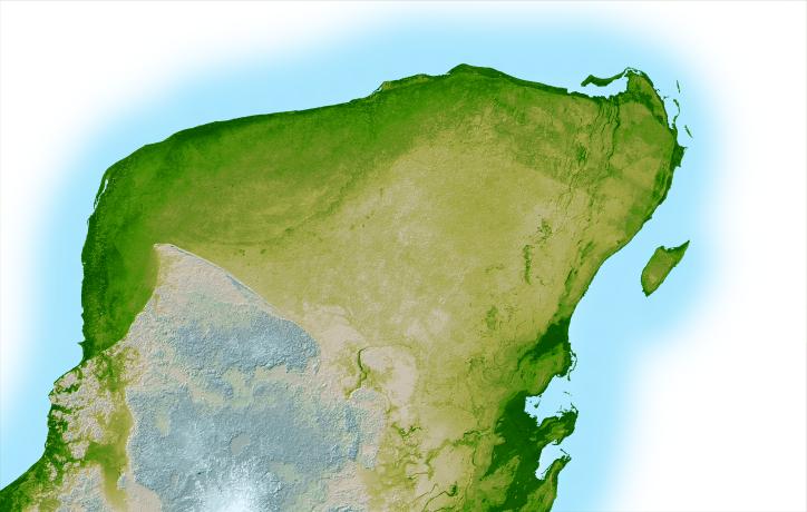
This shaded relief image of Mexico's Yucatan Peninsula show a subtle, but unmistakable, indication of the Chicxulub impact crater. Most scientists now agree that this impact was the cause of the Cretatious-Tertiary Extinction, the event 65 million years ago that marked the sudden extinction of the dinosaurs as well as the majority of life then on Earth.
Most of the peninsula is visible here, along with the island of Cozumel off the east coast. The Yucatan is a plateau composed mostly of limestone and is an area of very low relief with elevations varying by less than a few hundred meters (about 500 feet.) In this computer-enhanced image the topography has been greatly exaggerated to highlight a semicircular trough, the darker green arcing line at the upper left corner of the peninsula. This trough is only about 3 to 5 meters (10 to 15 feet) deep and is about 5 km. wide (3 miles), so subtle that if you walked across it you probably would not notice it, and is a surface expression of the crater's outer boundary. Scientists believe the impact, which was centered just off the coast in the Caribbean, altered the subsurface rocks such that the overlying limestone sediments, which formed later and erode very easily, would preferentially erode on the vicinity of the crater rim. This formed the trough as well as numerous sinkholes (called cenotes) which are visible as small circular depressions.
Two visualization methods were combined to produce the image: shading and color coding of topographic height. The shade image was derived by computing topographic slope in the northwest-southeast direction, so that northwestern slopes appear bright and southeastern slopes appear dark. Color coding is directly related to topographic height, with green at the lower elevations, rising through yellow and tan, to white at the highest elevations.
For a smaller, annotated version of this image, please select Figure 1, below:
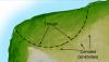 (Large image: ~1.5 mB jpeg)
Elevation data used in this image were acquired by the Shuttle Radar Topography Mission (SRTM) aboard the Space Shuttle Endeavour, launched on Feb. 11, 2000. SRTM used the same radar instrument that comprised the Spaceborne Imaging Radar-C/X-Band Synthetic Aperture Radar (SIR-C/X-SAR) that flew twice on the Space Shuttle Endeavour in 1994. SRTM was designed to collect 3-D measurements of the Earth's surface. To collect the 3-D data, engineers added a 60-meter (approximately 200-foot) mast, installed additional C-band and X-band antennas, and improved tracking and navigation devices. The mission is a cooperative project between NASA, the National Imagery and Mapping Agency (NIMA) of the U.S. Department of Defense and the German and Italian space agencies. It is managed by NASA's Jet Propulsion Laboratory, Pasadena, Calif., for NASA's Earth Science Enterprise, Washington, D.C.
Size: 261 by 162 kilometers (162 by 100 miles)
Location: 20.8 degrees North latitude, 89.3 degrees West longitude
Orientation: North toward the top, Mercator projection
Image Data: shaded and colored SRTM elevation model
Original Data Resolution: SRTM 1 arcsecond (about 30 meters or 98 feet)
Date Acquired: February 2000
 Planetary Data System


