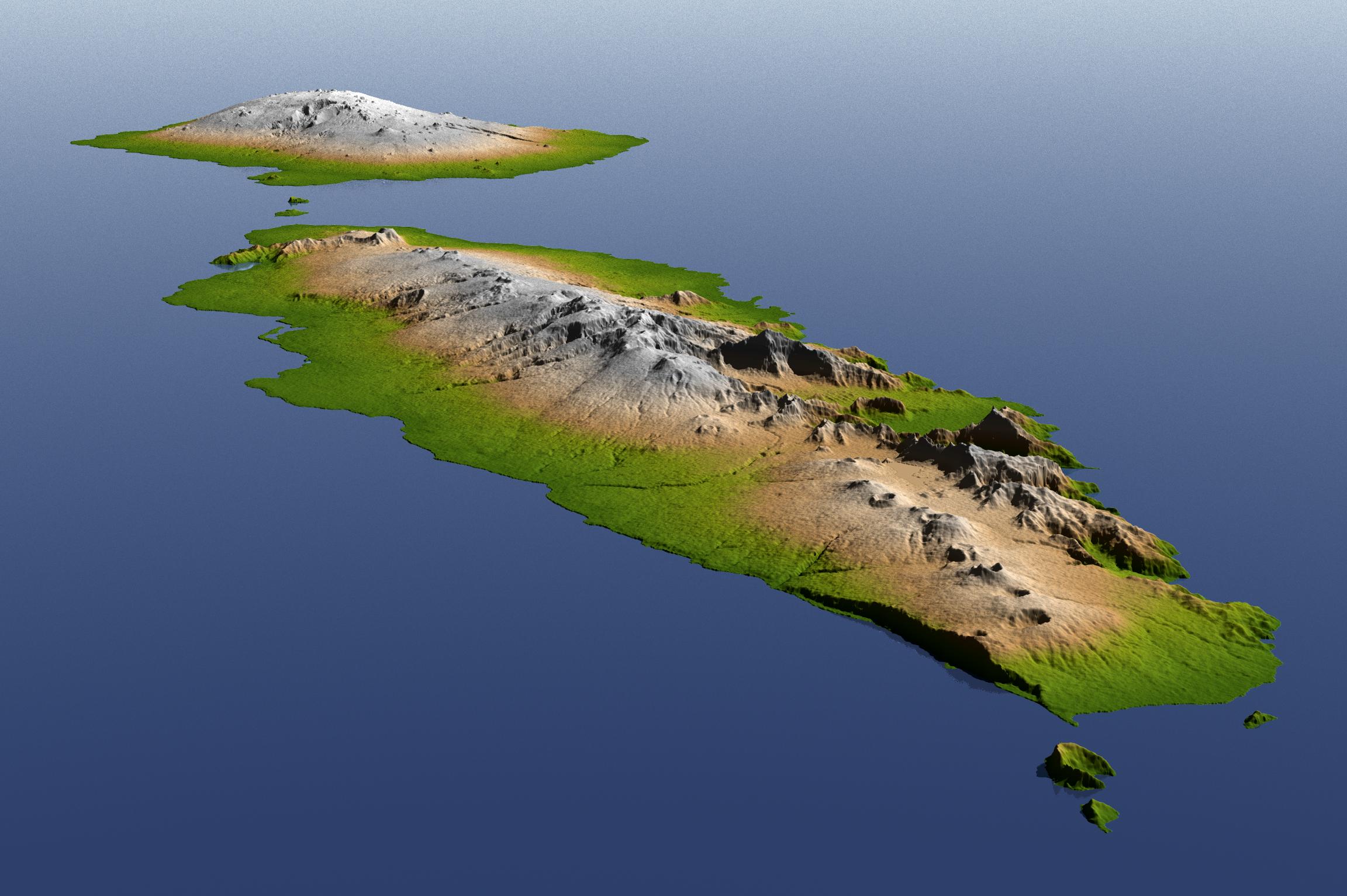
The topography of Savai'i (background) and Upolu (foreground), the two large islands of the Independent State of Samoa, is well shown in this color-coded perspective view generated with digital elevation data from the Shuttle Radar Topography Mission (SRTM).
The Samoan Islands are a product of volcanism, which is primarily evidenced by numerous volcanic cones, many of which are seen in this view. Tropical rainfall has deeply eroded parts of these islands, but most of the land surface is depositional: the product of lava flows, some of which have occurred in historic times. The total area of these islands is about 2,800 square kilometers (about 1,000 square miles). The highest point in Samoa is Mauga Silisili on Savai'i (1,858 meters, or 6,096 feet).
On September 29, 2009, a tsunami generated by a major undersea earthquake located about 200 kilometers (120 miles) south of Samoa inundated villages on the southern coast of the islands with an ocean surge perhaps more than 3 meters (10 feet) deep. It also impacted the more heavily populated northern coasts with a surge measured at nearly 1.5 meters (4 feet) at the capital city Apia (on Upolu). Scores of casualties have been reported. Digital topographic data such as those produced by SRTM aid researchers and planners in predicting which coastal regions are at the most risk from such waves, as well as from the more common storm surges caused by tropical storms and even sea level rise.
Two visualization methods were combined to produce the image: shading and color coding of topographic height. The shaded image was derived by computing topographic slope in the northeast-southwest direction, so that northeast slopes appear bright and southwest slopes appear dark. Color coding is directly related to topographic height, with green at the lower elevations, rising through yellow and tan, to white at the highest elevations. The image was then projected using the elevation data to produce this perspective view, with the topography exaggerated by a factor of two.
Elevation data used in this image were acquired by the Shuttle Radar Topography Mission aboard the Space Shuttle Endeavour, launched on Feb. 11, 2000. SRTM used the same radar instrument that comprised the Spaceborne Imaging Radar-C/X-Band Synthetic Aperture Radar (SIR-C/X-SAR) that flew twice on the Space Shuttle Endeavour in 1994. SRTM was designed to collect 3-D measurements of Earth's surface. To collect the 3-D data, engineers added a 60-meter (approximately 200-foot) mast, installed additional C-band and X-band antennas and improved tracking and navigation devices. The mission is a cooperative project between NASA, the National Geospatial-Intelligence Agency (NGA) of the U.S. Department of Defense and the German and Italian space agencies. It is managed by NASA's Jet Propulsion Laboratory, Pasadena, Calif., for NASA's Science Mission Directorate, Washington, D.C.
Location: 14 degrees South latitude, 172 degrees West longitude
Orientation: Northwest perspective view
Size: approximately 150 by 75 kilometers (100 by 50 miles)
SRTM Data Acquired: February 2000
