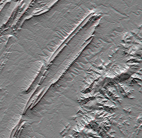
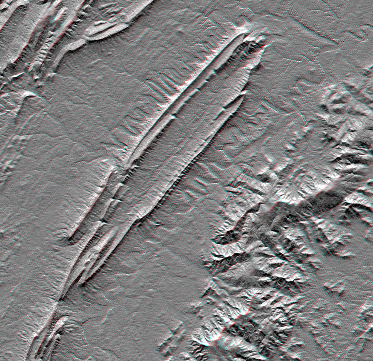
Massanutten Mountain lies in the Shenandoah Valley of northern Virginia. Rock layers in the mountain are folded downward in an overall "U" shape (called a syncline) which accounts for its peculiar double ridge shape with a highly elongated valley between. The ridges have formed because they are capped with a sandstone layer which is resistant to weathering and erosion. Limestones and shales are less resistant and form the lowlands and valleys. The north and south forks of the Shenandoah River flank Massanutten Mountain and display unusually pronounced meander patterns. Other layered sedimentary rocks form other ridgeline patterns in the Allegheny Mountains, to the upper left. But the igneous and metamorphic (crystalline) rocks of the Blue Ridge Mountains erode into a very different topographic pattern to the southeast. This small area provides an excellent example rock type, geologic structure, and fluvial (stream) processes all influencing landform development.
This anaglyph was produced by first shading a preliminary elevation model from data acquired by the Shuttle Radar Topography Mission. The stereoscopic effect was then created by generating two differing perspectives, one for each eye. When viewed through special glasses, the result is a vertically exaggerated view of the Earth's surface in its full three dimensions. Anaglyph glasses cover the left eye with a red filter and cover the right eye with a blue filter.
Elevation data used in this image were acquired by the Shuttle Radar Topography Mission aboard the Space Shuttle Endeavour, launched on February 11, 2000. The mission used the same radar instrument that comprised the Spaceborne Imaging Radar-C/X-Band Synthetic Aperture Radar that flew twice on the Space Shuttle Endeavour in 1994. The Shuttle Radar Topography Mission was designed to collect three-dimensional measurements of the Earth's surface. To collect the 3-D data, engineers added a 60-meter-long (200-foot) mast, installed additional C-band and X-band antennas, and improved tracking and navigation devices. The mission is a cooperative project between NASA, the National Imagery and Mapping Agency of the U.S. Department of Defense, and the German and Italian space agencies. It is managed by NASA's Jet Propulsion Laboratory, Pasadena, CA, for NASA's Earth Science Enterprise, Washington, DC.
Size: 49 x 37 kilometers (30 x 23 miles)
Location: 38.8 deg. North lat., 78.5 deg. West lon.
Orientation: North toward the top
Image Data: Anaglyph of SRTM elevation model
Date Acquired: February 2000
 Planetary Data System


