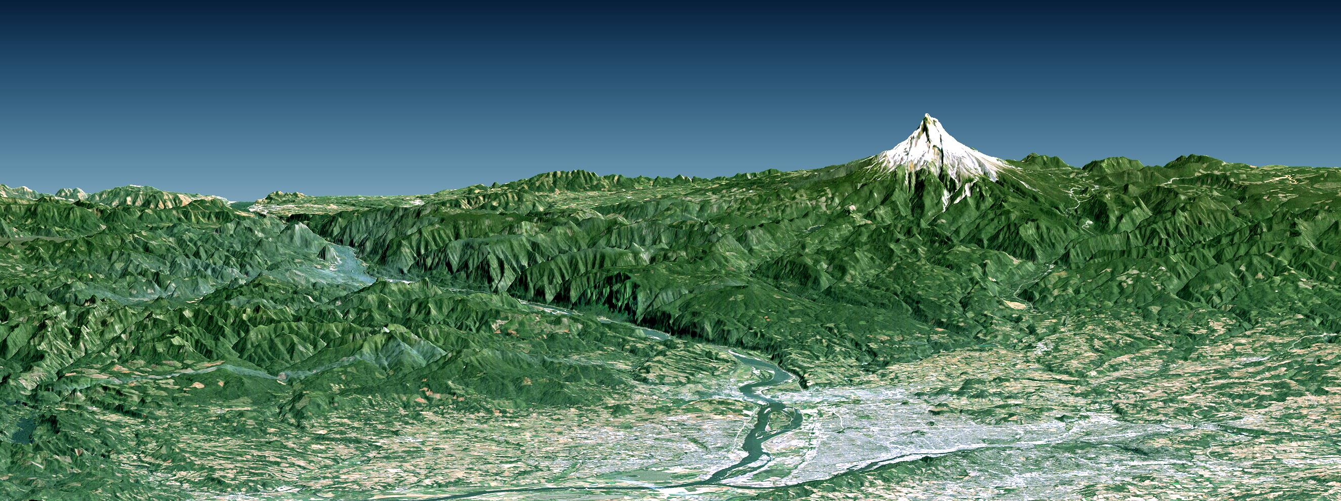
Portland, the largest city in Oregon, is located on the Columbia River at the northern end of the Willamette Valley. On clear days, Mount Hood highlights the Cascade Mountains backdrop to the east. The Columbia is the largest river in the American Northwest and is navigable up to and well beyond Portland. It is also the only river to fully cross the Cascade Range, and has carved the Columbia River Gorge, which is seen in the left-central part of this view. A series of dams along the river, at topographically favorable sites, provide substantial hydroelectric power to the region.
This perspective view was generated using topographic data from the Shuttle Radar Topography Mission (SRTM), a Landsat satellite image, and a false sky. Topographic expression is vertically exaggerated two times.
Landsat has been providing visible and infrared views of the Earth since 1972. SRTM elevation data substantially help in analyzing Landsat images by revealing the third dimension of Earth's surface, topographic height. The Landsat archive is managed by the U.S. Geological Survey's Eros Data Center (USGS EDC).
Elevation data used in this image were acquired by the Shuttle Radar Topography Mission (SRTM) aboard the Space Shuttle Endeavour, launched on February 11, 2000. SRTM used the same radar instrument that comprised the Spaceborne Imaging Radar-C/X-Band Synthetic Aperture Radar (SIR-C/X-SAR) that flew twice on the Space Shuttle Endeavour in 1994. SRTM was designed to collect three-dimensional measurements of the Earth's surface. To collect the 3-D data, engineers added a 60-meter-long (200-foot) mast, installed additional C-band and X-band antennas, and improved tracking and navigation devices. The mission is a cooperative project between the National Aeronautics and Space Administration (NASA), the National Geospatial-Intelligence Agency (NGA) of the U.S. Department of Defense (DoD), and the German and Italian space agencies. It is managed by NASA's Jet Propulsion Laboratory, Pasadena, Calif., for NASA's Earth Science Enterprise, Washington, DC.
Size: View width 88 kilometers (49 miles), View distance 106 kilometers (66 miles)
Location: 45.5 degrees North latitude, 122.5 degrees West longitude
Orientation: View East-Southeast, 10 degrees below horizontal, 2 times vertical exaggeration
Image Data: Landsat Bands 3, 2, 1 as red, green, blue, respectively
Date Acquired: February 2000 (SRTM), August 10, 1992 (Landsat)
