My
List |
Addition Date
|
Target
|
Mission
|
Instrument
|
Size
|

|
1999-05-01 |
Earth
|
Spaceborne Imaging Radar-C/X-Band Synthetic Aperture Radar
|
X-Band Radar
|
1840x2760x1 |
|
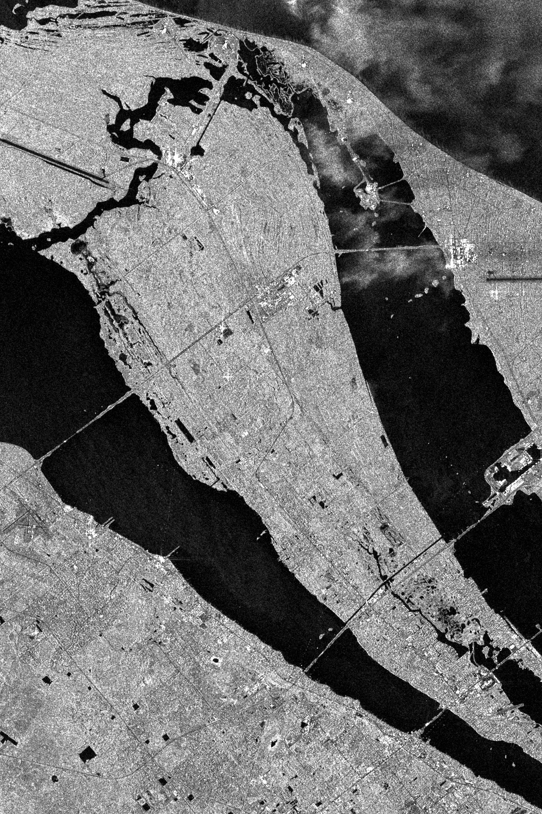
-
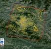
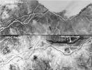
PIA01756:
-
Space Radar Image of Kennedy Space Center, Florida
Full Resolution:
TIFF
(5.548 MB)
JPEG
(1.394 MB)
|
|
|
1999-05-01 |
Earth
|
Spaceborne Imaging Radar-C/X-Band Synthetic Aperture Radar
|
X-Band Radar
|
1024x1024x1 |

|
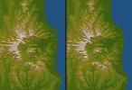
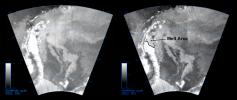
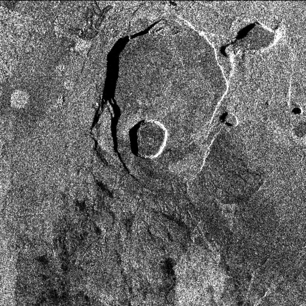
-
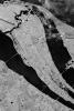
PIA01763:
-
Space Radar Image of Kilauea, Hawaii - Interferometry 1
Full Resolution:
TIFF
(804.8 kB)
JPEG
(400 kB)
|
|
|
2011-03-10 |
Earth
|
ARIA
|
X-band interferometric synthetic aperture radar
|
2692x863x3 |
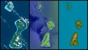
|
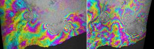
-
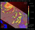
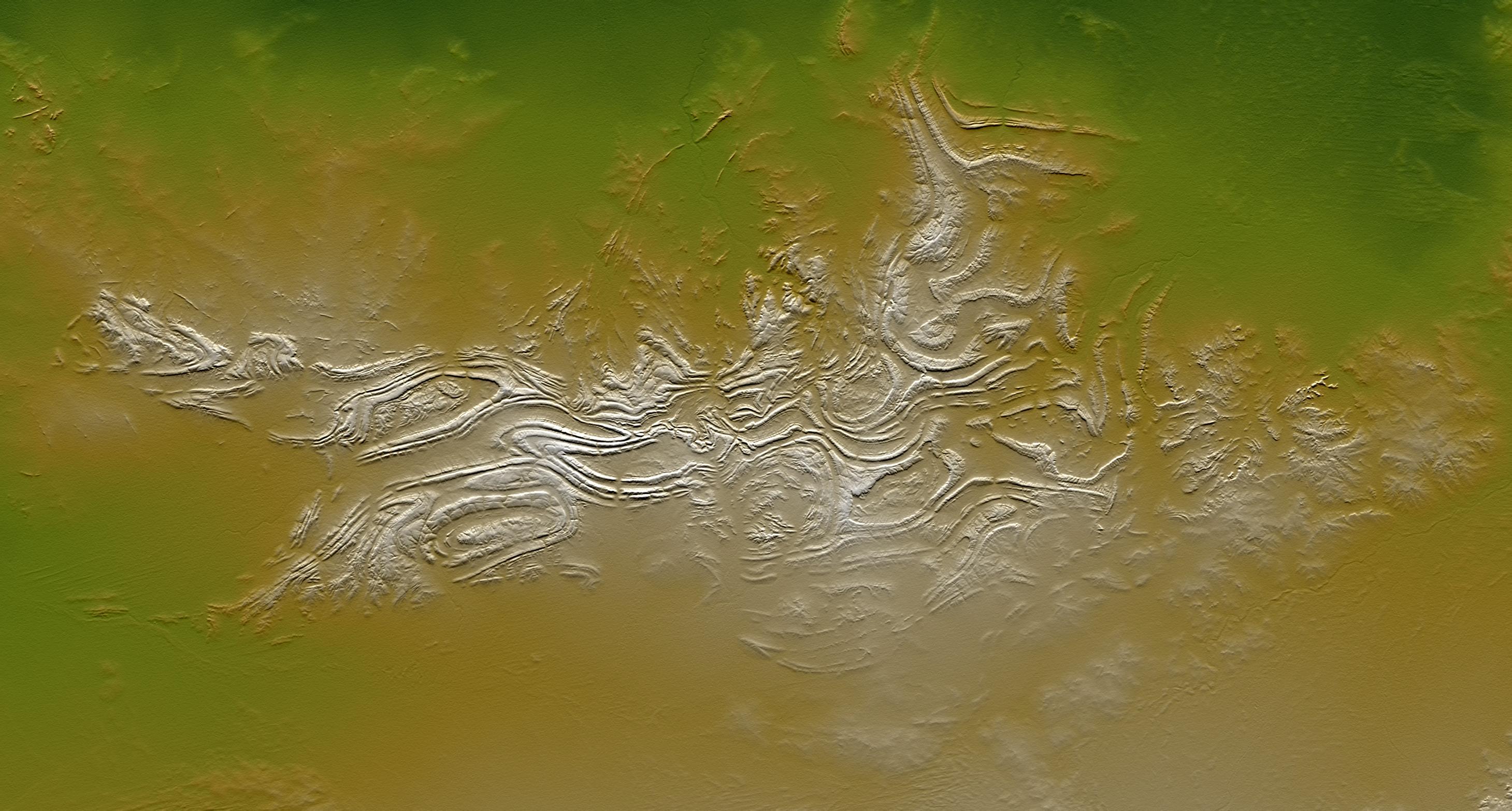
PIA13910:
-
INSAR Images Hawaii's Kilauea Volcano
Full Resolution:
TIFF
(6.977 MB)
JPEG
(732.1 kB)
|
|
|
2013-11-13 |
Earth
|
ARIA
|
X-band interferometric synthetic aperture radar
|
1623x956x3 |
|
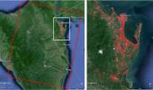
-
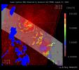
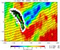
PIA17687:
-
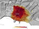
NASA-Generated Damage Map To Assist With Typhoon Haiyan Disaster Response
Full Resolution:
TIFF
(4.657 MB)
JPEG
(212.5 kB)
|
|
|
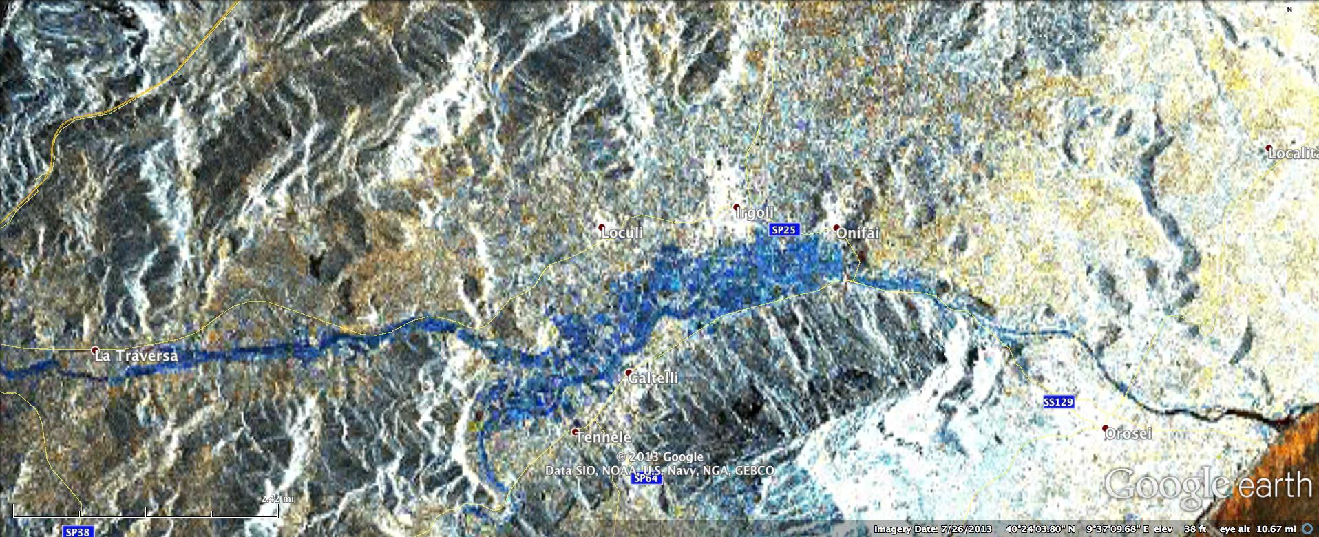
2013-11-26 |
Earth
|
ARIA
|
X-band Interferometric Synthetic Aperture Radar
|
1916x780x3 |

|
-
PIA17738:
-
NASA Produces Map to Aid in Italian Flood Response
Full Resolution:
TIFF
(4.485 MB)
JPEG
(344.8 kB)
|
|
|
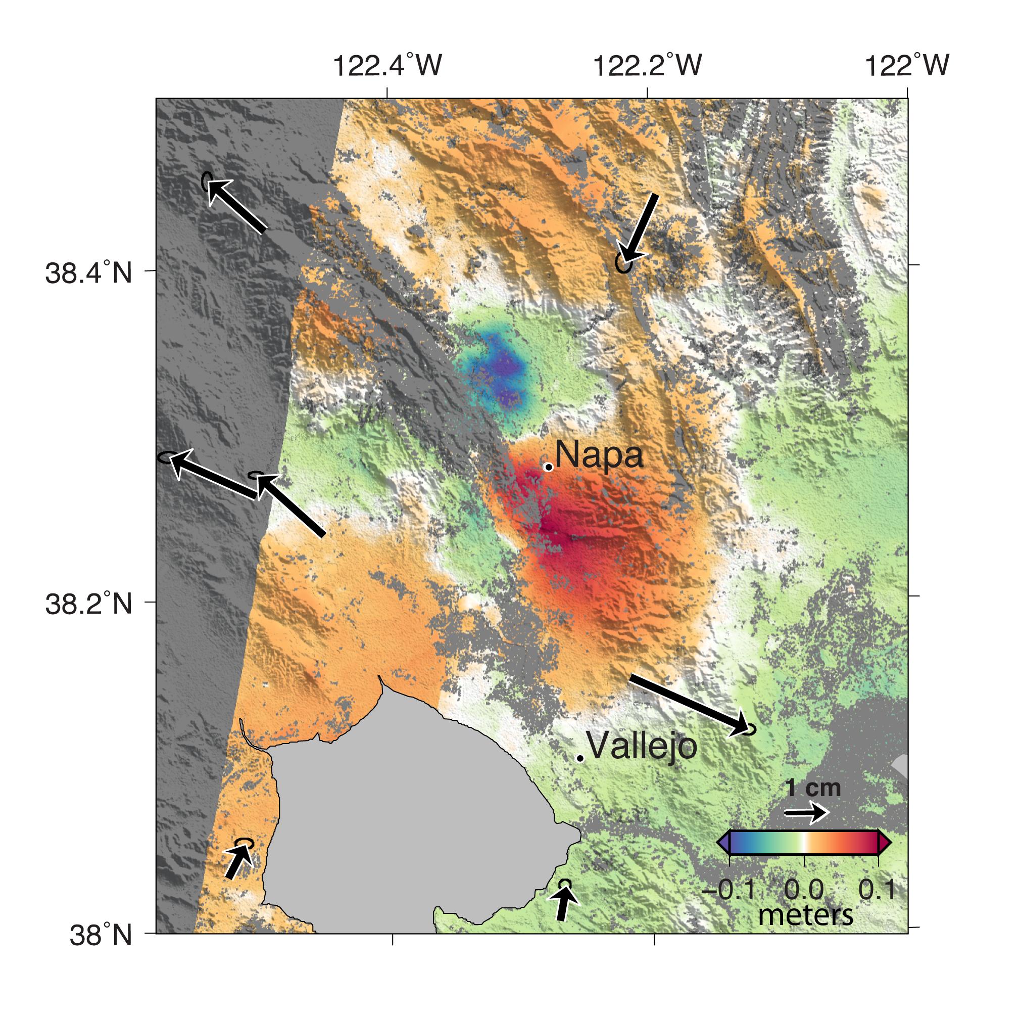
2014-09-04 |
Earth
|
ARIA
|
X-band Interferometric Synthetic Aperture Radar
|
2019x2004x3 |
|
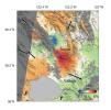
-
PIA18798:
-
NASA Analyses of Global Positioning System Data and Italian Radar Satellite Data Reveal Napa Quake Ground Deformation
Full Resolution:
TIFF
(12.14 MB)
JPEG
(554.3 kB)
|
|
|
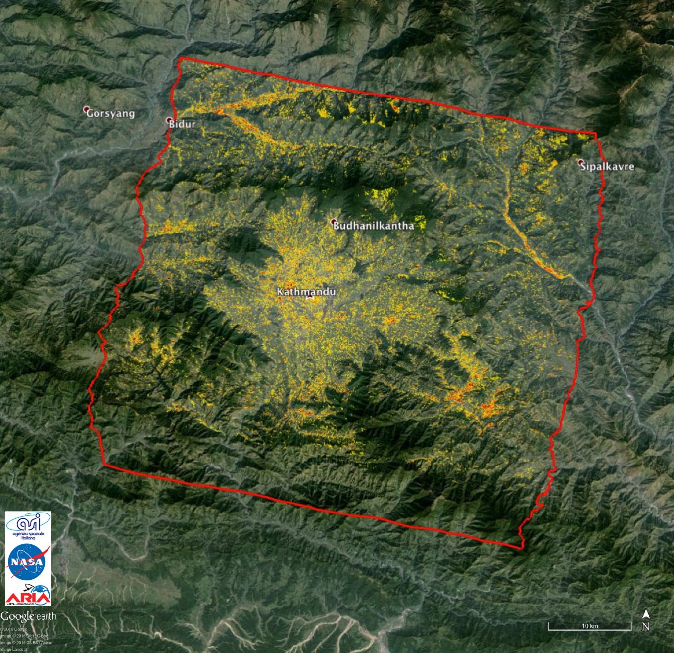
2015-05-01 |
Earth
|
ARIA
|
X-band Interferometric Synthetic Aperture Radar
|
1362x1320x3 |
|
-
PIA13911:
-
NASA-Generated Damage Map to Assist with 2015 Gorkha, Nepal Earthquake Disaster Response
Full Resolution:
TIFF
(5.396 MB)
JPEG
(349.8 kB)
|
|
|
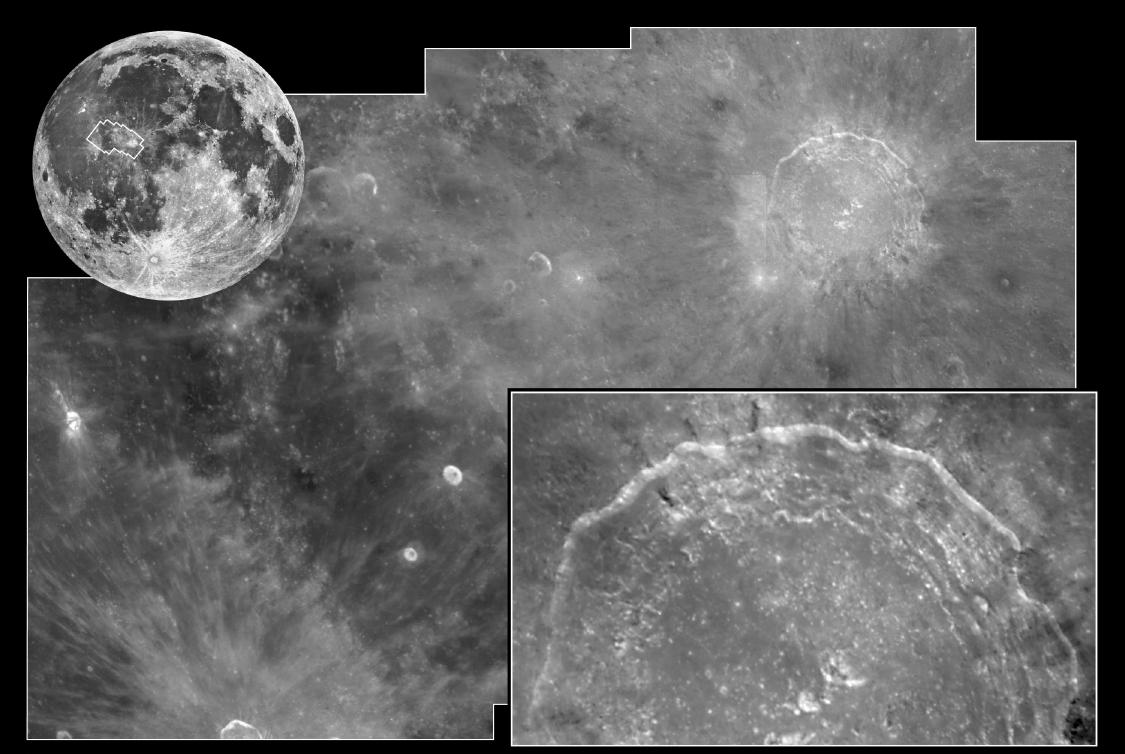
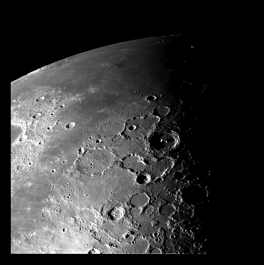
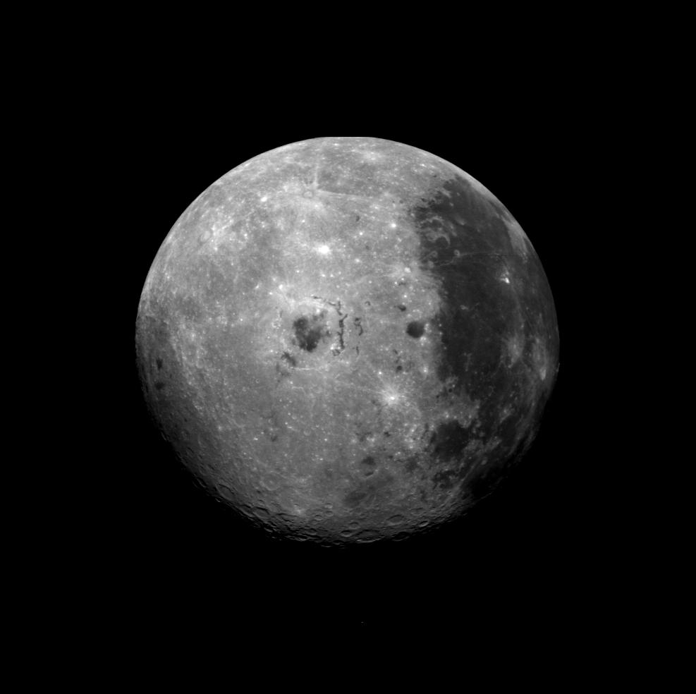
1999-05-21 |
Moon
|
Hubble Space Telescope
|
WFPC2
|
1125x754x1 |
|
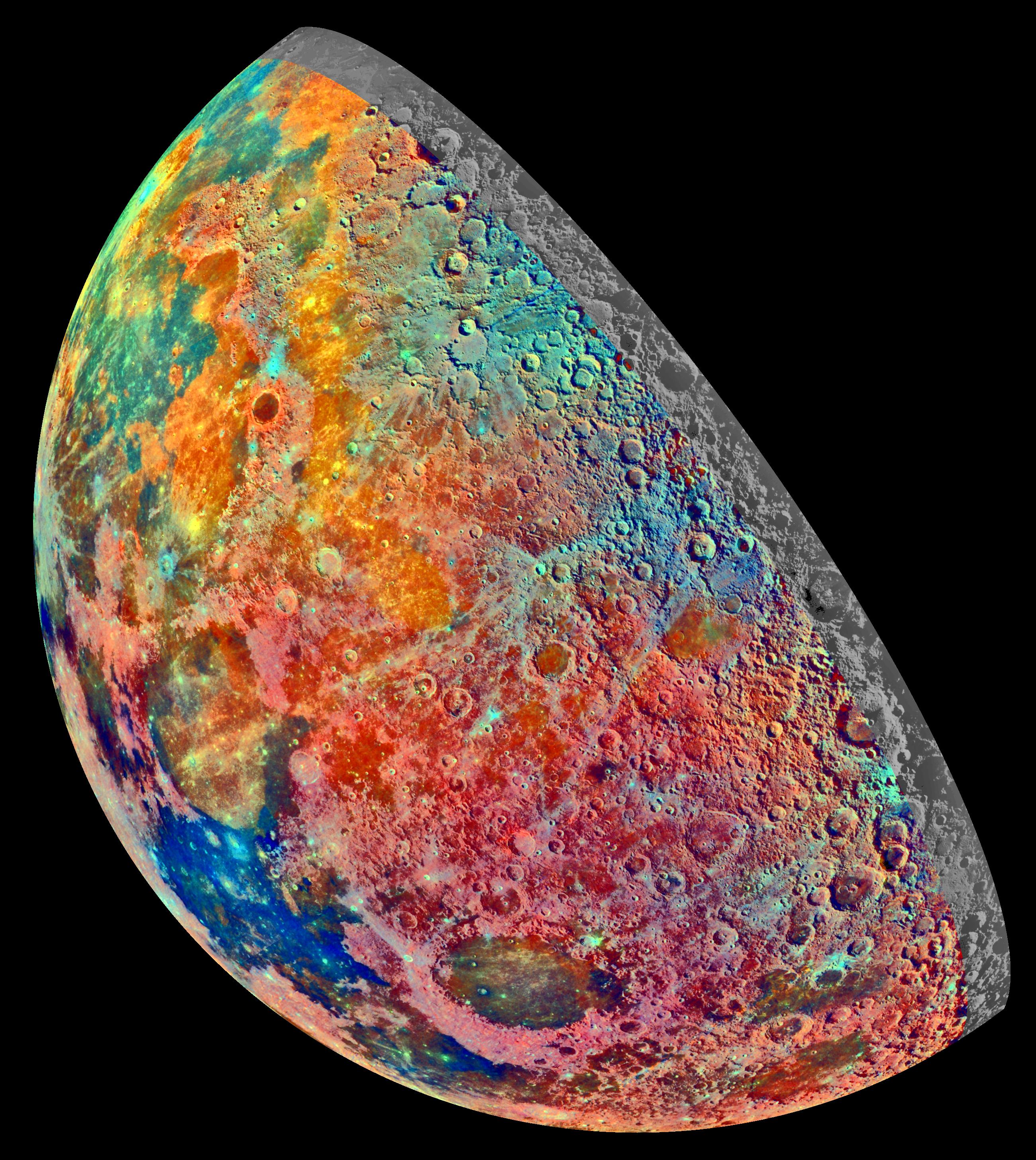
-
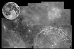
PIA01541:
-
Crater Copernicus
Full Resolution:
TIFF
(664 kB)
JPEG
(100.7 kB)
|
|
|
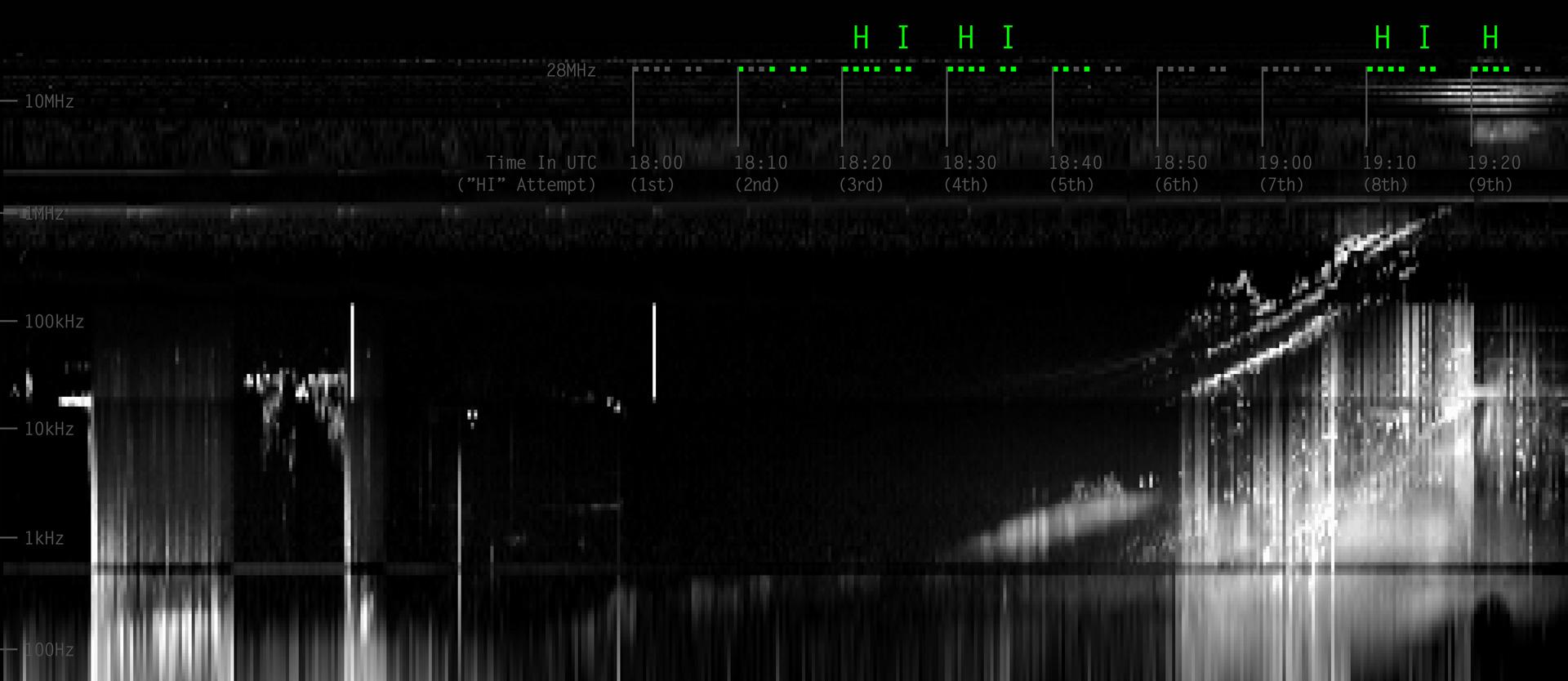
2013-12-10 |
Earth
|
Juno
|
Waves
|
1920x834x3 |

|
-
PIA17744:
-
Juno Detects a Ham Radio "HI" from Earth

Full Resolution:
TIFF
(4.806 MB)
JPEG
(136.4 kB)
|
|
|
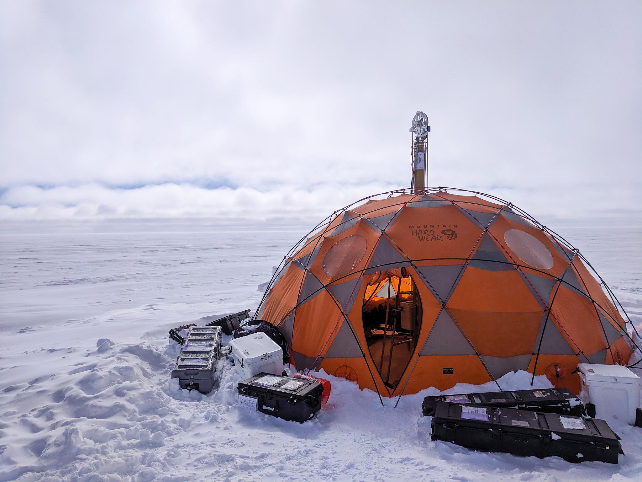
2021-04-07 |
Earth
|
|
WATSON
|
2048x1536x3 |

|
-
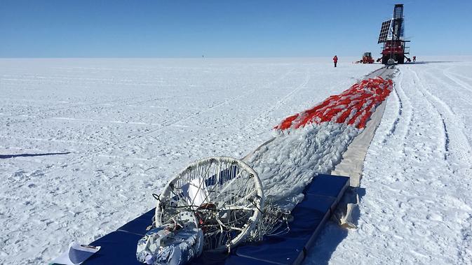
PIA24169:
-
WATSON's Field Test in Greenland
Full Resolution:
TIFF
(7.031 MB)
JPEG
(319.2 kB)
|
|
|
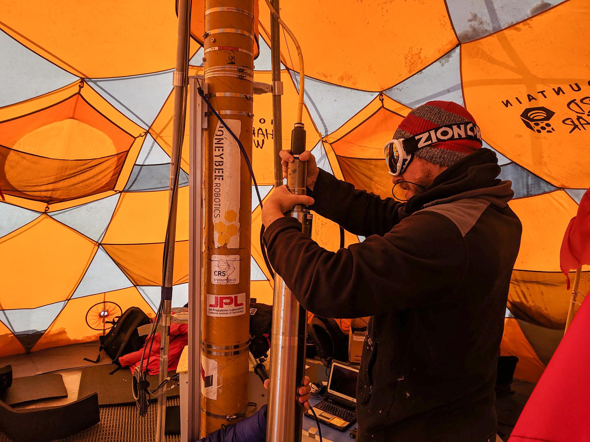
2021-04-07 |
Earth
|
|
WATSON
|
2048x1536x3 |

|
-
PIA24170:
-
Preparing WATSON for Borehole Descent
Full Resolution:
TIFF
(8.505 MB)
JPEG
(413.1 kB)
|
|
|
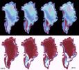
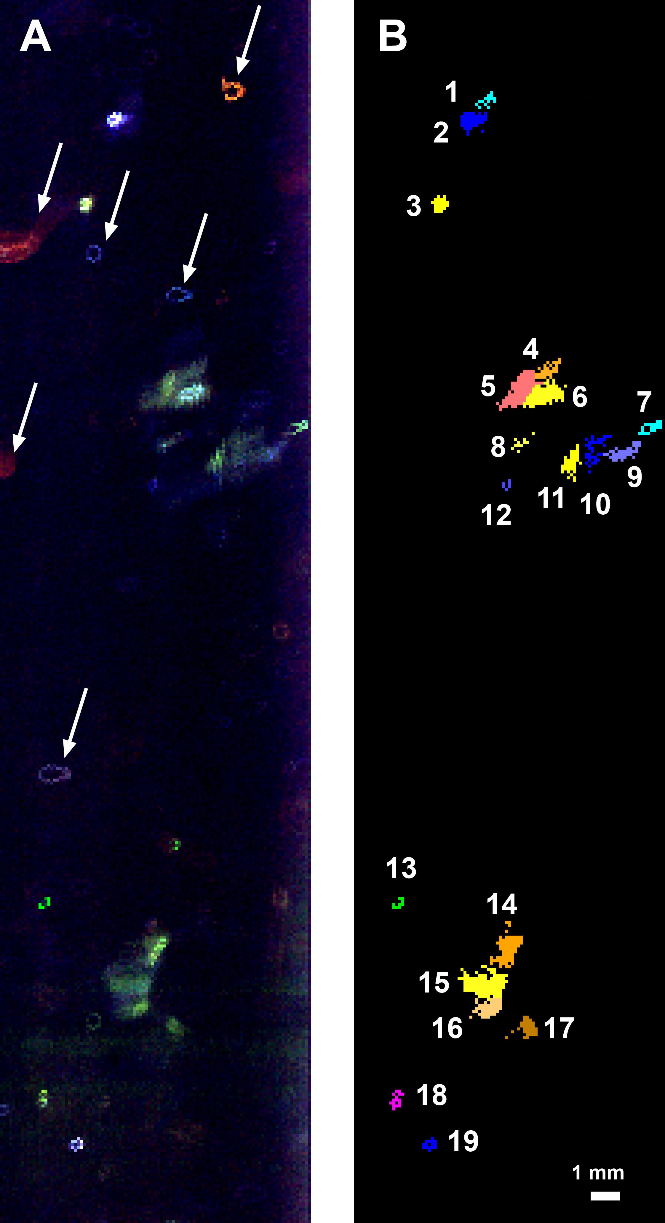
2021-04-07 |
Earth
|
|
WATSON
|
2244x4128x3 |
|
-
PIA24140:
-
Fluorescence Map of a Greenland Borehole
Full Resolution:
TIFF
(7.9 MB)
JPEG
(385.4 kB)
|
|
|
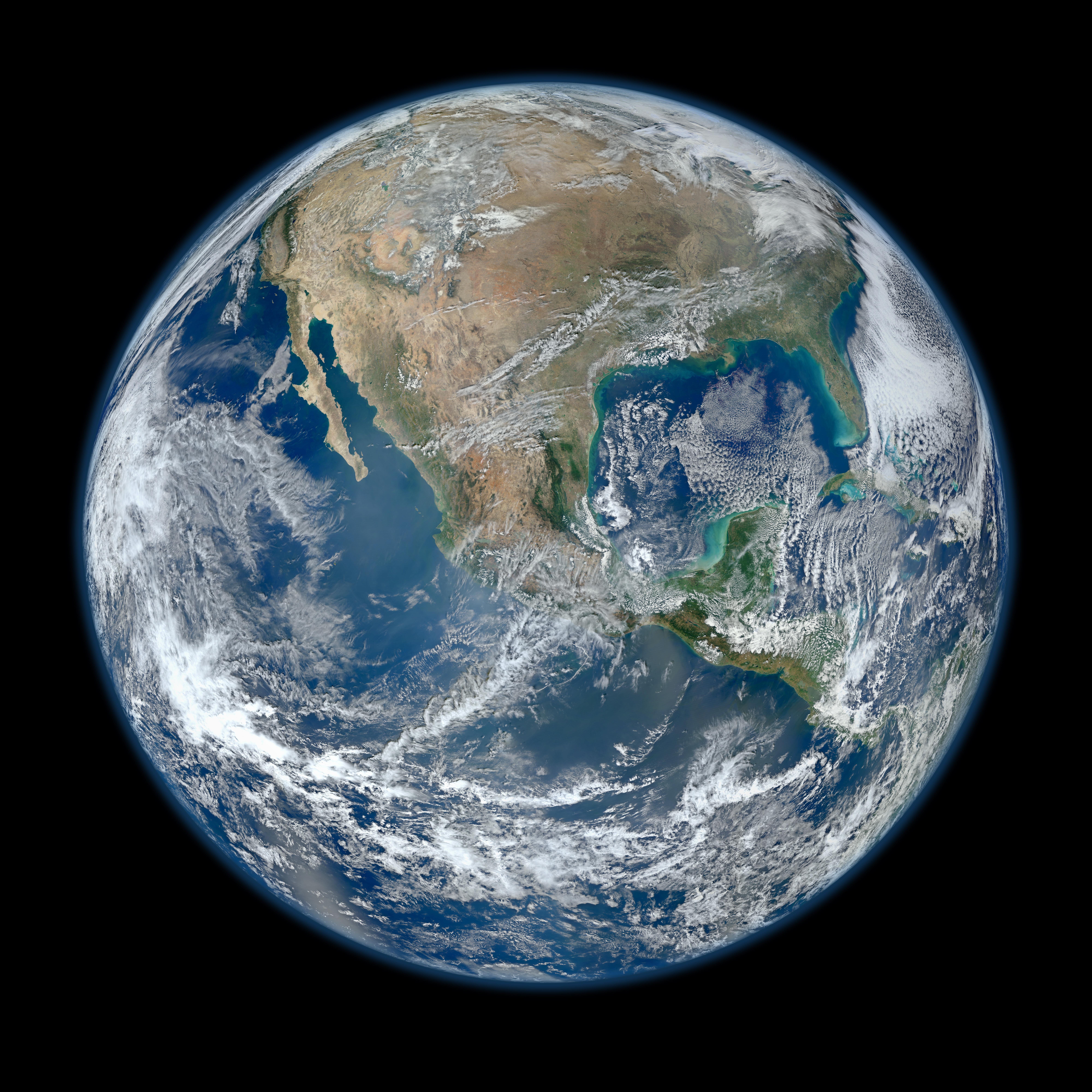
2012-01-30 |
Earth
|
Suomi NPP
|
VIIRS
|
8000x8000x3 |
|
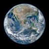
-
PIA18033:
-
Earth
Full Resolution:
TIFF
(192.1 MB)
JPEG
(7.241 MB)
|
|
|
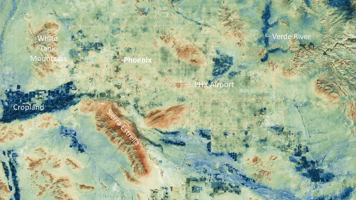
2023-08-08 |
Earth
|
Suomi NPP
|
VIIRS
|
1200x675x3 |

|
-
PIA25868:
-
Phoenix Land-Surface Temperatures Documented Amid Record Heat
Full Resolution:
TIFF
(2.431 MB)
JPEG
(160.2 kB)
|
|
|
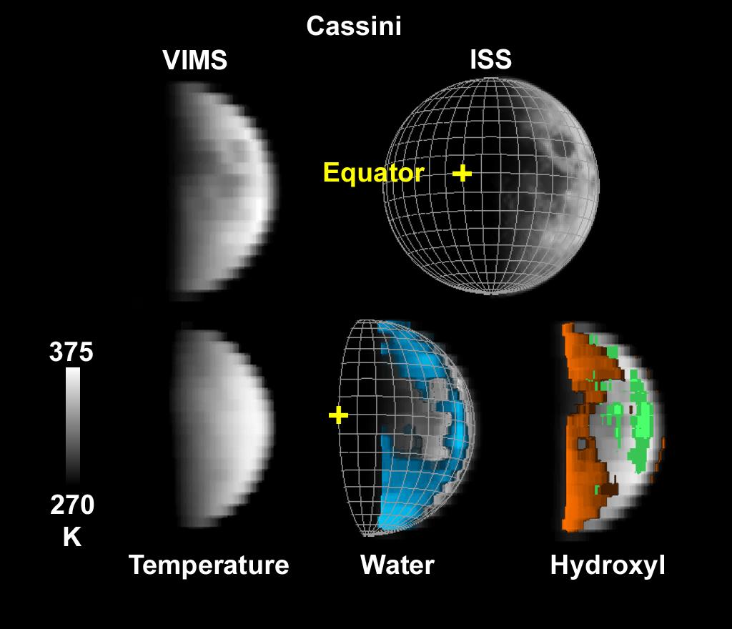
2009-09-24 |
Moon
|
Cassini-Huygens
|
VIMS
ISS
|
1024x880x3 |

|
-
PIA12228:
-
Cassini's Look at Water on the Moon
Full Resolution:
TIFF
(2.707 MB)
JPEG
(73.38 kB)
|
|
|
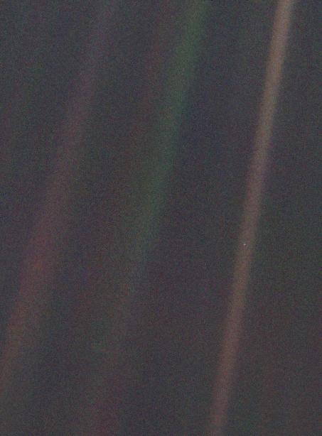
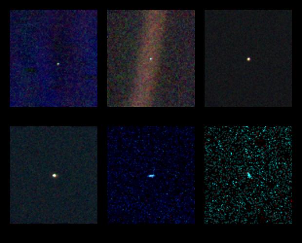
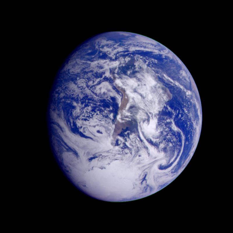
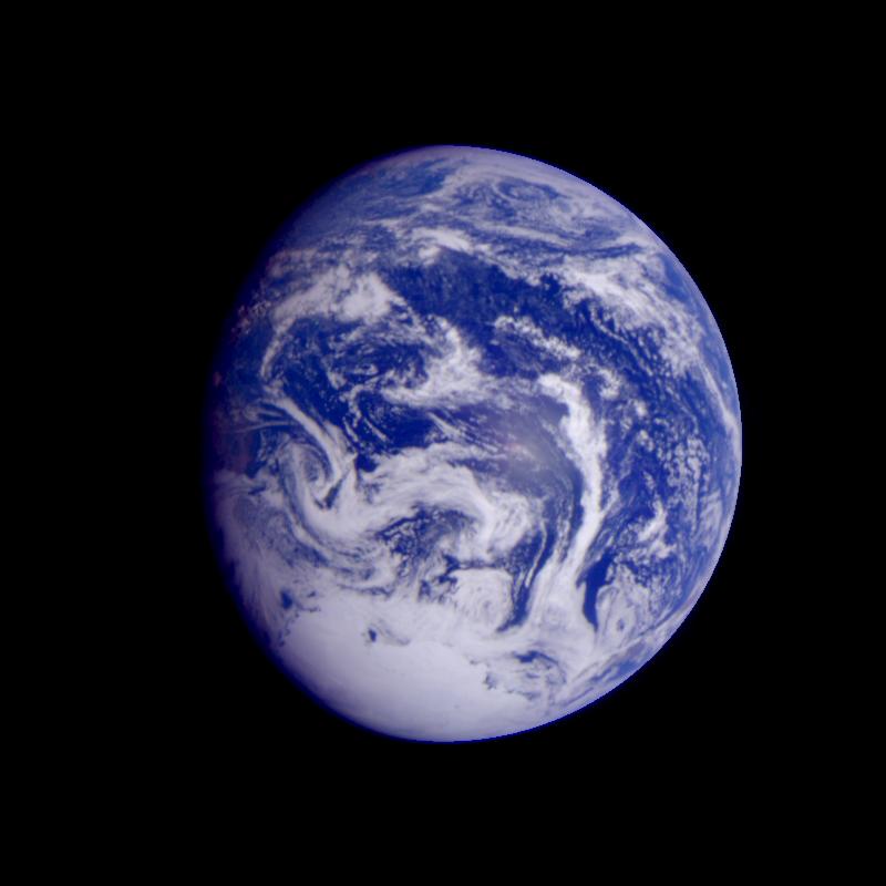
1996-09-12 |
Earth
|
Voyager
|
VG ISS - Narrow Angle
|
453x614x3 |
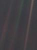
|
-
PIA00452:
-
Solar System Portrait - Earth as 'Pale Blue Dot'
Full Resolution:
TIFF
(698 kB)
JPEG
(30.18 kB)
|
|
|
1996-09-13 |
Earth
|
Voyager
|
VG ISS - Narrow Angle
|
620x500x3 |
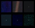
|
-
PIA00453:
-
Solar System Portrait - Views of 6 Planets
Full Resolution:
TIFF
(530.3 kB)
JPEG
(33.82 kB)
|
|
|
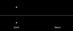
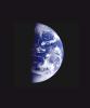
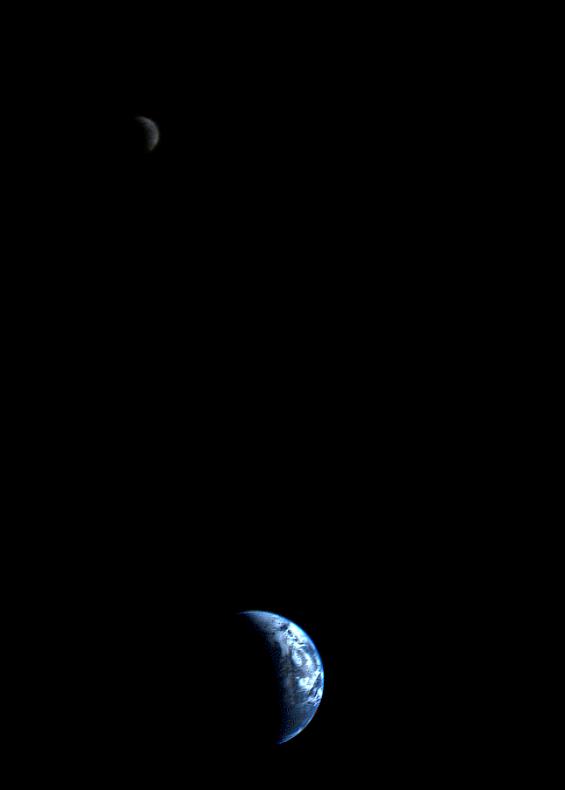
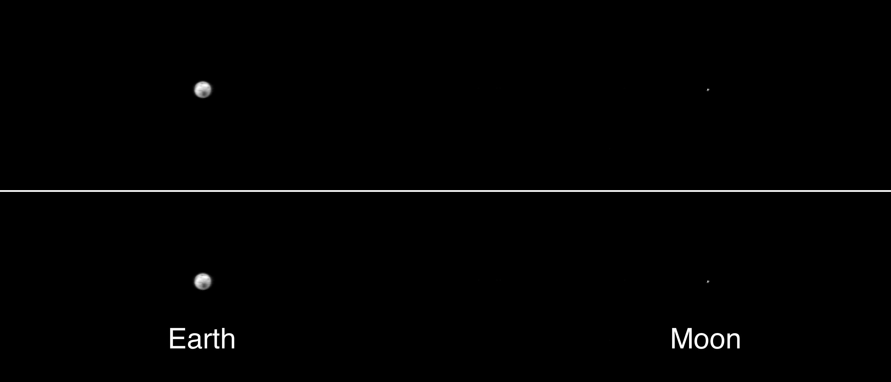
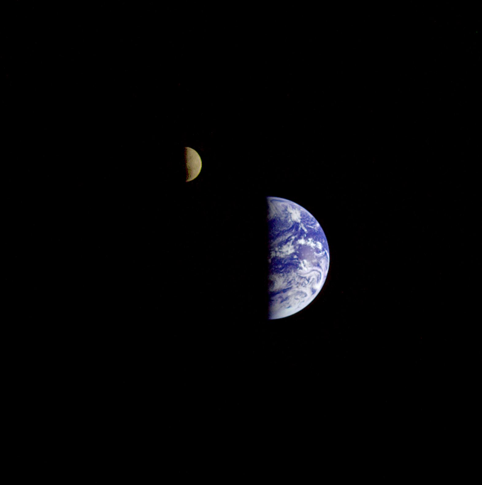
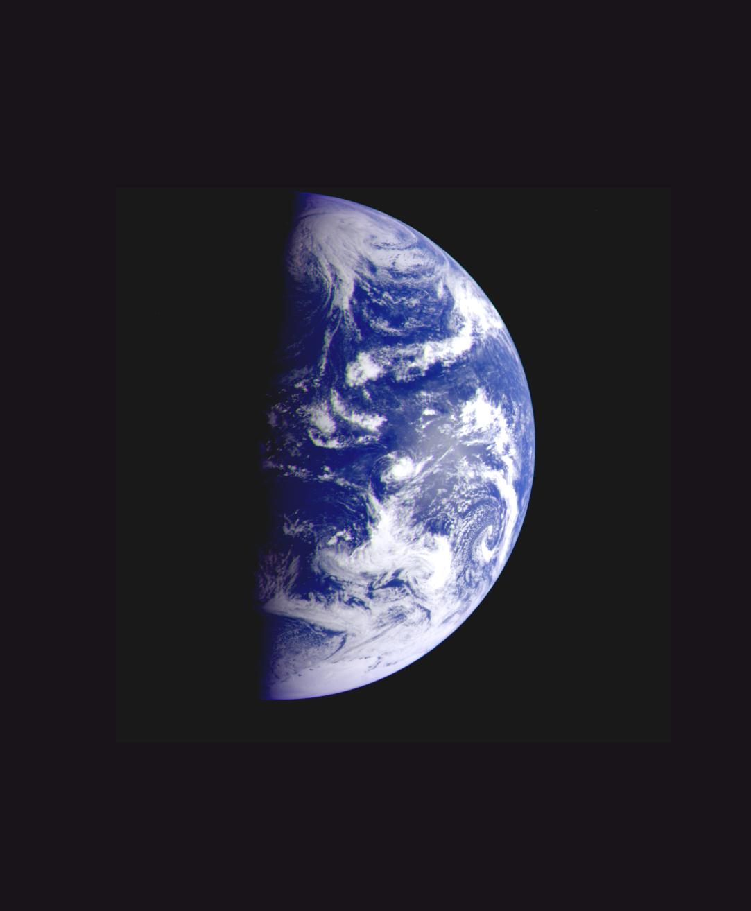
1999-05-15 |
Earth
|
Voyager
|
VG ISS - Narrow Angle
|
565x790x3 |
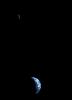
|
-
PIA01967:
-
Crescent-shaped Earth and Moon
Full Resolution:
TIFF
(48.38 kB)
JPEG
(9.77 kB)
|
|
|
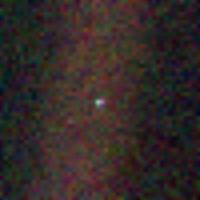
1999-12-10 |
Earth
|
Voyager
|
VG ISS - Narrow Angle
|
200x200x3 |
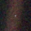
|
-
PIA02228:
-
Solar System Portrait - Earth
Full Resolution:
TIFF
(117.8 kB)
JPEG
(4.977 kB)
|
|
|
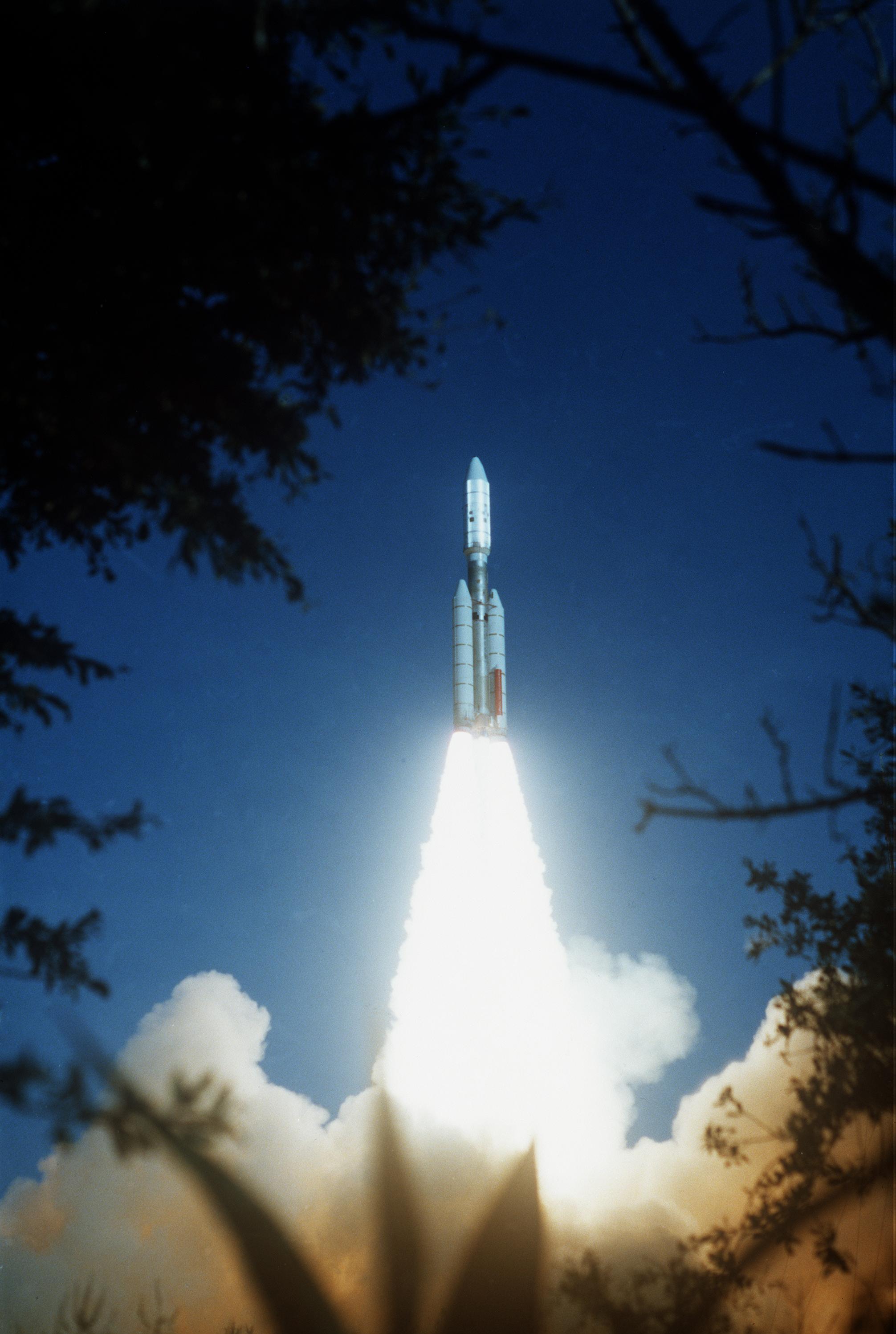
1998-10-30 |
Earth
|
Voyager
|
VG Imaging Science Subsystem
|
2012x2994x3 |
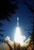
|
-
PIA01480:
-
Voyager 2 Launch
Full Resolution:
TIFF
(17.25 MB)
JPEG
(444 kB)
|
|
|
1996-06-03 |
Moon
|
DSPSE
|
Ultraviolet/Visible Camera
|
7943x7943x1 |
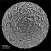
|
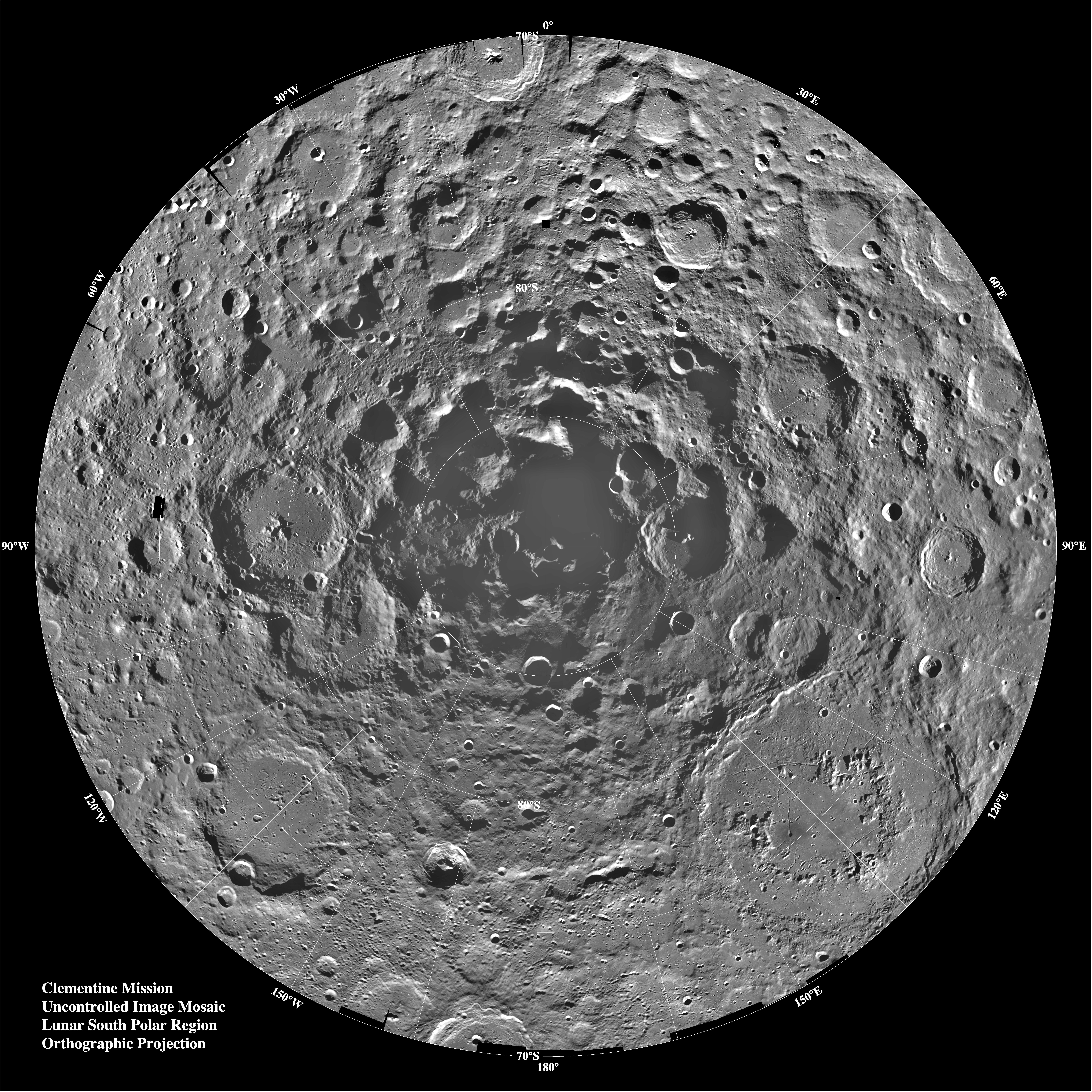
-
PIA00001:
-
South Pole Region of the Moon as Seen by Clementine
Full Resolution:
TIFF
(32.98 MB)
JPEG
(6.572 MB)
PNG
(26.32 MB)
|
|
|
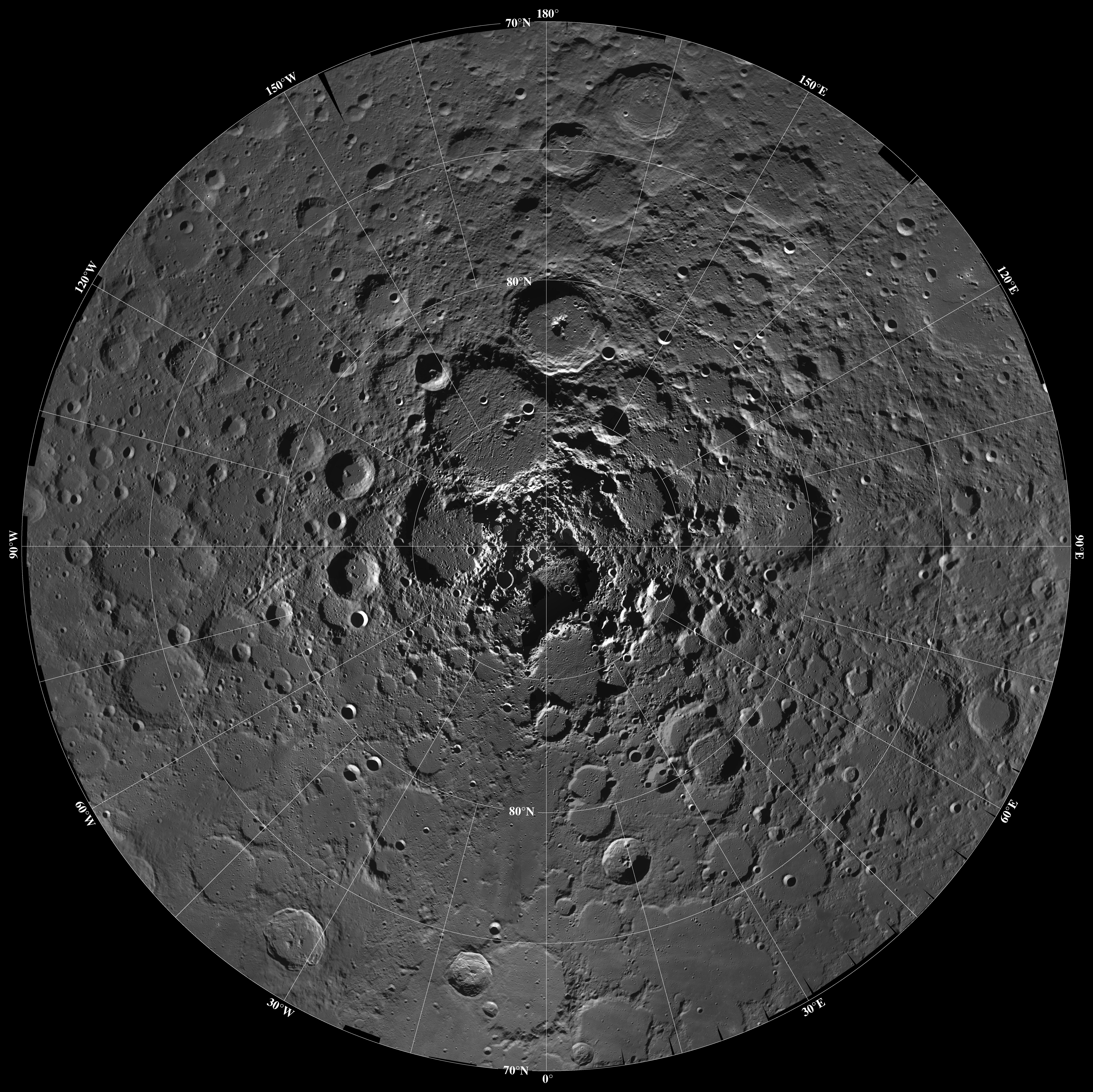
1996-06-03 |
Moon
|
DSPSE
|
Ultraviolet/Visible Camera
|
7738x7730x1 |
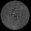
|
-
PIA00002:
-
North Pole Region of the Moon as Seen by Clementine
Full Resolution:
TIFF
(37.43 MB)
JPEG
(5.483 MB)
|
|
|
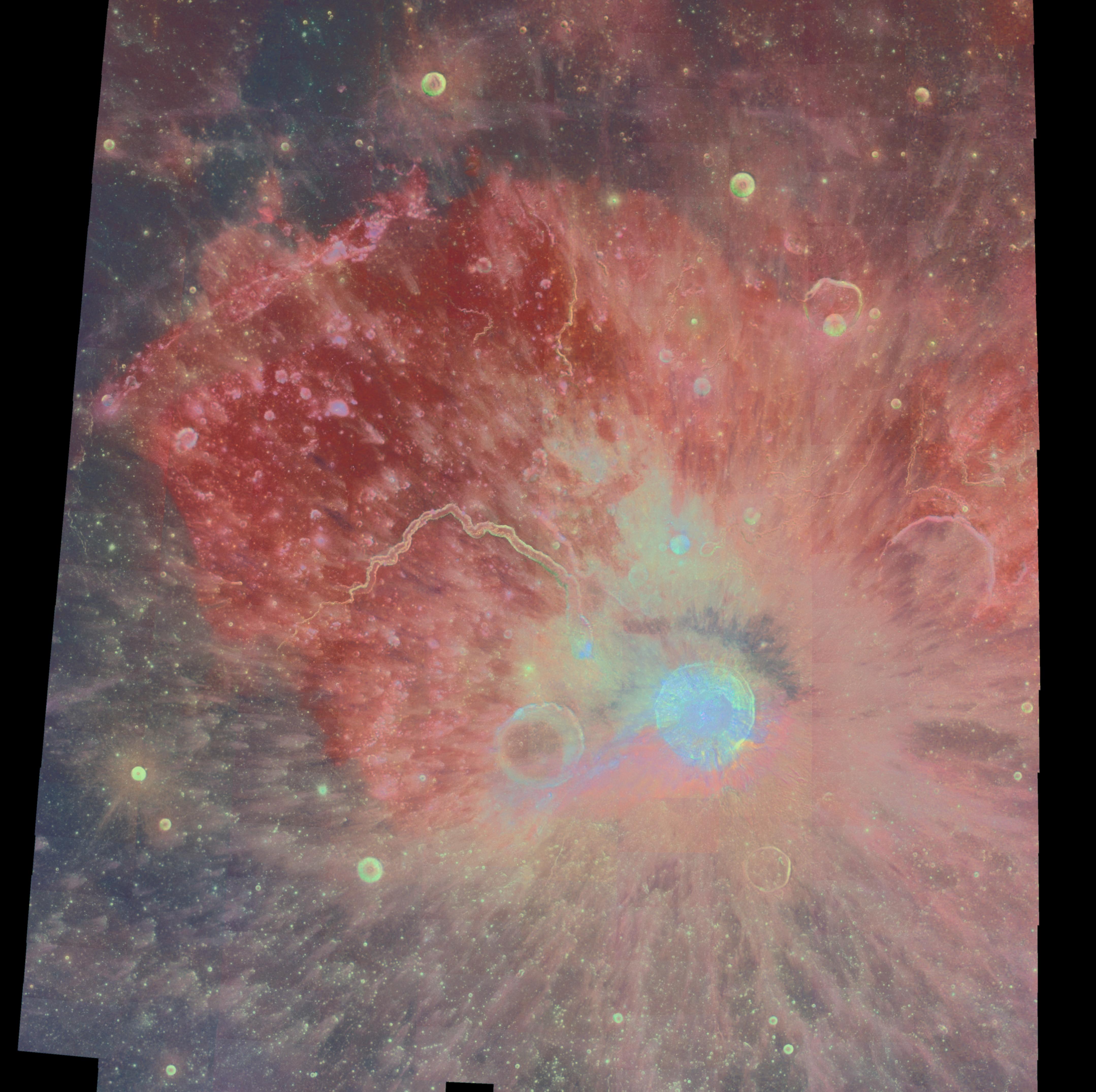
1998-06-03 |
Moon
|
DSPSE
|
Ultraviolet/Visible Camera
|
4316x4299x3 |
|
-
PIA00090:
-
Multispectral Mosaic of the Aristarchus Crater and Plateau
Full Resolution:
TIFF
(45.47 MB)
JPEG
(1.293 MB)
|
|
|
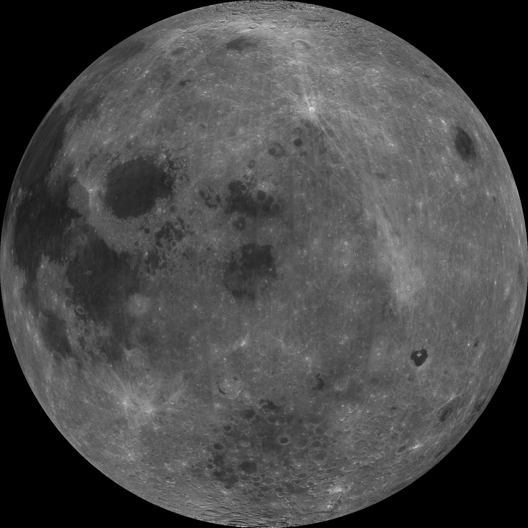
1998-06-04 |
Moon
|
DSPSE
|
Ultraviolet/Visible Camera
|
1719x1719x1 |
|
-
PIA00302:
-
Nearside of Earth's Moon as Seen by the Clementine Spacecraft
Full Resolution:
TIFF
(1.905 MB)
JPEG
(265.4 kB)
|
|
|
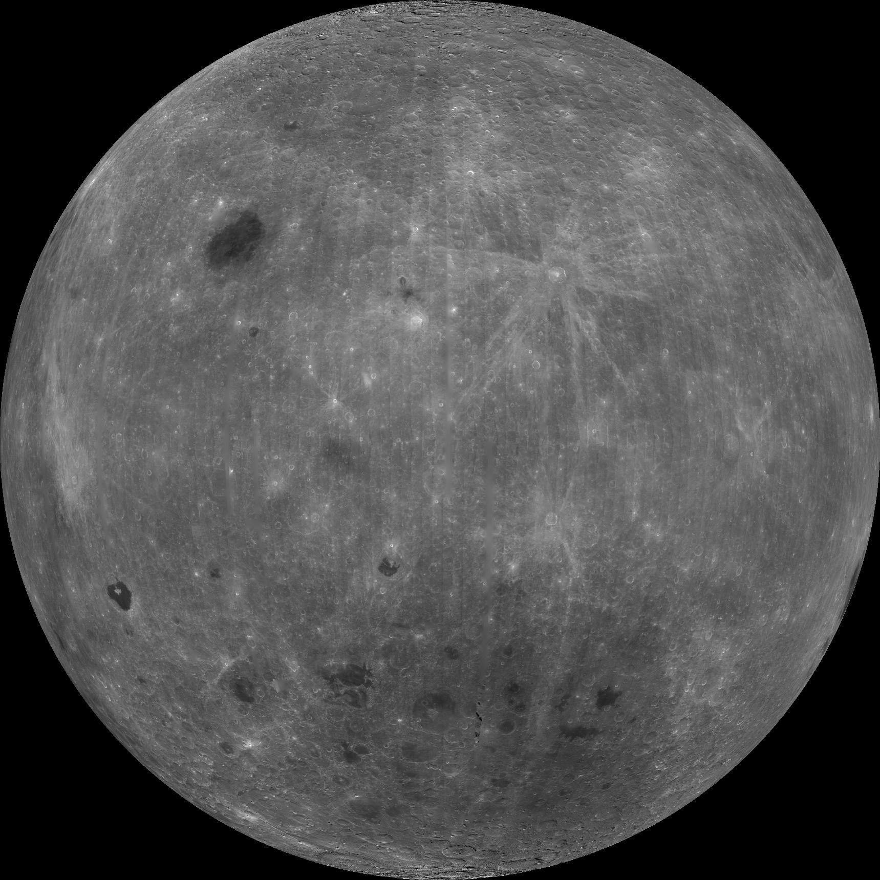
1998-06-04 |
Moon
|
DSPSE
|
Ultraviolet/Visible Camera
|
1719x1719x1 |

|
-
PIA00303:
-
East Limb View of Earth's Moon as Seen by the Clementine Spacecraft
Full Resolution:
TIFF
(2.029 MB)
JPEG
(303.8 kB)
|
|
|
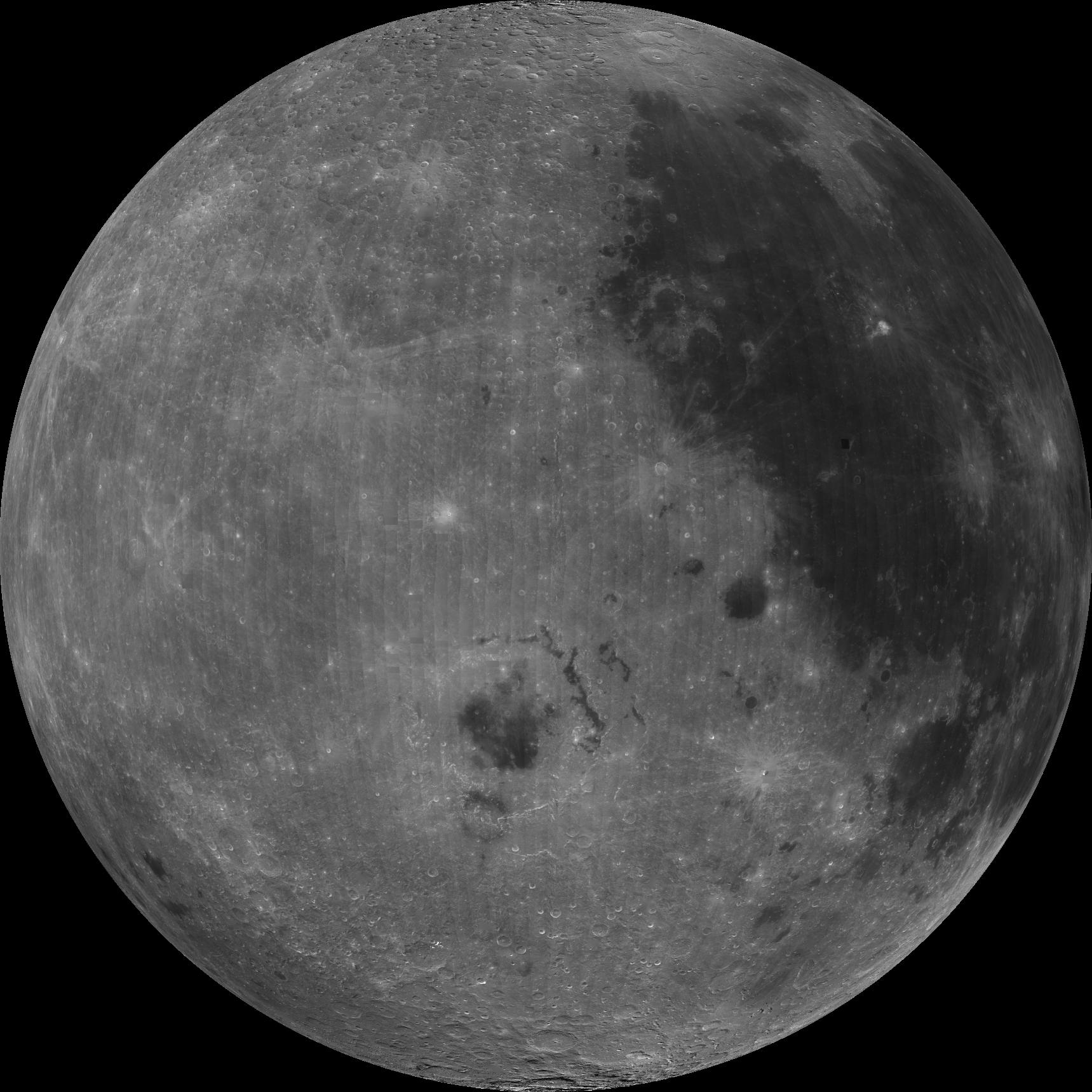
1998-06-04 |
Moon
|
DSPSE
|
Ultraviolet/Visible Camera
|
1719x1719x1 |
|
-
PIA00304:
-
Farside View of Earth's Moon as Seen by the Clementine Spacecraft
Full Resolution:
TIFF
(1.976 MB)
JPEG
(318.8 kB)
|
|
|
1998-06-04 |
Moon
|
DSPSE
|
Ultraviolet/Visible Camera
|
1719x1719x1 |

|
-
PIA00305:
-
West Limb View of Earth's Moon as Seen by the Clementine Spacecraft
Full Resolution:
TIFF
(2.016 MB)
JPEG
(291.8 kB)
|
|
|
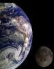
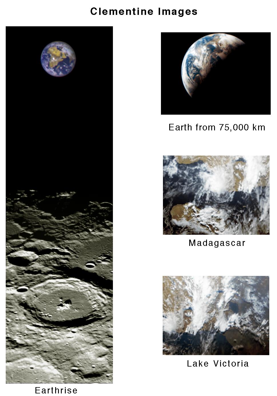
1999-06-12 |
Earth
|
DSPSE
|
Ultraviolet/Visible Camera
|
969x1385x3 |
|
-
PIA00432:
-
Clementine Images of Earth and Moon
Full Resolution:
TIFF
(1.272 MB)
JPEG
(132.8 kB)
|
|
|
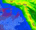
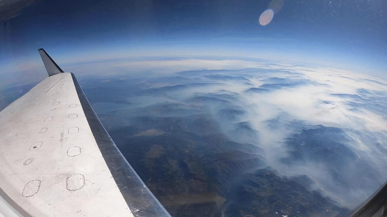
2020-09-15 |
Earth
|
|
UAVSAR
|
1280x720x3 |

|
-
PIA24102:
-
NASA's UAVSAR Flights Observe California Fires
Full Resolution:
TIFF
(2.43 MB)
JPEG
(81.83 kB)
|
|
|
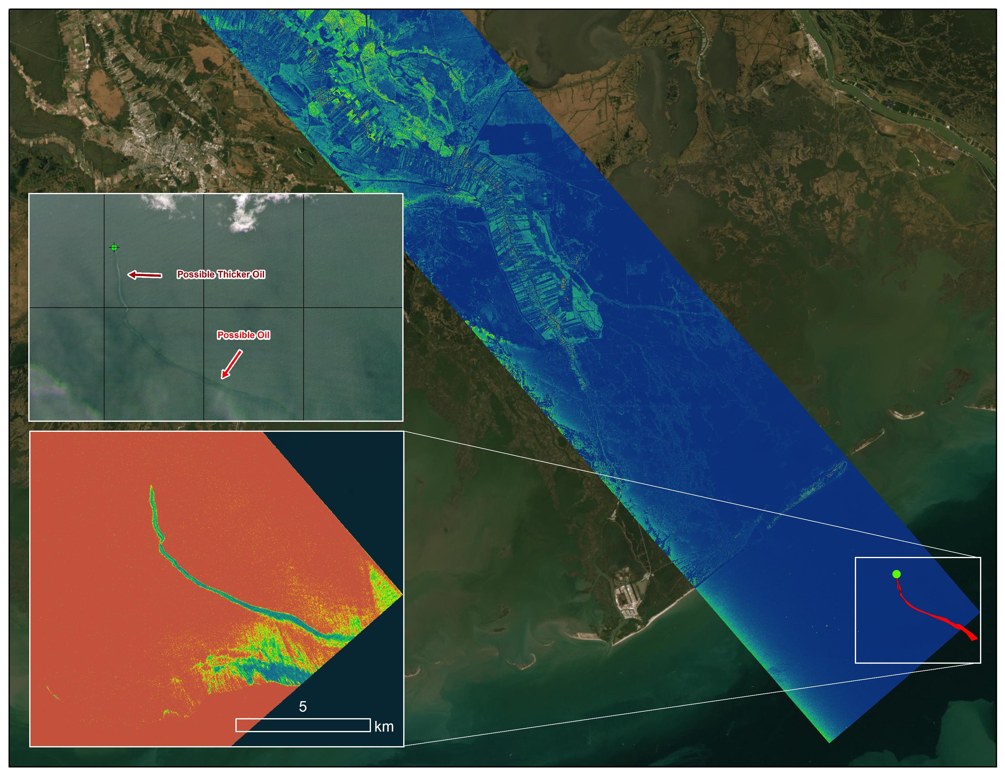
2021-09-20 |
Earth
|
Delta-X
|
UAVSAR
|
3300x2550x3 |
|
-
PIA24540:
-
Delta-X Oil Slick Radar Signal in Gulf of Mexico
Full Resolution:
TIFF
(16.81 MB)
JPEG
(966.2 kB)
|
|
|
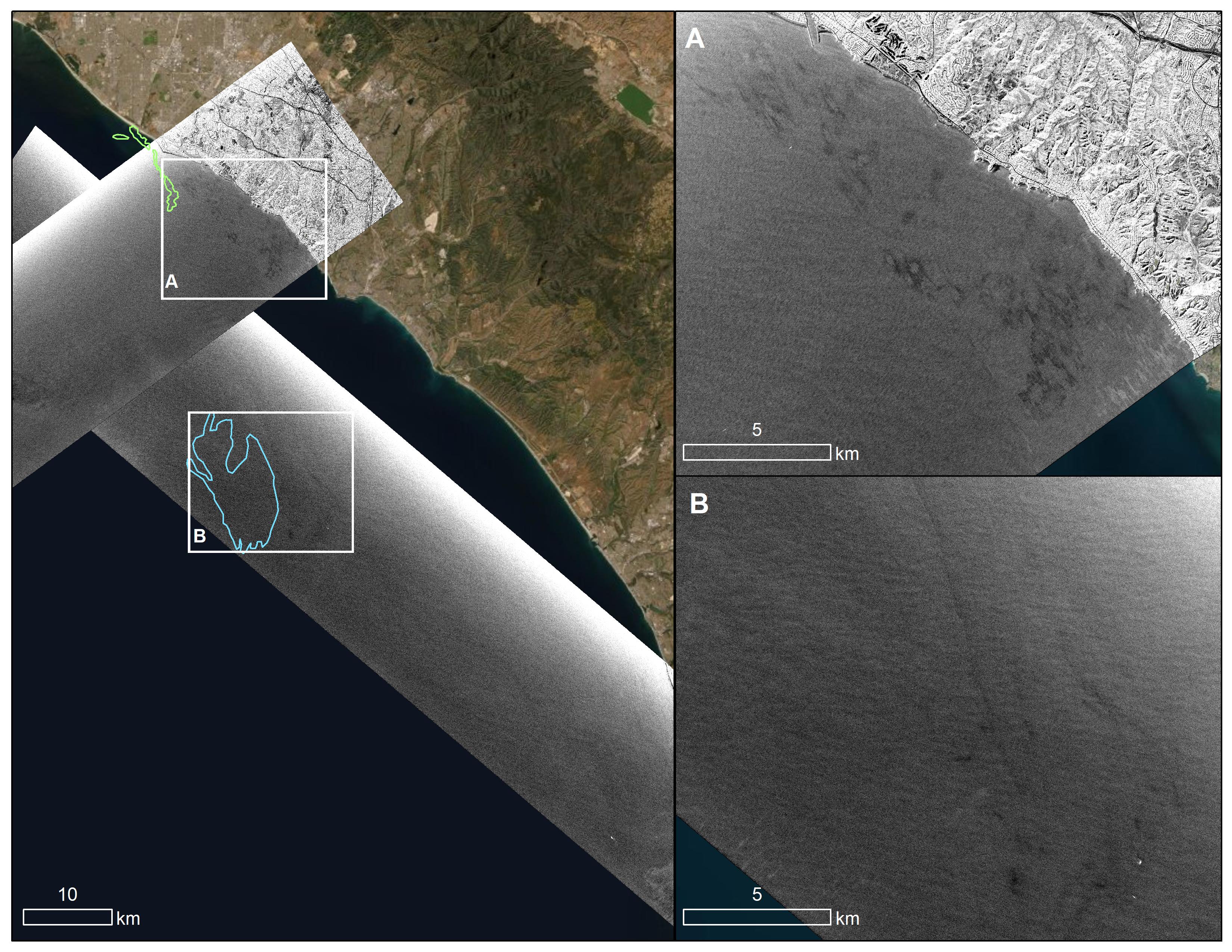
2021-10-13 |
Earth
|
|
UAVSAR
|
3300x2550x3 |
|
-
PIA23782:
-
UAVSAR Oil Slicks
Full Resolution:
TIFF
(13.21 MB)
JPEG
(2.027 MB)
|
|
|
2021-10-13 |
Earth
|
|
UAVSAR
|
4032x3024x3 |

|
-
PIA24901:
-
UAVSAR Flight Crew
Full Resolution:
TIFF
(22.67 MB)
JPEG
(1.01 MB)
|
|
|
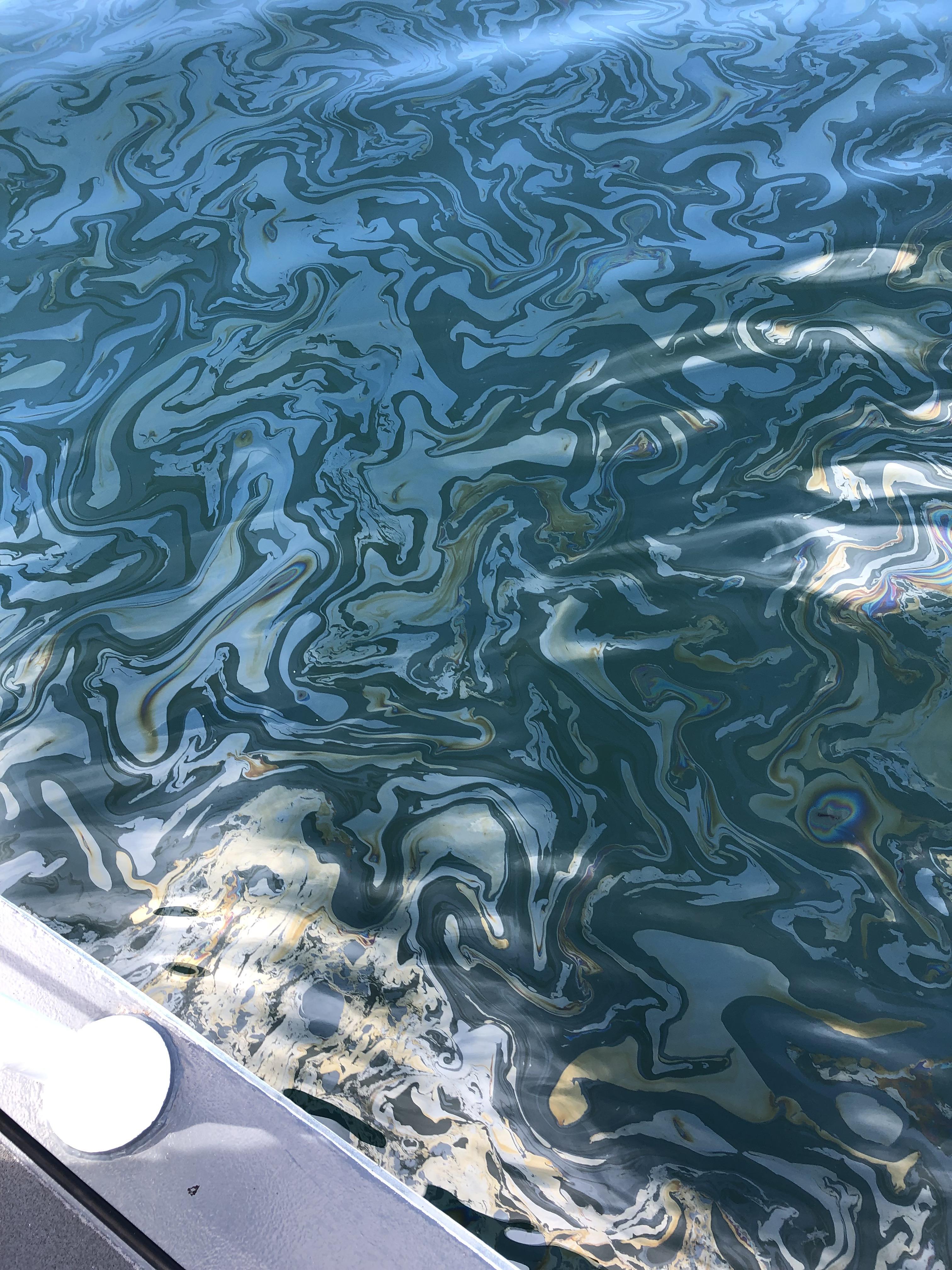
2021-12-13 |
Earth
|
|
UAVSAR
|
3024x4032x3 |

|
-
PIA23699:
-
Natural Oil Seepage Off California Coast
Full Resolution:
TIFF
(34.33 MB)
JPEG
(1.609 MB)
|
|
|
2022-12-19 |
Earth
|
|
UAVSAR
|
3750x3750x3 |

|
-
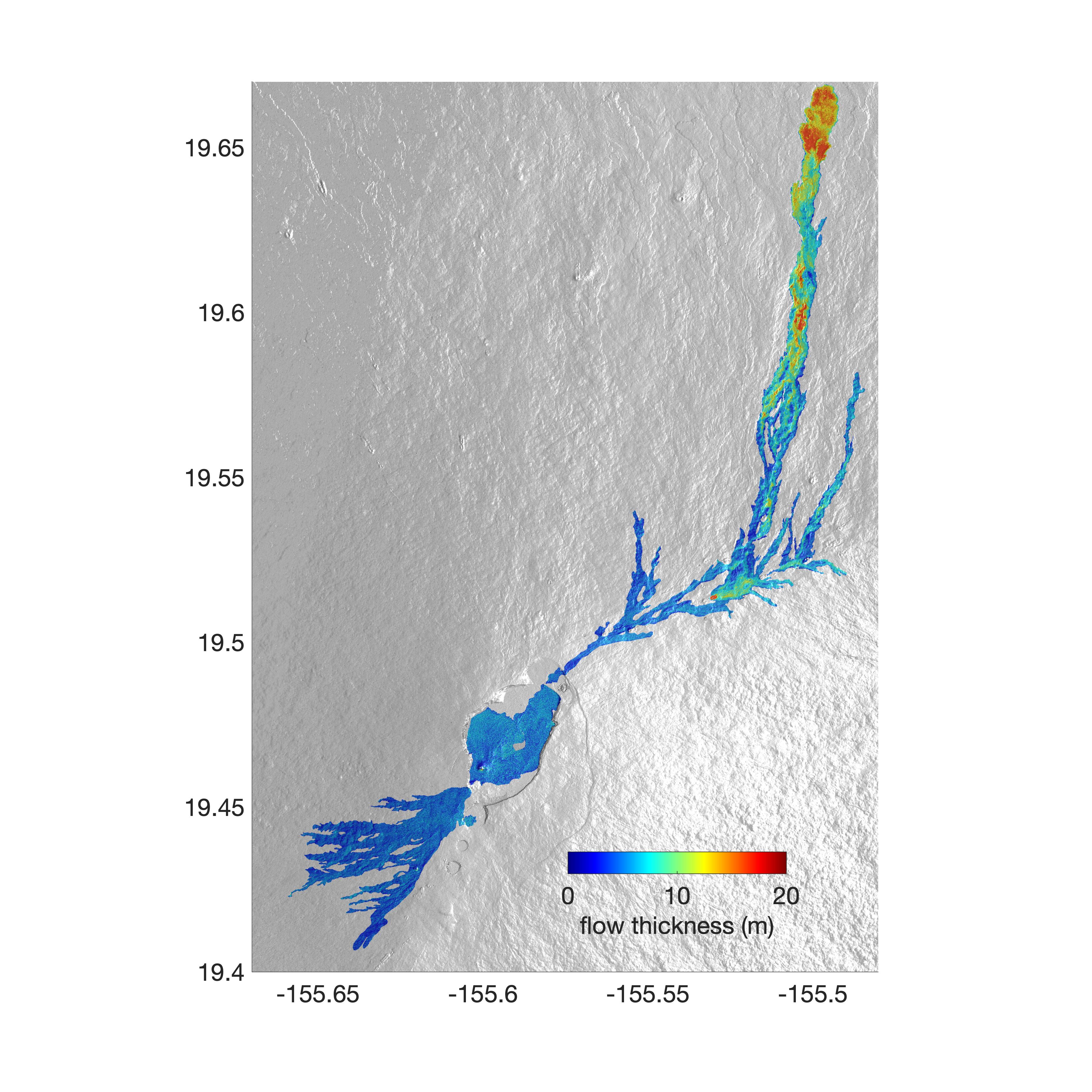
PIA25526:
-
Airborne NASA Radar Maps Mauna Loa Lava Changes in Hawaii
Full Resolution:
TIFF
(11.11 MB)
JPEG
(1.418 MB)
|
|
|
2025-01-31 |
Earth
|
|
UAVSAR
|
1440x1090x3 |
|
-
PIA26495:
-
NASA Radar Looks at Palos Verdes Landslides
Full Resolution:
TIFF
(2.762 MB)
JPEG
(259.6 kB)
|
|
|
2002-07-05 |
Moon
|
Ranger 9
|
TV Camera
|
550x473x3 |
|
-
PIA03495:
-
Live from the Moon - Impact!
Full Resolution:
|
|
|
2009-08-13 |
Earth
|
Aura
|
TES
|
800x600x3 |

|
-
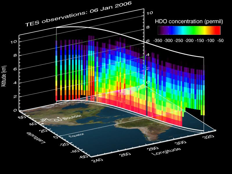
PIA12170:
-
A NASA Space Sleuth Hunts the Trail of Earth's Water
Full Resolution:
TIFF
(1.442 MB)
JPEG
(75.35 kB)
|
|
|
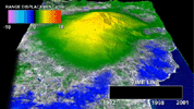
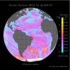
2012-02-06 |
Earth
|
Aura
|
TES
|
1115x560x3 |
|
-
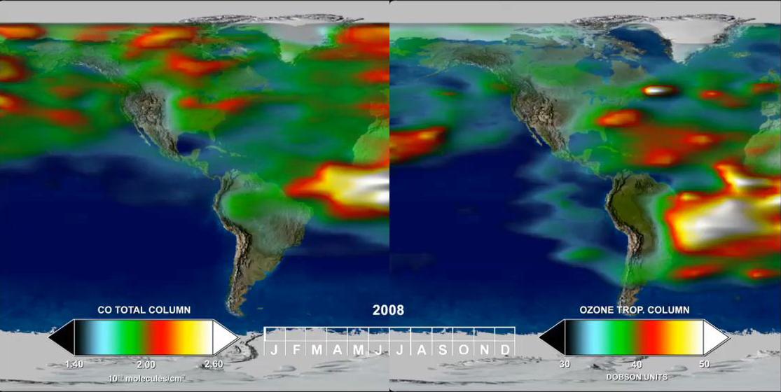
PIA15005:
-
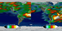
Annual Variation in Global CO and O3
Full Resolution:
TIFF
(1.876 MB)
JPEG
(70.63 kB)
|
|
|
2012-02-06 |
Earth
|
Aura
|
TES
|
1021x575x3 |
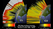
|
-
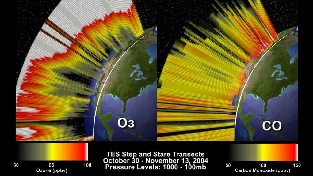
PIA15006:
-
O3 and CO Transects over North America
Full Resolution:
TIFF
(1.764 MB)
JPEG
(110.1 kB)
|
|
|
2004-04-01 |
Earth
|
Aura
|
TES
|
1041x761x3 |
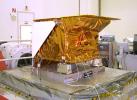
|
-
PIA15608:
-
NASA's Tropospheric Emission Spectrometer (TES) Instrument Onboard Aura
Full Resolution:
TIFF
(2.378 MB)
JPEG
(128.1 kB)
|
|
|
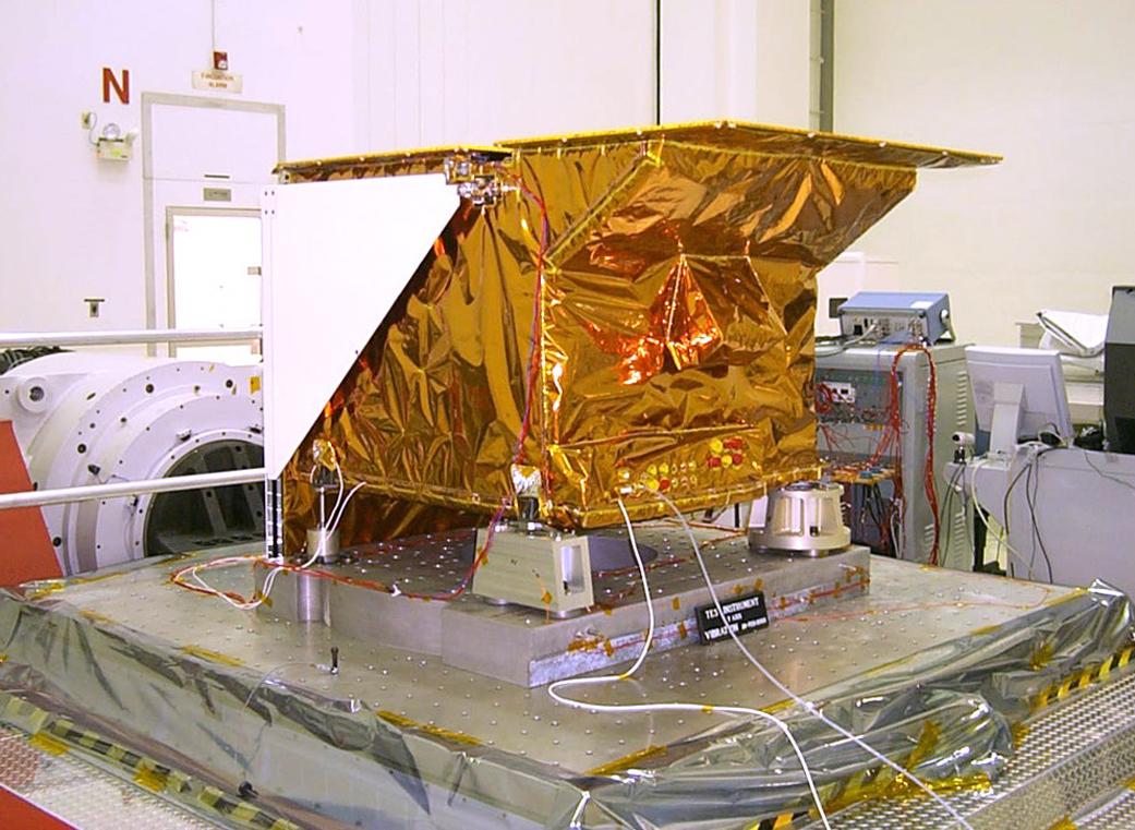
2001-04-26 |
Earth
|
2001 Mars Odyssey
|
THEMIS
|
3000x1681x3 |
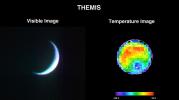
|
-
PIA00558:
-
2001 Mars Odyssey Images Earth (Visible and Infrared)
Full Resolution:
TIFF
(2.994 MB)
JPEG
(217.5 kB)
|
|
|
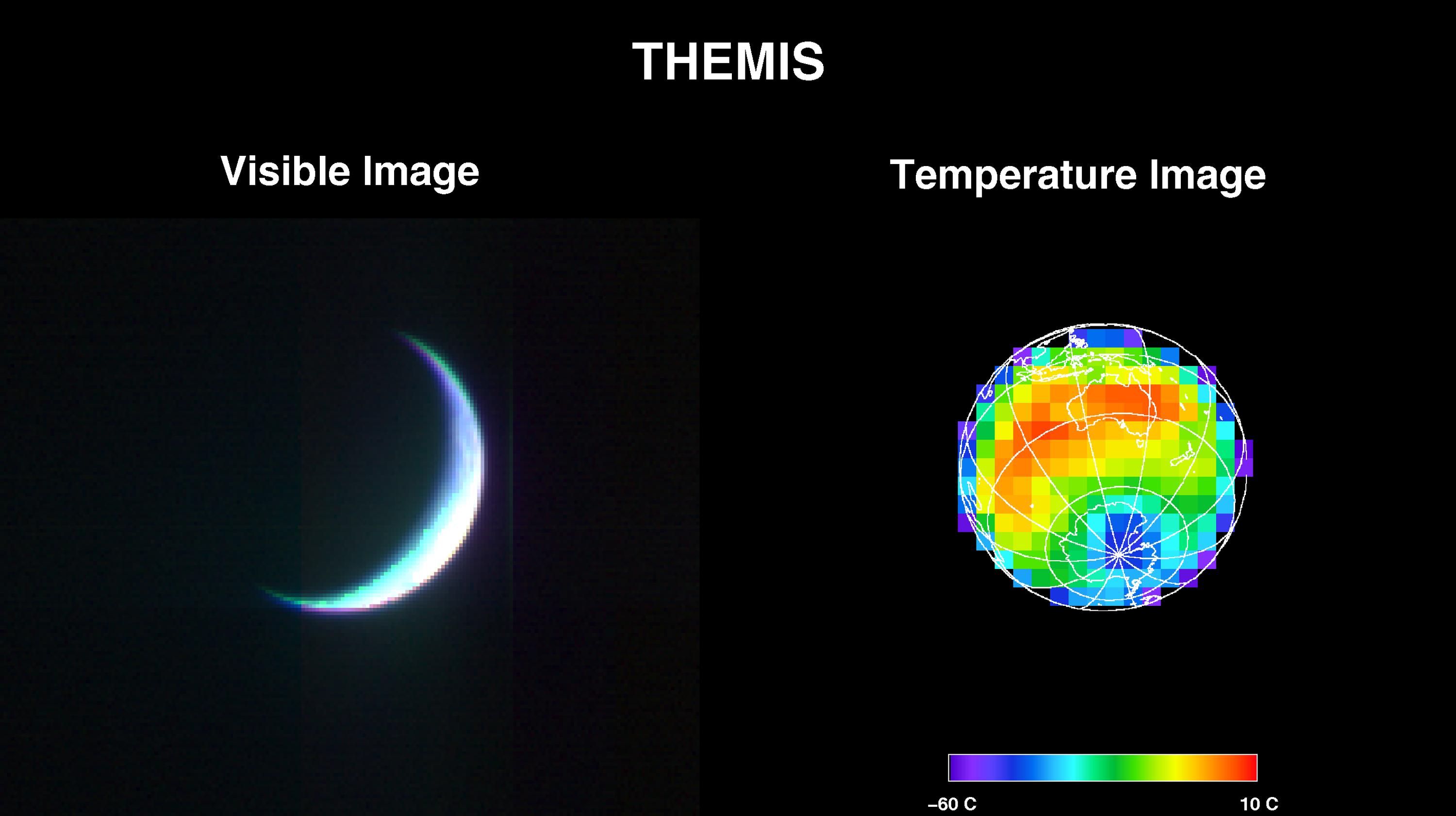
2001-05-01 |
Earth
|
2001 Mars Odyssey
|
THEMIS
|
3124x1342x1 |
|
-
PIA00559:
-
The Earth and Moon As Seen by 2001 Mars Odyssey's Thermal Emission Imaging System
Full Resolution:
TIFF
(101.6 kB)
JPEG
(69.4 kB)
|
|
|
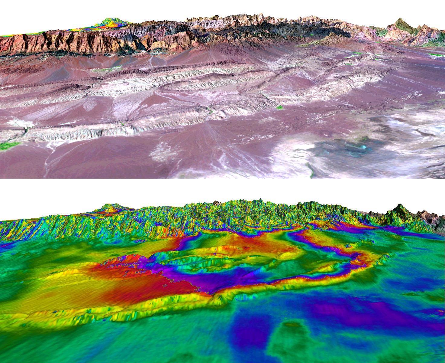
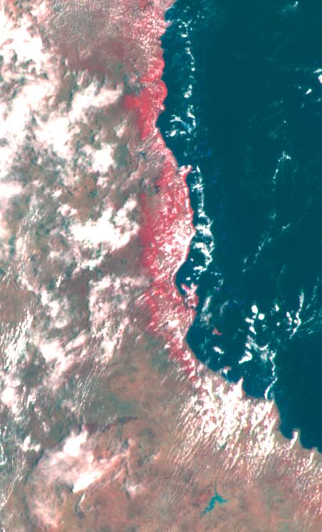
2004-06-25 |
Earth
|
European Remote Sensing Satellite Mission (ERS)
Landsat
|
Synthetic Aperture Radar (SAR)
Thematic Mapper (TM)
|
1473x1200x3 |

|
-
PIA06310:
-
Shahdad, Southeast Iran, Radar Interferometry -- Silent Earthquake, Perspective View
Full Resolution:
TIFF
(4.672 MB)
JPEG
(367.1 kB)
|
|
|
2012-02-06 |
Earth
|
European Remote Sensing Satellite Mission (ERS)
|
Synthetic Aperture Radar (SAR)
|
1024x576x3 |
|
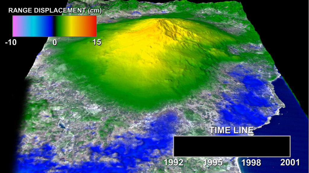
-
PIA13201:
-
Mount Etna InSAR Time Series Animation
Full Resolution:
TIFF
(1.772 MB)
JPEG
(100.7 kB)
|
|
|
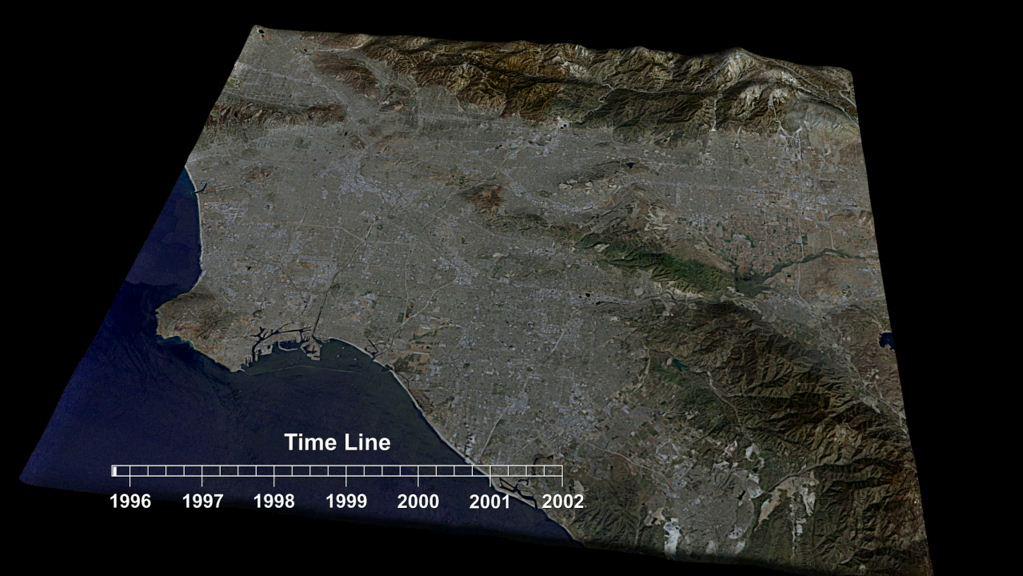
2012-02-06 |
Earth
|
European Remote Sensing Satellite Mission (ERS)
|
Synthetic Aperture Radar (SAR)
|
1023x576x3 |
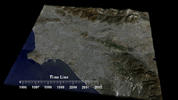
|
-
PIA13202:
-
Southern California INSAR Time Series
Full Resolution:
TIFF
(1.77 MB)
JPEG
(87.02 kB)
|
|
|
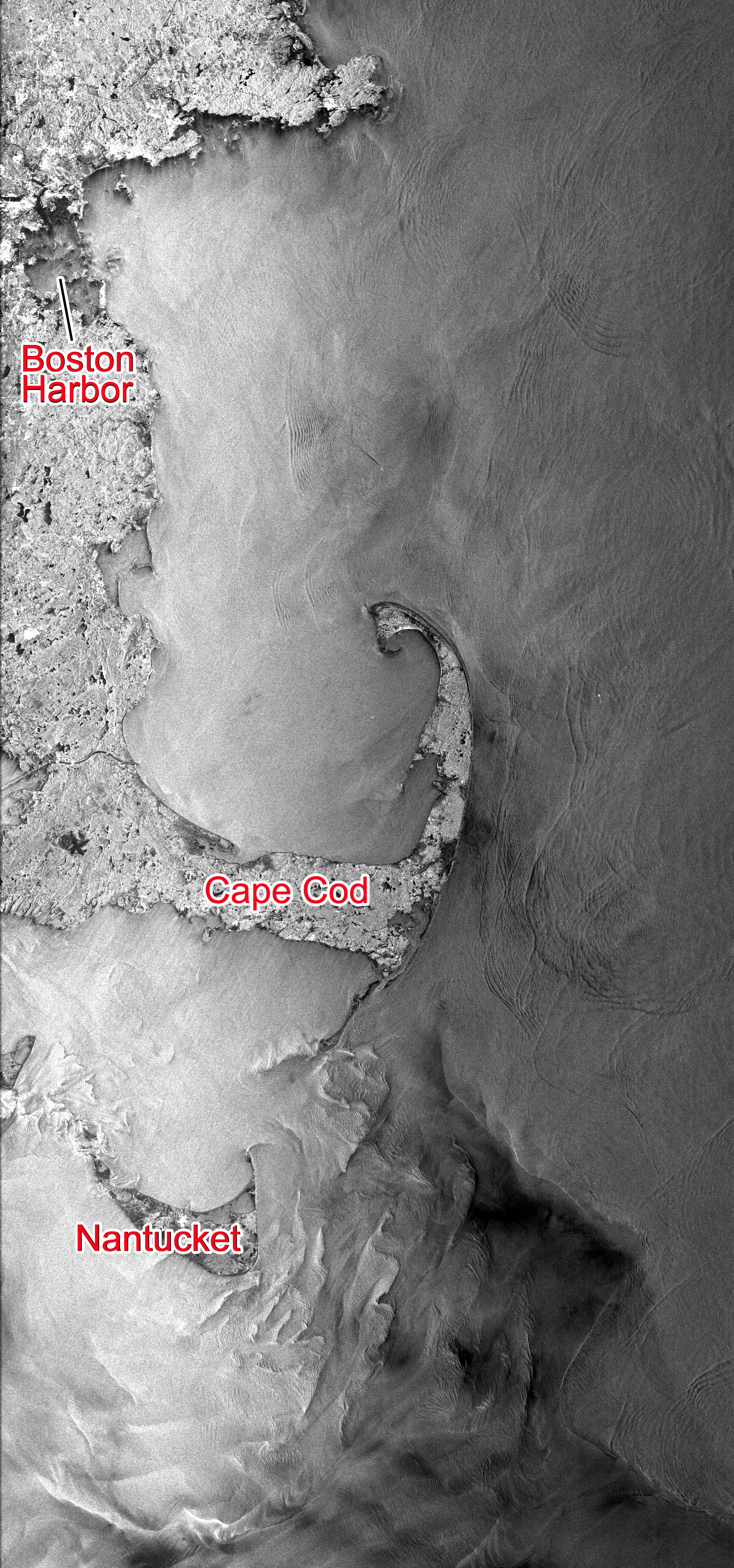
2014-03-18 |
Earth
|
Seasat
|
Synthetic Aperture Radar (SAR)
|
3000x6407x3 |

|
-
PIA18137:
-
NASA's Seasat Satellite Shows Massachusetts Coast
Full Resolution:
TIFF
(57.69 MB)
JPEG
(3.845 MB)
|
|
|
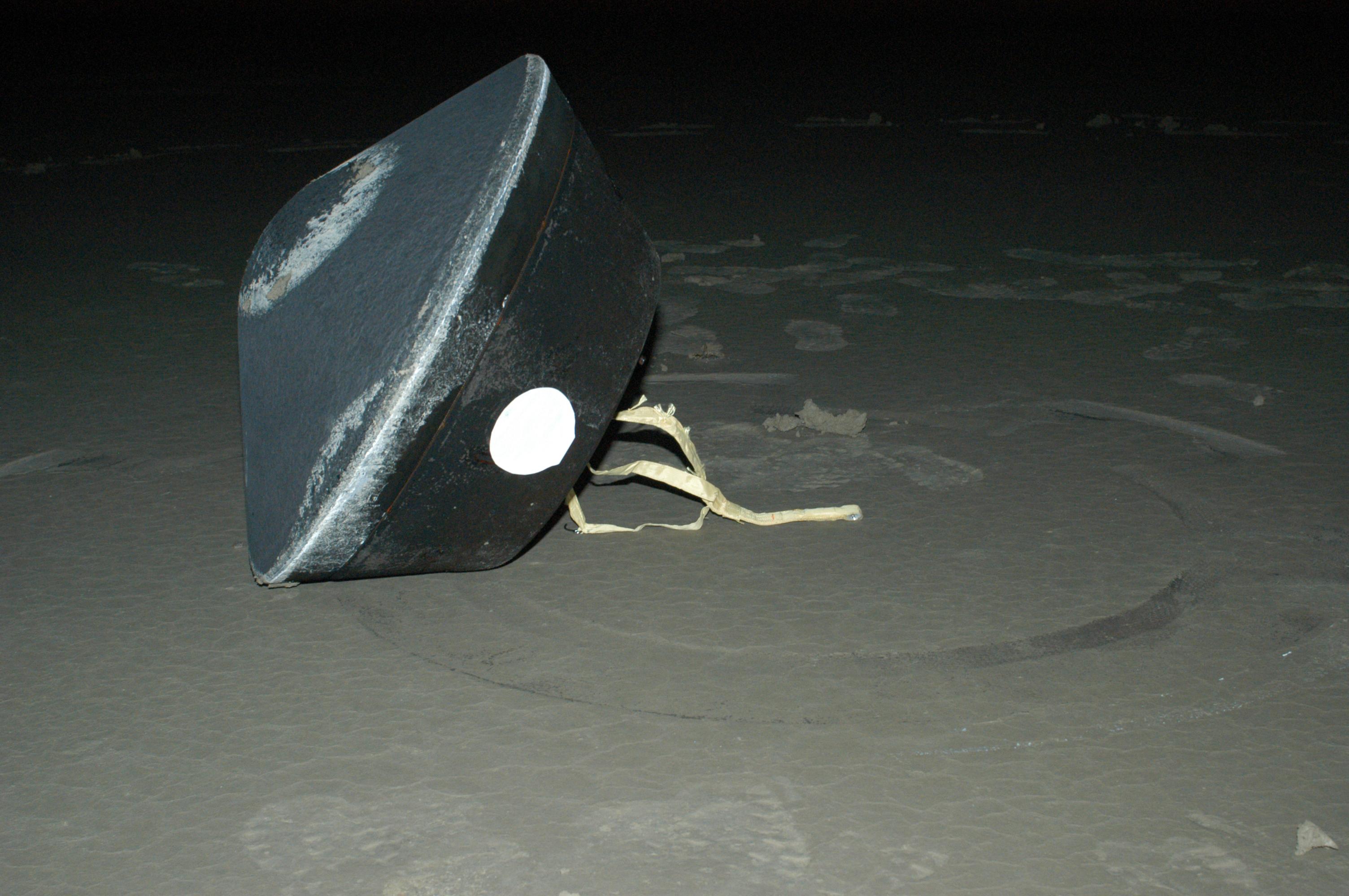
2006-01-17 |
Earth
|
Stardust
|
Stardust Capsule
|
3008x2000x3 |

|
-
PIA03669:
-
Sample Return Capsule
Full Resolution:
TIFF
(18.05 MB)
JPEG
(556.9 kB)
|
|
|
1999-06-12 |
Moon
|
DSPSE
|
Star Tracker
|
1168x1552x1 |
|
-
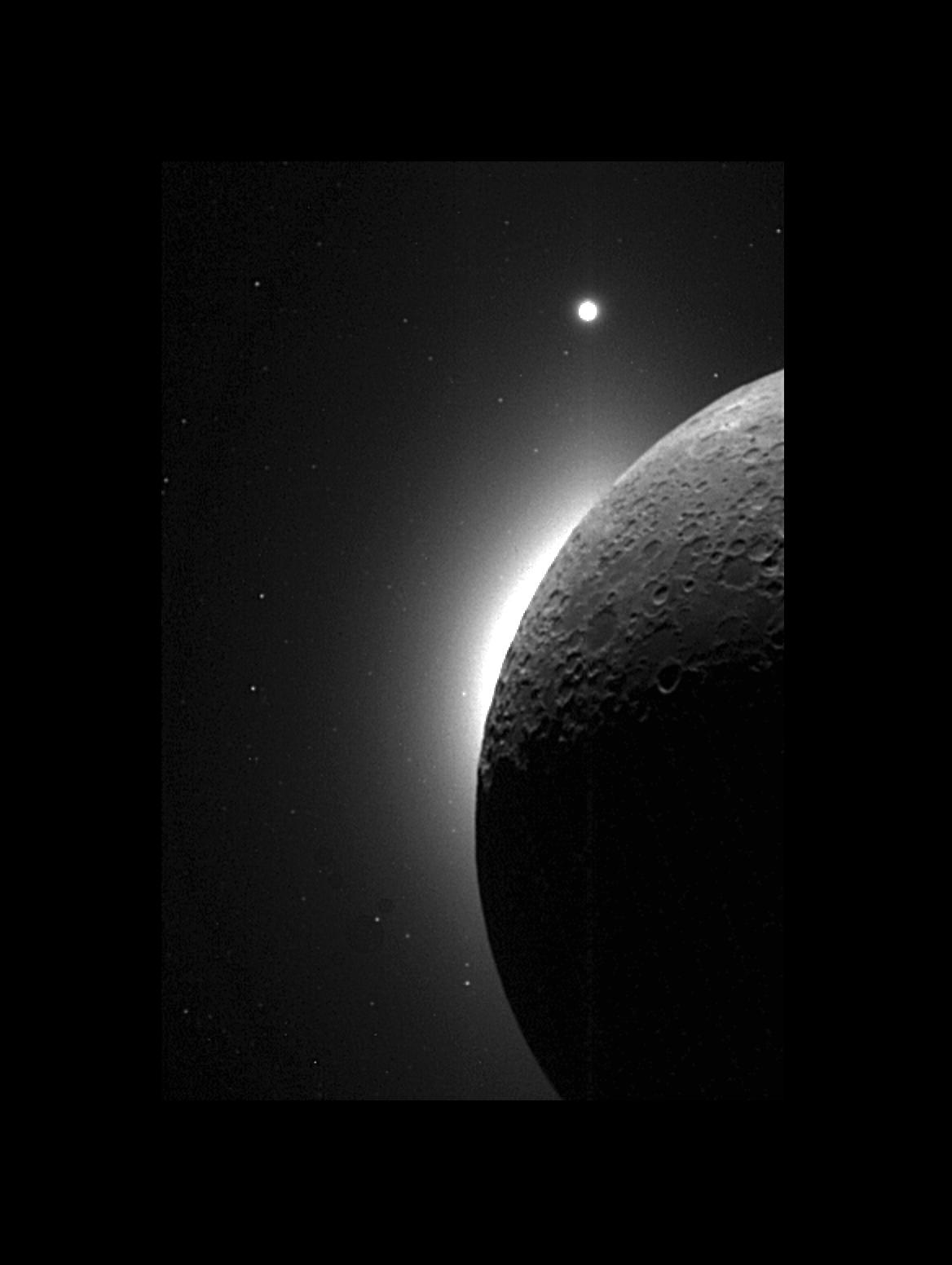
PIA00434:
-
Clementine Observes the Moon, Solar Corona, and Venus
Full Resolution:
TIFF
(573.3 kB)
JPEG
(74.17 kB)
|
|
|
2013-12-10 |
Earth
|
Juno
|
Star Tracker
|
483x376x3 |

|
-
PIA17748:
-
Juno's Approach to the Earth-Moon System
Full Resolution:
TIFF
(545.2 kB)
JPEG
(5.373 kB)
|
|
|
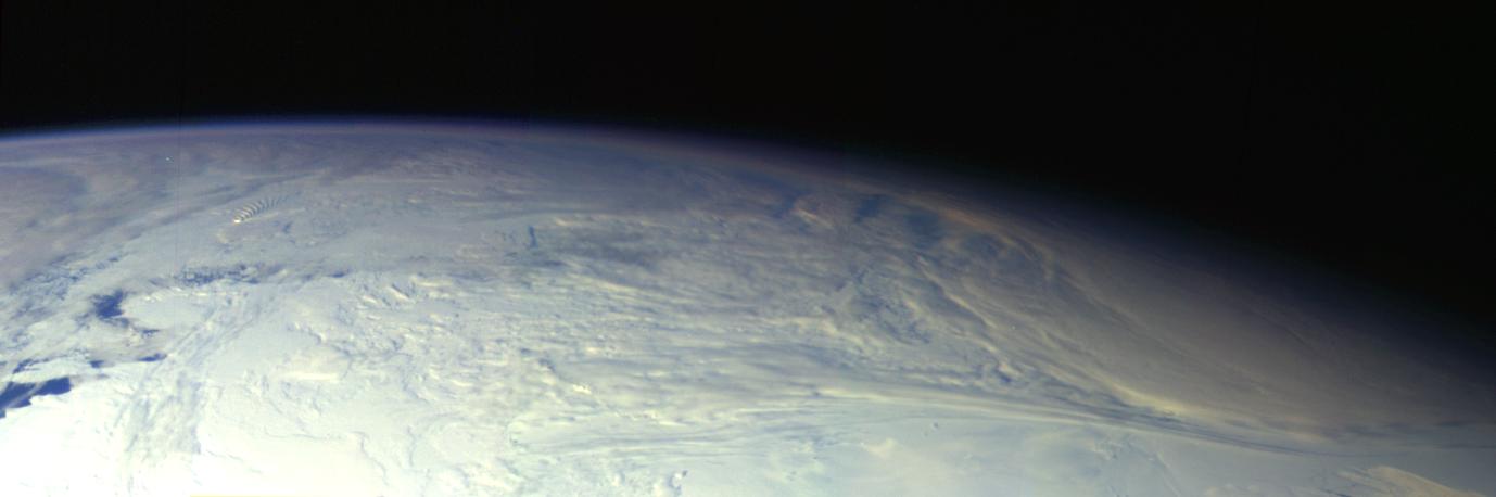
2015-01-22 |
Earth
|
|
SPIDER
|
673x379x3 |

|
-
PIA19177:
-
SPIDER Readied for Launch
Full Resolution:
TIFF
(765.7 kB)
JPEG
(54.71 kB)
|
|
|
2005-01-06 |
Earth
|
Shuttle Radar Topography Mission (SRTM)
|
Spaceborne Imaging Radar
C/X-Band Synthetic Aperture Radar
|
5342x1746x3 |
|
-
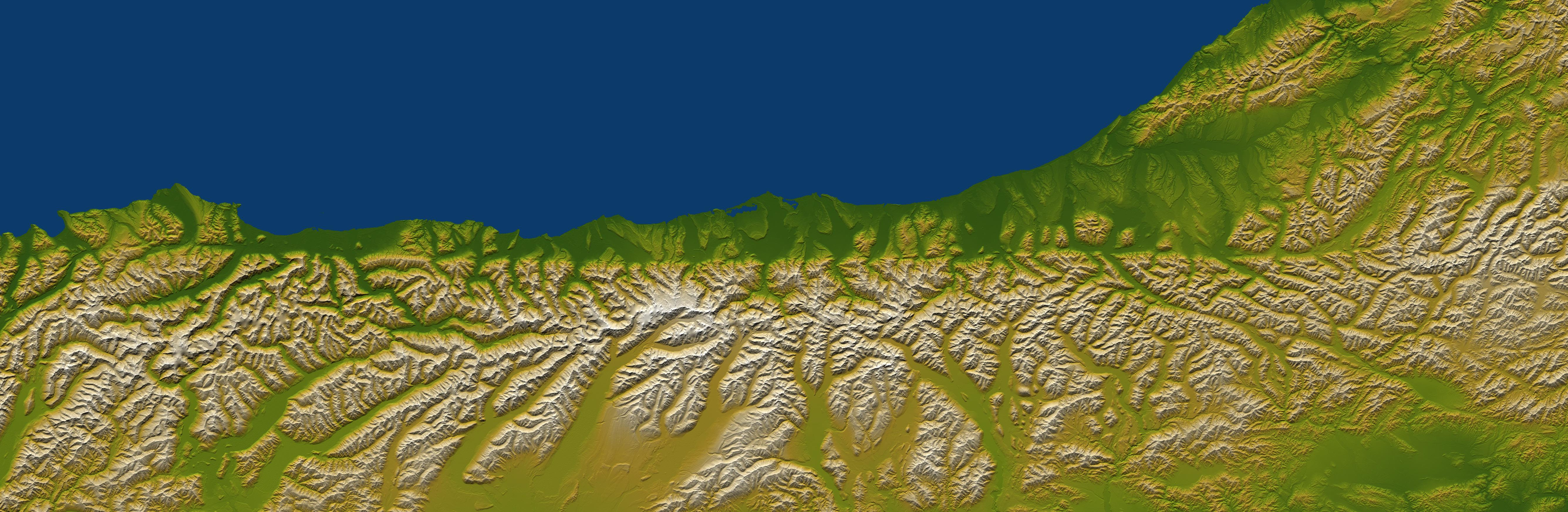
PIA06661:
-
Alpine Fault, New Zealand, SRTM Shaded Relief and Colored Height
Full Resolution:
TIFF
(22.84 MB)
JPEG
(1.473 MB)
|
|
|
2005-01-06 |
Earth
|
Shuttle Radar Topography Mission (SRTM)
|
Spaceborne Imaging Radar
C/X-Band Synthetic Aperture Radar
|
2919x1565x3 |

|
-
PIA06663:
-
Davenport Ranges, Northern Territory, Australia, SRTM Shaded Relief and
Colored Height
Full Resolution:
TIFF
(10.79 MB)
JPEG
(608.1 kB)
|
|
|
2005-01-06 |
Earth
|
Shuttle Radar Topography Mission (SRTM)
|
Spaceborne Imaging Radar
C/X-Band Synthetic Aperture Radar
|
1610x1100x3 |
|
-
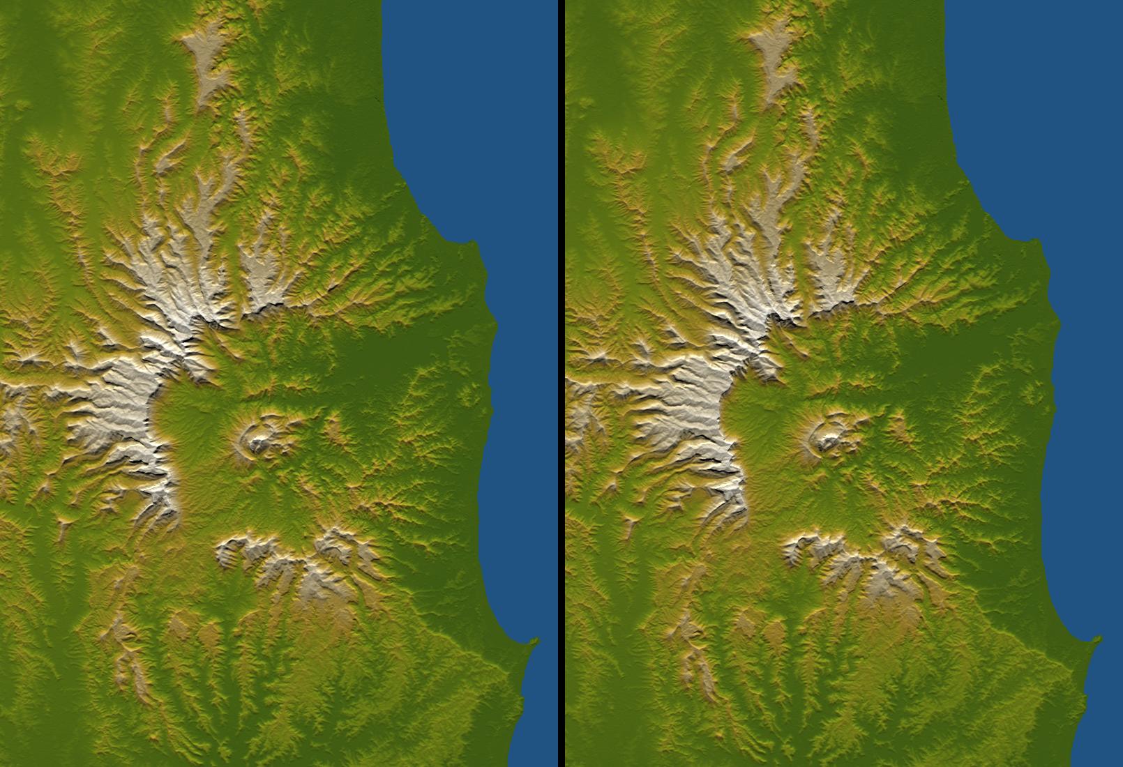
PIA06664:
-
Tweed Extinct Volcano, Australia, Stereo Pair of SRTM Shaded Relief and
Colored Height
Full Resolution:
TIFF
(4.368 MB)
JPEG
(254.5 kB)
|
|
|
2005-01-06 |
Earth
|
Landsat
Shuttle Radar Topography Mission (SRTM)
|
Spaceborne Imaging Radar
C/X-Band Synthetic Aperture Radar
|
1414x810x3 |
|
-
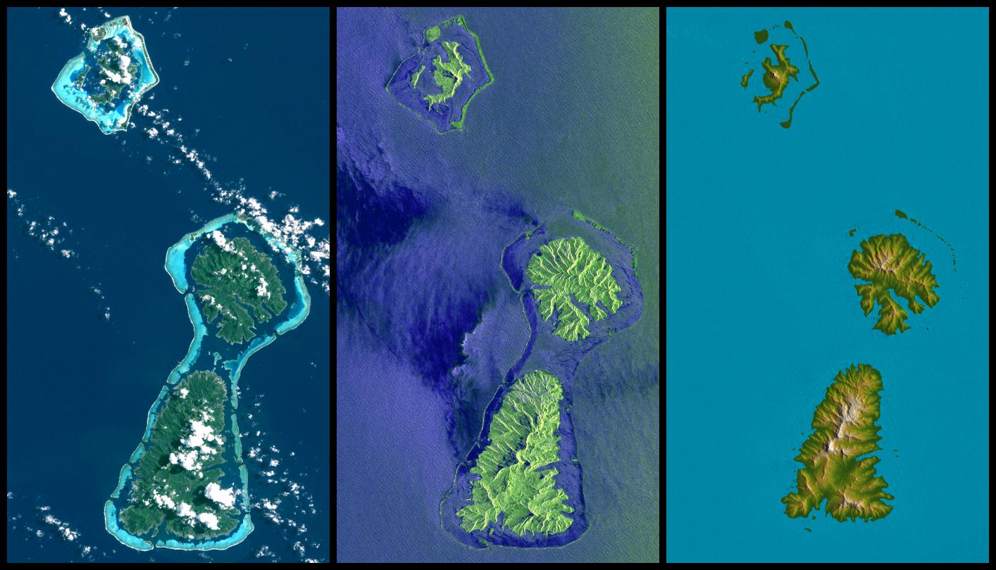
PIA06660:
-
Bora Bora, Tahaa, and Raiatea, French Polynesia, Landsat and SIR-C Images
Compared to SRTM Shaded Relief and Colored Height
Full Resolution:
TIFF
(2.921 MB)
JPEG
(158.8 kB)
|
|
|
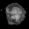
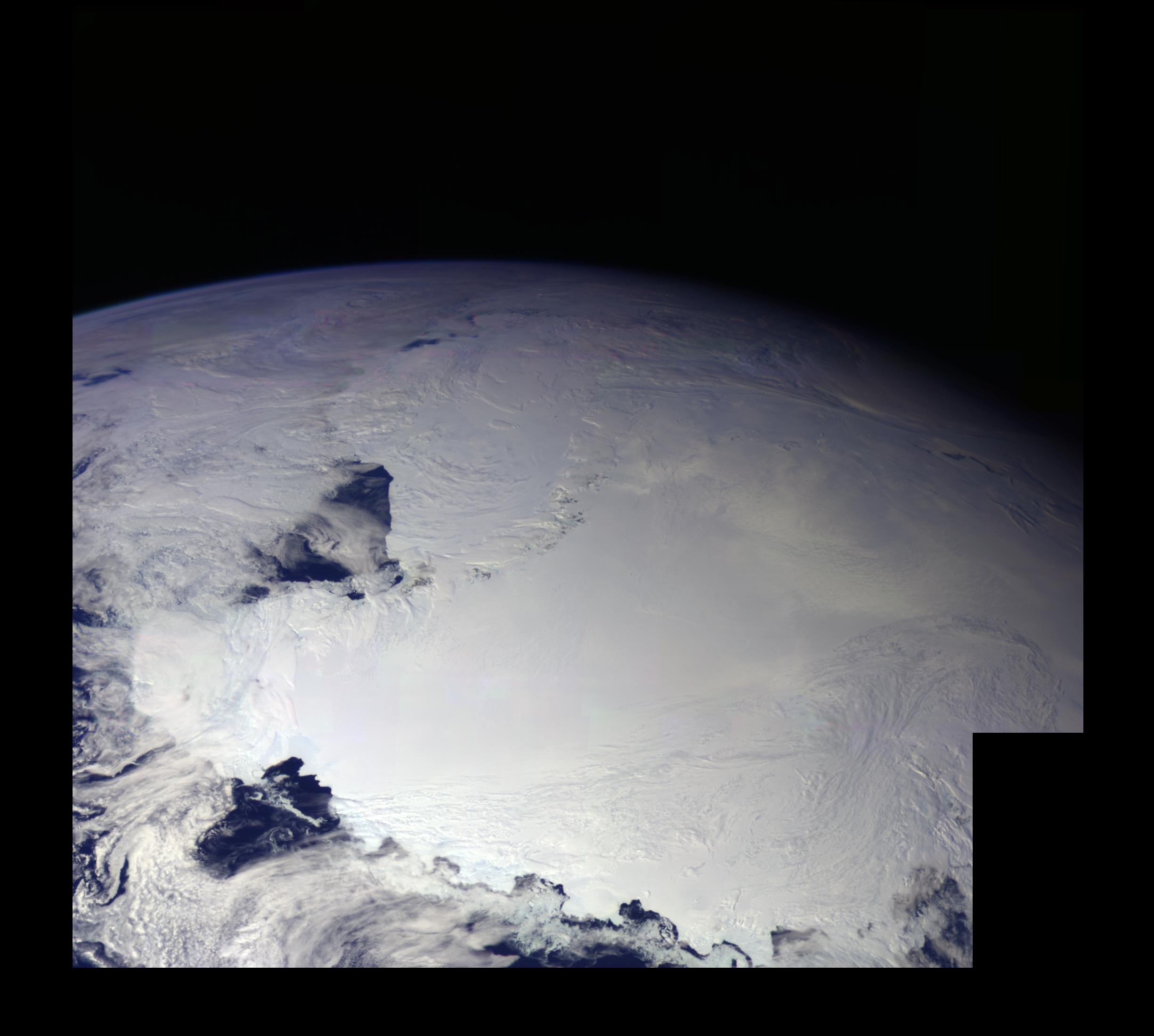
1996-01-29 |
Earth
|
Galileo
|
Solid-State Imaging
|
427x754x3 |
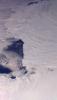
|
-
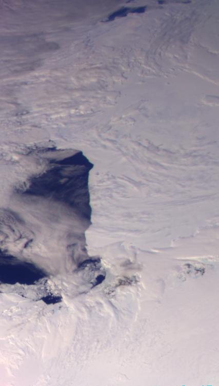
PIA00074:
-
Antarctica - Ross Ice Shelf
Full Resolution:
TIFF
(657.6 kB)
JPEG
(28.73 kB)
|
|
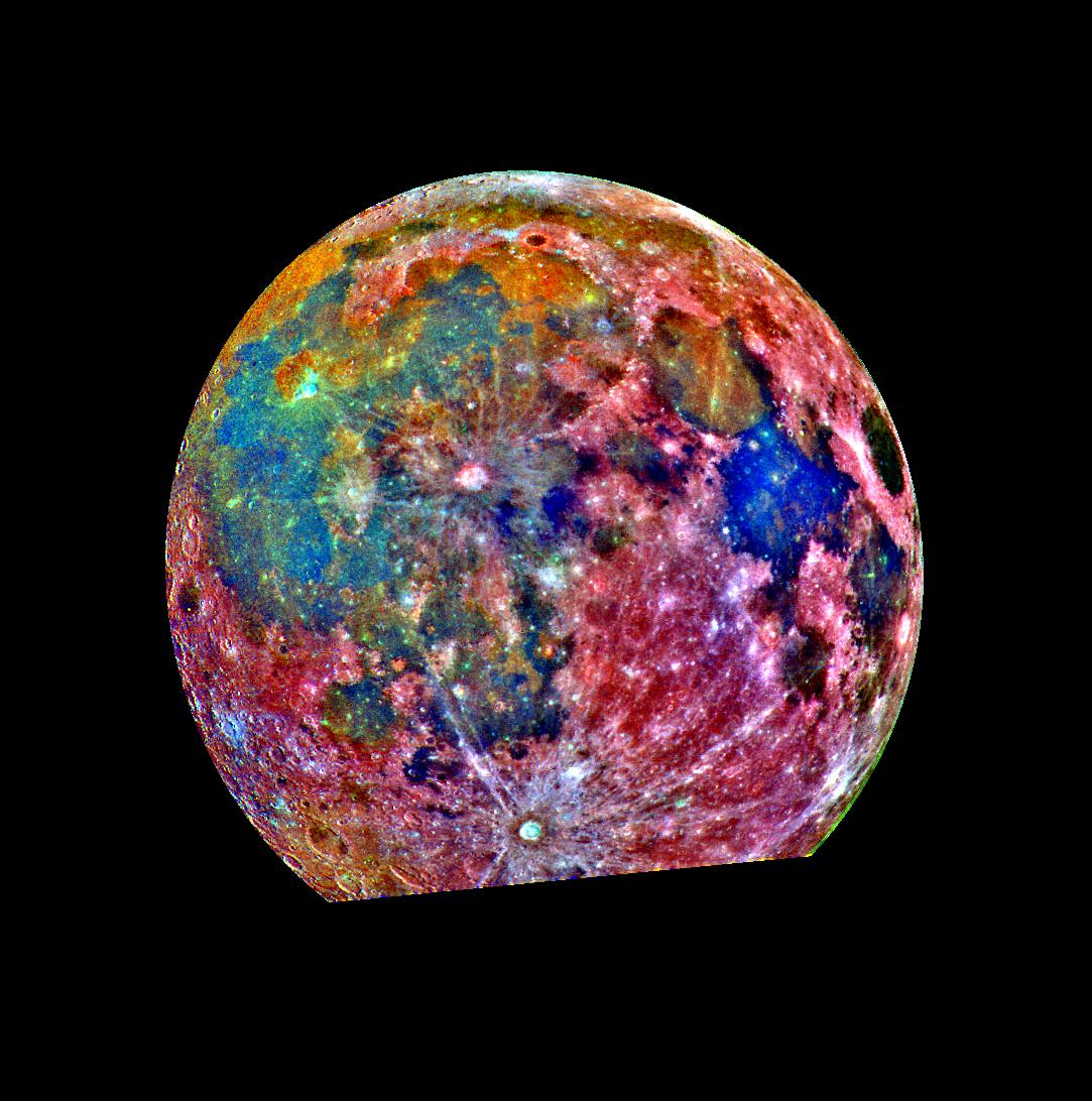
|
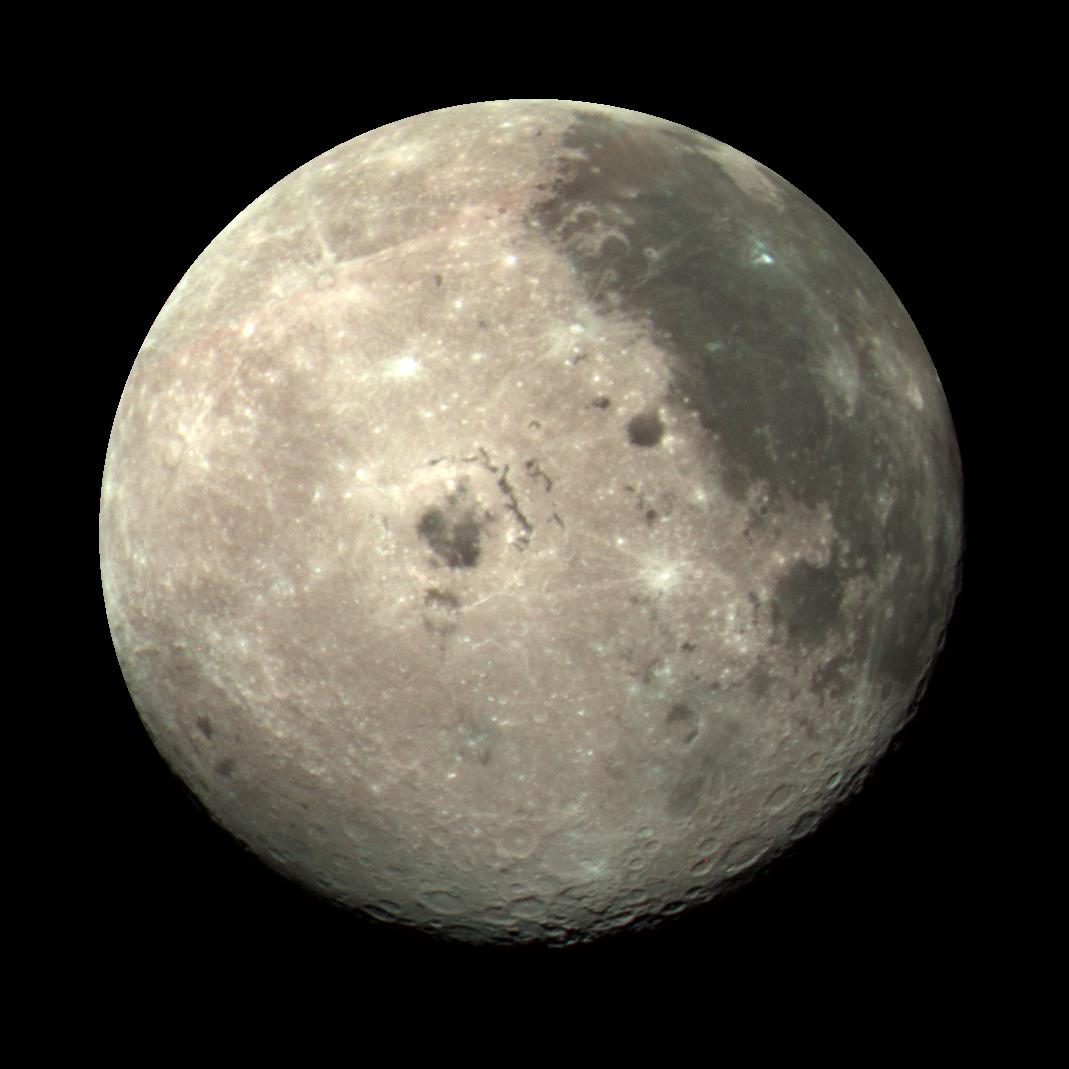
1996-01-29 |
Moon
|
Galileo
|
Solid-State Imaging
|
1988x1069x3 |
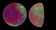
|
-
PIA00075:
-
Moon Color Visualizations
Full Resolution:
TIFF
(3.367 MB)
JPEG
(295.4 kB)
|
|
|
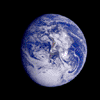
1996-01-29 |
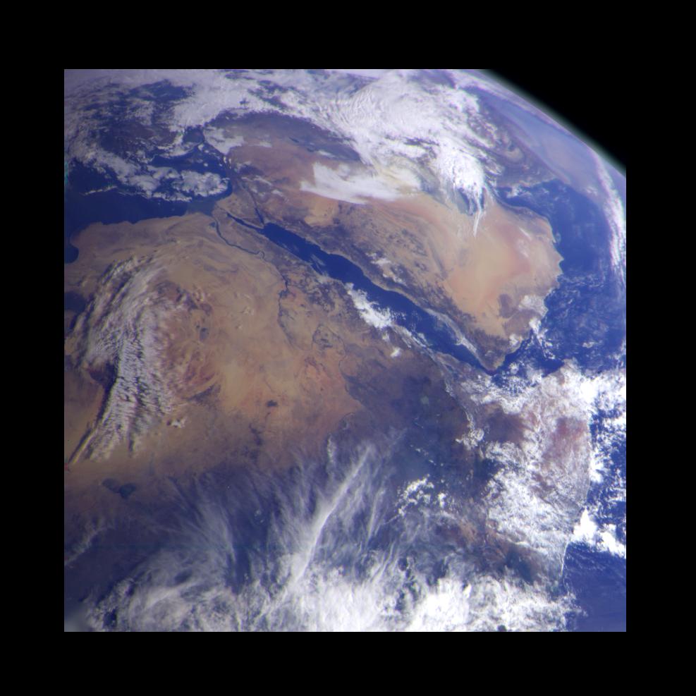
Earth
|
Galileo
|
Solid-State Imaging
|
800x800x3 |
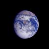
|
-
PIA00076:
-
Earth - Full Disk View of Africa
Full Resolution:
TIFF
(506.5 kB)
JPEG
(34.9 kB)
|
|
|
1996-01-29 |
Moon
|
Galileo
|
Solid-State Imaging
|
1988x1069x1 |
|
-
PIA00077:
-
Moon - 2 Views of Orientale Basin
Full Resolution:
TIFF
(882.2 kB)
JPEG
(133.4 kB)
|
|
|
1996-02-02 |
Moon
|
Galileo
|
Solid-State Imaging
|
1069x1069x3 |
|
-
PIA00113:
-
Moon Color Composite
Full Resolution:
TIFF
(1.786 MB)
JPEG
(76.81 kB)
|
|
|
1996-01-29 |
Earth
|
Galileo
|
Solid-State Imaging
|
800x800x3 |
|
-
PIA00114:
-
Earth - South America (First Frame of Earth Spin Movie)
Full Resolution:
TIFF
(760.1 kB)
JPEG
(50.21 kB)
|
|
|
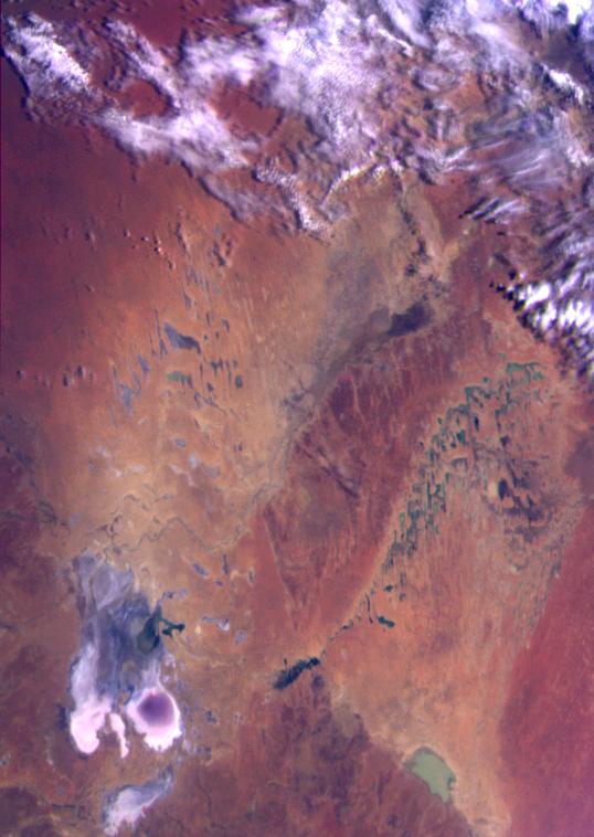
2001-02-28 |
Earth
|
Galileo
|
Solid-State Imaging
|
538x758x3 |

|
-
PIA00115:
-
Earth - Simpson Desert, Central Australia
Full Resolution:
TIFF
(920 kB)
JPEG
(59.48 kB)
|
|
|
1996-02-01 |
Earth
|
Galileo
|
Solid-State Imaging
|
1378x458x3 |
|
-
PIA00116:
-
Earth - Antarctica Mosaic
Full Resolution:
TIFF
(1.091 MB)
JPEG
(41.89 kB)
|
|
|
1996-02-09 |
Earth
|
Galileo
|
Solid-State Imaging
|
2450x2200x3 |
|
-
PIA00117:
-
Earth - Ross Ice Shelf, Antarctica
Full Resolution:
TIFF
(7.234 MB)
JPEG
(268.4 kB)
|
|
|
1996-01-29 |
Moon
|
Galileo
|
Solid-State Imaging
|
800x800x1 |
|
-
PIA00120:
-
Moon - Western Hemisphere
Full Resolution:
TIFF
(301.2 kB)
JPEG
(134.9 kB)
|
|
|
2001-02-28 |
Earth
|
Galileo
|
Solid-State Imaging
|
452x746x3 |
|
-
PIA00121:
-
Earth - Eastern Australia Coast
Full Resolution:
TIFF
(693.7 kB)
JPEG
(57.29 kB)
|
|
|
1996-02-08 |
Earth
|
Galileo
|
Solid-State Imaging
|
800x800x3 |
|
-
PIA00122:
-
Earth - India and Australia
Full Resolution:
TIFF
(534.7 kB)
JPEG
(38.04 kB)
|
|
|
1996-01-29 |
Earth
|
Galileo
|
Solid-State Imaging
|
800x800x3 |

|
-
PIA00123:
-
Earth - Pacific Ocean
Full Resolution:
TIFF
(653.7 kB)
JPEG
(44.28 kB)
|
|
|
1996-01-29 |
Moon
|
Galileo
|
Solid-State Imaging
|
876x879x1 |
|
-
PIA00126:
-
Moon - North Pole
Full Resolution:
TIFF
(303.1 kB)
JPEG
(96.51 kB)
|
|
|
1996-01-29 |
Earth
|
Galileo
|
Solid-State Imaging
|
987x987x3 |
|
-
PIA00127:
-
Earth - Northeast Africa and the Arabian Peninsula
Full Resolution:
TIFF
(1.878 MB)
JPEG
(94.22 kB)
|
|
|
1996-02-05 |
Moon
|
Galileo
|
Solid-State Imaging
|
3211x2672x1 |
|
-
PIA00128:
-
Moon - 18 Image Mosaic
Full Resolution:
TIFF
(4.805 MB)
JPEG
(1.171 MB)
|
|
|
1996-01-29 |
Moon
|
Galileo
|
Solid-State Imaging
|
696x993x3 |
|
-
PIA00129:
-
Moon - False Color Mosaic
Full Resolution:
TIFF
(1.498 MB)
JPEG
(100.6 kB)
|
|
|
1996-02-05 |
Moon
|
Galileo
|
Solid-State Imaging
|
3296x3809x1 |

|
-
PIA00130:
-
Moon - North Pole Mosaic
Full Resolution:
TIFF
(4.431 MB)
JPEG
(795.9 kB)
|
|
|
1996-02-05 |
Moon
|
Galileo
|
Solid-State Imaging
|
2600x2910x3 |
|
-
PIA00131:
-
Moon - False Color Mosaic
Full Resolution:
TIFF
(16.68 MB)
JPEG
(1.131 MB)
|
|
|
1996-01-29 |
Moon
|
Galileo
|
Solid-State Imaging
|
1083x1092x3 |
|
-
PIA00132:
-
Moon - False Color Mosaic
Full Resolution:
TIFF
(1.575 MB)
JPEG
(168.1 kB)
|
|
|
1996-08-05 |
Earth
|
Galileo
|
Solid-State Imaging
|
3670x6735x3 |
|
-
PIA00133:
-
Earth - False Color Mosaic of the Andes
Full Resolution:
TIFF
(49.61 MB)
JPEG
(2.406 MB)
|
|
|
1996-01-29 |
Earth
|
Galileo
|
Solid-State Imaging
|
1572x1580x3 |
|
-
PIA00134:
-
Earth - Moon Conjunction
Full Resolution:
TIFF
(640.6 kB)
JPEG
(53.53 kB)
|
|
|
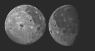
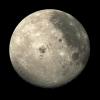
1996-02-08 |
Moon
|
Galileo
|
Solid-State Imaging
|
800x1220x1 |
|
-
PIA00224:
-
Moon - Western Near Side
Full Resolution:
TIFF
(118.2 kB)
JPEG
(31.73 kB)
|
|
|
1996-02-08 |
Moon
|
Galileo
|
Solid-State Imaging
|
987x984x1 |

|
-
PIA00225:
-
Far Side of the Moon
Full Resolution:
TIFF
(255.4 kB)
JPEG
(47.45 kB)
|
|
|
1996-02-08 |
Earth
|
Galileo
|
Solid-State Imaging
|
650x650x1 |
|
-
PIA00226:
-
Global View of Earth in the Near-Infrared
Full Resolution:
TIFF
(223.3 kB)
JPEG
(44.25 kB)
|
|
|
1996-02-08 |
Earth
|
Galileo
|
Solid-State Imaging
|
888x894x1 |
|
-
PIA00230:
-
Galileo Optical Experiment (GOPEX)
Full Resolution:
TIFF
(152.7 kB)
JPEG
(41.31 kB)
|
|
|
1996-02-08 |
Earth
|
Galileo
|
Solid-State Imaging
|
1083x1314x3 |
|
-
PIA00232:
-
Earth - Departing Image by Galileo
Full Resolution:
TIFF
(823.3 kB)
JPEG
(64.79 kB)
|
|
|
1998-06-04 |
Earth
|
Galileo
|
Solid-State Imaging
|
1700x2164x3 |
|
-
PIA00342:
-
The Earth & Moon
Full Resolution:
TIFF
(7.005 MB)
JPEG
(262.2 kB)
|
|
|
1997-09-10 |
Earth
|
Galileo
|
Solid-State Imaging
|
1020x1128x3 |
|
-
PIA00728:
-
Global Images of Earth
Full Resolution:
TIFF
(2.169 MB)
JPEG
(117.6 kB)
|
|
|
1997-09-10 |
Earth
|
Galileo
|
Solid-State Imaging
|
452x439x3 |
|
-
PIA00729:
-
South Polar Projection of Earth
Full Resolution:
TIFF
(169.4 kB)
JPEG
(29.01 kB)
|
|
|
2012-12-12 |
Earth
|
Space Shuttle
|
SIR-C/X-SAR
|
2128x1612x1 |
|
-
PIA16179:
-
Nile River in Black and White
Full Resolution:
TIFF
(3.435 MB)
JPEG
(707.9 kB)
|
|
|
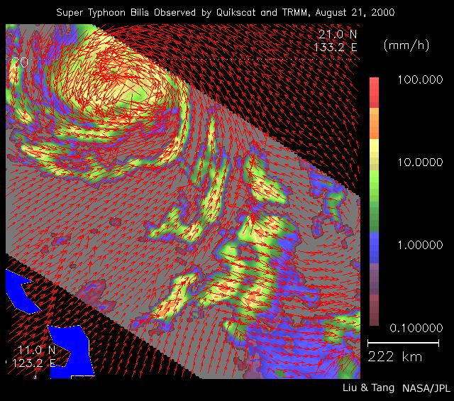
2000-08-23 |
Earth
|
QuikScat
|
SeaWinds Scatterometer
|
640x565x3 |
|
-
PIA01047:
-
Typhoon Bilis
Full Resolution:
TIFF
(229 kB)
JPEG
(123.4 kB)
|
|
|
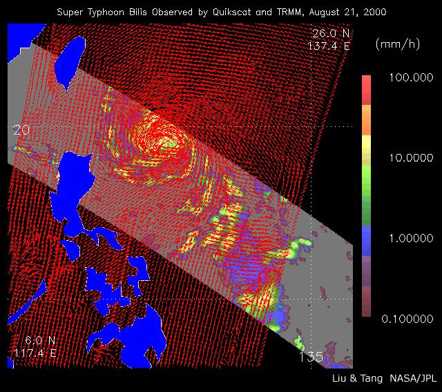
2002-07-05 |
Earth
|
QuikScat
|
SeaWinds Scatterometer
|
640x568x3 |
|
-
PIA01048:
-
Typhoon Bilis
Full Resolution:
TIFF
(166 kB)
JPEG
(122.5 kB)
|
|
|
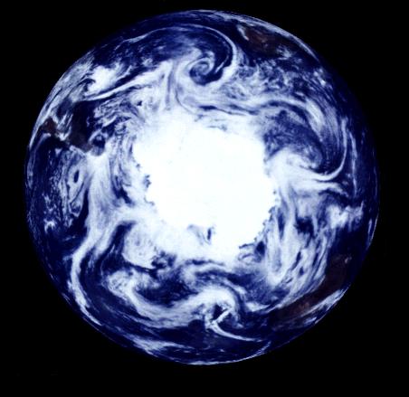
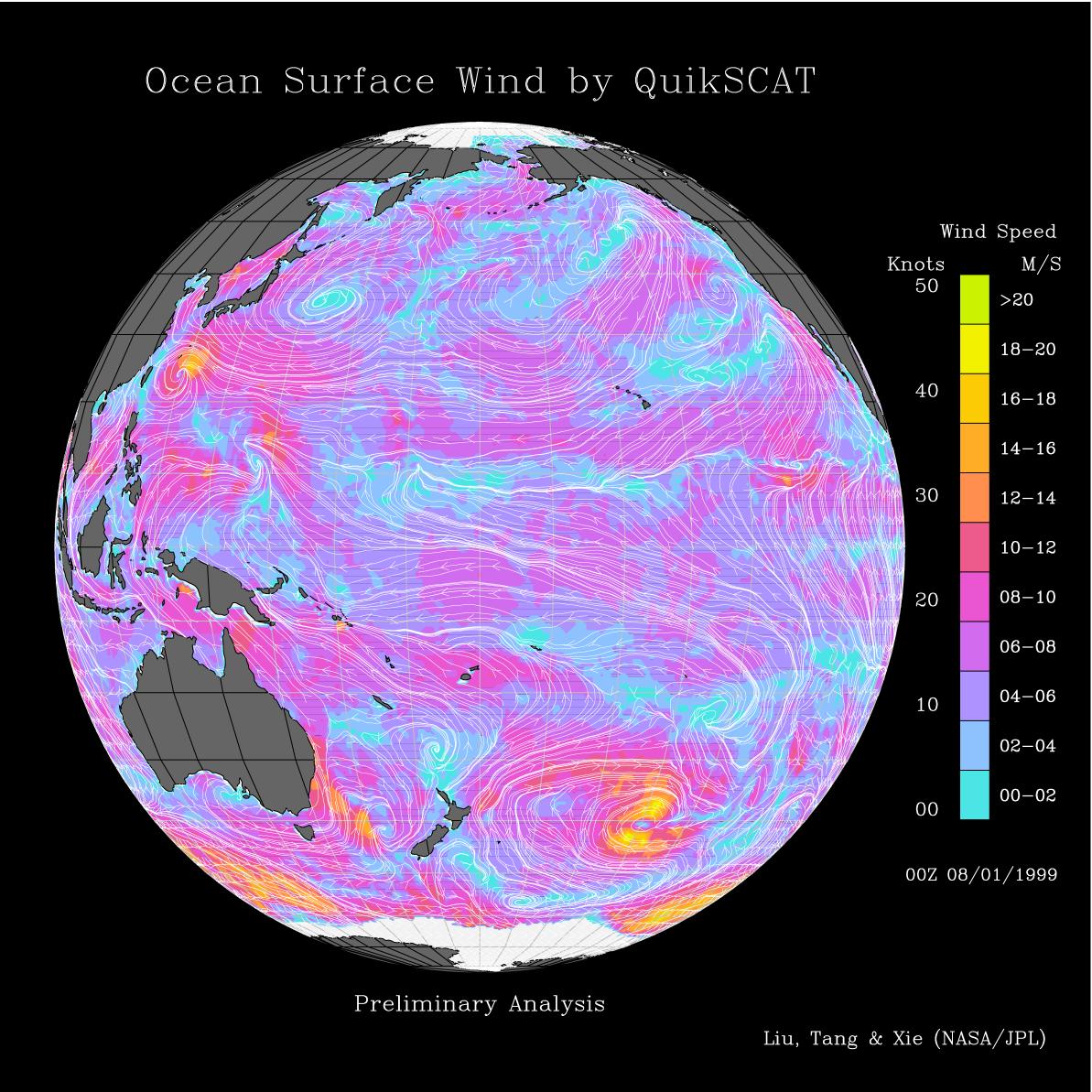
1999-08-09 |
Earth
|
QuikScat
|
SeaWinds Scatterometer
|
1193x1193x3 |
|
-
PIA01346:
-
Pacific Ocean Surface Winds from QuikScat
Full Resolution:
TIFF
(1.208 MB)
JPEG
(258.1 kB)
|
|
|
1999-08-09 |
Earth
|
QuikScat
|
SeaWinds Scatterometer
|
1193x1193x3 |
|
-
PIA01347:
-
Atlantic Ocean Surface Winds from QuikScat
Full Resolution:
TIFF
(1.065 MB)
JPEG
(237.9 kB)
|
|
|
1999-09-08 |
Earth
|
QuikScat
|
SeaWinds Scatterometer
|
900x900x1 |
|
-
PIA02329:
-
SeaWinds Watches for Breakup of Giant Iceberg
Full Resolution:
TIFF
(132.8 kB)
JPEG
(49.24 kB)
|
|
|
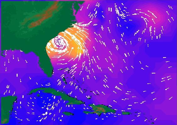
1999-09-16 |
Earth
|
QuikScat
|
SeaWinds Scatterometer
|
564x400x3 |
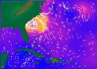
|
-
PIA02334:
-
SeaWinds Radar Stares Into The Eye Of Angry Hurricane Floyd
Full Resolution:
TIFF
(192.6 kB)
JPEG
(44.92 kB)
|
|
|
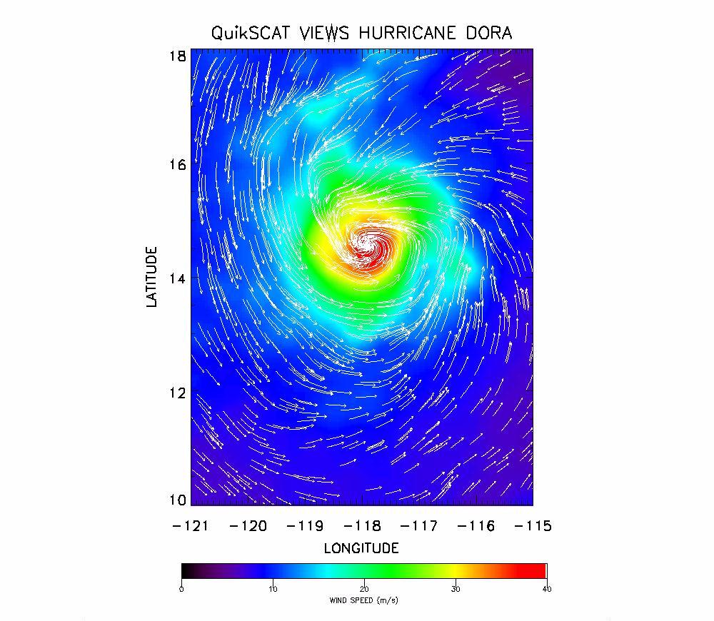
1999-08-25 |
Earth
|
QuikScat
|
SeaWinds Scatterometer
|
1000x870x3 |

|
-
PIA02404:
-
SeaWinds Radar Clocks Hurricane Dora's Wind Speeds
Full Resolution:
TIFF
(1.118 MB)
JPEG
(142.8 kB)
|
|
|
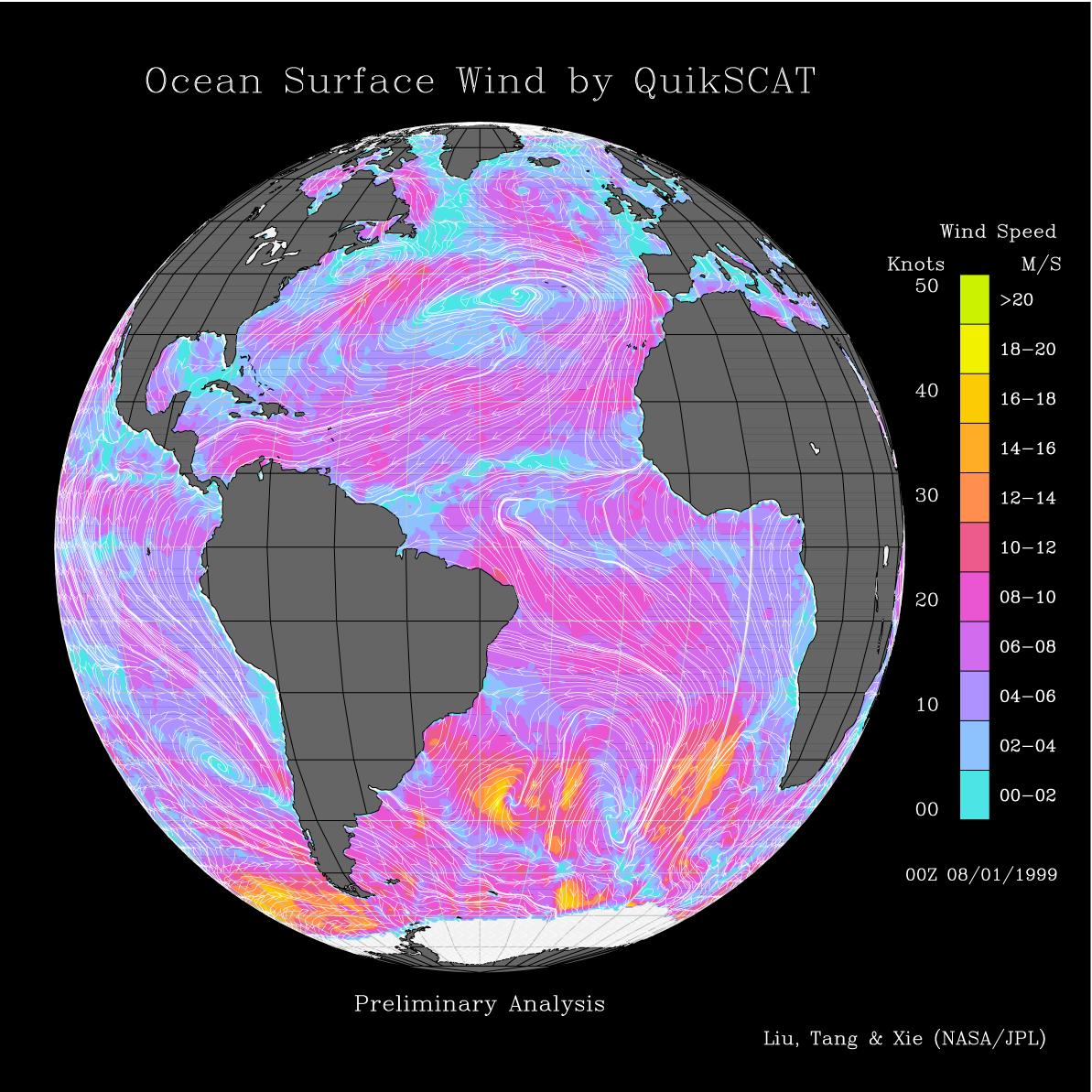
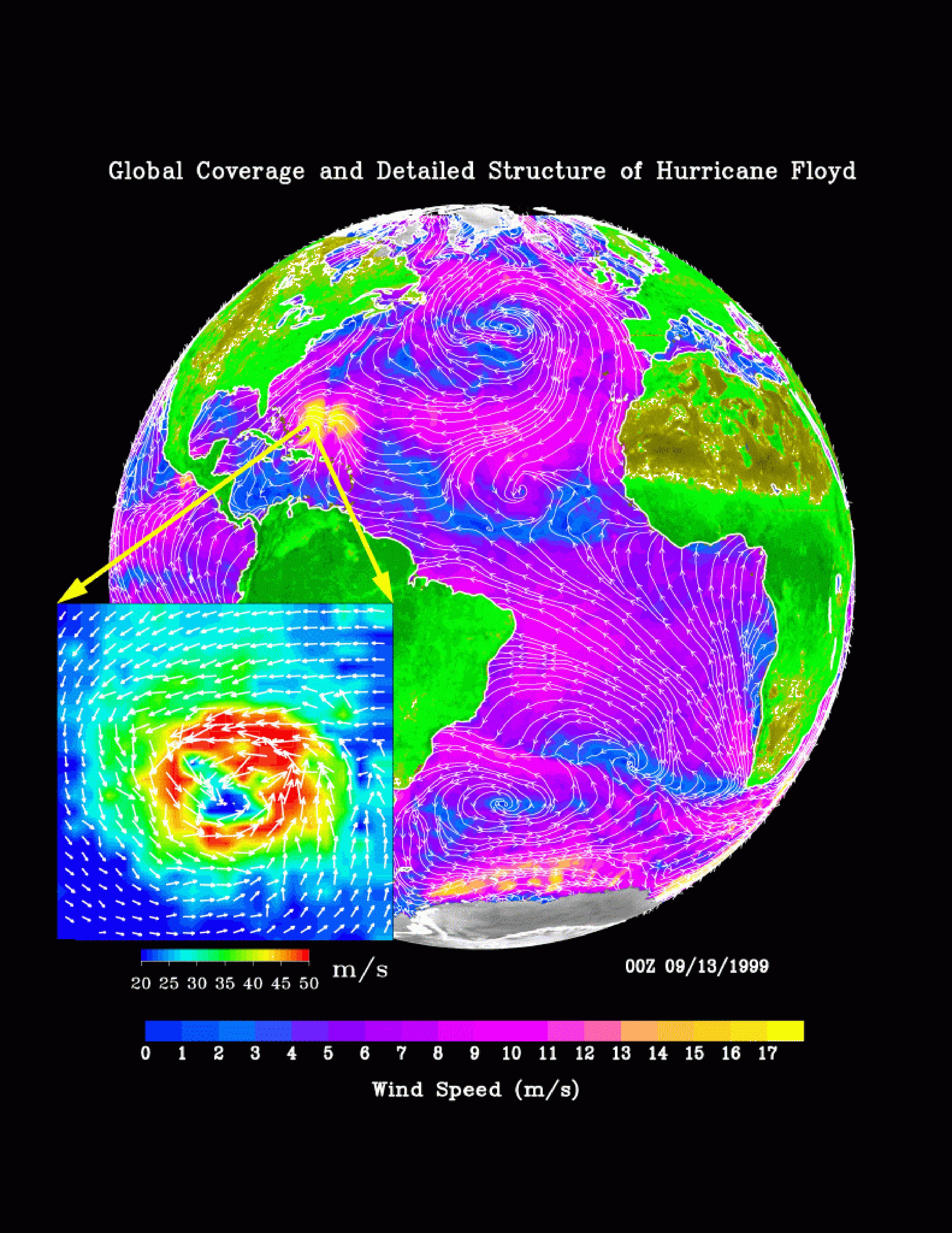
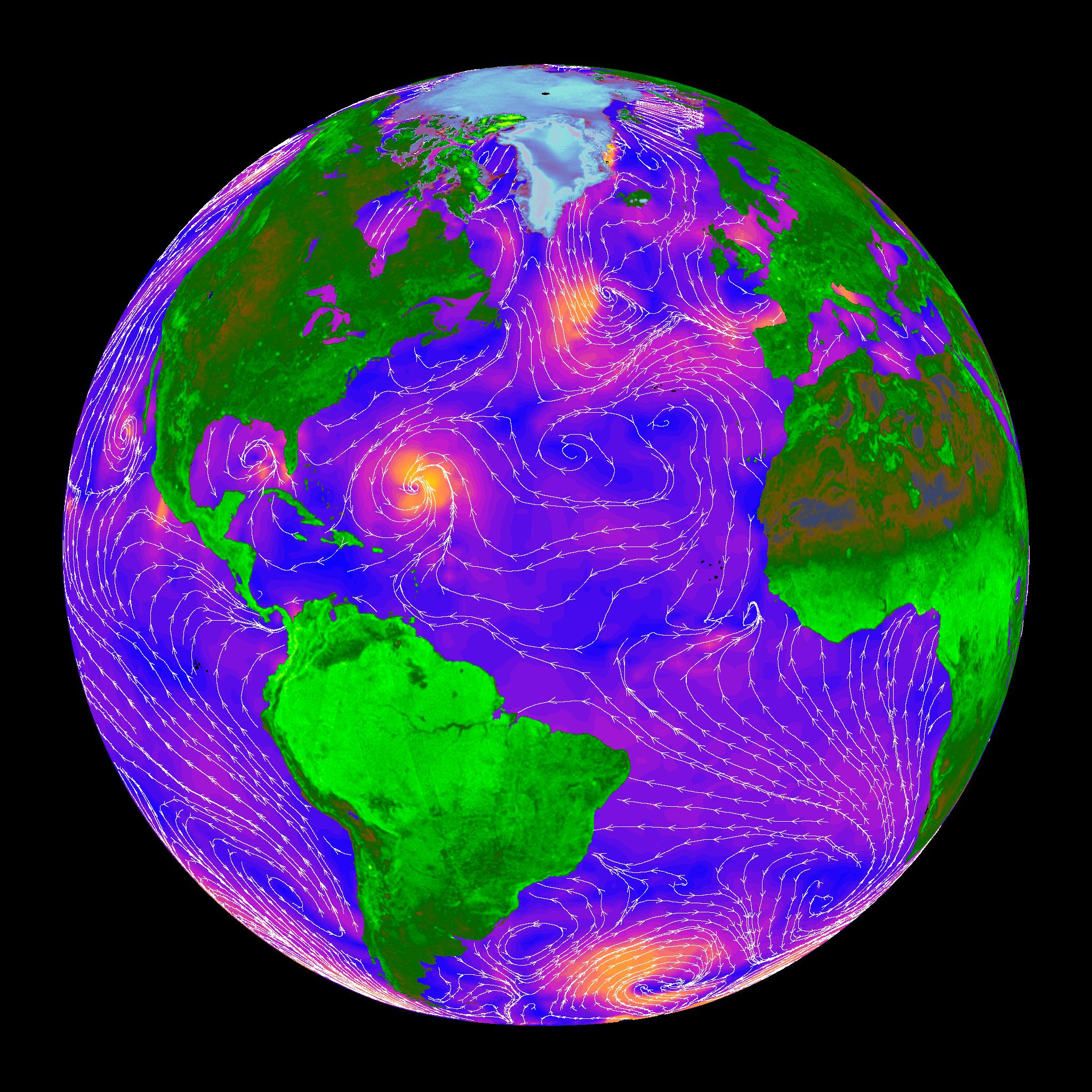
2000-05-07 |
Earth
|
QuikScat
|
SeaWinds Scatterometer
|
3296x4267x3 |

|
-
PIA02455:
-
SeaWinds Global Coverage with Detail of Hurricane Floyd
Full Resolution:
TIFF
(1.921 MB)
JPEG
(1.595 MB)
|
|
|
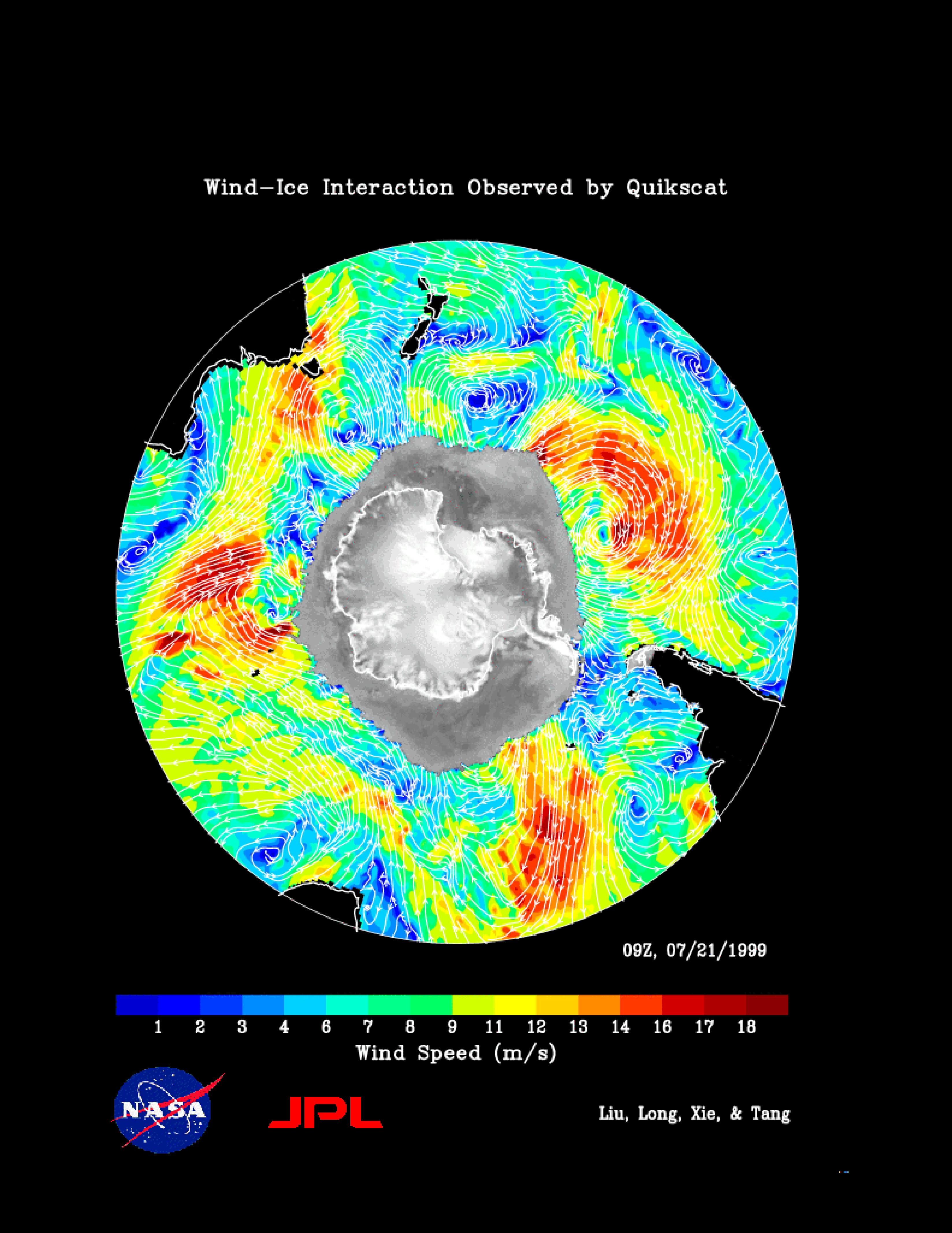
2000-05-07 |
Earth
|
QuikScat
|
SeaWinds Scatterometer
|
3296x4267x3 |
|
-
PIA02456:
-
SeaWinds Wind-Ice Interaction
Full Resolution:
TIFF
(1.974 MB)
JPEG
(1.274 MB)
|
|
|
2000-05-07 |
Earth
|
QuikScat
|
SeaWinds Scatterometer
|
2638x2201x3 |
|
-
PIA02457:
-
SeaWinds - South Georgia Island
Full Resolution:
TIFF
(1.029 MB)
JPEG
(1.018 MB)
|
|
|
2000-05-08 |
Earth
|
QuikScat
|
SeaWinds Scatterometer
|
2048x2048x3 |
|
-
PIA02458:
-
SeaWinds - Oceans, Land, Polar Regions
Full Resolution:
TIFF
(934.2 kB)
JPEG
(679.2 kB)
|
|
|
2000-05-08 |
Earth
|
QuikScat
|
SeaWinds Scatterometer
|
1452x1280x3 |
|
-
PIA02459:
-
SeaWinds - Greenland
Full Resolution:
TIFF
(765.6 kB)
JPEG
(205.7 kB)
|
|
|
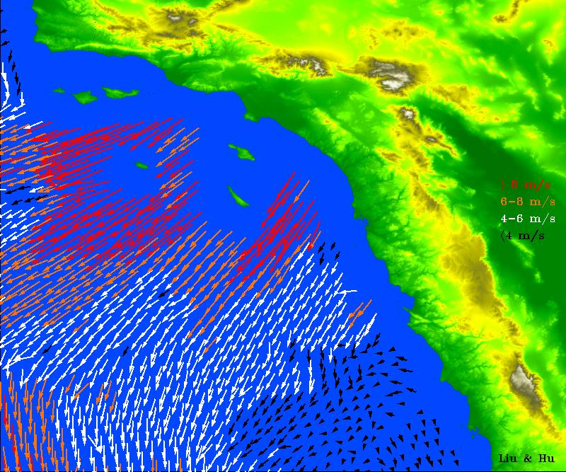
2003-01-08 |
Earth
|
QuikScat
|
SeaWinds Scatterometer
|
800x667x3 |
|
-
PIA03892:
-
Santa Ana Winds Over Los Angeles
Full Resolution:
TIFF
(1.608 MB)
JPEG
(154.9 kB)
|
|
|
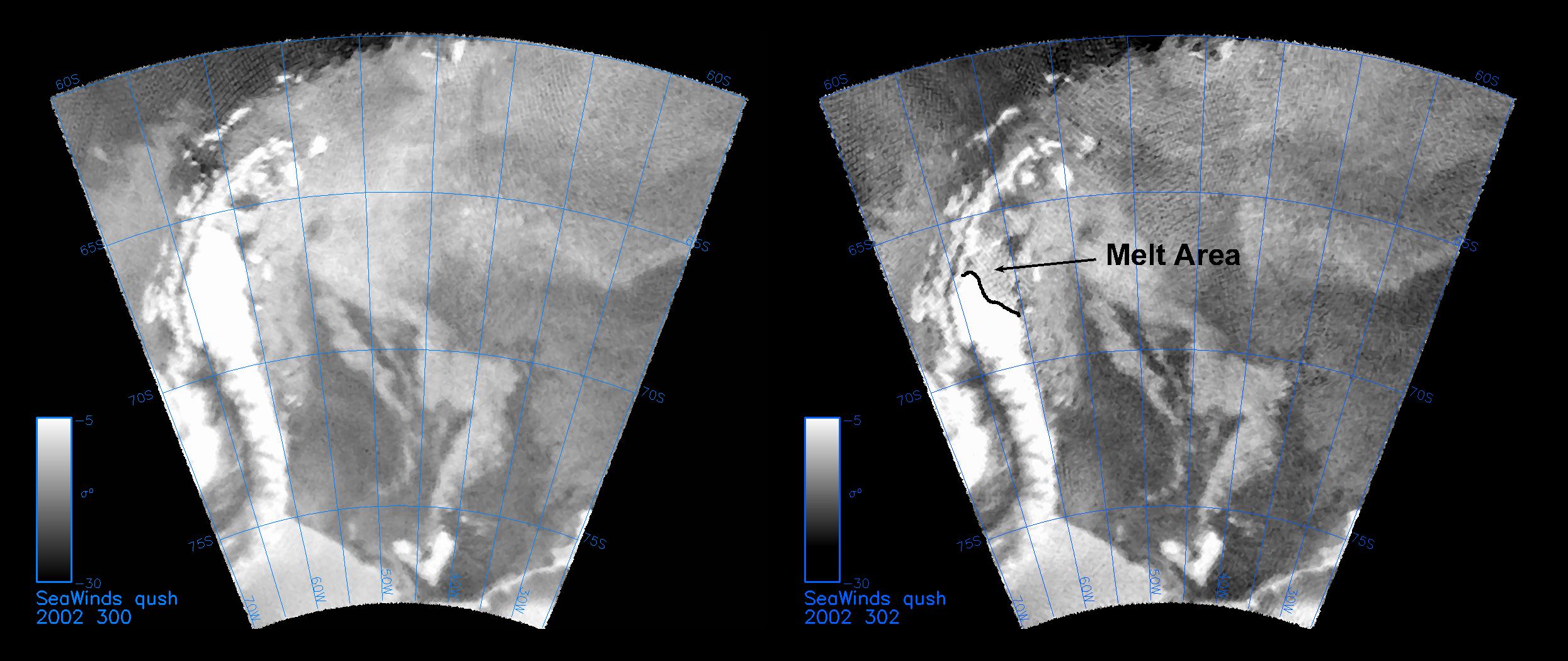
2003-01-13 |
Earth
|
QuikScat
|
SeaWinds Scatterometer
|
2490x1050x3 |
|
-
PIA03894:
-
QuikScat Captures an Early Melt
Full Resolution:
TIFF
(2.168 MB)
JPEG
(289.1 kB)
|
|
|
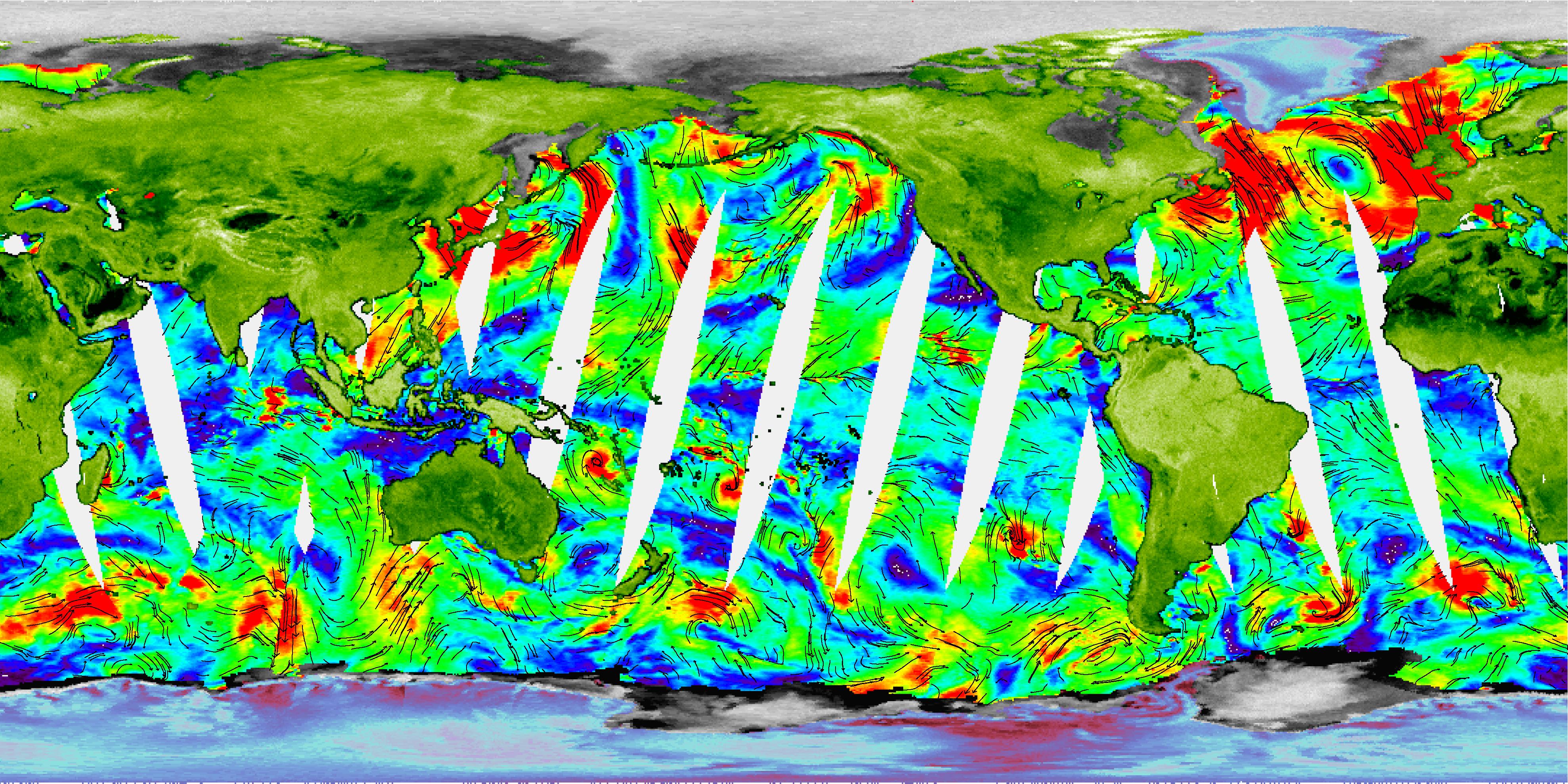
2003-02-24 |
Earth
|
SeaWinds
|
SeaWinds Scatterometer
|
3956x1978x3 |
|
-
PIA03896:
-
NASA's Newest SeaWinds Instrument Breezes Into Operation
Full Resolution:
TIFF
(9.364 MB)
JPEG
(1.724 MB)
|
 Planetary Data System


