Your search criteria found
12731
images
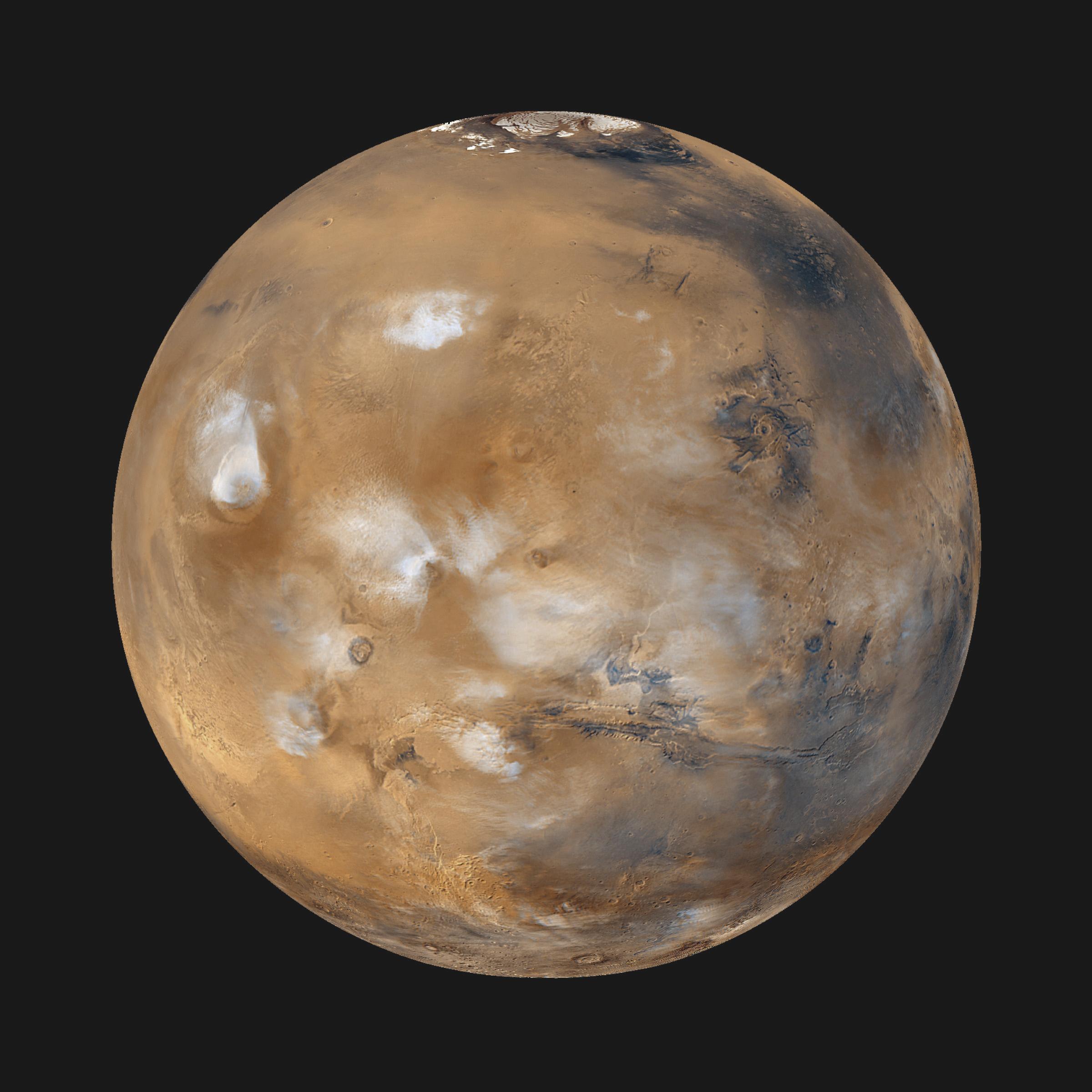
Target is Mars (and available satellites)
Go to PIAxxxxx:
Refine this list of images by:
Target:
Deimos
Mars
Phobos
Mission:
2001 Mars Odyssey
Antarctic Meteorite Location and Mapping Project (AMLAMP)
Dawn
ExoMars
Hubble Space Telescope
InSight
MAVEN
Mariner Mars 1964 (Mariner 4)
Mariner Mars 1969 (Mariner 7)
Mariner Mars 1971 (Mariner 9)
Mars 2020
Mars 2020 Rover
Mars Atmosphere and Volatile Evolution MissioN (MAVEN)
Mars Climate Orbiter
Mars Cube One (MarCO)
Mars Exploration Rover (MER)
Mars Express (MEX)
Mars Global Surveyor (MGS)
Mars Helicopter
Mars Pathfinder (MPF)
Mars Reconnaissance Orbiter (MRO)
Mars Sample Return
Mars Sample Return (MSR)
Mars Science Laboratory (MSL)
Phoenix
Rosetta
Viking
Spacecraft:
2001 Mars Odyssey
Curiosity
Dawn
InSight Mars Lander
Ingenuity
MAVEN
MarCO-B
Mariner 4
Mariner 7
Mariner 9
Mars Climate Orbiter
Mars Express (MEX)
Mars Express (MEX) Orbiter
Mars Global Surveyor Orbiter
Mars Pathfinder Lander
Mars Pathfinder Rover
Mars Reconnaissance Orbiter (MRO)
Mars Sample Return
Mars Science Laboratory (MSL)
NASA's Mars Pathfinder Lander
Opportunity
Perseverance
Philae Lander
Phoenix Lander
Phoenix Mars Lander
Spirit
Viking Lander 1
Viking Lander 2
Viking Orbiter 1
Viking Orbiter 2
Instrument:
Alpha Particle X-ray Spectrometer
Alpha Particle X-ray Spectrometer (MSL)
Atmospheric Structure / Meteorology Instrument
CHIMRA
Camera 1
Camera 2
Chemistry & Mineralogy (CheMin)
Chemistry and Camera (ChemCam)
Comet Infrared and Visible Analyser (CIVA
Compact Reconnaissance Imaging Spectrometer for Mars (CRISM)
Context Camera (CTX)
Deep Space Network
Descent Image Motion Estimation System (DIMES)
Dynamic Albedo of Neutrons
Dynamic Albedo of Neutrons (DAN)
Gamma Ray Spectrometer - Neutron Spectrometer
Gamma Ray Spectrometer Suite
Hazard Avoidance Camera
Hazard Avoidance Camera (M2020)
Hazard Avoidance Camera (MSL)
Heat and Physical Properties Package (HP3)
High Resolution Imaging Science Experiment (HiRISE)
High Resolution Instrument (HRI)
High Resolution Stereo Camera
Imager for Mars Pathfinder
Imaging Ultraviolet Spectrograph
Imaging Ultraviolet Spectrograph (IUVS)
Instrument Context Camera (ICC)
Instrument Deployment Camera (IDC)
Lander Vision System Camera (LCAM)
Magnetometer
Mars Advanced Radar for Subsurface and Ionosphere Sounding (MARSIS)
Mars Advanced Radar for Subsurface and Ionospheric Sounding (MARSIS)
Mars Climate Sounder (MCS)
Mars Color Imager (MARCI)
Mars Descent Imager
Mars Environmental Dynamics Analyzer (MEDA)
Mars Hand Lens Imager (MAHLI)
Mars Horizon Sensor Assembly
Mars Orbiter Camera (MOC)
Mars Orbiter Laser Altimeter
Mars Radiation Experiment
Mastcam
Mastcam-Z
Microscopic Imager
Microscopy Electrochemistry and Conductivity Analyzer (MECA)
Miniature Thermal Emission Spectrometer
Moessbauer Spectrometer
Navigation Camera
Navigation Camera (M2020)
Navigation Camera (MSL)
Neutral Gas and Ion Mass Spectrometer
Neutron Spectrometer
Optical Microscope
Optical Navigation Camera
Panoramic Camera
Planetary Instrument for X-ray Lithochemistry (PIXL)
Radar System
Radiation Assessment Detector (RAD)
Radio Science Subsystem
Robotic Arm
Robotic Arm (MSL)
Robotic Arm Camera (RAC)
Rock Abrasion Tool (RAT)
Rover Cameras
Rover Environmental Monitoring Station (REMS)
Sample Analysis at Mars (SAM)
Scanning Habitable Environments with Raman & Luminescence for Organics and Chemicals (SHERLOC)
Seismic Experiment for Interior Structure (SEIS)
Shallow Subsurface Radar (SHARAD)
Stereo Imager (SSI)
SuperCam
Surface Stereo Imager (SSI)
Thermal Emission Imaging System
Thermal Emission Spectrometer
Thermal and Electrical Conductivity Probe
Thermal and Evolved Gas Analyzer
Trace Gas Orbiter
Visual Imaging Subsystem
Visual Imaging Subsystem - Camera A
Visual Imaging Subsystem - Camera B
Wide Field Planetary Camera 2
Click on an image for detailed information
Click on a column heading to sort in ascending or descending order
My
List
Addition Date
Target
Mission
Instrument
Size
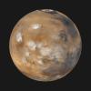
2000-04-07
Mars
Mars Global Surveyor (MGS)
Mars Orbiter Camera (MOC)
1336x1168x3
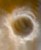
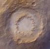
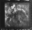
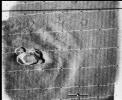
PIA02381:
Cydonia: Wide Angle Color Image
Full Resolution:
TIFF
(4.201 MB)
JPEG
(196.6 kB)
2000-04-07
Mars
Mars Global Surveyor (MGS)
Mars Orbiter Camera (MOC)
1024x5248x1
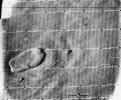
PIA02382:
Cydonia: Two Years Later
Full Resolution:
TIFF
(3.85 MB)
JPEG
(630.9 kB)
2000-04-07
Mars
Mars Global Surveyor (MGS)
Mars Orbiter Camera (MOC)
768x3712x1
PIA02383:
Cydonia: Two Years Later
Full Resolution:
TIFF
(1.834 MB)
JPEG
(472.8 kB)
2000-04-07
Mars
Mars Global Surveyor (MGS)
Mars Orbiter Camera (MOC)
1024x6016x1
PIA02384:
Cydonia: Two Years Later
Full Resolution:
TIFF
(4.324 MB)
JPEG
(742.1 kB)
2000-04-07
Mars
Mars Global Surveyor (MGS)
Mars Orbiter Camera (MOC)
672x9856x1
PIA02385:
Cydonia: Two Years Later
Full Resolution:
TIFF
(5.211 MB)
JPEG
(906.6 kB)
2000-04-07
Mars
Mars Global Surveyor (MGS)
Mars Orbiter Camera (MOC)
512x2432x1
PIA02386:
Cydonia: Two Years Later
Full Resolution:
TIFF
(595.9 kB)
JPEG
(336.8 kB)
2000-04-07
Mars
Mars Global Surveyor (MGS)
Mars Orbiter Camera (MOC)
1024x7680x1
PIA02387:
Cydonia: Two Years Later
Full Resolution:
TIFF
(3.687 MB)
JPEG
(1.371 MB)
2000-04-07
Mars
Mars Global Surveyor (MGS)
Mars Orbiter Camera (MOC)
512x8064x1
PIA02388:
Cydonia: Two Years Later
Full Resolution:
TIFF
(2.664 MB)
JPEG
(439.3 kB)
2000-04-07
Mars
Mars Global Surveyor (MGS)
Mars Orbiter Camera (MOC)
768x5888x1
PIA02389:
Cydonia: Two Years Later
Full Resolution:
TIFF
(2.78 MB)
JPEG
(724.8 kB)
2000-04-11
Mars
Mars Global Surveyor (MGS)
Mars Orbiter Camera (MOC)
2496x972x1
PIA02390:
High-Resolution South Polar Cap Mosaics
Full Resolution:
TIFF
(2.268 MB)
JPEG
(248.1 kB)
2000-04-11
Mars
Mars Global Surveyor (MGS)
Mars Orbiter Camera (MOC)
2493x972x3
PIA02391:
High-Resolution South Polar Cap Mosaics
Full Resolution:
TIFF
(1.84 MB)
JPEG
(284.7 kB)
2000-04-20
Mars
Mars Global Surveyor (MGS)
Mars Orbiter Camera (MOC)
512x15488x3
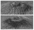
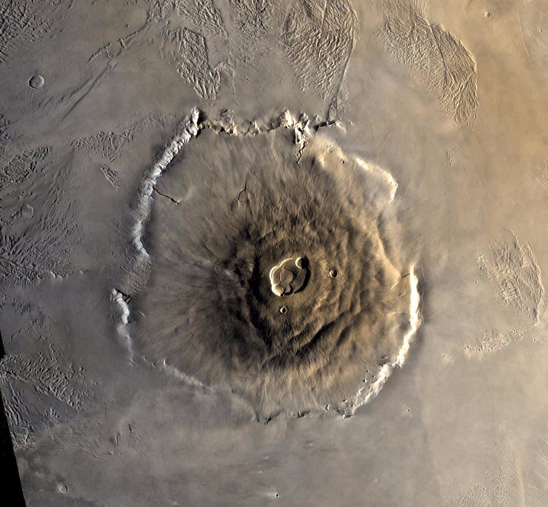
PIA02392:
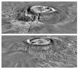
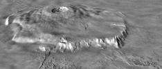
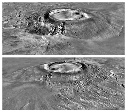
A Traverse Across the Summit of Olympus Mons
Full Resolution:
TIFF
(5.766 MB)
JPEG
(1.069 MB)
2000-04-29
Mars
Mars Global Surveyor (MGS)
Mars Orbiter Camera (MOC)
1690x1234x3
PIA02393:
South Polar Cap, Summer 2000
Full Resolution:
TIFF
(5.016 MB)
JPEG
(142.7 kB)
2000-04-29
Mars
Mars Global Surveyor (MGS)
Mars Orbiter Camera (MOC)
528x655x3
PIA02394:
The Frosty Rims of Lomonosov Crater in Winter
Full Resolution:
TIFF
(1.022 MB)
JPEG
(21.97 kB)
2000-05-22
Mars
Mars Global Surveyor (MGS)
Mars Orbiter Camera (MOC)
800x7000x3
PIA02395:
A Valley in the Libya Montes
Full Resolution:
TIFF
(10.34 MB)
JPEG
(706.3 kB)
2000-05-22
Mars
Mars Global Surveyor (MGS)
Mars Orbiter Camera (MOC)
2174x987x3
PIA02396:
A Regional View of the Libya Montes
Full Resolution:
TIFF
(4.827 MB)
JPEG
(153.5 kB)
2000-05-22
Mars
Mars Global Surveyor (MGS)
Mars Orbiter Camera (MOC)
800x7000x1
PIA02397:
The Plains of Central Terra Meridiani
Full Resolution:
TIFF
(4.047 MB)
JPEG
(836.7 kB)
2000-05-22
Mars
Mars Global Surveyor (MGS)
Mars Orbiter Camera (MOC)
512x1381x1
PIA02398:
Layers and a Dust Devil in Melas Chasma
Full Resolution:
TIFF
(692.5 kB)
JPEG
(191.1 kB)
1999-09-08
Mars
Mars Pathfinder (MPF)
Imager for Mars Pathfinder
7238x3135x3
PIA02405:
Twin Peaks in Super Resolution - Left Eye
Full Resolution:
TIFF
(65.93 MB)
JPEG
(2.307 MB)
1999-09-08
Mars
Mars Pathfinder (MPF)
Imager for Mars Pathfinder
7296x3135x3
PIA02406:
Twin Peaks in Super Resolution - Right Eye
Full Resolution:
TIFF
(70.57 MB)
JPEG
(2.584 MB)
2000-11-03
Mars
Galileo
Mars Global Surveyor (MGS)
Mars Orbiter Camera (MOC)
Solid-State Imaging
2800x1824x3
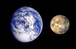
PIA02570:
Earth Mars Comparison
Full Resolution:
TIFF
(5.946 MB)
JPEG
(269.4 kB)
2000-09-05
Mars
Mars Pathfinder (MPF)
Imager for Mars Pathfinder
4096x4096x3
PIA02652:
Mars Pathfinder "Filled Donut" Mosaic
Full Resolution:
TIFF
(43.45 MB)
JPEG
(1.781 MB)
2000-09-08
Mars
Mars Global Surveyor (MGS)
Mars Orbiter Camera (MOC)
2400x2400x3
PIA02653:
Mars Daily Global Image from April 1999
Full Resolution:
TIFF
(9.058 MB)
JPEG
(341.5 kB)
2000-05-22
Mars
Mars Global Surveyor (MGS)
Mars Orbiter Camera (MOC)
1368x1319x3
PIA02800:
The Martian North Polar Cap in Summer
Full Resolution:
TIFF
(4.691 MB)
JPEG
(162 kB)
2000-05-22
Mars
Mars Global Surveyor (MGS)
Mars Orbiter Camera (MOC)
836x3919x1
PIA02801:
Ridged Terrain on the Floor Melas Chasma
Full Resolution:
TIFF
(3.129 MB)
JPEG
(558.5 kB)
2000-05-22
Mars
Mars Global Surveyor (MGS)
Mars Orbiter Camera (MOC)
512x1837x1
PIA02802:
Hot-Cross-Bun' on the Northern Plains
Full Resolution:
TIFF
(841.6 kB)
JPEG
(166 kB)
2000-09-07
Mars
Mars Global Surveyor (MGS)
MOLA
524x462x1
PIA02803:
Major Martian Volcanoes from MOLA - Alba Patera
Full Resolution:
TIFF
(239.9 kB)
JPEG
(52.87 kB)
2000-09-07
Mars
Mars Global Surveyor (MGS)
MOLA
524x462x1
PIA02804:
Major Martian Volcanoes from MOLA - Arsia Mons
Full Resolution:
TIFF
(231.1 kB)
JPEG
(52.9 kB)
2000-09-07
Mars
Mars Global Surveyor (MGS)
MOLA
2100x900x1
PIA02805:
Major Martian Volcanoes from MOLA - Olympus Mons
Full Resolution:
TIFF
(1.538 MB)
JPEG
(270.9 kB)
2000-09-07
Mars
Mars Global Surveyor (MGS)
MOLA
2100x900x1
PIA02806:
Major Martian Volcanoes from MOLA - Olympus Mons
Full Resolution:
TIFF
(1.451 MB)
JPEG
(205 kB)
2000-09-12
Mars
Mars Global Surveyor (MGS)
Mars Orbiter Camera (MOC)
885x1369x3
PIA02807:
Recent Mars and Earth Dust Storms Compared
Full Resolution:
TIFF
(3.507 MB)
JPEG
(164.4 kB)
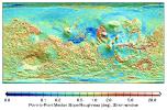
2000-10-06
Mars
Mars Global Surveyor (MGS)
MOLA
669x441x3
PIA02808:
MOLA Global Roughness Map of Mars
Full Resolution:
TIFF
(248.3 kB)
JPEG
(114.3 kB)
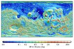
2000-10-06
Mars
Mars Global Surveyor (MGS)
MOLA
669x441x3
PIA02809:
MOLA Global Map of Surface Gradients on Mars
Full Resolution:
TIFF
(254.8 kB)
JPEG
(128.2 kB)
2000-10-06
Mars
Mars Global Surveyor (MGS)
Mars Orbiter Camera (MOC)
1637x1062x3
PIA02810:
Looking Out Across Dao, Niger, and Harmakhis Valles
Full Resolution:
TIFF
(4.302 MB)
JPEG
(171.7 kB)
2000-10-16
Mars
Mars Global Surveyor (MGS)
Mars Orbiter Camera (MOC)
2068x2512x3
PIA02811:
Frosted Southern Plains in Early Spring
Full Resolution:
TIFF
(11.42 MB)
JPEG
(234.1 kB)
2000-10-16
Mars
Mars Global Surveyor (MGS)
Mars Orbiter Camera (MOC)
451x2375x3
PIA02812:
Spring Thaw in Northwestern Planum Australe
Full Resolution:
TIFF
(2.155 MB)
JPEG
(75.1 kB)
2000-10-16
Mars
Mars Global Surveyor (MGS)
Mars Orbiter Camera (MOC)
672x2603x1
PIA02813:
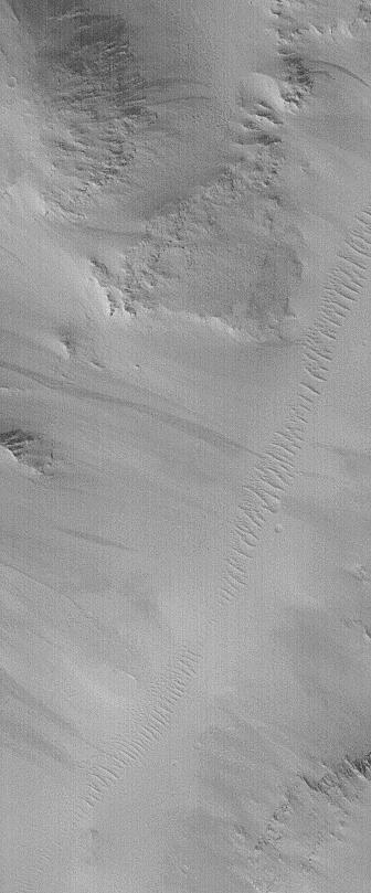
Groovy Terrain in Mangala Valles
Full Resolution:
TIFF
(1.84 MB)
JPEG
(368 kB)
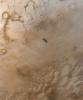
2000-10-16
Mars
Mars Global Surveyor (MGS)
Mars Orbiter Camera (MOC)
672x1242x1
PIA02814:
Channels and Gullies in Nirgal Vallis--The Work of Water?
Full Resolution:
TIFF
(732 kB)
JPEG
(172.3 kB)
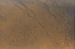
2000-10-16
Mars
Mars Global Surveyor (MGS)
Mars Orbiter Camera (MOC)
1010x1010x3
PIA02815:
South Polar Terrain in 3-D
Full Resolution:
TIFF
(3.018 MB)
JPEG
(209.5 kB)
2001-01-17
Mars
Mars Global Surveyor (MGS)
Thermal Emission Spectrometer
4000x2769x3
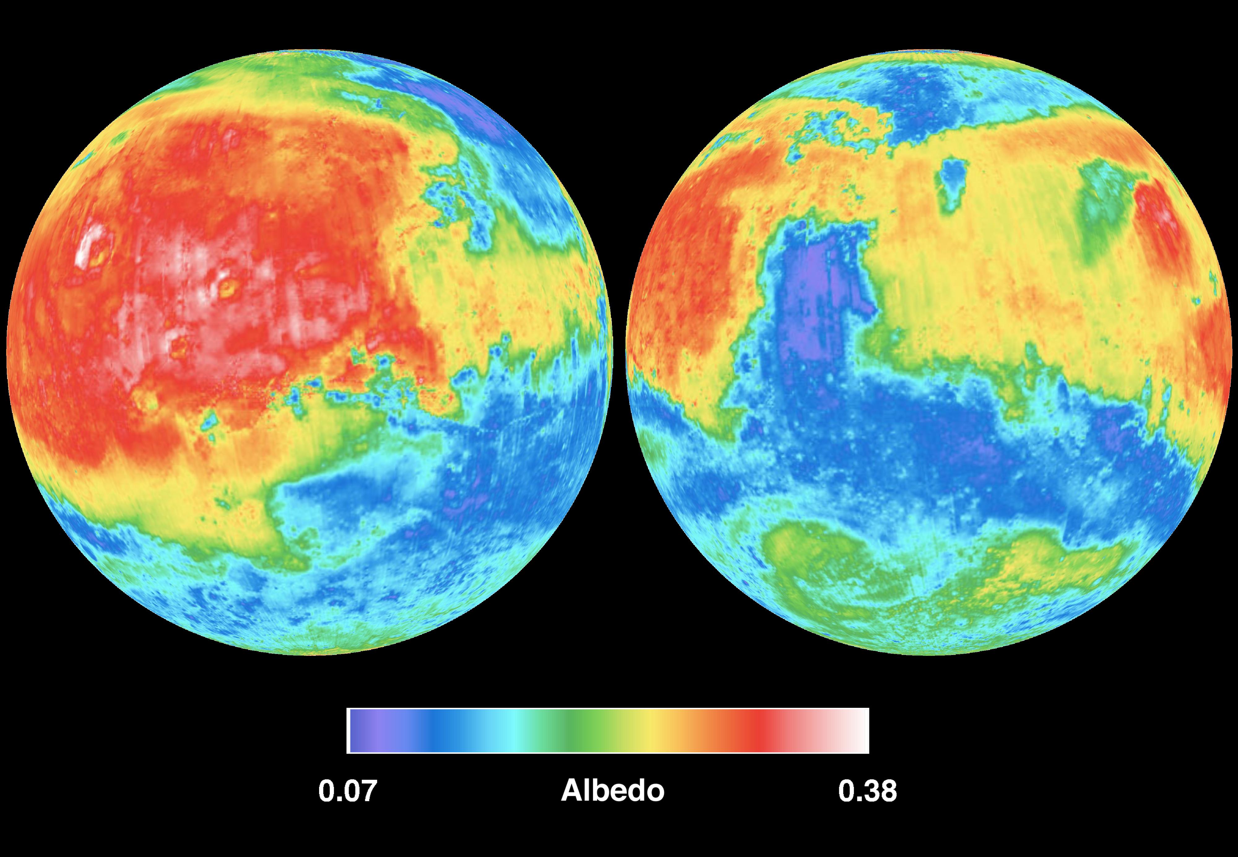
PIA02816:
Mars Albedo
Full Resolution:
TIFF
(20.01 MB)
JPEG
(715.4 kB)
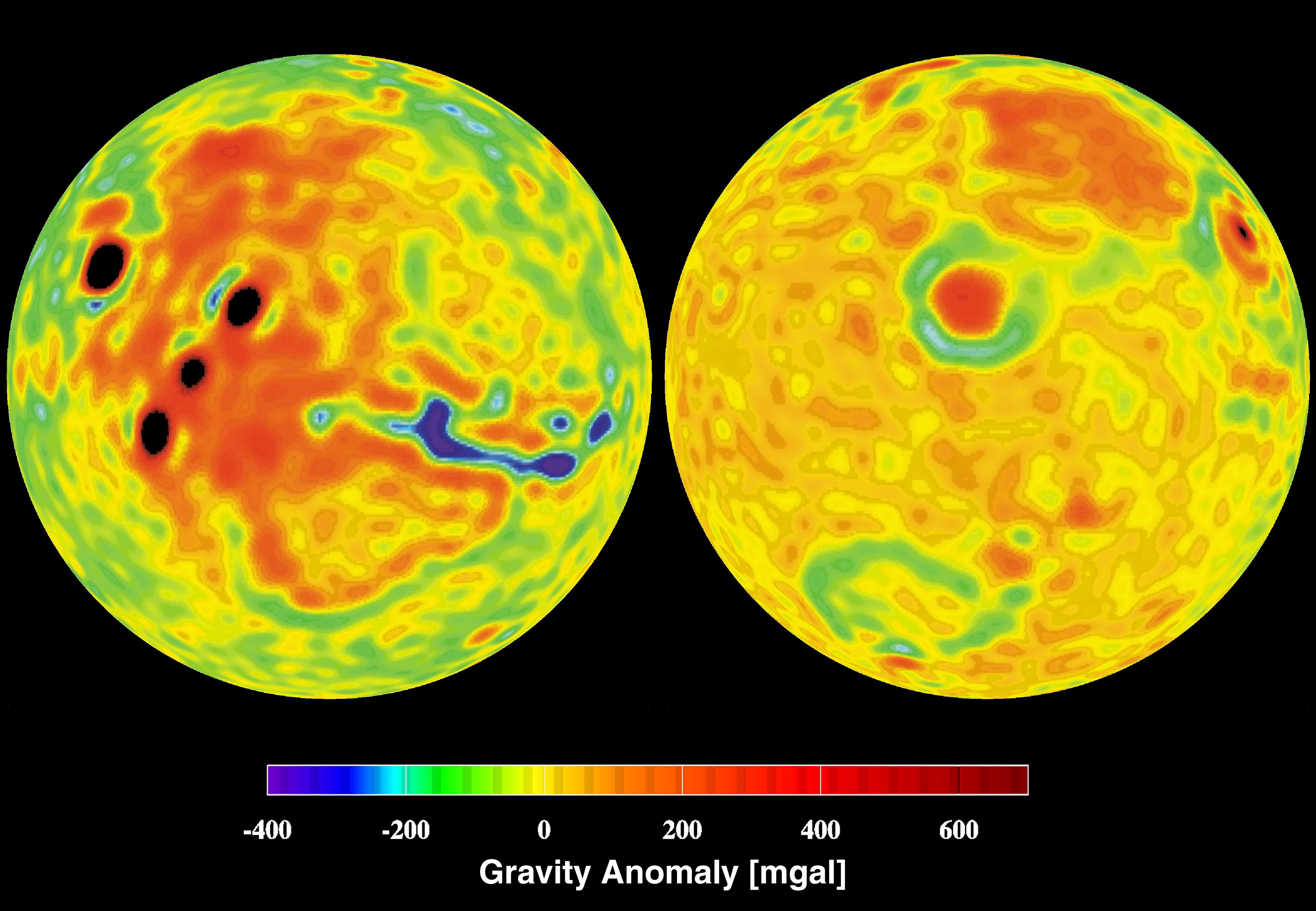
2001-01-17
Mars
Mars Global Surveyor (MGS)
4000x2769x3
PIA02817:
Mars Gravity Anomoly Map
Full Resolution:
TIFF
(16.6 MB)
JPEG
(619.8 kB)
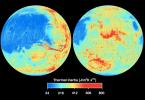
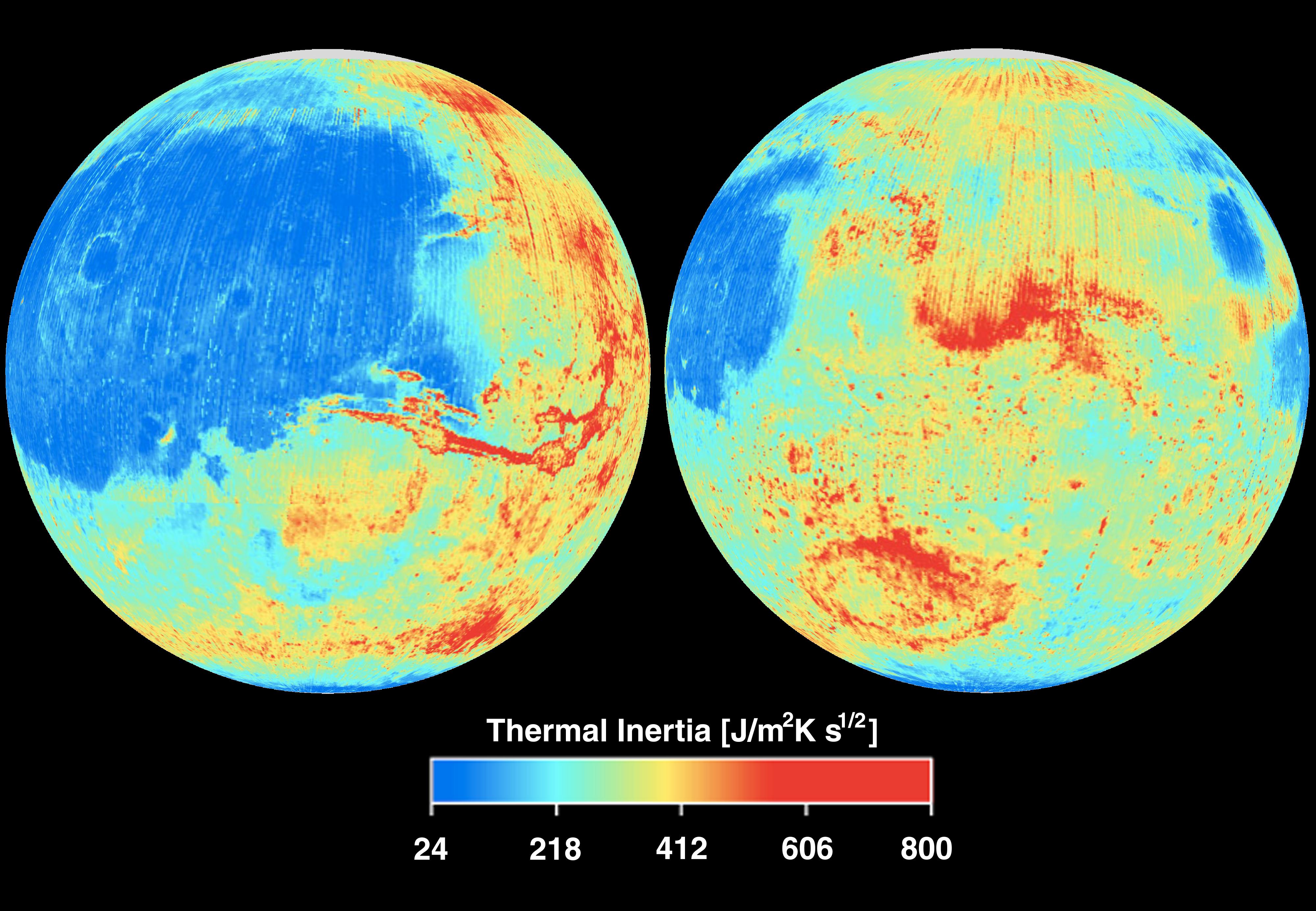
2001-01-17
Mars
Mars Global Surveyor (MGS)
Thermal Emission Spectrometer
4000x2769x3
PIA02818:
Mars Thermal Inertia
Full Resolution:
TIFF
(21.3 MB)
JPEG
(883.2 kB)
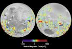
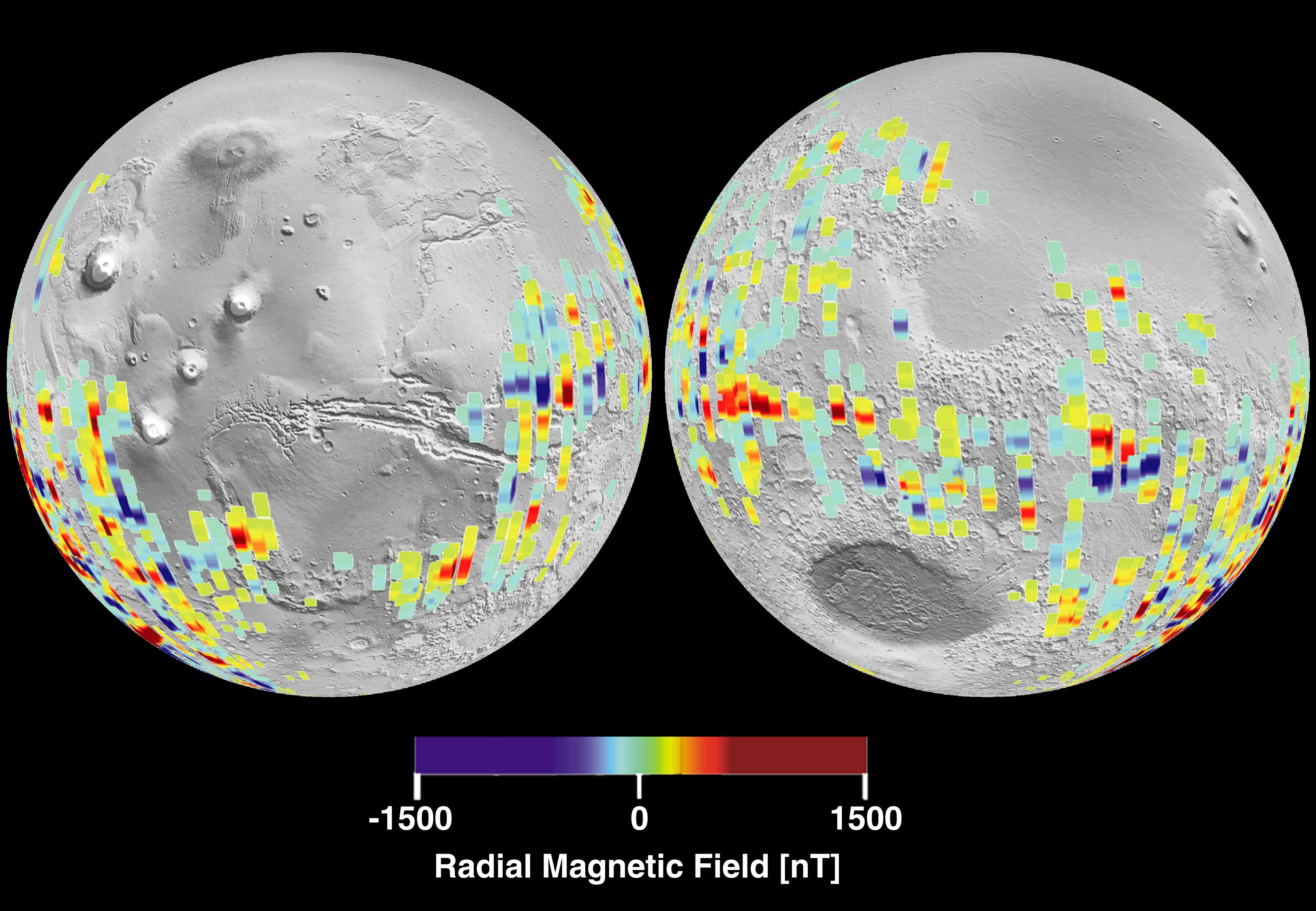
2001-01-17
Mars
Mars Global Surveyor (MGS)
Magnetometer
4000x2769x3
PIA02819:
Mars Crustal Magnetic Field Remnants
Full Resolution:
TIFF
(11.85 MB)
JPEG
(959.2 kB)
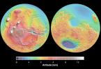
2001-01-17
Mars
Mars Global Surveyor (MGS)
MOLA
4000x2769x3
PIA02820:
Mars Topography
Full Resolution:
TIFF
(21.78 MB)
JPEG
(1.109 MB)
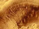
2000-11-01
Mars
Mars Global Surveyor (MGS)
Mars Orbiter Camera (MOC)
3047x2279x3
PIA02824:
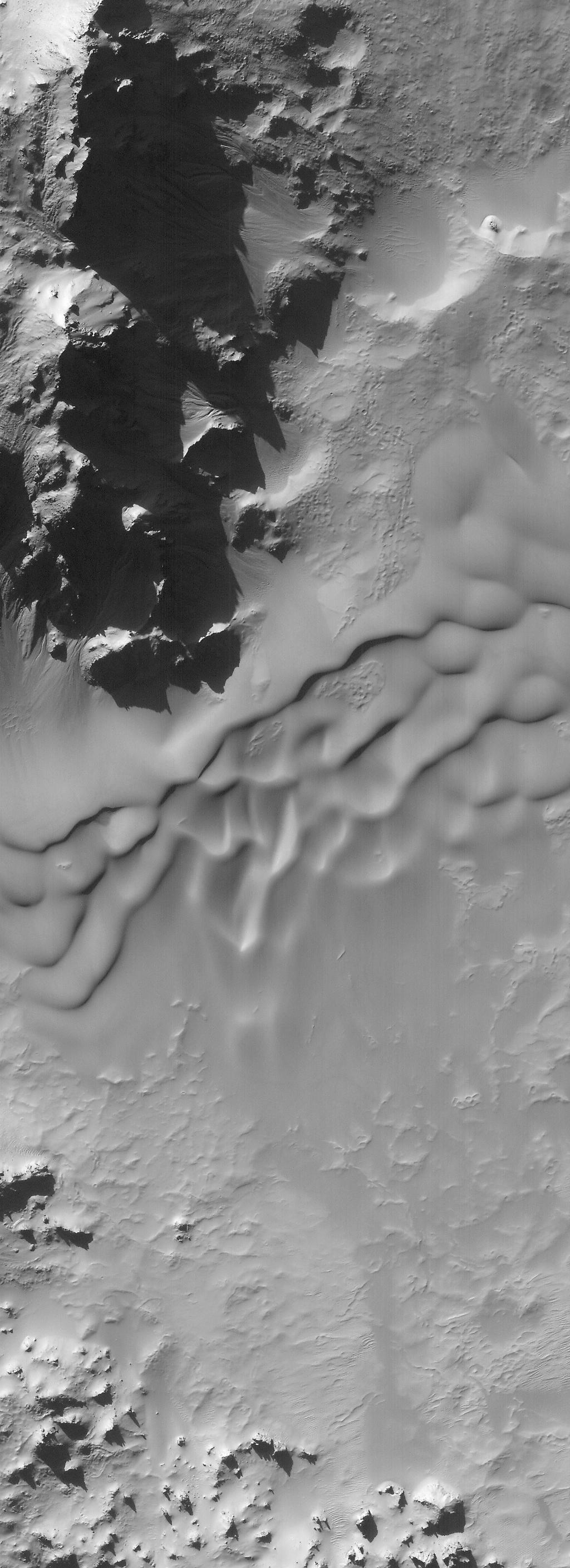
Evidence for Recent Liquid Water on Mars: Channeled Aprons in a Small Crater within Newton Crater
Full Resolution:
TIFF
(5.505 MB)
JPEG
(1.132 MB)
2000-11-11
Mars
Mars Global Surveyor (MGS)
Mars Orbiter Camera (MOC)
1340x510x3
PIA02827:
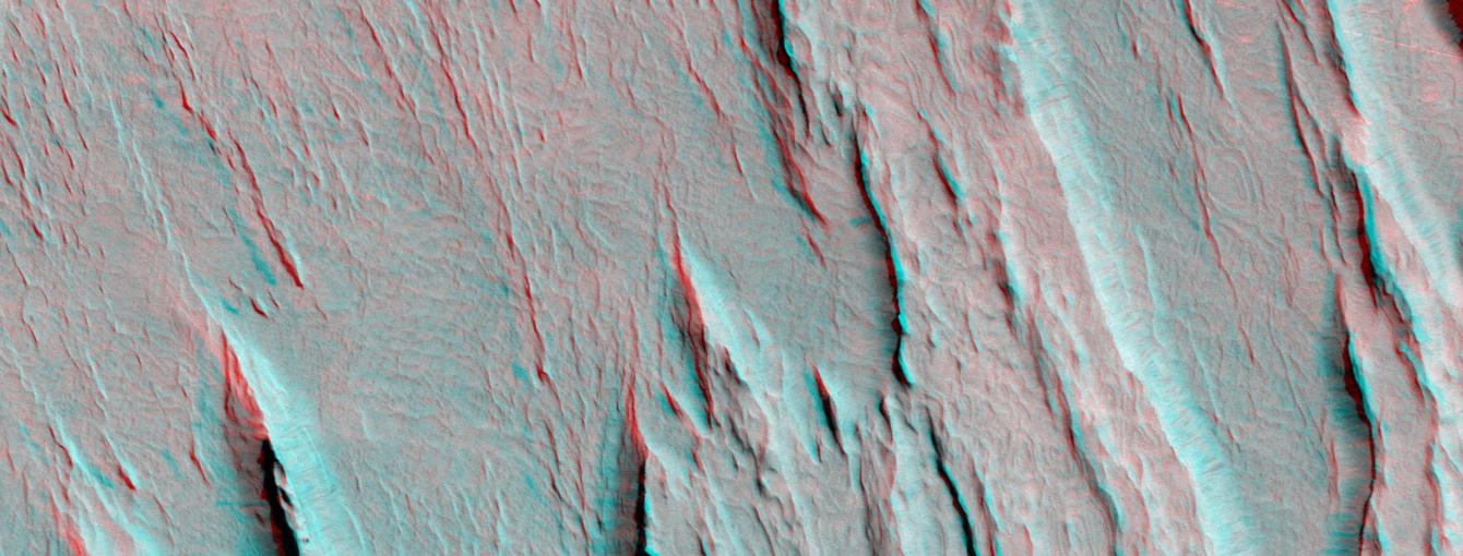
A 3-D Look at Wind-Sculpted Ridges in Aeolis
Full Resolution:
TIFF
(2.174 MB)
JPEG
(118.7 kB)
2000-11-18
Mars
Mars Global Surveyor (MGS)
Mars Orbiter Camera (MOC)
1024x2816x1
PIA02828:
Autumn Afternoon in Hale Crater
Full Resolution:
TIFF
(2.212 MB)
JPEG
(333.9 kB)
2000-11-27
Mars
Mars Global Surveyor (MGS)
Mars Orbiter Camera (MOC)
797x1069x3
PIA02833:
The Frosted Craters of Northern Spring and Southern Autumn - Lomonosov Crater
Full Resolution:
TIFF
(1.51 MB)
JPEG
(38.46 kB)
2000-11-27
Mars
Mars Global Surveyor (MGS)
Mars Orbiter Camera (MOC)
768x829x3
PIA02834:
The Frosted Craters of Northern Spring and Southern Autumn - Unnamed Crater
Full Resolution:
TIFF
(1.635 MB)
JPEG
(49.11 kB)
2000-11-27
Mars
Mars Global Surveyor (MGS)
Mars Orbiter Camera (MOC)
393x395x3
PIA02835:
The Frosted Craters of Northern Spring and Southern Autumn - Barnard Crater
Full Resolution:
TIFF
(326.4 kB)
JPEG
(10.34 kB)
2000-11-27
Mars
Mars Global Surveyor (MGS)
Mars Orbiter Camera (MOC)
893x891x3
PIA02836:
The Frosted Craters of Northern Spring and Southern Autumn - Lowell Crater
Full Resolution:
TIFF
(2.421 MB)
JPEG
(74.91 kB)
2000-12-04
Mars
Mars Global Surveyor (MGS)
Mars Orbiter Camera (MOC)
1024x1322x3
PIA02839:
Layered Outcrops of Far West Candor Chasma
Full Resolution:
TIFF
(4.395 MB)
JPEG
(241.8 kB)
2000-12-04
Mars
Mars Global Surveyor (MGS)
Mars Orbiter Camera (MOC)
512x875x3
PIA02840:
Layered Material in West Arabia Terra Crater
Full Resolution:
TIFF
(1.261 MB)
JPEG
(135.4 kB)
2000-12-05
Mars
Mars Global Surveyor (MGS)
Mars Orbiter Camera (MOC)
512x875x3
PIA02841:
Layered Material in West Arabia Terra Crater
Full Resolution:
TIFF
(1.283 MB)
JPEG
(114 kB)
2000-12-05
Mars
Mars Global Surveyor (MGS)
Mars Orbiter Camera (MOC)
512x875x3
PIA02842:
Layered Material in West Arabia Terra Crater
Full Resolution:
TIFF
(1.12 MB)
JPEG
(111.5 kB)
2000-12-05
Mars
Mars Global Surveyor (MGS)
Mars Orbiter Camera (MOC)
835x7367x1
PIA02843:
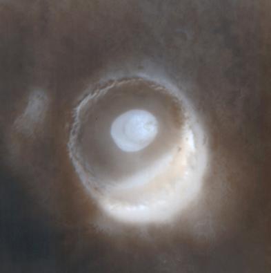
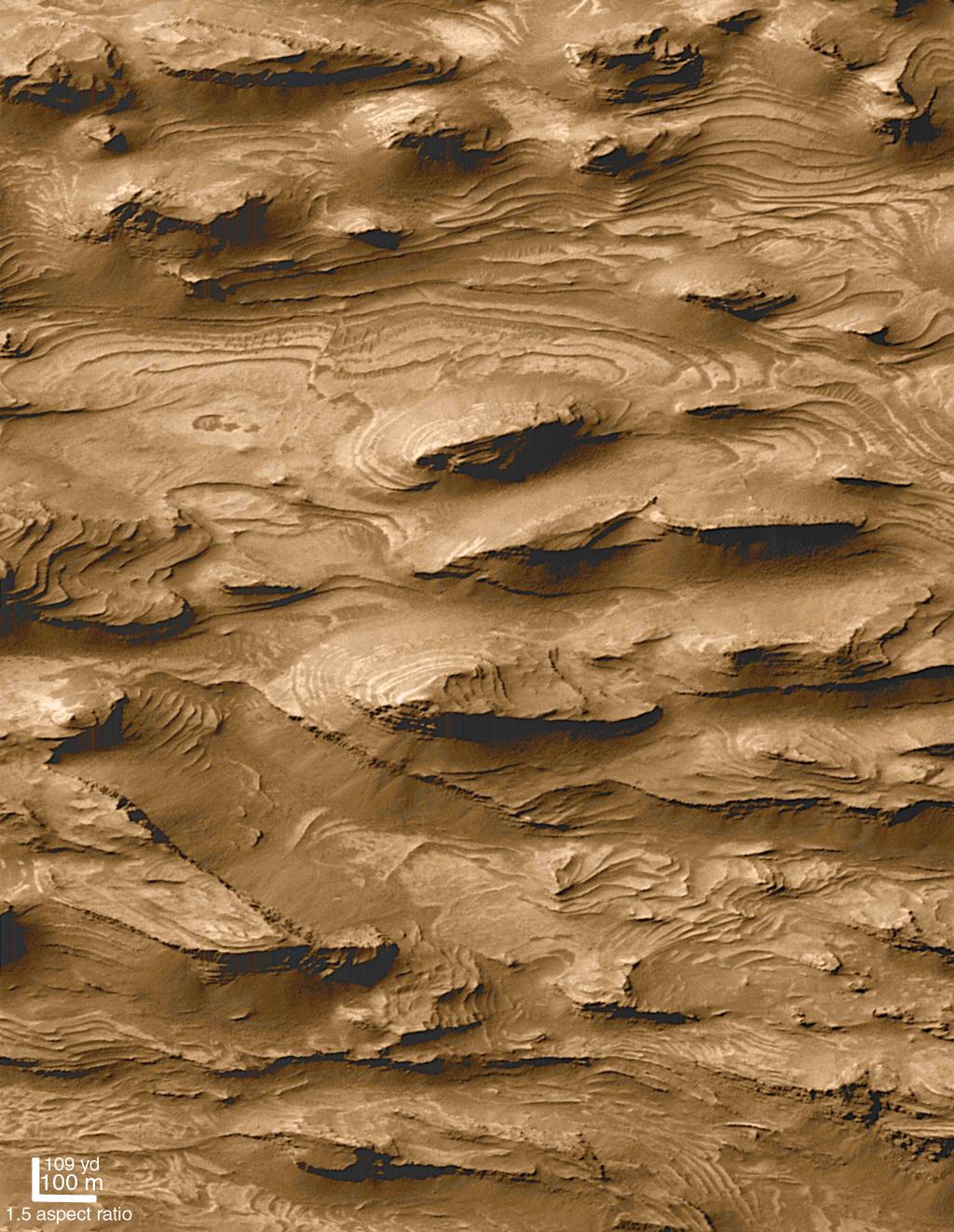
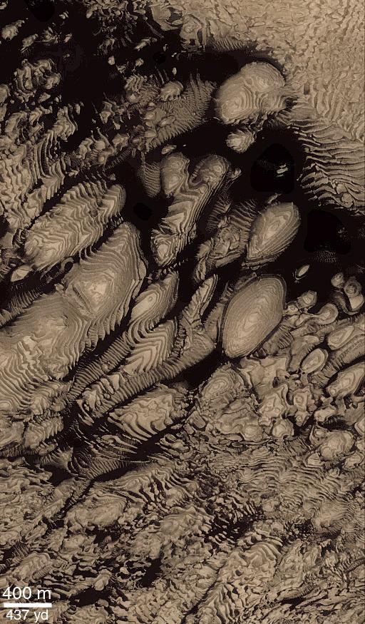
Sediment History Preserved in Gale Crater Central Mound
Full Resolution:
TIFF
(5.051 MB)
JPEG
(734.4 kB)
2000-12-05
Mars
Mars Global Surveyor (MGS)
Mars Orbiter Camera (MOC)
781x1073x1
PIA02844:
Sediment History Preserved in Gale Crater Central Mound
Full Resolution:
TIFF
(845.7 kB)
JPEG
(140.4 kB)
2000-12-05
Mars
Mars Global Surveyor (MGS)
Mars Orbiter Camera (MOC)
780x1173x1
PIA02845:
Sediment History Preserved in Gale Crater Central Mound
Full Resolution:
TIFF
(874.7 kB)
JPEG
(139.1 kB)
2000-12-05
Mars
Mars Global Surveyor (MGS)
Mars Orbiter Camera (MOC)
836x916x3
PIA02846:
Sediment History Preserved in Gale Crater Central Mound
Full Resolution:
TIFF
(2.273 MB)
JPEG
(155.6 kB)
2000-12-05
Mars
Mars Global Surveyor (MGS)
Mars Orbiter Camera (MOC)
512x1642x1
PIA02847:
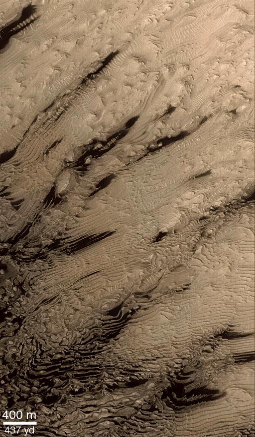
Light-toned Layered Outcrops in Valles Marineris Walls
Full Resolution:
TIFF
(848.8 kB)
JPEG
(172.5 kB)
2000-12-05
Mars
Mars Global Surveyor (MGS)
Mars Orbiter Camera (MOC)
836x3158x1
PIA02848:
'White Rock' of Pollack Crater
Full Resolution:
TIFF
(2.816 MB)
JPEG
(603.9 kB)
2000-12-05
Mars
Mars Global Surveyor (MGS)
Mars Orbiter Camera (MOC)
518x894x1
PIA02849:
'White Rock' of Pollack Crater
Full Resolution:
TIFF
(453.8 kB)
JPEG
(96.46 kB)
2001-01-13
Mars
Mars Global Surveyor (MGS)
Mars Orbiter Camera (MOC)
2003x601x1
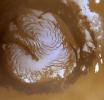
PIA02897:
North Polar Cap Layers and Frost on the First Day of Summer
Full Resolution:
TIFF
(886.7 kB)
JPEG
(209.9 kB)
2001-01-13
Mars
Mars Global Surveyor (MGS)
Mars Orbiter Camera (MOC)
2003x601x1
PIA02898:
North Polar Ice Cap Surface
Full Resolution:
TIFF
(1.247 MB)
JPEG
(404.5 kB)
2001-01-13
Mars
Mars Global Surveyor (MGS)
Mars Orbiter Camera (MOC)
2003x601x1
PIA02899:
Complex exposures of North Polar layered material
Full Resolution:
TIFF
(1.13 MB)
JPEG
(239 kB)
2000-11-04
Mars
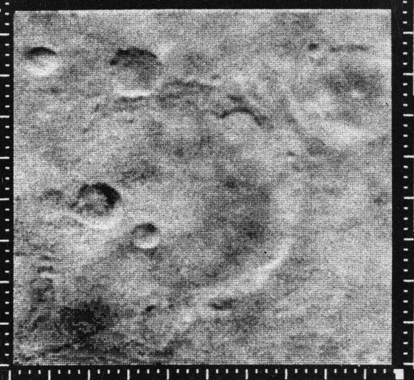
Mariner Mars 1964 (Mariner 4)
600x550x1
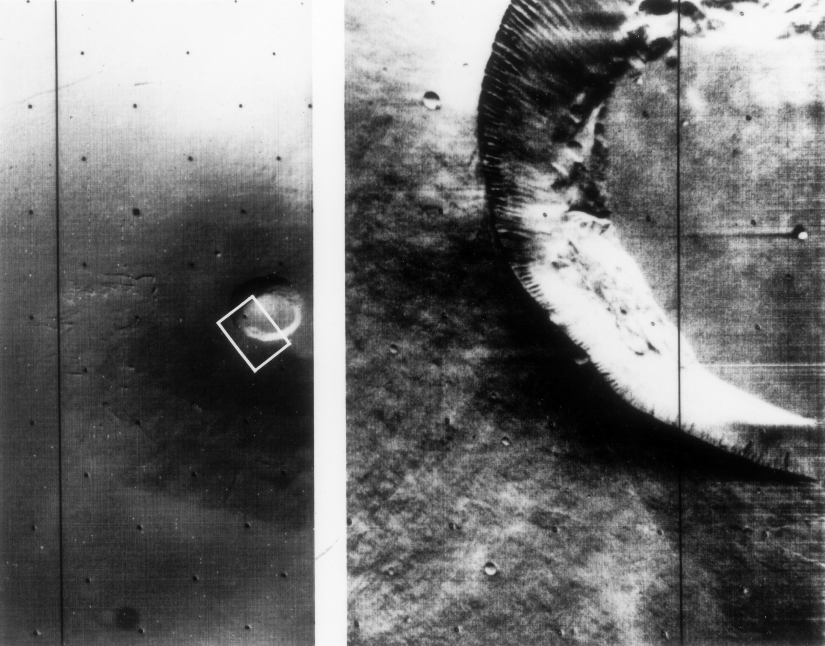
PIA02979:
Mariner Crater
Full Resolution:
TIFF
(405.6 kB)
JPEG
(102.7 kB)
2000-11-04
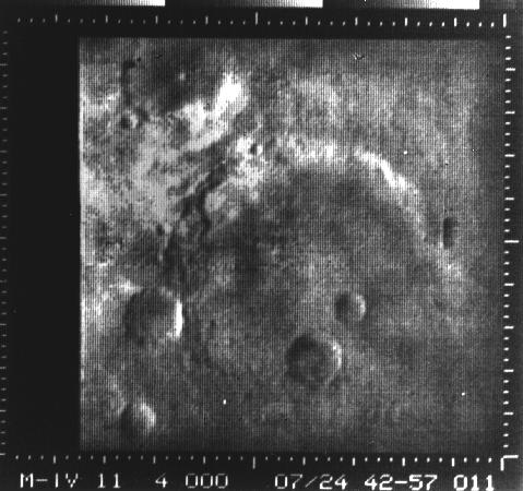
Mars
Mariner Mars 1964 (Mariner 4)
479x450x1
PIA02980:
Atlantis Region on Mars - Mariner 4
Full Resolution:
TIFF
(180.5 kB)
JPEG
(43.25 kB)
2000-11-04
Mars
Mariner Mars 1969 (Mariner 7)
640x360x1
PIA02981:
Mars full disk approach view from Mariner 7
Full Resolution:
TIFF
(108.3 kB)
JPEG
(29.53 kB)
2000-11-04
Mars
Viking
1124x1040x3
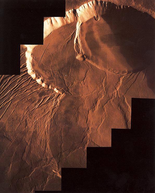
PIA02982:
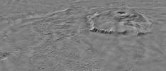
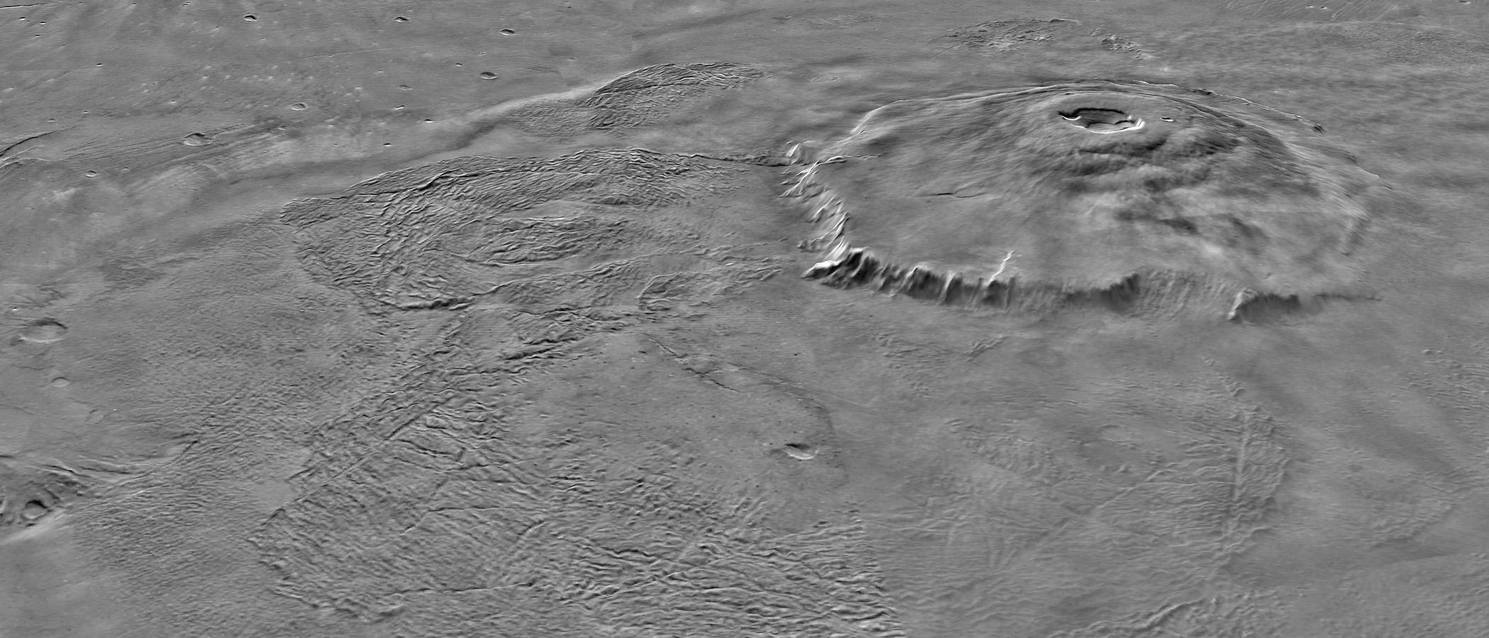
Color Mosaic of Olympus Mons
Full Resolution:
TIFF
(3.086 MB)
JPEG
(192.7 kB)
2000-11-04
Mars
Mariner Mars 1971 (Mariner 9)
2701x2116x1
PIA02983:
Mariner 9 views of shield volcano
Full Resolution:
TIFF
(4.705 MB)
JPEG
(516.3 kB)
2000-11-04
Mars
Viking
595x742x3
PIA02984:
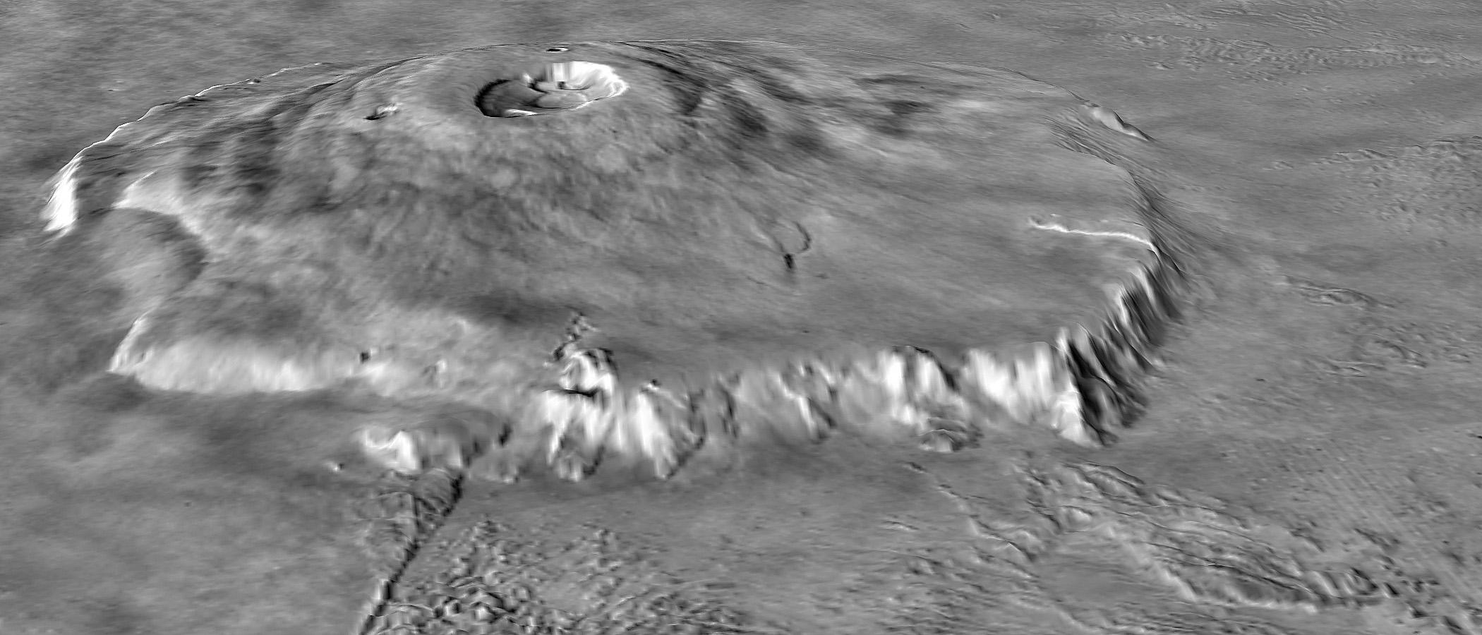
Photomosiac of Olympus Mons
Full Resolution:
TIFF
(1.244 MB)
JPEG
(94.69 kB)
2000-11-04
Mars
Viking
1169x1055x1
PIA02985:
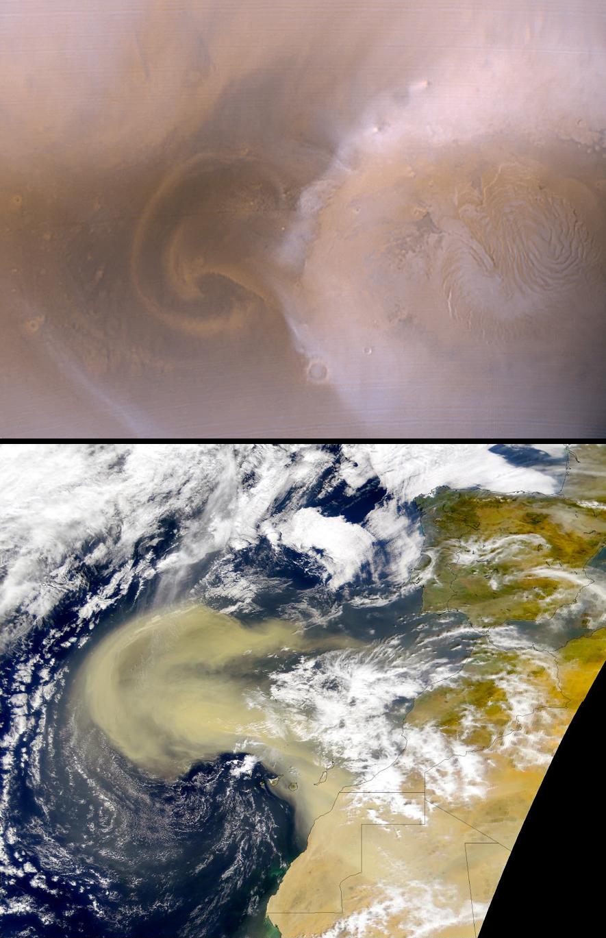
Dust storm in the Thaumasia region of Mars
Full Resolution:
TIFF
(384.9 kB)
JPEG
(152.2 kB)
2000-11-07
Mars
Viking
600x600x3
PIA02987:
Photomosiac of the Tharsis Region
Full Resolution:
TIFF
(827.6 kB)
JPEG
(47.71 kB)
2000-11-22
Mars
Mariner Mars 1971 (Mariner 9)
4288x6265x1
PIA02989:
South Polar Cap of Mars as seen by Mariners 9 & 7
Full Resolution:
TIFF
(23.13 MB)
JPEG
(3.019 MB)
2000-11-10
Mars
Viking
Visual Imaging Subsystem - Camera A
11649x5721x3
PIA02992:
Mars Digital Image Mosaic Globe
Full Resolution:
TIFF
(120 MB)
JPEG
(8.664 MB)
2000-11-10
Mars
Mars Global Surveyor (MGS)
MOLA
11649x5723x3
PIA02993:
Mars Orbiter Laser Altimiter (MOLA) Globe
Full Resolution:
TIFF
(158.6 MB)
JPEG
(11 MB)
2000-11-22
Mars
Mariner Mars 1971 (Mariner 9)
5484x4461x1
PIA02995:
Nix Olympica Identified by Mariner 9 on Mars Approach
Full Resolution:
TIFF
(9.878 MB)
JPEG
(1.116 MB)
2000-11-22
Mars
Mariner Mars 1971 (Mariner 9)
4967x3860x1
PIA02996:
South Pole as viewed by Mariner 9 on Mars Approach
Full Resolution:
TIFF
(7.276 MB)
JPEG
(568 kB)
2000-11-22
Mars
Mariner Mars 1971 (Mariner 9)
5925x4847x1
PIA02997:
Mariner 9 View of Arsia Silva
Full Resolution:
TIFF
(29.36 MB)
JPEG
(4.353 MB)
2000-11-22
Mars
Mariner Mars 1971 (Mariner 9)
7278x3159x1
PIA02998:
Mariner 9 views Canyon System emerging from Martian Dust Storm
Full Resolution:
TIFF
(16.73 MB)
JPEG
(2.845 MB)
2000-11-22
Mars
Mariner Mars 1971 (Mariner 9)
5360x4419x1
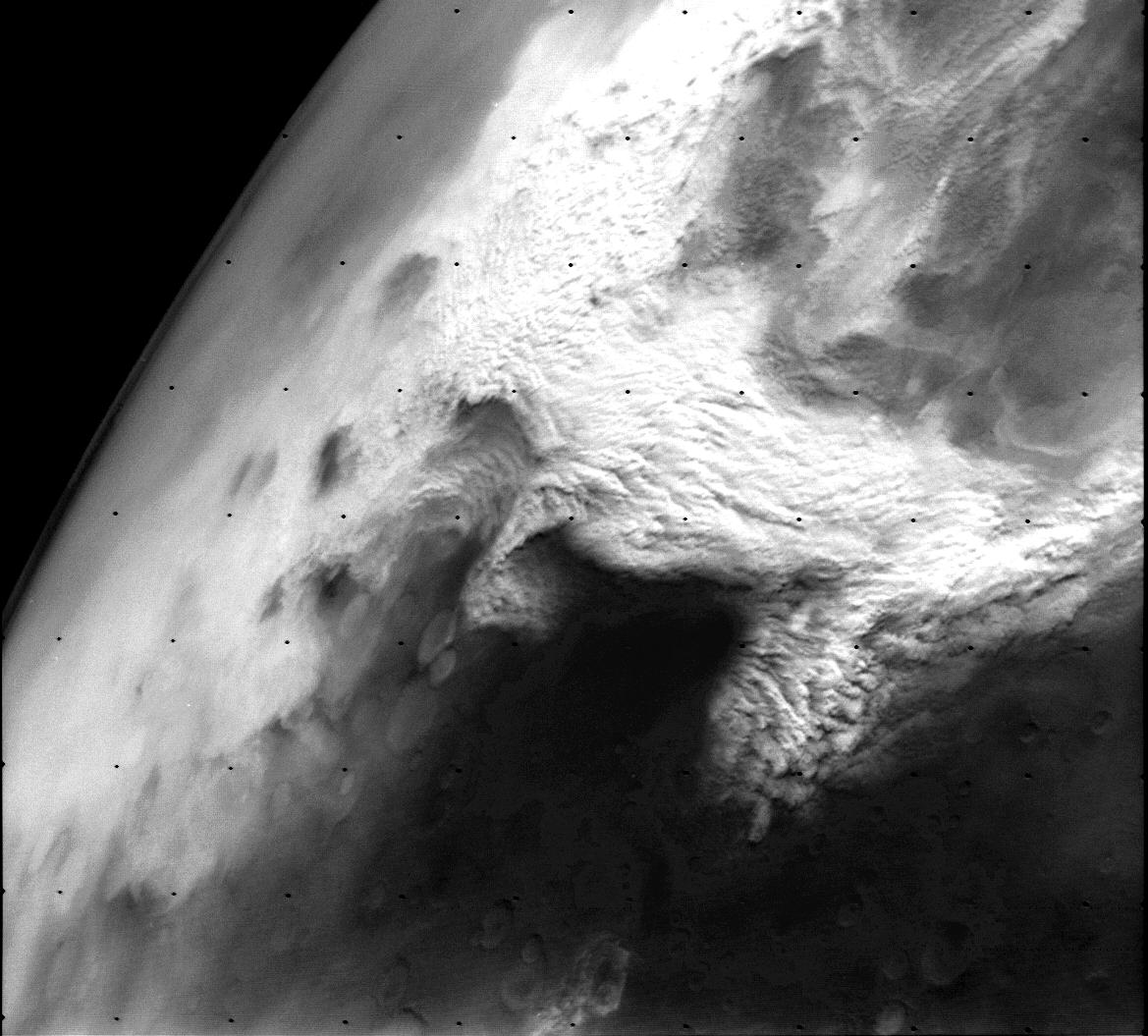
PIA02999:
Mariner 9 views Ascraeus Mons standing above the Martian Dust Storm
Full Resolution:
TIFF
(23.15 MB)
JPEG
(3.465 MB)
2000-11-22
Mars
Mariner Mars 1971 (Mariner 9)
5287x4384x1
PIA03100:
Mariner 9 views Ascraeus Lacus above the Martian Dust Storm
Full Resolution:
TIFF
(23.33 MB)
JPEG
(3.518 MB)
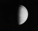
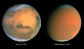
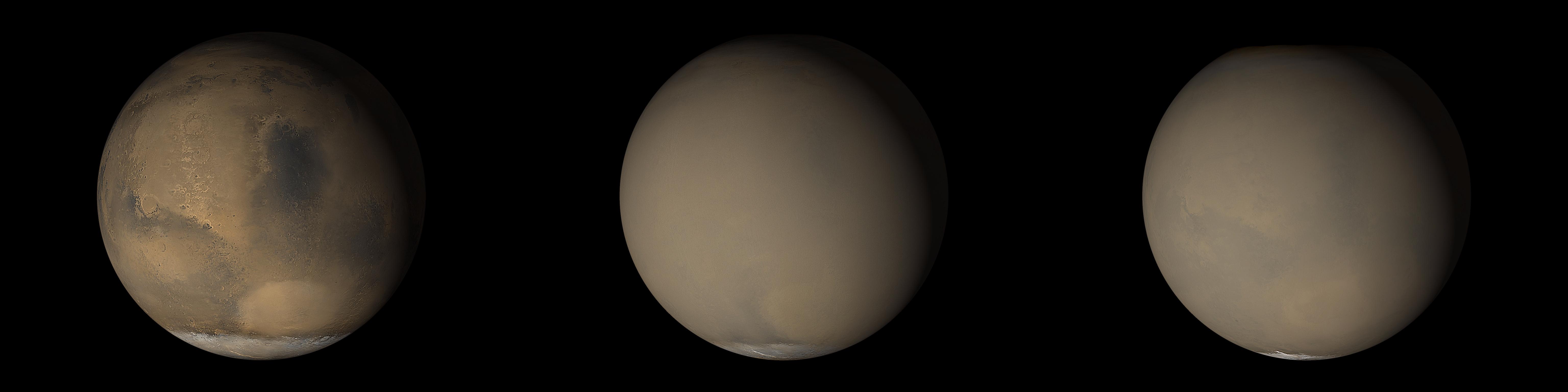
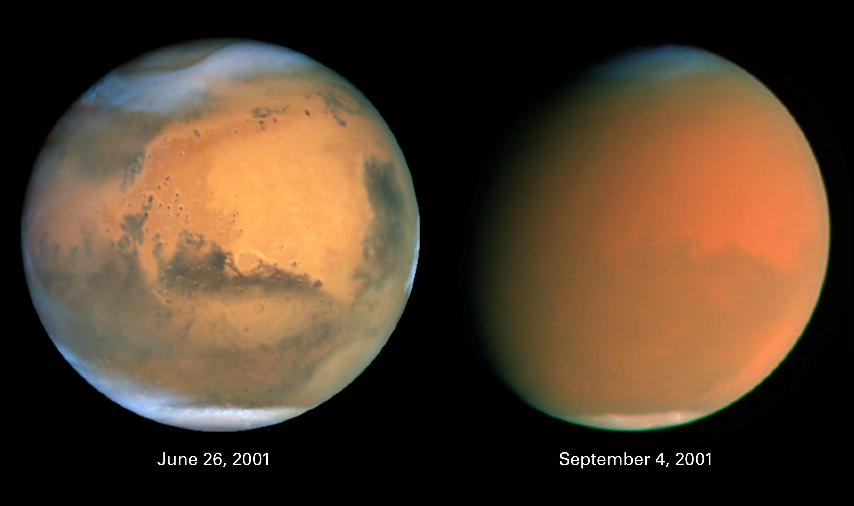
2001-07-21
Mars
Hubble Space Telescope
WFPC2
500x500x3
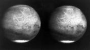
PIA03154:
Hubble Captures Best View of Mars Ever Obtained from Earth
Full Resolution:
TIFF
(463.3 kB)
JPEG
(17.85 kB)
2001-07-30
Mars
Viking
Camera 1
8550x1852x1
PIA03163:
Morning on Chryse Planitia - Viking Lander 1 Camera 1 Mosaic
Full Resolution:
TIFF
(6.985 MB)
JPEG
(1.413 MB)
2001-07-30
Mars
Viking
Camera 1
8550x1852x1
PIA03164:
Morning on Chryse Planitia - Viking Lander 1 Camera 2 Mosaic
Full Resolution:
TIFF
(7.228 MB)
JPEG
(1.383 MB)
2001-07-30
Mars
Viking
Camera 1
8550x1852x1
PIA03165:
Afternoon on Chryse Planitia - Viking Lander 1 Camera 1 Mosaic
Full Resolution:
TIFF
(6.989 MB)
JPEG
(1.123 MB)
2001-07-30
Mars
Viking
Camera 1
8550x1852x1
PIA03166:
Afternoon on Chryse Planitia - Viking Lander 1 Camera 2 Mosaic
Full Resolution:
TIFF
(7.736 MB)
JPEG
(1.24 MB)
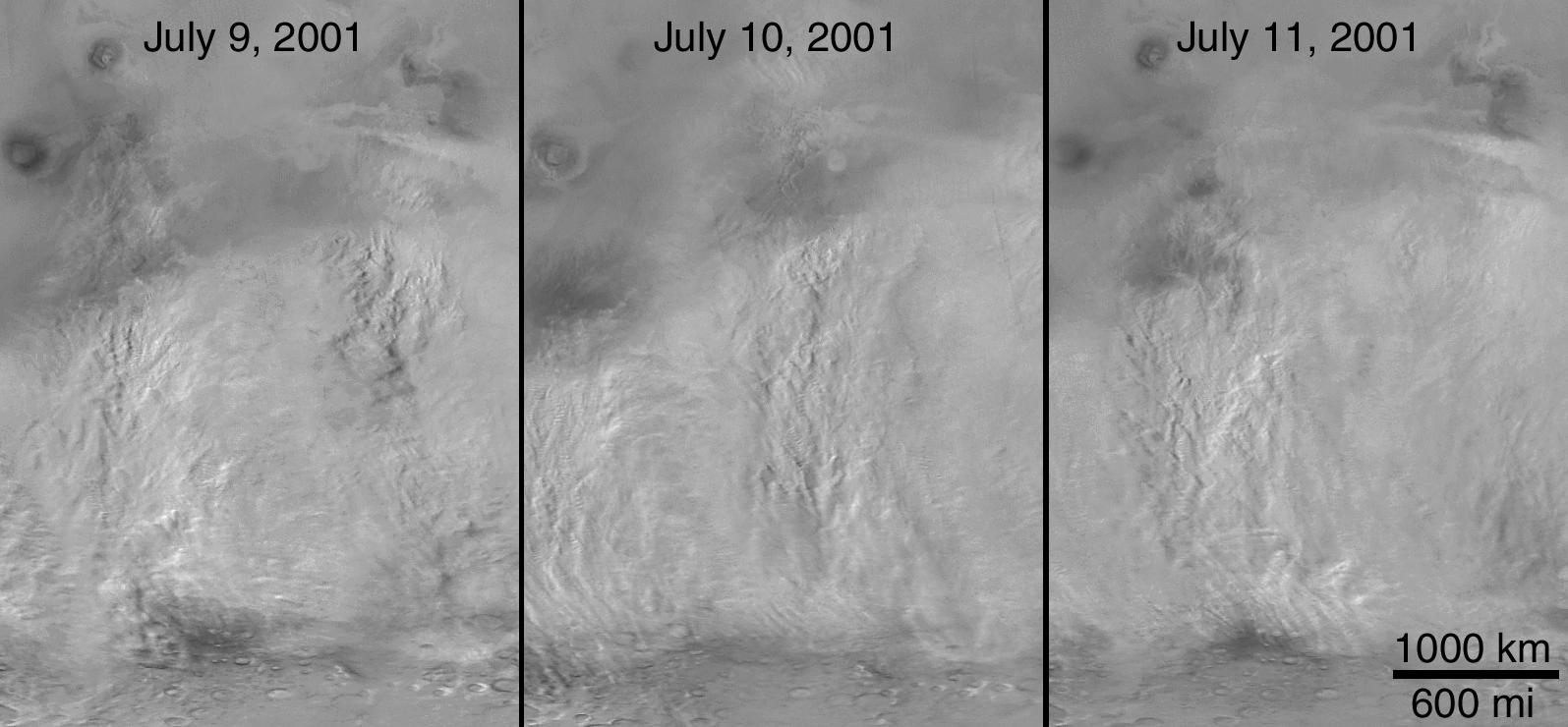
2001-10-13
Mars
Mars Global Surveyor (MGS)
Mars Orbiter Camera (MOC)
1339x2847x1
PIA03168:
Snapshot of Southern Spring Dust Storm Activity
Full Resolution:
TIFF
(1.977 MB)
JPEG
(192.2 kB)
2001-10-13
Mars
Mars Global Surveyor (MGS)
Mars Orbiter Camera (MOC)
522x734x3
PIA03169:
Springtime on the Martian South Polar Cap
Full Resolution:
TIFF
(954.6 kB)
JPEG
(34.89 kB)
2001-10-13
Mars
Mars Global Surveyor (MGS)
Mars Orbiter Camera (MOC)
6144x1536x3
PIA03170:
The 2001 Great Dust Storms - Hellas/Syrtis Major
Full Resolution:
TIFF
(11.1 MB)
JPEG
(376.4 kB)
2001-10-13
Mars
Mars Global Surveyor (MGS)
Mars Orbiter Camera (MOC)
6144x1536x3
PIA03171:
The 2001 Great Dust Storms - Tharsis
Full Resolution:
TIFF
(11.29 MB)
JPEG
(378.3 kB)
2001-10-13
Mars
Mars Global Surveyor (MGS)
Mars Orbiter Camera (MOC)
1595x740x1
PIA03172:
The 2001 Great Dust Storms - Daedalia/Claritas/Syria Dust Plumes
Full Resolution:
TIFF
(743.2 kB)
JPEG
(120.8 kB)
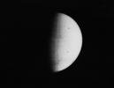
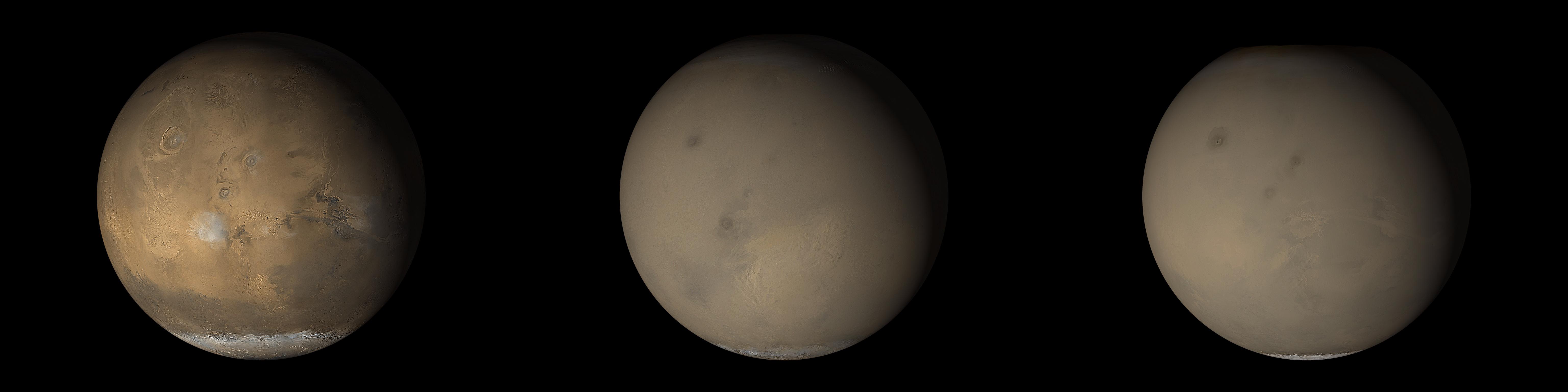
2001-10-13
Mars
Hubble Space Telescope
WFPC2
2826x1677x3
PIA03173:
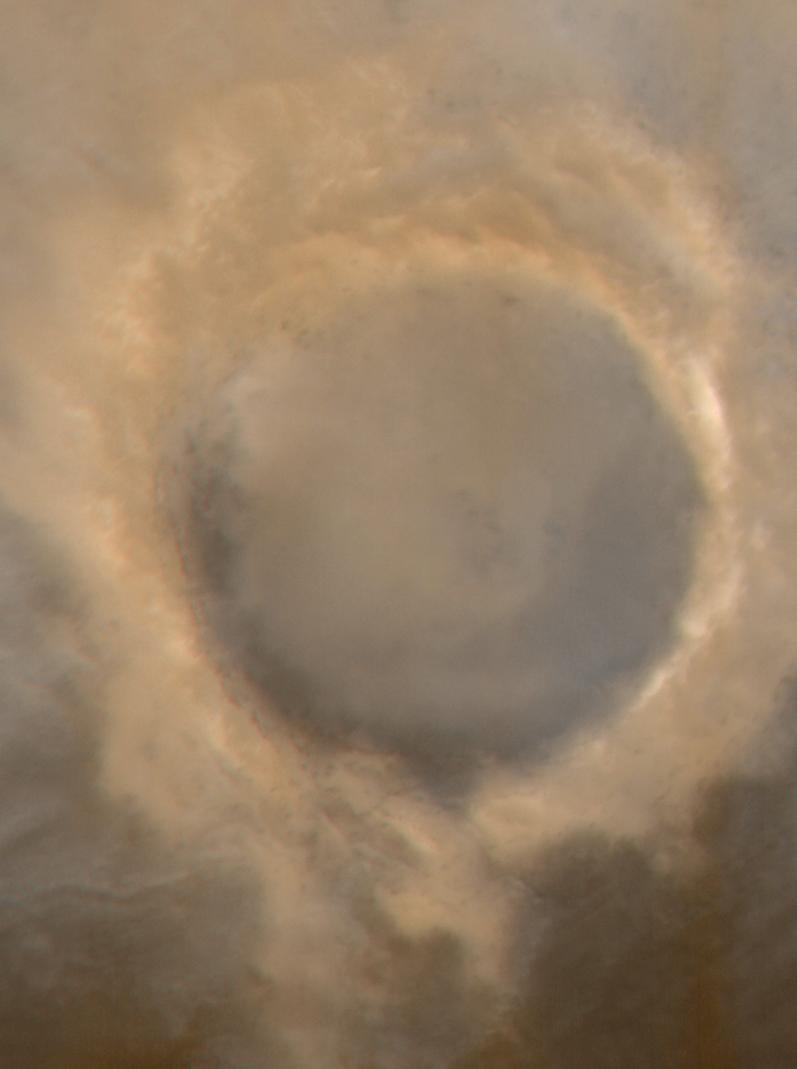
Scientists Track "Perfect Storm" on Mars
Full Resolution:
TIFF
(7.452 MB)
JPEG
(168.7 kB)
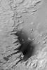
2001-10-26
Mars
Mars Global Surveyor (MGS)
Mars Orbiter Camera (MOC)
600x900x1
PIA03174:
Fractures/Pits in Northern Plains (Utopia Plains: 44.9 N, 274.7 W)
Full Resolution:
TIFF
(349.4 kB)
JPEG
(190.4 kB)
2001-10-26
Mars
Mars Global Surveyor (MGS)
Mars Orbiter Camera (MOC)
492x900x1
PIA03175:
Toe of Ganges Chasma Landslide ( 8.0 S, 44.4W)
Full Resolution:
TIFF
(256.8 kB)
JPEG
(129.7 kB)
2001-10-26
Mars
Mars Global Surveyor (MGS)
Mars Orbiter Camera (MOC)
600x900x1
PIA03176:
Dunes in Herschel Crater (Herschel Crater: 15.7 S, 228.8 W)
Full Resolution:
TIFF
(276.1 kB)
JPEG
(126.1 kB)
2001-10-31
Mars
Mars Global Surveyor (MGS)
Mars Orbiter Camera (MOC)
595x900x1
PIA03177:
Ancient Layered Rocks in Schiaparelli Crater
Full Resolution:
TIFF
(250.6 kB)
JPEG
(116 kB)
2001-11-21
Mars
Mars Global Surveyor (MGS)
Mars Orbiter Camera (MOC)
336x809x1
PIA03178:
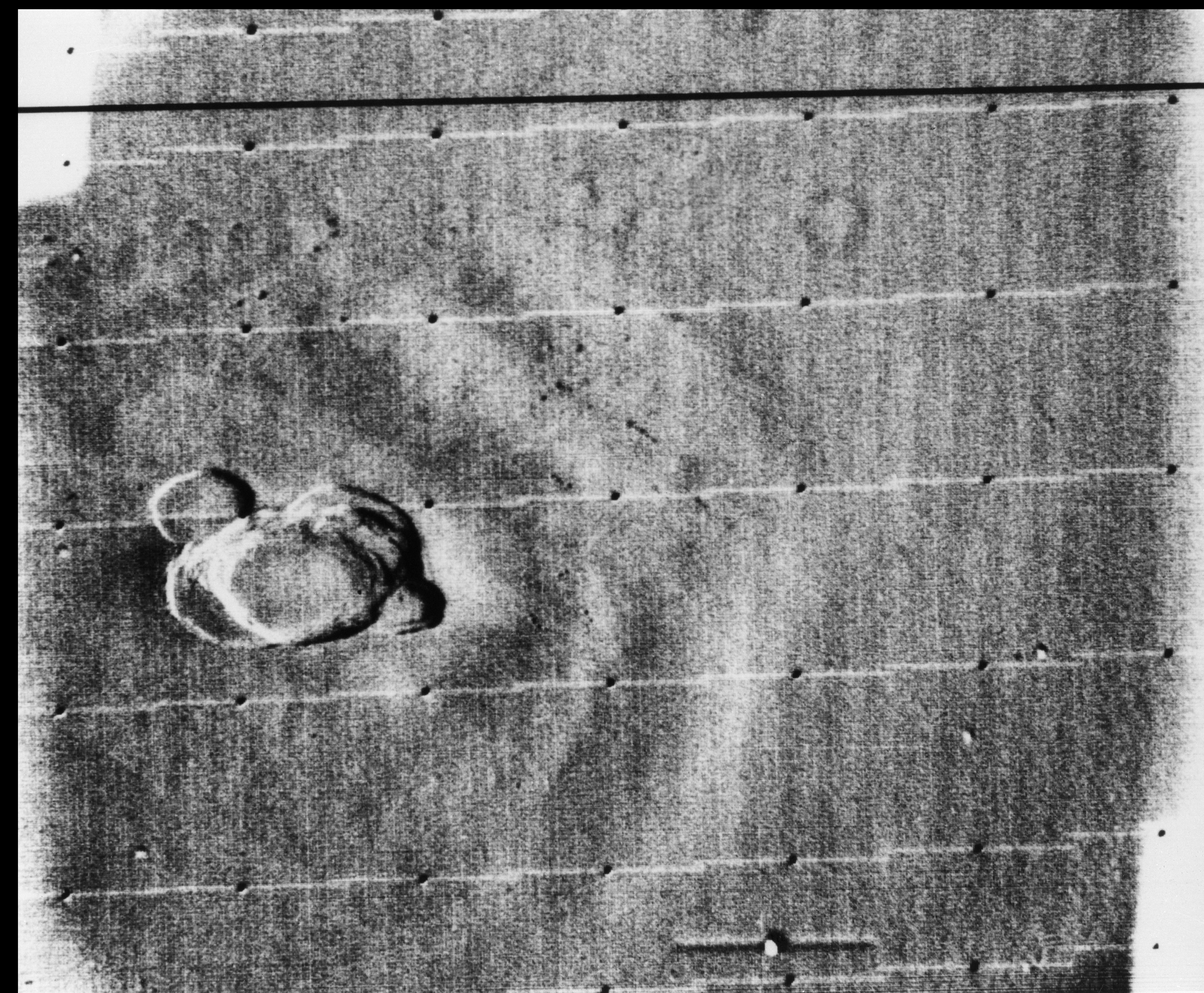
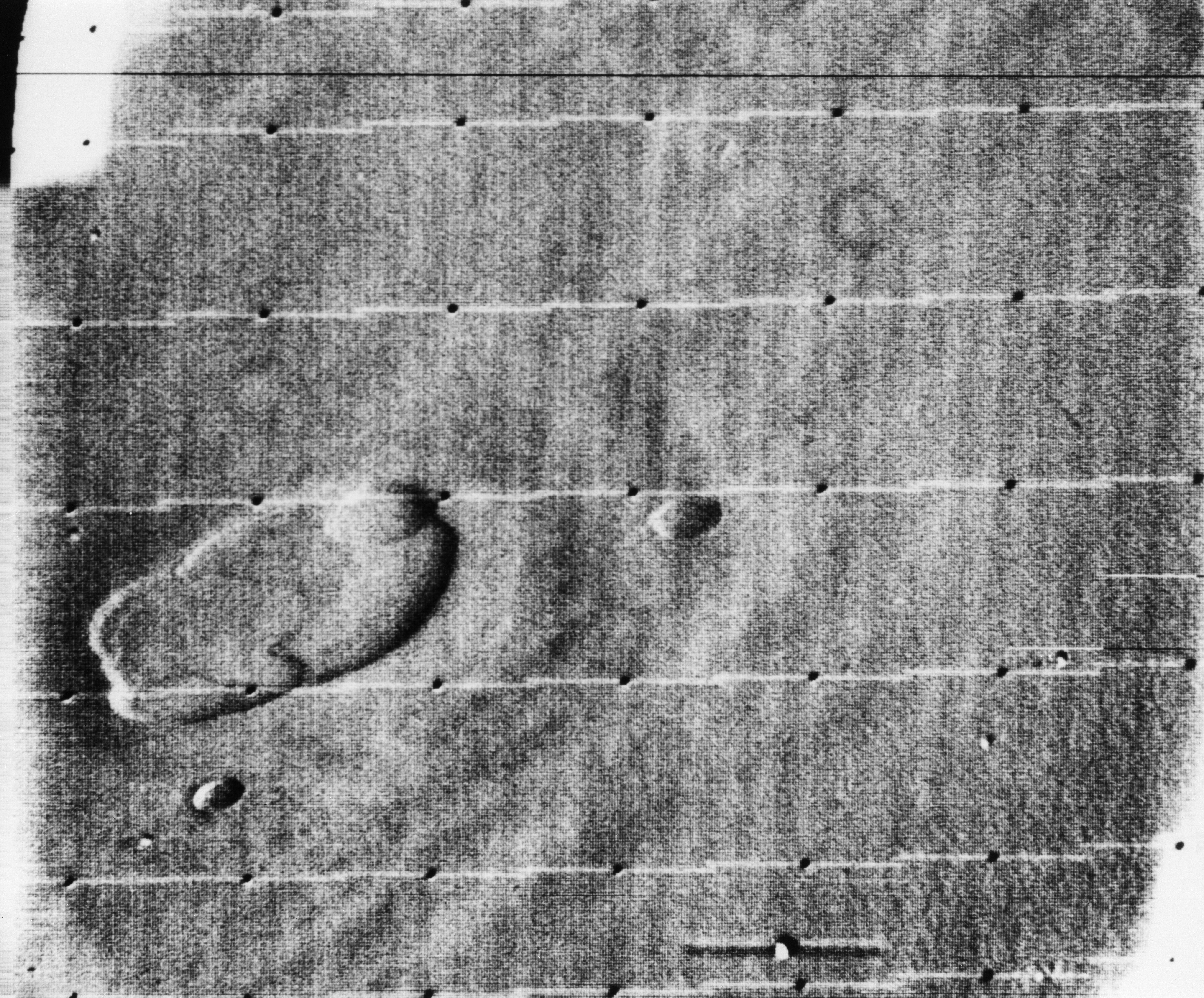
MOC's 100,000th Image
Full Resolution:
TIFF
(183.5 kB)
JPEG
(44.18 kB)
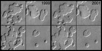
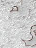
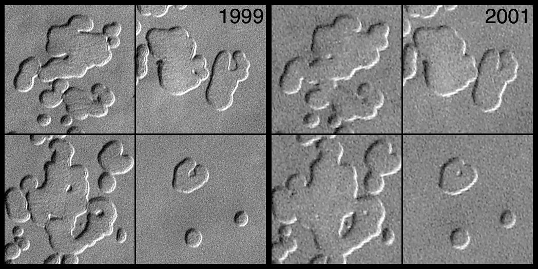
2001-12-11
Mars
Mars Global Surveyor (MGS)
Mars Orbiter Camera (MOC)
1048x524x1
PIA03179:
MOC Observes Changes in the South Polar Cap: Evidence for Recent Climate Change on Mars
Full Resolution:
TIFF
(515.7 kB)
JPEG
(117.9 kB)
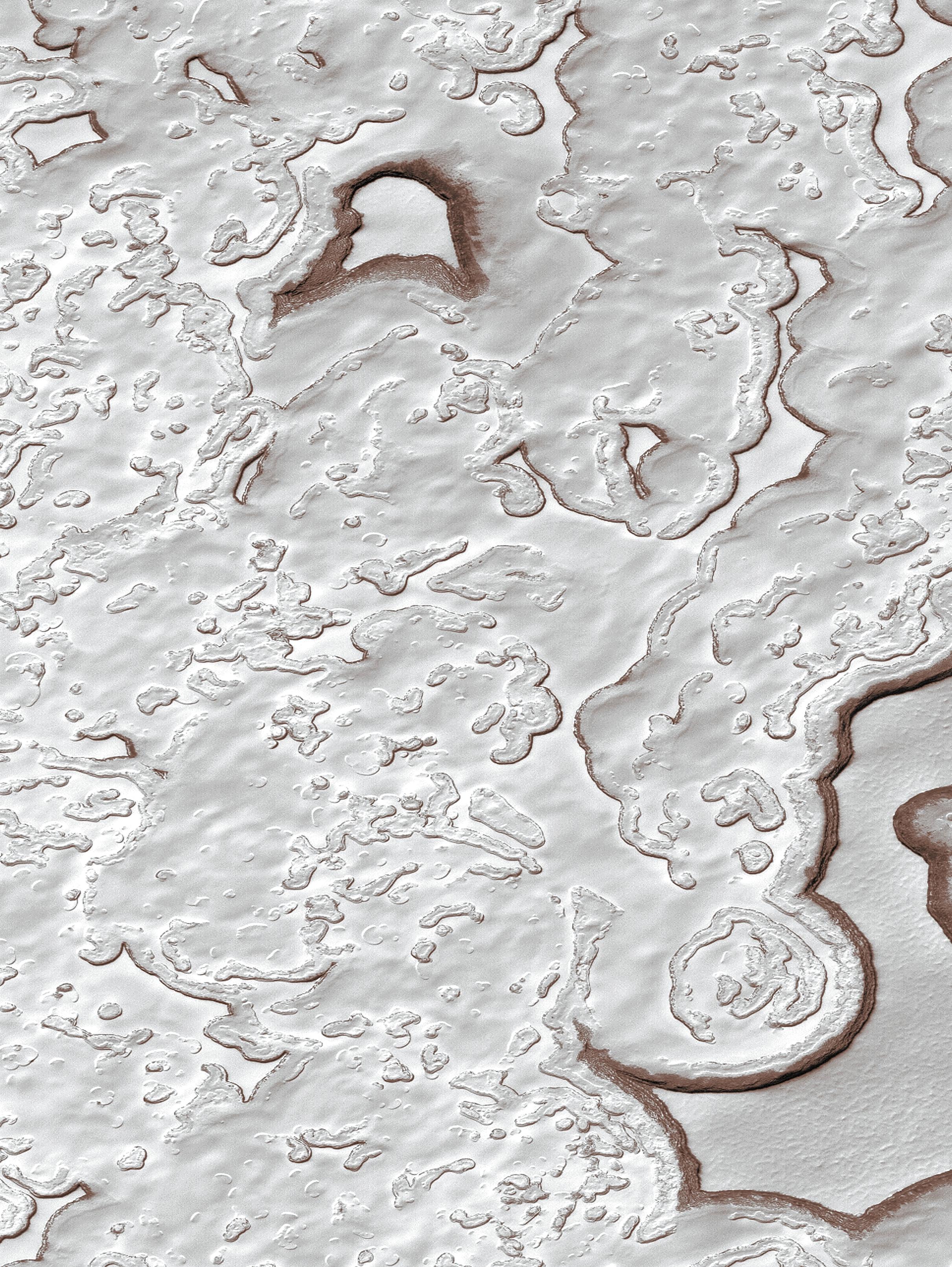
2001-12-11
Mars
Mars Global Surveyor (MGS)
Mars Orbiter Camera (MOC)
2421x3220x3
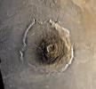
PIA03180:
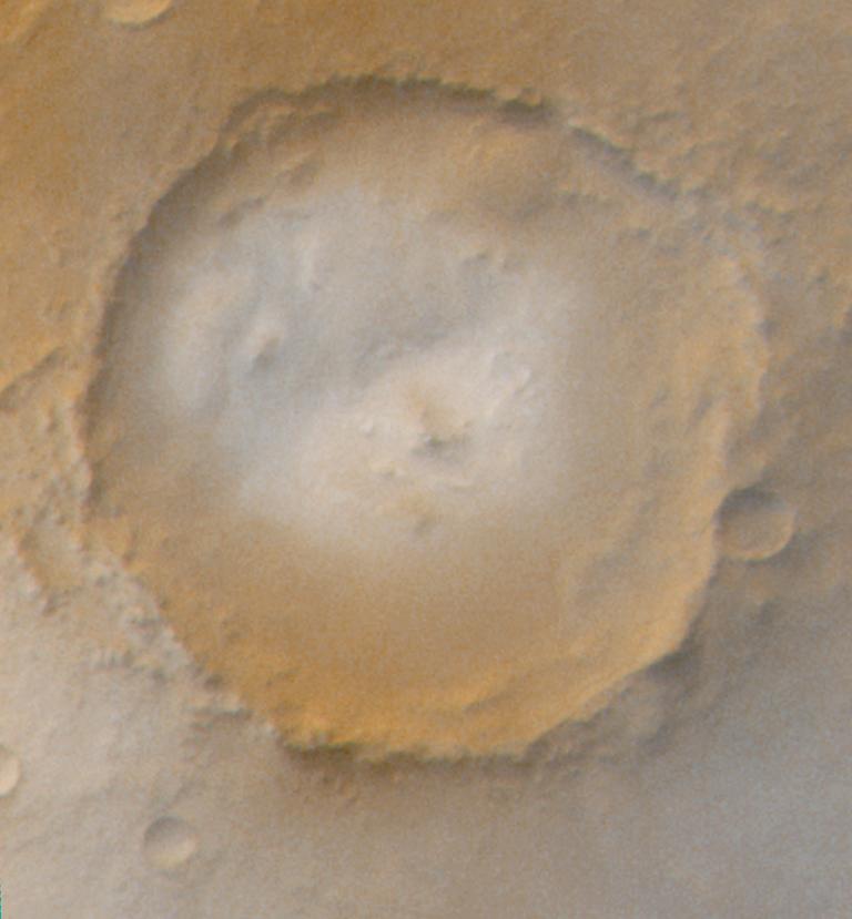
MOC View of the Martian South Polar Residual Cap
Full Resolution:
TIFF
(16.51 MB)
JPEG
(1.335 MB)
1-100
101-200
201-300
301-400
401-500
501-600
601-700
701-800
801-900
901-1000
Currently displaying images:
801 - 900
of 12731


