|
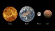
Your search criteria found 12731 images Target is Mars (and available satellites) |
| My List |
Addition Date | Target |
Mission
|
Instrument | Size |

|
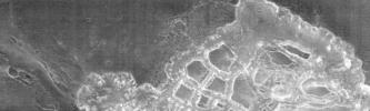
2003-02-05 | Mars | 1500x1125x3 | ||

|
|||||
|
|
2006-08-16 | Mars | 2910x4093x3 | ||

|
|||||
|
|
2013-03-20 | Mars | 726x400x3 | ||
|
|||||
|
|
2014-10-09 | Mars | 2560x1600x3 | ||
|
|||||
|
|
2014-10-09 | Mars | 1000x1000x3 | ||
|
|||||
|
|
2015-05-04 | Mars | 720x412x3 | ||

|
|||||
|
|
2016-10-05 | Mars | 3082x1899x3 | ||
|
|||||
|
|
2019-07-22 | Mars | 1400x788x3 | ||
|
|||||
|
|
2019-12-10 | Mars | 960x540x3 | ||
|
|||||
|
|
2020-06-16 | Mars | 2500x2569x3 | ||
|
|||||
|
|
2020-07-28 | Mars | 1600x900x3 | ||
|
|||||
|
|
2020-07-28 | Mars | 1920x1080x3 | ||
|
|||||
|
|
2020-10-20 | Mars | 3840x2160x3 | ||
|
|||||
|
|
2021-01-27 | Mars | 4029x3567x3 | ||
|
|||||
|
|
2021-09-28 | Mars | 1600x900x3 | ||
|
|||||
|
|
2022-05-17 | Mars | 3840x2160x3 | ||
|
|||||
|
|
2023-10-26 | Mars | 2221x1288x3 | ||
|
|||||
|
|
2023-10-26 | Mars | 2852x1169x3 | ||
|
|||||
|
|
2009-06-26 | Mars |
2001 Mars Odyssey |
THEMIS |
1297x2904x1 |
|
|
|||||
|
|
2001-03-27 | Mars |
2001 Mars Odyssey |
Mars Orbiter Camera (MOC) THEMIS |
1440x1080x3 |
|
|||||
|
|
2001-03-27 | Mars |
2001 Mars Odyssey |
Mars Orbiter Camera (MOC) THEMIS |
1440x1080x3 |
|
|||||
|
|
2001-03-27 | Mars |
2001 Mars Odyssey |
Mars Orbiter Camera (MOC) THEMIS |
1440x1080x3 |
|
|||||
|
|
2022-08-25 | Mars |
2001 Mars Odyssey |
THEMIS |
670x1419x1 |
|
|
|||||
|
|
2001-11-09 | Mars |
2001 Mars Odyssey |
THEMIS |
1990x2192x3 |

|
|||||
|
|
2001-11-13 | Mars |
2001 Mars Odyssey |
THEMIS |
3658x2671x3 |
|
|||||
|
|
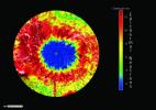
2002-03-01 | Mars |
2001 Mars Odyssey |
Mars Radiation Experiment |
3000x2400x3 |
|
|||||
|
|
2002-03-01 | Mars |
2001 Mars Odyssey |
Mars Radiation Experiment |
3000x2400x3 |

|
|||||
|
|
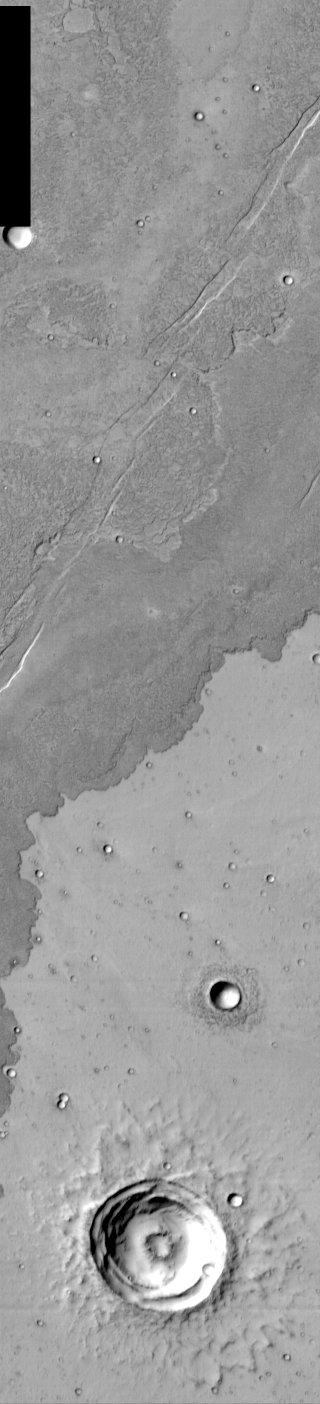
2002-03-05 | Mars |
2001 Mars Odyssey |
THEMIS |
952x474x1 |
|
|||||
|
|
2002-03-01 | Mars |
2001 Mars Odyssey |
THEMIS |
697x314x1 |
|
|||||
|
|
2002-03-01 | Mars |
2001 Mars Odyssey |
THEMIS |
2920x600x1 |
|
|||||
|
|
2002-03-01 | Mars |
2001 Mars Odyssey |
THEMIS |
665x302x3 |
|
|||||
|
|
2002-03-01 | Mars |
2001 Mars Odyssey |
THEMIS |
1063x320x1 |
|
|||||
|
|
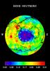
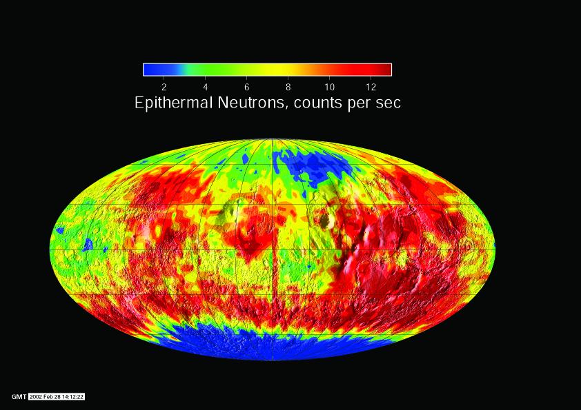
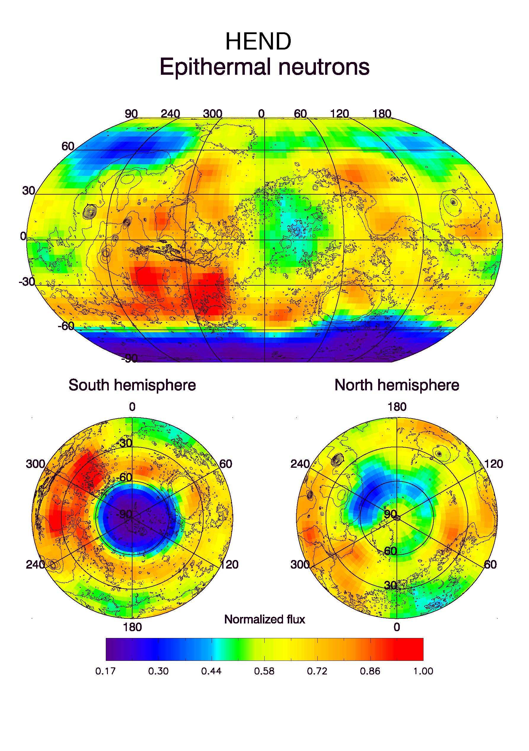
2002-03-01 | Mars |
2001 Mars Odyssey |
Gamma Ray Spectrometer Suite |
842x595x3 |

|
|||||
|
|
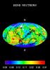
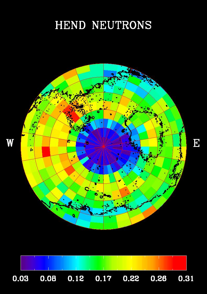
2002-03-01 | Mars |
2001 Mars Odyssey |
Gamma Ray Spectrometer Suite |
842x595x3 |
|
|||||
|
|
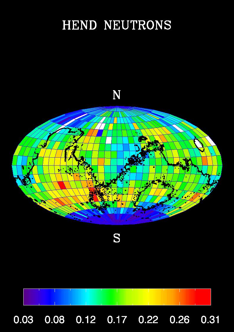
2002-03-01 | Mars |
2001 Mars Odyssey |
Gamma Ray Spectrometer Suite |
793x1123x3 |
|
|||||
|
|
2002-03-06 | Mars |
2001 Mars Odyssey |
Gamma Ray Spectrometer Suite |
793x1123x3 |
|
|||||
|
|
2003-01-13 | Mars |
2001 Mars Odyssey |
THEMIS |
320x1404x1 |
|
|
|||||
|
|
2002-04-25 | Mars |
2001 Mars Odyssey |
THEMIS |
1212x3061x1 |
|
|
|||||
|
|
2002-05-21 | Mars |
2001 Mars Odyssey |
THEMIS |
1183x3061x1 |
|
|
|||||
|
|
2002-05-21 | Mars |
2001 Mars Odyssey |
THEMIS |
1238x3043x1 |
|
|
|||||
|
|
2002-05-21 | Mars |
2001 Mars Odyssey |
THEMIS |
1237x3043x1 |
|
|
|||||
|
|
2002-05-21 | Mars |
2001 Mars Odyssey |
THEMIS |
1235x3025x1 |
|
|
|||||
|
|
2002-05-21 | Mars |
2001 Mars Odyssey |
THEMIS |
1236x3025x1 |
|
|
|||||
|
|
2002-05-21 | Mars |
2001 Mars Odyssey |
THEMIS |
1240x3043x1 |
|
|
|||||
|
|
2002-05-21 | Mars |
2001 Mars Odyssey |
THEMIS |
1228x3025x1 |
|
|
|||||
|
|
2002-05-21 | Mars |
2001 Mars Odyssey |
THEMIS |
1189x3061x1 |
|
|
|||||
|
|
2002-05-21 | Mars |
2001 Mars Odyssey |
THEMIS |
1210x3061x1 |
|
|
|||||
|
|
2002-05-21 | Mars |
2001 Mars Odyssey |
THEMIS |
1238x3043x1 |
|
|
|||||
|
|
2002-05-21 | Mars |
2001 Mars Odyssey |
THEMIS |
1239x3043x1 |
|
|
|||||
|
|
2002-05-21 | Mars |
2001 Mars Odyssey |
THEMIS |
967x2738x1 |
|
|
|||||
|
|
2002-05-21 | Mars |
2001 Mars Odyssey |
THEMIS |
1217x3061x1 |
|
|
|||||
|
|
2002-05-21 | Mars |
2001 Mars Odyssey |
THEMIS |
1235x3079x1 |
|
|
|||||
|
|
2002-05-21 | Mars |
2001 Mars Odyssey |
THEMIS |
1215x3061x1 |
|
|
|||||
|
|
2002-05-21 | Mars |
2001 Mars Odyssey |
THEMIS |
1201x3043x1 |
|
|
|||||
|
|
2002-05-21 | Mars |
2001 Mars Odyssey |
THEMIS |
1238x3133x1 |
|
|
|||||
|
|
2002-05-21 | Mars |
2001 Mars Odyssey |
THEMIS |
1163x2809x1 |
|
|
|||||
|
|
2002-05-21 | Mars |
2001 Mars Odyssey |
THEMIS |
1154x2989x1 |
|
|
|||||
|
|
2002-05-21 | Mars |
2001 Mars Odyssey |
THEMIS |
1233x3025x1 |
|
|
|||||
|
|
2002-05-23 | Mars |
2001 Mars Odyssey |
THEMIS |
1172x2791x1 |
|
|
|||||
|
|
2002-05-23 | Mars |
2001 Mars Odyssey |
THEMIS |
1238x3043x1 |
|
|
|||||
|
|
2002-05-23 | Mars |
2001 Mars Odyssey |
THEMIS |
1237x3151x1 |
|
|
|||||
|
|
2002-05-23 | Mars |
2001 Mars Odyssey |
THEMIS |
1235x3043x1 |
|
|
|||||
|
|
2002-05-23 | Mars |
2001 Mars Odyssey |
THEMIS |
1235x3025x1 |
|
|
|||||
|
|
2002-05-23 | Mars |
2001 Mars Odyssey |
THEMIS |
1160x2989x1 |
|
|
|||||
|
|
2002-05-23 | Mars |
2001 Mars Odyssey |
THEMIS |
1236x3025x1 |
|
|
|||||
|
|
2002-05-23 | Mars |
2001 Mars Odyssey |
THEMIS |
1231x2935x1 |
|
|
|||||
|
|
2002-05-23 | Mars |
2001 Mars Odyssey |
THEMIS |
1240x3169x1 |
|
|
|||||
|
|
2002-05-24 | Mars |
2001 Mars Odyssey |
THEMIS |
1157x3079x1 |
|
|
|||||
|
|
2002-06-05 | Mars |
2001 Mars Odyssey |
THEMIS |
1205x3007x1 |
|
|
|||||
|
|
2002-06-04 | Mars |
2001 Mars Odyssey |
THEMIS |
1233x2989x1 |
|
|
|||||
|
|
2002-06-04 | Mars |
2001 Mars Odyssey |
THEMIS |
1237x3043x1 |
|
|
|||||
|
|
2002-06-04 | Mars |
2001 Mars Odyssey |
THEMIS |
1157x2989x1 |
|
|
|||||
|
|
2002-06-04 | Mars |
2001 Mars Odyssey |
THEMIS |
1189x3007x1 |
|
|
|||||
|
|
2002-06-04 | Mars |
2001 Mars Odyssey |
THEMIS |
1236x3097x1 |
|
|
|||||
|
|
2002-06-04 | Mars |
2001 Mars Odyssey |
THEMIS |
1207x3061x1 |
|
|
|||||
|
|
2002-06-04 | Mars |
2001 Mars Odyssey |
THEMIS |
1237x3043x1 |
|
|
|||||
|
|
2002-05-28 | Mars |
2001 Mars Odyssey |
Gamma Ray Spectrometer Suite |
2668x1371x3 |
|
|||||
|
|
2002-05-28 | Mars |
2001 Mars Odyssey |
Gamma Ray Spectrometer Suite |
2668x1371x3 |
|
|||||
|
|
2002-05-28 | Mars |
2001 Mars Odyssey |
Gamma Ray Spectrometer Suite |
1640x1750x3 |
|
|||||
|
|
2002-05-28 | Mars |
2001 Mars Odyssey |
Gamma Ray Spectrometer Suite |
1764x1068x3 |
|
|||||
|
|
2002-05-28 | Mars |
2001 Mars Odyssey |
Gamma Ray Spectrometer Suite |
5300x6450x3 |
|
|||||
|
|
2002-05-29 | Mars |
2001 Mars Odyssey |
THEMIS |
289x1751x3 |
|
|
|||||
|
|
2002-05-29 | Mars |
2001 Mars Odyssey |
THEMIS |
1611x1384x1 |
|
|||||
|
|
2002-05-30 | Mars |
2001 Mars Odyssey |
Gamma Ray Spectrometer Suite |
1785x2532x3 |
|
|||||
|
|
2002-05-30 | Mars |
2001 Mars Odyssey |
Gamma Ray Spectrometer Suite |
1785x2532x3 |
|
|||||
|
|
2002-06-17 | Mars |
2001 Mars Odyssey |
THEMIS |
1235x3043x1 |
|
|
|||||
|
|
2002-06-17 | Mars |
2001 Mars Odyssey |
THEMIS |
1234x3025x1 |
|
|
|||||
|
|
2002-06-17 | Mars |
2001 Mars Odyssey |
THEMIS |
1222x3025x1 |
|
|
|||||
|
|
2002-06-17 | Mars |
2001 Mars Odyssey |
THEMIS |
1160x3079x1 |
|
|
|||||
|
|
2002-06-17 | Mars |
2001 Mars Odyssey |
THEMIS |
1238x3043x1 |
|
|
|||||
|
|
2002-06-17 | Mars |
2001 Mars Odyssey |
THEMIS |
1224x2881x1 |
|
|
|||||
|
|
2002-06-17 | Mars |
2001 Mars Odyssey |
THEMIS |
1231x3169x1 |
|
|
|||||
|
|
2003-04-09 | Mars |
2001 Mars Odyssey |
THEMIS |
289x1751x3 |
|
|
|||||
|
|
2002-06-17 | Mars |
2001 Mars Odyssey |
THEMIS |
1611x1384x1 |
|
|||||
|
|
2002-06-17 | Mars |
2001 Mars Odyssey |
THEMIS |
1239x3043x1 |
|
|
|||||
|
|
2002-06-17 | Mars |
2001 Mars Odyssey |
THEMIS |
1234x3025x1 |
|
|
|||||
|
|
2002-06-17 | Mars |
2001 Mars Odyssey |
THEMIS |
1227x3025x1 |
|
|
|||||
|
|
2002-06-17 | Mars |
2001 Mars Odyssey |
THEMIS |
1231x3025x1 |
|
|
|||||
|
|
2002-06-17 | Mars |
2001 Mars Odyssey |
THEMIS |
1203x3007x1 |
|
|
|||||
|
|
2002-06-17 | Mars |
2001 Mars Odyssey |
THEMIS |
1240x3043x1 |
|
|
|||||
 |
 |
|
|
|
|
|
|
|
|

|
|
| 1-100 | 101-200 | 201-300 | 301-400 | 401-500 | 501-600 | 601-700 | 701-800 | 801-900 | 901-1000 |
| Currently displaying images: 1 - 100 of 12731 |