- Original Caption Released with Image:
-

(A) |

(B) | 
(C) |
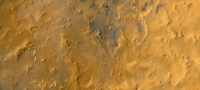
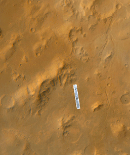
This Mars Global Surveyor Mars Orbiter Camera narrow angle image (top) shows an intermountain valley floor in the Libya Montes region of Mars. Its regional setting is seen in the wide angle color mosaic (Figure A). The Libya Montes were formed by the giant impact that created the ancient Isidis basin. The Libya Mountains and valleys -- like the one shown here -- were subsequently modified and eroded by other processes, including wind, impact cratering, and flow of liquid water to make the small valley that runs across the middle of the scene. Until the mission was canceled, the Libya Montes region was among the top two candidates for the Mars Surveyor 2001 Lander. This image, illuminated by sunlight from the left, covers an area 3 kilometers (1.9 miles) wide and 19 kilometers (11.8 miles) long. The scene is located near 1.5°N, 278.4°W and was acquired on June 27, 1999. The high resolution color view (top) was created by combining the colors derived from Mars Orbiter Camera Wide Angle views of the region obtained in May 1999 (Figures A and B) with the high resolution view obtained in June 1999 (Figure C).
- Image Credit:
-
NASA/JPL/MSSS
Image Addition Date: -
2000-05-22
|

