- Original Caption Released with Image:
-
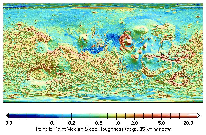
The median of slopes in 35-km windows indicate the typical roughness on 300-meter baselines. The rougher nature of the heavily cratered terrain in the Southern Hemisphere is apparent, as well as that of Valles Marineris (12S, 289E) canyon walls and the Olympus Mons (18N, 227E) aureole deposits. The Northern Lowlands are smooth, especially Amazonis Planitia (16N, 202E), a region to the west of Olympus Mons, were typical median slopes on these baselines are often smaller than 0.1 degree. A shaded relief map of the topography is overlaid is monochrome.
- Image Credit:
-
NASA/JPL/GSFC
Image Addition Date: -
2000-10-06
|
