My
List |
Addition Date
|
Target
|
Mission
|
Instrument
|
Size
|

|
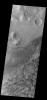
2023-05-12 |
Mars
|
Mars Reconnaissance Orbiter (MRO)
|
HiRISE
|
2880x1800x3 |
|
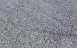
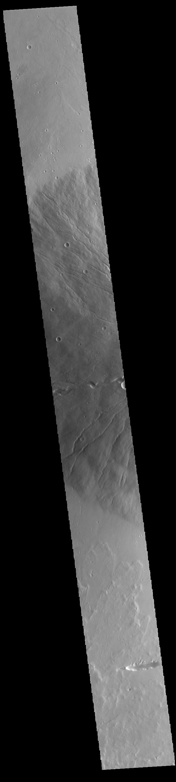
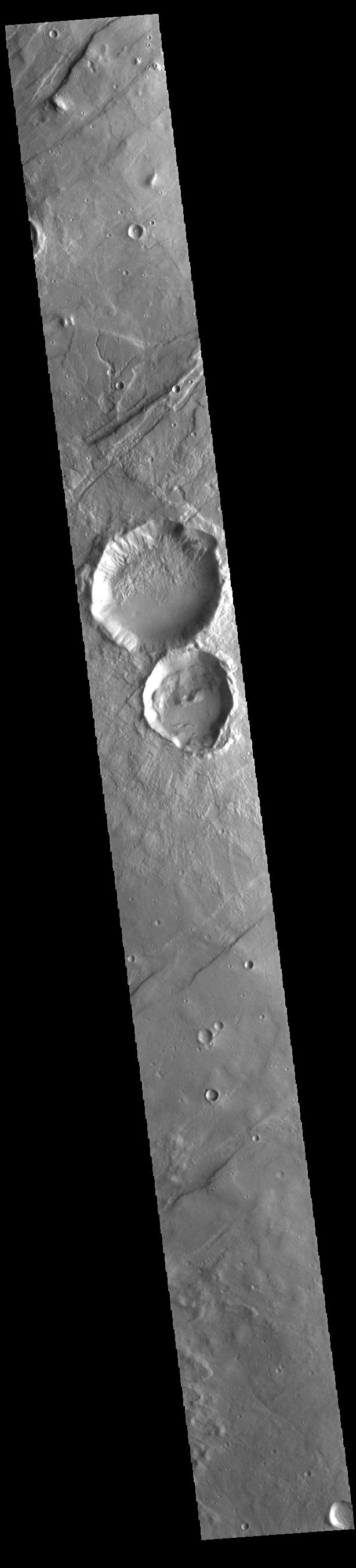
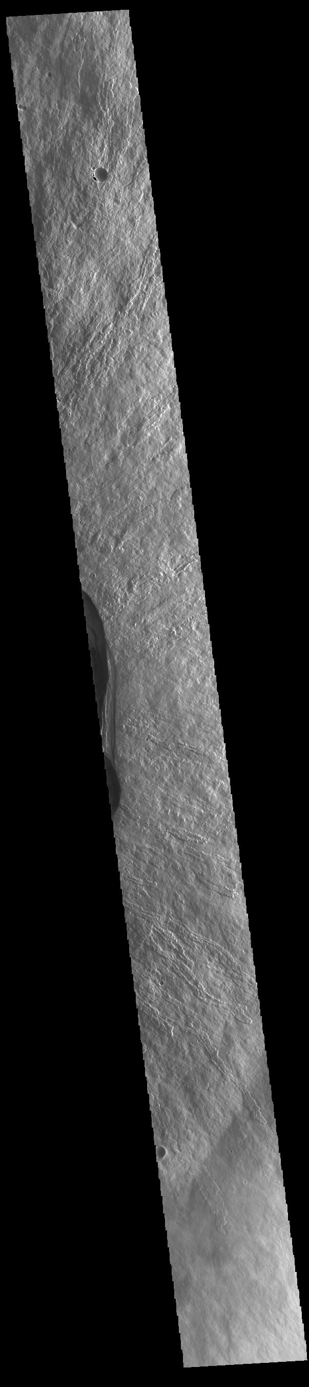
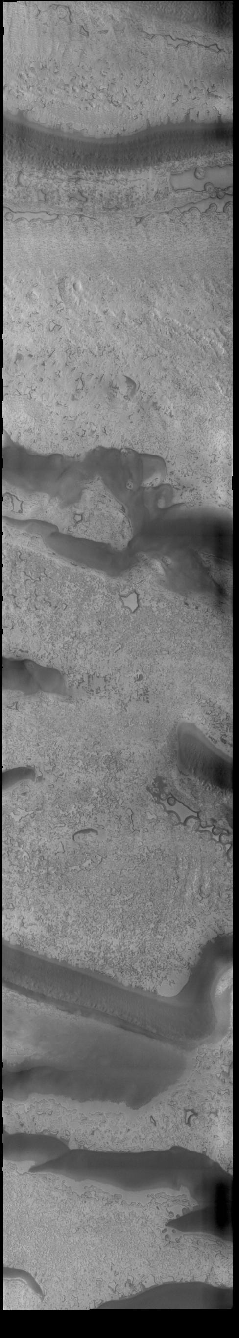
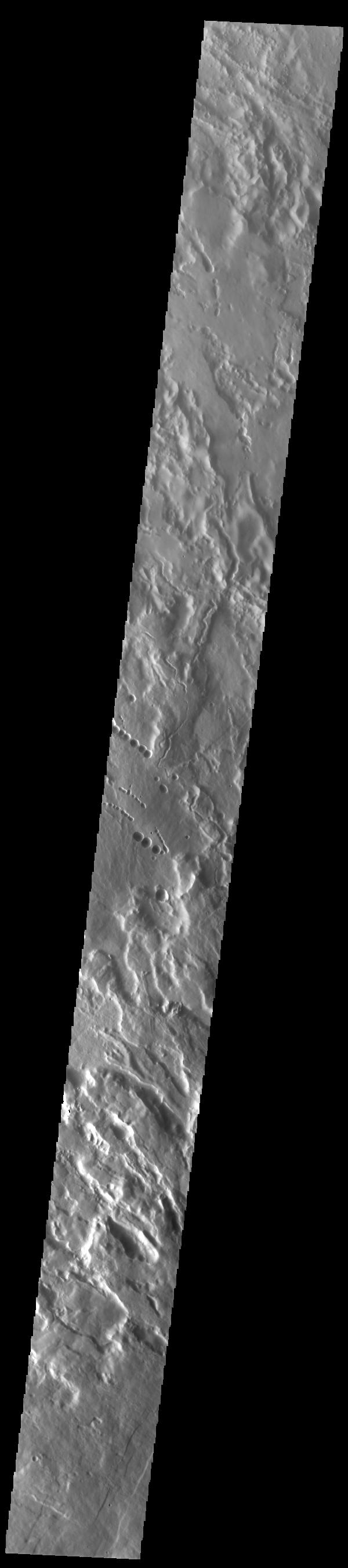
-
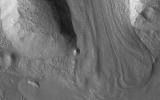
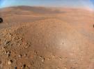
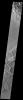
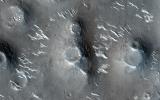
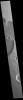
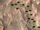
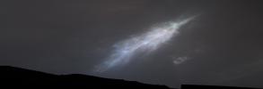
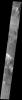
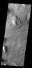
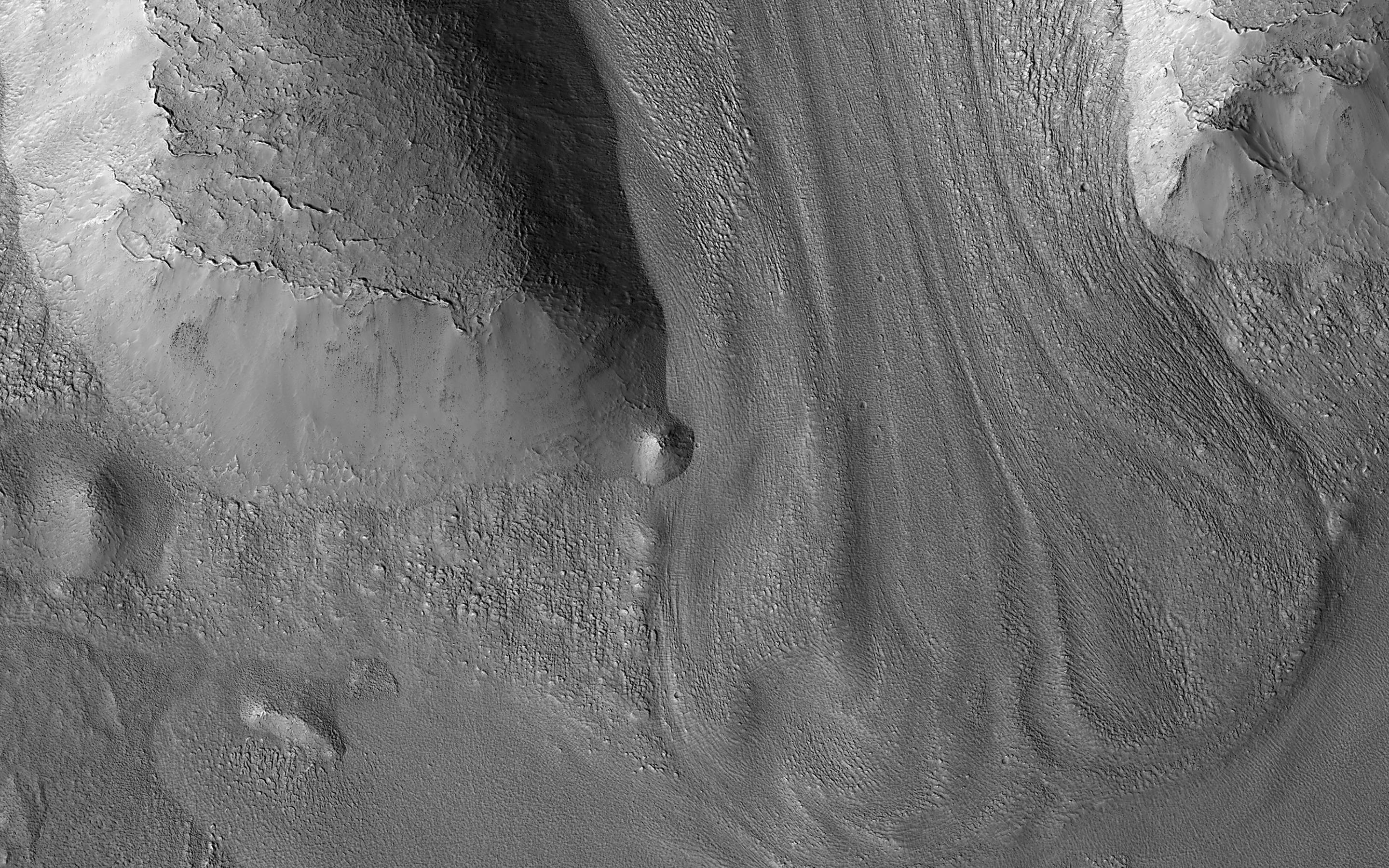
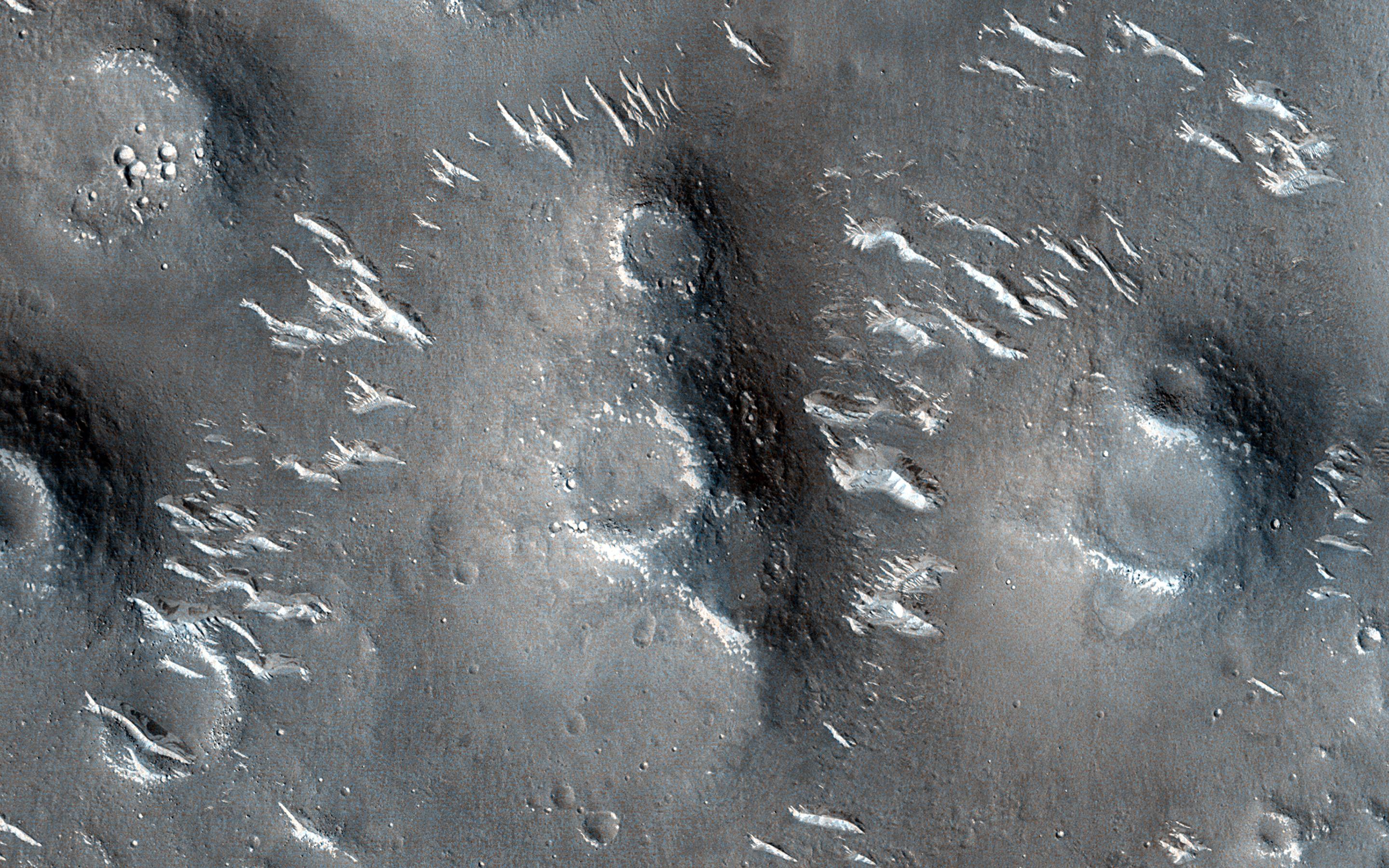
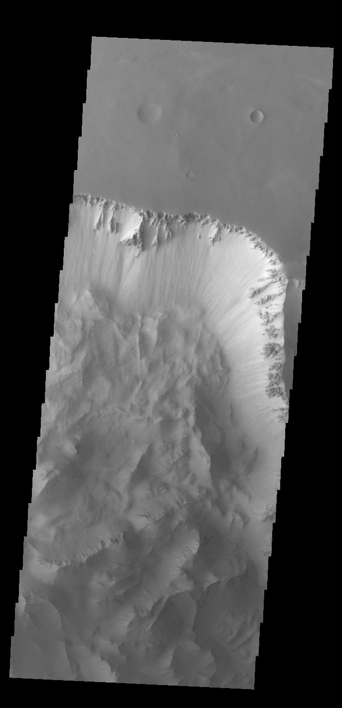
PIA25947:
-
Glacier-like Features on Mars
Full Resolution:
TIFF
(8.111 MB)
JPEG
(1.232 MB)
|
|
|
2023-05-12 |
Mars
|
2001 Mars Odyssey
|
THEMIS
|
611x2705x1 |
|
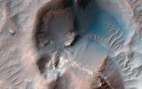
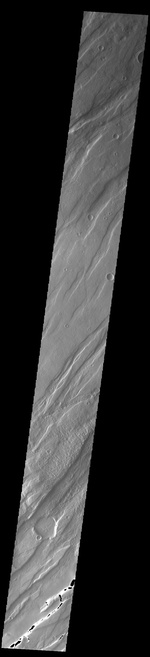
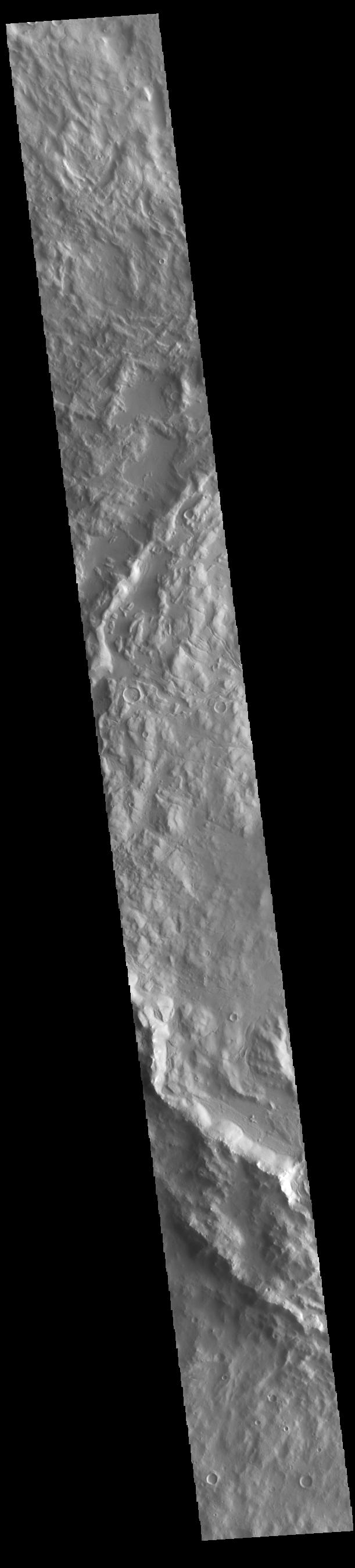
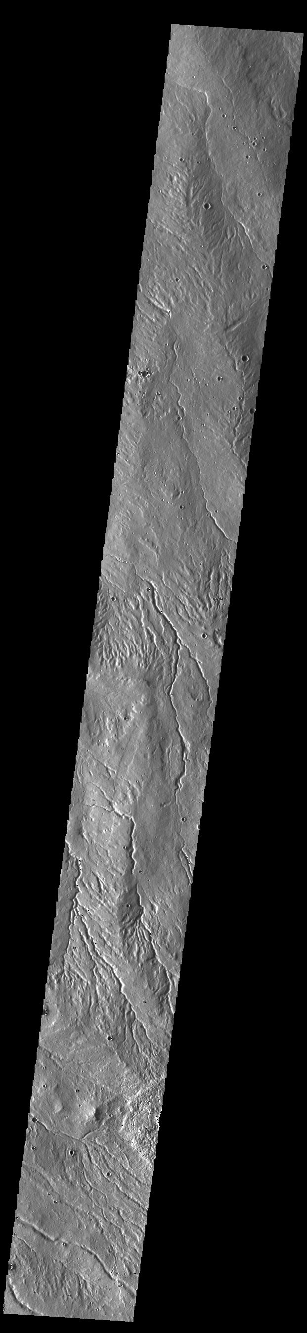
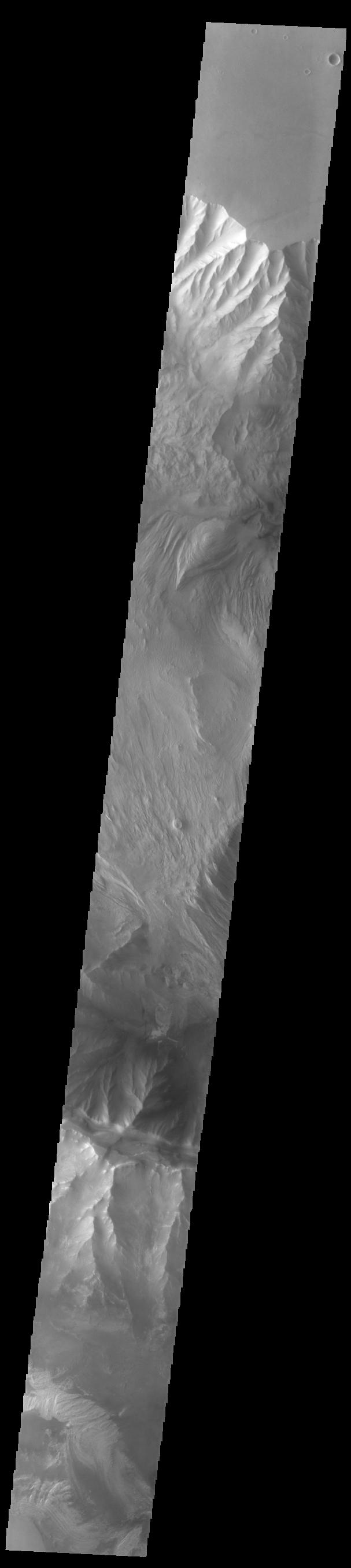
-
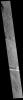
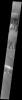
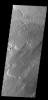
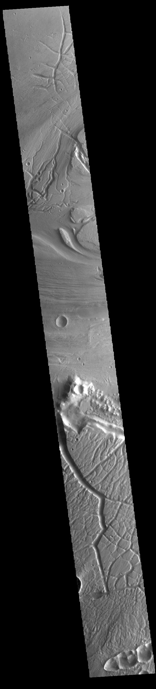
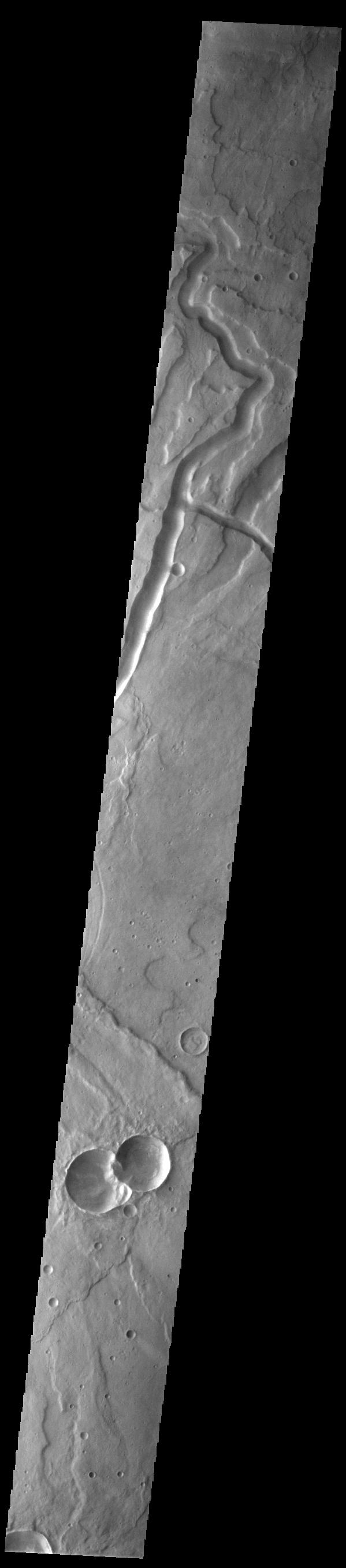
PIA25930:
-
Ares Vallis
Full Resolution:
TIFF
(821.1 kB)
JPEG
(108.8 kB)
|
|
|
2023-05-11 |
Mars
|
Mars 2020 Rover
|
Mastcam-Z
|
4345x2113x3 |
|
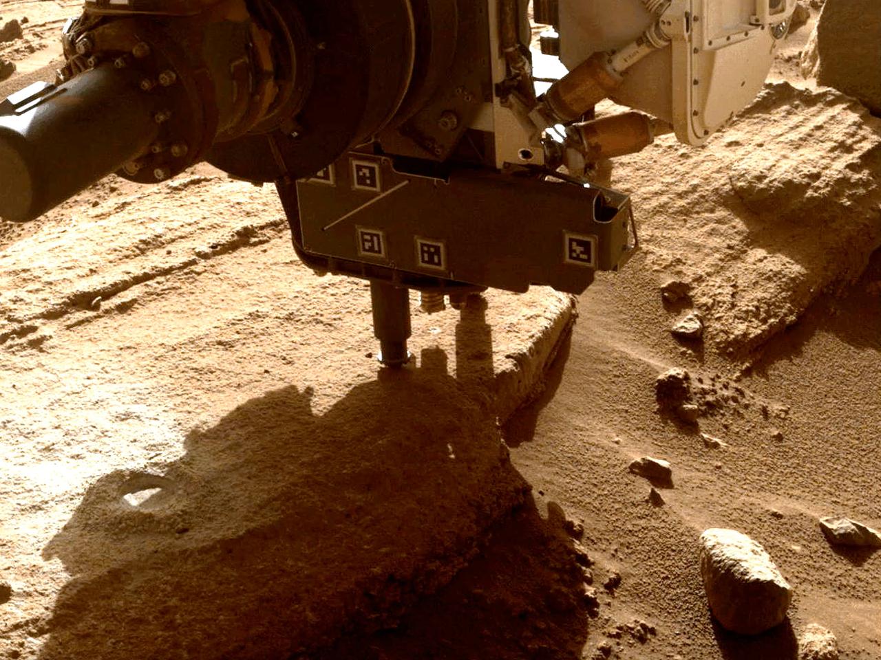
-
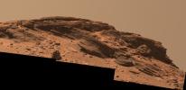
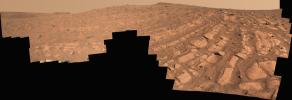
PIA25911:
-
Mastcam-Z's View of 'Franklin Cliffs'
Full Resolution:
TIFF
(18.86 MB)
JPEG
(964.2 kB)
|
|
|
2023-05-11 |
Mars
|
Mars 2020 Rover
|
Mastcam-Z
|
8323x3435x3 |
|
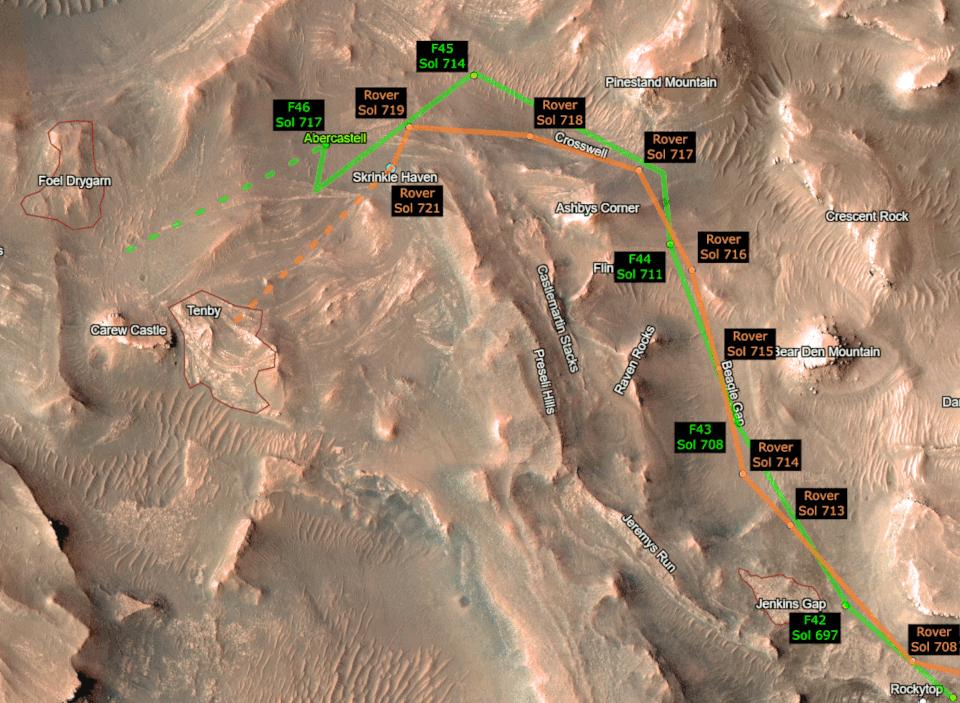
-
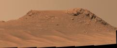
PIA25830:
-
Mastcam-Z's View of 'Pinestand'
Full Resolution:
TIFF
(63.95 MB)
JPEG
(3.231 MB)
|
|
|
2023-05-11 |
Mars
|
Mars 2020 Rover
|
Mastcam-Z
|
9000x3083x3 |
|
-
PIA25829:
-
Curved Bands of Rocks at 'Skrinkle Haven'
Full Resolution:
TIFF
(51.01 MB)
JPEG
(3.842 MB)
|
|
|
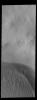
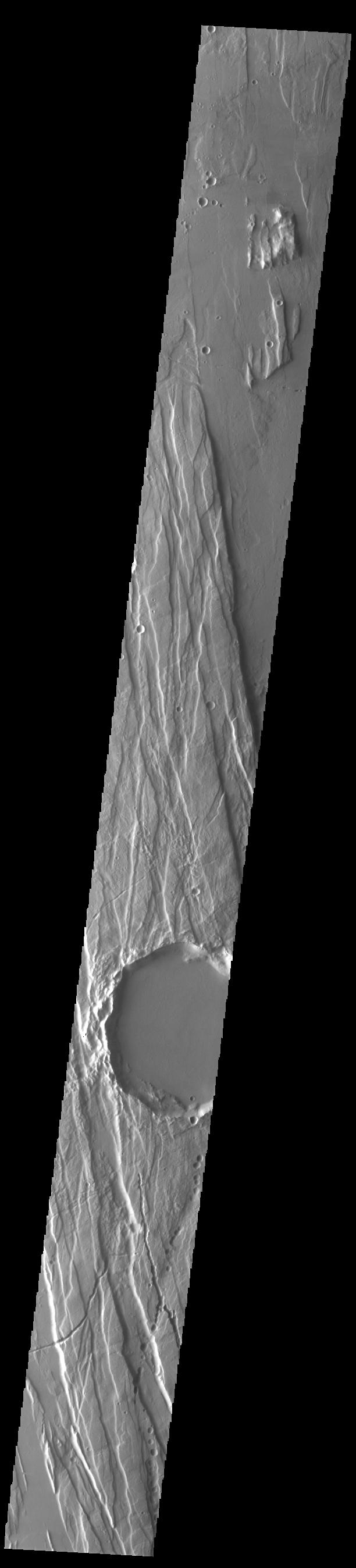
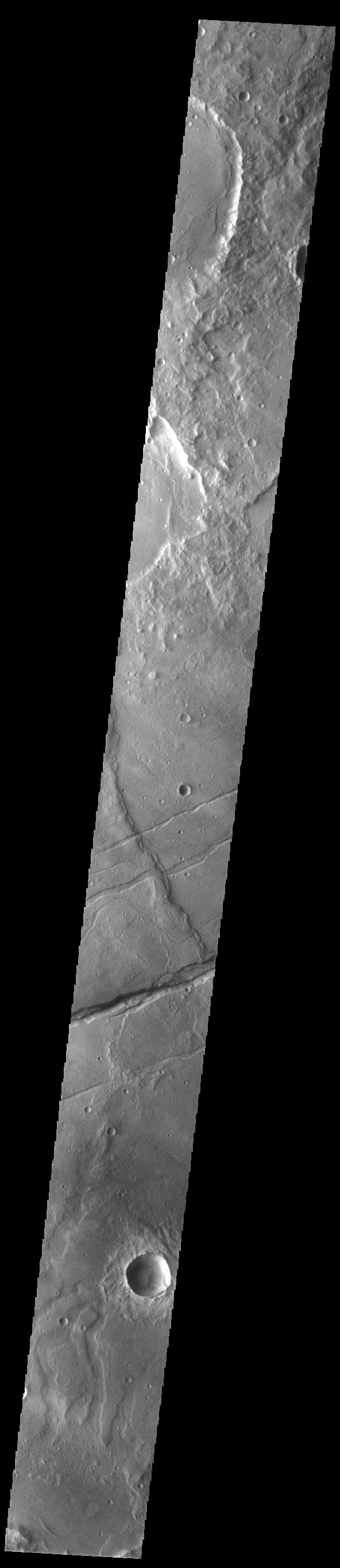
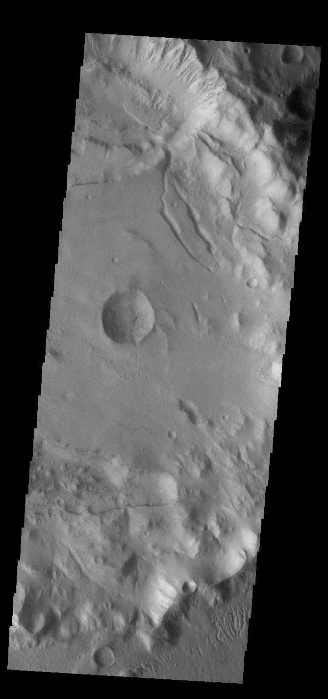
2023-05-11 |
Mars
|
2001 Mars Odyssey
|
THEMIS
|
621x2698x1 |
|
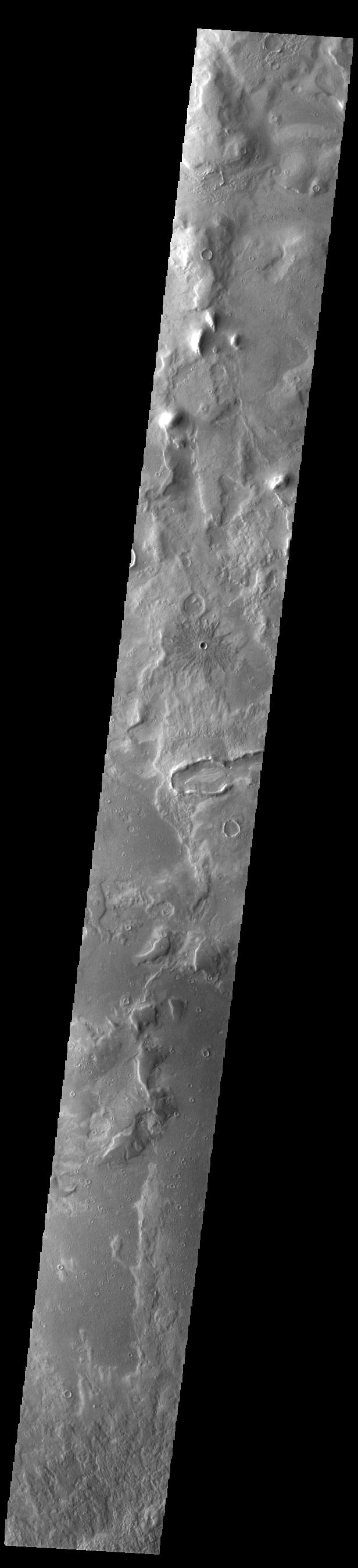
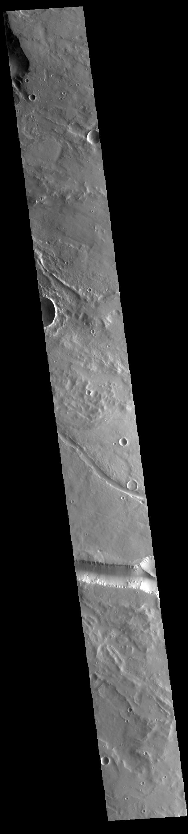
-
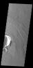
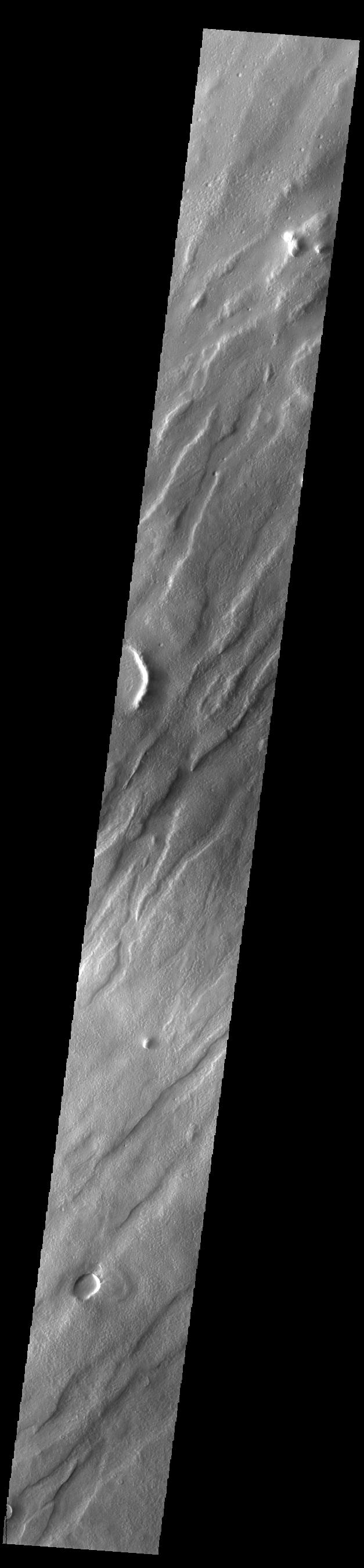
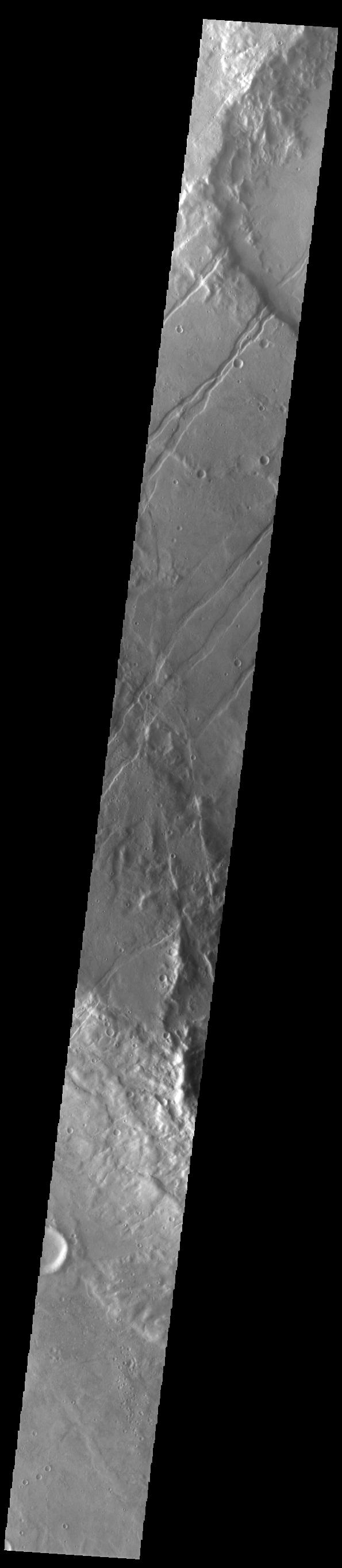
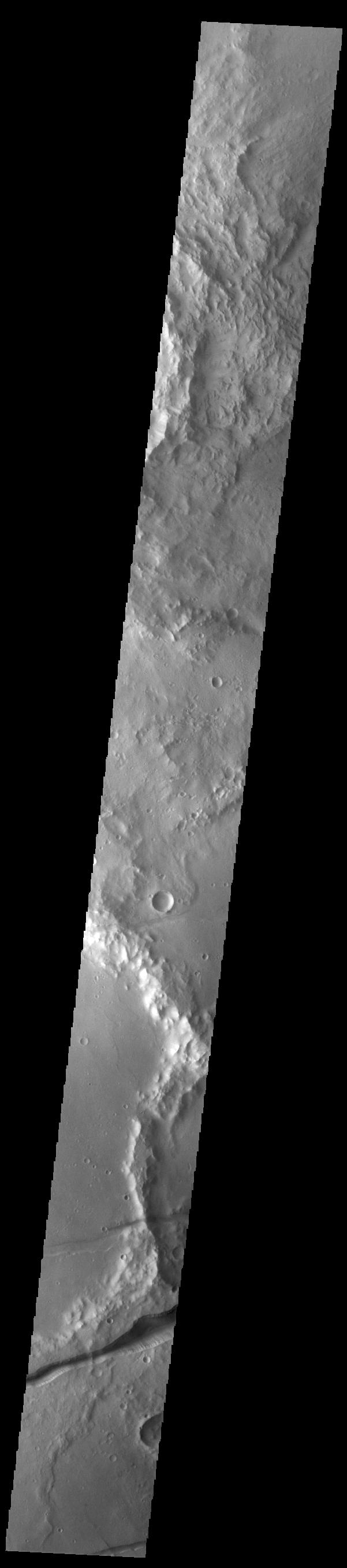
PIA25929:
-
Protonilus Mensae
Full Resolution:
TIFF
(787.4 kB)
JPEG
(87.87 kB)
|
|
|
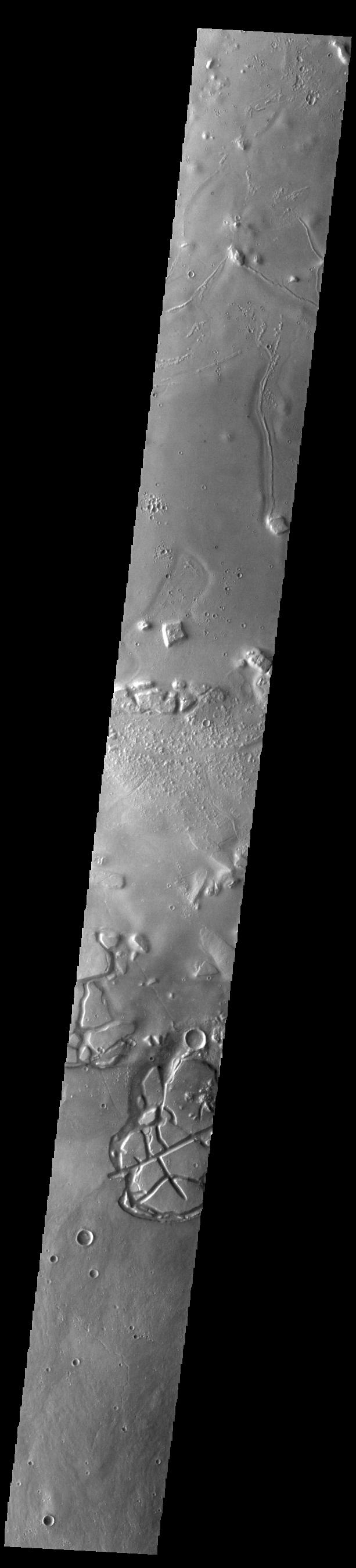
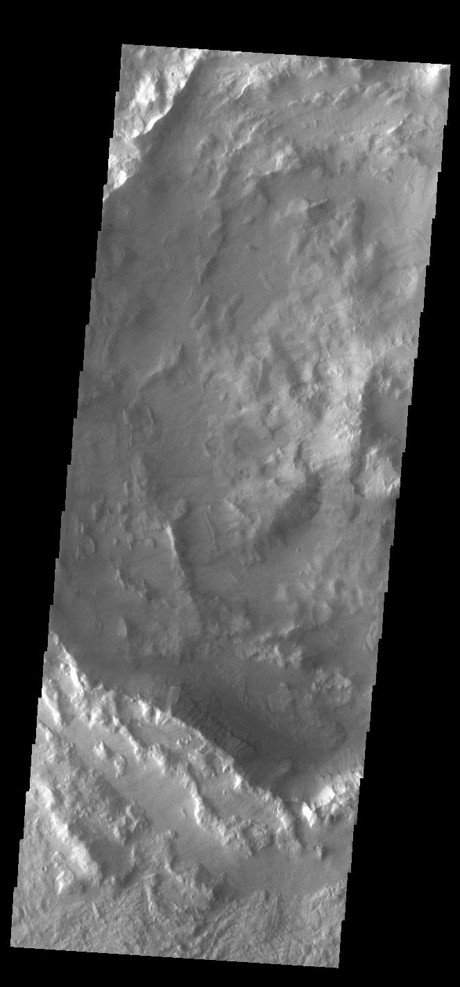
2023-05-10 |
Mars
|
2001 Mars Odyssey
|
THEMIS
|
612x2703x1 |
|
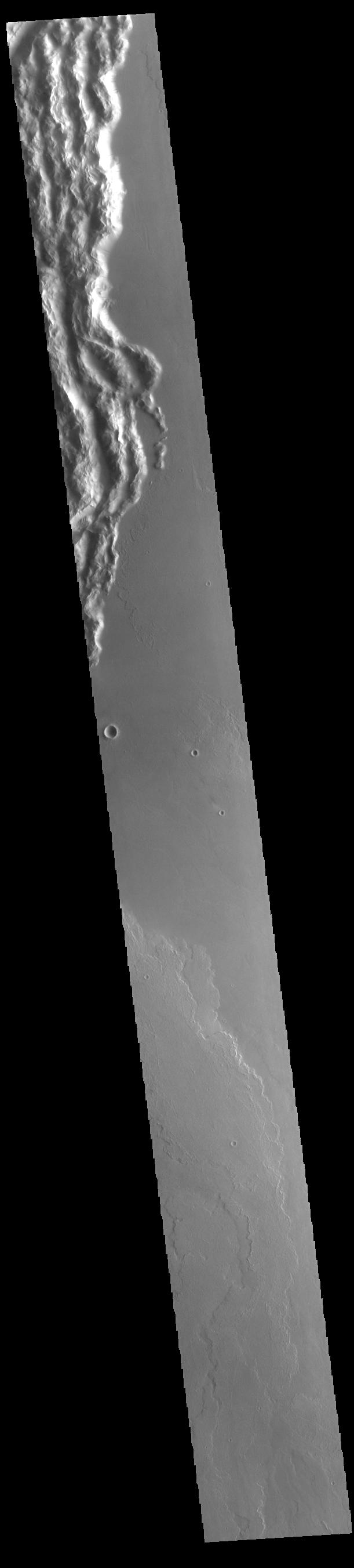
-
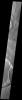
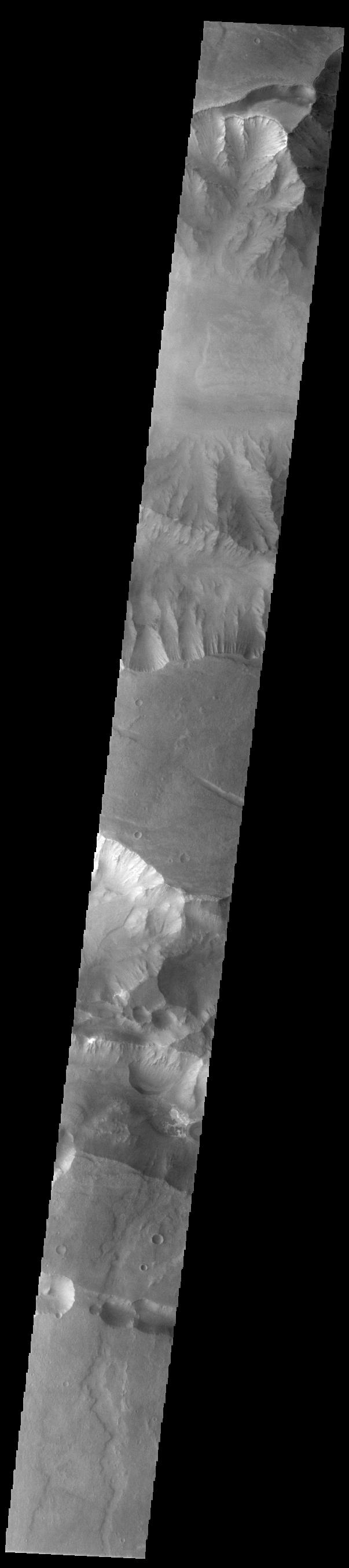
PIA25928:
-
Olympus Mons Flows
Full Resolution:
TIFF
(786 kB)
JPEG
(89.84 kB)
|
|
|
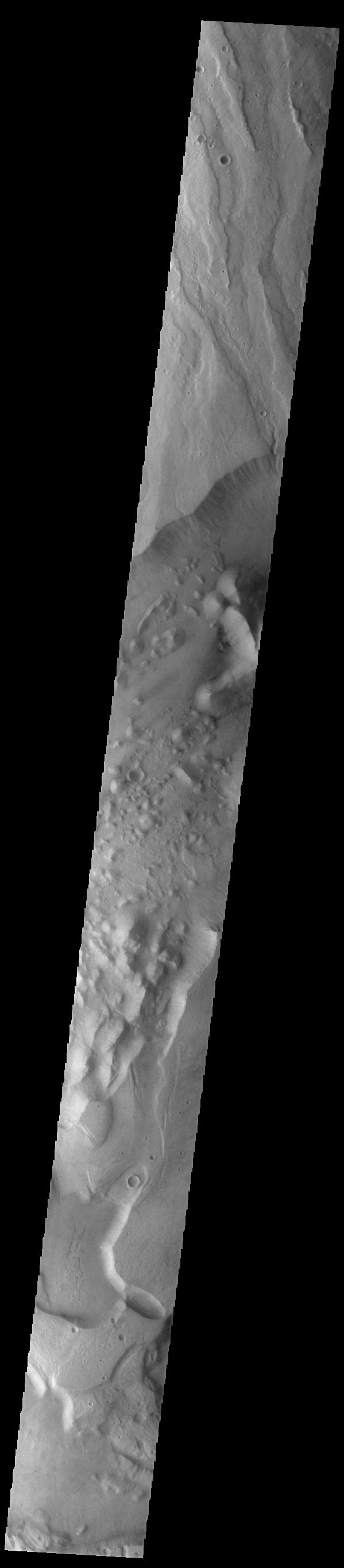
2023-05-09 |
Mars
|
2001 Mars Odyssey
|
THEMIS
|
611x2696x1 |
|
-
PIA25927:
-
Kasei Valles
Full Resolution:
TIFF
(815.1 kB)
JPEG
(111.3 kB)
|
|
|
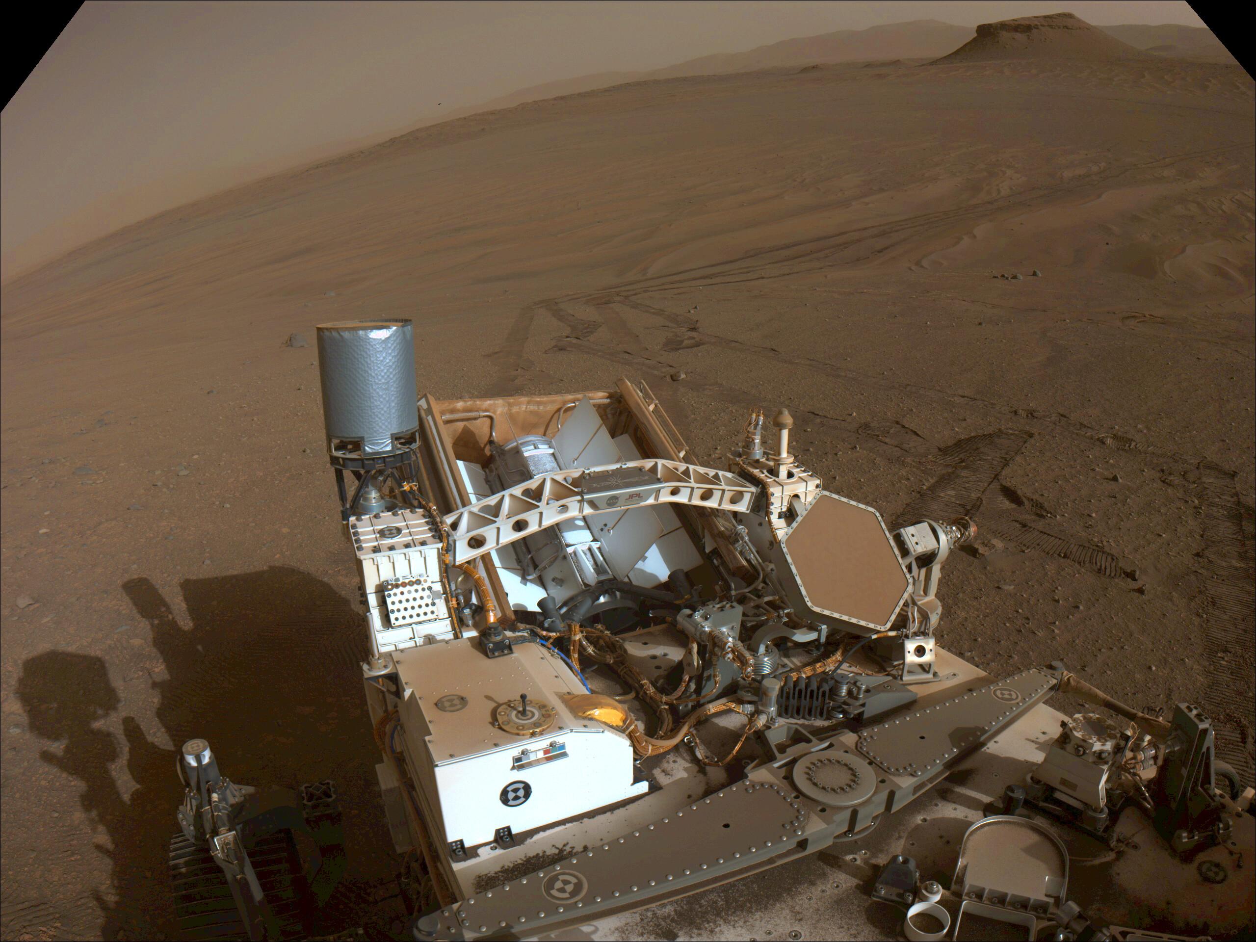
2023-05-08 |
Mars
|
Mars Science Laboratory (MSL)
|
MAHLI
|
1580x1179x3 |
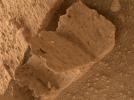
|
-
PIA25828:
-
Curiosity Finds a Book-Like Rock
Full Resolution:
TIFF
(5.575 MB)
JPEG
(316.9 kB)
|
|
|
2023-05-08 |
Mars
|
2001 Mars Odyssey
|
THEMIS
|
616x2697x1 |
|
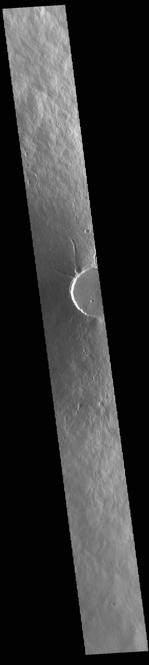
-
PIA25926:
-
Phlegra Montes Crater
Full Resolution:
TIFF
(860.5 kB)
JPEG
(119.2 kB)
|
|
|
2023-05-05 |
Mars
|
2001 Mars Odyssey
|
THEMIS
|
606x2695x1 |

|
-
PIA25925:
-
Elysium Mons
Full Resolution:
TIFF
(772.9 kB)
JPEG
(94.16 kB)
|
|
|
2023-05-04 |
Mars
|
2001 Mars Odyssey
|
THEMIS
|
611x2703x1 |
|
-
PIA25924:
-
Cyane Sulci
Full Resolution:
TIFF
(753.1 kB)
JPEG
(82.6 kB)
|
|
|
2023-05-03 |
Mars
|
2001 Mars Odyssey
|
THEMIS
|
610x2699x1 |

|
-
PIA25923:
-
Ceraunius Tholus
Full Resolution:
TIFF
(732.5 kB)
JPEG
(78.8 kB)
|
|
|
2023-05-02 |
Mars
|
2001 Mars Odyssey
|
THEMIS
|
620x2701x1 |
|
-
PIA25922:
-
Tantalus Fossae
Full Resolution:
TIFF
(852.5 kB)
JPEG
(122.7 kB)
|
|
|
2023-05-01 |
Mars
|
2001 Mars Odyssey
|
THEMIS
|
615x2696x1 |
|
-
PIA25921:
-
Tempe Fossae
Full Resolution:
TIFF
(812.7 kB)
JPEG
(106.7 kB)
|
|
|
2023-04-28 |
Mars
|
2001 Mars Odyssey
|
THEMIS
|
615x2694x1 |
|
-
PIA25910:
-
Alba Mons Dark Streaks
Full Resolution:
TIFF
(859.5 kB)
JPEG
(137.2 kB)
|
|
|
2023-04-27 |
Mars
|
2001 Mars Odyssey
|
THEMIS
|
609x2703x1 |
|
-
PIA25909:
-
Terra Sabaea Crater
Full Resolution:
TIFF
(804.3 kB)
JPEG
(105.4 kB)
|
|
|
2023-04-26 |
Mars
|
2001 Mars Odyssey
|
THEMIS
|
307x2702x1 |

|
-
PIA25908:
-
Olympia Undae
Full Resolution:
TIFF
(830.6 kB)
JPEG
(143.8 kB)
|
|
|
2023-04-25 |
Mars
|
2001 Mars Odyssey
|
THEMIS
|
627x2699x1 |

|
-
PIA25907:
-
Tantalus Fossae
Full Resolution:
TIFF
(868.8 kB)
JPEG
(127.4 kB)
|
|
|
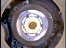
2023-04-24 |
Mars
|
InSight
|
|
1591x1718x3 |
|
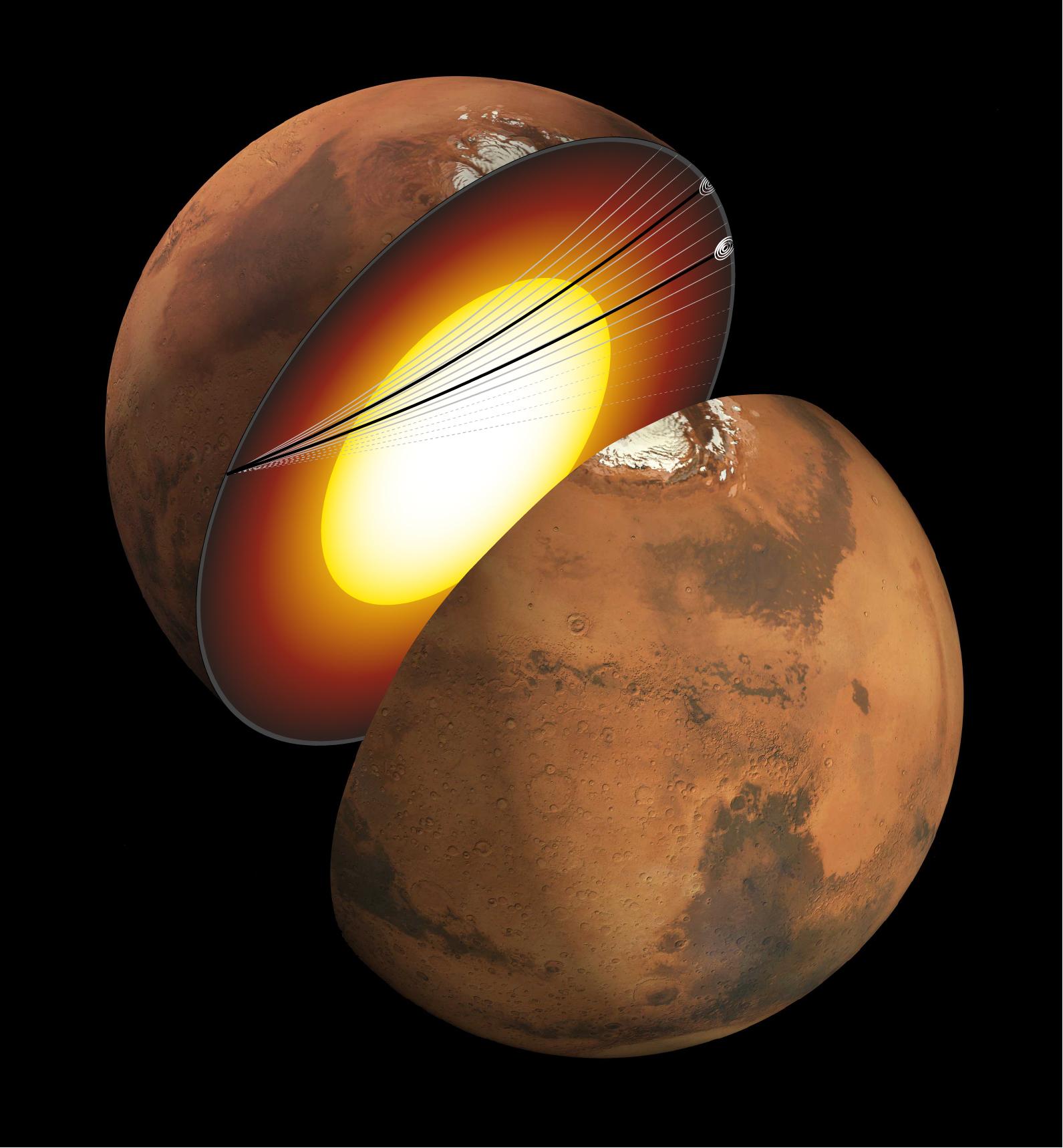
-
PIA25827:
-
InSight Detects Quakes That Entered Martian Core (Artist's Concept)
Full Resolution:
TIFF
(4.052 MB)
JPEG
(188.3 kB)
|
|
|
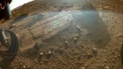
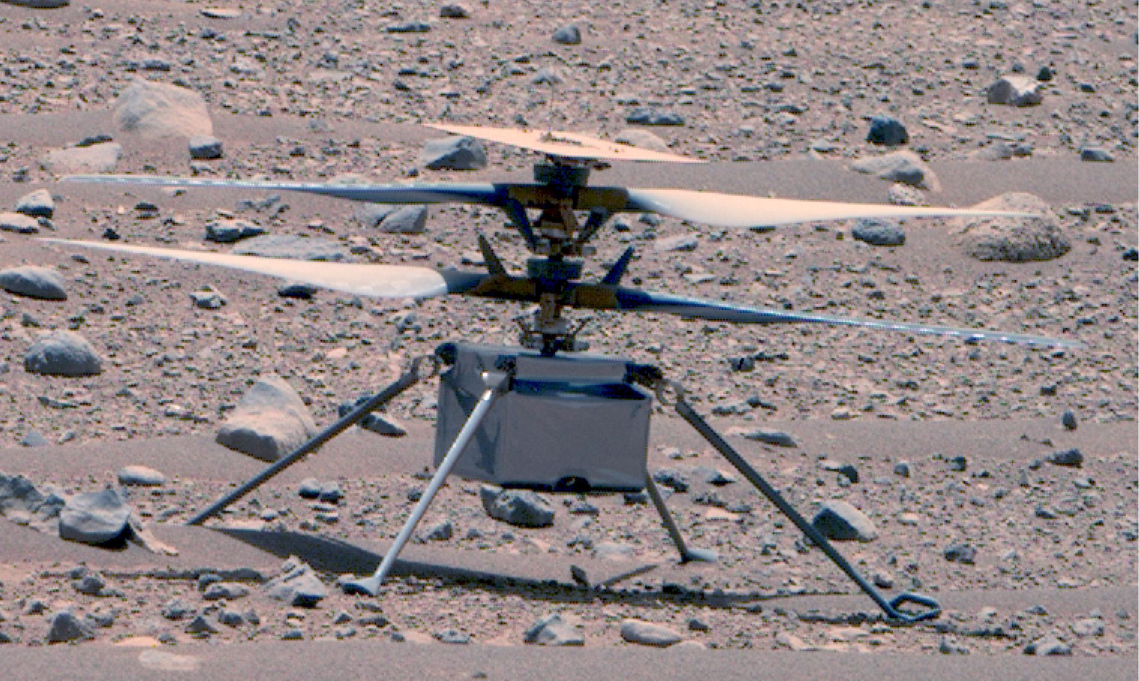
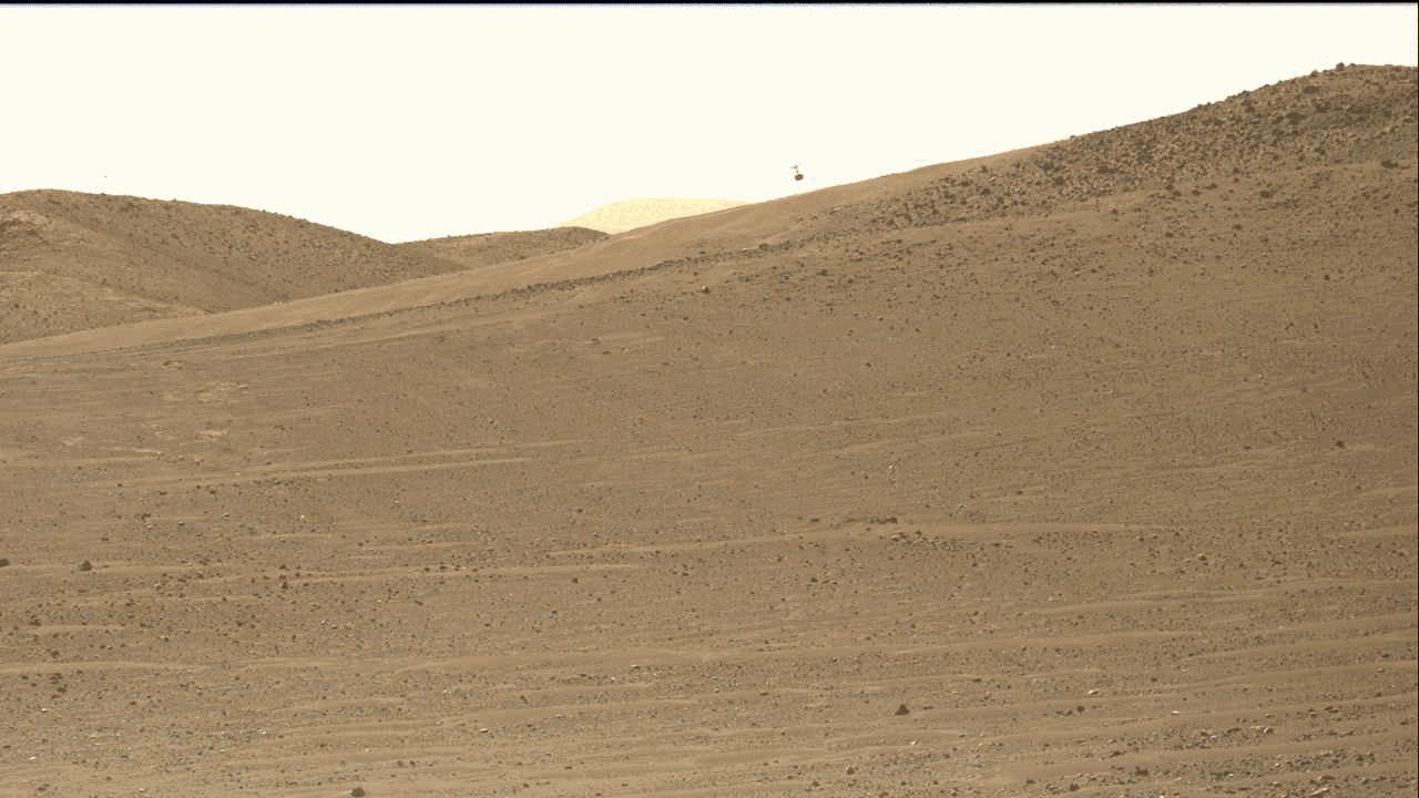
2023-04-24 |
Mars
|
Mars Helicopter
|
|
4208x3120x3 |
|
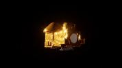
-
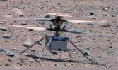
PIA25884:
-
Ingenuity Captures Perseverance at Belva Crater
Full Resolution:
TIFF
(39.41 MB)
JPEG
(3.234 MB)
|
|
|
2023-04-24 |
Mars
|
2001 Mars Odyssey
|
THEMIS
|
613x2705x1 |
|
-
PIA25906:
-
Granicus Valles
Full Resolution:
TIFF
(822.4 kB)
JPEG
(112.5 kB)
|
|
|
2023-04-21 |
Mars
|
2001 Mars Odyssey
|
THEMIS
|
615x2703x1 |

|
-
PIA25905:
-
Adamas Labyrinthus
Full Resolution:
TIFF
(852 kB)
JPEG
(127 kB)
|
|
|
2023-04-20 |
Mars
|
Mars Helicopter
|
|
1648x1200x3 |
|
-
PIA25883:
-
Ingenuity at 'Airfield Mu'
Full Resolution:
TIFF
(5.419 MB)
JPEG
(322.1 kB)
|
|
|
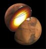
2023-04-20 |
Mars
|
Mars Sample Return (MSR)
|
|
3840x2160x3 |
|
-
PIA25860:
-
Illustration of the Capture, Containment, and Return System for Mars Sample Return
Full Resolution:
TIFF
(12.9 MB)
JPEG
(323.7 kB)
|
|
|
2023-04-20 |
Mars
|
2001 Mars Odyssey
|
THEMIS
|
615x2693x1 |
|
-
PIA25904:
-
Cerulli Crater
Full Resolution:
TIFF
(822.7 kB)
JPEG
(111.9 kB)
|
|
|
2023-04-19 |
Mars
|
Mars Helicopter
|
|
6523x4889x3 |
|
-
PIA25882:
-
Ingenuity Team Celebrates Two Years of Mars Flight
Full Resolution:
TIFF
(90.84 MB)
JPEG
(4.682 MB)
|
|
|
2023-04-19 |
Mars
|
2001 Mars Odyssey
|
THEMIS
|
617x2700x1 |
|
-
PIA25903:
-
Jezero Crater Rim
Full Resolution:
TIFF
(778.8 kB)
JPEG
(88.96 kB)
|
|
|
2023-04-18 |
Mars
|
Mars 2020 Rover
|
Mastcam-Z
|
2274x1360x3 |
|
-
PIA25881:
-
Ingenuity at Two Years on Mars
Full Resolution:
TIFF
(9.282 MB)
JPEG
(562 kB)
|
|
|
2023-04-18 |
Mars
|
2001 Mars Odyssey
|
THEMIS
|
614x2701x1 |

|
-
PIA25902:
-
Tempe Terra Craters
Full Resolution:
TIFF
(820.7 kB)
JPEG
(111.4 kB)
|
|
|
2023-04-17 |
Mars
|
2001 Mars Odyssey
|
THEMIS
|
615x2702x1 |
|
-
PIA25901:
-
Elysium Fossae
Full Resolution:
TIFF
(832.1 kB)
JPEG
(116.1 kB)
|
|
|
2023-04-14 |
Mars
|
2001 Mars Odyssey
|
THEMIS
|
611x2699x1 |
|
-
PIA25880:
-
Cerulli Crater
Full Resolution:
TIFF
(832.6 kB)
JPEG
(107.3 kB)
|
|
|
2023-04-13 |
Mars
|
Mars Reconnaissance Orbiter (MRO)
|
HiRISE
|
2880x1800x3 |
|
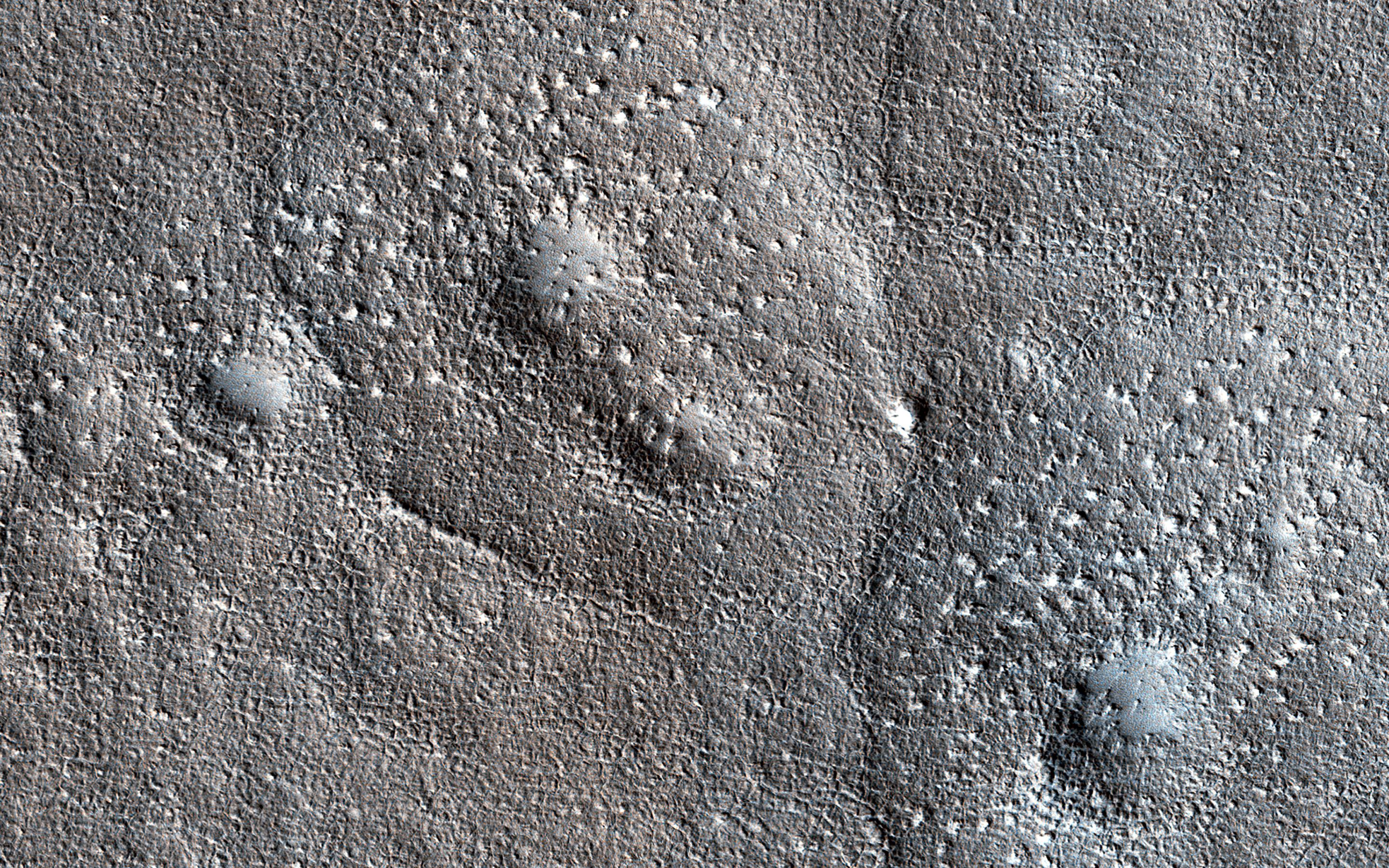
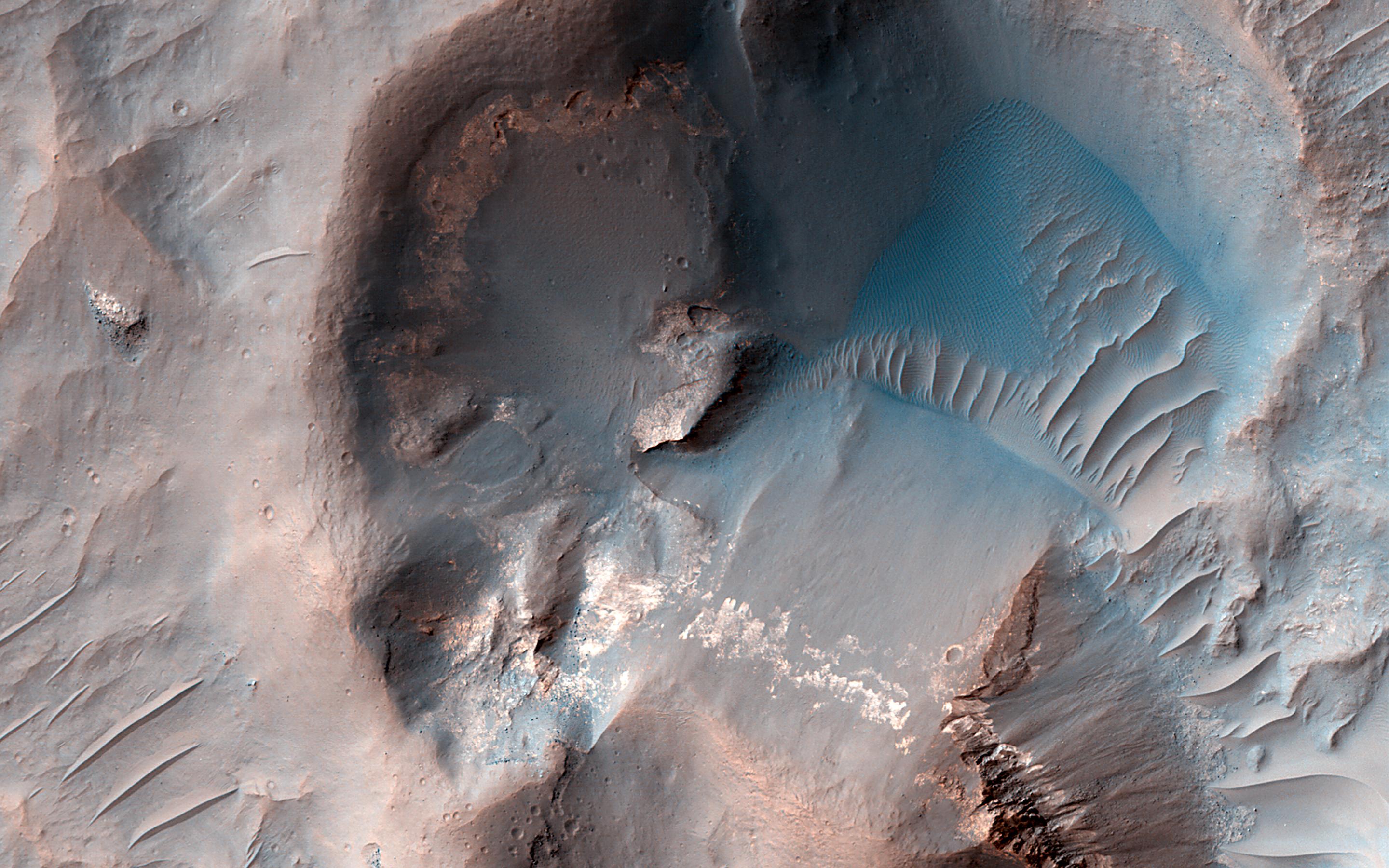
-
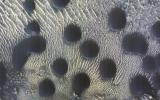
PIA25900:
-
Bumpy, Expanded Craters
Full Resolution:
TIFF
(15.56 MB)
JPEG
(1.522 MB)
|
|
|
2023-04-13 |
Mars
|
Mars Reconnaissance Orbiter (MRO)
|
HiRISE
|
2880x1800x3 |
|
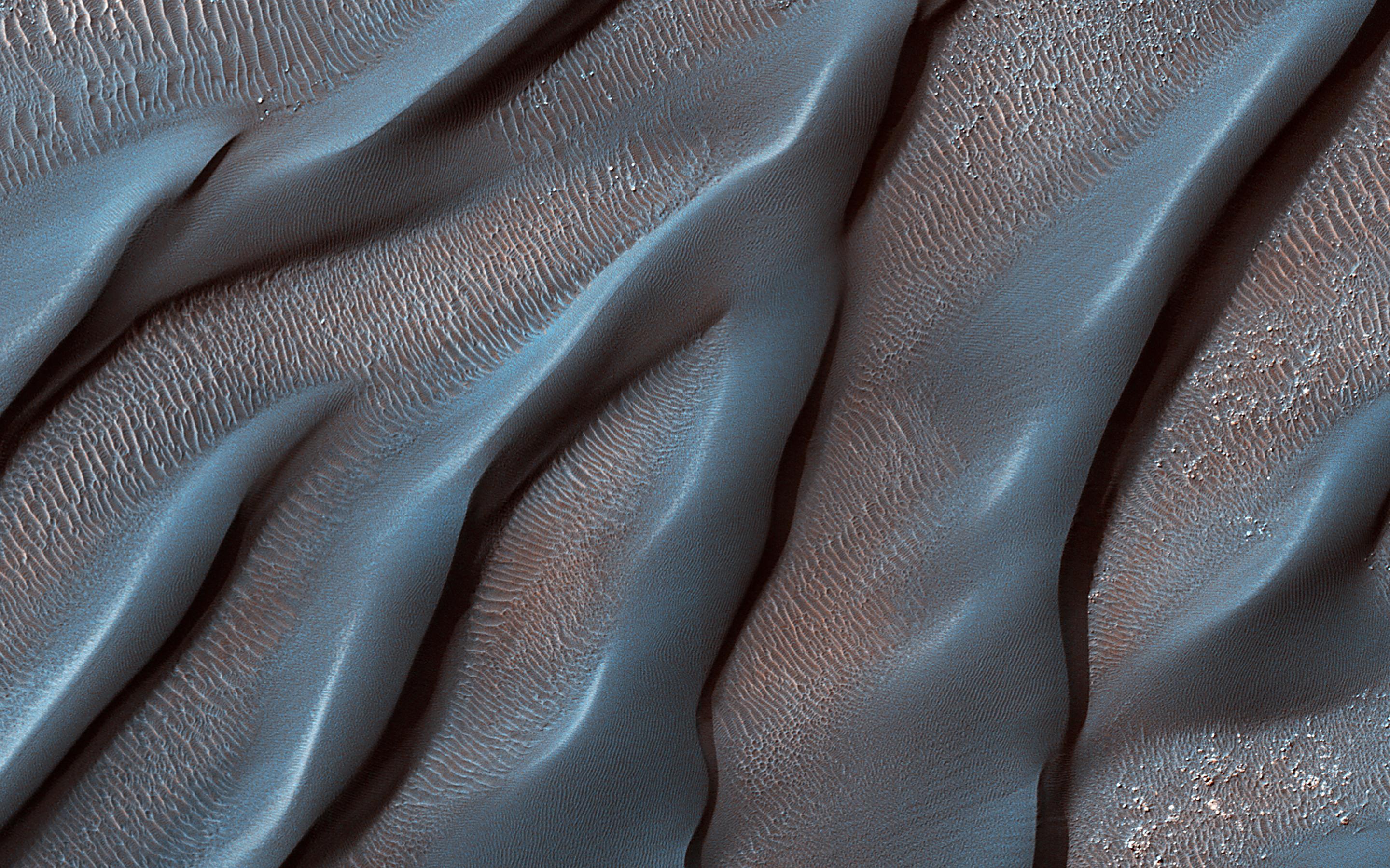
-
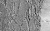
PIA25899:
-
Waxing and Waning Winds
Full Resolution:
TIFF
(15.56 MB)
JPEG
(921.6 kB)
|
|
|
2023-04-13 |
Mars
|
Mars Reconnaissance Orbiter (MRO)
|
HiRISE
|
2880x1800x3 |
|
-
PIA25898:
-
Candidate Mud Volcanoes in Utopia Planitia
Full Resolution:
TIFF
(15.56 MB)
JPEG
(1.001 MB)
|
|
|
2023-04-13 |
Mars
|
Mars Reconnaissance Orbiter (MRO)
|
HiRISE
|
2880x1800x3 |
|
-
PIA25897:
-
Looking at the Crater Half Full
Full Resolution:
TIFF
(15.56 MB)
JPEG
(644.2 kB)
|
|
|
2023-04-13 |
Mars
|
2001 Mars Odyssey
|
THEMIS
|
613x2695x1 |
|
-
PIA25879:
-
Tempe Fossae
Full Resolution:
TIFF
(820.6 kB)
JPEG
(106 kB)
|
|
|
2023-04-12 |
Mars
|
2001 Mars Odyssey
|
THEMIS
|
621x2694x1 |
|
-
PIA25878:
-
Alba Mons Flank
Full Resolution:
TIFF
(881.8 kB)
JPEG
(167.1 kB)
|
|
|
2023-04-11 |
Mars
|
2001 Mars Odyssey
|
THEMIS
|
610x2702x1 |
|
-
PIA25877:
-
Uranius Mons
Full Resolution:
TIFF
(731.9 kB)
JPEG
(80.07 kB)
|
|
|
2023-04-10 |
Mars
|
2001 Mars Odyssey
|
THEMIS
|
609x2702x1 |
|
-
PIA25876:
-
Elysium Fossae
Full Resolution:
TIFF
(791.5 kB)
JPEG
(96.84 kB)
|
|
|
2023-04-07 |
Mars
|
2001 Mars Odyssey
|
THEMIS
|
603x2701x1 |

|
-
PIA25875:
-
Ascraeus Mons
Full Resolution:
TIFF
(799.6 kB)
JPEG
(138.6 kB)
|
|
|
2023-04-06 |
Mars
|
Mars Sample Return (MSR)
|
|
3840x2160x3 |
|
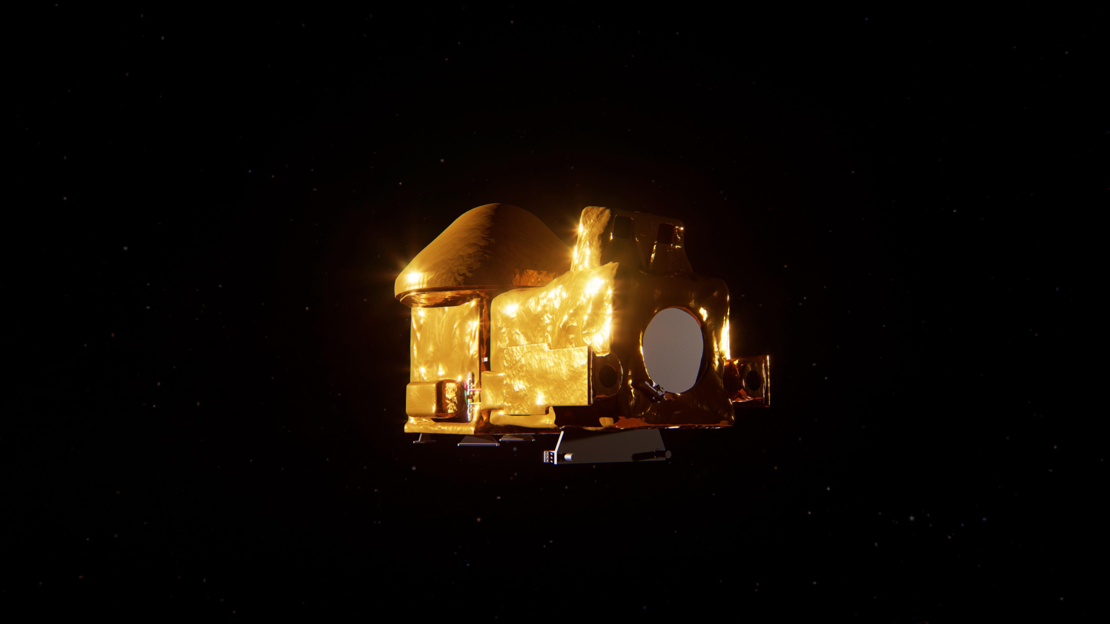
-
PIA25894:
-
Artist's concept of the Capture, Containment, and Return System
Full Resolution:
TIFF
(6.158 MB)
JPEG
(221.5 kB)
|
|
|
2023-04-06 |
Mars
|
Mars Sample Return (MSR)
|
|
2888x1624x3 |
|
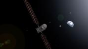
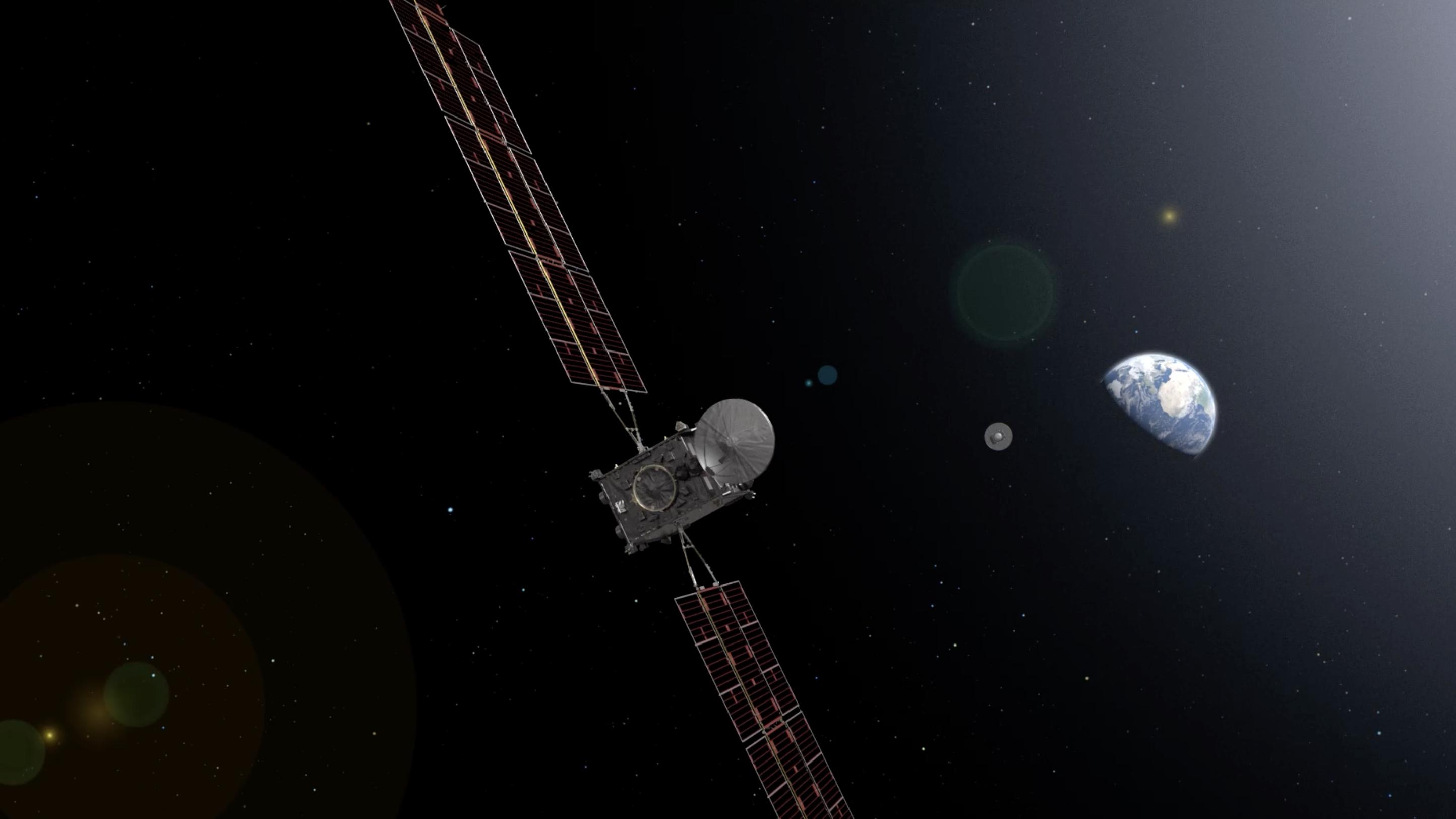
-
PIA25893:
-
Artist's Concept of Earth Return Orbiter Releasing Capsule containing Martian Samples
Full Resolution:
TIFF
(4.746 MB)
JPEG
(175.3 kB)
|
|
|
2023-04-06 |
Mars
|
Mars Sample Return (MSR)
|
|
8000x4500x3 |
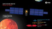
|
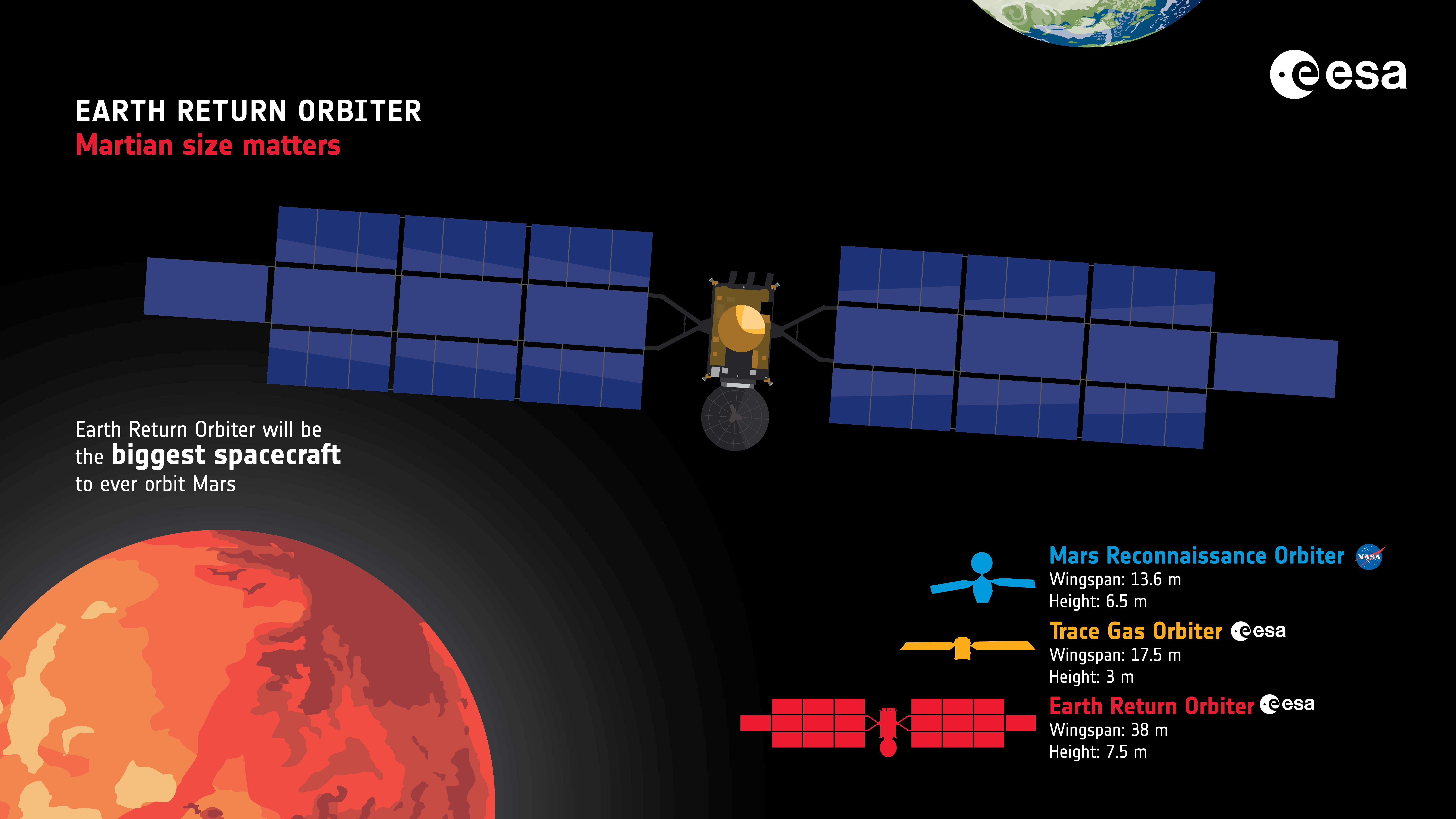
-
PIA25892:
-
Earth Return Orbiter Infographic
Full Resolution:
TIFF
(7.031 MB)
JPEG
(1.048 MB)
|
|
|
2023-04-06 |
Mars
|
Mars Sample Return (MSR)
|
|
2888x1624x3 |
|
-
PIA25891:
-
Artist's concept of the Earth Return Orbiter over Mars
Full Resolution:
TIFF
(7.889 MB)
JPEG
(257.2 kB)
|
|
|
2023-04-06 |
Mars
|
2001 Mars Odyssey
|
THEMIS
|
309x2703x1 |

|
-
PIA25874:
-
Olympia Undae
Full Resolution:
TIFF
(791.9 kB)
JPEG
(101.3 kB)
|
|
|
2023-04-05 |
Mars
|
2001 Mars Odyssey
|
THEMIS
|
614x2702x1 |

|
-
PIA25873:
-
Acheron Fossae
Full Resolution:
TIFF
(810.6 kB)
JPEG
(104.3 kB)
|
|
|
2023-04-04 |
Mars
|
2001 Mars Odyssey
|
THEMIS
|
614x2698x1 |
|
-
PIA25872:
-
Mamers Valles
Full Resolution:
TIFF
(752.5 kB)
JPEG
(74.44 kB)
|
|
|
2023-04-03 |
Mars
|
2001 Mars Odyssey
|
THEMIS
|
615x2700x1 |
|
-
PIA25871:
-
Granicus Valles
Full Resolution:
TIFF
(838 kB)
JPEG
(104.6 kB)
|
|
|
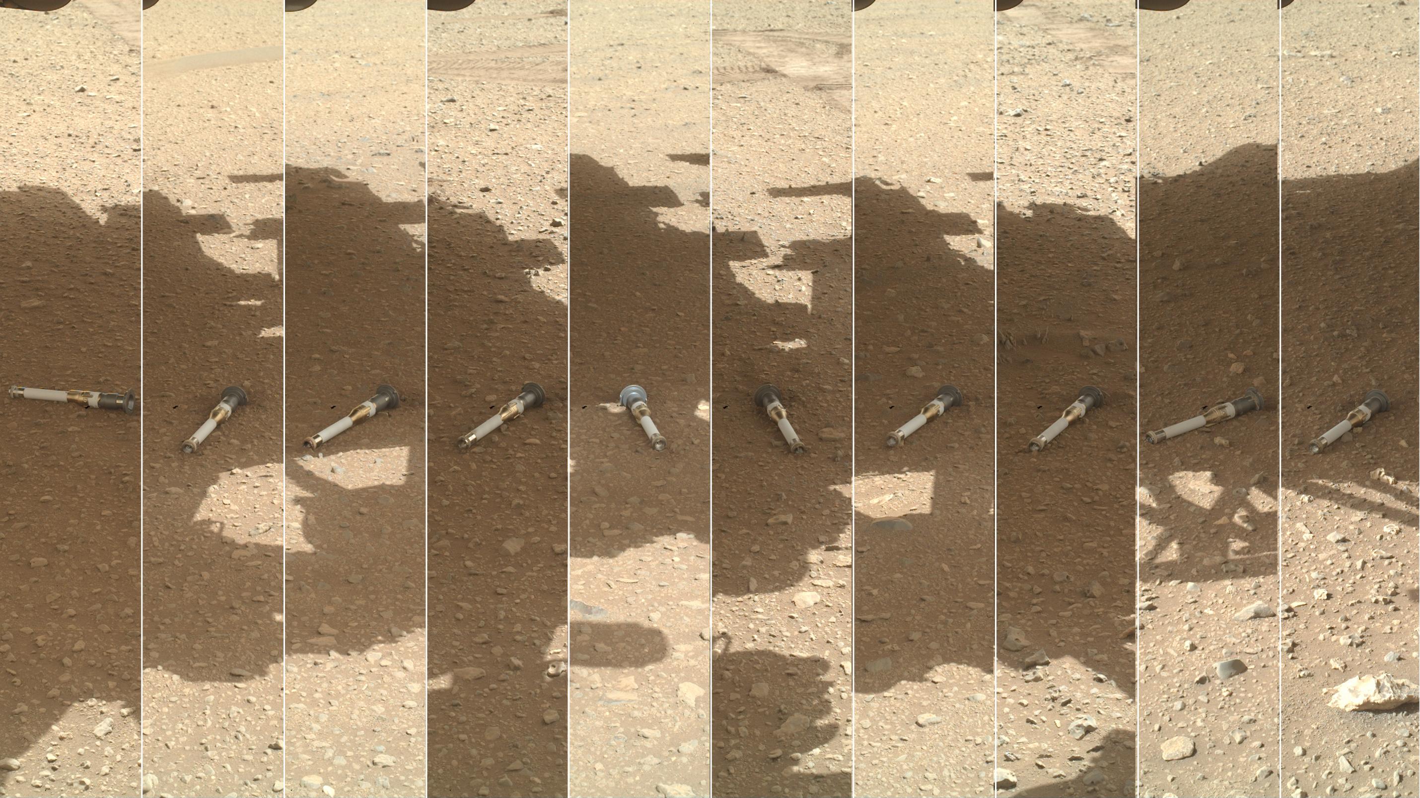
2023-03-31 |
Mars
|
Mars 2020 Rover
|
Mastcam-Z
|
1648x1200x3 |
|
-
PIA25690:
-
Perseverance's Rock Core From 'Berea' Outcrop
Full Resolution:
TIFF
(5.935 MB)
JPEG
(156.6 kB)
|
|
|
2023-03-31 |
Mars
|
Mars 2020 Rover
|
Hazard Avoidance Camera (M2020)
|
1280x960x3 |

|
-
PIA25689:
-
Perseverance Cores 'Berea'
Full Resolution:
TIFF
(3.688 MB)
JPEG
(223.2 kB)
|
|
|
2023-03-31 |
Mars
|
Mars 2020 Rover
|
Hazard Avoidance Camera (M2020)
|
5120x2880x3 |
|
-
PIA25688:
-
Perseverance Samples 'Berea'
Full Resolution:
TIFF
(44.26 MB)
JPEG
(1.798 MB)
|
|
|
2023-03-31 |
Mars
|
2001 Mars Odyssey
|
THEMIS
|
614x2694x1 |
|
-
PIA25855:
-
Lycus Sulci
Full Resolution:
TIFF
(815.2 kB)
JPEG
(103.4 kB)
|
|
|
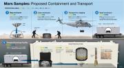
2023-03-30 |
Mars
|
Mars Sample Return (MSR)
|
|
11250x6250x3 |
|
-
PIA25857:
-
Mars Samples: Proposed Containment and Transport
Full Resolution:
TIFF
(52.28 MB)
JPEG
(3.525 MB)
|
|
|
2023-03-30 |
Mars
|
2001 Mars Odyssey
|
THEMIS
|
612x2696x1 |

|
-
PIA25854:
-
Ceraunius Fossae
Full Resolution:
TIFF
(815 kB)
JPEG
(108.7 kB)
|
|
|
2023-03-29 |
Mars
|
2001 Mars Odyssey
|
THEMIS
|
613x2699x1 |
|
-
PIA25853:
-
Galaxias Chaos
Full Resolution:
TIFF
(839.3 kB)
JPEG
(109.3 kB)
|
|
|
2023-03-28 |
Mars
|
2001 Mars Odyssey
|
THEMIS
|
599x2723x1 |
|
-
PIA25852:
-
Dao and Niger Valles
Full Resolution:
TIFF
(781.4 kB)
JPEG
(90.35 kB)
|
|
|
2023-03-27 |
Mars
|
2001 Mars Odyssey
|
THEMIS
|
594x2726x1 |
|
-
PIA25851:
-
Rabe Crater Dunes
Full Resolution:
TIFF
(727.2 kB)
JPEG
(81.93 kB)
|
|
|
2023-03-24 |
Mars
|
2001 Mars Odyssey
|
THEMIS
|
607x2711x1 |
|
-
PIA25850:
-
Ophir and Candor Chasmata
Full Resolution:
TIFF
(733 kB)
JPEG
(77.87 kB)
|
|
|
2023-03-23 |
Mars
|
Mars Helicopter
|
|
960x703x3 |
|
-
PIA25687:
-
Ingenuity and Perseverance Make Tracks
Full Resolution:
TIFF
(2.026 MB)
JPEG
(123.9 kB)
|
|
|
2023-03-23 |
Mars
|
2001 Mars Odyssey
|
THEMIS
|
609x2710x1 |
|
-
PIA25849:
-
Eumenides Dorsum
Full Resolution:
TIFF
(807.8 kB)
JPEG
(110.4 kB)
|
|
|
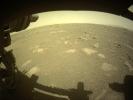
2023-03-22 |
Mars
|
Mars 2020 Rover
|
Navigation Camera (M2020)
|
1266x966x3 |

|
-
PIA25821:
-
Perseverance Views Drifting Clouds
Full Resolution:
TIFF
(1.866 MB)
JPEG
(38.67 kB)
|
|
|
2023-03-22 |
Mars
|
2001 Mars Odyssey
|
THEMIS
|
602x2714x1 |
|
-
PIA25848:
-
Chaos
Full Resolution:
TIFF
(783.1 kB)
JPEG
(94.26 kB)
|
|
|
2023-03-21 |
Mars
|
2001 Mars Odyssey
|
THEMIS
|
595x2728x1 |
|
-
PIA25847:
-
Icaria Fossae
Full Resolution:
TIFF
(746.6 kB)
JPEG
(93.97 kB)
|
|
|
2023-03-20 |
Mars
|
2001 Mars Odyssey
|
THEMIS
|
488x2726x1 |
|
-
PIA25846:
-
South Polar Ice
Full Resolution:
TIFF
(1.308 MB)
JPEG
(167.4 kB)
|
|
|
2023-03-17 |
Mars
|
2001 Mars Odyssey
|
THEMIS
|
488x2727x1 |

|
-
PIA25845:
-
South Polar Ice
Full Resolution:
TIFF
(1.329 MB)
JPEG
(171.5 kB)
|
|
|
2023-03-16 |
Mars
|
2001 Mars Odyssey
|
THEMIS
|
306x2867x1 |

|
-
PIA25844:
-
Southern Dunes
Full Resolution:
TIFF
(676.9 kB)
JPEG
(55.25 kB)
|
|
|
2023-03-15 |
Mars
|
2001 Mars Odyssey
|
THEMIS
|
486x2724x1 |

|
-
PIA25843:
-
South Polar Ice
Full Resolution:
TIFF
(1.325 MB)
JPEG
(179.5 kB)
|
|
|
2023-03-14 |
Mars
|
Mars 2020 Rover
|
Mastcam-Z
|
1280x720x3 |

|
-
PIA25686:
-
Perseverance's Mastcam-Z Views Ingenuity's 47th Takeoff
Full Resolution:
TIFF
(1.549 MB)
JPEG
(101.7 kB)
|
|
|
2023-03-14 |
Mars
|
2001 Mars Odyssey
|
THEMIS
|
592x2726x1 |

|
-
PIA25842:
-
Sirenum Fossae
Full Resolution:
TIFF
(787.4 kB)
JPEG
(114.1 kB)
|
|
|
2023-03-13 |
Mars
|
2001 Mars Odyssey
|
THEMIS
|
663x1423x1 |

|
-
PIA25841:
-
Rugged Crater Floor
Full Resolution:
TIFF
(694.6 kB)
JPEG
(81.7 kB)
|
|
|
2023-03-10 |
Mars
|
2001 Mars Odyssey
|
THEMIS
|
591x2731x1 |
|
-
PIA25820:
-
Gorgonum Chaos
Full Resolution:
TIFF
(749.2 kB)
JPEG
(93.84 kB)
|
|
|
2023-03-09 |
Mars
|
2001 Mars Odyssey
|
THEMIS
|
596x2731x1 |
|
-
PIA25819:
-
Proctor Crater Dunes
Full Resolution:
TIFF
(687.1 kB)
JPEG
(75.87 kB)
|
|
|
2023-03-08 |
Mars
|
2001 Mars Odyssey
|
THEMIS
|
607x2709x1 |
|
-
PIA25818:
-
Wind Erosion
Full Resolution:
TIFF
(795.7 kB)
JPEG
(101.1 kB)
|
|
|
2023-03-07 |
Mars
|
2001 Mars Odyssey
|
THEMIS
|
600x2705x1 |

|
-
PIA25817:
-
Arsia Mons Flank
Full Resolution:
TIFF
(770.3 kB)
JPEG
(103.1 kB)
|
|
|
2023-03-06 |
Mars
|
Mars Science Laboratory (MSL)
|
Mastcam
|
3417x1163x3 |
|
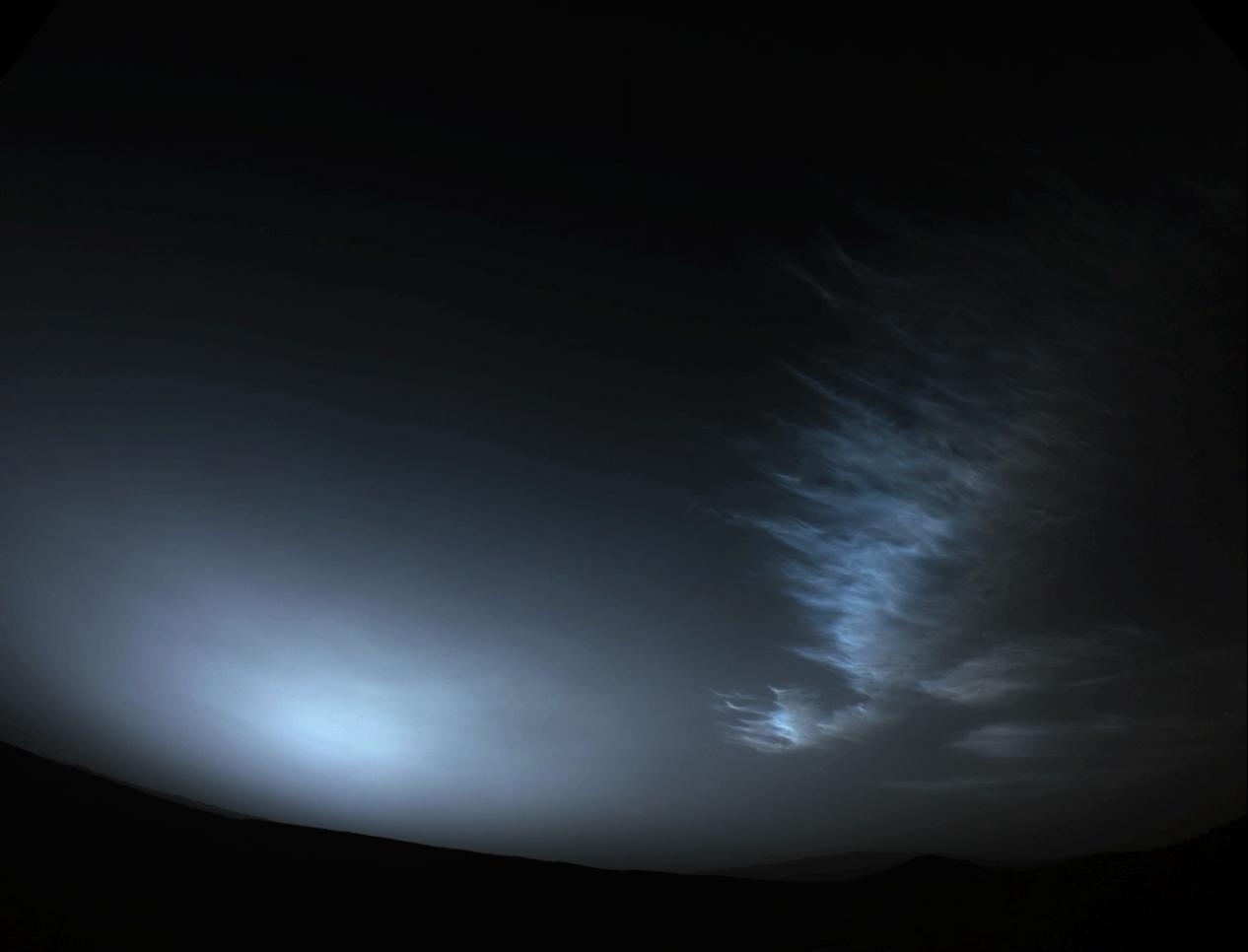
-
PIA25740:
-
Curiosity Views Feather-Shaped Iridescent Cloud
Full Resolution:
TIFF
(5.465 MB)
JPEG
(93.38 kB)
|
|
|
2023-03-06 |
Mars
|
Mars Science Laboratory (MSL)
|
Mastcam
|
3813x1024x3 |

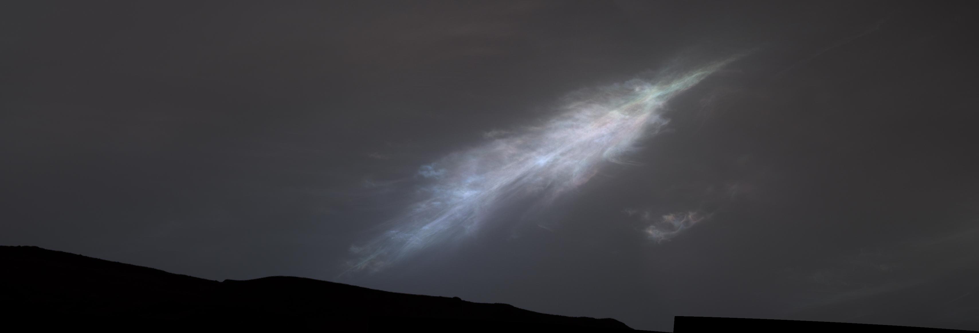
|
-
PIA25739:
Curiosity Views First Martian 'Sun Rays'
Full Resolution:
TIFF
(7.479 MB)
JPEG
(97.4 kB)
|
|
|
2023-03-06 |
Mars
|
2001 Mars Odyssey
|
THEMIS
|
607x2711x1 |
|
-
PIA25816:
-
Coprates Chasma
Full Resolution:
TIFF
(748.1 kB)
JPEG
(83.19 kB)
|
|
|
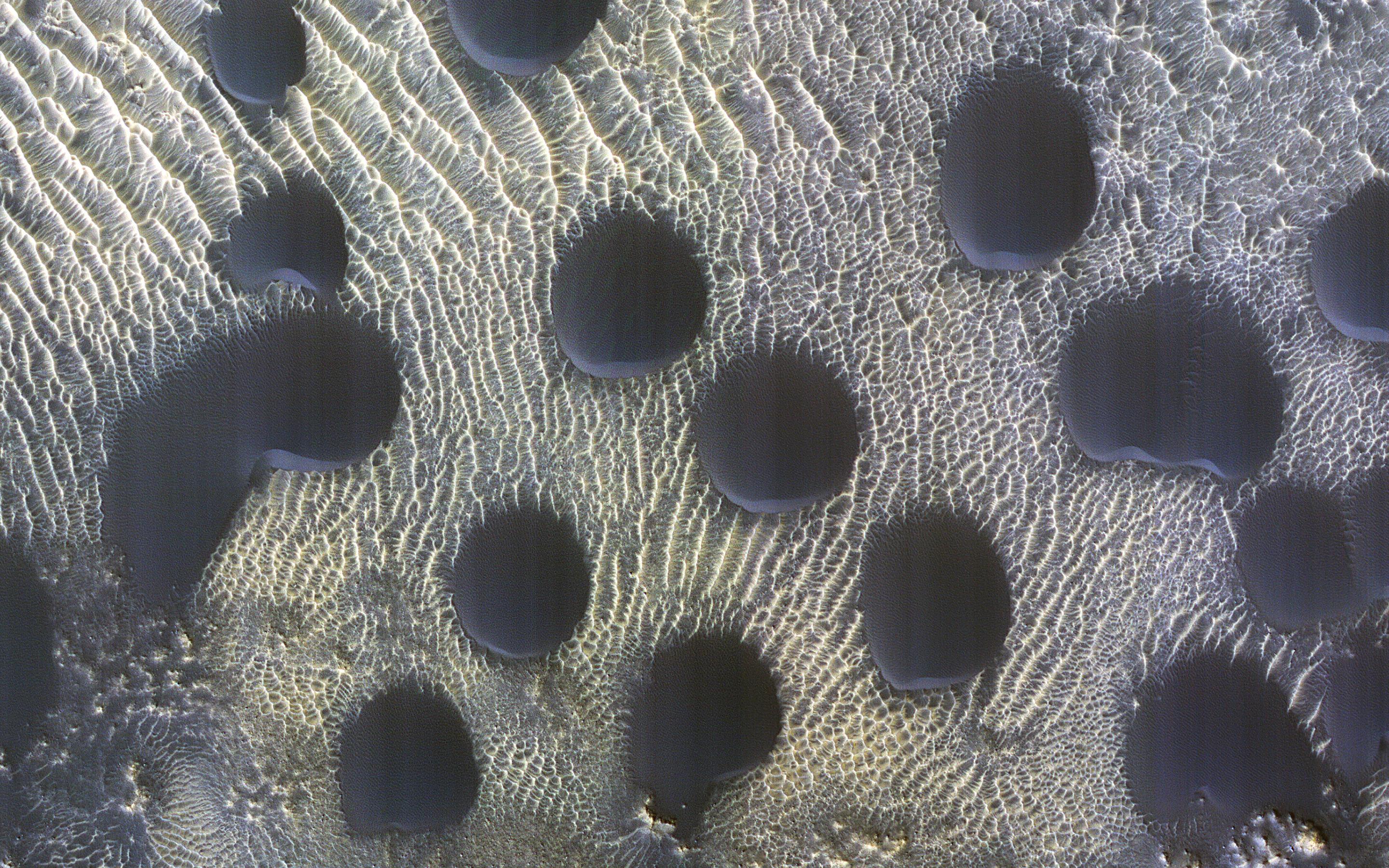
2023-03-03 |
Mars
|
Mars Reconnaissance Orbiter (MRO)
|
HiRISE
|
2880x1800x3 |
|
-
PIA25795:
-
Circular Sand Dunes
Full Resolution:
TIFF
(15.56 MB)
JPEG
(1.184 MB)
|
|
|
2023-03-03 |
Mars
|
Mars Reconnaissance Orbiter (MRO)
|
HiRISE
|
2880x1800x3 |
|
-
PIA25794:
-
Glacial (Ice) or Lava Flow?
Full Resolution:
TIFF
(8.207 MB)
JPEG
(1.221 MB)
|
|
|
2023-03-03 |
Mars
|
Mars Reconnaissance Orbiter (MRO)
|
HiRISE
|
2880x1800x3 |
|
-
PIA25793:
-
Boulder Patterns
Full Resolution:
TIFF
(15.56 MB)
JPEG
(1.108 MB)
|
|
|
2023-03-03 |
Mars
|
Mars Reconnaissance Orbiter (MRO)
|
HiRISE
|
2880x1800x3 |
|
-
PIA25792:
-
A Look at a Steep North Polar Scarp
Full Resolution:
TIFF
(15.56 MB)
JPEG
(1.187 MB)
|
|
|
2023-03-03 |
Mars
|
2001 Mars Odyssey
|
THEMIS
|
490x5389x1 |

|
-
PIA25815:
-
South Polar Ice
Full Resolution:
TIFF
(2.643 MB)
JPEG
(378.5 kB)
|
|
|
2023-03-02 |
Mars
|
2001 Mars Odyssey
|
THEMIS
|
491x5388x1 |

|
-
PIA25814:
-
South Polar Ice
Full Resolution:
TIFF
(2.048 MB)
JPEG
(214.5 kB)
|
|
|
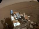
2023-03-01 |
Mars
|
Mars 2020 Rover
|
Navigation Camera (M2020)
|
3901x2116x3 |
|
-
PIA25685:
-
Perseverance's Navcam Captures Ingenuity
Full Resolution:
TIFF
(17.32 MB)
JPEG
(988.3 kB)
|
|
|
2023-03-01 |
Mars
|
2001 Mars Odyssey
|
THEMIS
|
599x2718x1 |

|
-
PIA25813:
-
Tyrrhenus Mons
Full Resolution:
TIFF
(772.3 kB)
JPEG
(97.4 kB)
|
|
|
2023-02-28 |
Mars
|
2001 Mars Odyssey
|
THEMIS
|
600x2731x1 |
|
-
PIA25812:
-
Matara Crater Dunes
Full Resolution:
TIFF
(720.7 kB)
JPEG
(75.36 kB)
|
|
|
2023-02-27 |
Mars
|
2001 Mars Odyssey
|
THEMIS
|
603x2705x1 |
|
-
PIA25811:
-
Coprates Chasma
Full Resolution:
TIFF
(772.3 kB)
JPEG
(90.94 kB)
|
|
|
2023-02-24 |
Mars
|
2001 Mars Odyssey
|
THEMIS
|
681x1418x1 |
|
-
PIA25810:
-
Daedalia Planum
Full Resolution:
TIFF
(752 kB)
JPEG
(133.7 kB)
|
|
|
2023-02-23 |
Mars
|
2001 Mars Odyssey
|
THEMIS
|
674x1409x1 |
|
-
PIA25809:
-
Daedalia Planum
Full Resolution:
TIFF
(658.7 kB)
JPEG
(75.36 kB)
|
|
|
2023-02-22 |
Mars
|
2001 Mars Odyssey
|
THEMIS
|
686x1420x1 |

|
-
PIA25808:
-
Ius Chasma Landslides
Full Resolution:
TIFF
(602.2 kB)
JPEG
(51.74 kB)
|
|
|
2023-02-21 |
Mars
|
2001 Mars Odyssey
|
THEMIS
|
601x2714x1 |
|
-
PIA25807:
-
Memnonia Fossae
Full Resolution:
TIFF
(777.3 kB)
JPEG
(97.8 kB)
|
|
|
2023-02-20 |
Mars
|
2001 Mars Odyssey
|
THEMIS
|
671x1435x1 |
|
-
PIA25806:
-
Russell Crater Dunes
Full Resolution:
TIFF
(709.1 kB)
JPEG
(89.79 kB)
|
|
|
2023-02-17 |
Mars
|
Mars 2020 Rover
|
Hazard Avoidance Camera (M2020)
|
1280x960x3 |
|
-
PIA25799:
-
Front Left Hazcam – Two Year Movie
Full Resolution:
TIFF
(3.393 MB)
JPEG
(143.6 kB)
|
|
|
2023-02-17 |
Mars
|
Mars 2020 Rover
|
Navigation Camera (M2020)
|
2560x1920x3 |
|
-
PIA25684:
-
Looking Back at Perseverance's Second Science Campaign
Full Resolution:
TIFF
(13.74 MB)
JPEG
(498 kB)
|
|
|
2023-02-17 |
Mars
|
2001 Mars Odyssey
|
THEMIS
|
534x1446x1 |
|
-
PIA25805:
-
Near Polar Dunes
Full Resolution:
TIFF
(597.7 kB)
JPEG
(48.33 kB)
|
|
|
2023-02-16 |
Mars
|
2001 Mars Odyssey
|
THEMIS
|
669x1423x1 |

|
-
PIA25804:
-
Crater Gullies
Full Resolution:
TIFF
(694.9 kB)
JPEG
(79.56 kB)
|
|
|
2023-02-15 |
Mars
|
2001 Mars Odyssey
|
THEMIS
|
671x1426x1 |
|
-
PIA25803:
-
Reull Vallis
Full Resolution:
TIFF
(724.7 kB)
JPEG
(100.2 kB)
|
|
|
2023-02-14 |
Mars
|
Mars 2020 Rover
|
Mastcam-Z
|
29705x20033x3 |
|
-
PIA25736:
-
Perseverance's Portrait of the Sample Depot
Full Resolution:
TIFF
(1.371 GB)
JPEG
(79.22 MB)
|
|
|
2023-02-14 |
Mars
|
Mars 2020 Rover
|
Scanning Habitable Environments with Raman & Luminescence for Organics and Chemicals (SHERLOC)
|
2860x1608x3 |
|
-
PIA25738:
-
WATSON's Photomontage of Mars Sample Depot
Full Resolution:
TIFF
(13.46 MB)
JPEG
(741.9 kB)
|
 Planetary Data System


