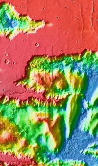
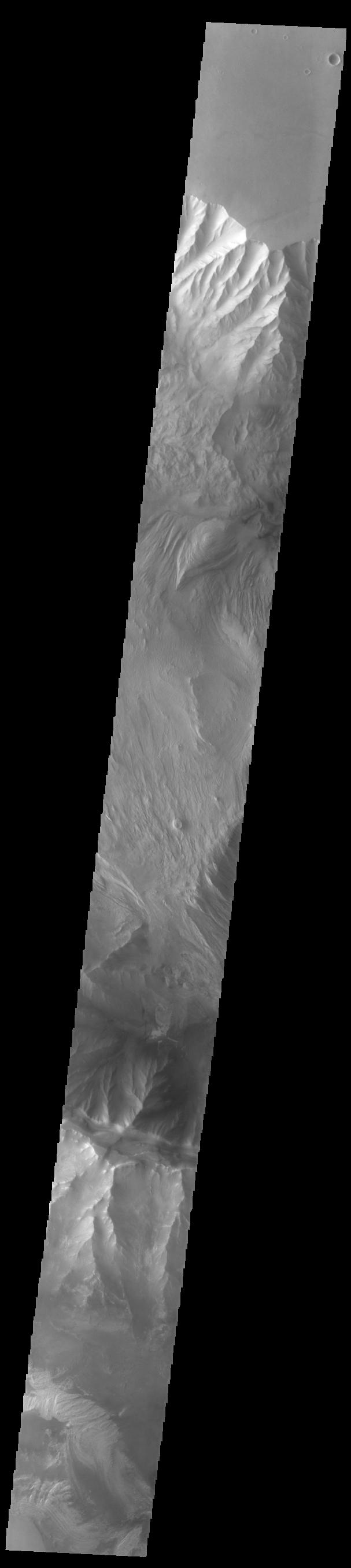
Context imageToday's VIS image shows western parts of Ophir Chasma (top of image) and Candor Chasma (bottom of image). Both are part of Valles Marineris. Candor Chasma is approximately 810 km long (503 miles) and is divided into two regions – eastern and western Candor. Ophir Chasma is approximately 317km long (197 miles). The floors of both chasmata include a variety of landforms, including layered deposits, dunes, landslide deposits and steep sided cliffs and mesas. Many forms of erosion have shaped both chasmata. There is evidence of wind and water erosion, as well as significant gravity driven mass wasting (landslides).
Orbit Number: 93311 Latitude: -4.15087 Longitude: 286.533 Instrument: VIS Captured: 2022-12-27 11:51
Please see the THEMIS Data Citation Note for details on crediting THEMIS images.
NASA's Jet Propulsion Laboratory manages the 2001 Mars Odyssey mission for NASA's Science Mission Directorate, Washington, D.C. The Thermal Emission Imaging System (THEMIS) was developed by Arizona State University, Tempe, in collaboration with Raytheon Santa Barbara Remote Sensing. The THEMIS investigation is led by Dr. Philip Christensen at Arizona State University. Lockheed Martin Astronautics, Denver, is the prime contractor for the Odyssey project, and developed and built the orbiter. Mission operations are conducted jointly from Lockheed Martin and from JPL, a division of the California Institute of Technology in Pasadena.
