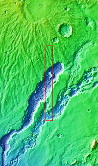
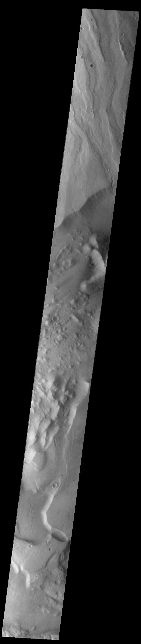
Context imageToday's VIS image shows a small portion of both Dao Vallis (middle of image) and Niger Vallis (bottom of image). Arising from the volcano Hadriacus Mons (top of image), Dao Vallis is approximately 1200km (750 miles) long. Niger Vallis is 333 km (207 miles) long. It has been proposed that heating of the region due to volcanic activity melted subsurface ice which was released to the surface to carve the two channels. Niger Vallis merges with Dao Vallis south of this image and then flow southwestward into the Hellas Planitia basin.
Orbit Number: 93355 Latitude: -33.4749 Longitude: 93.0394 Instrument: VIS Captured: 2022-12-31 02:58
Please see the THEMIS Data Citation Note for details on crediting THEMIS images.
NASA's Jet Propulsion Laboratory manages the 2001 Mars Odyssey mission for NASA's Science Mission Directorate, Washington, D.C. The Thermal Emission Imaging System (THEMIS) was developed by Arizona State University, Tempe, in collaboration with Raytheon Santa Barbara Remote Sensing. The THEMIS investigation is led by Dr. Philip Christensen at Arizona State University. Lockheed Martin Astronautics, Denver, is the prime contractor for the Odyssey project, and developed and built the orbiter. Mission operations are conducted jointly from Lockheed Martin and from JPL, a division of the California Institute of Technology in Pasadena.