Your search criteria found 12741 images
Target is Mars
Go to PIAxxxxx:
Refine this list of images by:
Target:
Mission:
Spacecraft:
Instrument:
Click on an image for detailed information
Click on a column heading to sort in ascending or descending order
My
List
Addition DateSort Ascending Target Mission Instrument Size
Add Image to Favorite List 2022-12-06 Mars 2001 Mars Odyssey
THEMIS
671x1425x1
This image from NASA's Mars Odyssey shows linear features which are tectonic graben. These graben are called Sirenum Fossae.
PIA25642:
Sirenum Fossae
Full Resolution:     TIFF (696.9 kB)     JPEG (79.04 kB)
Add Image to Favorite List 2022-12-05 Mars 2001 Mars Odyssey
THEMIS
666x1437x1
This image from NASA's Mars Odyssey shows a sand sheet with surface dune forms as well as smaller sand dunes within an unnamed crater in Noachis Terra.
PIA25641:
Crater Dunes
Full Resolution:     TIFF (584.2 kB)     JPEG (53.65 kB)
Add Image to Favorite List 2022-12-02 Mars 2001 Mars Odyssey
THEMIS
595x2722x1
This image from NASA's Mars Odyssey shows an unnamed region of fractures and graben, located south of Solis Planum, between Claitas Fossae and Coracis Fossae.
PIA25635:
Fossae
Full Resolution:     TIFF (750.7 kB)     JPEG (83.3 kB)
Add Image to Favorite List 2022-12-01 Mars 2001 Mars Odyssey
THEMIS
494x1400x1
This image from NASA's Mars Odyssey shows a line of clouds over the south polar cap.
PIA25634:
South Polar Clouds
Full Resolution:     TIFF (670.8 kB)     JPEG (78.4 kB)
Add Image to Favorite List 2022-11-30 Mars 2001 Mars Odyssey
THEMIS
494x1401x1
This image from NASA's Mars Odyssey shows layering in the south polar cap. The layers are formed over thousands of years of seasonal change, reflecting ice and dust surface deposition.
PIA25633:
Polar Layers
Full Resolution:     TIFF (693 kB)     JPEG (119 kB)
Add Image to Favorite List 2022-11-29 Mars 2001 Mars Odyssey
THEMIS
598x2735x1
This image from NASA's Mars Odyssey shows a large sand sheet with surface dune forms as well as smaller sand dunes within an unnamed crater in Noachis Terra.
PIA25632:
Crater Dunes
Full Resolution:     TIFF (750.6 kB)     JPEG (85.02 kB)
Add Image to Favorite List 2022-11-28 Mars 2001 Mars Odyssey
THEMIS
663x1433x1
This image from NASA's Mars Odyssey shows a section of Tader Valles located in Terra Sirenum. Tader Valles is 200 km long (124 miles).
PIA25631:
Tader Valles
Full Resolution:     TIFF (756.5 kB)     JPEG (145.2 kB)
Add Image to Favorite List 2022-11-25 Mars 2001 Mars Odyssey
THEMIS
594x2732x1
This image from NASA's Mars Odyssey shows Claritas Fossae, a graben filled highland, is located between the lava plains of Daedalia Planum and Solis Planum.
PIA25620:
Claritas Fossae
Full Resolution:     TIFF (769.9 kB)     JPEG (103 kB)
Add Image to Favorite List 2022-11-24 Mars 2001 Mars Odyssey
THEMIS
678x1422x1
This image from NASA's Mars Odyssey shows part of Mangala Fossae. Fossae are long linear depressions called a graben and were formed by extension of the crust and faulting.
PIA25619:
Mangala Fossae
Full Resolution:     TIFF (718.8 kB)     JPEG (97.28 kB)
Add Image to Favorite List 2022-11-23 Mars 2001 Mars Odyssey
THEMIS
271x2775x1
This image from NASA's Mars Odyssey shows Cavi Angusti, located near the south polar cap. It consists of large irregular steep-sided depressions termed cavi.
PIA25618:
Cavi Angusti
Full Resolution:     TIFF (700.9 kB)     JPEG (68.58 kB)
Add Image to Favorite List 2022-11-22 Mars 2001 Mars Odyssey
THEMIS
671x1423x1
This image from NASA's Mars Odyssey shows a short section of Reull Vallis. Reull Vallis starts in Promethei Terra and empties into Hellas Plainitia.
PIA25617:
Reull Vallis
Full Resolution:     TIFF (683.5 kB)     JPEG (80.14 kB)
Add Image to Favorite List 2022-11-21 Mars 2001 Mars Odyssey
THEMIS
668x1433x1
This image from NASA's Mars Odyssey shows sand dunes within Proctor Crater. These dunes are composed of basaltic sand that has collected in the bottom of the crater.
PIA25616:
Proctor Crater Dunes
Full Resolution:     TIFF (724.9 kB)     JPEG (98.68 kB)
Add Image to Favorite List 2022-11-18 Mars 2001 Mars Odyssey
THEMIS
597x2719x1
This image from NASA's Mars Odyssey shows a small portion of the immense lava flows that originated from Arsia Mons.
PIA25615:
Daedalia Planum
Full Resolution:     TIFF (739 kB)     JPEG (101.5 kB)
Add Image to Favorite List 2022-11-17 Mars Mars 2020 Rover
Hazard Avoidance Camera (M2020)
5120x2880x3
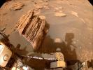
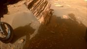
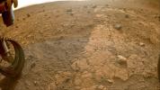
This image of Yori Pass was taken by a Hazcam imager aboard NASA's Perseverance Mars rover on November 5, 2022.
PIA25339:
Jezero Crater's Yori Pass
Full Resolution:     TIFF (44.26 MB)     JPEG (2.148 MB)
Add Image to Favorite List 2022-11-17 Mars 2001 Mars Odyssey
THEMIS
490x1397x1
This image from NASA's Mars Odyssey shows part of the south polar cap. Taken in summer, the CO2 (dry ice) cap shows the layering of ice and dust that formed over millions of years.
PIA25614:
South Polar Cap
Full Resolution:     TIFF (685.5 kB)     JPEG (158 kB)
Add Image to Favorite List 2022-11-16 Mars 2001 Mars Odyssey
THEMIS
668x1425x1
This image from NASA's Mars Odyssey shows two small landslide deposits within a crater.
PIA25613:
Landslides
Full Resolution:     TIFF (687 kB)     JPEG (78.1 kB)
Add Image to Favorite List 2022-11-15 Mars 2001 Mars Odyssey
THEMIS
601x2711x1
This image from NASA's Mars Odyssey shows Claritas Fossae is a graben filled highland, located between the lava plains of Daedalia Planum and Solis Planum.
PIA25612:
Claritas Fossae
Full Resolution:     TIFF (749.1 kB)     JPEG (88.9 kB)
Add Image to Favorite List 2022-11-14 Mars Mars Helicopter
6000x4326x3
This illustration depicts three different of models of NASA's solar-powered Mars helicopter.
PIA25338:
NASA's Mars Helicopters: Present, Future, and Proposed
Full Resolution:     TIFF (67.09 MB)     JPEG (2.575 MB)
Add Image to Favorite List 2022-11-14 Mars 2001 Mars Odyssey
THEMIS
1319x2683x1
This image from NASA's Mars Odyssey shows part of a crater and its ejecta. Located in Noachis Terra, this impact crater is not the typical round shape.
PIA25611:
Out of Round
Full Resolution:     TIFF (2.552 MB)     JPEG (383.4 kB)
Add Image to Favorite List 2022-11-11 Mars 2001 Mars Odyssey
THEMIS
666x1397x1
This image from NASA's Mars Odyssey shows a small portion of the immense lava flows that originated from Arsia Mons.
PIA25610:
Daedalia Planum
Full Resolution:     TIFF (746.3 kB)     JPEG (179.1 kB)
Add Image to Favorite List 2022-11-10 Mars 2001 Mars Odyssey
THEMIS
670x1427x1
This image from NASA's Mars Odyssey shows part of the floor of Hale Crater and the elongate axis of the central peak mountains.
PIA25609:
Hale Crater
Full Resolution:     TIFF (693.8 kB)     JPEG (85.73 kB)
Add Image to Favorite List 2022-11-09 Mars 2001 Mars Odyssey
THEMIS
669x1417x1
This image from NASA's Mars Odyssey shows a small portion of the immense lava flows that originated from Arsia Mons.
PIA25608:
Daedalia Planum
Full Resolution:     TIFF (750.7 kB)     JPEG (160 kB)
Add Image to Favorite List 2022-11-08 Mars 2001 Mars Odyssey
THEMIS
675x1420x1
This image from NASA's Mars Odyssey shows part of the floor of Eberswalde Crater.
PIA25607:
Eberswalde Crater
Full Resolution:     TIFF (734.5 kB)     JPEG (112.7 kB)
Add Image to Favorite List 2022-11-07 Mars 2001 Mars Odyssey
THEMIS
839x2736x1
This image from NASA's Mars Odyssey shows a short section of Reull Vallis. Reull Vallis starts in Promethei Terra and empties into Hellas Plainitia.
PIA25606:
Reull Vallis
Full Resolution:     TIFF (1.392 MB)     JPEG (165 kB)
Add Image to Favorite List 2022-11-04 Mars 2001 Mars Odyssey
THEMIS
670x1419x1
This image from NASA's Mars Odyssey shows a small portion of the immense lava flows that originated from Arsia Mons.
PIA25605:
Daedalia Planum
Full Resolution:     TIFF (743.6 kB)     JPEG (146 kB)
Add Image to Favorite List 2022-11-03 Mars Mars 2020 Rover
1630x1557x3
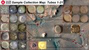
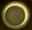
These images show changes in the dust accumulation over the course of four days on the rim of the collection tube containing Perseverance's 14th sample. The images were acquired by the rover's Sampling and Caching System Camera, or CacheCam.
PIA25337:
CacheCam Image of Perseverance's 14th Sample of Martian Rock
Full Resolution:     TIFF (6.384 MB)     JPEG (312 kB)
Add Image to Favorite List 2022-11-03 Mars 2001 Mars Odyssey
THEMIS
601x2714x1
This image from NASA's Mars Odyssey shows a small portion of the immense lava flows that originated from Arsia Mons.
PIA25604:
Daedalia Planum
Full Resolution:     TIFF (801.7 kB)     JPEG (151.3 kB)
Add Image to Favorite List 2022-11-02 Mars 2001 Mars Odyssey
THEMIS
598x2704x1
This image from NASA's Mars Odyssey shows part of the southern flank of Arsia Mons. The linear features are graben.
PIA25603:
Arsia Mons
Full Resolution:     TIFF (715 kB)     JPEG (91.93 kB)
Add Image to Favorite List 2022-11-01 Mars 2001 Mars Odyssey
THEMIS
677x1428x1
This image from NASA's Mars Odyssey shows a section of Ladon Vallis. The channel is 278km long (173 miles). Ladon Vallis is located in Noachis Terrra and flows northward to Margaritifer Terra.
PIA25602:
Ladon Valles
Full Resolution:     TIFF (731.4 kB)     JPEG (97.36 kB)
Add Image to Favorite List 2022-10-31 Mars 2001 Mars Odyssey
THEMIS
597x2732x1
This image from NASA's Mars Odyssey shows a small portion of both Dao Vallis and Niger Vallis.
PIA25601:
Dao and Niger Valles
Full Resolution:     TIFF (771.3 kB)     JPEG (95.12 kB)
Add Image to Favorite List 2022-10-28 Mars 2001 Mars Odyssey
THEMIS
593x2730x1
This image from NASA's Mars Odyssey shows Claritas Fossae, a graben filled highland, located between the lava plains of Daedalia Planum and Solis Planum.
PIA25580:
Claritas Fossae
Full Resolution:     TIFF (742.3 kB)     JPEG (96.72 kB)
Add Image to Favorite List 2022-10-27 Mars Mars Reconnaissance Orbiter (MRO)
CTX
3351x3083x1
This meteoroid impact crater on Mars was captured using the black-and-white Context Camera aboard NASA's Mars Reconnaissance Orbiter (MRO).
PIA25587:
Context Camera Views a Mars Impact Crater in Tempe Terra
Full Resolution:     TIFF (8.751 MB)     JPEG (1.998 MB)
Add Image to Favorite List 2022-10-27 Mars Mars Reconnaissance Orbiter (MRO)
HiRISE
1200x674x3
This animation depicts a flyover of a meteoroid impact crater on Mars that's surrounded by boulder-size chunks of ice. The animation was created using data from the HiRISE camera aboard NASA's Mars Reconnaissance Orbiter.
PIA25586:
Flyover of Mars Impact Using HiRISE Data (Animation)
Full Resolution:     TIFF (2.057 MB)     JPEG (69.31 kB)
Add Image to Favorite List 2022-10-27 Mars Mars Reconnaissance Orbiter (MRO)
MARCI
1920x1080x1
The Mars Color Imager (MARCI) camera aboard NASA's Mars Reconnaissance Orbiter (MRO) captured this before-and-after comparison of a region of Mars called Amazonis Planitia, which was struck by a meteoroid on Dec. 24, 2021.
PIA25585:
MARCI Views a Mars Impact Crater in Amazonis Planitia
Full Resolution:     TIFF (1.693 MB)     JPEG (156.5 kB)
Add Image to Favorite List 2022-10-27 Mars Mars Reconnaissance Orbiter (MRO)
CTX
5448x3523x1
This meteoroid impact crater on Mars was discovered using the black-and-white Context Camera aboard NASA's Mars Reconnaissance Orbiter. The Context Camera took these before-and-after images of the impact in a region of Mars called Amazonis Planitia.
PIA25584:
Context Camera Views an Impact Crater in Amazonis Planitia
Full Resolution:     TIFF (19.22 MB)     JPEG (5.28 MB)
Add Image to Favorite List 2022-10-27 Mars Mars Reconnaissance Orbiter (MRO)
HiRISE
1920x1080x3
Boulder-size blocks of water ice can be seen around the rim of an impact crater on Mars. The crater was formed Dec. 24, 2021, by a meteoroid strike in the Amazonis Planitia region.
PIA25583:
HiRISE Views a Mars Impact Crater Surrounded by Water Ice
Full Resolution:     TIFF (4.226 MB)     JPEG (341.2 kB)
Add Image to Favorite List 2022-10-27 Mars InSight
976x942x3
This video includes a seismogram and sonification of the signals recorded by NASA's InSight Mars lander, which detected a giant meteoroid strike on Dec. 24, 2021, the 1,094th Martian day, or sol, of the mission.
PIA25582:
NASA's InSight Records the Sound of a Martian Impact
Full Resolution:     TIFF (2.466 MB)     JPEG (47.12 kB)
Add Image to Favorite List 2022-10-27 Mars 2001 Mars Odyssey
THEMIS
602x2716x1
This image from NASA's Mars Odyssey shows a small portion of the immense lava flows that originated from Arsia Mons.
PIA25579:
Daedalia Planum
Full Resolution:     TIFF (776.6 kB)     JPEG (119.2 kB)
Add Image to Favorite List 2022-10-26 Mars 2001 Mars Odyssey
THEMIS
670x1435x1
This image from NASA's Mars Odyssey shows an unusual layer of smooth material covering the flanks of the volcano Peneus Patera just south of the Hellas Basin.
PIA25578:
Peneus Patera
Full Resolution:     TIFF (740.4 kB)     JPEG (127.9 kB)
Add Image to Favorite List 2022-10-25 Mars 2001 Mars Odyssey
THEMIS
605x2709x1
This image from NASA's Mars Odyssey shows part of Ius Chasma and one of its mega gullies.
PIA25577:
Ius Chasma
Full Resolution:     TIFF (690.6 kB)     JPEG (65.92 kB)
Add Image to Favorite List 2022-10-24 Mars Mars Reconnaissance Orbiter (MRO)
HiRISE
2880x1800x3
This image acquired on August 14, 2022 by NASA's Mars Reconnaissance Orbiter shows a curious depression with zig-zag walls on the north rim of Secchi Crater.
PIA25559:
The Tale of a Retreating Scarp
Full Resolution:     TIFF (15.56 MB)     JPEG (1.087 MB)
Add Image to Favorite List 2022-10-24 Mars Mars Reconnaissance Orbiter (MRO)
HiRISE
2880x1800x3
This image acquired on August 24, 2022 by NASA's Mars Reconnaissance Orbiter shows a large lava flow passed through the Athabasca Valles region of Mars long ago.
PIA25558:
In the Wake of Ancient Lava Flows
Full Resolution:     TIFF (15.56 MB)     JPEG (1.204 MB)
Add Image to Favorite List 2022-10-24 Mars Mars Reconnaissance Orbiter (MRO)
HiRISE
2880x1800x3
This image acquired on July 8, 2022 by NASA's Mars Reconnaissance Orbiter shows what appears to be a slightly expanded crater in a field of scalloped depressions. It's possible that it will evolve over time to look more like the scallops.
PIA25557:
A Crater in Scalloped Terrain
Full Resolution:     TIFF (15.56 MB)     JPEG (1.619 MB)
Add Image to Favorite List 2022-10-24 Mars Mars Reconnaissance Orbiter (MRO)
HiRISE
2880x1800x3
This image acquired on May 18, 2012 by NASA's Mars Reconnaissance Orbiter shows Echus Chaos, a region of low hills located between Lunae Planum and Echus Palus.
PIA25556:
Slipping and Sliding in Echus Chaos
Full Resolution:     TIFF (15.56 MB)     JPEG (757.9 kB)
Add Image to Favorite List 2022-10-24 Mars 2001 Mars Odyssey
THEMIS
666x1432x1
This image from NASA's Mars Odyssey shows a large sand sheet with surface dune forms as well as smaller sand dunes within an unnamed crater in Noachis Terra.
PIA25576:
Crater Dunes
Full Resolution:     TIFF (605 kB)     JPEG (52.71 kB)
Add Image to Favorite List 2022-10-21 Mars 2001 Mars Odyssey
THEMIS
664x1434x1
This image from NASA's Mars Odyssey shows Maunder Crater. Its floor has been filled by a significant amount of material.
PIA25575:
Maunder Crater
Full Resolution:     TIFF (679.2 kB)     JPEG (61.77 kB)
Add Image to Favorite List 2022-10-20 Mars 2001 Mars Odyssey
THEMIS
672x1425x1
This image from NASA's Mars Odyssey shows a small section of Nirgal Valles. Located in Noachis Terra, Nirgal Valles is 610km long (379 miles).
PIA25574:
Nirgal Vallis
Full Resolution:     TIFF (699.7 kB)     JPEG (91.86 kB)
Add Image to Favorite List 2022-10-19 Mars Mars Science Laboratory (MSL)
Mastcam
1328x1184x3
Curiosity used its Mast Camera, or Mastcam, to capture this image of its 36th successful drill hole on Mount Sharp, at a rock called Canaima. The pulverized rock sample was acquired on Oct. 3, 2022.
PIA25418:
Curiosity's 36th Drill Hole at Canaima
Full Resolution:     TIFF (4.172 MB)     JPEG (254.5 kB)
Add Image to Favorite List 2022-10-19 Mars Mars Science Laboratory (MSL)
Navigation Camera (M2020)
7696x2165x1
NASA's Curiosity Mars rover used its navigation cameras, or Navcams, to capture this panorama while driving through the narrow Paraitepuy Pass on Aug. 11, 2022, the 3,560th Martian day, or sol, of the mission.
PIA25417:
Curiosity's Navcams View Paraitepuy Pass
Full Resolution:     TIFF (11.31 MB)     JPEG (1.471 MB)
Add Image to Favorite List 2022-10-19 Mars Mars Science Laboratory (MSL)
MAHLI
3600x2700x3
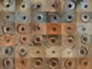
This grid shows all 36 holes drilled by NASA's Curiosity Mars rover using the drill on the end of its robotic arm. The images in the grid were captured by the Mars Hand Lens Imager (MAHLI) on the end of Curiosity's arm.
PIA25416:
Curiosity's 36 Drill Holes
Full Resolution:     TIFF (29.17 MB)     JPEG (2.337 MB)
Add Image to Favorite List 2022-10-19 Mars Mars Science Laboratory (MSL)
Mastcam
2073x1226x3
NASA's Curiosity Mars rover used its Mast Camera, or Mastcam, to capture this detail shot of the sandy foreground, a hill nicknamed Orinoco within the sulfate-bearing unit, and upper Mount Sharp in the distance.
PIA25415:
Curiosity's Close-Up of Rocks in Paraitepuy Pass
Full Resolution:     TIFF (7.414 MB)     JPEG (582.7 kB)
Add Image to Favorite List 2022-10-19 Mars Mars Science Laboratory (MSL)
Mastcam
8323x4225x3
NASA's Curiosity Mars rover used its Mast Camera, or Mastcam, to capture this panorama of a hill nicknamed Bolívar and adjacent sand ridges on Aug. 23, the 3,572nd Martian day, or sol, of the mission.
PIA25414:
Curiosity's View of Sand Ridges and Bolívar
Full Resolution:     TIFF (78.61 MB)     JPEG (6.244 MB)
Add Image to Favorite List 2022-10-19 Mars Mars Science Laboratory (MSL)
Mastcam
29163x8638x3
NASA's Curiosity Mars rover used its Mast Camera, or Mastcam, to capture this panorama while driving toward the center of this scene, an area that forms the narrow Paraitepuy Pass on Aug. 14, 2022.
PIA25413:
Curiosity's View of Paraitepuy Pass
Full Resolution:     TIFF (536.6 MB)     JPEG (46.38 MB)
Add Image to Favorite List 2022-10-19 Mars 2001 Mars Odyssey
THEMIS
667x1427x1
This image from NASA's Mars Odyssey shows part of Ariadnes Colles. The term colles means hills or knobs.
PIA25573:
Ariadnes Colles
Full Resolution:     TIFF (717.4 kB)     JPEG (94.25 kB)
Add Image to Favorite List 2022-10-18 Mars 2001 Mars Odyssey
THEMIS
658x1423x1
This image from NASA's Mars Odyssey shows Claritas Fossae, a graben filled highland, located between the lava plains of Daedalia Planum and Solis Planum.
PIA25572:
Claritas Fossae
Full Resolution:     TIFF (685.5 kB)     JPEG (78.26 kB)
Add Image to Favorite List 2022-10-17 Mars 2001 Mars Odyssey
THEMIS
662x1434x1
This image from NASA's Mars Odyssey shows many individual dunes located in Kaiser Crater.
PIA25571:
Kaiser Crater Dunes
Full Resolution:     TIFF (651.4 kB)     JPEG (63.96 kB)
Add Image to Favorite List 2022-10-14 Mars 2001 Mars Odyssey
THEMIS
666x1429x1
This image from NASA's Mars Odyssey shows a portion of Sirenum Fossae. The linear features are tectonic graben.
PIA25550:
Sirenum Fossae
Full Resolution:     TIFF (688.9 kB)     JPEG (85.02 kB)
Add Image to Favorite List 2022-10-13 Mars 2001 Mars Odyssey
THEMIS
604x2737x1
This image from NASA's Mars Odyssey shows complex dune forms located on the floor of Russell Crater.
PIA25549:
Russell Crater Dunes
Full Resolution:     TIFF (709.7 kB)     JPEG (75.72 kB)
Add Image to Favorite List 2022-10-12 Mars Mars Sample Return (MSR)
1050x591x3
This illustration depicts the Mars Earth Entry System for the Mars Sample Return campaign. The system would contain the orbiting sample inside a disk-shaped vehicle with a heat shield for safe entry through the Earth's atmosphere.
PIA25336:
Mars Earth Entry System Aeroshell at Entry (Illustration)
Full Resolution:     TIFF (739.4 kB)     JPEG (17.89 kB)
Add Image to Favorite List 2022-10-12 Mars 2001 Mars Odyssey
THEMIS
670x1423x1
This image from NASA's Mars Odyssey shows a portion of Sirenum Fossae. The linear features are tectonic graben.
PIA25548:
Sirenum Fossae
Full Resolution:     TIFF (652.6 kB)     JPEG (72.94 kB)
Add Image to Favorite List 2022-10-11 Mars 2001 Mars Odyssey
THEMIS
662x1432x1
This image from NASA's Mars Odyssey shows part of the floor of Rabe Crater.
PIA25547:
Rabe Crater Dunes
Full Resolution:     TIFF (673.2 kB)     JPEG (68.92 kB)
Add Image to Favorite List 2022-10-10 Mars 2001 Mars Odyssey
THEMIS
599x2722x1
This image from NASA's Mars Odyssey shows graben at the top of the image, Mangala Fossae, the rest are part of Memnonia Fossae.
PIA25546:
Memnonia Fossae
Full Resolution:     TIFF (780.6 kB)     JPEG (114.5 kB)
Add Image to Favorite List 2022-10-07 Mars Mars Reconnaissance Orbiter (MRO)
MARCI
3094x1669x3
The beige clouds seen in this global map of Mars are a continent-size dust storm captured on Sept. 29, 2022, by the Mars Color Imager camera aboard NASA's Mars Reconnaissance Orbiter.
PIA25412:
Mars Dust Storm in Relation to InSight, Curiosity and Perseverance
Full Resolution:     TIFF (9.951 MB)     JPEG (452.4 kB)
Add Image to Favorite List 2022-10-07 Mars 2001 Mars Odyssey
THEMIS
599x2720x1
This image from NASA's Mars Odyssey shows a complex channel, part of Mangala Fossae.
PIA25545:
Mangala Fossae
Full Resolution:     TIFF (785.7 kB)     JPEG (111.3 kB)
Add Image to Favorite List 2022-10-06 Mars 2001 Mars Odyssey
THEMIS
666x1432x1
This image from NASA's Mars Odyssey shows sand dunes within an unnamed creater in Noachis Terra.
PIA25544:
Crater Dunes
Full Resolution:     TIFF (617.7 kB)     JPEG (56.77 kB)
Add Image to Favorite List 2022-10-05 Mars 2001 Mars Odyssey
THEMIS
1330x2651x1
This image from NASA's Mars Odyssey shows the delta deposit on the floor of Eberswalde Crater.
PIA25543:
Eberswalde Crater Delta
Full Resolution:     TIFF (2.651 MB)     JPEG (374.1 kB)
Add Image to Favorite List 2022-10-04 Mars 2001 Mars Odyssey
THEMIS
661x1431x1
This image from NASA's Mars Odyssey shows apart of the rim of an unnamed crater in Terra Sirenum.
PIA25542:
Crater Gullies
Full Resolution:     TIFF (677.6 kB)     JPEG (83.6 kB)
Add Image to Favorite List 2022-10-03 Mars 2001 Mars Odyssey
THEMIS
669x1417x1
This image from NASA's Mars Odyssey shows an unnamed crater in Noachis Terra. This crater has a pit in the center of the floor of the crater.
PIA25541:
Central Pit Crater
Full Resolution:     TIFF (664 kB)     JPEG (76.56 kB)
Add Image to Favorite List 2022-09-30 Mars Mars Helicopter
480x640x1
During the 33rd flight of NASA's Ingenuity Mars Helicopter, a small piece of foreign object debris can be seen attached to one of the rotorcraft's landing legs before falling away to the surface. There's no indication of damage to the helicopter.
PIA25331:
Navigation Camera Imagery of Ingenuity's Flight 33
Full Resolution:     TIFF (251.3 kB)     JPEG (26.57 kB)
Add Image to Favorite List 2022-09-30 Mars Mars Reconnaissance Orbiter (MRO)
HiRISE
2880x1800x3
This image acquired on August 28, 2022 by NASA's Mars Reconnaissance Orbiter shows several shallow gully channels with associated debris aprons emanating from a buried layer on the interior of a crater wall.
PIA25554:
Gullies and Boulder Tracks
Full Resolution:     TIFF (15.08 MB)     JPEG (973.4 kB)
Add Image to Favorite List 2022-09-30 Mars Mars Reconnaissance Orbiter (MRO)
HiRISE
2880x1800x3
This image acquired on July 14, 2022 by NASA's Mars Reconnaissance Orbiter shows an area in the South Polar cap.
PIA25553:
The Ever-Changing Swiss Cheese of Mars
Full Resolution:     TIFF (11.74 MB)     JPEG (557 kB)
Add Image to Favorite List 2022-09-30 Mars Mars Reconnaissance Orbiter (MRO)
HiRISE
2880x1800x3
This image acquired on July 22, 2022 by NASA's Mars Reconnaissance Orbiter shows sand dunes moving across the landscape. Winter frost covers the colder, north-facing half of each dune.
PIA25552:
Frosted Dunes in the Depths of Winter
Full Resolution:     TIFF (15.56 MB)     JPEG (1.164 MB)
Add Image to Favorite List 2022-09-30 Mars Mars Reconnaissance Orbiter (MRO)
HiRISE
2880x1800x3
This image acquired on November 13, 2020 by NASA's Mars Reconnaissance Orbiter shows an area where the flowing water may have stripped away some of the rocks and soils at the bottom of the valley, leaving behind the ridge-like formations.
PIA25551:
Landforms in Ares Vallis
Full Resolution:     TIFF (8.47 MB)     JPEG (1.733 MB)
Add Image to Favorite List 2022-09-30 Mars 2001 Mars Odyssey
THEMIS
602x2700x1
This image from NASA's Mars Odyssey shows a cross section of Pavonis Mons, including part of the summit caldera.
PIA25540:
Pavonis Mons
Full Resolution:     TIFF (697.1 kB)     JPEG (79.62 kB)
Add Image to Favorite List 2022-09-29 Mars 2001 Mars Odyssey
THEMIS
685x1423x1
This image from NASA's Mars Odyssey shows one of the mega-gullies that empties into Echus Chasma. Echus Chasma is approximately 4km deep in this region, and is the source of Kasei Valles.
PIA25539:
Echus Chasma Mega-gully
Full Resolution:     TIFF (707.8 kB)     JPEG (73.95 kB)
Add Image to Favorite List 2022-09-28 Mars 2001 Mars Odyssey
THEMIS
672x1425x1
This image from NASA's Mars Odyssey shows a small section of Ma'adim Valles. Ma'adim Valles is an outflow channel that arises in the southern lowlands and flows northward into Gusev Crater.
PIA25538:
Ma'adim Vallis
Full Resolution:     TIFF (720.4 kB)     JPEG (85.45 kB)
Add Image to Favorite List 2022-09-27 Mars 2001 Mars Odyssey
THEMIS
665x1428x1
This image from NASA's Mars Odyssey shows sand dunes within Proctor Crater. These dunes are composed of basaltic sand that has collected in the bottom of the crater.
PIA25537:
Proctor Crater Dunes
Full Resolution:     TIFF (721.9 kB)     JPEG (95.31 kB)
Add Image to Favorite List 2022-09-26 Mars 2001 Mars Odyssey
THEMIS
668x1423x1
This image from NASA's Mars Odyssey shows a small section of Uzboi Vallis. This valley system arises just north of Argyre Planitia and flows northward into Holden Crater.
PIA25536:
Uzboi Vallis
Full Resolution:     TIFF (702.9 kB)     JPEG (81.92 kB)
Add Image to Favorite List 2022-09-23 Mars 2001 Mars Odyssey
THEMIS
669x1439x1
This image from NASA's Mars Odyssey shows an unusual layer of smooth material covering the flanks of the volcano Peneus Patera, located south of the Hellas Basin.
PIA25535:
Peneus Patera
Full Resolution:     TIFF (735.9 kB)     JPEG (129 kB)
Add Image to Favorite List 2022-09-22 Mars 2001 Mars Odyssey
THEMIS
660x1432x1
This image from NASA's Mars Odyssey shows part of the floor of Kaiser Crater. Kaiser Crater is 207 km (129 miles) in diameter and is located in Noachis Terra west of Hellas Planitia.
PIA25534:
Kaiser Crater Dunes
Full Resolution:     TIFF (675.7 kB)     JPEG (73.79 kB)
Add Image to Favorite List 2022-09-21 Mars 2001 Mars Odyssey
THEMIS
673x1424x1
This image from NASA's Mars Odyssey shows Mangala Fossae, a long linear depression called a graben, formed by extension of the crust and faulting.
PIA25533:
Mangala Fossae
Full Resolution:     TIFF (674.8 kB)     JPEG (74.47 kB)
Add Image to Favorite List 2022-09-20 Mars 2001 Mars Odyssey
THEMIS
677x1423x1
This image from NASA's Mars Odyssey shows a small section of Osuga Valles.
PIA25532:
Osuga Valles
Full Resolution:     TIFF (724.6 kB)     JPEG (100.5 kB)
Add Image to Favorite List 2022-09-19 Mars 2001 Mars Odyssey
THEMIS
668x1437x1
This image from NASA's Mars Odyssey shows complex dune forms located on the floor of Russell Crater.
PIA25531:
Russell Crater Dunes
Full Resolution:     TIFF (658.4 kB)     JPEG (63.66 kB)
Add Image to Favorite List 2022-09-19 Mars Mars Reconnaissance Orbiter (MRO)
HiRISE
4047x2956x3
NASA's Mars Reconnaissance Orbiter captured this image of a meteoroid impact that was first detected by the agency's InSight lander using its seismometer. This crater was formed on Aug. 30, 2021.
PIA25411:
InSight-Detected Impact in August 2021
Full Resolution:     TIFF (35.9 MB)     JPEG (1.611 MB)
Add Image to Favorite List 2022-09-19 Mars Mars Reconnaissance Orbiter (MRO)
HiRISE
2675x3147x3
NASA's Mars Reconnaissance Orbiter captured this image of a meteoroid impact that was later associated with a seismic event detected by the agency's InSight lander using its seismometer. This crater was formed on May 27, 2020.
PIA25410:
InSight-Detected Impact in May 2020
Full Resolution:     TIFF (25.26 MB)     JPEG (1.547 MB)
Add Image to Favorite List 2022-09-19 Mars Mars Reconnaissance Orbiter (MRO)
HiRISE
4047x3466x3
NASA's Mars Reconnaissance Orbiter captured this image of a meteoroid impact that was first detected by the agency's InSight lander using its seismometer. This crater was formed on Feb. 18, 2021.
PIA25409:
InSight-Detected Impact in February 2021
Full Resolution:     TIFF (40.22 MB)     JPEG (844.9 kB)
Add Image to Favorite List 2022-09-19 Mars Mars Reconnaissance Orbiter (MRO)
HiRISE
4994x3341x3
These craters were formed by a September 5, 2021, meteoroid impact on Mars, the first to be detected by NASA's InSight.
PIA25408:
InSight Detects an Impact for the First Time
Full Resolution:     TIFF (50.08 MB)     JPEG (2.9 MB)
Add Image to Favorite List 2022-09-16 Mars 2001 Mars Odyssey
THEMIS
1331x2661x1
This image from NASA's Mars Odyssey shows the delta deposit located on the floor of Eberswalde Crater.
PIA25520:
Eberswalde Crater Delta
Full Resolution:     TIFF (2.787 MB)     JPEG (480 kB)
Add Image to Favorite List 2022-09-15 Mars 2001 Mars Odyssey
THEMIS
678x1422x1
This image from NASA's Mars Odyssey shows part of the southwestern cliffside of Melas Chasma.
PIA25519:
Melas Chasma Cliffs
Full Resolution:     TIFF (648.5 kB)     JPEG (50.85 kB)
Add Image to Favorite List 2022-09-15 Mars Mars 2020 Rover
Scanning Habitable Environments with Raman & Luminescence for Organics and Chemicals (SHERLOC)
1252x936x3
This video from NASA's Perseverance rover shows increasingly close views of an abraded rock at Wildcat Ridge in Mars' Jezero Crater.
PIA25246:
Zooming in on Perseverance Rover's Wildcat Ridge Abrasion Patch
Full Resolution:     TIFF (3.517 MB)     JPEG (259.4 kB)
Add Image to Favorite List 2022-09-15 Mars Mars 2020 Rover
Scanning Habitable Environments with Raman & Luminescence for Organics and Chemicals (SHERLOC)
1920x1080x3
This annotated image from NASA's Perseverance Mars rover shows how its SHERLOC instrument investigates a rock surface.
PIA25245:
How SHERLOC Analyzes a Rock Target
Full Resolution:     TIFF (5.365 MB)     JPEG (283.3 kB)
Add Image to Favorite List 2022-09-15 Mars Mars Reconnaissance Orbiter (MRO)
CRISM
HiRISE
1920x1080x3
This annotated image highlights potential routes that NASA's Perseverance team is considering in September 2022 for the rover to drive.
PIA25244:
Potential Driving Routes for NASA's Perseverance Rover
Full Resolution:     TIFF (6.223 MB)     JPEG (406.8 kB)
Add Image to Favorite List 2022-09-15 Mars Mars 2020 Rover
Navigation Camera (M2020)
1620x1080x3
This annotated image from NASA's Perseverance Mars rover shows its wheel tracks in Jezero Crater.
PIA25243:
Perseverance's View of Possible Future Sample Cache Depot Site
Full Resolution:     TIFF (5.251 MB)     JPEG (217.7 kB)
Add Image to Favorite List 2022-09-15 Mars Mars 2020 Rover
Mastcam-Z
964x463x3
This pair of images shows two cylinders of rock the size of classroom chalk inside the drill of NASA's Perseverance rover from an outcrop called Wildcat Ridge in Mars' Jezero Crater.
PIA24929:
Perseverance Rock Cores From Wildcat Ridge
Full Resolution:     TIFF (1.302 MB)     JPEG (63.69 kB)
Add Image to Favorite List 2022-09-15 Mars Mars 2020 Rover
Mastcam-Z
3225x2631x3
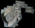
Composed of multiple images from NASA's Perseverance Mars rover, this mosaic shows a rocky outcrop called Wildcat Ridge.
PIA24928:
Sample Collection and Rock Analysis at Wildcat Ridge
Full Resolution:     TIFF (17.01 MB)     JPEG (1.04 MB)
Add Image to Favorite List 2022-09-15 Mars Mars 2020 Rover
Mastcam-Z
844x412x3
This pair of images shows two cylinders of rock the size of classroom chalk inside the drill of NASA's Perseverance rover from an outcrop called Skinner Ridge in Mars' Jezero Crater.
PIA24927:
Rock Cores From Skinner Ridge
Full Resolution:     TIFF (1.044 MB)     JPEG (61.1 kB)
Add Image to Favorite List 2022-09-15 Mars Mars 2020 Rover
Scanning Habitable Environments with Raman & Luminescence for Organics and Chemicals (SHERLOC)
1962x752x3
This pair of images from NASA's Perseverance shows close-up views of two rock types the rover investigated in the delta area of Mars' Jezero Crater.
PIA24926:
2 Abrasion Patches From Perseverance at Jezero Delta
Full Resolution:     TIFF (4.01 MB)     JPEG (209 kB)
Add Image to Favorite List 2022-09-15 Mars Mars 2020 Rover
Mastcam-Z
13235x7349x3
NASA's Perseverance rover puts its robotic arm to work around a rocky outcrop called Skinner Ridge in Mars' Jezero Crater.
PIA24925:
Perseverance Workspace at Skinner Ridge
Full Resolution:     TIFF (201.6 MB)     JPEG (8.688 MB)
Add Image to Favorite List 2022-09-15 Mars Mars 2020 Rover
Mastcam-Z
15261x8765x3
NASA's Perseverance rover collected rock samples for possible return to Earth in the future from two locations seen in this image of Mars' Jezero Crater: Wildcat Ridge and Skinner Ridge.
PIA24924:
2 Perseverance Sampling Locations in Jezero's Delta
Full Resolution:     TIFF (292.2 MB)     JPEG (17.42 MB)
Add Image to Favorite List 2022-09-15 Mars Mars Reconnaissance Orbiter (MRO)
HiRISE
1920x1080x3
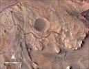
NASA's Perseverance rover has been investigating rocks at the front of the delta in Mars' Jezero Crater along the path indicated in this annotated image taken by the agency's Mars Reconnaissance Orbiter (MRO).
PIA24923:
Perseverance Exploring the Front of the Delta
Full Resolution:     TIFF (6.111 MB)     JPEG (355.5 kB)
Retrieve Previous Set  Jump to a Previous Set   Jump to a Previous Set   Jump to a Previous Set   Jump to a Previous Set   Jump to a Previous Set   Current Set   Jump to a Following Set   Jump to a Following Set   Jump to a Following Set   Jump to a Following Set   Retrieve Next Set 
 1-100   101-200   201-300   301-400   401-500   501-600   601-700   701-800   801-900   901-1000 
Currently displaying images: 501 - 600 of 12741