My
List |
Addition Date
|
Target
|
Mission
|
Instrument
|
Size
|

|
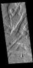
2023-08-15 |
Mars
|
2001 Mars Odyssey
|
THEMIS
|
669x1428x3 |
|
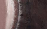
-
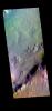
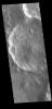
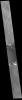
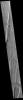
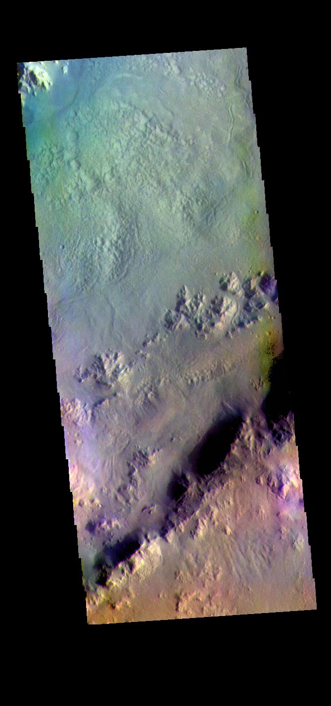
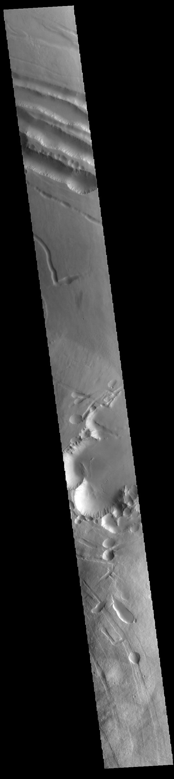
PIA26057:
-
Pal Crater - False Color
Full Resolution:
TIFF
(1.918 MB)
JPEG
(95.99 kB)
|
|
|
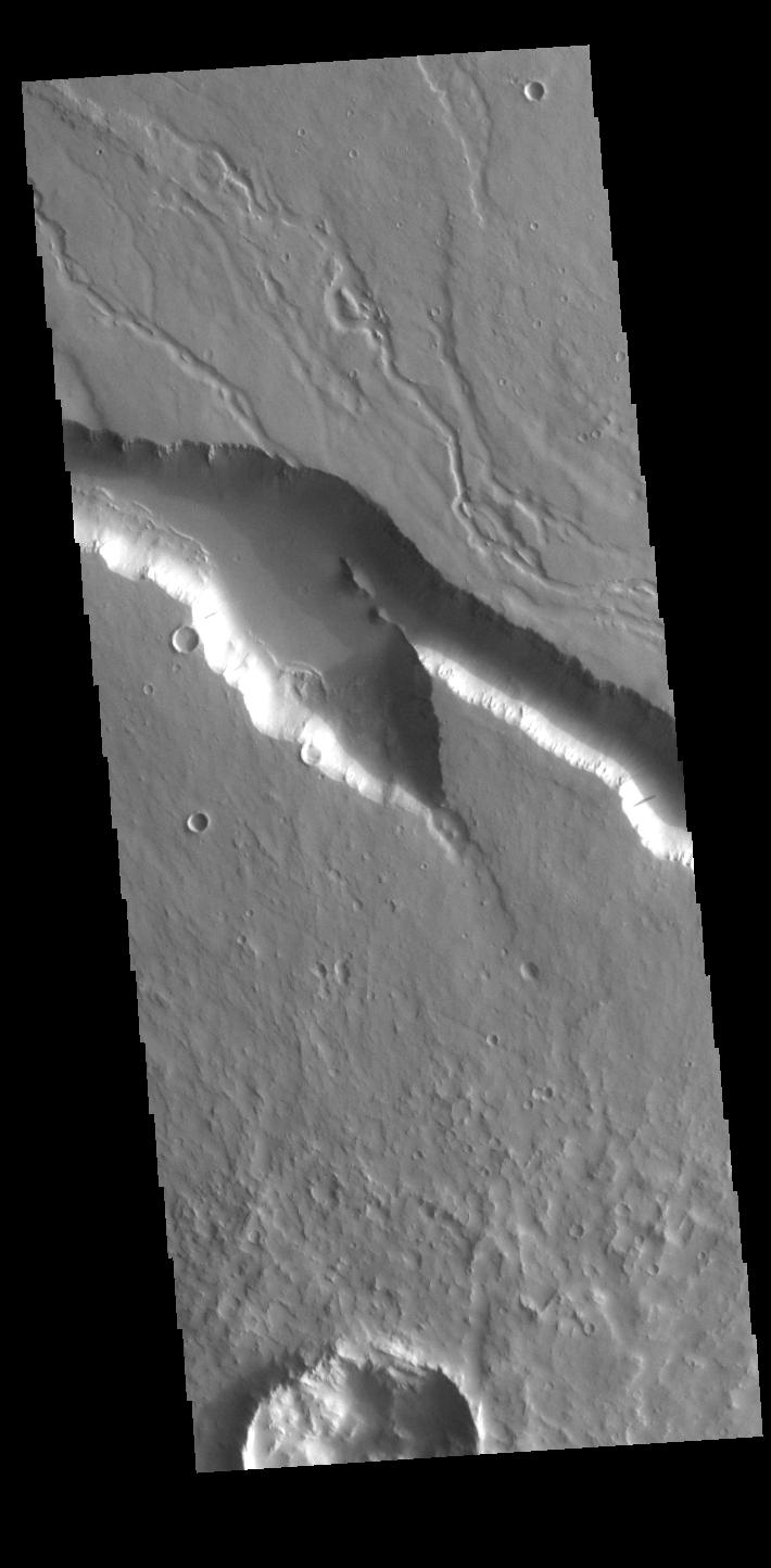
2023-08-14 |
Mars
|
2001 Mars Odyssey
|
THEMIS
|
615x2700x3 |
|
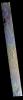
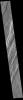
-
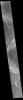
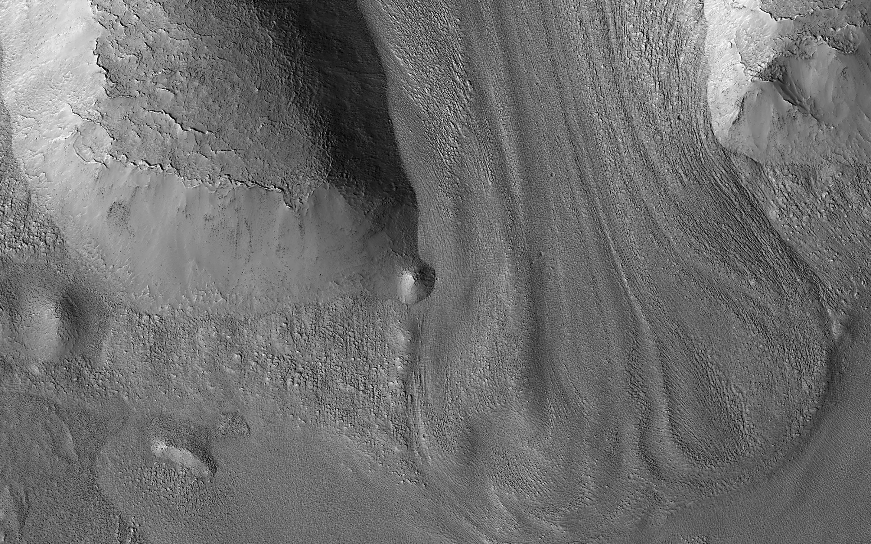
PIA26056:
-
Terra Sabaea - False Color
Full Resolution:
TIFF
(2.308 MB)
JPEG
(120.8 kB)
|
|
|
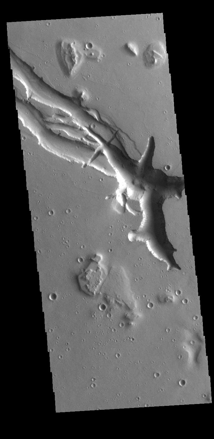
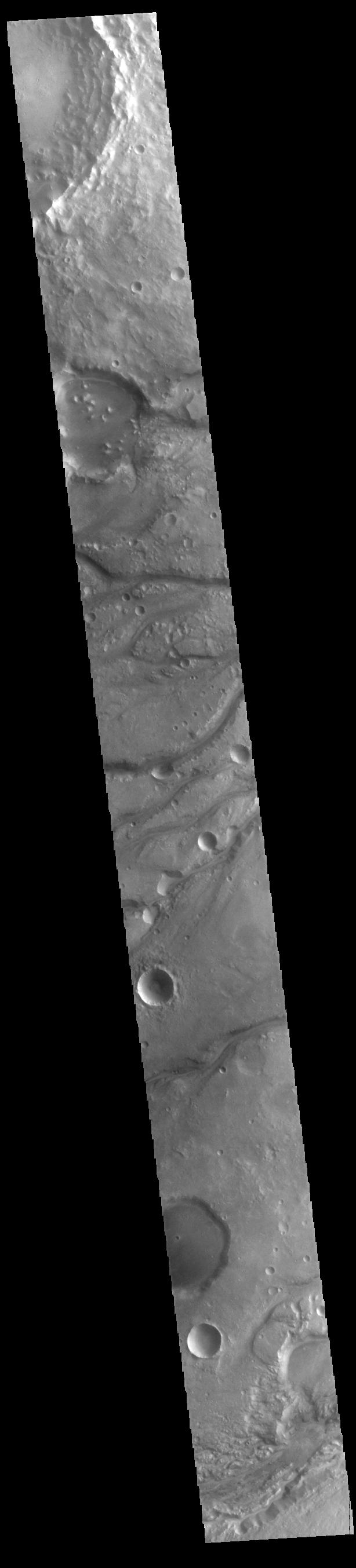
2023-08-11 |
Mars
|
2001 Mars Odyssey
|
THEMIS
|
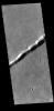
608x2698x1 |
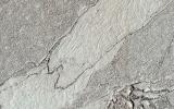
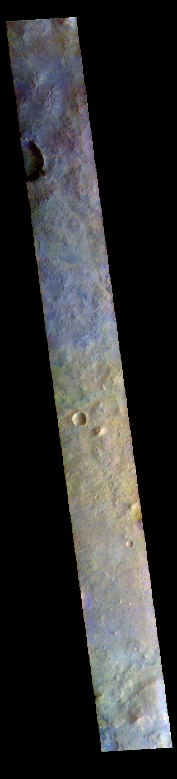
|
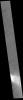
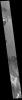
-
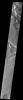
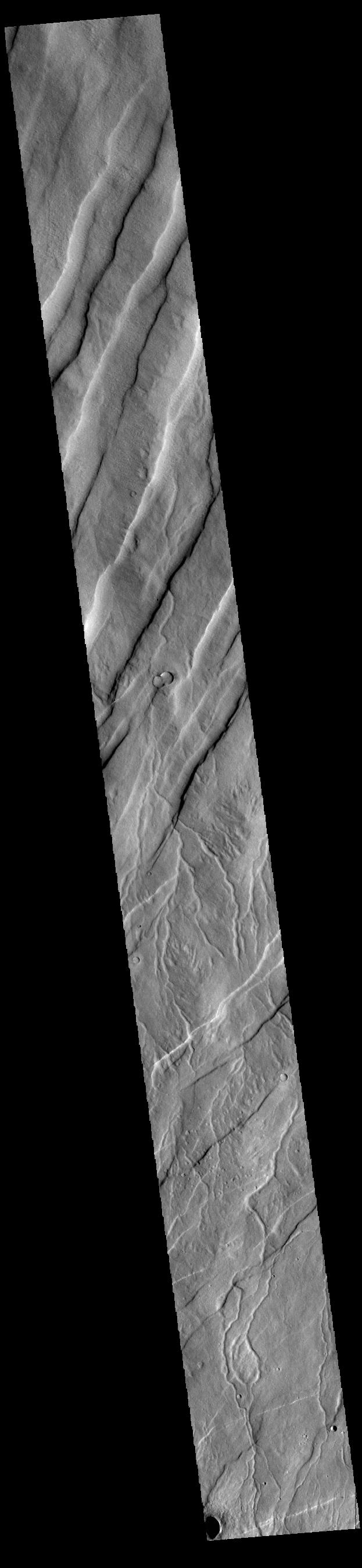
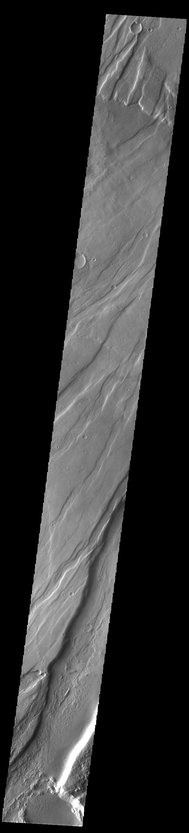
PIA26055:
-
Olympus Mons
Full Resolution:
TIFF
(762.1 kB)
JPEG
(107.1 kB)
|
|
|
2023-08-10 |
Mars
|
Mars Sample Return (MSR)
|
|
1920x1080x3 |
|
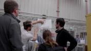
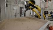
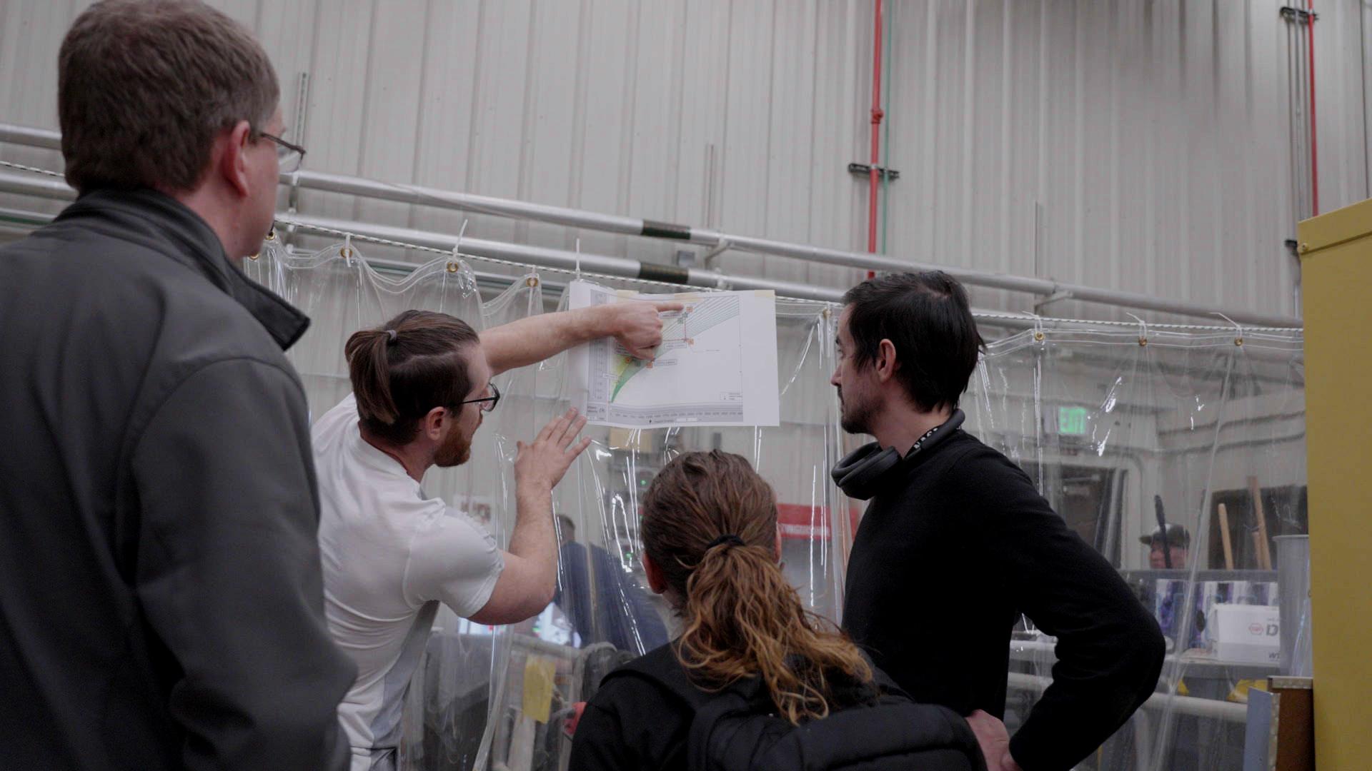
-
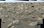
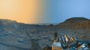
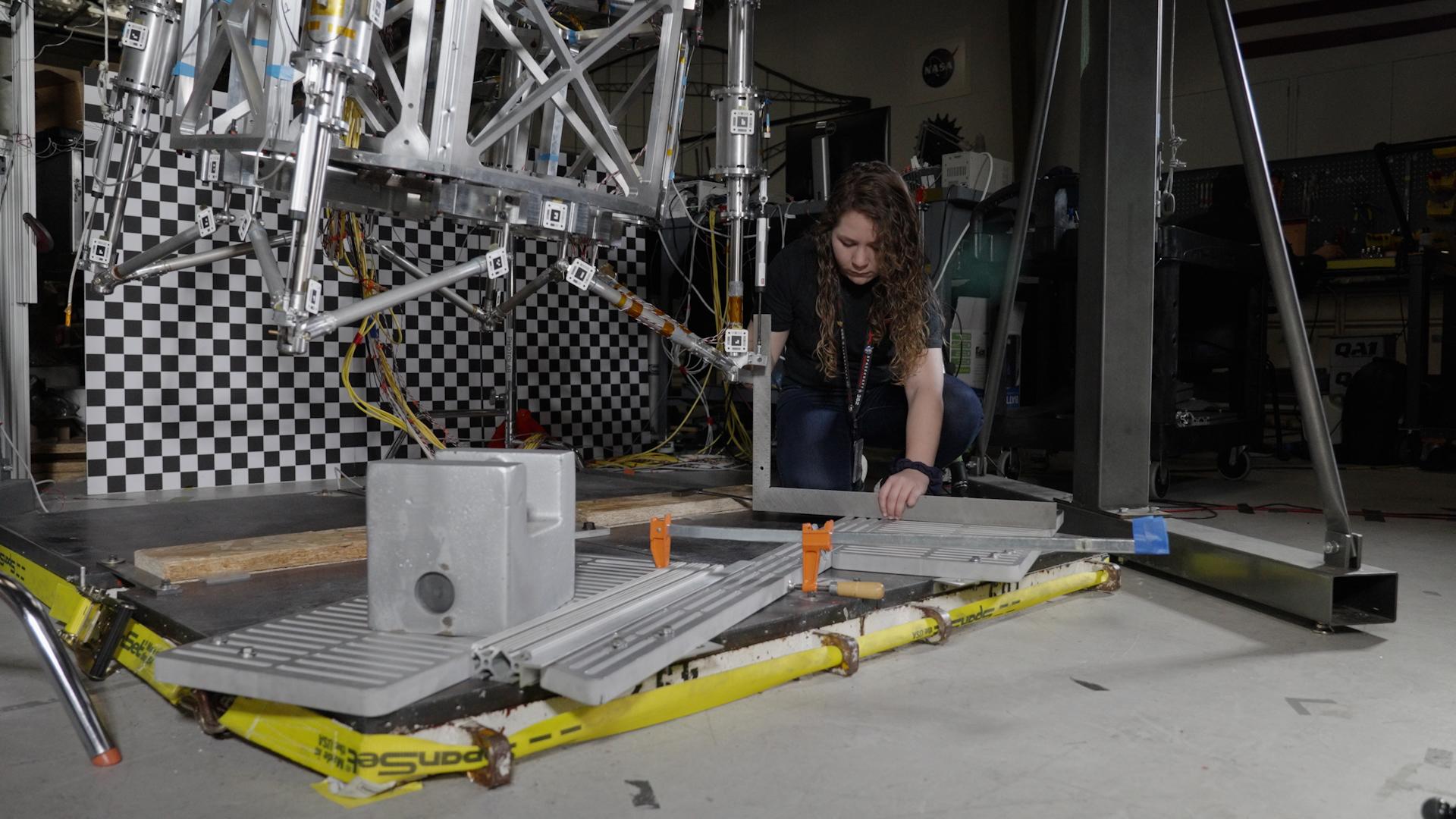
PIA25826:
-
Going Over the Footpad Test Data
Full Resolution:
TIFF
(4.761 MB)
JPEG
(161.3 kB)
|
|
|
2023-08-10 |
Mars
|
Mars Sample Return (MSR)
|
|
1920x1080x3 |
|
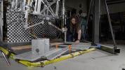
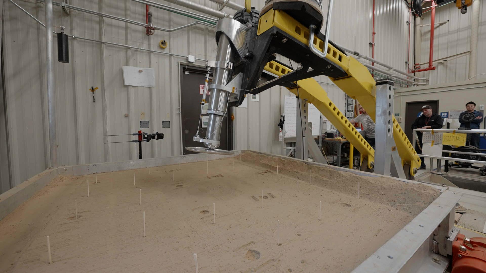
-
PIA25824:
-
A Full-Size Footpad Test
Full Resolution:
TIFF
(4.517 MB)
JPEG
(191.2 kB)
|
|
|
2023-08-10 |
Mars
|
Mars Sample Return (MSR)
|
|
1920x1080x3 |
|
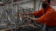
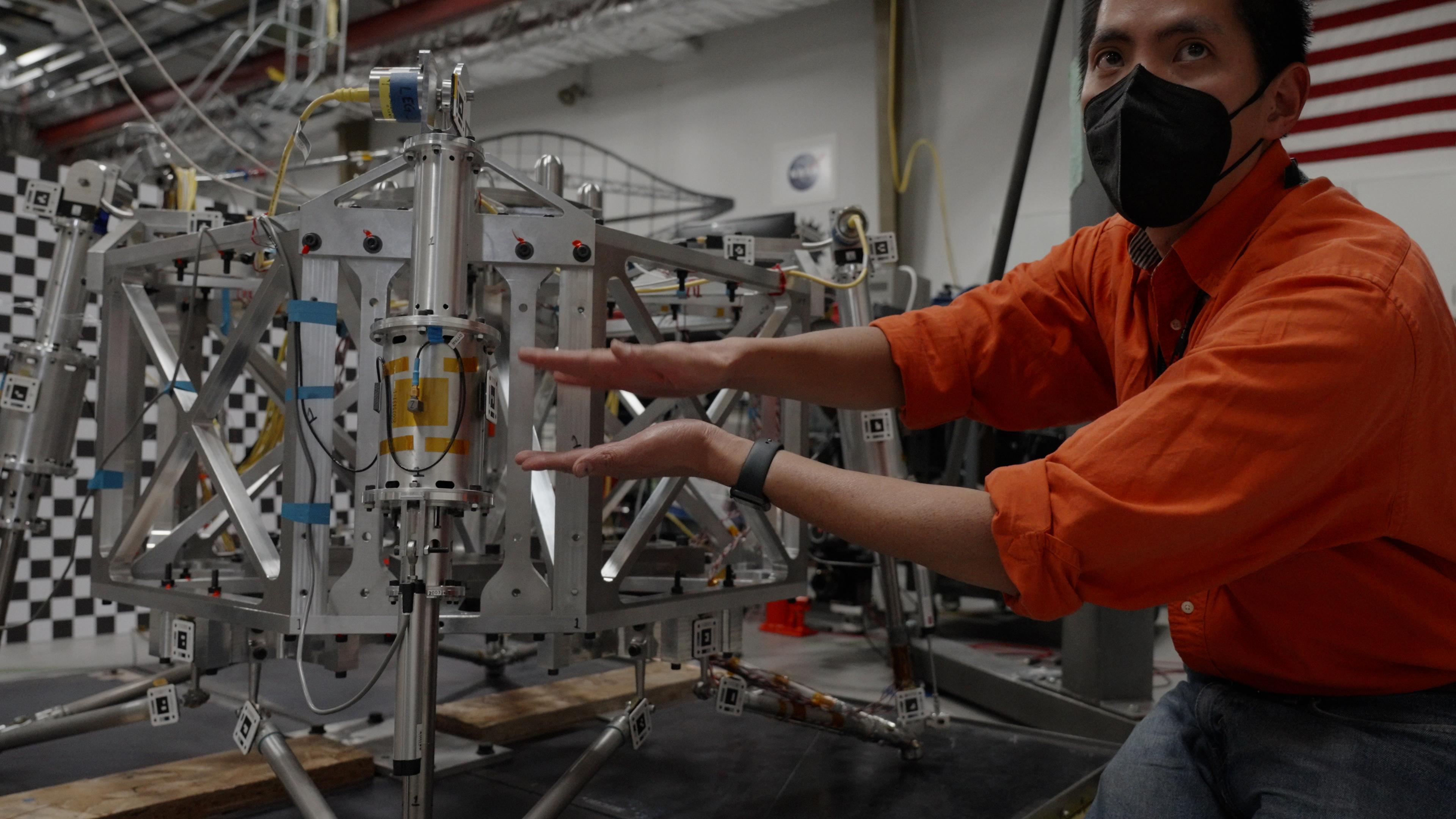
-
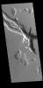
PIA25823:
-
Setting Guardrails for Mars Lander Testing
Full Resolution:
TIFF
(5.194 MB)
JPEG
(249.2 kB)
|
|
|
2023-08-10 |
Mars
|
Mars Sample Return (MSR)
|
|
3840x2160x3 |
|
-
PIA25822:
-
Testing a Prototype Mars Lander
Full Resolution:
TIFF
(20.42 MB)
JPEG
(665 kB)
|
|
|
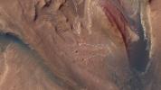
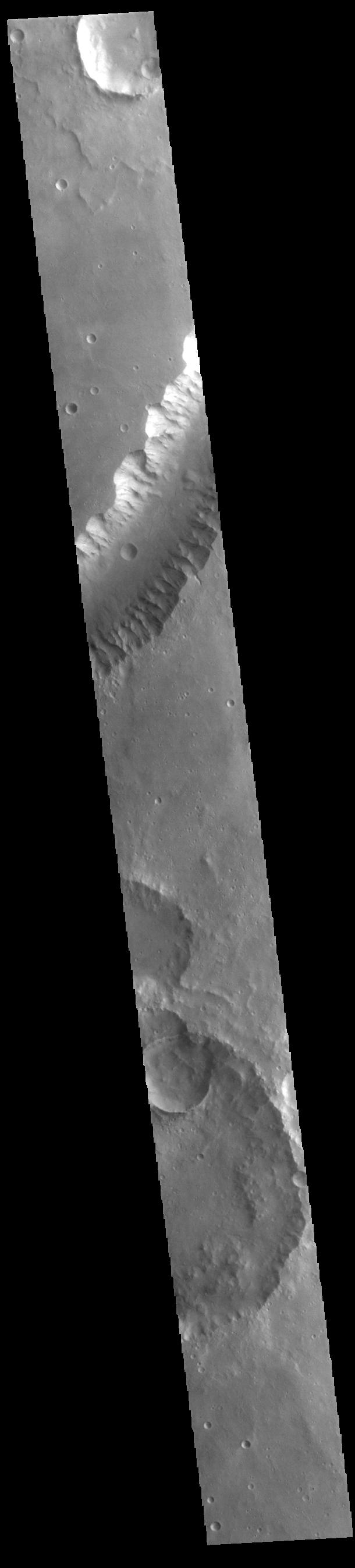
2023-08-10 |
Mars
|
2001 Mars Odyssey
|
THEMIS
|
623x2700x1 |
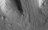
|
-
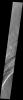
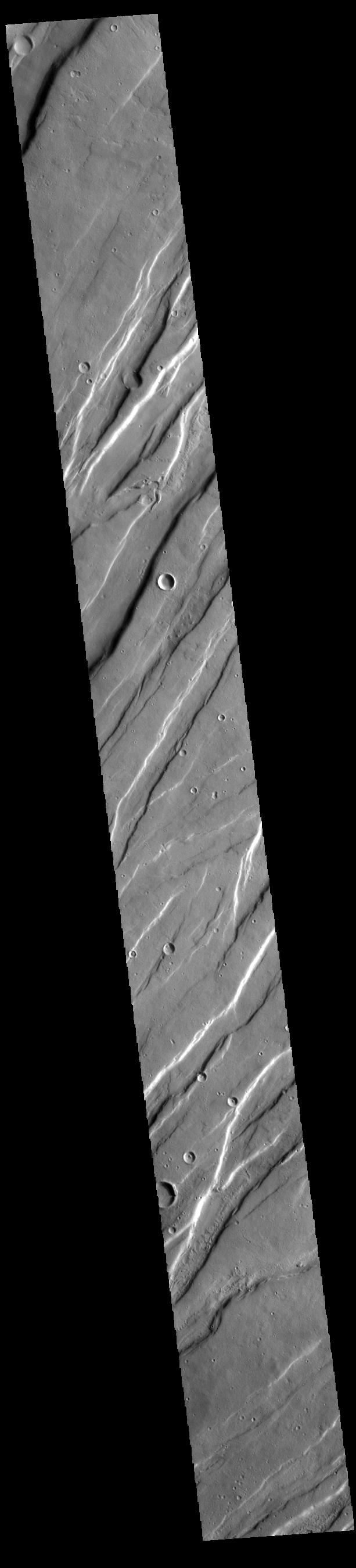
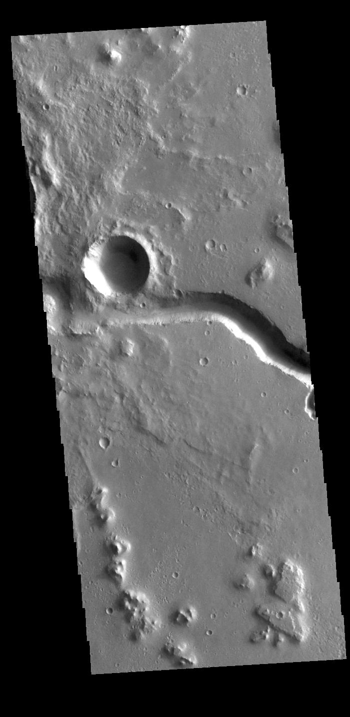
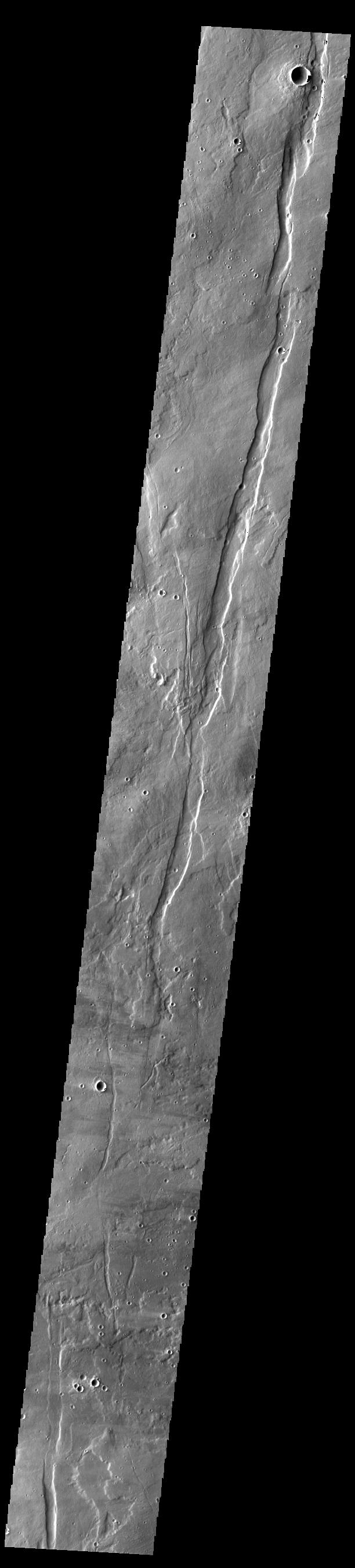
PIA26054:
-
Alba Fossae
Full Resolution:
TIFF
(871 kB)
JPEG
(134.5 kB)
|
|
|
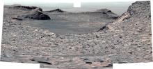
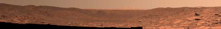
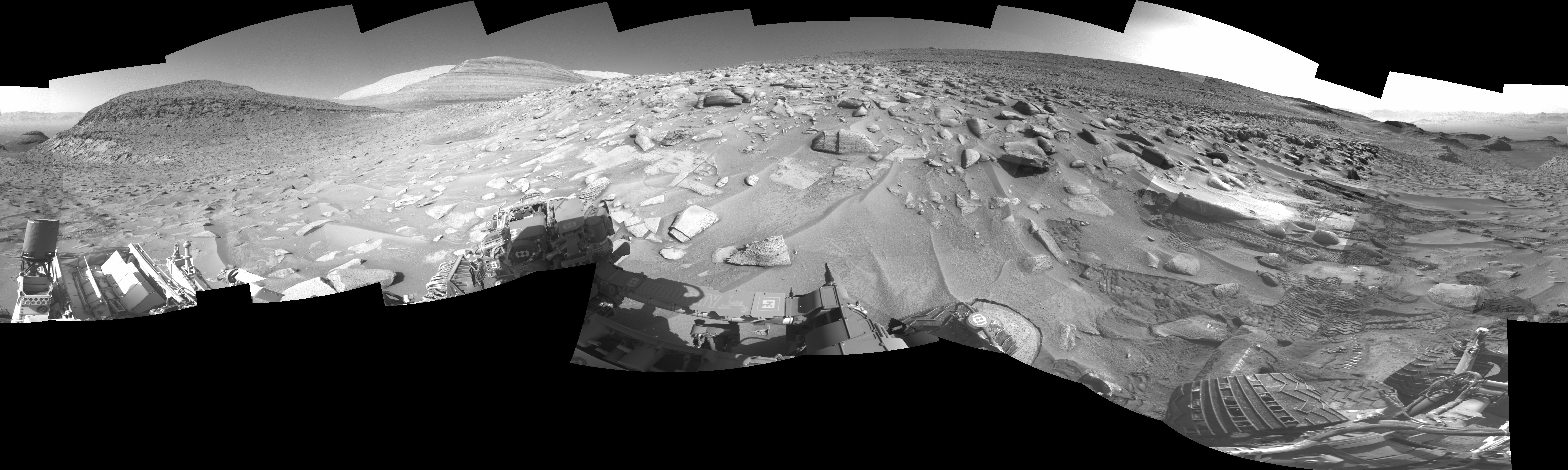
2023-08-09 |
Mars
|
Mars Science Laboratory (MSL)
|
Mastcam
|
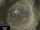
29163x8162x3 |
|
-
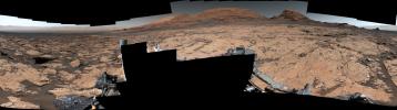
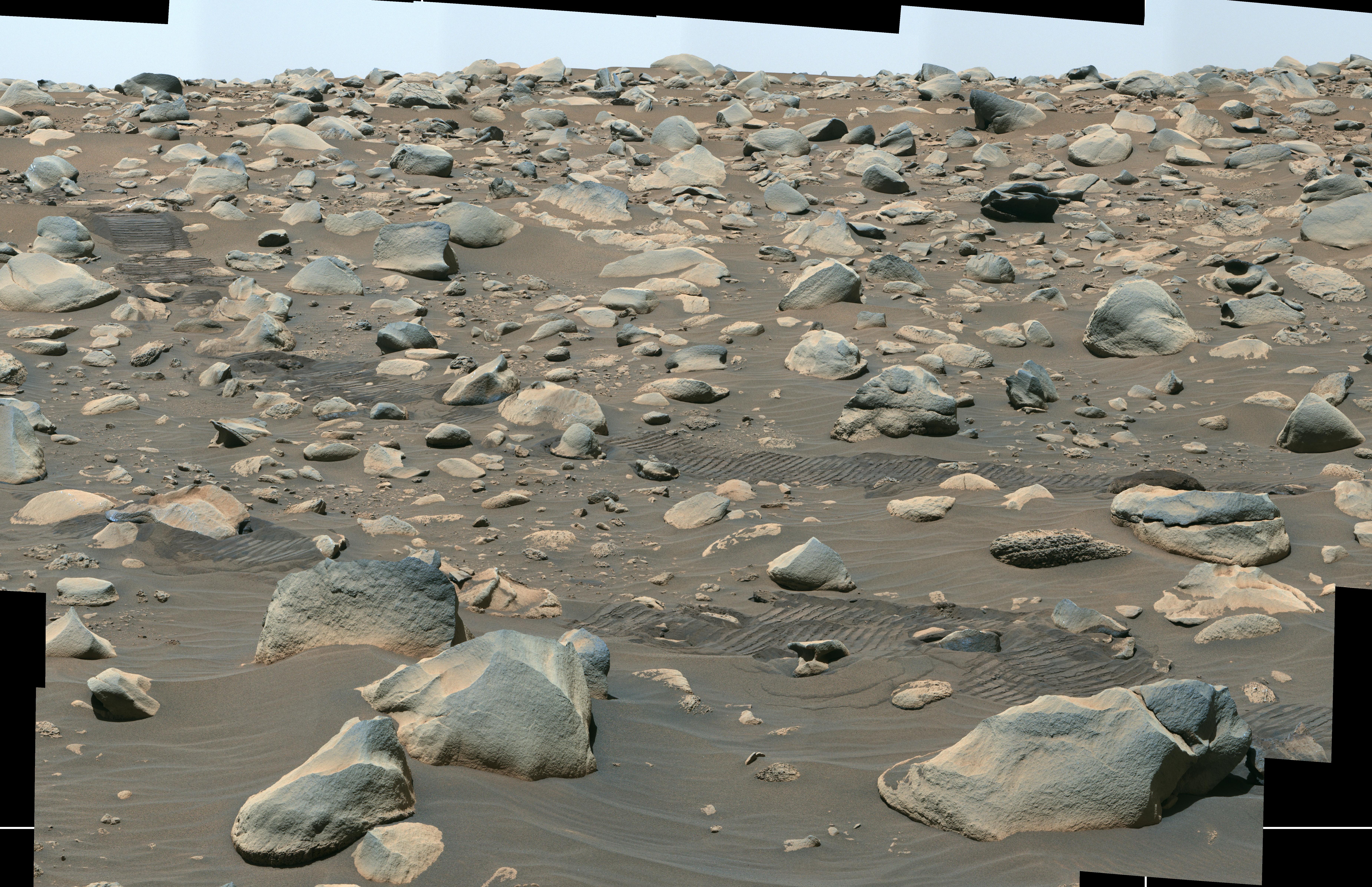
PIA25915:
Curiosity Views Mud Cracks in the Clay-Sulfate Transition Region
Full Resolution:
TIFF
(476.1 MB)
JPEG
(31.49 MB)
|
|
|
2023-08-09 |
Mars
|
2001 Mars Odyssey
|
THEMIS
|
603x2701x1 |
|
-
PIA26053:
-
Ascraeus Mons
Full Resolution:
TIFF
(757.3 kB)
JPEG
(103.1 kB)
|
|
|
2023-08-08 |
Mars
|
2001 Mars Odyssey
|
THEMIS
|
613x2699x1 |

|
-
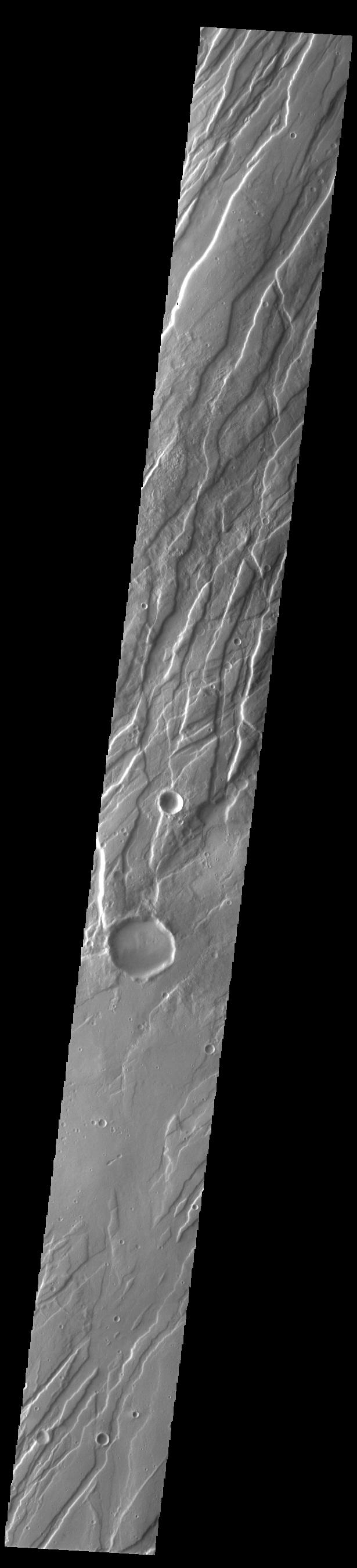
PIA26052:
-
Tempe Fossae
Full Resolution:
TIFF
(814.7 kB)
JPEG
(113.7 kB)
|
|
|
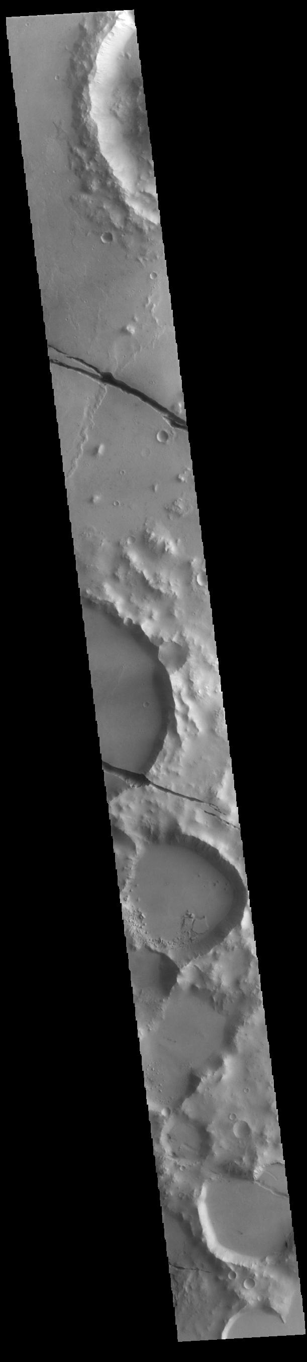
2023-08-07 |
Mars
|
Mars Helicopter
|
|
4208x3120x3 |
|
-
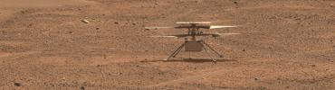
PIA25969:
-
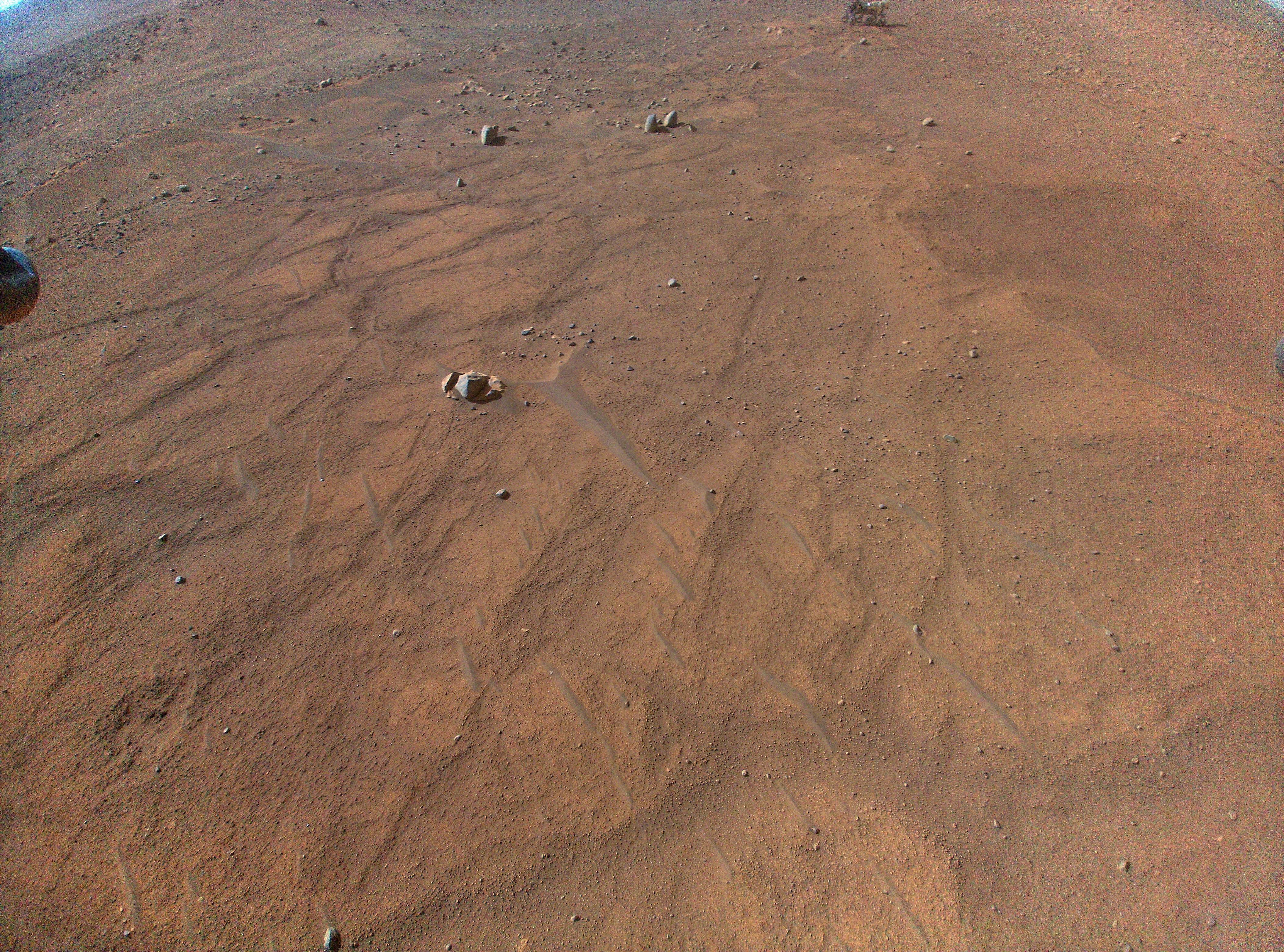
Perseverance Seen From Above During Flight 54
Full Resolution:
TIFF
(39.41 MB)
JPEG
(3.087 MB)
|
|
|
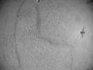
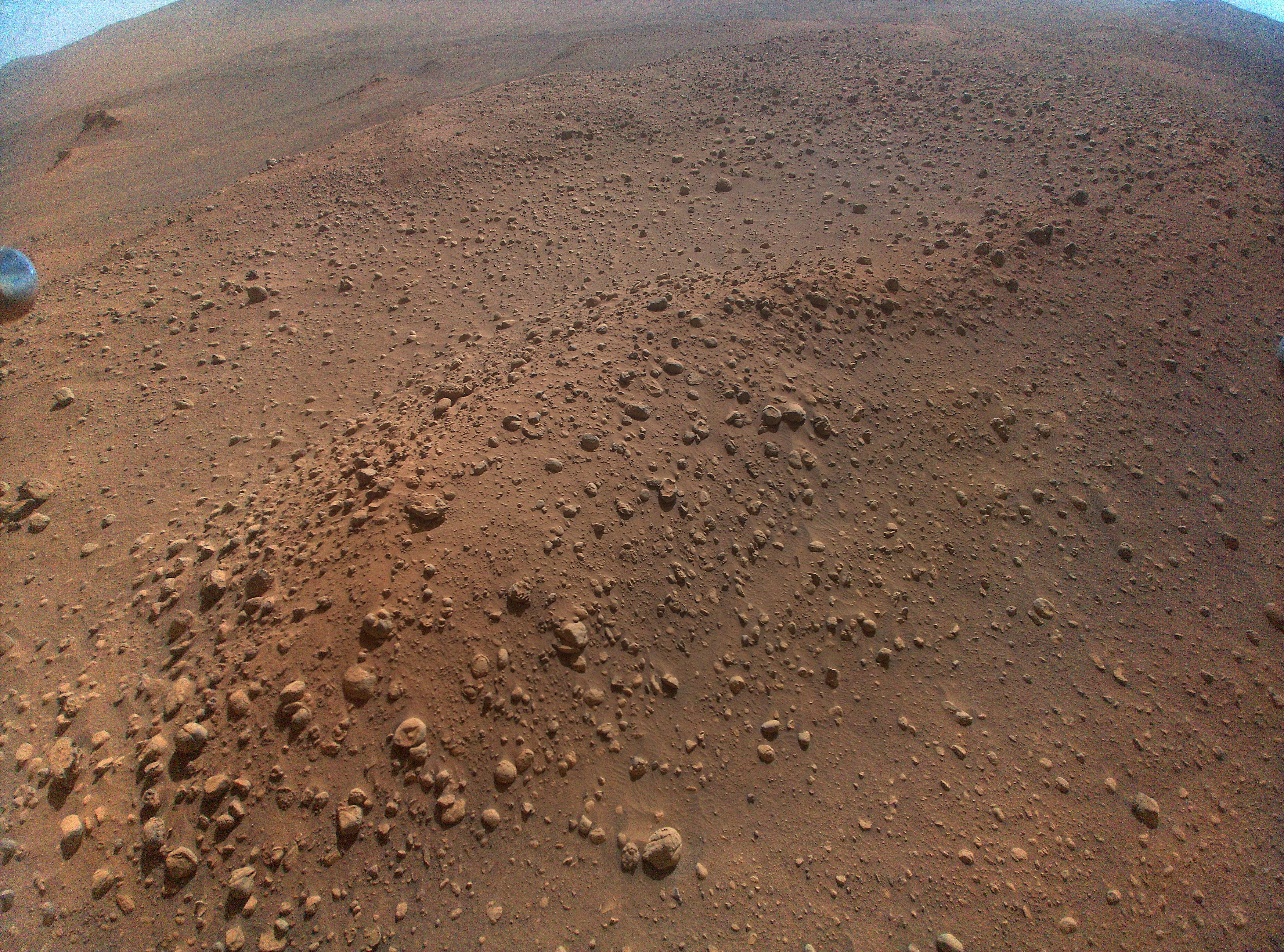
2023-08-07 |
Mars
|
Mars 2020 Rover
|
Mastcam-Z
|
4160x1127x3 |
|
-
PIA25968:
Perseverance Checks Out Ingenuity
Full Resolution:
TIFF
(14.07 MB)
JPEG
(988.6 kB)
|
|
|
2023-08-07 |
Mars
|
2001 Mars Odyssey
|
THEMIS
|
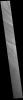
691x1428x1 |
|
-
PIA26051:
-
Dark Slope Streaks
Full Resolution:
TIFF
(668.1 kB)
JPEG
(56.72 kB)
|
|
|
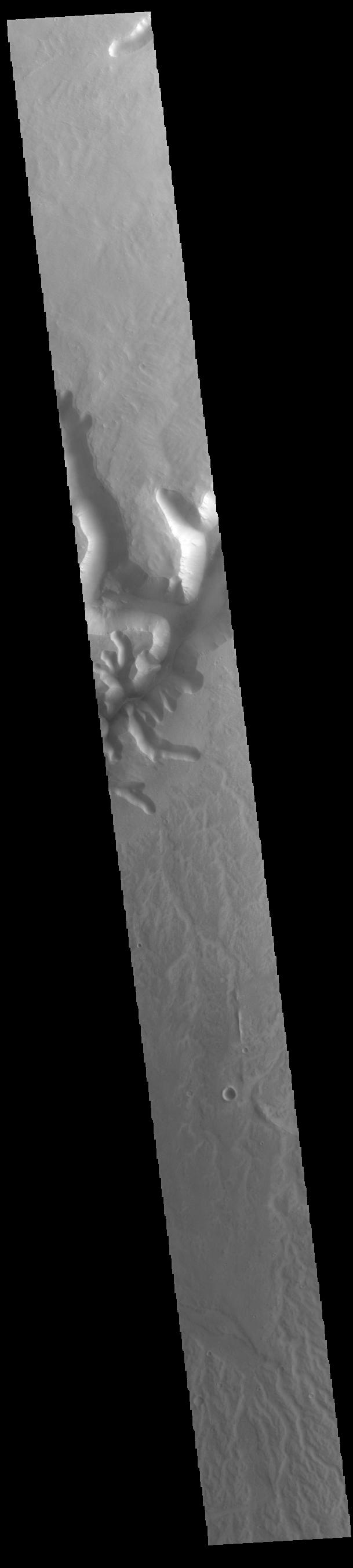
2023-08-04 |
Mars
|
2001 Mars Odyssey
|
THEMIS
|
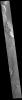
701x1435x1 |

|
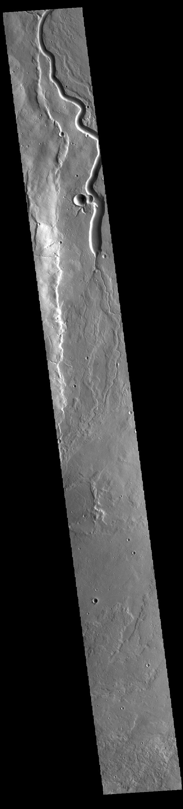
-
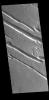
PIA26040:
-
Hephaestus Fossae
Full Resolution:
TIFF
(717.8 kB)
JPEG
(93.43 kB)
|
|
|
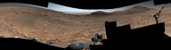
2023-08-03 |
Mars
|
Mars Science Laboratory (MSL)
|
Navcam (MSL)
|
7696x1503x1 |
|
-
PIA26018:
Curiosity Looks Over the Hill
Full Resolution:
TIFF
(8.746 MB)
JPEG
(1.204 MB)
|
|
|
2023-08-03 |
Mars
|
Mars Science Laboratory (MSL)
|
Navcam (MSL)
|
1024x1024x1 |

|
-
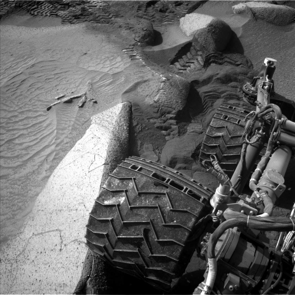
PIA26016:
-
Curiosity's Navcams View Its Wheels
Full Resolution:
TIFF
(1.05 MB)
JPEG
(187.4 kB)
|
|
|
2023-08-03 |
Mars
|
Mars Science Laboratory (MSL)
|
Mastcam
|
5684x3174x3 |
|
-
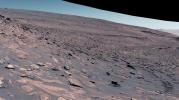
PIA26013:
-
Curiosity's Attempted Climb up a Slope
Full Resolution:
TIFF
(54.15 MB)
JPEG
(5.622 MB)
|
|
|
2023-08-03 |
Mars
|
Mars Science Laboratory (MSL)
|
Mastcam
|
9000x2584x3 |
|
-
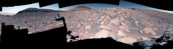
PIA26012:
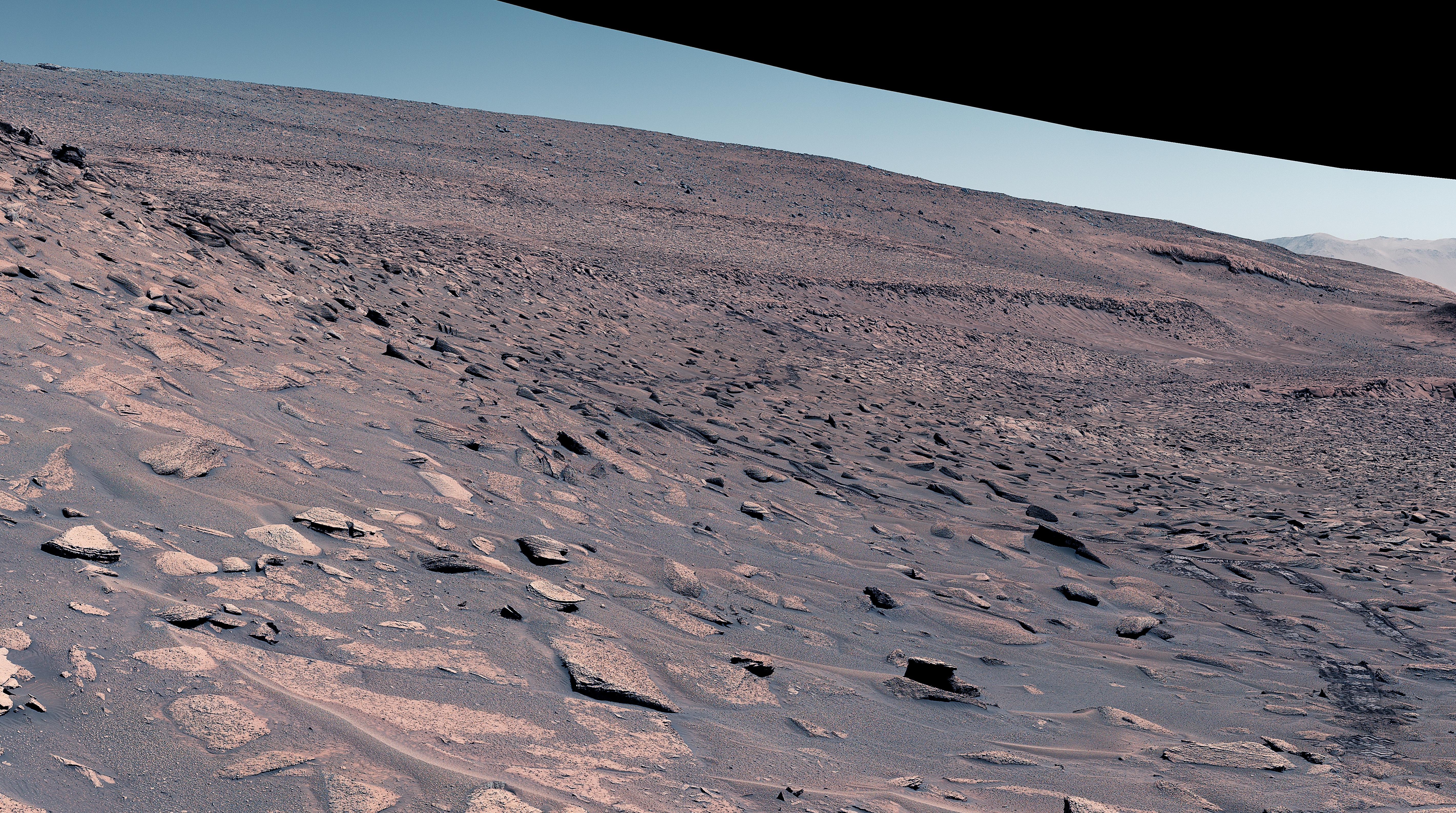
-
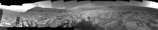
Curiosity's View up a Challenging Slope
Full Resolution:
TIFF
(48.08 MB)
JPEG
(4.328 MB)
|
|
|
2023-08-03 |
Mars
|
Mars Science Laboratory (MSL)
|
Mastcam
|
2892x1314x3 |
|
-
PIA26011:
-
Curiosity's View Back Toward 'Marker Band Valley'
Full Resolution:
TIFF
(11.1 MB)
JPEG
(1.224 MB)
|
|
|
2023-08-03 |
Mars
|
Mars Science Laboratory (MSL)
|
Mastcam
|
4617x2950x3 |
|
-
PIA25920:
-
Curiosity's Climb Attempt Leaves Tracks
Full Resolution:
TIFF
(30.24 MB)
JPEG
(2.791 MB)
|
|
|
2023-08-03 |
Mars
|
Mars Reconnaissance Orbiter (MRO)
|
HiRISE
|
3840x2160x3 |
|
-
PIA26017:
-
A Map of Curiosity's Difficult Climb
Full Resolution:
TIFF
(24.89 MB)
JPEG
(2.072 MB)
|
|
|
2023-08-03 |
Mars
|
Mars Science Laboratory (MSL)
|
Navcam (MSL)
|
7696x2307x1 |

|
-
PIA26015:
-
Curiosity Views Its Tracks Using Its Navcam
Full Resolution:
TIFF
(11.71 MB)
JPEG
(1.667 MB)
|
|
|
2023-08-03 |
Mars
|
Mars Science Laboratory (MSL)
|
Mastcam
|
9000x2641x3 |
|
-
PIA26014:
-
Curiosity Views a Crater at 'Jau'
Full Resolution:
TIFF
(45.85 MB)
JPEG
(3.742 MB)
|
|
|
2023-08-03 |
Mars
|
2001 Mars Odyssey
|
THEMIS
|
596x1446x1 |

|
-
PIA26039:
-
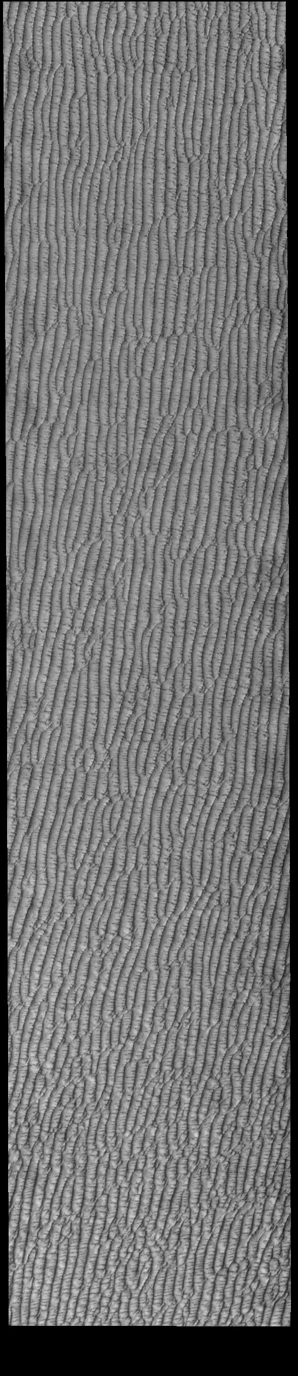
Olympia Undae
Full Resolution:
TIFF
(859.8 kB)
JPEG
(178.1 kB)
|
|
|
2023-08-02 |
Mars
|
2001 Mars Odyssey
|
THEMIS
|
717x1457x1 |
|
-
PIA26038:
-
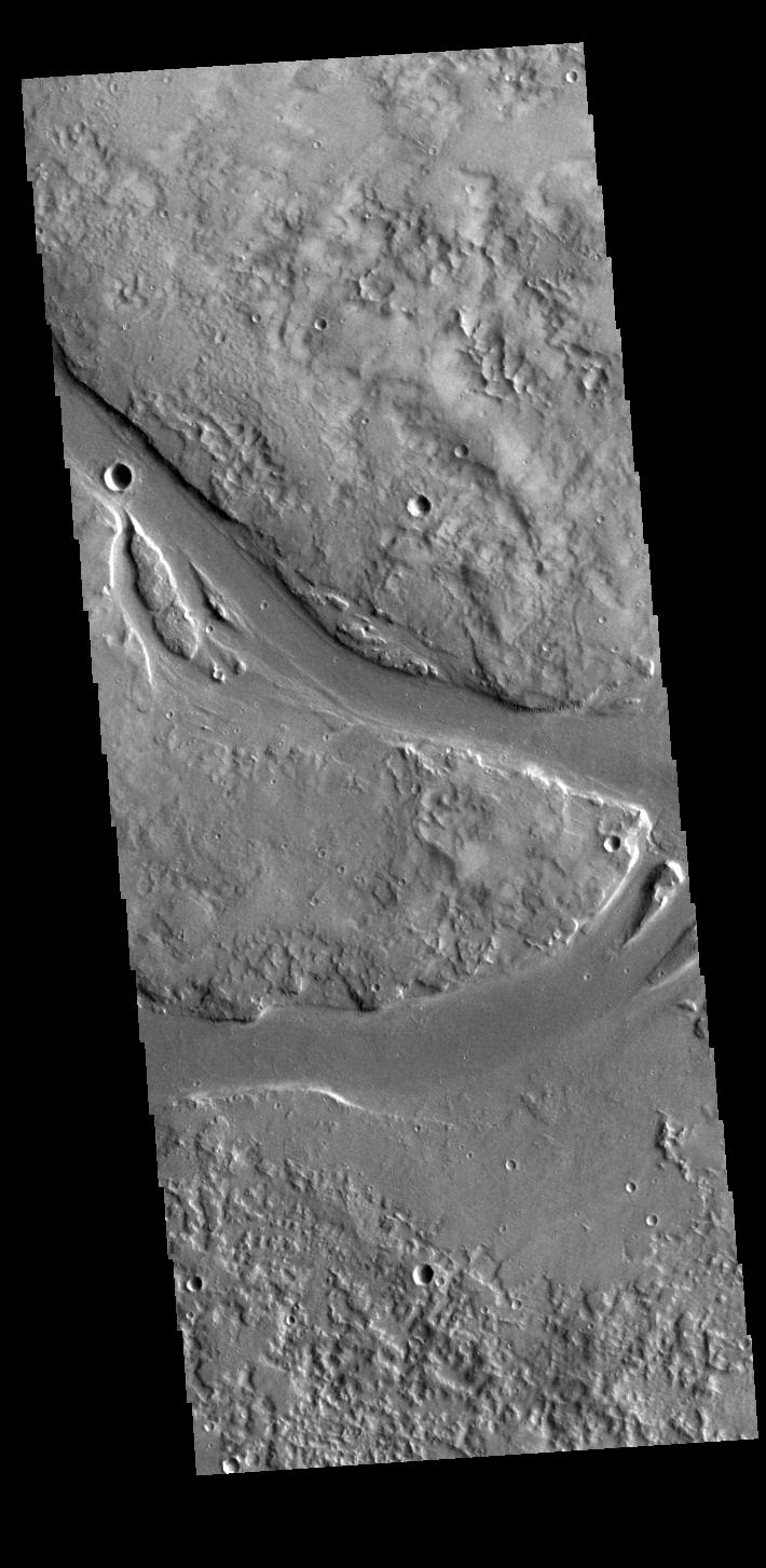
Arabia Terra Channel
Full Resolution:
TIFF
(713.9 kB)
JPEG
(80.55 kB)
|
|
|
2023-08-01 |
Mars
|
2001 Mars Odyssey
|
THEMIS
|
715x1459x1 |
|
-
PIA26037:
-
Artynia Catena
Full Resolution:
TIFF
(721.3 kB)
JPEG
(89.3 kB)
|
|
|
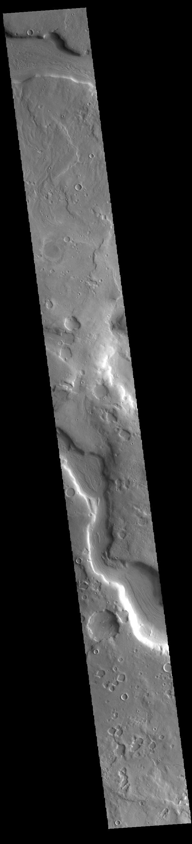
2023-07-31 |
Mars
|
2001 Mars Odyssey
|
THEMIS
|
699x1431x1 |

|
-
PIA26036:
-
Bahram Vallis
Full Resolution:
TIFF
(654.4 kB)
JPEG
(73.44 kB)
|
|
|
2023-07-28 |
Mars
|
2001 Mars Odyssey
|
THEMIS
|
704x1443x1 |
|
-
PIA26035:
-
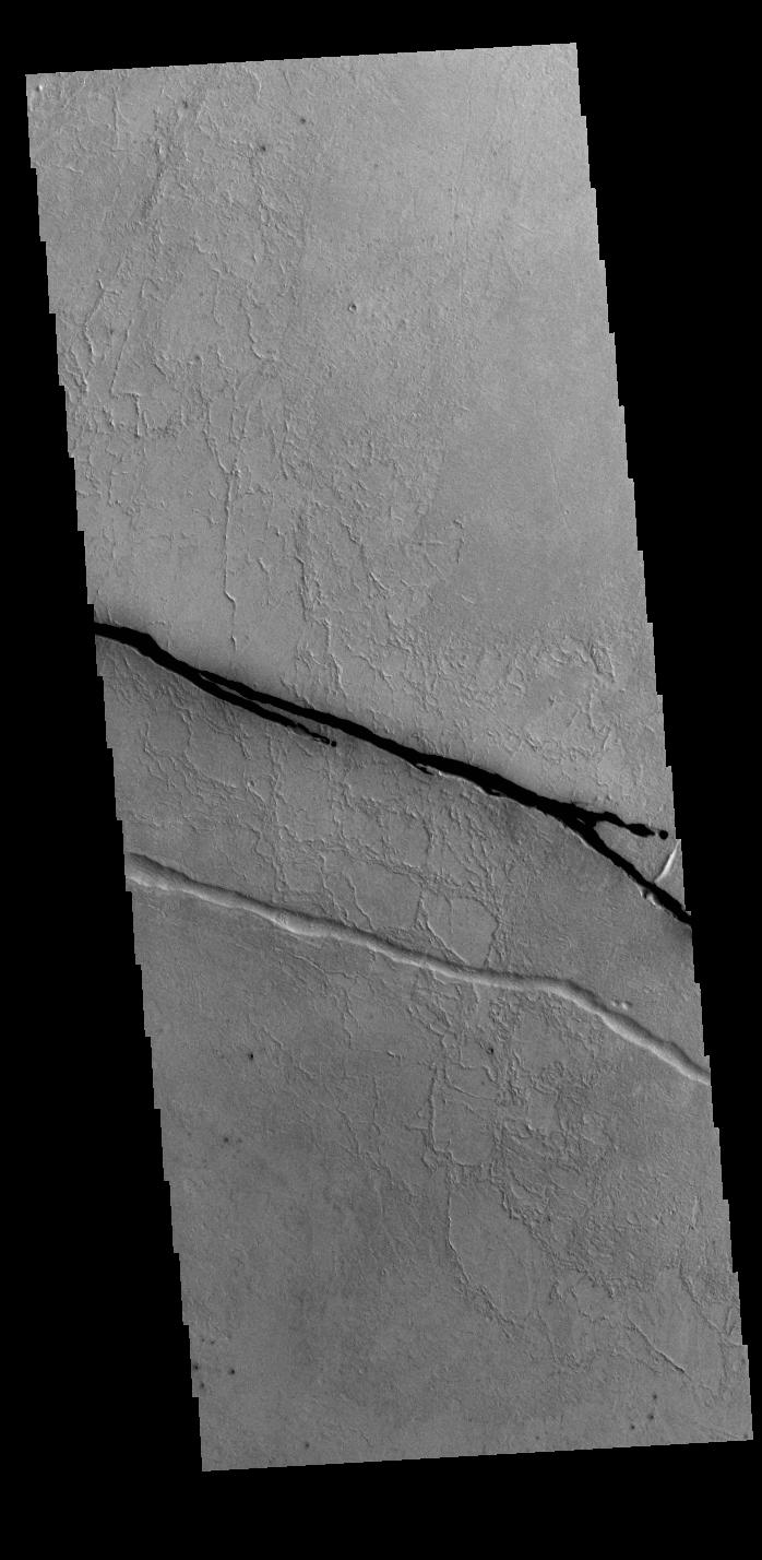
Tantalus Fossae
Full Resolution:
TIFF
(727.7 kB)
JPEG
(82.51 kB)
|
|
|
2023-07-27 |
Mars
|
2001 Mars Odyssey
|
THEMIS
|
713x1455x1 |
|
-
PIA26034:
-
Utopia Planitia Crater
Full Resolution:
TIFF
(787.3 kB)
JPEG
(114.6 kB)
|
|
|
2023-07-26 |
Mars
|
2001 Mars Odyssey
|
THEMIS
|
710x1453x1 |

|
-
PIA26033:
-
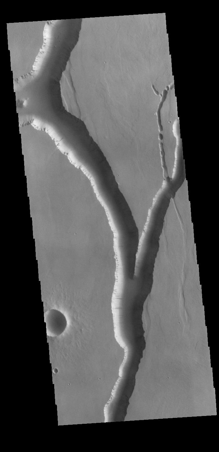
Granicus Valles
Full Resolution:
TIFF
(784.9 kB)
JPEG
(125.4 kB)
|
|
|
2023-07-25 |
Mars
|
2001 Mars Odyssey
|
THEMIS
|
589x2717x1 |

|
-
PIA26032:
-
Olympia Undae
Full Resolution:
TIFF
(1.602 MB)
JPEG
(302.2 kB)
|
|
|
2023-07-24 |
Mars
|
2001 Mars Odyssey
|
THEMIS
|
698x1428x1 |

|
-
PIA26031:
-
Cerberus Fossae
Full Resolution:
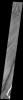
TIFF
(706.4 kB)
JPEG
(106.7 kB)
|
|
|
2023-07-21 |
Mars
|
2001 Mars Odyssey
|
THEMIS
|
699x1443x1 |

|
-
PIA26030:
-
Olympica Fossae
Full Resolution:
TIFF
(636.2 kB)
JPEG
(60.15 kB)
|
|
|
2023-07-20 |
Mars
|
2001 Mars Odyssey
|
THEMIS
|
704x1442x1 |
|
-
PIA26029:
-
Tempe Fossae
Full Resolution:
TIFF
(760.6 kB)
JPEG
(98.38 kB)
|
|
|
2023-07-19 |
Mars
|
Mars 2020 Rover
|
Mastcam-Z
|
7400x4784x3 |
|
-
PIA25963:
-
Perseverance Views Jezero Boulder Field
Full Resolution:
TIFF
(104.1 MB)
JPEG
(5.348 MB)
|
|
|
2023-07-19 |
Mars
|
Mars 2020 Rover
|
|
1100x1100x3 |
|
-
PIA25962:
-
Perseverance's 'Otis Peak' Sample Reveals Colors of Conglomerate
Full Resolution:
TIFF
(3.631 MB)
JPEG
(225.8 kB)
|
|
|
2023-07-19 |
Mars
|
2001 Mars Odyssey
|
THEMIS
|
1172x2671x1 |

|
-
PIA26028:
-
Olympia Undae
Full Resolution:
TIFF
(3.134 MB)
JPEG
(524.3 kB)
|
|
|
2023-07-18 |
Mars
|
2001 Mars Odyssey
|
THEMIS
|
606x2711x1 |
|
-
PIA26027:
-
Memnonia Sulci
Full Resolution:
TIFF
(812.4 kB)
JPEG
(130.7 kB)
|
|
|
2023-07-17 |
Mars
|
2001 Mars Odyssey
|
THEMIS
|
610x2709x1 |
|
-
PIA26026:
-
Wind Etching
Full Resolution:
TIFF
(771.9 kB)
JPEG
(100.6 kB)
|
|
|
2023-07-14 |
Mars
|
2001 Mars Odyssey
|
THEMIS
|
601x2706x1 |

|
-
PIA26025:
-
Oti Fossae
Full Resolution:
TIFF
(770.8 kB)
JPEG
(115 kB)
|
|
|
2023-07-13 |
Mars
|
2001 Mars Odyssey
|
THEMIS
|
699x1437x1 |
|
-
PIA26024:
-
Labeatis Fossae
Full Resolution:
TIFF
(716 kB)
JPEG
(108.3 kB)
|
|
|
2023-07-12 |
Mars
|
Mars 2020 Rover
|
Scanning Habitable Environments with Raman & Luminescence for Organics and Chemicals (SHERLOC)
|
1799x1337x3 |
|
-
PIA25919:
-
Perseverance Rover's SHERLOC Studies 'Quartier'
Full Resolution:
TIFF
(7.219 MB)
JPEG
(443.5 kB)
|
|
|
2023-07-12 |
Mars
|
2001 Mars Odyssey
|
THEMIS
|
706x1438x1 |

|
-
PIA26023:
-
Elyisum Fossae
Full Resolution:
TIFF
(709.9 kB)
JPEG
(86.27 kB)
|
|
|
2023-07-11 |
Mars
|
2001 Mars Odyssey
|
THEMIS
|
608x2707x1 |
|
-
PIA26022:
-
Xanthe Terra Margin
Full Resolution:
TIFF
(753.7 kB)
JPEG
(82.41 kB)
|
|
|
2023-07-10 |
Mars
|
2001 Mars Odyssey
|
THEMIS
|
602x2692x1 |
|
-
PIA26021:
-
Ascraeus Mons Summit
Full Resolution:
TIFF
(760.2 kB)
JPEG
(111.8 kB)
|
|
|
2023-07-07 |
Mars
|
2001 Mars Odyssey
|
THEMIS
|
607x2708x1 |
|
-
PIA26005:
-
Hebes and Ophir Chasmata
Full Resolution:
TIFF
(720.6 kB)
JPEG
(84.64 kB)
|
|
|
2023-07-06 |
Mars
|
2001 Mars Odyssey
|
THEMIS
|
710x1444x1 |

|
-
PIA26004:
-
Elysium Fossae
Full Resolution:
TIFF
(695.3 kB)
JPEG
(78.81 kB)
|
|
|
2023-07-05 |
Mars
|
2001 Mars Odyssey
|
THEMIS
|
612x2698x1 |
|
-
PIA26003:
-
Tantalus Fossae
Full Resolution:
TIFF
(815.2 kB)
JPEG
(114.9 kB)
|
|
|
2023-07-04 |
Mars
|
2001 Mars Odyssey
|
THEMIS
|
610x2695x1 |

|
-
PIA26002:
-
Shalbatana Vallis
Full Resolution:
TIFF
(763 kB)
JPEG
(87.78 kB)
|
|
|
2023-07-03 |
Mars
|
2001 Mars Odyssey
|
THEMIS
|
706x1443x1 |
|
-
PIA26001:
-
Hebrus Valles
Full Resolution:
TIFF
(710.7 kB)
JPEG
(87.13 kB)
|
|
|
2023-06-30 |
Mars
|
Mars Helicopter
|
|
640x480x1 |
|
-
PIA25918:
-
Ingenuity Before Flight 52's Landing
Full Resolution:
TIFF
(283.2 kB)
JPEG
(24.64 kB)
|
|
|
2023-06-30 |
Mars
|
2001 Mars Odyssey
|
THEMIS
|
611x2704x1 |

|
-
PIA26000:
-
Cerberus Fossae
Full Resolution:
TIFF
(768.7 kB)
JPEG
(82.67 kB)
|
|
|
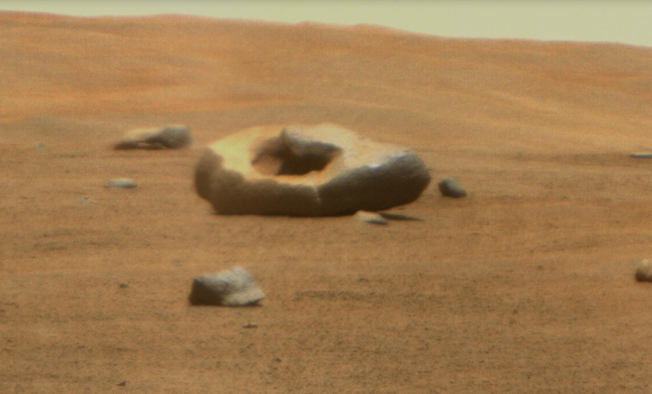
2023-06-29 |
Mars
|
Mars 2020 Rover
|
Mastcam-Z
|
1906x1174x3 |
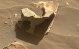
|
-
PIA25917:
-
Perseverance Finds a Hollowed-Out Rock
Full Resolution:
TIFF
(6.716 MB)
JPEG
(285.3 kB)
|
|
|
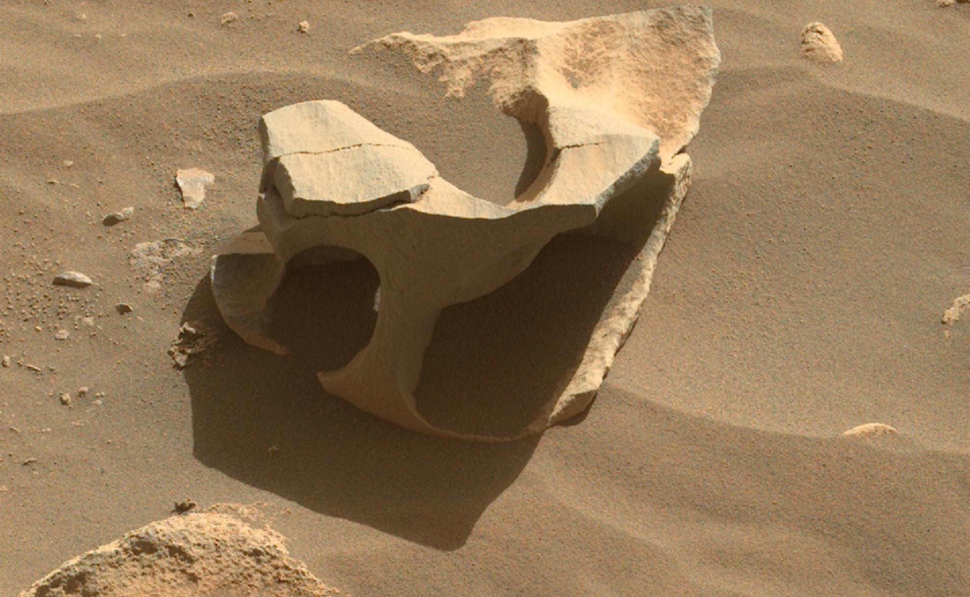
2023-06-29 |
Mars
|
Mars 2020 Rover
|
SuperCam
|
2106x1274x3 |
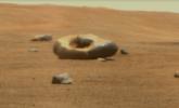
|
-
PIA25916:
-
Perseverance Discovers a Doughnut-Shaped Rock
Full Resolution:
TIFF
(6.335 MB)
JPEG
(217.4 kB)
|
|
|
2023-06-29 |
Mars
|
2001 Mars Odyssey
|
THEMIS
|
615x2701x1 |

|
-
PIA25999:
-
Cerberus Fossae
Full Resolution:
TIFF
(773.4 kB)
JPEG
(90.2 kB)
|
|
|
2023-06-28 |
Mars
|
2001 Mars Odyssey
|
THEMIS
|
614x2693x1 |
|
-
PIA25998:
-
Rubicon Valles
Full Resolution:
TIFF
(845.3 kB)
JPEG
(138.9 kB)
|
|
|
2023-06-27 |
Mars
|
2001 Mars Odyssey
|
THEMIS
|
607x2703x1 |
|
-
PIA25997:
-
Pavonis Mons Flank
Full Resolution:
TIFF
(749.2 kB)
JPEG
(94.7 kB)
|
|
|
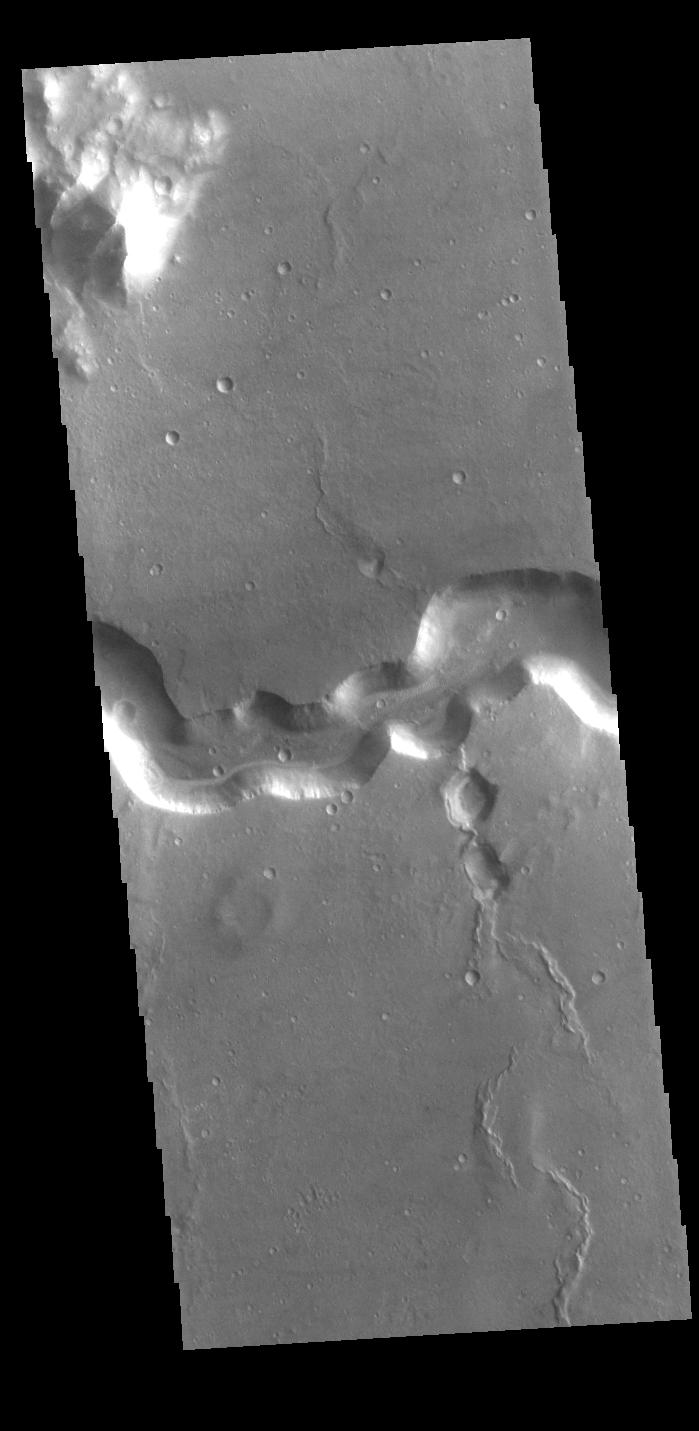
2023-06-26 |
Mars
|
2001 Mars Odyssey
|
THEMIS
|
609x2705x1 |

|
-
PIA25996:
-
Channel
Full Resolution:
TIFF
(699.9 kB)
JPEG
(69.4 kB)
|
|
|
2023-06-23 |
Mars
|
2001 Mars Odyssey
|
THEMIS
|
614x2707x1 |

|
-
PIA25995:
-
Maumee Valles
Full Resolution:
TIFF
(800.3 kB)
JPEG
(99.88 kB)
|
|
|
2023-06-22 |
Mars
|
2001 Mars Odyssey
|
THEMIS
|
614x2697x1 |
|
-
PIA25994:
-
Arabia Terra Channel
Full Resolution:
TIFF
(810 kB)
JPEG
(101.3 kB)
|
|
|
2023-06-21 |
Mars
|
2001 Mars Odyssey
|
THEMIS
|
615x2699x1 |
|
-
PIA25993:
-
Terra Sabaea Channels
Full Resolution:
TIFF
(787.4 kB)
JPEG
(91.18 kB)
|
|
|
2023-06-20 |
Mars
|
2001 Mars Odyssey
|
THEMIS
|
612x2702x1 |

|
-
PIA25992:
-
Cyane Sulci
Full Resolution:
TIFF
(757.6 kB)
JPEG
(92.87 kB)
|
|
|
2023-06-19 |
Mars
|
2001 Mars Odyssey
|
THEMIS
|
612x2699x1 |
|
-
PIA25991:
-
Ceraunius Fossae
Full Resolution:
TIFF
(837.6 kB)
JPEG
(138.1 kB)
|
|
|
2023-06-16 |
Mars
|
2001 Mars Odyssey
|
THEMIS
|
615x2699x1 |

|
-
PIA25980:
-
Tempe Fossae
Full Resolution:
TIFF
(827.2 kB)
JPEG
(113 kB)
|
|
|
2023-06-15 |
Mars
|
2001 Mars Odyssey
|
THEMIS
|
615x2697x1 |
|
-
PIA25979:
-
Tempe Fossae
Full Resolution:
TIFF
(814.5 kB)
JPEG
(106.3 kB)
|
|
|
2023-06-14 |
Mars
|
2001 Mars Odyssey
|
THEMIS
|
612x2700x1 |

|
-
PIA25978:
-
Buvinda Vallis
Full Resolution:
TIFF
(840.3 kB)
JPEG
(120 kB)
|
|
|
2023-06-13 |
Mars
|
Mars Science Laboratory (MSL)
|
Navigation Camera (M2020)
|
3840x2160x3 |
|
-
PIA25912:
-
Curiosity's 'Postcard' of 'Marker Band Valley'
Full Resolution:
TIFF
(19.22 MB)
JPEG
(666.5 kB)
|
|
|
2023-06-13 |
Mars
|
2001 Mars Odyssey
|
THEMIS
|
622x2697x1 |
|
-
PIA25977:
-
Mareotis Fossae
Full Resolution:
TIFF
(835.3 kB)
JPEG
(107.1 kB)
|
|
|
2023-06-12 |
Mars
|
2001 Mars Odyssey
|
THEMIS
|
713x1449x1 |
|
-
PIA25976:
-
Elysium Fossae
Full Resolution:
TIFF
(708.2 kB)
JPEG
(79.8 kB)
|
|
|
2023-06-09 |
Mars
|
2001 Mars Odyssey
|
THEMIS
|
612x2700x1 |
|
-
PIA25975:
-
Cerberus Fossae/Athabasca Valles
Full Resolution:
TIFF
(768 kB)
JPEG
(82.95 kB)
|
|
|
2023-06-08 |
Mars
|
Mars Science Laboratory (MSL)
|
|
13200x10200x3 |
|
-
PIA25914:
-
Curiosity's Quadrant Themes
Full Resolution:
TIFF
(147.4 MB)
JPEG
(15.53 MB)
|
|
|
2023-06-08 |
Mars
|
Mars 2020 Rover
|
|
12000x12000x3 |
|
-
PIA25913:
-
Perseverance's Quadrant Themes
Full Resolution:
TIFF
(422.3 MB)
JPEG
(24.42 MB)
|
|
|
2023-06-08 |
Mars
|
2001 Mars Odyssey
|
THEMIS
|
614x2708x1 |
|
-
PIA25974:
-
Eumenides Dorsum
Full Resolution:
TIFF
(836.8 kB)
JPEG
(134.6 kB)
|
|
|
2023-06-07 |
Mars
|
2001 Mars Odyssey
|
THEMIS
|
716x1456x1 |
|
-
PIA25973:
-
Ravius Valles
Full Resolution:
TIFF
(793.8 kB)
JPEG
(124.4 kB)
|
|
|
2023-06-06 |
Mars
|
2001 Mars Odyssey
|
THEMIS
|
609x2701x1 |
|
-
PIA25972:
-
Ascraeus Mons
Full Resolution:
TIFF
(774.6 kB)
JPEG
(94.43 kB)
|
|
|
2023-06-05 |
Mars
|
2001 Mars Odyssey
|
THEMIS
|
610x2709x1 |
|
-
PIA25971:
-
Shalbatana Vallis
Full Resolution:
TIFF
(746.4 kB)
JPEG
(77.26 kB)
|
|
|
2023-06-02 |
Mars
|
2001 Mars Odyssey
|
THEMIS
|
717x1456x1 |
|
-
PIA25945:
-
Ismeniae Fossae
Full Resolution:
TIFF
(780.7 kB)
JPEG
(94.25 kB)
|
|
|
2023-06-01 |
Mars
|
2001 Mars Odyssey
|
THEMIS
|
618x2693x1 |
|
-
PIA25944:
-
Alba Fossae
Full Resolution:
TIFF
(844.4 kB)
JPEG
(127.8 kB)
|
|
|
2023-05-31 |
Mars
|
2001 Mars Odyssey
|
THEMIS
|
712x1447x1 |
|
-
PIA25943:
-
Terra Sabaea
Full Resolution:
TIFF
(717 kB)
JPEG
(73.73 kB)
|
|
|
2023-05-30 |
Mars
|
2001 Mars Odyssey
|
THEMIS
|
612x2703x1 |
|
-
PIA25942:
-
Windstreaks
Full Resolution:
TIFF
(781.2 kB)
JPEG
(94.9 kB)
|
|
|
2023-05-29 |
Mars
|
2001 Mars Odyssey
|
THEMIS
|
610x2698x1 |
|
-
PIA25941:
-
Elysium Fossae
Full Resolution:
TIFF
(768.5 kB)
JPEG
(98.34 kB)
|
|
|
2023-05-26 |
Mars
|
Mars Helicopter
|
|
1627x1125x3 |

|
-
PIA25961:
-
Leading Up to Flight 50
Full Resolution:
TIFF
(5.493 MB)
JPEG
(302.7 kB)
|
|
|
2023-05-26 |
Mars
|
Mars Helicopter
|
|
4208x3120x3 |

|
-
PIA25890:
-
'Castell Henllys' From Above
Full Resolution:
TIFF
(39.41 MB)
JPEG
(3.102 MB)
|
|
|
2023-05-26 |
Mars
|
2001 Mars Odyssey
|
THEMIS
|
611x2693x1 |
|
-
PIA25940:
-
Tractus Catena
Full Resolution:
TIFF
(803.4 kB)
JPEG
(101.5 kB)
|
|
|
2023-05-25 |
Mars
|
2001 Mars Odyssey
|
THEMIS
|
612x2700x1 |

|
-
PIA25939:
-
Kasei Valles
Full Resolution:
TIFF
(757.4 kB)
JPEG
(77.79 kB)
|
|
|
2023-05-24 |
Mars
|
2001 Mars Odyssey
|
THEMIS
|
612x2701x1 |
|
-
PIA25938:
-
Arabia Terra Craters
Full Resolution:
TIFF
(818.1 kB)
JPEG
(104.6 kB)
|
|
|
2023-05-23 |
Mars
|
2001 Mars Odyssey
|
THEMIS
|
618x2696x1 |
|
-
PIA25937:
-
Terra Sabaea Channels
Full Resolution:
TIFF
(802.6 kB)
JPEG
(91.28 kB)
|
|
|
2023-05-22 |
Mars
|
2001 Mars Odyssey
|
THEMIS
|
611x2702x1 |

|
-
PIA25936:
-
Bahram Vallis
Full Resolution:
TIFF
(781.5 kB)
JPEG
(91.45 kB)
|
|
|
2023-05-19 |
Mars
|
2001 Mars Odyssey
|
THEMIS
|
620x2696x1 |
|
-
PIA25935:
-
Alba Fossae
Full Resolution:
TIFF
(809.8 kB)
JPEG
(102 kB)
|
|
|
2023-05-18 |
Mars
|
Mars 2020 Rover
|
Mastcam-Z
|
9000x1191x3 |
|
-
PIA25889:
Perseverance Takes in View at Belva Crater
Full Resolution:
TIFF
(23.28 MB)
JPEG
(1.248 MB)
|
|
|
2023-05-18 |
Mars
|
2001 Mars Odyssey
|
THEMIS
|
613x2701x1 |
|
-
PIA25934:
-
Granicus Valles
Full Resolution:
TIFF
(823.4 kB)
JPEG
(114.4 kB)
|
|
|
2023-05-17 |
Mars
|
2001 Mars Odyssey
|
THEMIS
|
611x2707x1 |
|
-
PIA25933:
-
Cerberus Fossae
Full Resolution:
TIFF
(735.6 kB)
JPEG
(73.04 kB)
|
|
|
2023-05-16 |
Mars
|
2001 Mars Odyssey
|
THEMIS
|
612x2699x1 |

|
-
PIA25932:
-
Lycus Sulci
Full Resolution:
TIFF
(836.3 kB)
JPEG
(113.6 kB)
|
|
|
2023-05-15 |
Mars
|
2001 Mars Odyssey
|
THEMIS
|
605x2703x1 |

|
-
PIA25931:
-
Pavonis Mons Flank
Full Resolution:
TIFF
(747.9 kB)
JPEG
(82.84 kB)
|
|
|
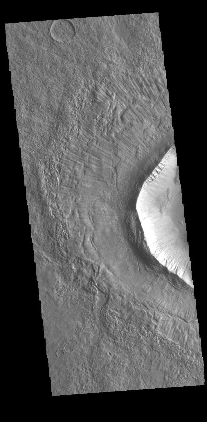
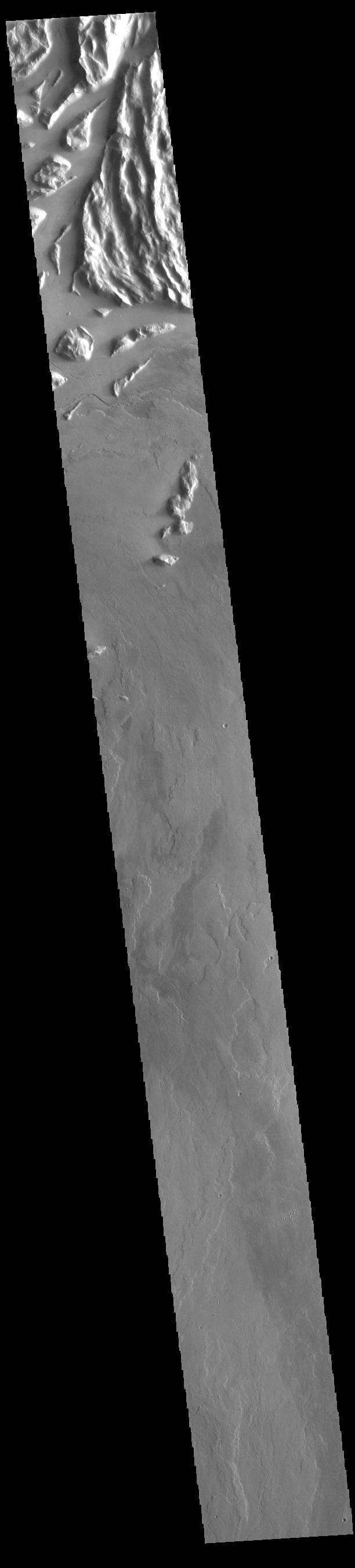
2023-05-12 |
Mars
|
Mars Reconnaissance Orbiter (MRO)
|
HiRISE
|
2880x1800x3 |
|
-
PIA25950:
-
Ridges in Lycus Sulci
Full Resolution:
TIFF
(8.276 MB)
JPEG
(1.154 MB)
|
|
|
2023-05-12 |
Mars
|
Mars Reconnaissance Orbiter (MRO)
|
HiRISE
|
2880x1800x3 |
|
-
PIA25949:
-
Icy Cliffs at the Martian North Pole
Full Resolution:
TIFF
(14.8 MB)
JPEG
(471.5 kB)
|
|
|
2023-05-12 |
Mars
|
Mars Reconnaissance Orbiter (MRO)
|
HiRISE
|
2880x1800x3 |
|
-
PIA25948:
-
Complicated Lava Cooling
Full Resolution:
TIFF
(15.56 MB)
JPEG
(1.473 MB)
|
|
|
2023-05-12 |
Mars
|
Mars Reconnaissance Orbiter (MRO)
|
HiRISE
|
2880x1800x3 |
|
-
PIA25947:
-
Glacier-like Features on Mars
Full Resolution:
TIFF
(8.111 MB)
JPEG
(1.232 MB)
|
|
|
2023-05-12 |
Mars
|
2001 Mars Odyssey
|
THEMIS
|
611x2705x1 |
|
-
PIA25930:
-
Ares Vallis
Full Resolution:
TIFF
(821.1 kB)
JPEG
(108.8 kB)
|
 Planetary Data System


