|
Your search criteria found 2289 images Target is Earth |
| My List |
Addition Date | Target | Mission |
Instrument
|
Size |

|
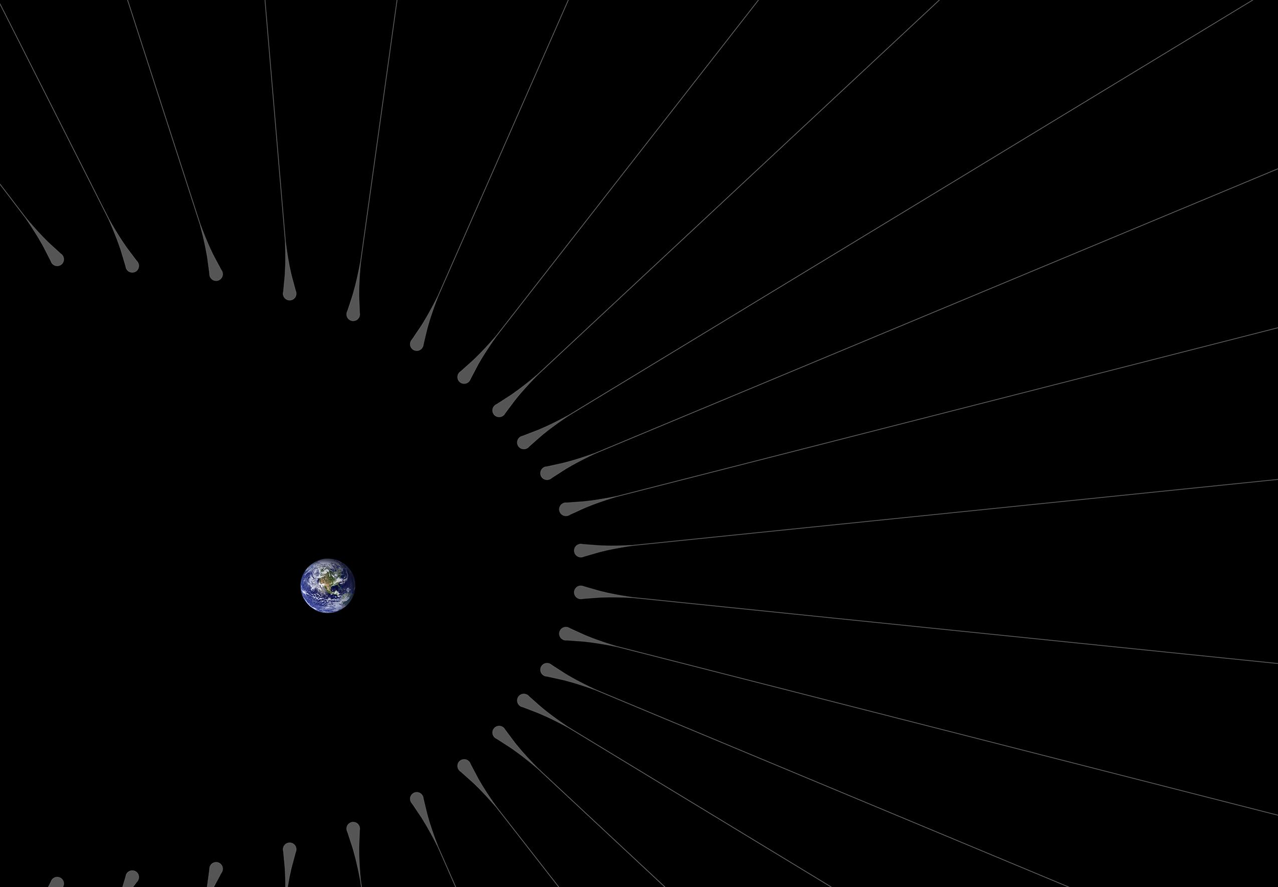
2013-05-02 | Earth |
Airborne Snow Observatory |
1648x2546x3 | |
|
|||||
|
|
2013-12-09 | Earth |
Airborne Snow Observatory |
639x361x3 | |
|
|||||
|
|
2013-12-09 | Earth |
Airborne Snow Observatory |
1705x1318x3 | |
|
|||||
|
|
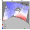
2014-01-28 | Earth |
UAVSAR |
5184x3456x3 | |
|
|||||
|
|
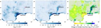
2013-08-29 | Earth |
Landsat |
2180x1453x3 | |
|
|||||
|
|
2013-10-09 | Earth |
Juno |
8500x4781x3 | |
|
|||||
|
|
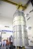
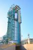
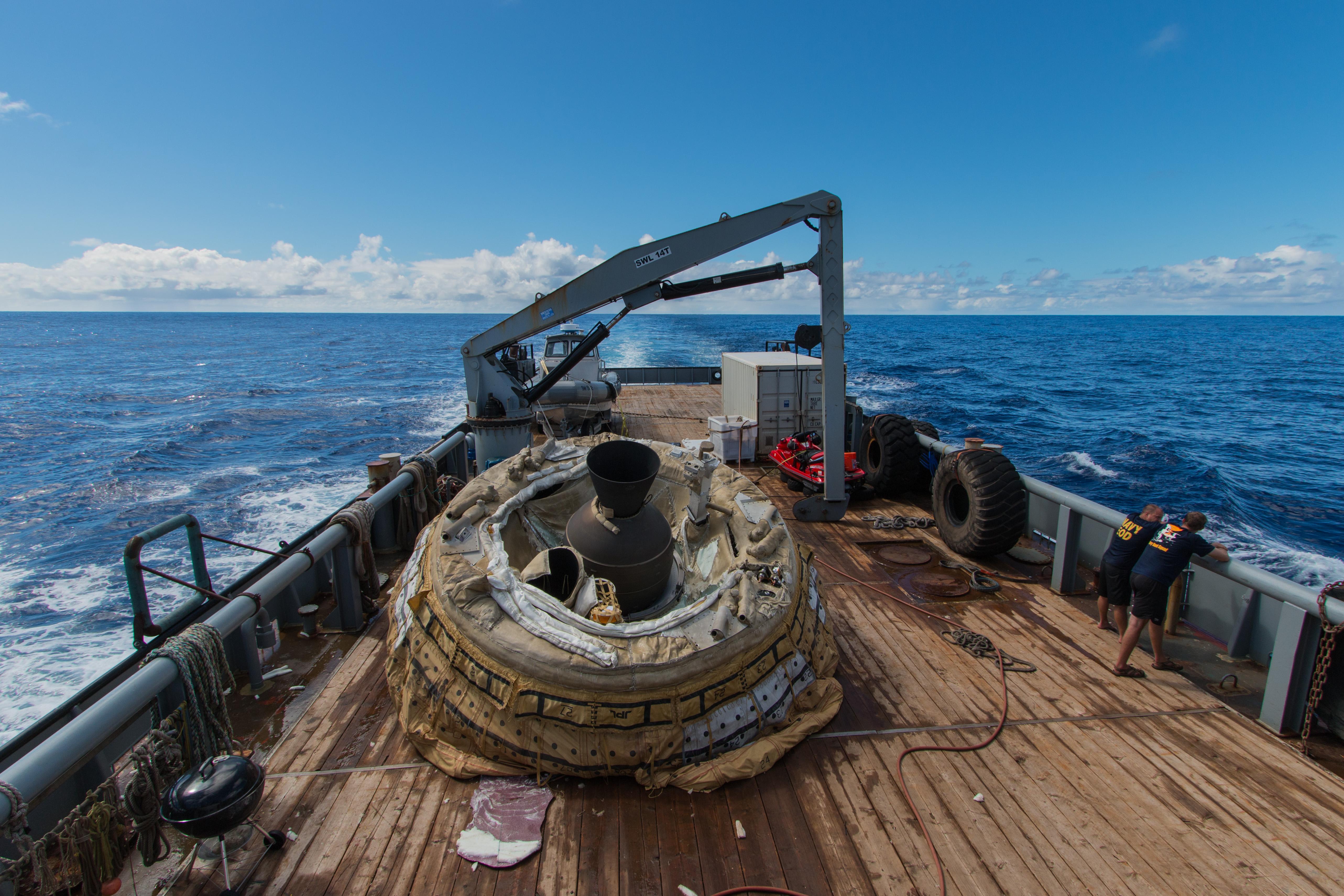
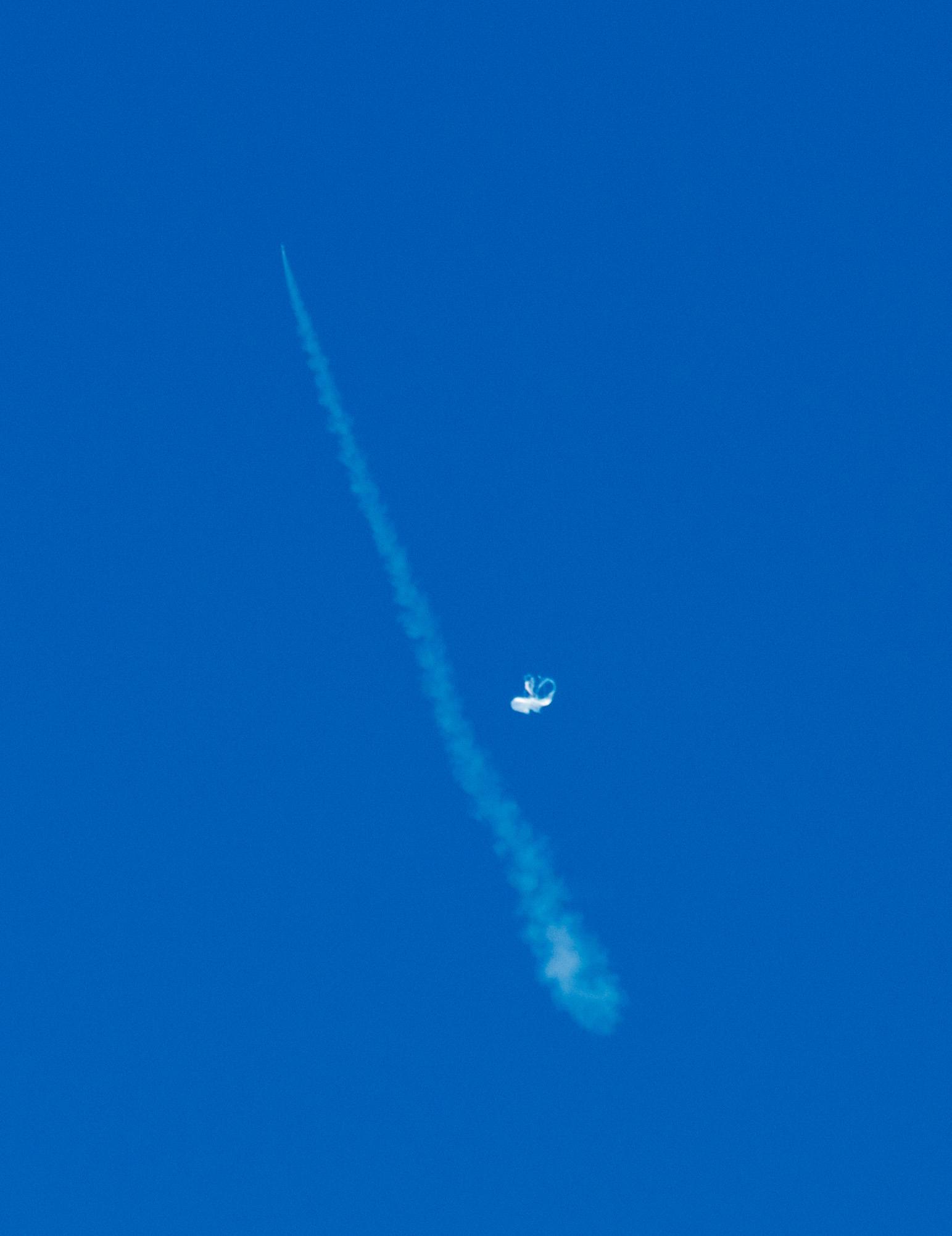
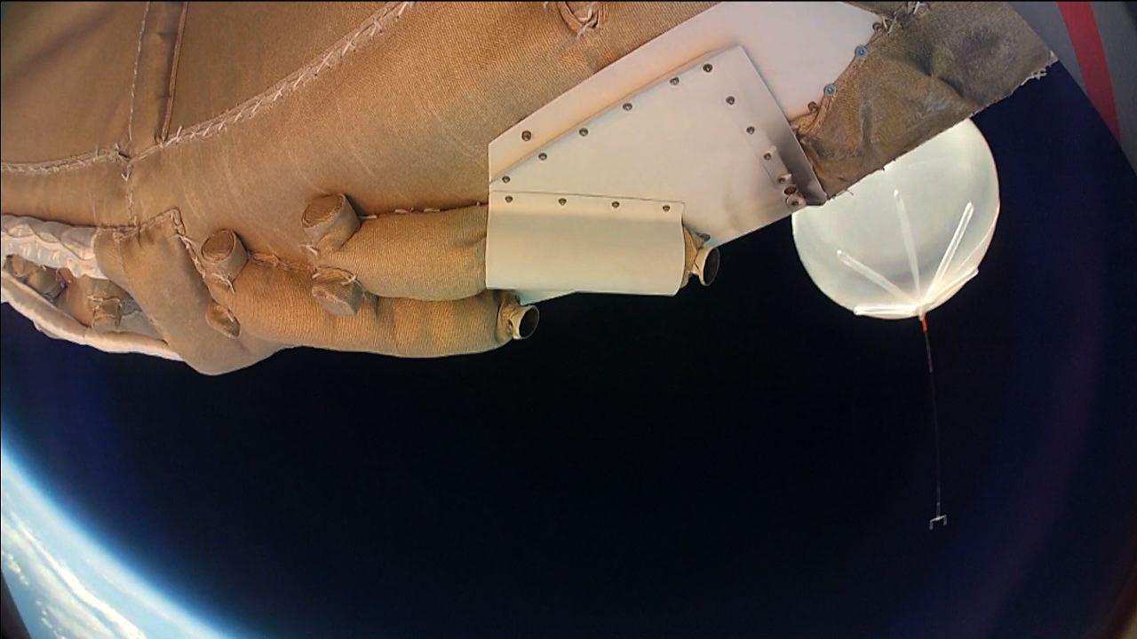
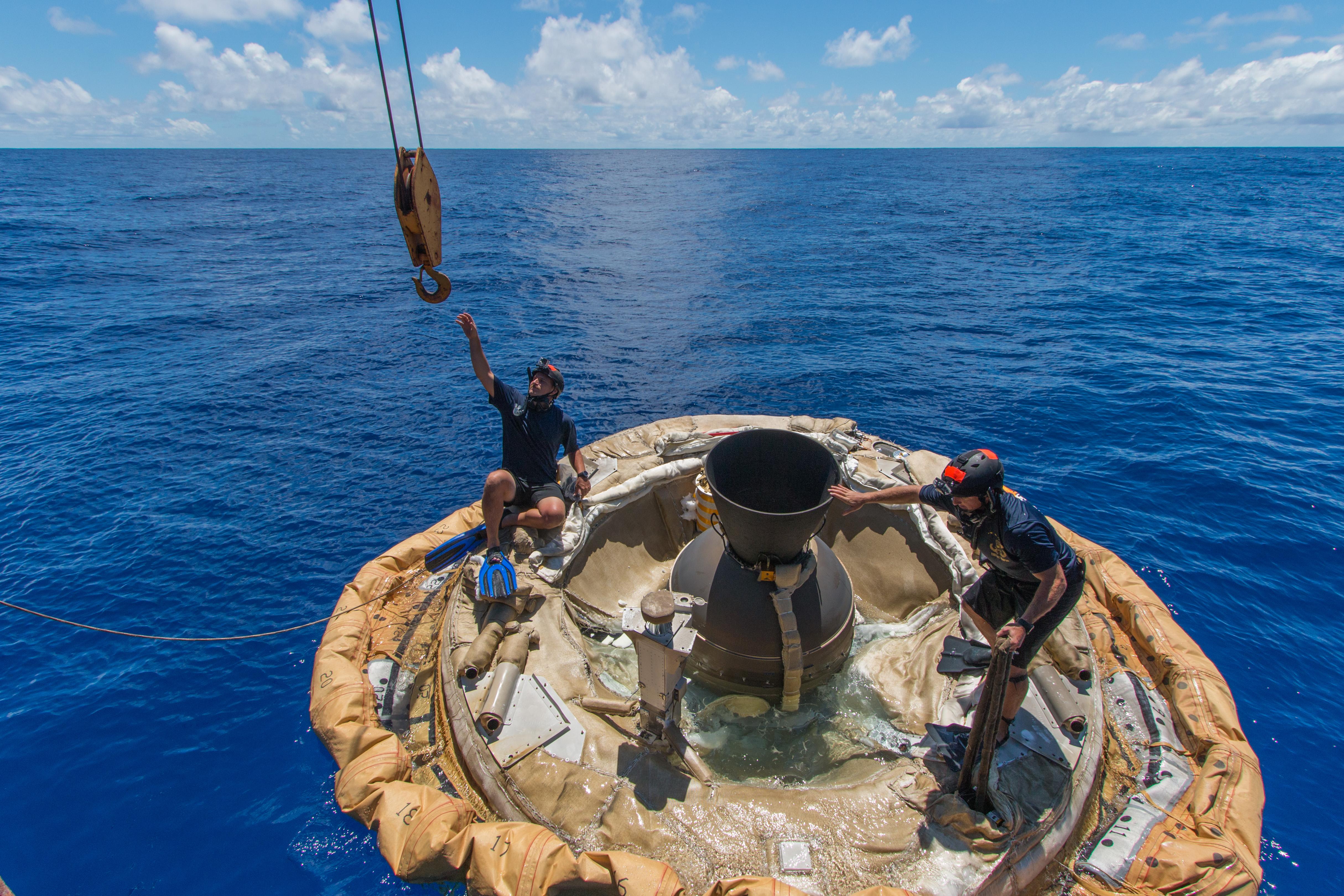
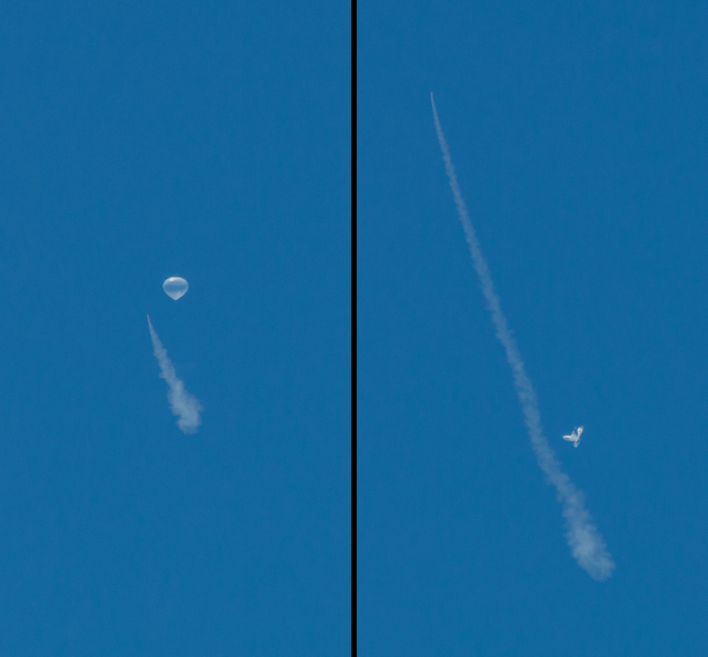
2014-06-04 | Earth |
LDSD |
3264x2448x3 | |
|
|||||
|
|
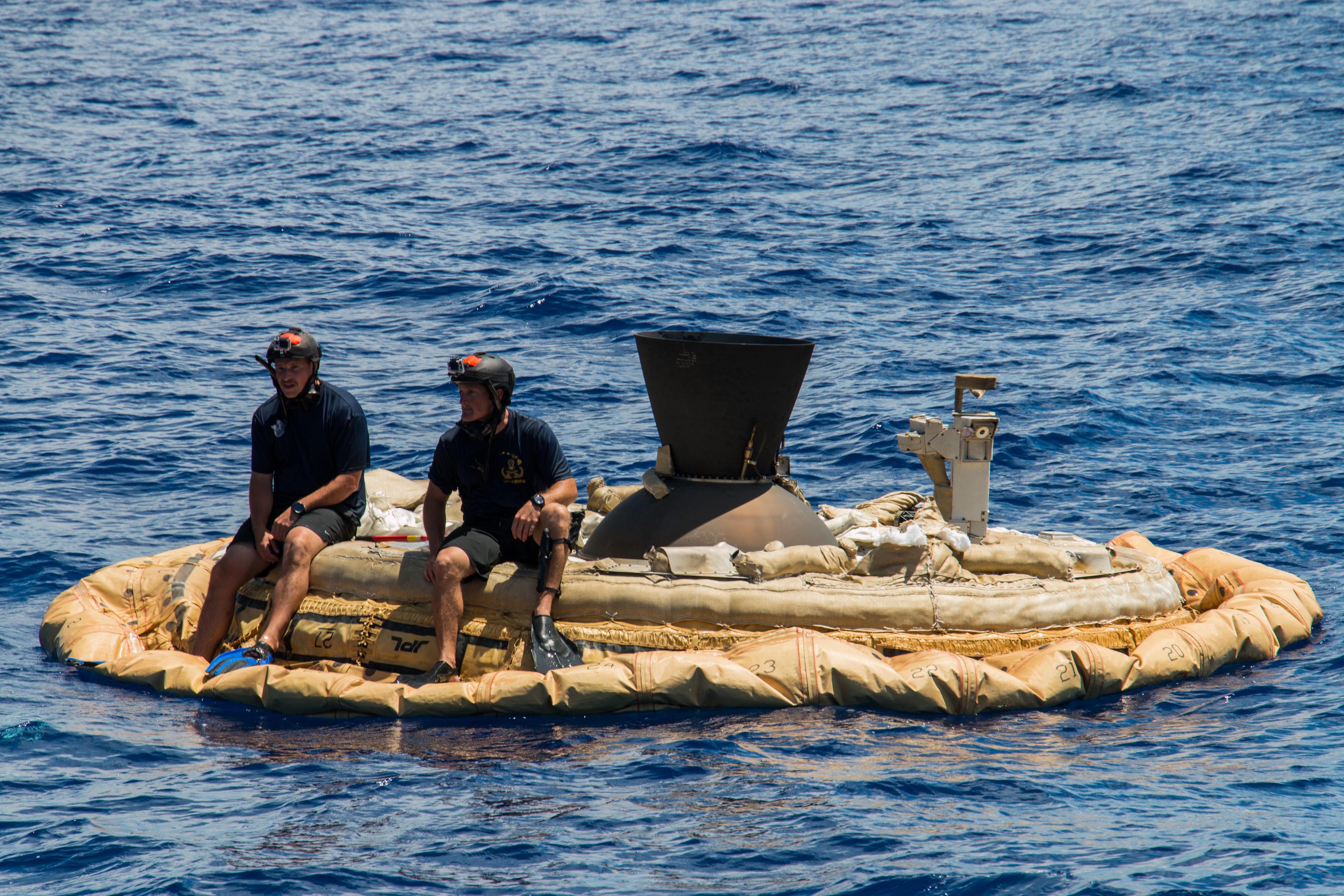
2014-06-04 | Earth |
LDSD |
3264x2448x3 | |

|
|||||
|
|
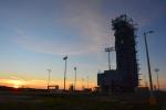
2014-06-06 | Earth |
LDSD |
1280x720x3 | |
|
|||||
|
|
2014-06-29 | Earth |
LDSD |
4901x3257x3 | |
|
|||||
|
|
2014-06-29 | Earth |
LDSD |
5130x3420x3 | |

|
|||||
|
|
2014-06-29 | Earth |
LDSD |
1543x2004x3 | |

|
|||||
|
|
2014-06-29 | Earth |
LDSD |
5441x3627x3 | |
|
|||||
|
|
2014-06-29 | Earth |
LDSD |
5392x3595x3 | |
|
|||||
|
|
2014-07-01 | Earth |
LDSD |
5472x3648x3 | |
|
|||||
|
|
2014-07-28 | Earth | 3717x3583x3 | ||
|
|||||
|
|
2014-07-28 | Earth | 752x564x3 | ||

|
|||||
|
|
2014-07-24 | Earth | 3888x2592x3 | ||
|
|||||
|
|
2014-08-08 | Earth |
LDSD |
4850x3223x3 | |
|
|||||
|
|
2014-08-08 | Earth |
LDSD |
3010x1698x3 | |
|
|||||
|
|
2014-08-08 | Earth |
LDSD |
732x549x3 | |
|
|||||
|
|
2014-08-08 | Earth |
LDSD |
1280x720x3 | |
|
|||||
|
|
2014-08-08 | Earth |
LDSD |
4859x3239x3 | |
|
|||||
|
|
2014-08-08 | Earth |
LDSD |
2324x2156x3 | |
|
|||||
|
|
2014-08-08 | Earth |
LDSD |
959x540x3 | |
|
|||||
|
|
2014-08-21 | Earth | 1537x2148x3 | ||
|
|||||
|
|
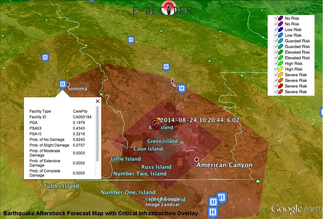
2014-09-03 | Earth |
E-DECIDER |
1027x698x3 | |

|
|||||
|
|
2014-12-08 | Earth |
Mars Science Laboratory (MSL) |
5271x1865x3 | |
|
|||||
|
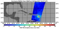
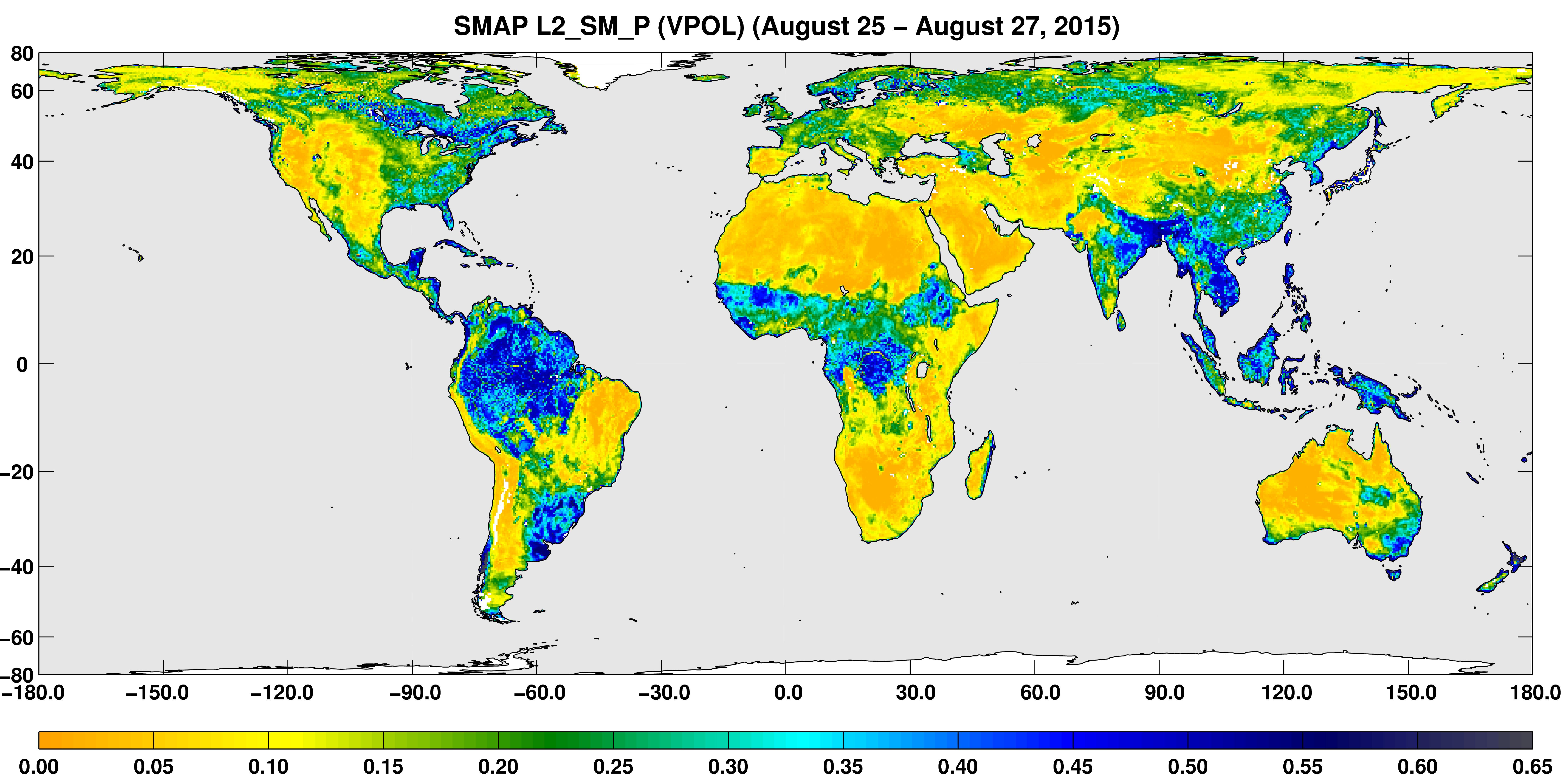
|
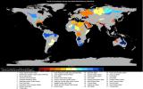
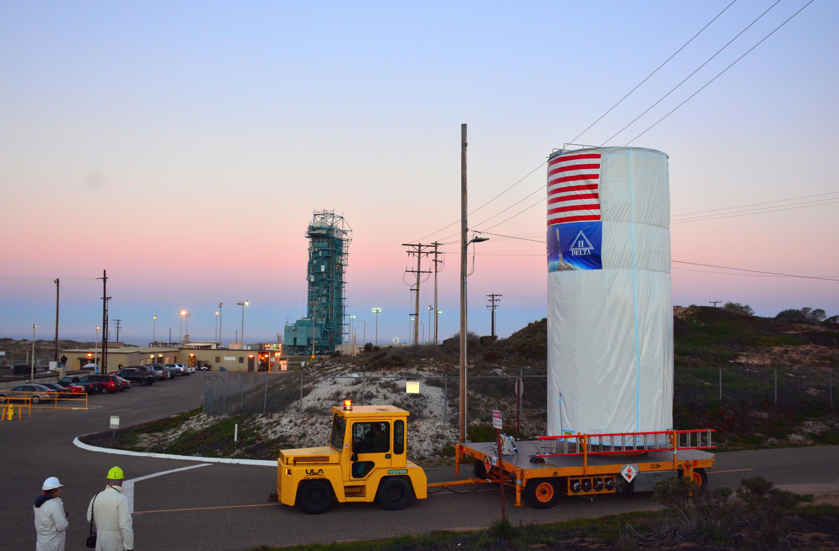
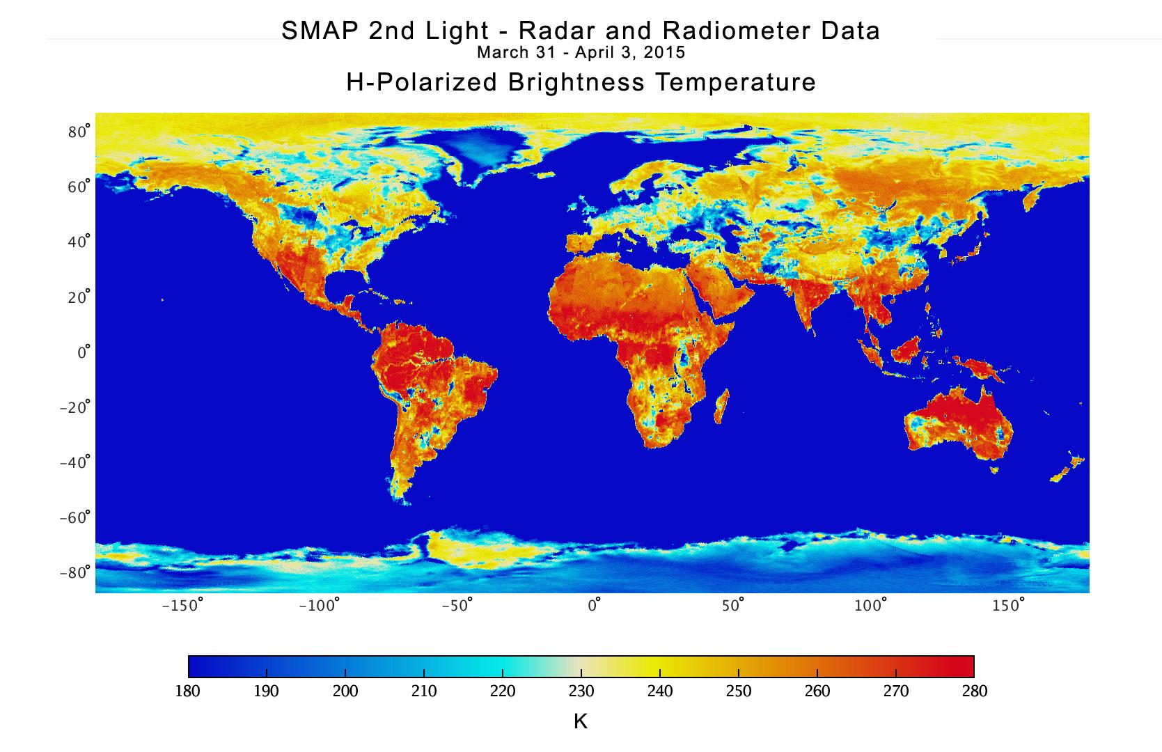
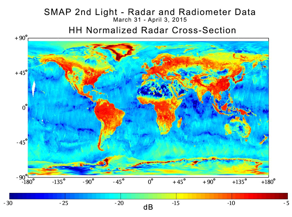
2015-01-20 | Earth |
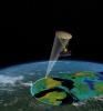
SMAP |
3000x1996x3 | |
|
|||||
|
|
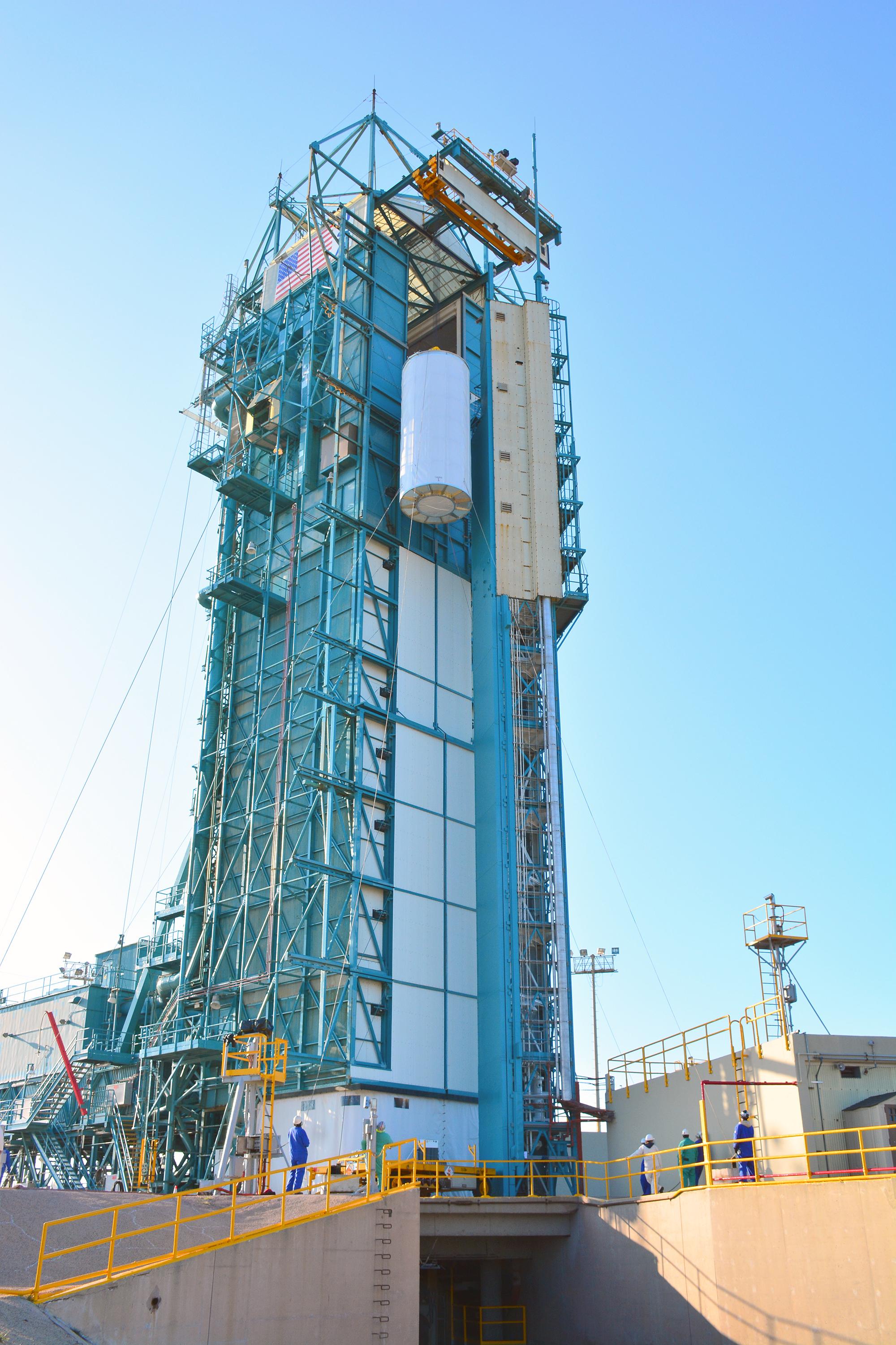
2015-01-21 | Earth |
SMAP |
8192x8784x3 | |
|
|||||
|
|
2015-01-21 | Earth |
SMAP |
2002x3000x3 | |
|
|||||
|
|
2015-01-21 | Earth |
SMAP |
2815x1850x3 | |

|
|||||
|
|
2015-01-21 | Earth |
SMAP |
2000x3000x3 | |
|
|||||
|
|
2015-01-21 | Earth |
SMAP |
3000x2000x3 | |
|
|||||
|
|
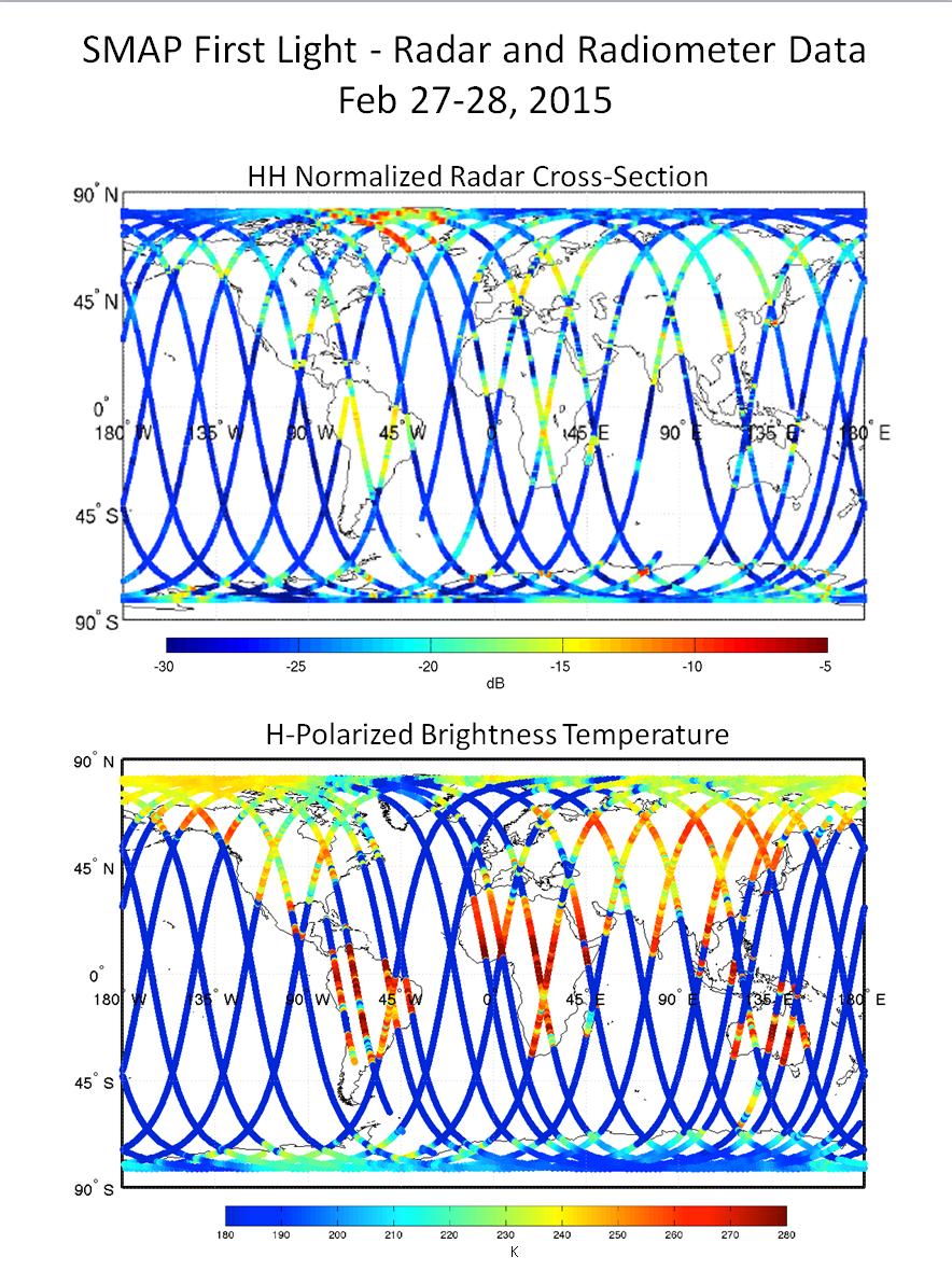
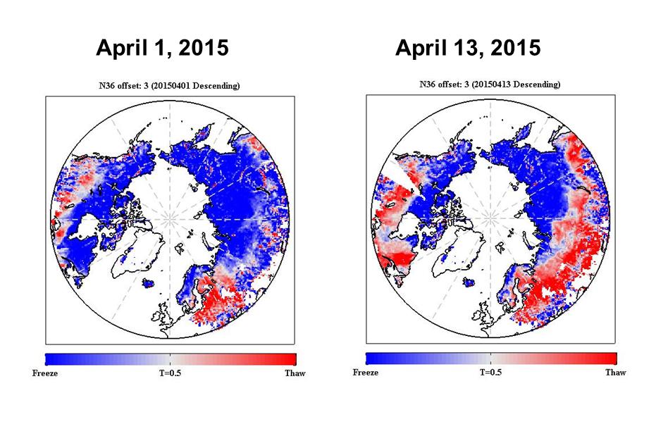
2015-03-09 | Earth |
SMAP |
884x1180x3 | |
|
|||||
|
|
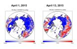
2015-04-14 | Earth | 4500x6000x3 | ||
|
|||||
|
|
2015-04-14 | Earth | 4500x6000x3 | ||
|
|||||
|
|
2015-04-14 | Earth | 4500x6000x3 | ||

|
|||||
|
|
2015-04-14 | Earth | 4500x6000x3 | ||
|
|||||
|
|
2015-04-14 | Earth | 4500x6000x3 | ||

|
|||||
|
|
2015-06-05 | Earth |
LDSD |
1600x900x3 | |
|
|||||
|
|
2015-04-21 | Earth |
SMAP |
1669x1080x3 | |
|
|||||
|
|
2015-04-21 | Earth |
SMAP |
1187x882x3 | |
|
|||||
|
|
2015-04-22 | Earth | 1271x671x3 | ||
|
|||||
|
|
2015-04-29 | Earth |
SMAP |
931x602x3 | |
|
|||||
|
|
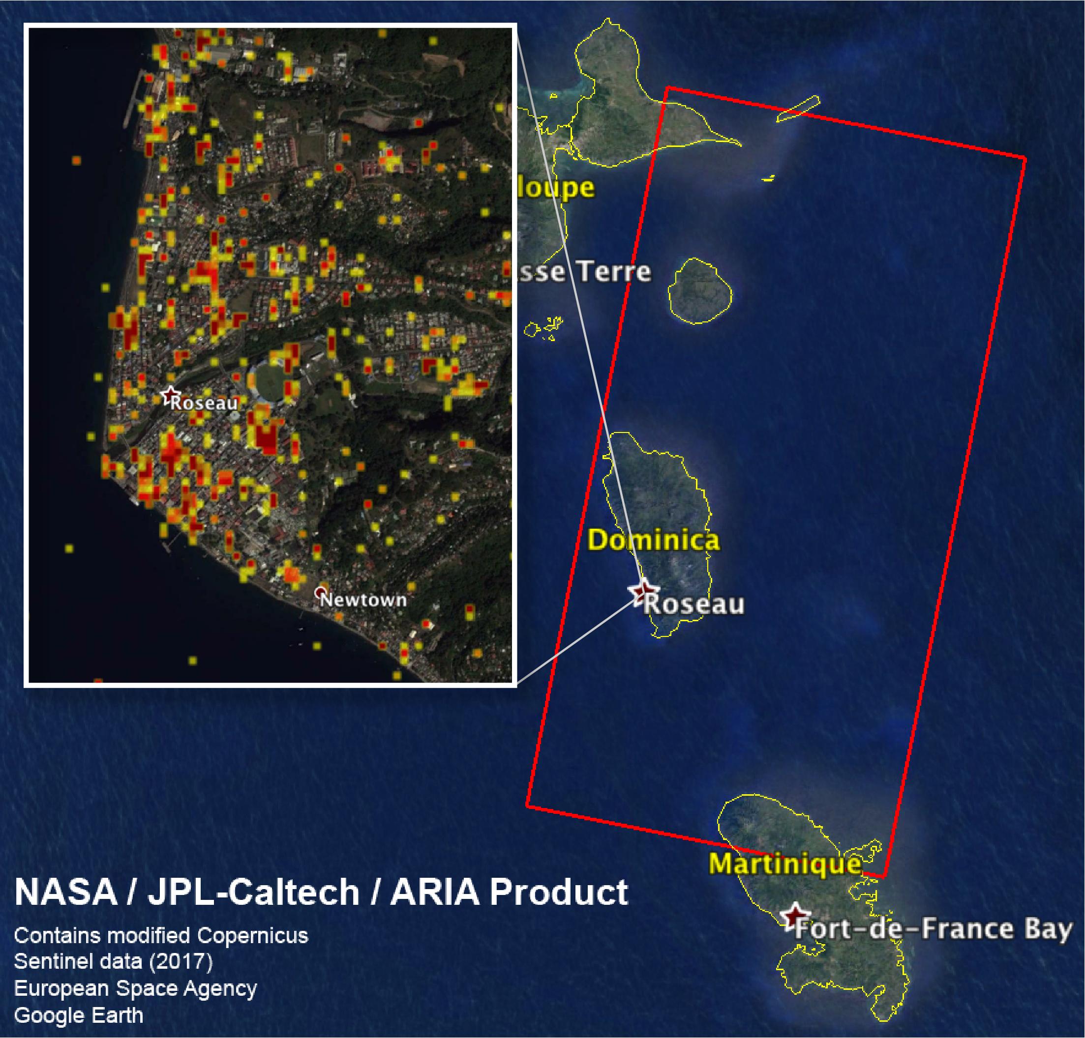
2015-05-04 | Earth |
ARIA |
2054x1024x3 | |

|
|||||
|
|
2015-05-06 | Earth |
SMAP |
2999x3006x3 | |
|
|||||
|
|
2015-05-11 | Earth | 1041x694x3 | ||
|
|||||
|
|
2015-05-11 | Earth |
LDSD |
2222x1249x3 | |
|
|||||
|
|
2015-05-19 | Earth |
SMAP |
13492x6783x3 | |
|
|||||
|
|
2015-05-19 | Earth |
SMAP |
9105x11395x3 | |
|
|||||
|
|
2015-06-05 | Earth |
LDSD |
1600x900x3 | |

|
|||||
|
|
2015-06-09 | Earth |
LDSD |
1600x900x3 | |
|
|||||
|
|
2015-06-11 | Earth |
LDSD |
4747x3391x3 | |
|
|||||
|
|
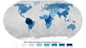
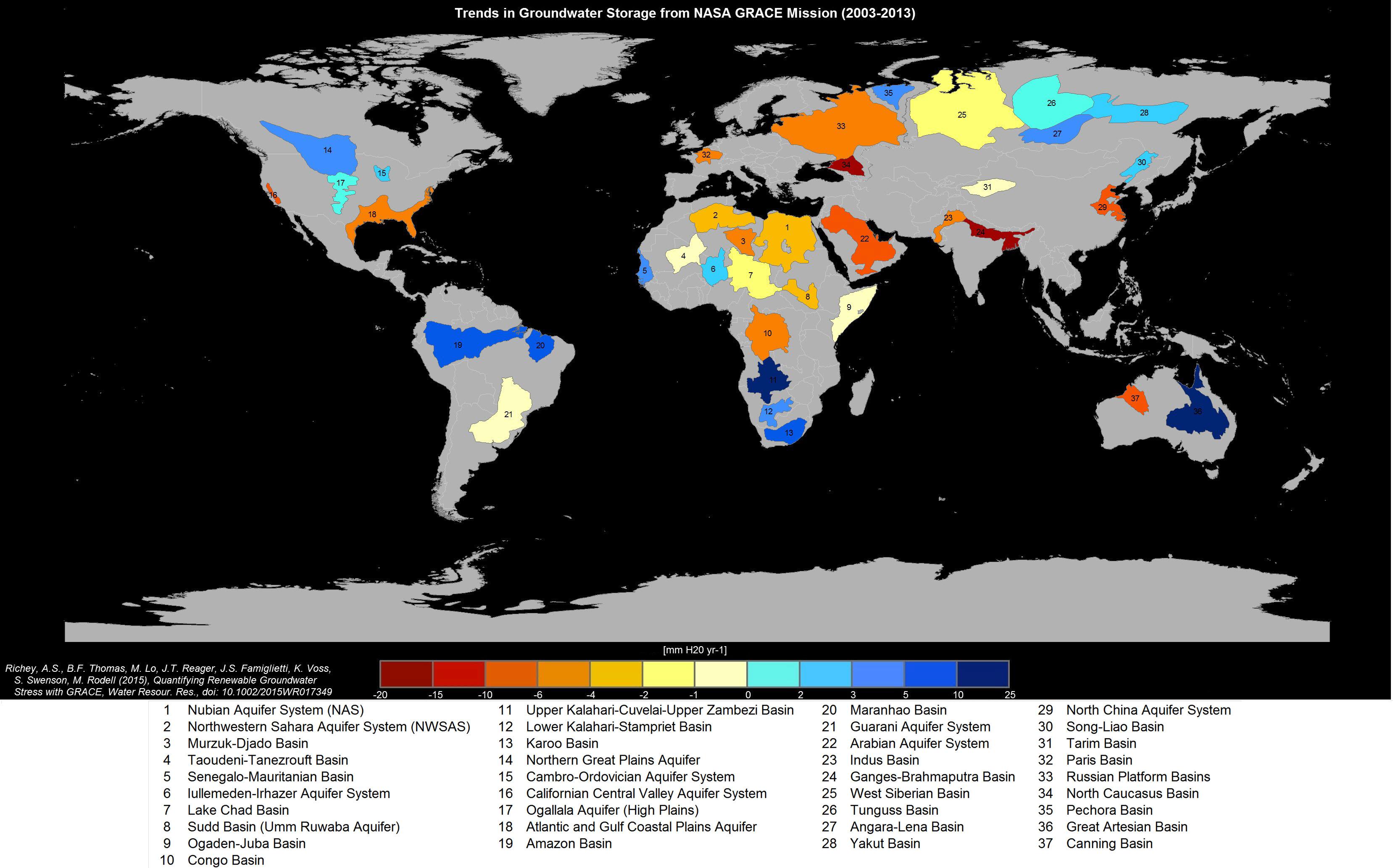
2015-06-16 | Earth |
GRACE |
3315x2066x3 | |
|
|||||
|
|
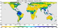
2015-09-02 | Earth |
SMAP |
7592x3775x3 | |
|
|||||
|
|
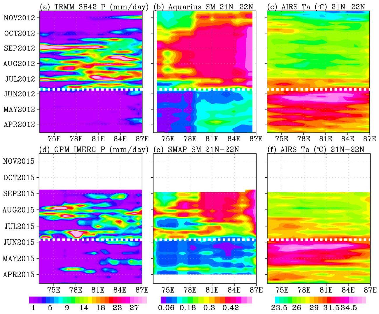
2015-09-12 | Earth |
Aqua Aquarius SMAP |
1299x1078x3 | |
|
|||||
|
|
2015-10-08 | Earth |
SMAP |
1093x1153x3 | |
|
|||||
|
|
2015-11-23 | Earth | 3090x2506x3 | ||
|
|||||
|
|
2015-11-23 | Earth | 2550x1769x3 | ||

|
|||||
|
|
2015-11-23 | Earth | 3090x2506x3 | ||
|
|||||
|
|
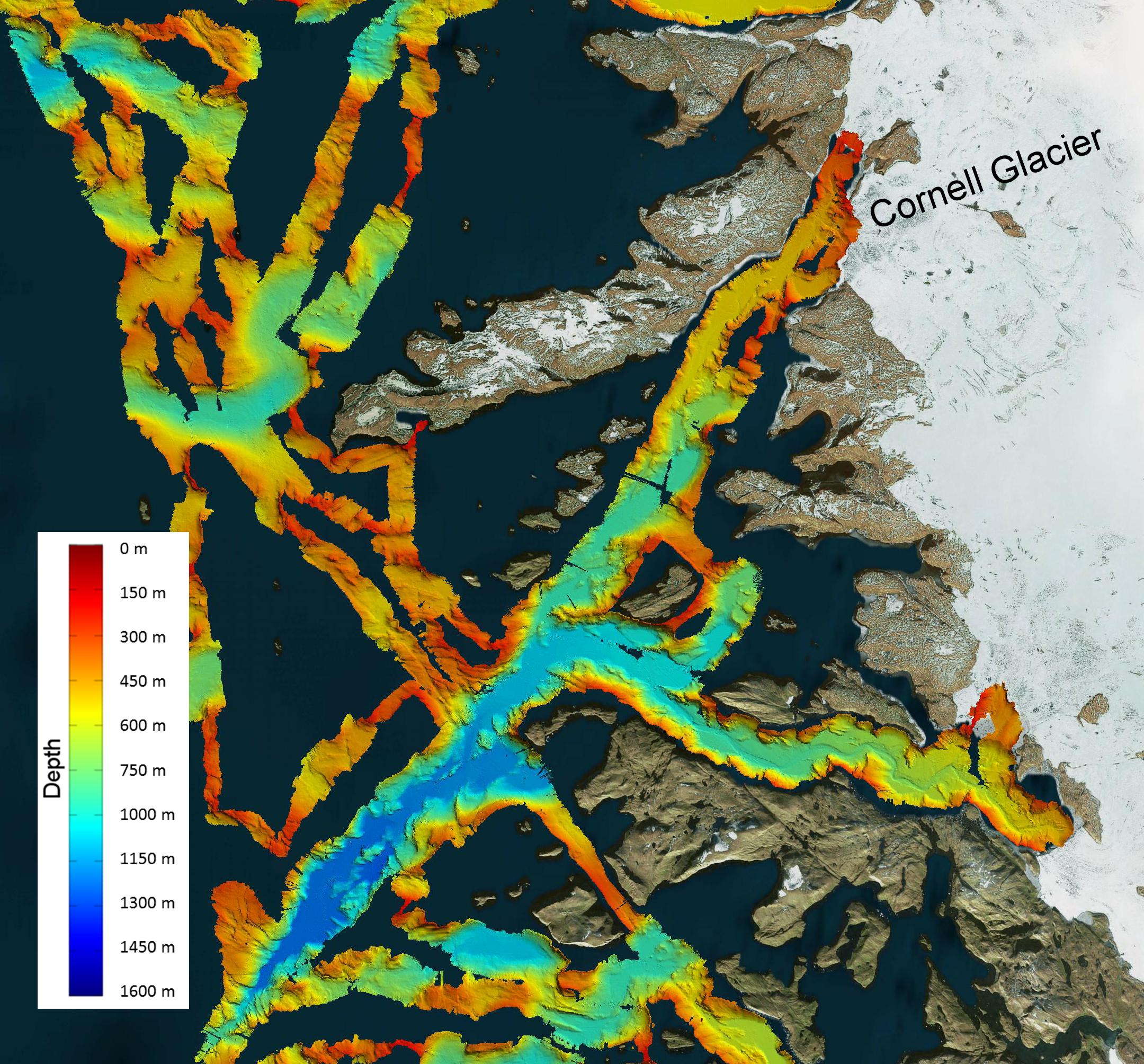
2016-03-08 | Earth |
OMG |
2160x2008x3 | |
|
|||||
|
|
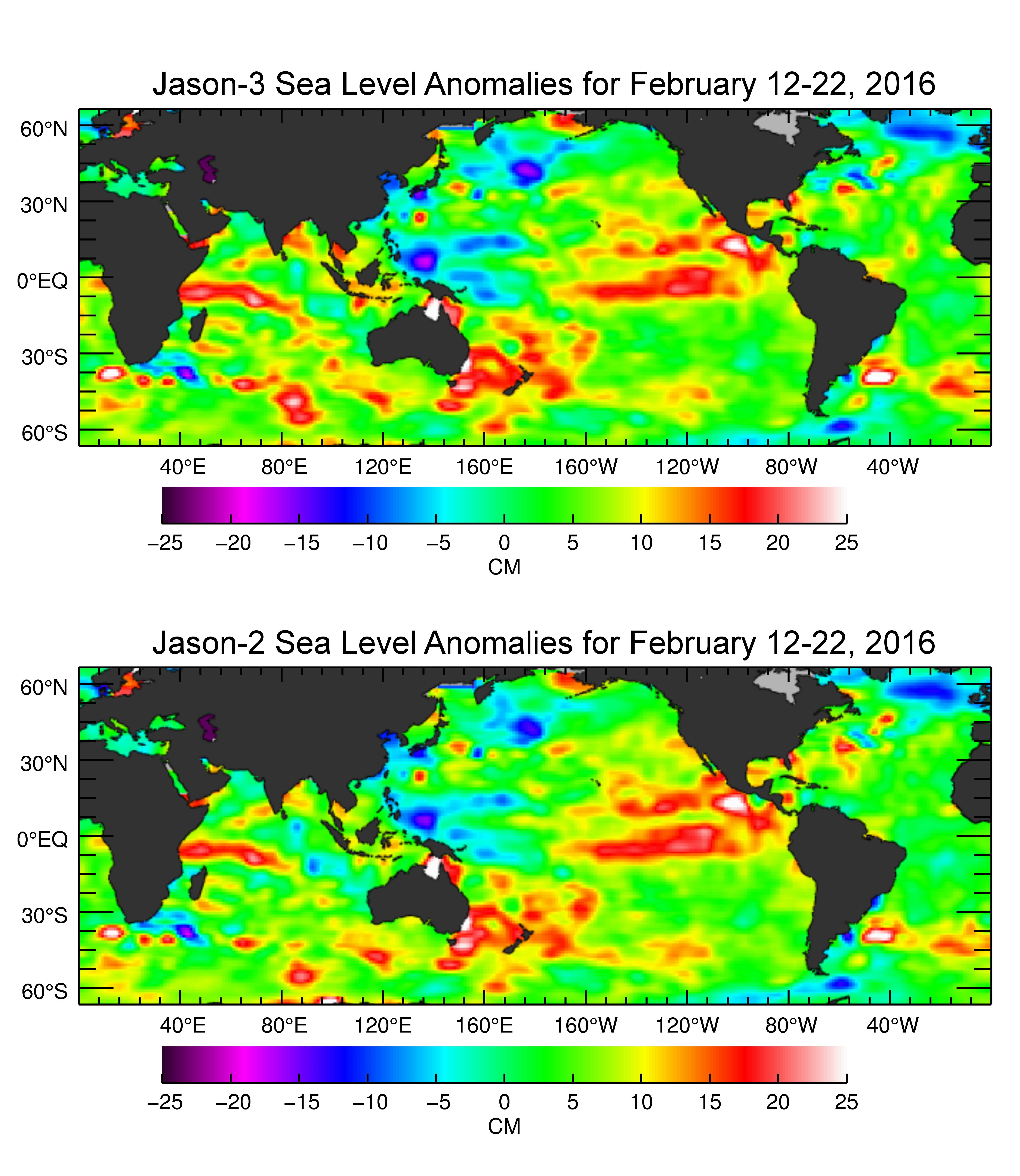
2016-03-16 | Earth |
Jason-3 |
4769x5500x3 | |
|
|||||
|
|
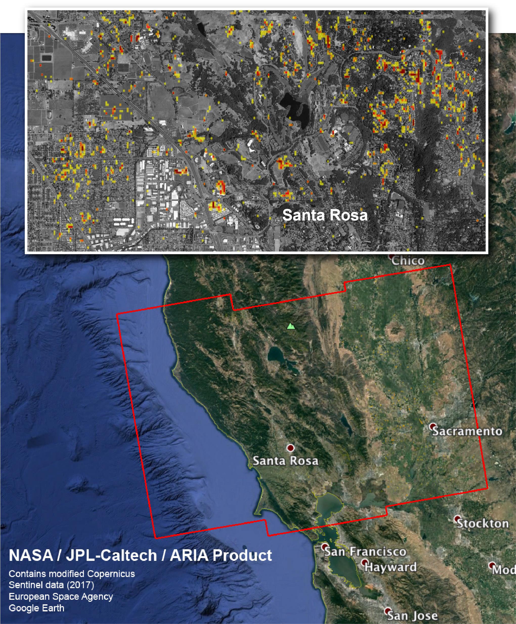
2016-08-31 | Earth |
ARIA |
668x675x3 | |
|
|||||
|
|
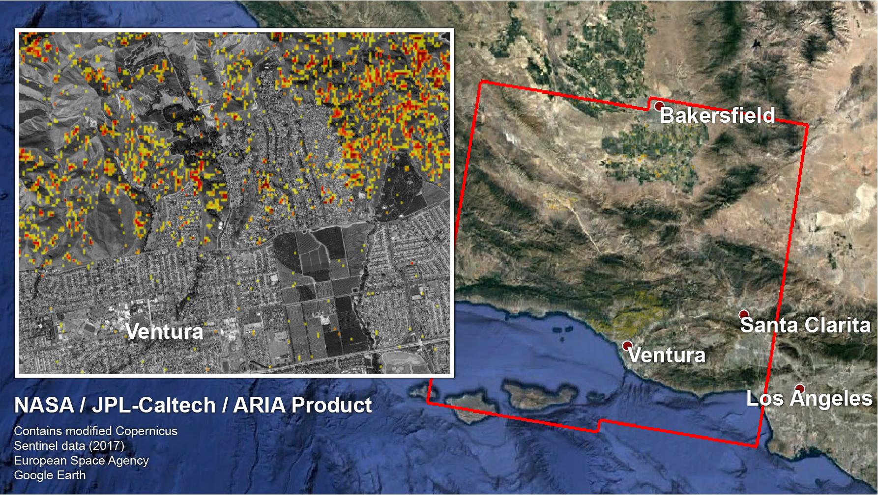
2016-09-01 | Earth |
ARIA |
1390x1231x3 | |

|
|||||
|
|
2016-10-05 | Earth |
ARIA |
1313x1164x3 | |
|
|||||
|
|
2016-10-07 | Earth |
SMAP |
1527x1175x3 | |

|
|||||
|
|
2016-11-16 | Earth |
ARIA |
1119x1289x3 | |

|
|||||
|
|
2017-01-25 | Earth |
Mars Reconnaissance Orbiter (MRO) |
4608x3456x3 | |

|
|||||
|
|
2017-08-28 | Earth |
SMAP |
3000x1240x3 | |
|
|||||
|
|
2017-08-29 | Earth |
SMAP |
3040x1626x3 | |
|
|||||
|
|
2017-08-30 | Earth |
SMAP |
11811x3410x3 | |
|
|||||
|
|
2017-08-31 | Earth |
ARIA |
824x1173x3 | |
|
|||||
|
|
2017-08-31 | Earth |
ARIA |
811x1174x3 | |
|
|||||
|
|
2017-09-05 | Earth |
SMAP |
1830x1976x3 | |
|
|||||
|
|
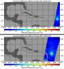
2017-09-13 | Earth |
SMAP |
5882x1662x3 | |
|
|||||
|
|
2017-09-19 | Earth |
ARIA |
3174x2707x3 | |

|
|||||
|
|
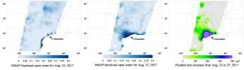
2017-09-19 | Earth |
SMAP |
1808x895x3 | |
|
|||||
|
|
2024-04-26 | Earth | 1440x810x3 | ||
|
|||||
|
|
2017-09-20 | Earth |
ARIA |
1860x1896x3 | |
|
|||||
|
|
2017-09-20 | Earth |
ARIA |
2512x2290x3 | |
|
|||||
|
|
2017-09-26 | Earth |
ARIA |
1600x900x3 | |

|
|||||
|
|
2017-09-29 | Earth |
ARIA |
2206x2112x3 | |

|
|||||
|
|
2017-10-18 | Earth |
ARIA |
2041x2471x3 | |
|
|||||
|
|
2017-12-14 | Earth |
ARIA |
1786x1008x3 | |
|
|||||
|
|
2018-02-15 | Earth | 6176x4063x3 | ||
|
|||||
|
|
2018-02-21 | Earth |
ARIA |
4568x3022x3 | |

|
|||||
|
|
2018-02-21 | Earth | 3778x2234x3 | ||
|
|||||
|
|
2018-02-22 | Earth |
ARIA |
2850x2116x3 | |
|
|||||
|
|
2018-03-15 | Earth | 1080x810x3 | ||
|
|||||
|
|
2018-04-12 | Earth |
ENVISAT |
2367x1334x3 | |
|
|||||
|
|
2018-05-15 | Earth |
MarCO |
1151x734x3 | |
|
|||||
|
|
2018-06-06 | Earth |
Jason-3 |
3300x1555x3 | |
|
|||||
|
|
2018-07-23 | Earth |
ECOSTRESS |
741x708x3 | |
|
|||||
|
|
2018-08-02 | Earth |
ECOSTRESS |
740x697x3 | |
|
|||||
|
|
2018-08-08 | Earth |
ARIA |
4135x2584x3 | |
|
|||||
|
|
2018-09-13 | Earth |
SMAP |
792x612x3 | |
|
|||||
|
|
2018-09-18 | Earth |
ECOSTRESS |
1473x1105x3 | |
|
|||||
|
|
2018-09-20 | Earth |
CubeSat |
790x787x3 | |
|
|||||
|
|
2018-09-25 | Earth |
CubeSat |
478x318x3 | |
|
|||||

|
 |
|
 |
 |
|
|
|
|
|
|

|
| 1-100 | 101-200 | 201-300 | 301-400 | 401-500 | 501-600 | 601-700 | 701-800 | 801-900 | 901-1000 |
| Currently displaying images: 201 - 300 of 2289 |