My
List |
Addition Date
|
Target
|
Mission
|
Instrument
|
Size
|

|
2009-07-16 |
Mars
|
Mars Exploration Rover (MER)
|
Navigation Camera
|
2722x1265x3 |
|
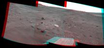
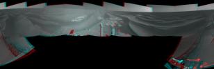
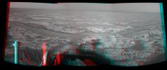
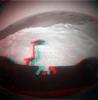
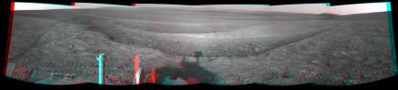
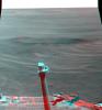
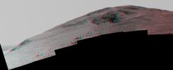
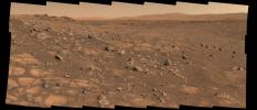
-
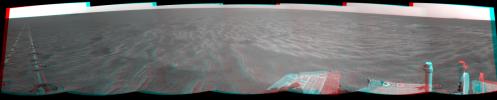
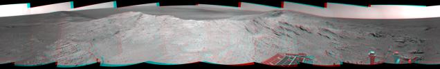
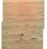
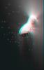
PIA12137:
-
Spirit's Look Ahead After Sol 1866 Drive (Stereo)
Full Resolution:
TIFF
(10.34 MB)
JPEG
(366.5 kB)
|
|
|
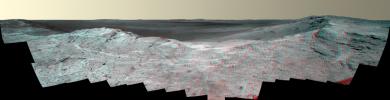
2009-07-16 |
Mars
|
Mars Exploration Rover (MER)
|
Navigation Camera
|
4115x1385x3 |
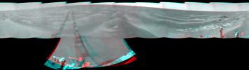
|
-
PIA12141:
-
Spirit Close to "Troy," Sol 1871 (Stereo)
Full Resolution:
TIFF
(17.1 MB)
JPEG
(692.3 kB)
|
|
|
2009-07-16 |
Mars
|
Mars Exploration Rover (MER)
|
Navigation Camera
|
5894x1270x3 |
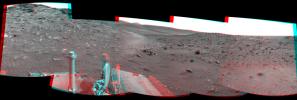
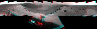
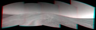
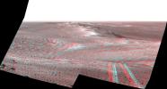
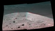
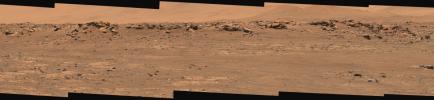
|
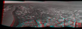
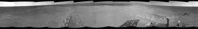
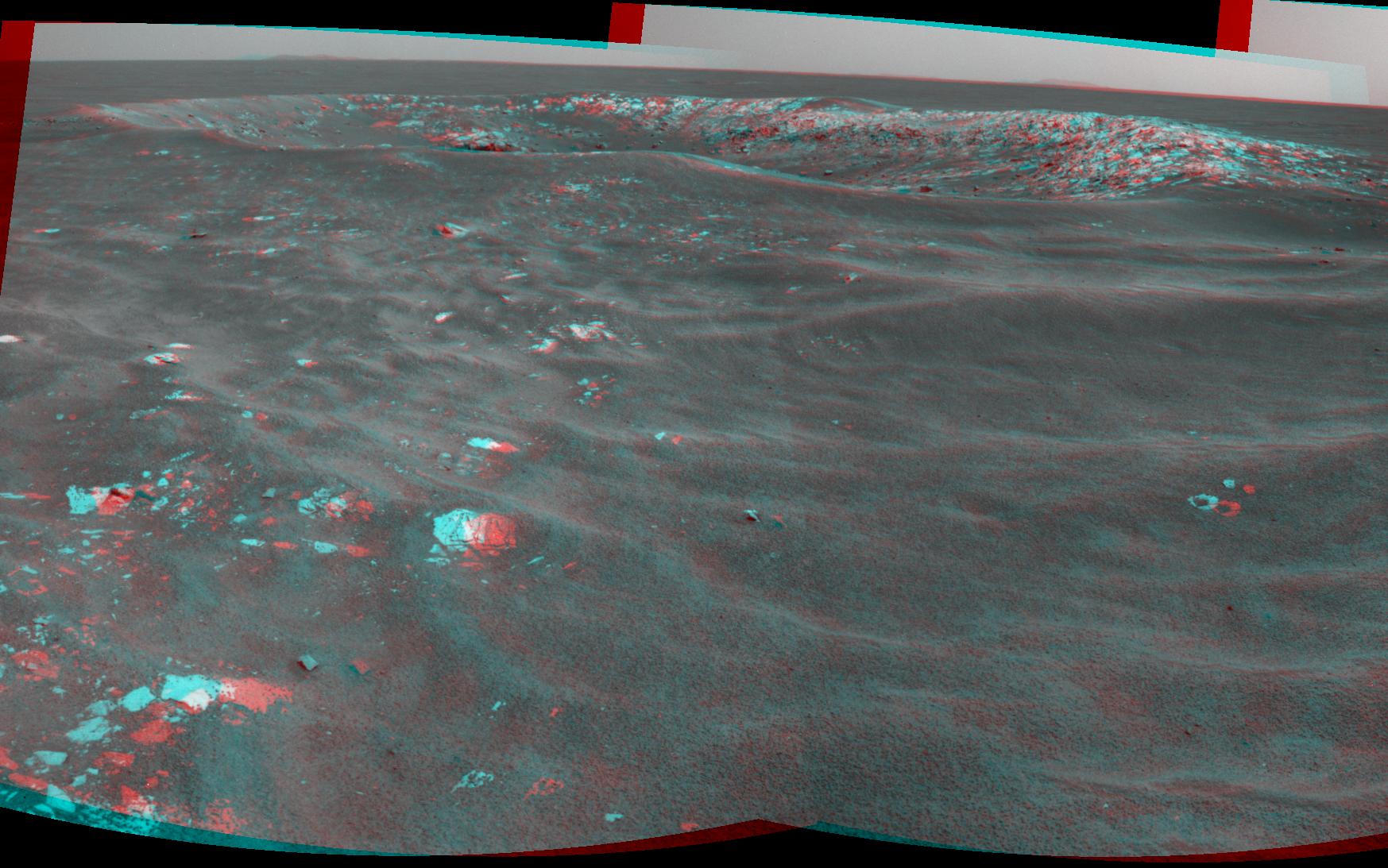
-
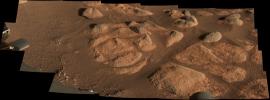
PIA12143:
Spirit's View from "Troy" (Stereo)
Full Resolution:
TIFF
(22.46 MB)
JPEG
(822.4 kB)
|
|
|
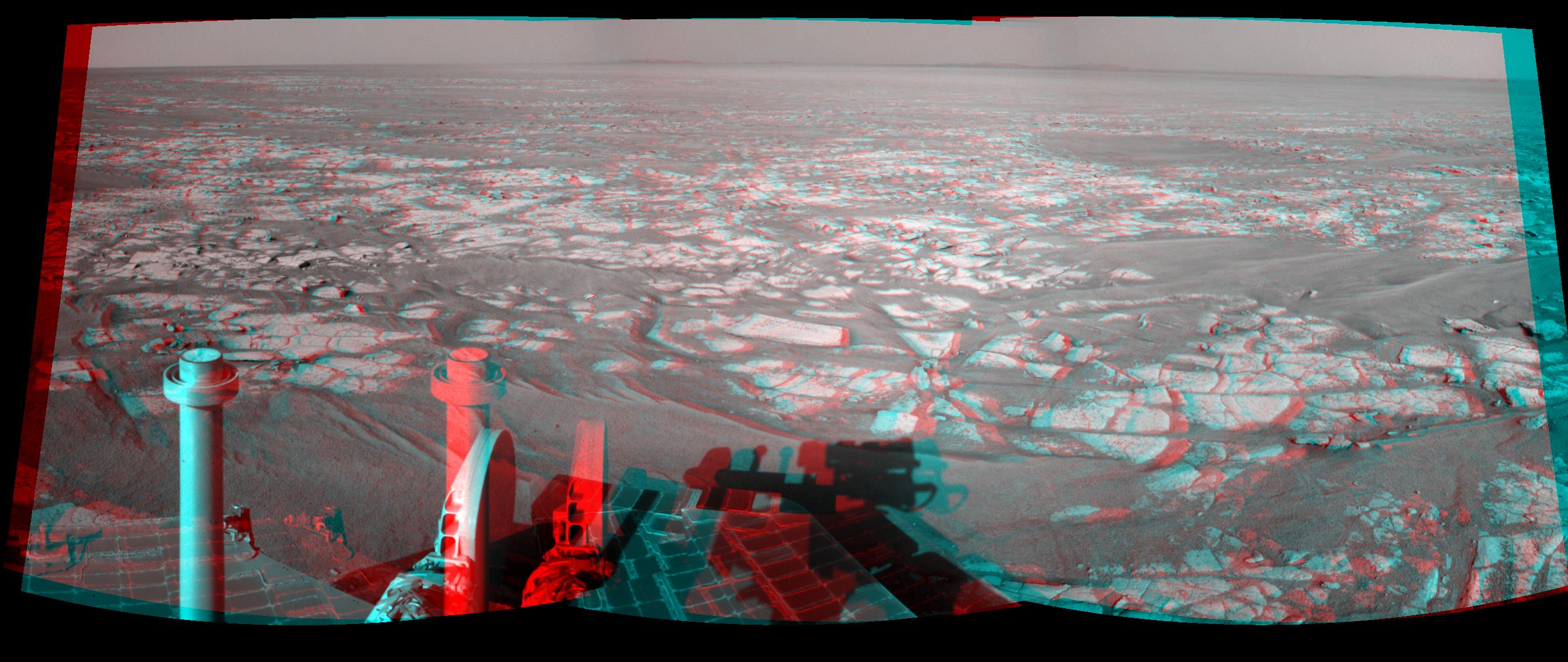
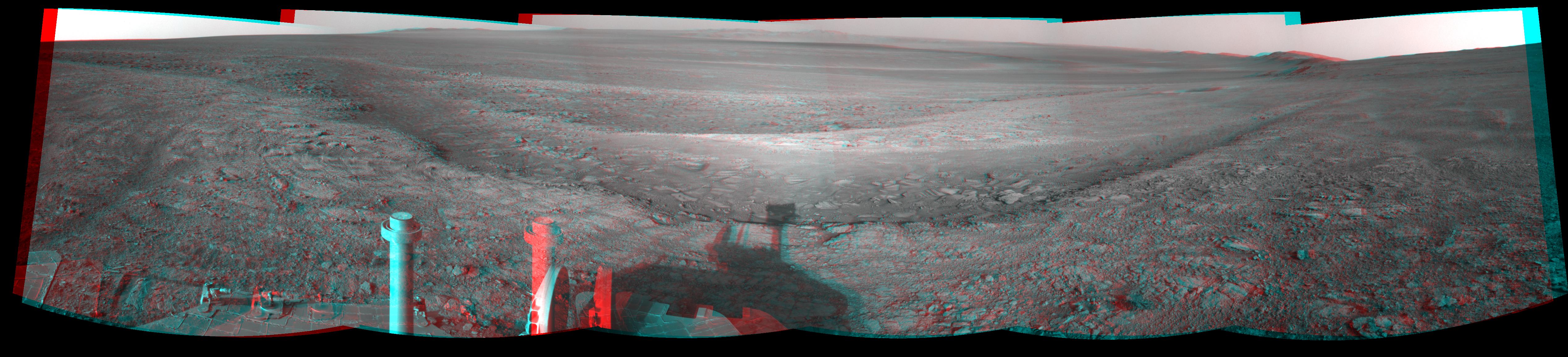
2009-07-23 |
Mars
|
Mars Exploration Rover (MER)
|
Navigation Camera
|
7753x2178x3 |
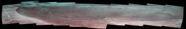
|
-
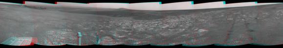
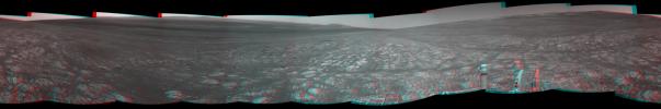
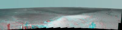
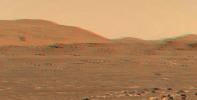
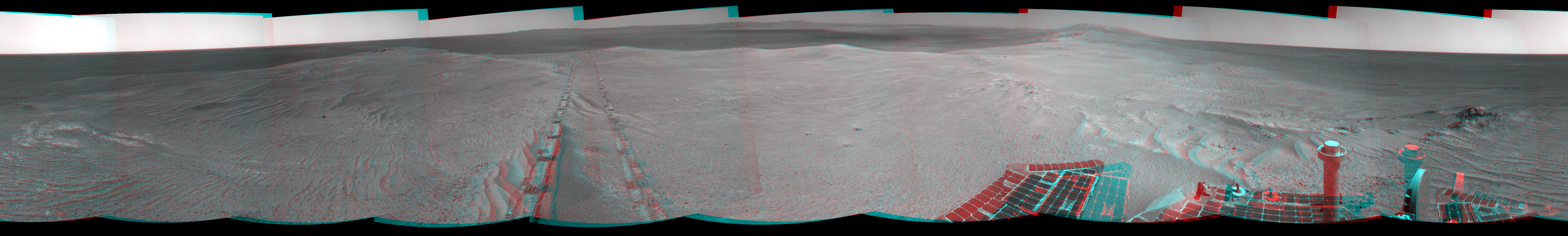
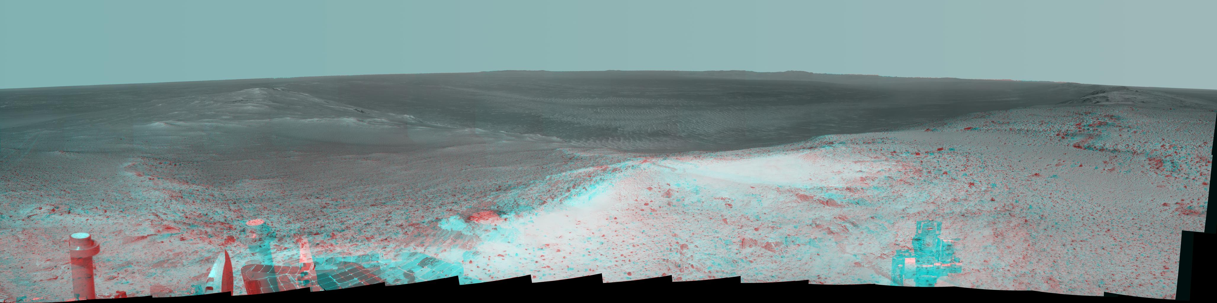
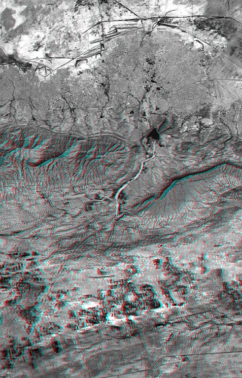
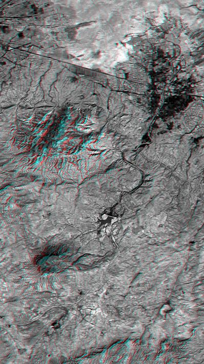
PIA12154:
Opportunity's Surroundings on Sol 1950 (Stereo)
Full Resolution:
TIFF
(50.66 MB)
JPEG
(1.35 MB)
|
|
|
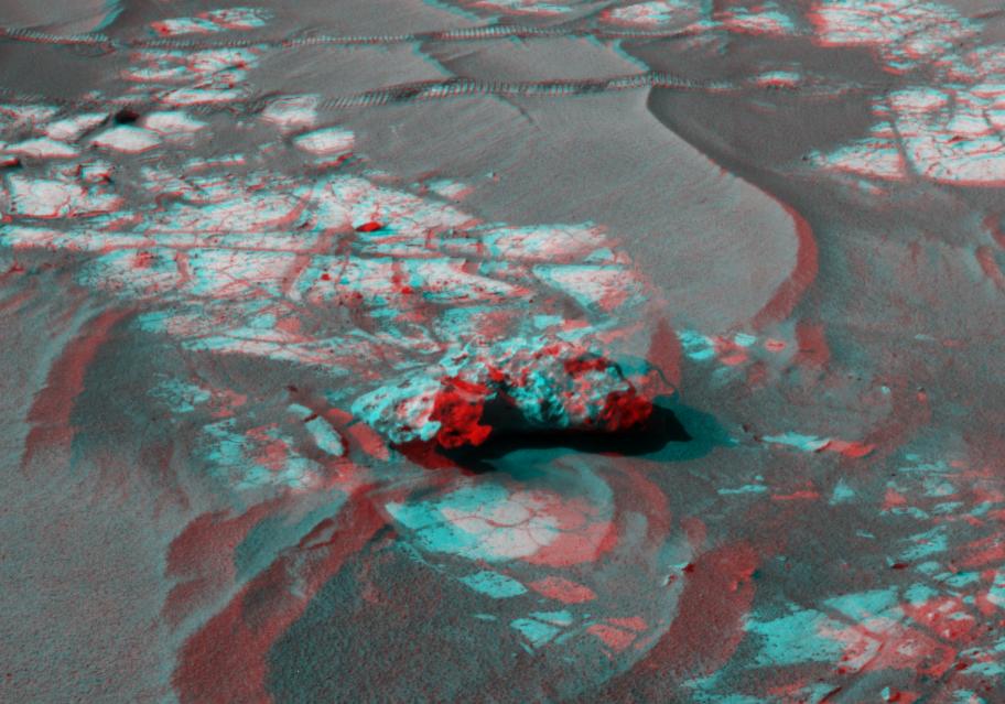
2009-08-06 |
Mars
|
Mars Exploration Rover (MER)
|
Panoramic Camera
|
1024x766x3 |
|
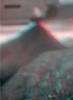
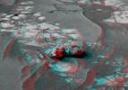
-
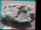
PIA12165:
-
'Block Island' Meteorite on Mars, Sol 1961 (Stereo)
Full Resolution:
TIFF
(2.356 MB)
JPEG
(102.9 kB)
|
|
|
2009-08-21 |
Mars
|
Mars Exploration Rover (MER)
|
Microscopic Imager
|
735x1014x3 |
|
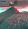
-
PIA12180:
-
Spirit's View of Own Underbelly, (Sol 1925 Stereo)
Full Resolution:
TIFF
(2.239 MB)
JPEG
(74.14 kB)
|
|
|
2009-08-21 |
Mars
|
Mars Exploration Rover (MER)
|
Microscopic Imager
|
947x1000x3 |
|
-
PIA12181:
-
Spirit's View of Own Underbelly, (Stereo from Two Sols)
Full Resolution:
TIFF
(2.845 MB)
JPEG
(69.71 kB)
|
|
|
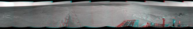
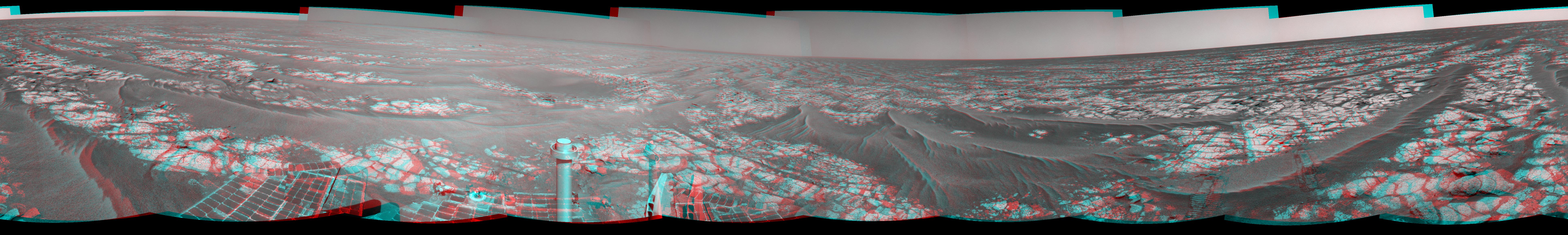
2009-08-26 |
Mars
|
Mars Exploration Rover (MER)
|
Panoramic Camera
|
23123x5093x3 |
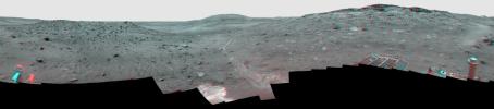
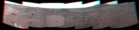
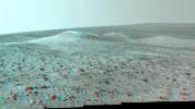
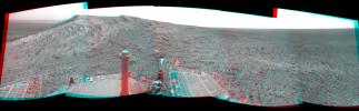
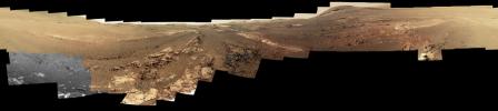
|
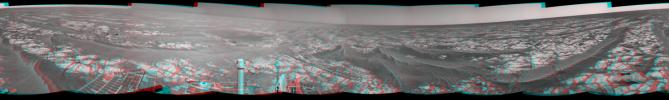
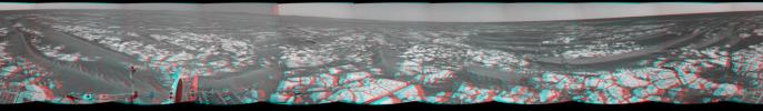
-
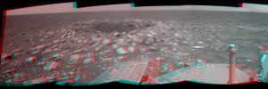
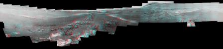
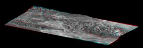
PIA12202:
'Calypso' Panorama of Spirit's View from 'Troy' (Stereo)
Full Resolution:
TIFF
(353.3 MB)
JPEG
(9.053 MB)
|
|
|
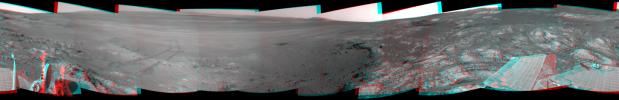
2010-06-25 |
Mars
|
Mars Exploration Rover (MER)
|
Navigation Camera
|
7753x2513x3 |
|
-
PIA13221:
-
Opportunity's Surroundings After Sol 2220 Drive (Stereo)
Full Resolution:
TIFF
(58.45 MB)
JPEG
(1.074 MB)
|
|
|
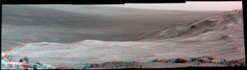
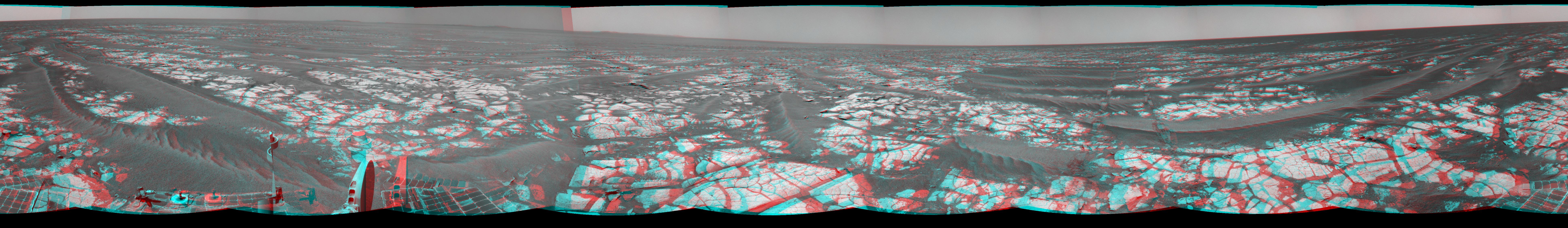
2010-09-07 |
Mars
|
Mars Exploration Rover (MER)
|
Navigation Camera
|
4278x1143x3 |
|
-
PIA13371:
-
'Cambridge Bay' Outcrop Examined by Opportunity (Stereo)
Full Resolution:
TIFF
(14.67 MB)
JPEG
(549.4 kB)
|
|
|
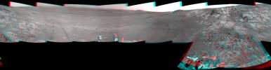
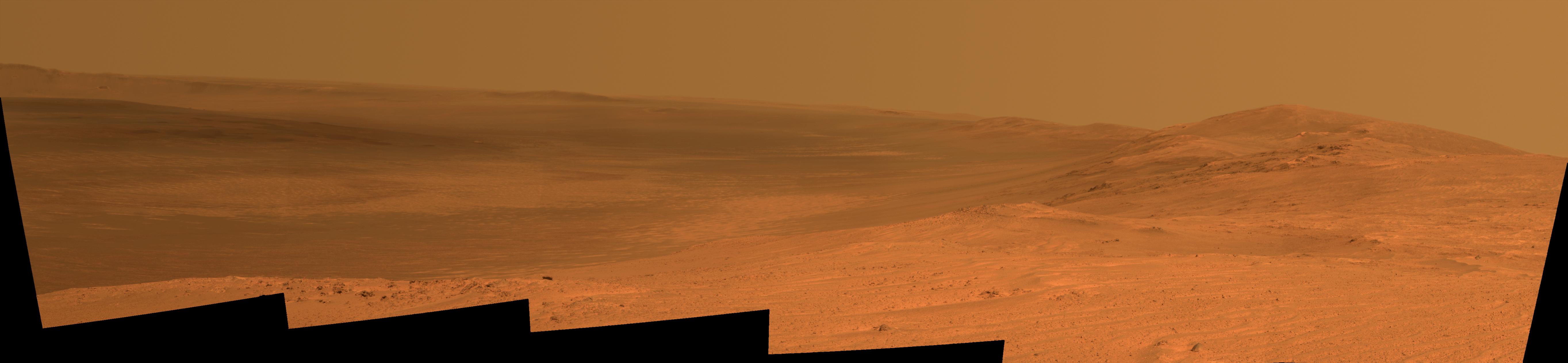
2010-09-29 |
Mars
|
Mars Exploration Rover (MER)
|
Navigation Camera
|
7753x1161x3 |
|
-
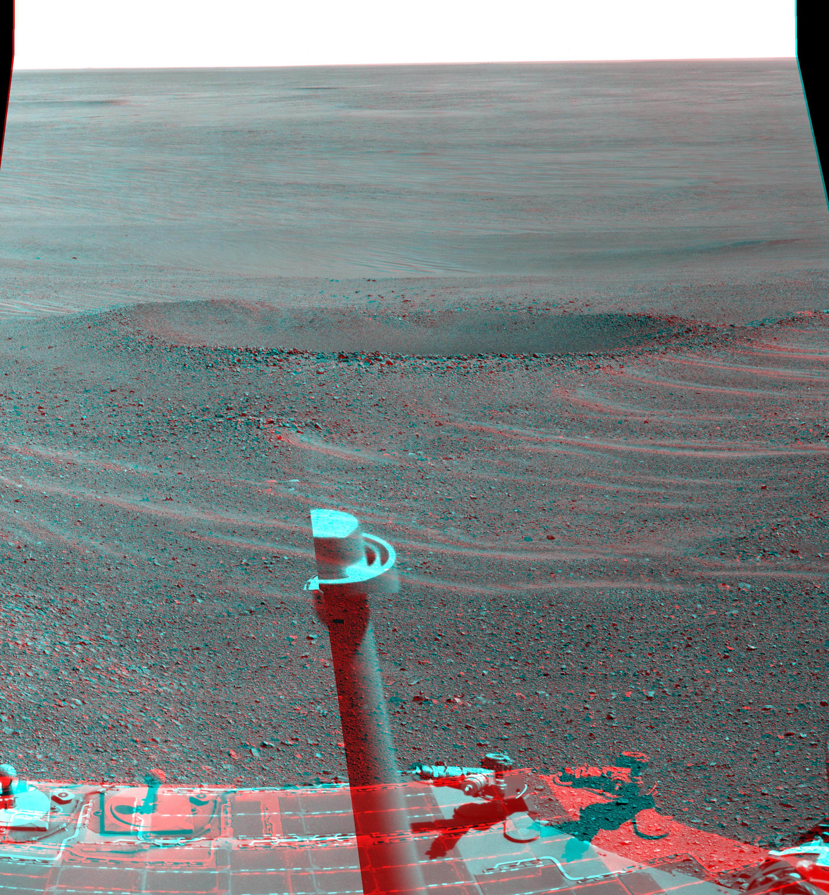
PIA13415:
Opportunity's Surroundings After Sol 2363 Drive (Stereo)
Full Resolution:
TIFF
(27 MB)
JPEG
(1.221 MB)
|
|
|
2010-09-29 |
Mars
|
Mars Exploration Rover (MER)
|
Navigation Camera
|
912x639x3 |
|
-
PIA13417:
-
Opportunity's Close-up of 'Oileán Ruaidh' (Stereo)
Full Resolution:
TIFF
(1.751 MB)
JPEG
(91.42 kB)
|
|
|
2010-10-19 |
Mars
|
Mars Exploration Rover (MER)
|
Navigation Camera
|
2719x1145x3 |
|
-
PIA13491:
-
Opportunity's Eastward View After Sol 2382 Drive (Stereo)
Full Resolution:
TIFF
(9.349 MB)
JPEG
(332.7 kB)
|
|
|
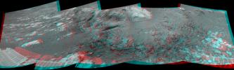
2010-11-12 |
Mars
|
Mars Exploration Rover (MER)
|
Navigation Camera
|
7753x1131x3 |
|
-
PIA13589:
Opportunity's Surroundings After Sol 2393 Drive (Stereo)
Full Resolution:
TIFF
(26.31 MB)
JPEG
(1.238 MB)
|
|
|
2010-11-12 |
Mars
|
Mars Exploration Rover (MER)
|
Navigation Camera
|
2681x1133x3 |

|
-
PIA13587:
-
Opportunity's Eastward View After Sol 2401 Drive (Stereo)
Full Resolution:
TIFF
(9.122 MB)
JPEG
(390.4 kB)
|
|
|
2010-11-18 |
Mars
|
Mars Exploration Rover (MER)
|
Panoramic Camera
|
6876x1055x3 |
|
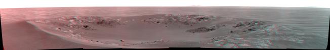
-
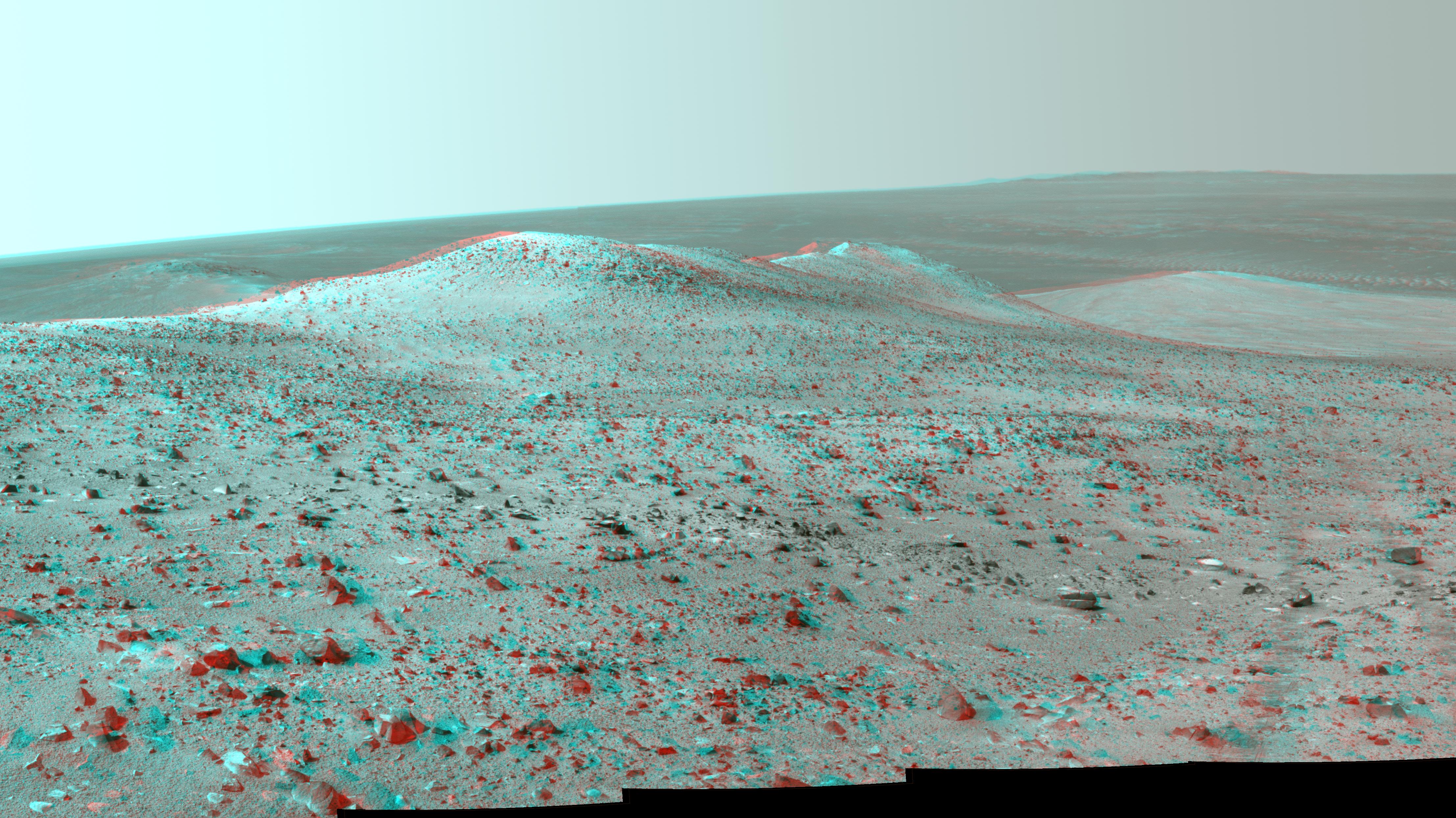
PIA13595:
'Intrepid' Crater on Mars (Stereo)
Full Resolution:
TIFF
(21.76 MB)
JPEG
(873.7 kB)
|
|
|
2010-11-18 |
Mars
|
Mars Exploration Rover (MER)
|
Navigation Camera
|
2777x1055x3 |
|
-
PIA13597:
-
'Yankee Clipper' Crater on Mars (Stereo)
Full Resolution:
TIFF
(8.789 MB)
JPEG
(184.1 kB)
|
|
|
2010-12-28 |
Mars
|
Mars Exploration Rover (MER)
|
Hazcam
|
1004x1024x3 |
|
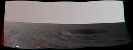
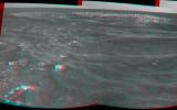
-
PIA13710:
-
Fisheye Stereo from Edge of 'Santa Maria' Crater, Sol 2459
Full Resolution:
TIFF
(3.089 MB)
JPEG
(111.5 kB)
|
|
|
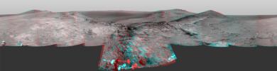
2011-01-13 |
Mars
|
Mars Exploration Rover (MER)
|
Navigation Camera
|
7753x2352x3 |
|
-
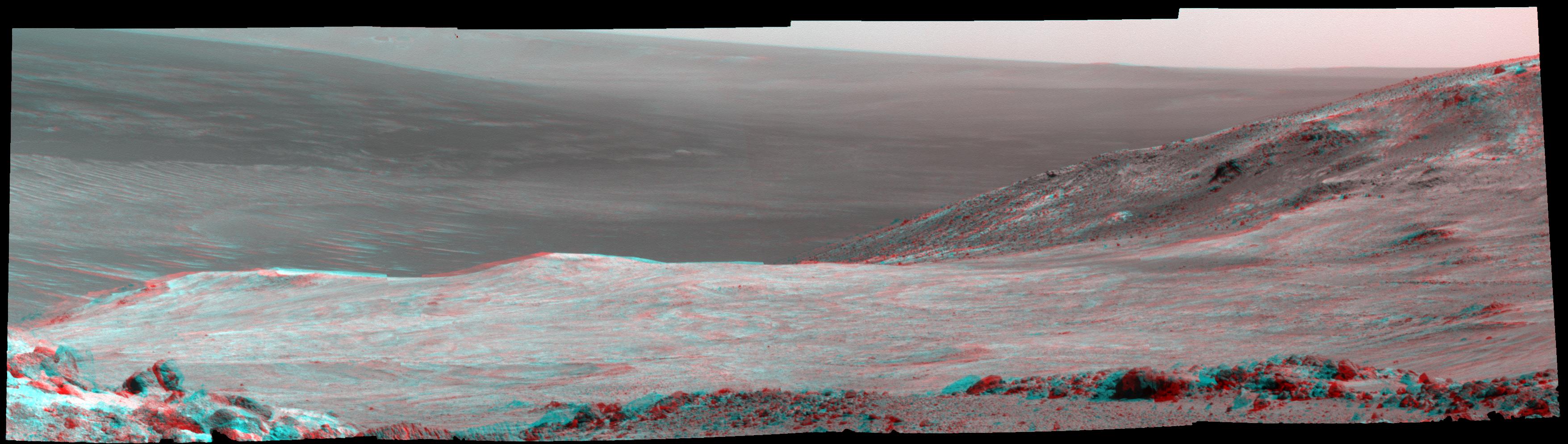
PIA13757:
-
View of 'Santa Maria' Crater from Western Rim, Sol 2454 (Stereo)
Full Resolution:
TIFF
(54.71 MB)
JPEG
(1.487 MB)
|
|
|
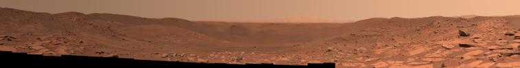
2011-01-20 |
Mars
|
Mars Exploration Rover (MER)
|
Panoramic Camera
|
14745x4000x3 |
|
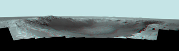
-
PIA13796:
-
Stereo Panorama of 'Santa Maria' Crater for Opportunity's Anniversary
Full Resolution:
TIFF
(176.9 MB)
JPEG
(3.45 MB)
|
|
|
2011-05-04 |
Mars
|
Mars Exploration Rover (MER)
|
Navigation Camera
|
1747x1093x3 |
|
-
PIA13989:
-
Martian 'Freedom 7' Crater 50 Years After Freedom 7 Flight (Stereo)
Full Resolution:
TIFF
(5.737 MB)
JPEG
(245.7 kB)
|
|
|
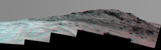
2011-05-18 |
Mars
|
Mars Exploration Rover (MER)
|
Navigation Camera
|
5733x1153x3 |
|
-
PIA14130:
Autonomous Hazard Checks Leave Patterned Rover Tracks on Mars (Stereo)
Full Resolution:
TIFF
(19.83 MB)
JPEG
(736.2 kB)
|
|
|
2011-06-02 |
Mars
|
Mars Exploration Rover (MER)
|
Navigation Camera
|
4905x1182x3 |
|
-
PIA14133:
-
Opportunity Beside a Small, Young Crater (Stereo)
Full Resolution:
TIFF
(17.39 MB)
JPEG
(702.3 kB)
|
|
|
2011-08-15 |
Mars
|
Mars Exploration Rover (MER)
|
Navigation Camera
|
6767x1169x3 |
|
-
PIA14531:
'Spirit Point' Vista from Opportunity, in Stereo
Full Resolution:
TIFF
(23.73 MB)
JPEG
(1.008 MB)
|
|
|
2012-09-07 |
Mars
|
Mars Exploration Rover (MER)
|
Navigation Camera
|
7688x987x1 |
|
-
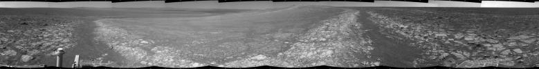
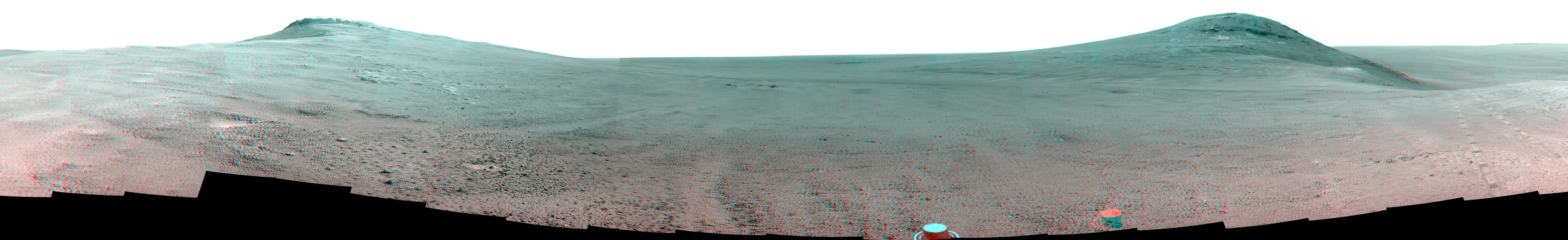
PIA16122:
Opportunity's Surroundings on 3,000th Sol
Full Resolution:
TIFF
(7.596 MB)
JPEG
(1.148 MB)
|
|
|
2012-09-07 |
Mars
|
Mars Exploration Rover (MER)
|
Navigation Camera
|
7753x1152x3 |

|
-
PIA16123:
Opportunity's Surroundings on 3,000th Sol, in 3-D
Full Resolution:
TIFF
(26.8 MB)
JPEG
(1.421 MB)
|
|
|
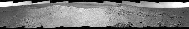
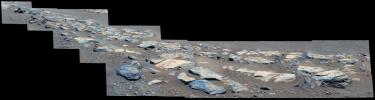
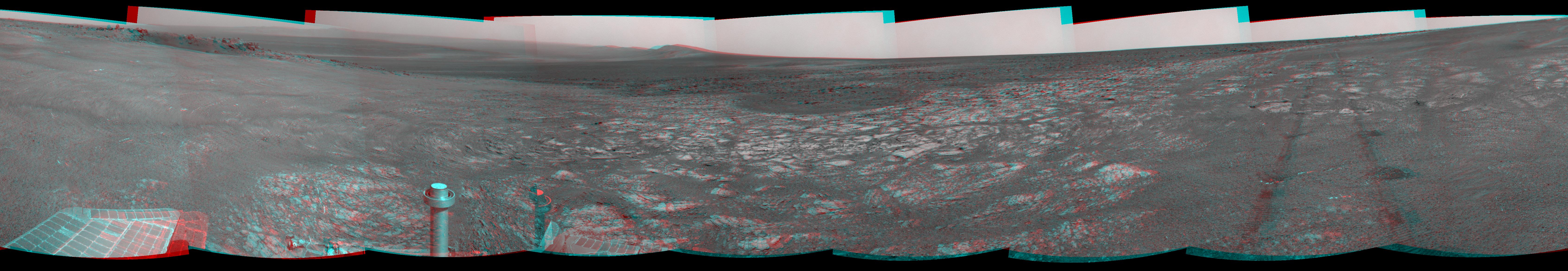
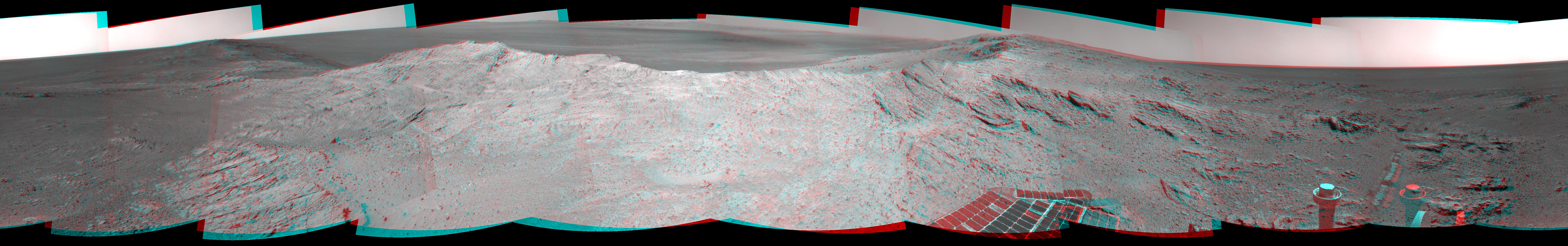
2012-10-03 |
Mars
|
Mars Exploration Rover (MER)
|
Navigation Camera
|
7753x1287x3 |
|
-
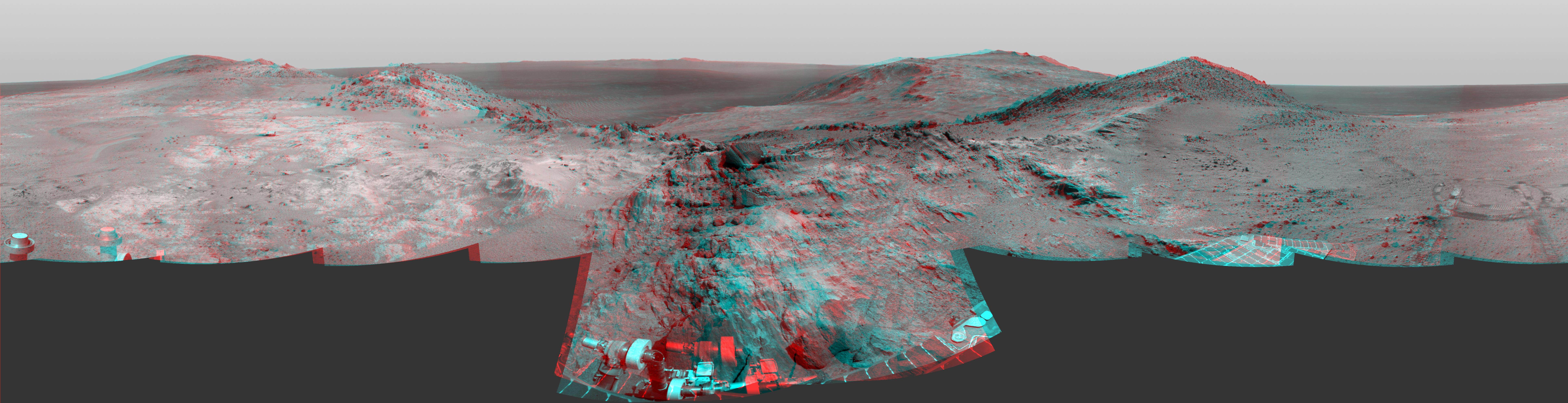
PIA16222:
'Matijevic Hill' on Rim of Mars' Endeavour Crater, Stereo View
Full Resolution:
TIFF
(29.94 MB)
JPEG
(1.162 MB)
|
|
|
2012-12-19 |
Mars
|
Mars Exploration Rover (MER)
|
Navigation Camera
|
7753x1255x3 |
|
-
PIA16557:
Opportunity's Surroundings on Sol 3071, Stereo View
Full Resolution:
TIFF
(29.2 MB)
JPEG
(1.296 MB)
|
|
|
2012-12-19 |
Mars
|
Mars Exploration Rover (MER)
|
Navigation Camera
|
7753x2005x3 |
|
-
PIA16559:
Opportunity's Surroundings on Sol 3105, Stereo View
Full Resolution:
TIFF
(46.65 MB)
JPEG
(1.802 MB)
|
|
|
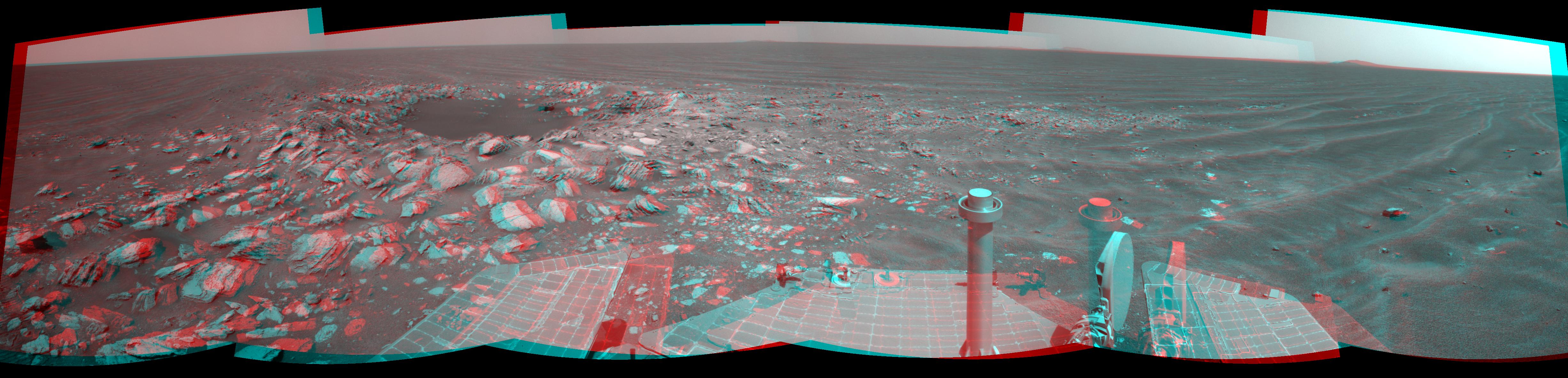
2012-12-19 |
Mars
|
Mars Exploration Rover (MER)
|
Navigation Camera
|
4285x1289x3 |
|
-
PIA16561:
-
Opportunity at 'Copper Cliff,' Sol 3153
Full Resolution:
TIFF
(16.58 MB)
JPEG
(862.8 kB)
|
|
|
2013-01-22 |
Mars
|
Mars Exploration Rover (MER)
|
Panoramic Camera
|
14669x5000x3 |

|
-
PIA16709:
-
'Matijevic Hill' Panorama for Rover's Ninth Anniversary (Stereo)
Full Resolution:
TIFF
(220.1 MB)
JPEG
(7.268 MB)
|
|
|
2013-04-16 |
Mars
|
Mars Exploration Rover (MER)
|
Navigation Camera
|
5076x1157x3 |
|
-
PIA16924:
Opportunity Overlooking Endeavour Crater, Stereo View
Full Resolution:
TIFF
(17.63 MB)
JPEG
(764.1 kB)
|
|
|
2013-10-23 |
Mars
|
Mars Exploration Rover (MER)
|
Navigation Camera
|
4278x1333x3 |
|
-
PIA17367:
-
Mars Hill-Climbing Opportunity at 'Solander Point,' in Stereo
Full Resolution:
TIFF
(17.12 MB)
JPEG
(474 kB)
|
|
|
2014-05-19 |
Mars
|
Mars Exploration Rover (MER)
|
Panoramic Camera
|
5454x1264x3 |
|
-
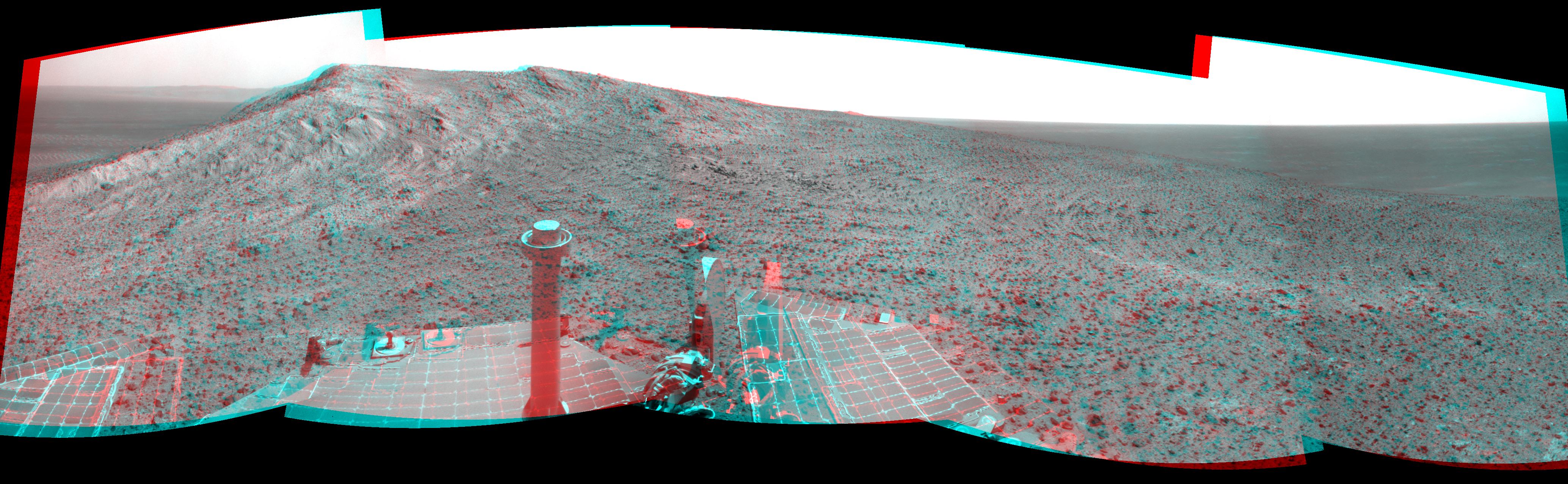
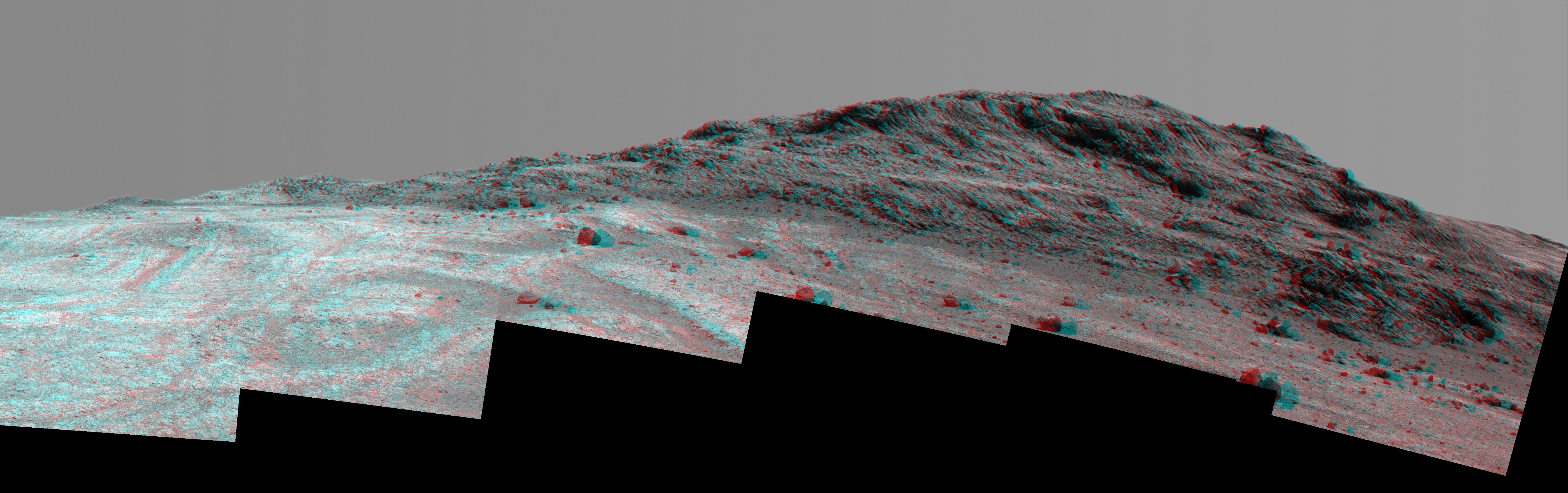
PIA18093:
Endeavour Crater Rim From 'Murray Ridge' on Mars
Full Resolution:
TIFF
(20.69 MB)
JPEG
(398 kB)
|
|
|
2014-05-19 |
Mars
|
Mars Exploration Rover (MER)
|
Navigation Camera
|
7753x1217x1 |
|
-
PIA18095:
Approaching a Target Deposit on Mars Crater Rim
Full Resolution:
TIFF
(9.445 MB)
JPEG
(1.222 MB)
|
|
|
2014-05-19 |
Mars
|
Mars Exploration Rover (MER)
|
Navigation Camera
|
7753x1217x3 |
|
-
PIA18096:
Approaching a Target Deposit on Mars Crater Rim (Stereo)
Full Resolution:
TIFF
(28.32 MB)
JPEG
(1.311 MB)
|
|
|
2014-05-19 |
Mars
|
Mars Exploration Rover (MER)
|
Navigation Camera
|
7753x1168x1 |
|
-
PIA18098:
Opportunity's Tracks Near Crater Rim Ridgeline
Full Resolution:
TIFF
(9.065 MB)
JPEG
(993.8 kB)
|
|
|
2014-05-19 |
Mars
|
Mars Exploration Rover (MER)
|
Navigation Camera
|
7753x1168x3 |
|
-
PIA18099:
Opportunity's Tracks Near Crater Rim Ridgeline (Stereo)
Full Resolution:
TIFF
(27.18 MB)
JPEG
(1.024 MB)
|
|
|
2014-06-23 |
Mars
|
Mars Exploration Rover (MER)
|
Panoramic Camera
|
7793x2000x3 |
|
-
PIA18395:
'Pillinger Point' Overlooking Endeavour Crater on Mars (Stereo)
Full Resolution:
TIFF
(46.77 MB)
JPEG
(2.275 MB)
|
|
|
2014-07-28 |
Mars
|
Mars Exploration Rover (MER)
|
Panoramic Camera
|
2817x3040x3 |
|
-
PIA18415:
-
'Lunokhod 2' Crater on Mars (Stereo)
Full Resolution:
TIFF
(25.7 MB)
JPEG
(1.707 MB)
|
|
|
2014-09-09 |
Mars
|
Mars Exploration Rover (MER)
|
Panoramic Camera
|
2134x1148x3 |
|
-
PIA18606:
-
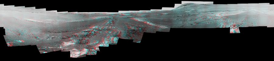
Rover's Tracks in Stereo View Along Rim of Endeavour Crater
Full Resolution:
TIFF
(7.353 MB)
JPEG
(323 kB)
|
|
|
2014-10-16 |
Mars
|
Mars Exploration Rover (MER)
|
Panoramic Camera
|
4430x2488x3 |
|
-
PIA18616:
-
Opportunity's Northward View of 'Wdowiak Ridge' (Stereo)
Full Resolution:
TIFF
(33.09 MB)
JPEG
(1.566 MB)
|
|
|
2015-01-08 |
Mars
|
Mars Exploration Rover (MER)
|
Navigation Camera
|
4136x1278x3 |
|
-
PIA19100:
-
Approach to 'Cape Tribulation' Summit (Stereo)
Full Resolution:
TIFF
(15.87 MB)
JPEG
(779.7 kB)
|
|
|
2015-01-22 |
Mars
|
Mars Exploration Rover (MER)
|
Panoramic Camera
|
4109x1024x3 |
|
-
PIA19111:
High Viewpoint for 11-Year-Old Rover Mission on Mars (Stereo)
Full Resolution:
TIFF
(12.63 MB)
JPEG
(475.3 kB)
|
|
|
2015-03-23 |
Mars
|
Mars Exploration Rover (MER)
|
Panoramic Camera
|
3511x994x3 |
|
-
PIA19153:
Mars 'Marathon Valley' Overlook, in Stereo
Full Resolution:
TIFF
(10.47 MB)
JPEG
(431.7 kB)
|
|
|
2015-03-24 |
Mars
|
Mars Exploration Rover (MER)
|
Navigation Camera
|
7719x1982x3 |
|
-
PIA19156:
Opportunity's Approach to 'Marathon Valley' (Stereo)
Full Resolution:
TIFF
(45.91 MB)
JPEG
(1.493 MB)
|
|
|
2015-09-25 |
Mars
|
Mars Exploration Rover (MER)
|
Panoramic Camera
|
5595x1758x3 |
|
-
PIA19911:
-
'Hinners Point' Above Floor of 'Marathon Valley' on Mars (Stereo)
Full Resolution:
TIFF
(15.79 MB)
JPEG
(1.128 MB)
|
|
|
2016-02-25 |
Mars
|
Mars Exploration Rover (MER)
|
Panoramic Camera
|
6015x2459x3 |
|
-
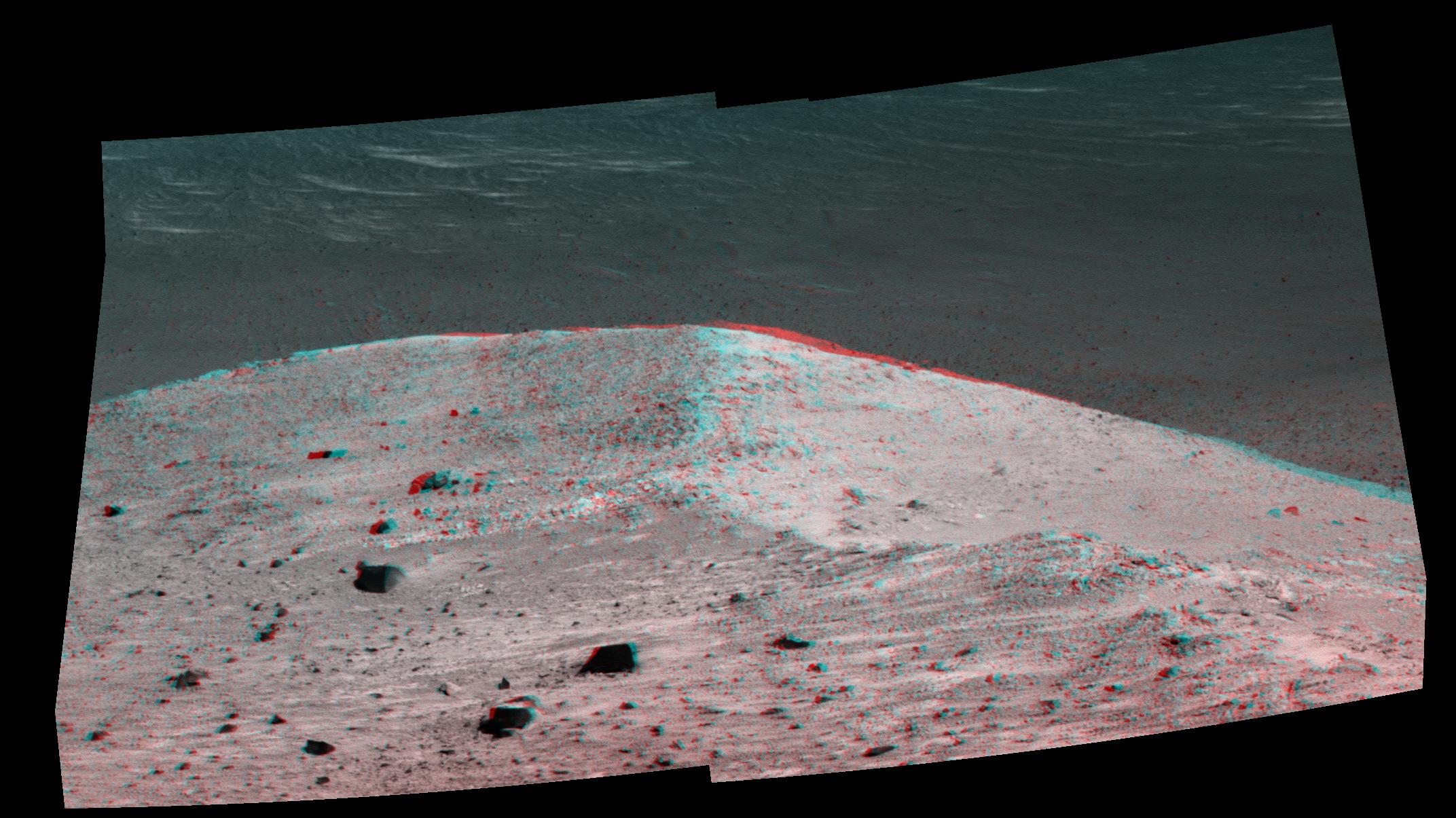
PIA20320:
-
Steep 'Knudsen Ridge' Along 'Marathon Valley' on Mars (Stereo)
Full Resolution:
TIFF
(17.97 MB)
JPEG
(1.276 MB)
|
|
|
2016-10-07 |
Mars
|
Mars Exploration Rover (MER)
|
Panoramic Camera
|
2144x1205x3 |
|
-
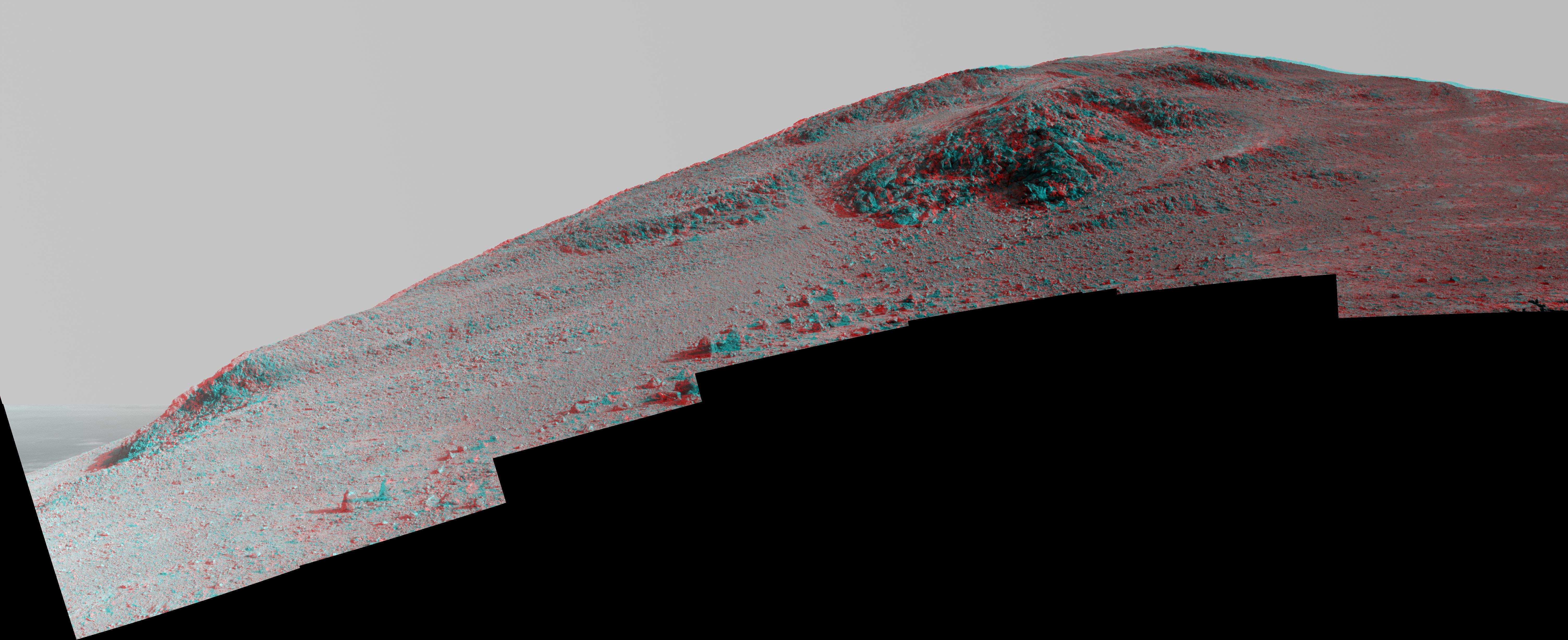
PIA20853:
-
'Spirit Mound' at Edge of Endeavour Crater, Mars (Anaglyph)
Full Resolution:
TIFF
(4.643 MB)
JPEG
(320.8 kB)
|
|
|
2017-06-16 |
Mars
|
Mars Exploration Rover (MER)
|
Panoramic Camera
|
9222x1452x3 |
|
-
PIA21706:
Mars Rover Opportunity's View of 'Orion Crater' (Stereo)
Full Resolution:
TIFF
(26.06 MB)
JPEG
(2.533 MB)
|
|
|
2017-07-20 |
Mars
|
Mars Exploration Rover (MER)
|
Panoramic Camera
|
7000x1070x3 |

|
-
PIA21721:
Panorama Above 'Perseverance Valley' on Mars (Stereo)
Full Resolution:
TIFF
(15.32 MB)
JPEG
(1.169 MB)
|
|
|
2019-03-12 |
Mars
|
Mars Exploration Rover (MER)
|
Panoramic Camera
|
900x201x3 |
|
-
PIA22909:
Opportunity Legacy Pan (True Color)
Full Resolution:
TIFF
(310.9 kB)
JPEG
(24.82 kB)
|
|
|
2019-03-12 |
Mars
|
Mars Exploration Rover (MER)
|
Panoramic Camera
|
900x201x3 |
|
-
PIA22910:
Opportunity Legacy Pan (Anaglyph)
Full Resolution:
TIFF
(316.2 kB)
JPEG
(23.12 kB)
|
|
|
2021-04-06 |
Mars
|
Mars 2020 Rover
|
Mastcam-Z
|
1603x1192x3 |

|
-
PIA24547:
-
Mastcam-Z Gives Ingenuity a Close-up
Full Resolution:
TIFF
(5.734 MB)
JPEG
(424.5 kB)
|
|
|
2021-05-11 |
Mars
|
Mars 2020 Rover
|
Mastcam-Z
|
11363x4204x3 |
|
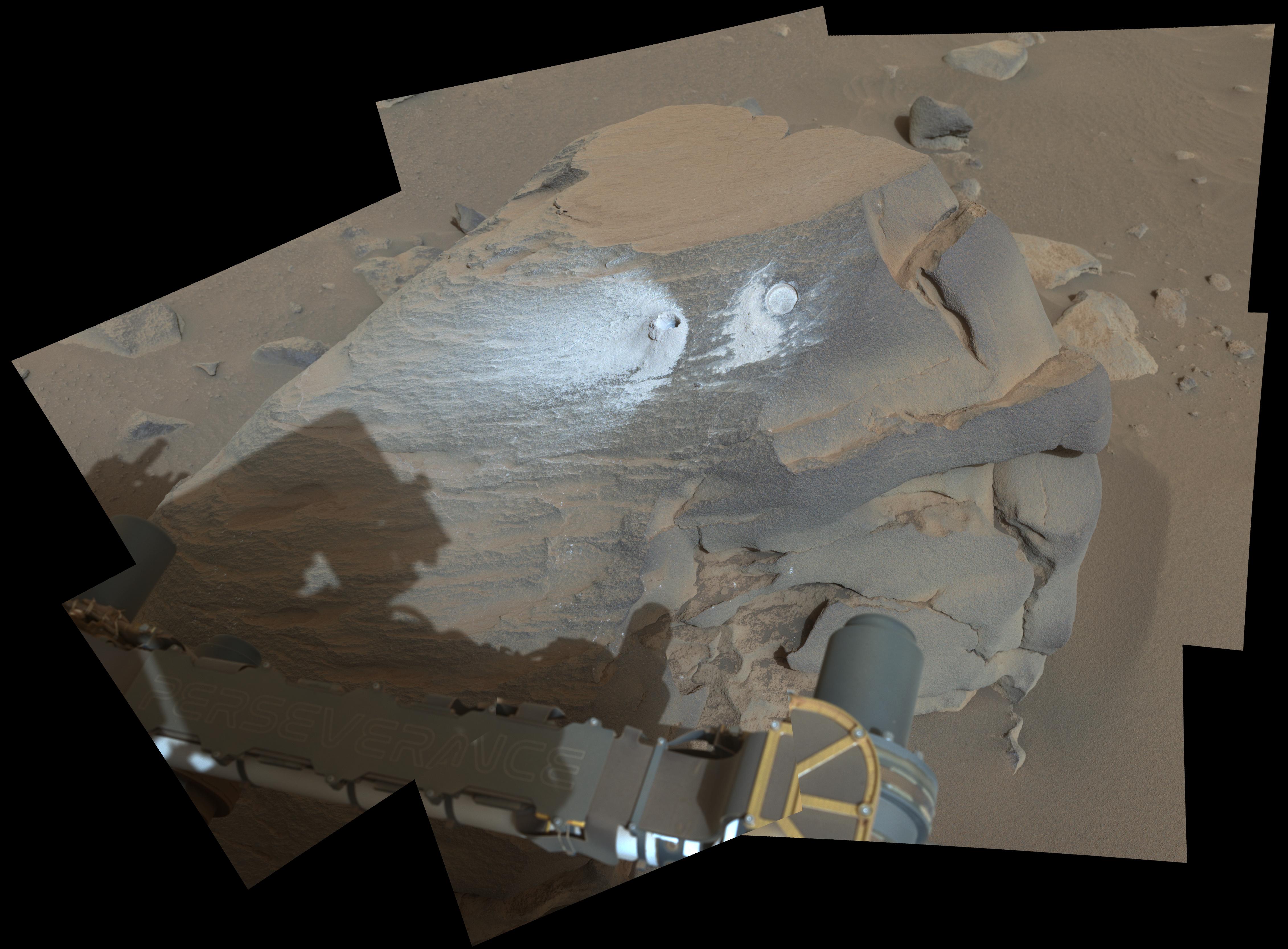
-
PIA24627:
-
Perseverance's Mastcam-Z Images Intriguing Rocks
Full Resolution:
TIFF
(117.3 MB)
JPEG
(7.456 MB)
|
|
|
2021-05-12 |
Mars
|
Mars 2020 Rover
|
Mastcam-Z
|
1260x638x3 |
|
-
PIA24522:
-
Ingenuity Flies in 3D
Full Resolution:
TIFF
(1.908 MB)
JPEG
(77.2 kB)
|
|
|
2021-06-25 |
Mars
|
Mars 2020 Rover
|
Mastcam-Z
|
1788x1870x3 |
|
-
PIA24670:
-
Ingenuity Helicopter in 3D
Full Resolution:
TIFF
(10.03 MB)
JPEG
(598.3 kB)
|
|
|
2021-07-21 |
Mars
|
Mars 2020 Rover
|
Mastcam-Z
|
10178x4367x3 |
|
-
PIA24746:
-
Perseverance Scouts First Sampling Location
Full Resolution:
TIFF
(101.4 MB)
JPEG
(5.824 MB)
|
|
|
2021-07-21 |
Mars
|
Mars 2020 Rover
|
Mastcam-Z
|
5609x1296x3 |
|
-
PIA24745:
An Expanse for Perseverance to Explore
Full Resolution:
TIFF
(16.75 MB)
JPEG
(925.3 kB)
|
|
|
2021-09-10 |
Mars
|
Mars 2020 Rover
|
Mastcam-Z
|
19564x5219x3 |
|
-
PIA24833:
Malamaire View of Citadelle Area
Full Resolution:
TIFF
(178.3 MB)
JPEG
(12.86 MB)
|
|
|
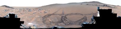
2023-05-18 |
Mars
|
Mars 2020 Rover
|
Mastcam-Z
|
9000x1191x3 |
|
-
PIA25889:
Perseverance Takes in View at Belva Crater
Full Resolution:
TIFF
(23.28 MB)
JPEG
(1.248 MB)
|
|
|
2023-08-07 |
Mars
|
Mars 2020 Rover
|
Mastcam-Z
|
4160x1127x3 |
|
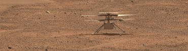
-
PIA25968:
Perseverance Checks Out Ingenuity
Full Resolution:
TIFF
(14.07 MB)
JPEG
(988.6 kB)
|
|
|
2023-08-31 |
Mars
|
Mars 2020 Rover
|
Mastcam-Z
|
9000x819x3 |

|
-
PIA25965:
Perseverance Rover Looks West
Full Resolution:
TIFF
(13.43 MB)
JPEG
(613.3 kB)
|
|
|
2023-12-12 |
Mars
|
Mars 2020 Rover
|
Mastcam-Z
|
9000x2425x3 |
|
-
PIA26080:
Perseverance's 360-Degree View From 'Airey Hill'
Full Resolution:
TIFF
(48.29 MB)
JPEG
(2.638 MB)
|
|
|
2024-04-03 |
Mars
|
Mars 2020 Rover
|
Mastcam-Z
|
4524x3334x3 |
|
-
PIA26312:
-
Perseverance's View of 'Bunsen Peak'
Full Resolution:
TIFF
(27.75 MB)
JPEG
(1.119 MB)
|
|
|
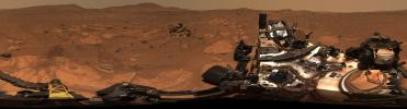
2024-12-12 |
Mars
|
Mars 2020 Rover
|
Mastcam-Z
|
30000x7333x3 |
|
-
PIA26474:
Perseverance Makes Tracks at 'Rio Chiquito'
Full Resolution:
TIFF
(454.3 MB)
JPEG
(30.81 MB)
|
|
|
2009-07-21 |
Moon
|
Lunar Reconnaissance Orbiter (LRO)
|
Lunar Reconnaissance Orbiter Camera (NAC)
|
1000x1000x3 |
|
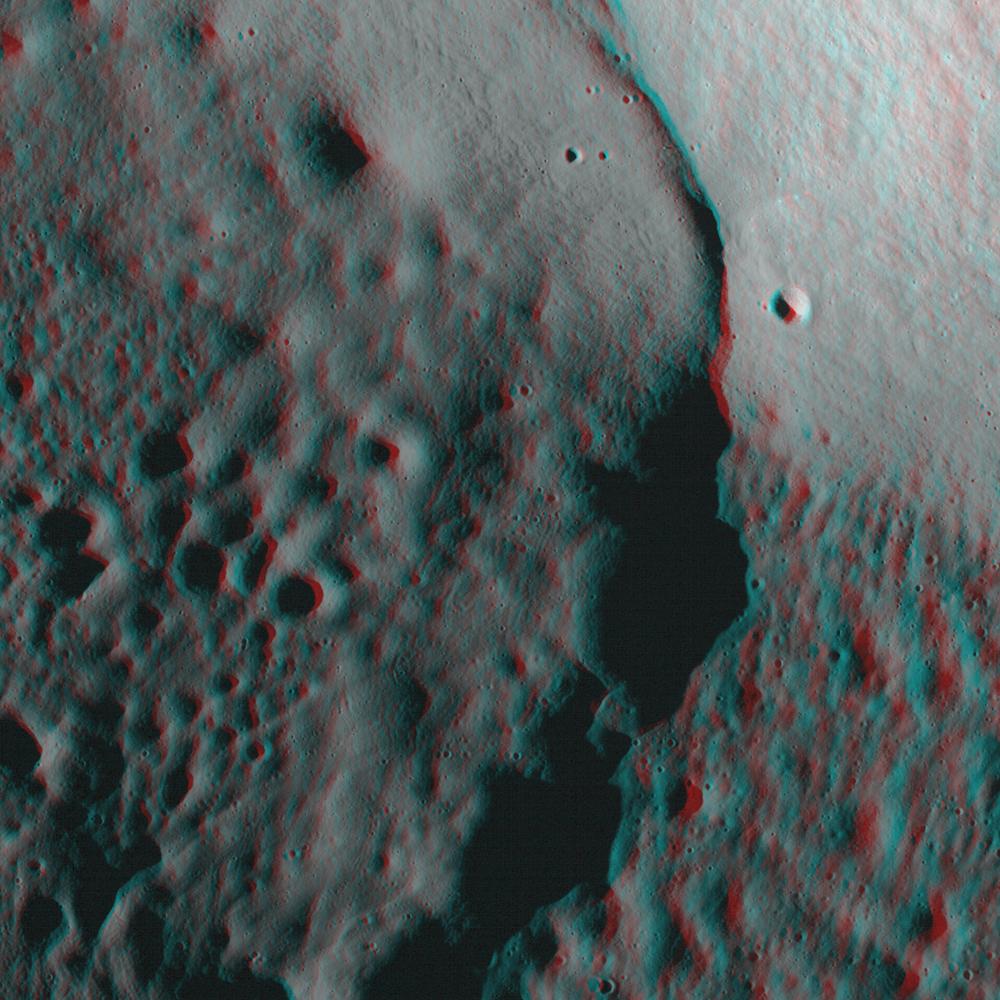
-
PIA12890:
-
The Moon in 3-D
Full Resolution:
TIFF
(3.004 MB)
JPEG
(145.4 kB)
|
|
|
2010-05-05 |
Moon
|
Lunar Reconnaissance Orbiter (LRO)
|
Lunar Reconnaissance Orbiter Camera (NAC)
|
1000x1000x3 |
|
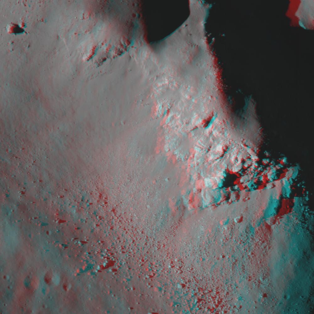
-
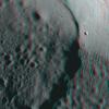
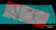
PIA13094:
-
Central Peak of Copernicus Crater (Anaglyph)
Full Resolution:
TIFF
(3.004 MB)
JPEG
(107.4 kB)
|
|
|
2000-02-16 |
Earth
|
Landsat
Shuttle Radar Topography Mission (SRTM)
|
C-Band Interferometric Radar
Thematic Mapper
|
1412x1588x3 |
|
-
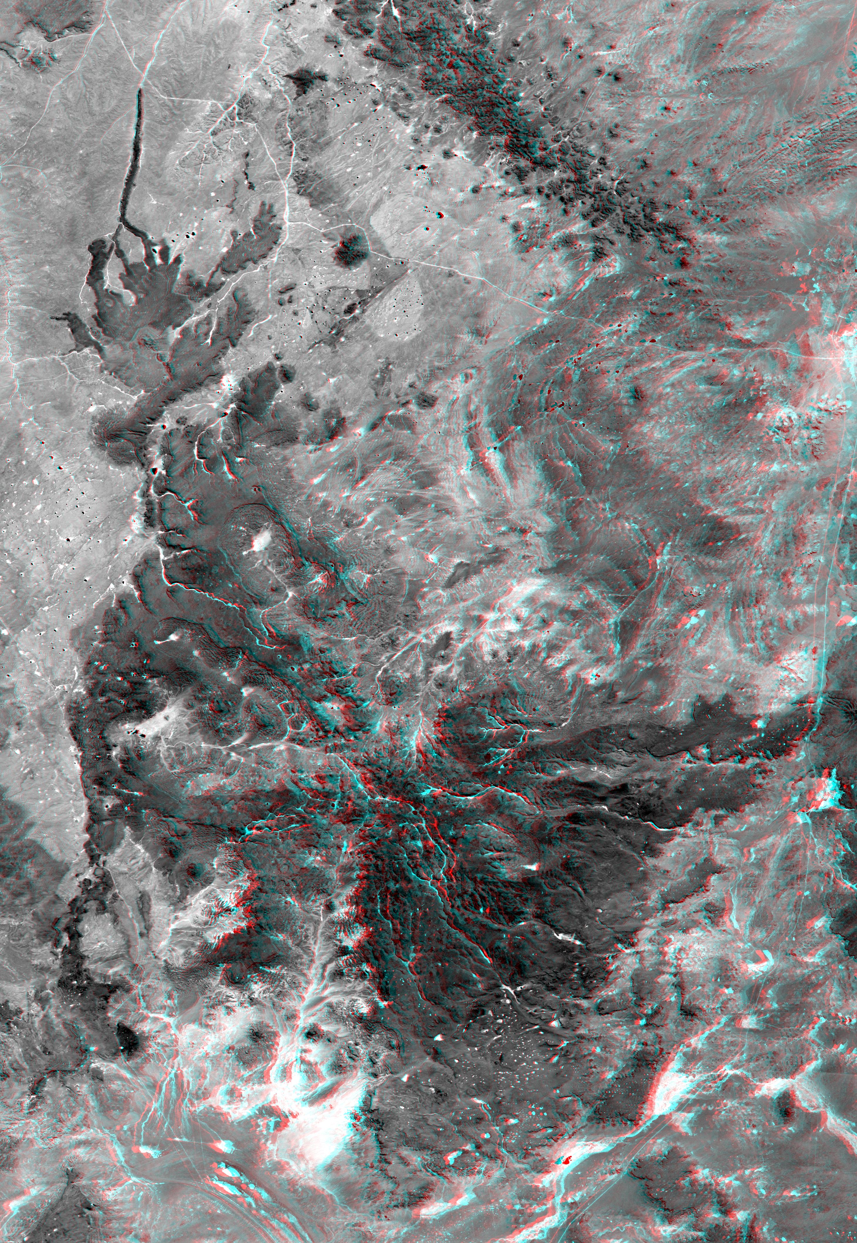
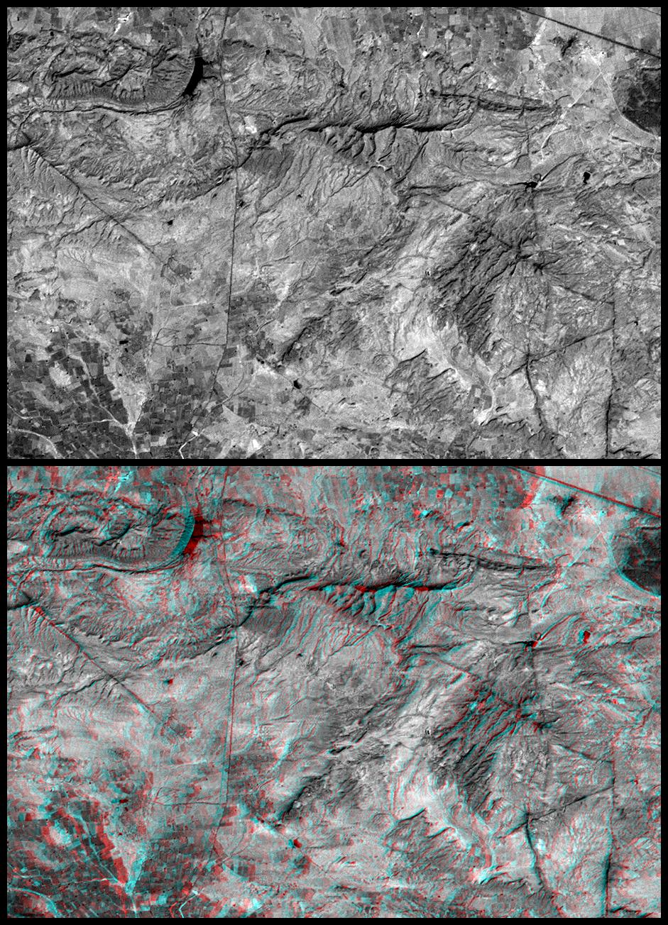
PIA02709:
-
Anaglyph with Landsat Overlay, Kamchatka Peninsula, Russia
Full Resolution:
TIFF
(6.288 MB)
JPEG
(309.4 kB)
|
|
|
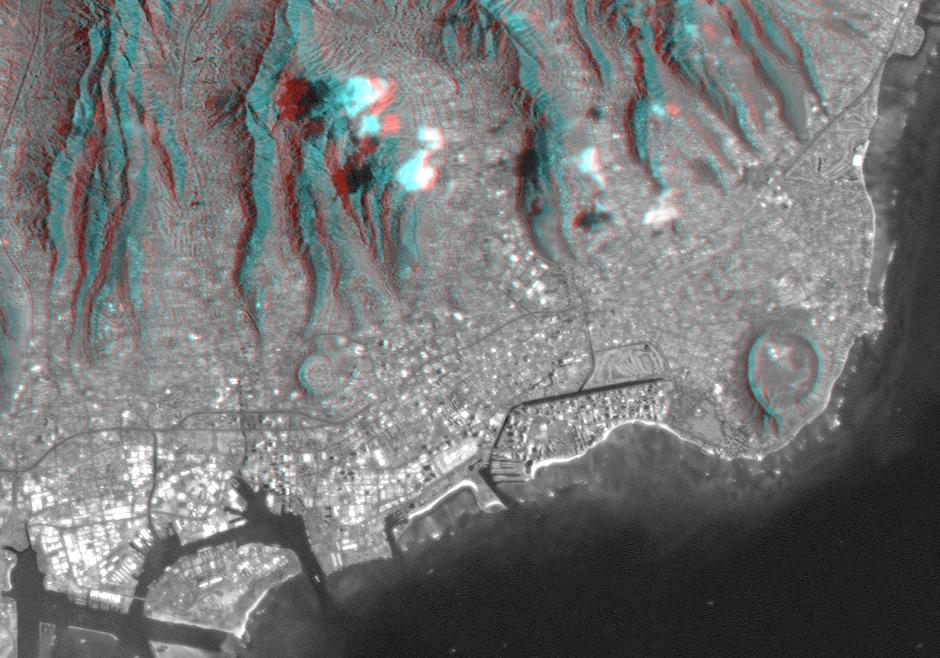
2000-02-20 |
Earth
|
Landsat
Shuttle Radar Topography Mission (SRTM)
|
C-Band Interferometric Radar
Thematic Mapper
|
940x658x3 |
|
-
PIA02728:
-
Anaglyph, Landsat overlay Honolulu, Hawaii
Full Resolution:
TIFF
(1.436 MB)
JPEG
(112.3 kB)
|
|
|
2000-03-10 |
Earth
|
Landsat
Shuttle Radar Topography Mission (SRTM)
|
C-Band Interferometric Radar
Thematic Mapper
|
1218x1366x3 |
|
-
PIA02736:
-
Anaglyph, Landsat overlay, Southernmost Coastal Oman
Full Resolution:
TIFF
(4.27 MB)
JPEG
(312.1 kB)
|
|
|
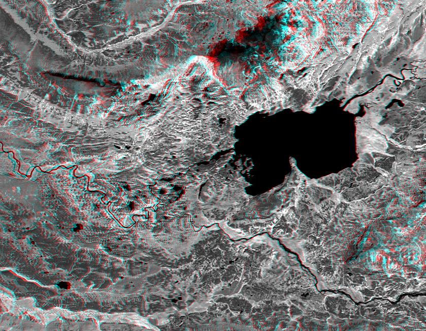
2000-04-13 |
Earth
|
Landsat
Shuttle Radar Topography Mission (SRTM)
|
C-Band Interferometric Radar
Thematic Mapper
|
839x651x3 |
|
-
PIA02744:
-
Anaglyph, Lake Palanskoye Landslide, Kamchatka Peninsula, Russia
Full Resolution:
TIFF
(1.501 MB)
JPEG
(180.1 kB)
|
|
|
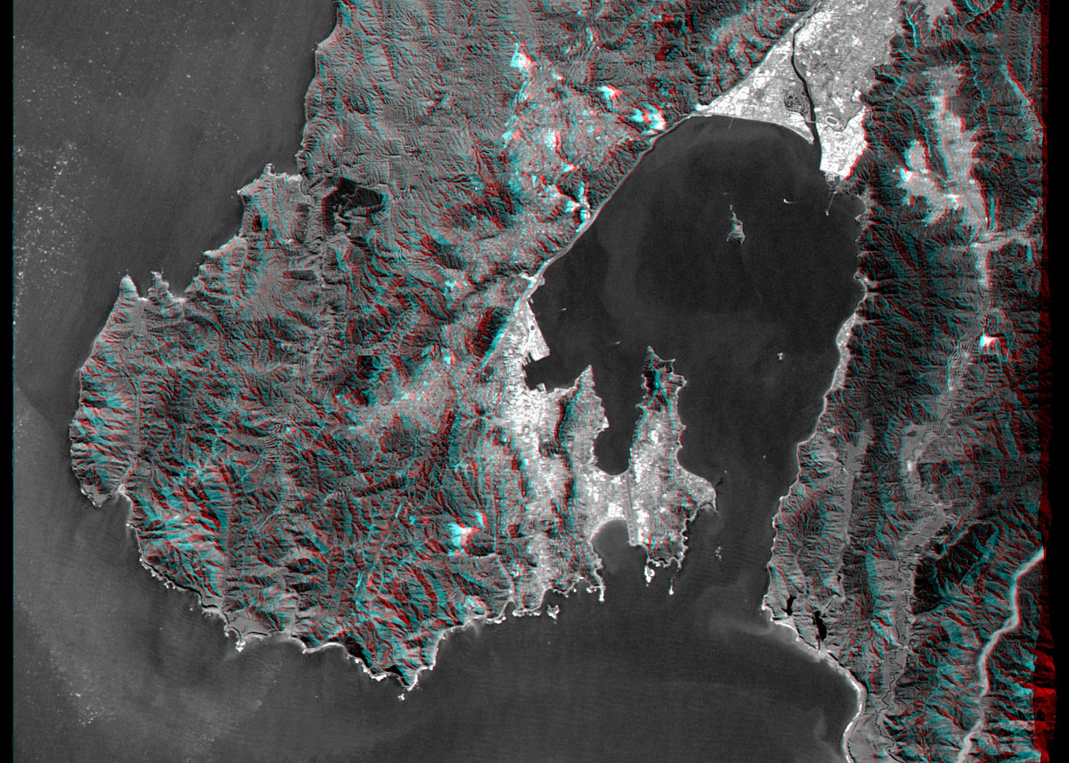
2000-05-11 |
Earth
|
Landsat
Shuttle Radar Topography Mission (SRTM)
|
C-Band Interferometric Radar
Thematic Mapper
|
2158x1540x3 |
|
-
PIA02750:
-
Anaglyph, Landsat Overlay: Wellington, New Zealand
Full Resolution:
TIFF
(7.542 MB)
JPEG
(613.9 kB)
|
|
|
2000-06-22 |
Earth
|
Landsat
Shuttle Radar Topography Mission (SRTM)
|
C-Band Interferometric Radar
Thematic Mapper
|
2920x4236x3 |
|
-
PIA02755:
-
Anaglyph, Patagonia, Argentina
Full Resolution:
TIFF
(19.93 MB)
JPEG
(2.452 MB)
|
|
|
2000-06-29 |
Earth
|
Landsat
Shuttle Radar Topography Mission (SRTM)
|
C-Band Interferometric Radar
Thematic Mapper
|
506x798x3 |
|
-
PIA02761:
-
Anaglyph: Patagonia, Argentina
Full Resolution:
TIFF
(1.101 MB)
JPEG
(79.37 kB)
|
|
|
2000-07-13 |
Earth
|
Landsat
Shuttle Radar Topography Mission (SRTM)
|
C-Band Interferometric Radar
Thematic Mapper
|
1631x956x3 |
|
-
PIA02762:
-
Anaglyph: Basalt Cliffs, Patagonia, Argentina
Full Resolution:
TIFF
(2.516 MB)
JPEG
(296.4 kB)
|
|
|
2000-07-20 |
Earth
|
Landsat
Shuttle Radar Topography Mission (SRTM)
|
C-Band Interferometric Radar
Thematic Mapper
|
718x907x3 |
|
-
PIA02764:
-
SRTM Anaglyph: Inverted Topography, Patagonia, Argentina
Full Resolution:
TIFF
(1.025 MB)
JPEG
(149.5 kB)
|
|
|
2000-07-27 |
Earth
|
Landsat
Shuttle Radar Topography Mission (SRTM)
|
C-Band Interferometric Radar
Thematic Mapper
|
999x1335x3 |
|
-
PIA02766:
-
SRTM Anaglyph: Meseta de Somuncura, Patagonia, Argentina (Near Los Menucos)
Full Resolution:
TIFF
(3.633 MB)
JPEG
(273.4 kB)
|
|
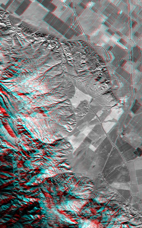
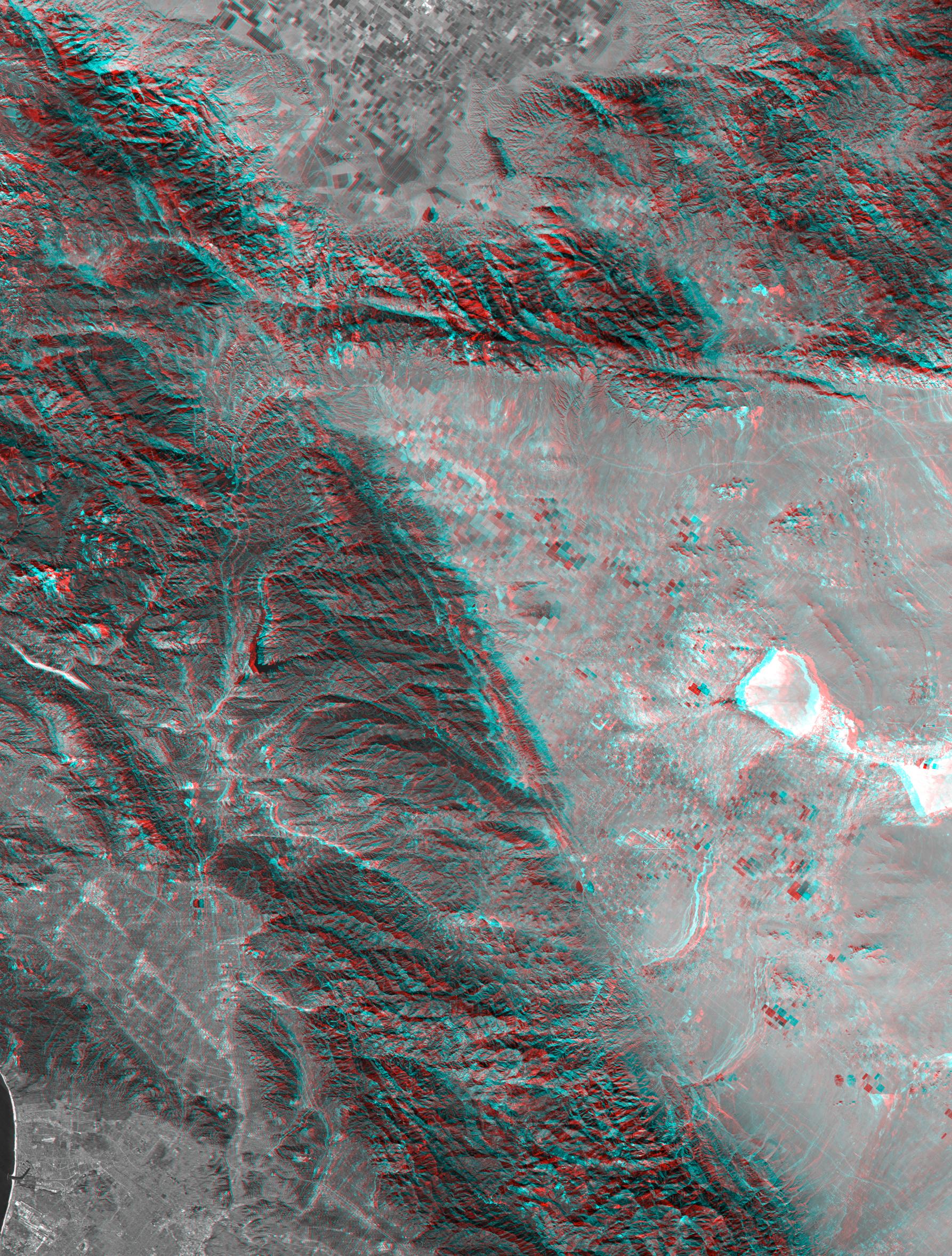
|
2000-08-31 |
Earth
|
Landsat
Shuttle Radar Topography Mission (SRTM)
|
C-Band Interferometric Radar
Thematic Mapper
|
499x801x3 |
|
-
PIA02772:
-
SRTM Anaglyph: Wheeler Ridge, California
Full Resolution:
TIFF
(1.069 MB)
JPEG
(109.4 kB)
|
|
|
2000-09-21 |
Earth
|
Landsat
Shuttle Radar Topography Mission (SRTM)
|
C-Band Interferometric Radar
Thematic Mapper
|
1786x2356x3 |
|
-
PIA02777:
-
SRTM Anaglyph with Landsat Overlay: Los Angeles to San Joaquin Valley, California
Full Resolution:
TIFF
(12.92 MB)
JPEG
(1.054 MB)
|
|
|
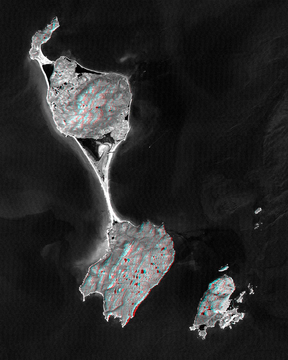
2000-10-20 |
Earth
|
Landsat
Shuttle Radar Topography Mission (SRTM)
|
C-Band Interferometric Radar
Thematic Mapper
|
1212x1518x3 |
|
-
PIA02781:
-
SRTM Anaglyph with Landsat Overlay: Miquelon and Saint Pierre Islands
Full Resolution:
TIFF
(3.237 MB)
JPEG
(324.2 kB)
|
|
|
2001-04-05 |
Earth
|
Landsat
Shuttle Radar Topography Mission (SRTM)
|
C-Band Interferometric Radar
Thematic Mapper
|
451x691x3 |
|
-
PIA02797:
-
SRTM Anaglyph: Bhuj, India, Two Weeks After Earthquake
Full Resolution:
TIFF
(870.6 kB)
JPEG
(98.48 kB)
|
|
|
2001-05-02 |
Earth
|
Landsat
Shuttle Radar Topography Mission (SRTM)
|
C-Band Interferometric Radar
Thematic Mapper
|
477x745x3 |
|
-
PIA03303:
-
SRTM Anaglyph: Haro and Kas Hills
Full Resolution:
TIFF
(989 kB)
JPEG
(108.1 kB)
|
|
|
2001-05-24 |
Earth
|
Landsat
Shuttle Radar Topography Mission (SRTM)
|
C-Band Interferometric Radar
Thematic Mapper
|
941x1304x3 |
|
-
PIA03307:
-
SRTM Anaglyph: Roads versus Dikes near Bhuj, India
Full Resolution:
TIFF
(2.534 MB)
JPEG
(344.1 kB)
|
|
|
2001-05-31 |
Earth
|
Landsat
Shuttle Radar Topography Mission (SRTM)
|
C-Band Interferometric Radar
Thematic Mapper
|
398x710x3 |
|
-
PIA03309:
-
SRTM Anaglyph: Northwest of Bhuj, India
Full Resolution:
TIFF
(802.2 kB)
JPEG
(84.41 kB)
|
|
|
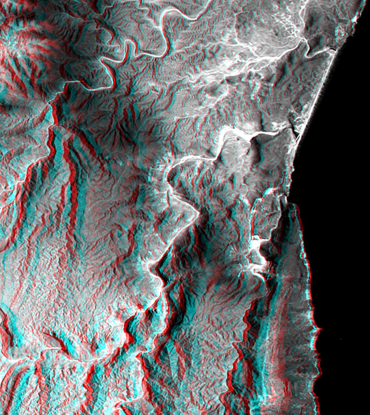
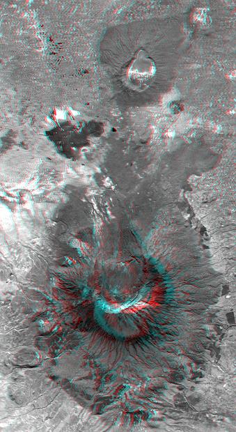
2002-02-01 |
Earth
|
Landsat
Shuttle Radar Topography Mission (SRTM)
|
C-Band Interferometric Radar
Thematic Mapper
|
1384x2022x3 |
|
-
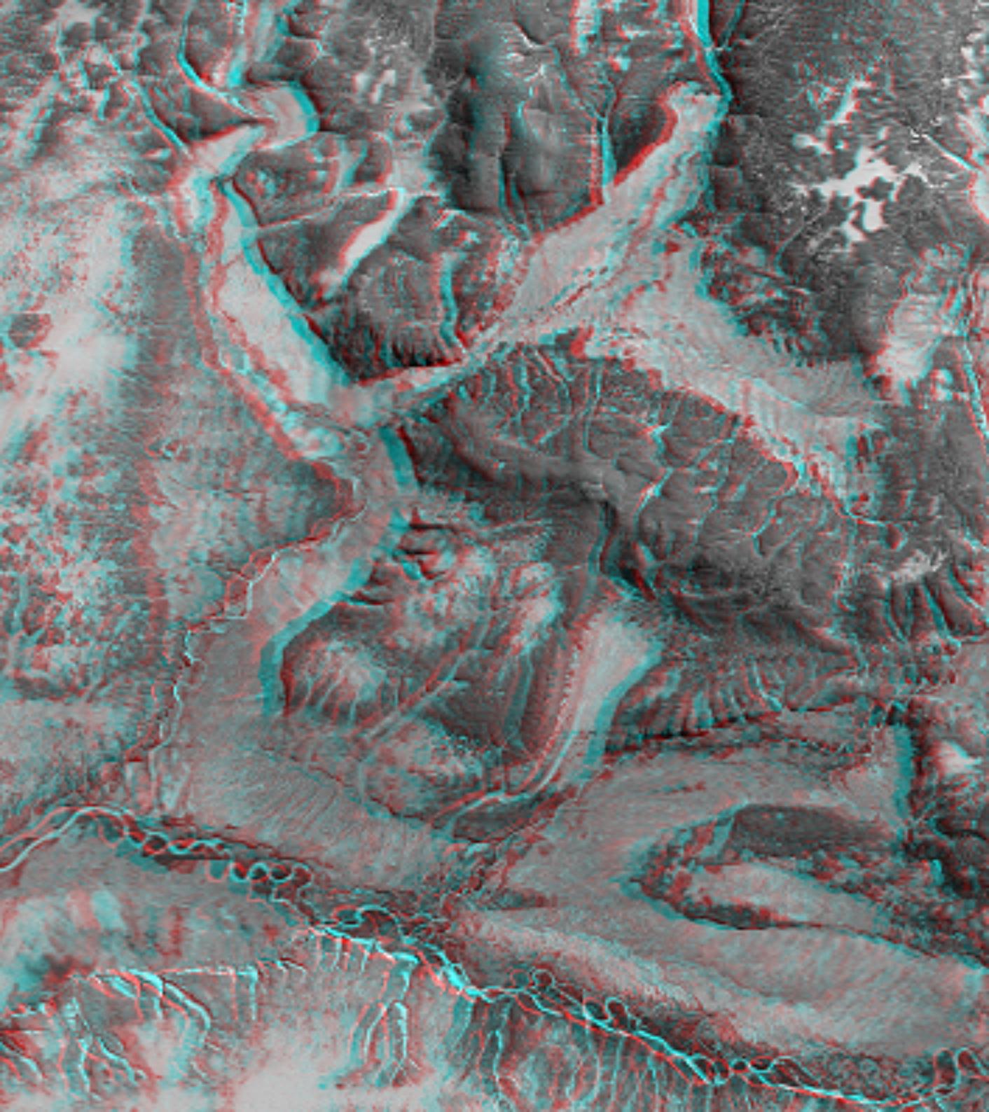
PIA03340:
-
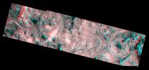
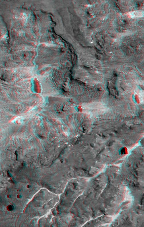
Nyiragongo volcano, Congo, Anaglyph, SRTM / Landsat
Full Resolution:
TIFF
(7.001 MB)
JPEG
(499 kB)
|
|
|
2002-02-06 |
Earth
|
Landsat
Shuttle Radar Topography Mission (SRTM)
|
C-Band Interferometric Radar
Thematic Mapper
|
925x2385x3 |
|
-
PIA03343:
-
Anaglyph, Salt Lake City, Utah
Full Resolution:
TIFF
(6.158 MB)
JPEG
(683.6 kB)
|
|
|
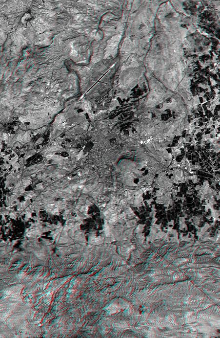
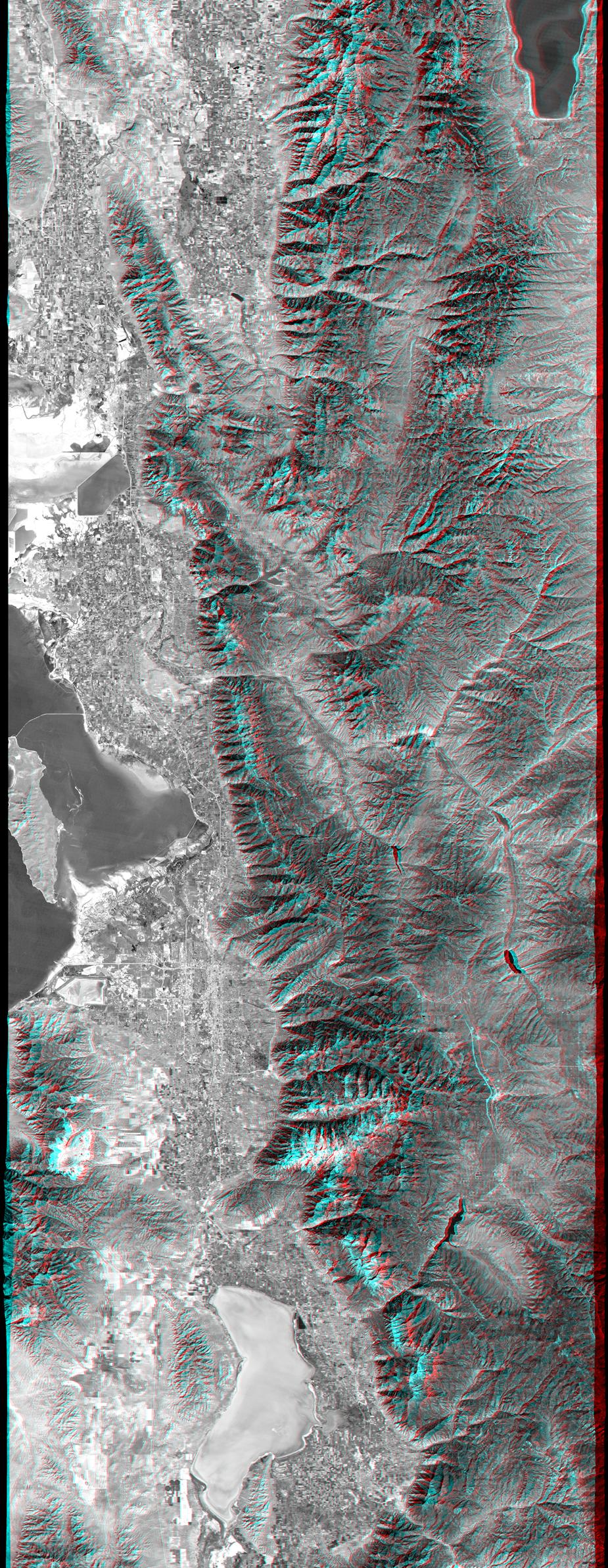
2002-02-28 |
Earth
|
Landsat
Shuttle Radar Topography Mission (SRTM)
|
C-Band Interferometric Radar
Thematic Mapper
|
1958x799x3 |
|
-
PIA03345:
-
Anaglyph, Metro Los Angeles, Calif.: Malibu to Mount Baldy
Full Resolution:
TIFF
(3.198 MB)
JPEG
(298.8 kB)
|
|
|
2002-09-12 |
Earth
|
Landsat
Shuttle Radar Topography Mission (SRTM)
|
C-Band Interferometric Radar
Thematic Mapper
|
339x620x3 |
|
-
PIA03358:
-
Anaglyph with Landsat Overlay, Mount Meru, Tanzania
Full Resolution:
TIFF
(602.1 kB)
JPEG
(56.43 kB)
|
|
|
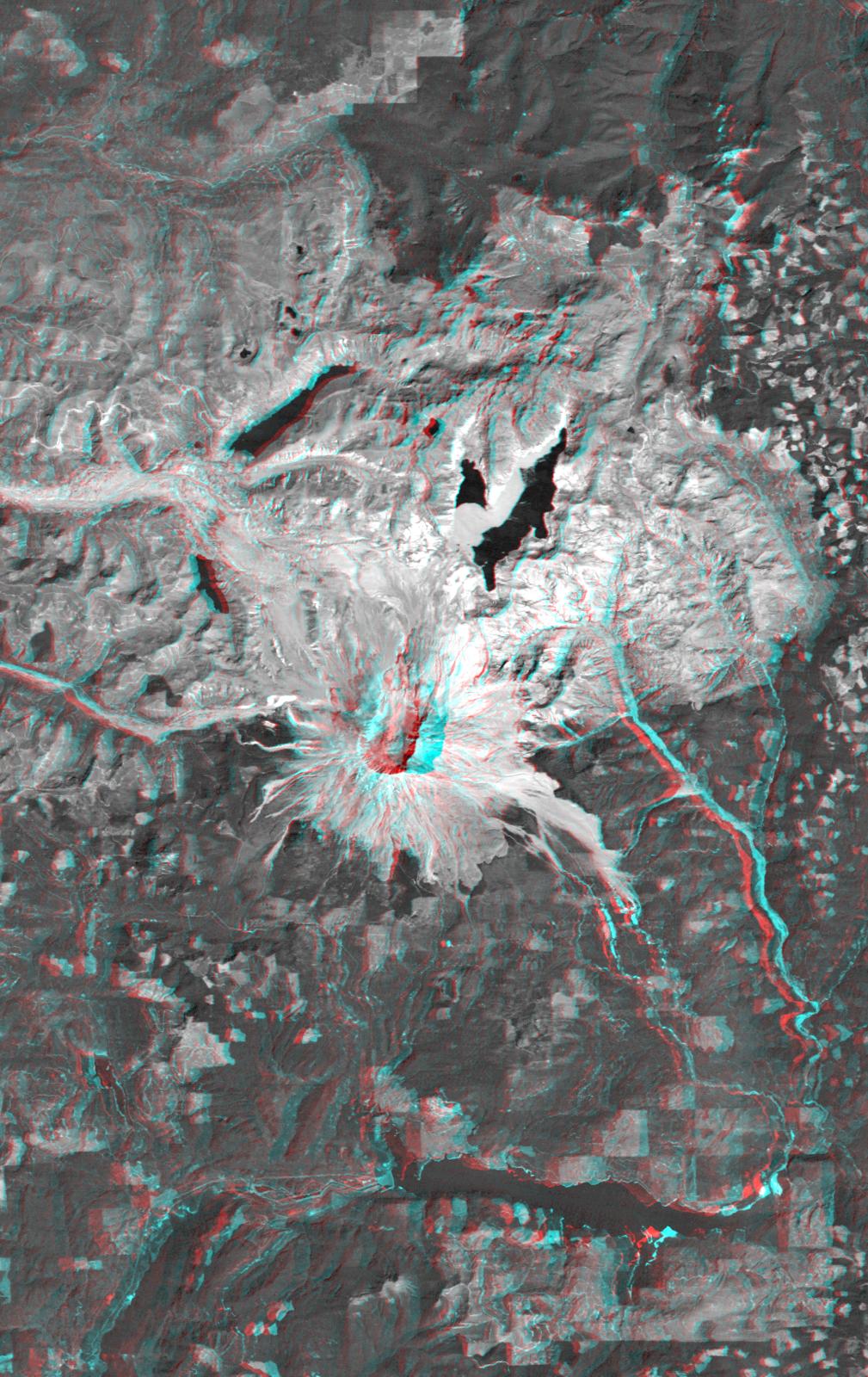
2002-09-19 |
Earth
|
Landsat
Shuttle Radar Topography Mission (SRTM)
|
C-Band Interferometric Radar
Thematic Mapper
|
1009x1600x3 |
|
-
PIA03360:
-
Anaglyph, Mount St Helens, Washington State
Full Resolution:
TIFF
(4.217 MB)
JPEG
(309 kB)
|
|
|
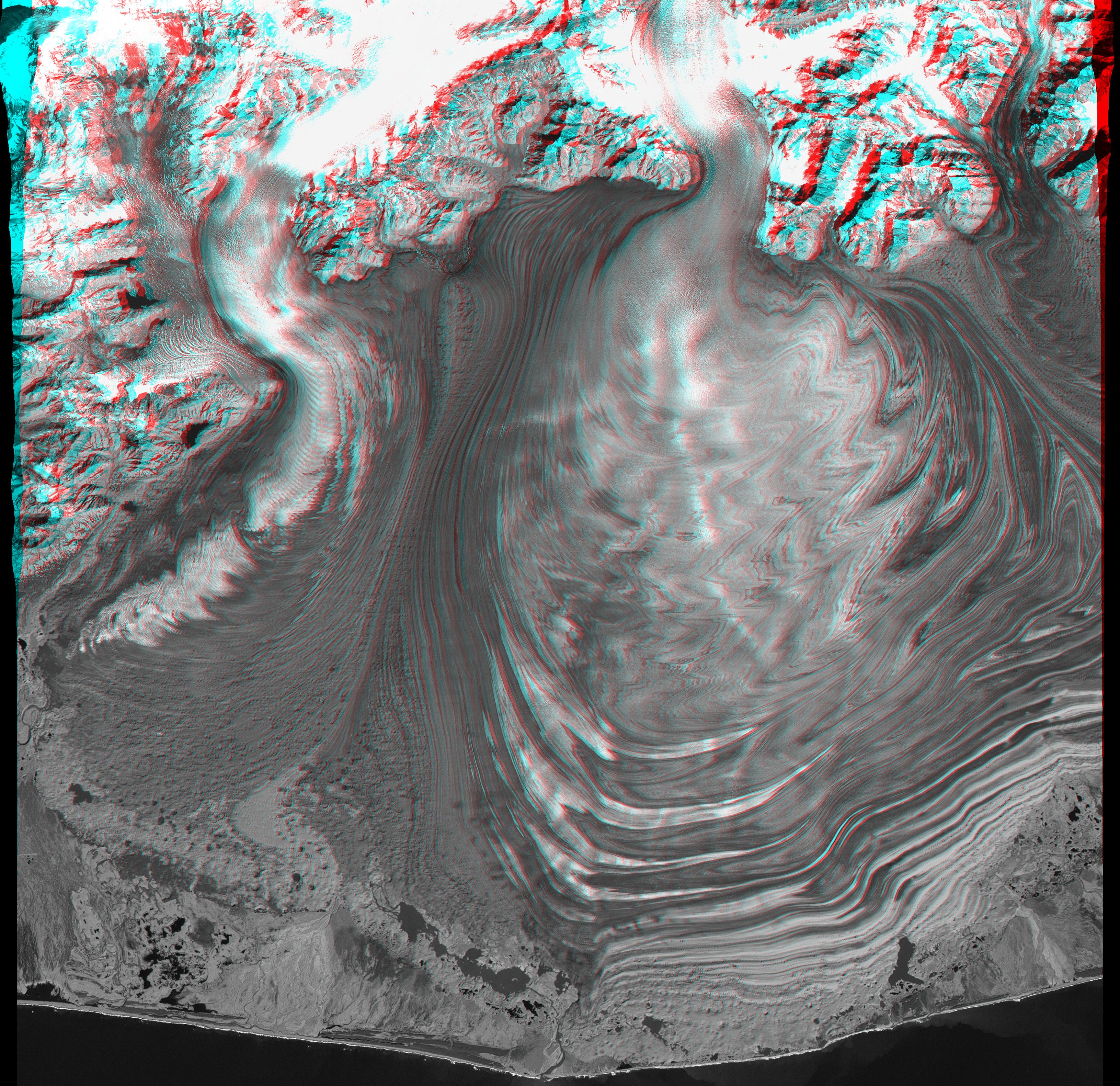
2003-05-01 |
Earth
|
Landsat
Shuttle Radar Topography Mission (SRTM)
|
C-Band Interferometric Radar
Thematic Mapper
|
3262x3162x3 |
|
-
PIA03387:
-
Malaspina Glacier, Alaska, Anaglyph with Landsat Overlay
Full Resolution:
TIFF
(26.8 MB)
JPEG
(2.079 MB)
|
|
|
2003-07-03 |
Earth
|
Landsat
Shuttle Radar Topography Mission (SRTM)
|
C-Band Interferometric Radar
|
2805x1705x3 |
|
-
PIA03392:
-
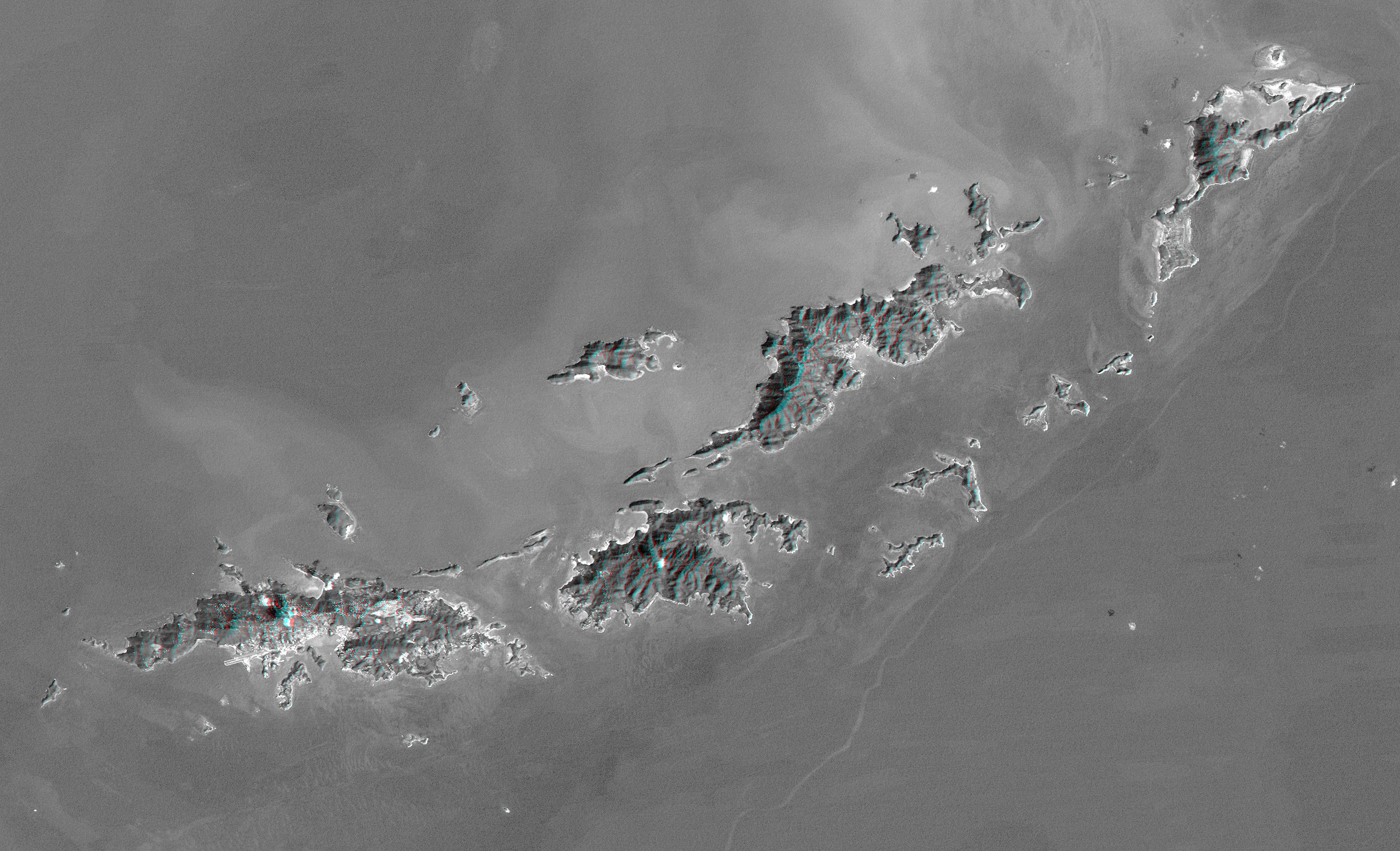
Anaglyph with Landsat Virgin Islands, Caribbean
Full Resolution:
TIFF
(7.529 MB)
JPEG
(737 kB)
|
|
|
2004-06-17 |
Earth
|
Landsat
Shuttle Radar Topography Mission (SRTM)
|
C-Band Interferometric Radar
X-Band Radar
|
4463x3000x3 |
|
-
PIA04960:
-
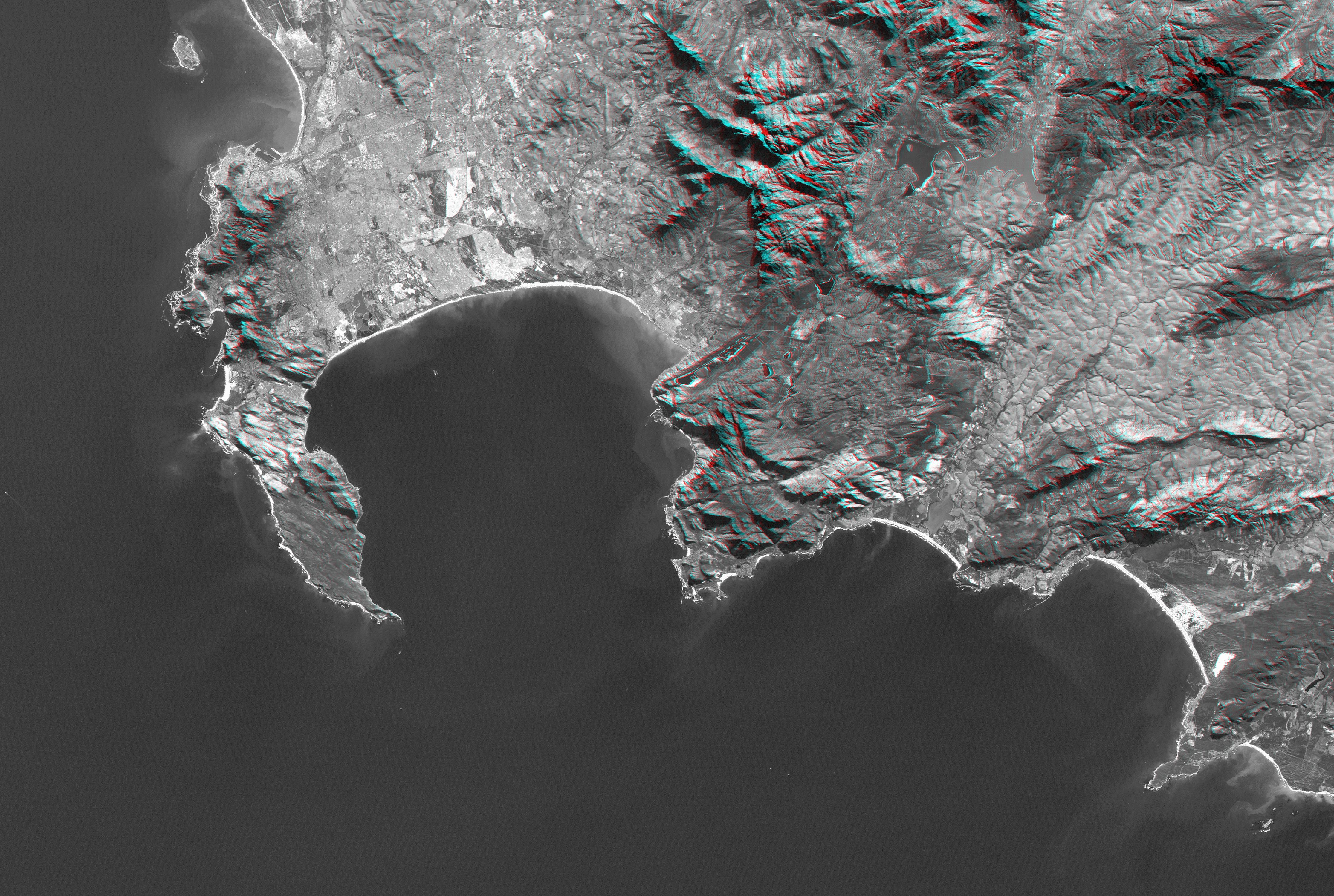
Cape Town, South Africa, Anaglyph, Landsat Image over SRTM Elevation
Full Resolution:
TIFF
(26.41 MB)
JPEG
(2.219 MB)
|
|
|
2004-06-17 |
Earth
|
Landsat
Shuttle Radar Topography Mission (SRTM)
|
C-Band Interferometric Radar
X-Band Radar
|
5657x3645x3 |
|
-
PIA04962:
-
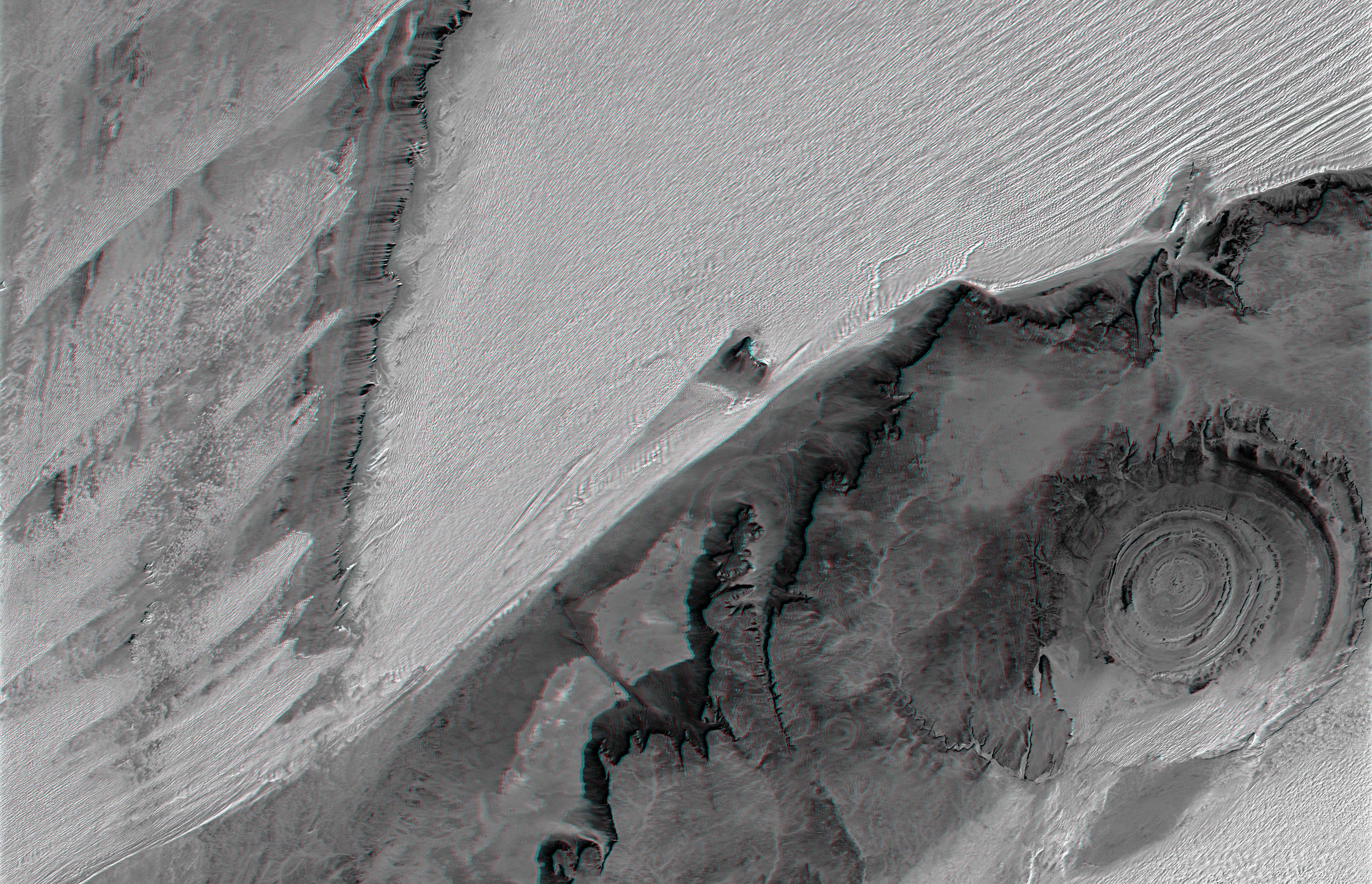
Richat Structure, Mauritania, Anaglyph, Landsat Image over SRTM Elevation
Full Resolution:
TIFF
(54.43 MB)
JPEG
(3.974 MB)
|
|
|
2004-07-03 |
Earth
|
Landsat
Shuttle Radar Topography Mission (SRTM)
|
C-Band Radar
X-Band Radar
|
5000x1700x3 |
|
-
PIA04968:
-
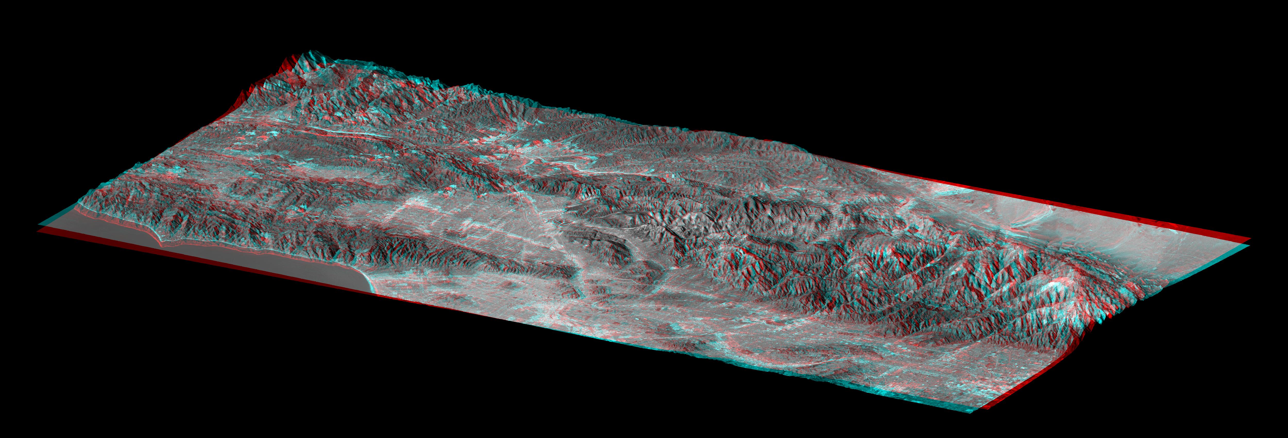
Library of Congress Model, Anaglyph
Full Resolution:
TIFF
(9.503 MB)
JPEG
(858.8 kB)
|
|
|
1998-05-21 |
Europa
|
Galileo
|
Solid-State Imaging
|
856x407x3 |
|
-
PIA01406:
-
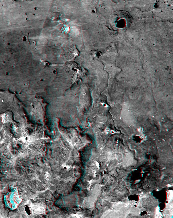
Topography within Europa's Mannann'an Crater
Full Resolution:
TIFF
(405.7 kB)
JPEG
(51.08 kB)
|
|
|
1998-12-07 |
Europa
|
Galileo
|
Solid-State Imaging
|
1152x626x3 |
|
-
PIA01654:
-
Rugged Terrain on Europa in 3-D Stereo
Full Resolution:
TIFF
(1.106 MB)
JPEG
(117.9 kB)
|
|
|
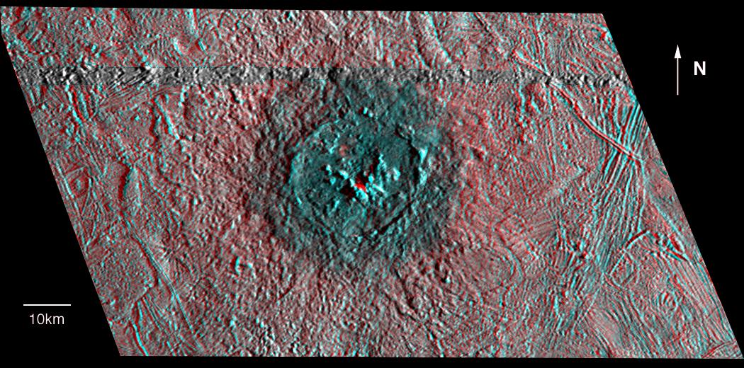
1999-01-18 |
Europa
|
Galileo
|
Solid-State Imaging
|
1050x520x3 |
|
-
PIA01665:
-
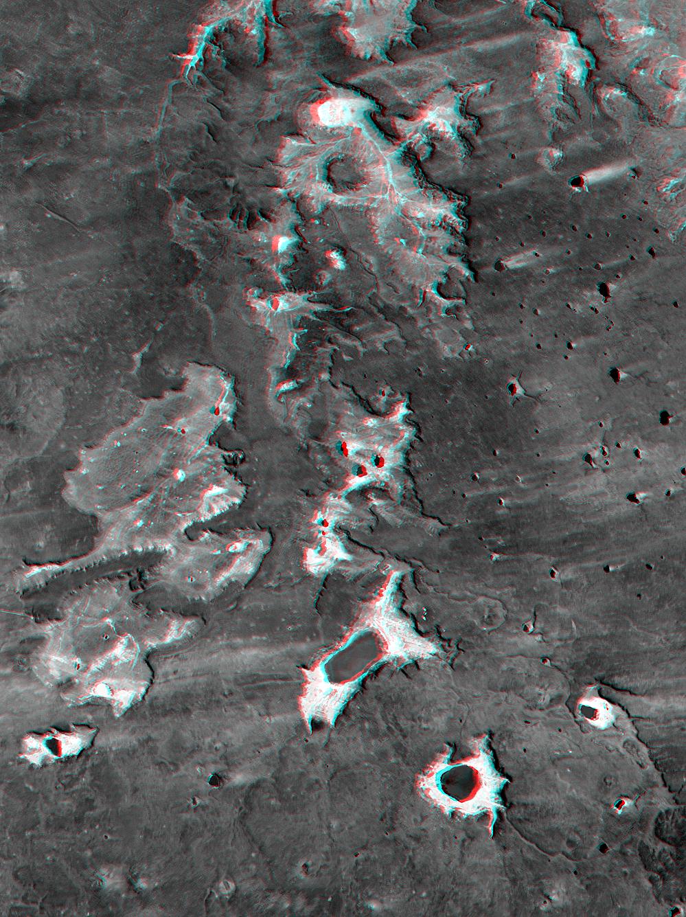
Red-Blue Three Dimensional View of Pwyll crater
Full Resolution:
TIFF
(1.248 MB)
JPEG
(152 kB)
|
|
|
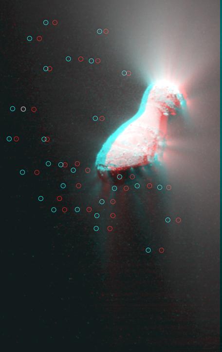
2010-11-18 |
Hartley 2
|
EPOXI
|
Medium Resolution Instrument (MRI)
|
456x722x3 |
|
-
PIA13627:
-
Hartley 2 in 3-D
Full Resolution:
TIFF
(989.1 kB)
JPEG
(25.46 kB)
|
|
|
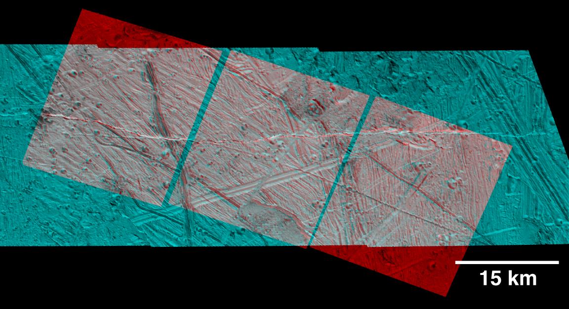
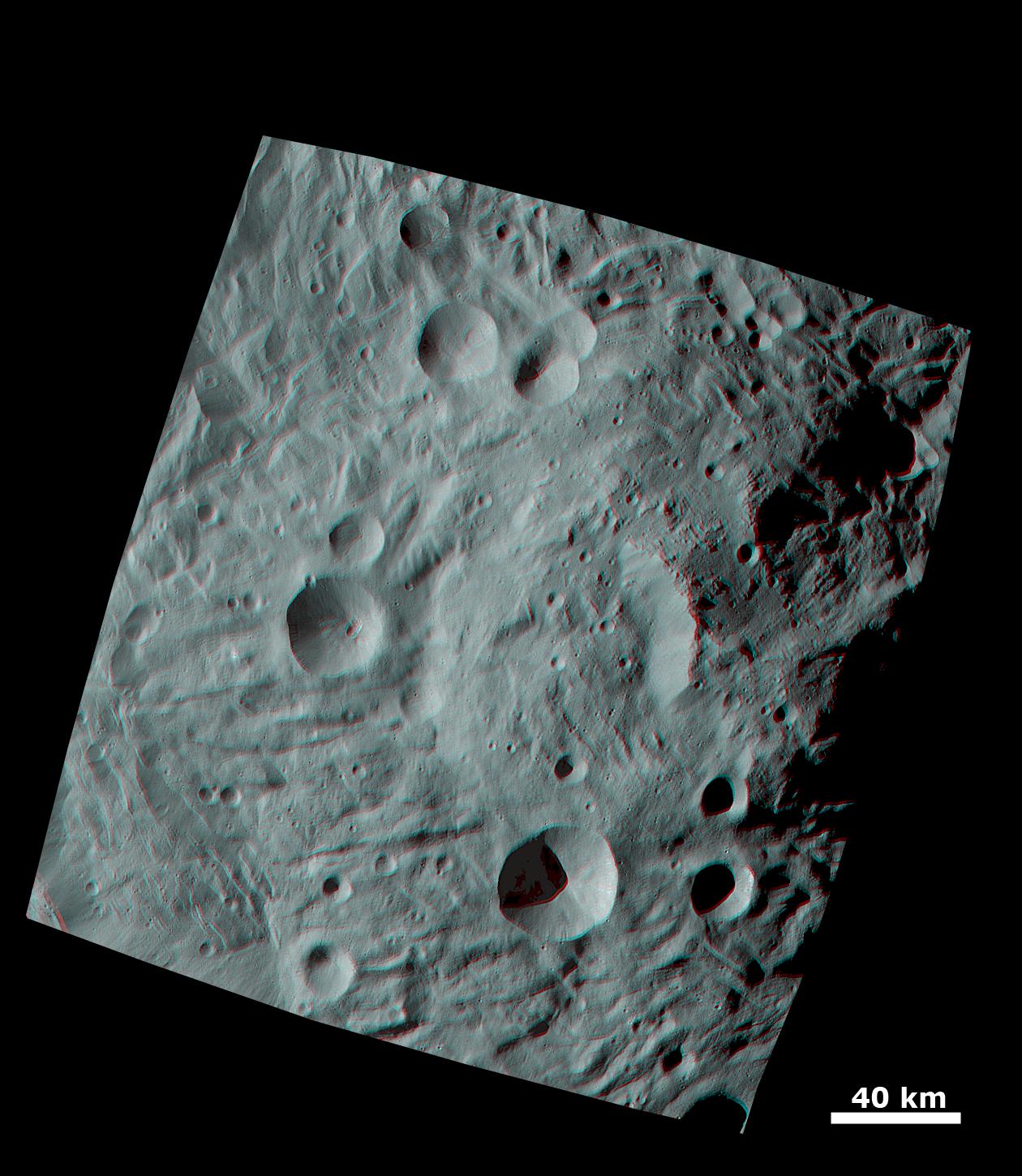
2011-10-11 |
Vesta
|
Dawn
|
Framing Camera
|
1260x1450x3 |
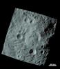
|
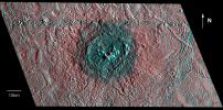
-
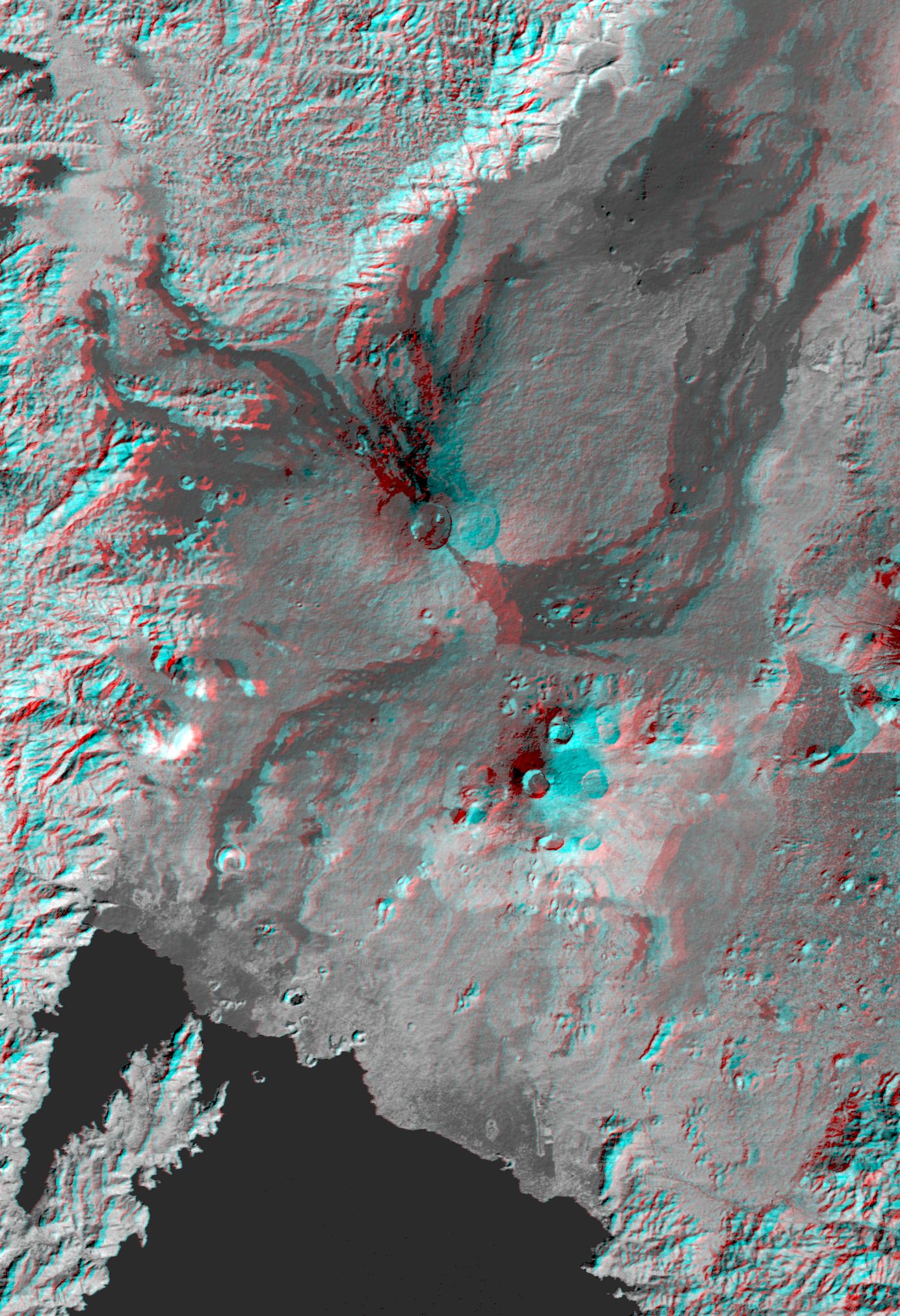
PIA14891:
-
Anaglyph Image of the Mountain-Central Complex in Vesta's South Polar Region
Full Resolution:
TIFF
(5.487 MB)
JPEG
(220.5 kB)
|
 Planetary Data System


