Click on an image for detailed information
Click on a column heading to sort in ascending or descending order

My
List |
Addition Date
|
Target
|
Mission
|
Instrument
|
Size
|

|
2011-08-06 |
Earth
|
Juno
|
JunoCam
|
640x480x1 |
|
-
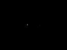
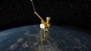
PIA18427:
-
Juno's Post-launch view of Earth and Moon
Full Resolution:
TIFF
(307.7 kB)
JPEG
(4.026 kB)
|
|
|
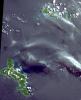
2011-08-04 |
Earth
|
Mars Reconnaissance Orbiter (MRO)
|
HiRISE
|
1578x1065x3 |

|
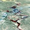
-
PIA14475:
-
Warm-Season Flows on Slope in Horowitz Crater (Eight-Image Sequence)
Full Resolution:
TIFF
(1.684 MB)
JPEG
(231.7 kB)
|
|
|
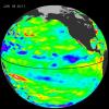
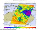
2011-08-03 |
Earth
|
Aqua
|
AIRS
|
900x695x3 |
|
-
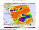
PIA14516:
-
NASA Image Captures Emily's Trek Toward Hispaniola
Full Resolution:
TIFF
(1.879 MB)
JPEG
(116.6 kB)
|
|
|
2011-08-03 |
Earth
|
Terra
|
MISR
|
952x727x3 |
|
-
PIA14489:
-
Where on Earth...? MISR Mystery Image Quiz #25: Western Cape, South Africa
Full Resolution:
TIFF
(2.079 MB)
JPEG
(146.7 kB)
|
|
|
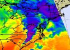
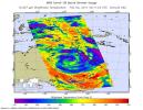
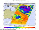
2011-08-02 |
Earth
|
Aqua
|
AIRS
|
1000x1000x3 |
|
-
PIA14515:
-
NASA Image Shows a Slightly Stronger Emily
Full Resolution:
TIFF
(3.004 MB)
JPEG
(135.7 kB)
|
|
|
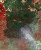
2011-08-02 |
Earth
|
Terra
|
ASTER
|
1237x1841x3 |
|
-
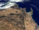
PIA14514:
-
Principality of Liechtenstein
Full Resolution:
TIFF
(6.84 MB)
JPEG
(505.6 kB)
|
|
|
2011-07-29 |
Earth
|
Aqua
|
AIRS
|
927x1000x3 |
|
-
PIA14499:
-
NASA Satellite Tracks Texas-Bound Tropical Storm Don
Full Resolution:
TIFF
(2.785 MB)
JPEG
(105.6 kB)
|
|
|
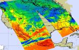
2011-07-28 |
Earth
|
Aqua
|
AIRS
|
1200x900x3 |
|
-
PIA14488:
-
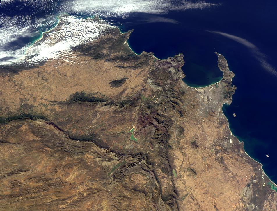
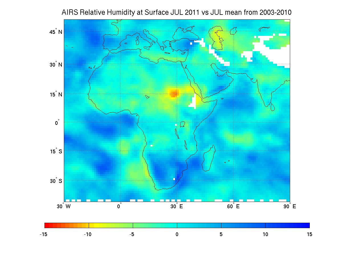
NASA Satellite Tracks Severity of African Drought
Full Resolution:
TIFF
(3.244 MB)
JPEG
(119.7 kB)
|
|
|
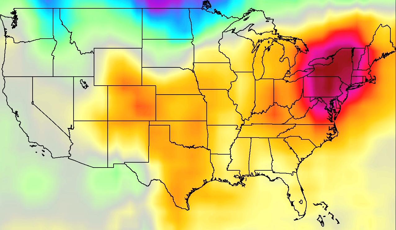
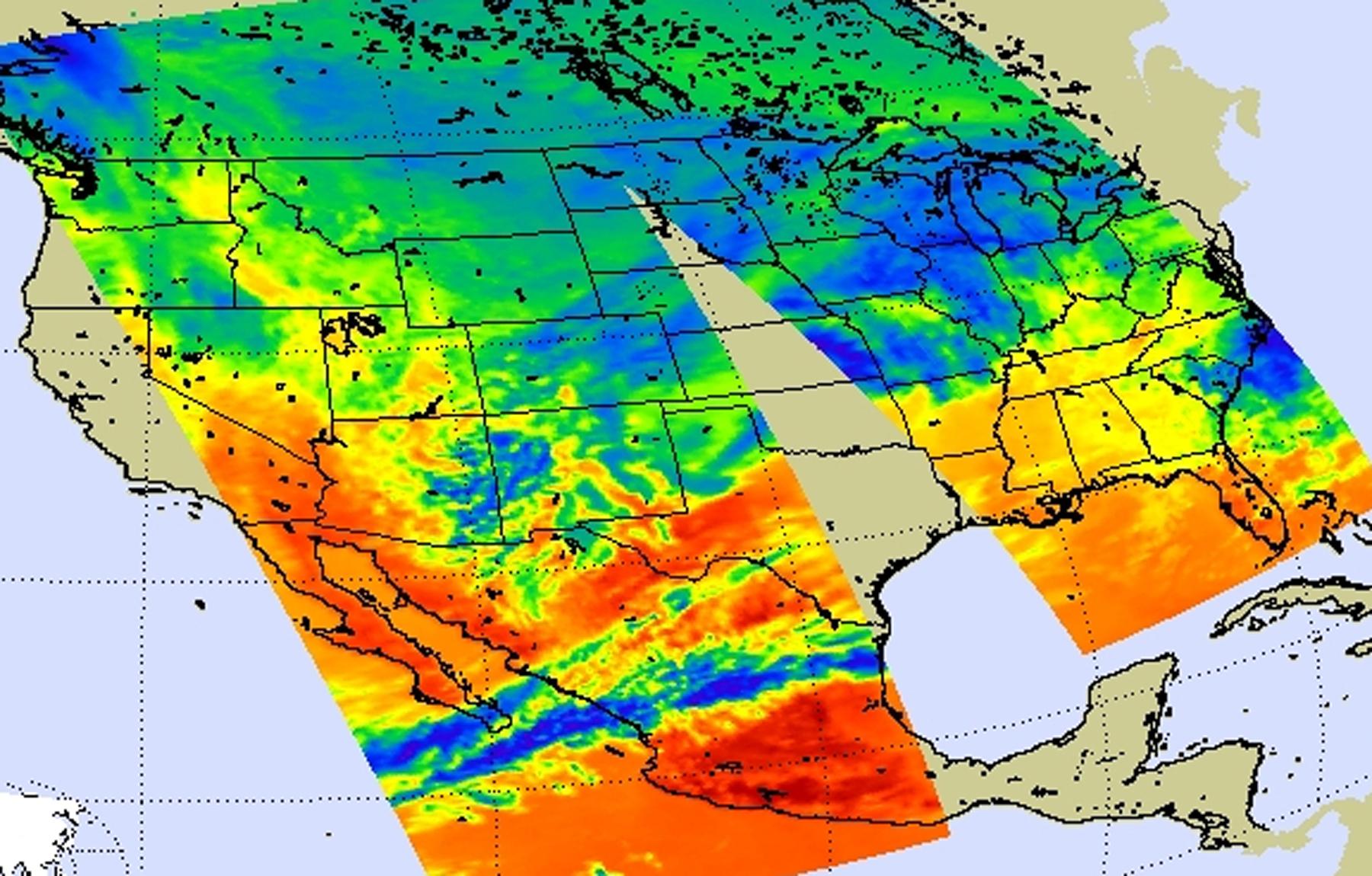
2011-07-26 |
Earth
|
Aqua
|
AIRS
|
1276x744x3 |
|
-
PIA14480:
-
NASA AIRS Movies Show Evolution of U.S. 2011 Heat Wave

Full Resolution:
TIFF
(2.851 MB)
JPEG
(114.3 kB)
|
|
|
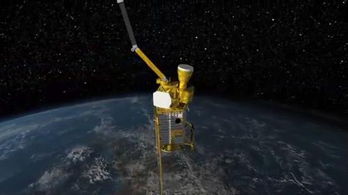
2011-07-12 |
Earth
|
SMAP
|
|
500x280x3 |
|
-
PIA14392:
-
SMAP Flys over Earth (Artist Concept)
Full Resolution:
TIFF
(420.7 kB)
JPEG
(18.16 kB)
|
|
|
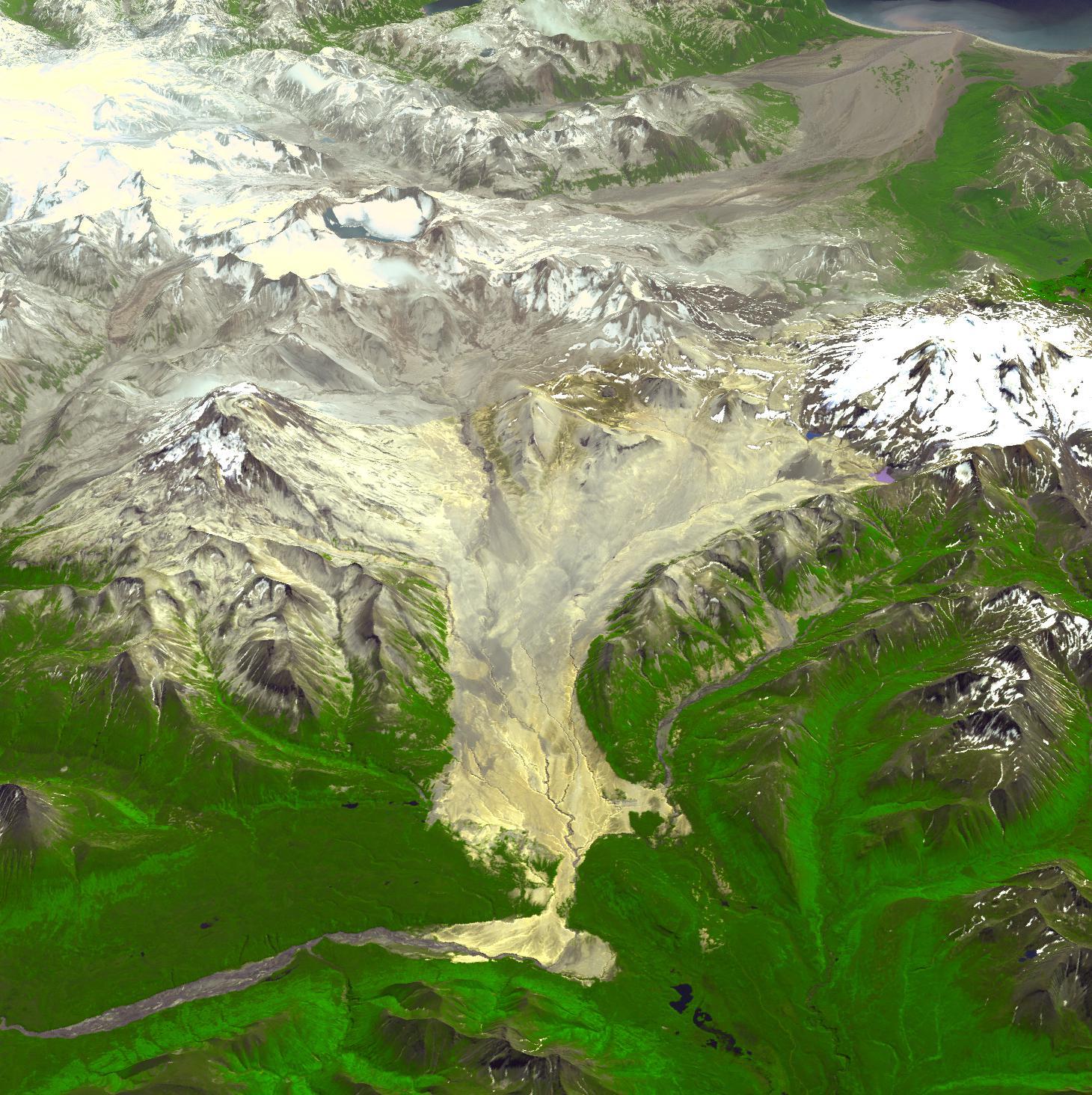
2011-07-12 |
Earth
|
Terra
|
ASTER
|
1460x1464x3 |
|
-
PIA14391:
-
Valley of Ten Thousand Smokes, Alaska
Full Resolution:
TIFF
(6.424 MB)
JPEG
(428 kB)
|
|
|
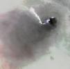
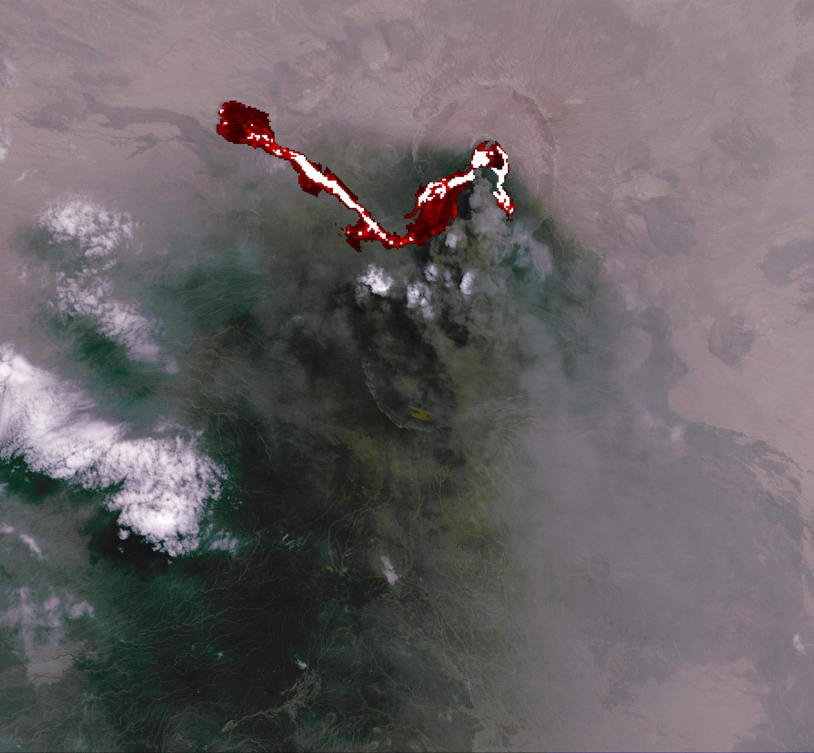
2011-07-07 |
Earth
|
Terra
|
ASTER
|
2682x2481x3 |
|
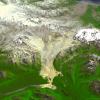
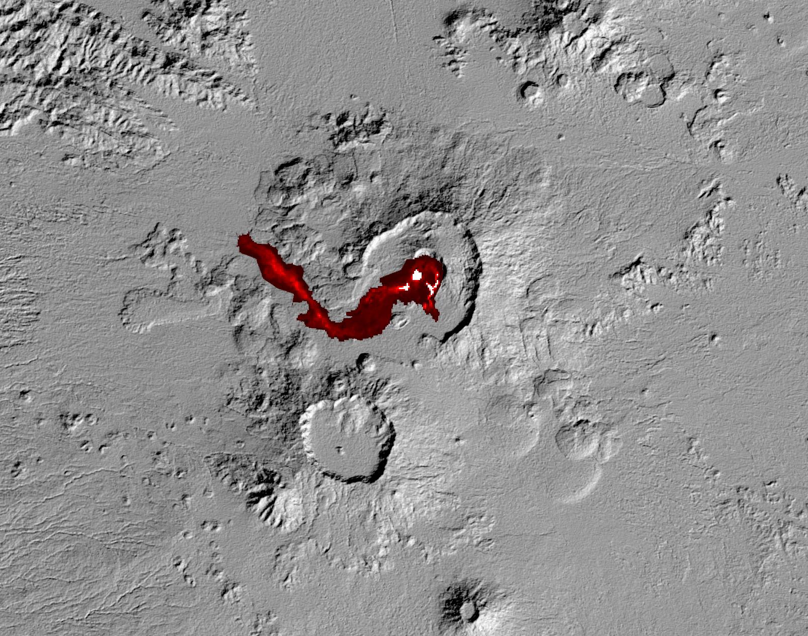
-
PIA14390:
-
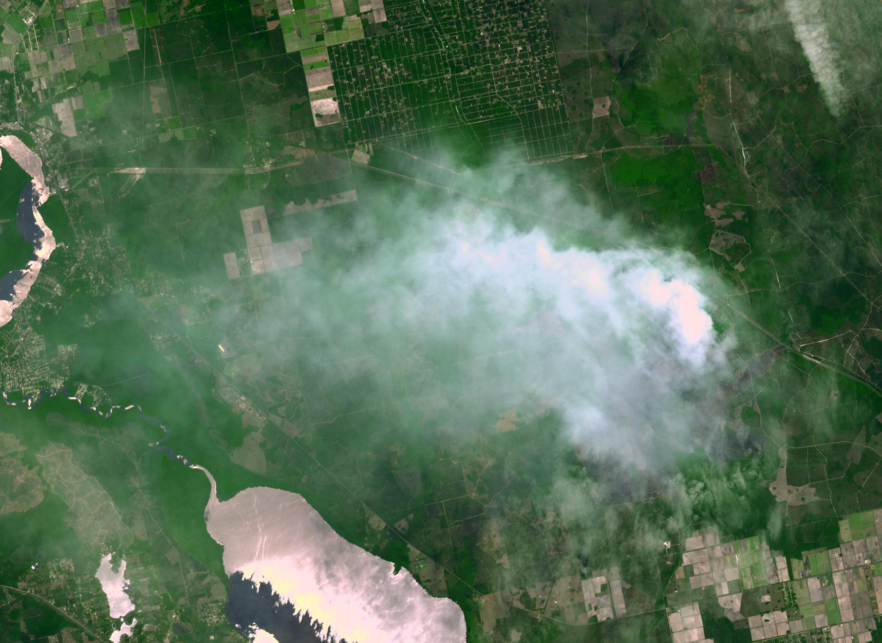
Africa's Nabro Volcano Spews a Fiery Brew in NASA Spacecraft Image
Full Resolution:
TIFF
(19.98 MB)
JPEG
(511.6 kB)
|
|
|
2011-07-06 |
Earth
|
|
|
361x252x3 |
|
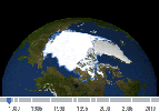
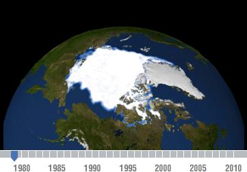
-
PIA14385:
-
Declining Arctic Sea Ice: 1979-2010
Full Resolution:
TIFF
(92.85 kB)
JPEG
(13.15 kB)
|
|
|
2011-07-06 |
Earth
|
OSTM/Jason-2
|
Altimeter
|
900x900x3 |
|
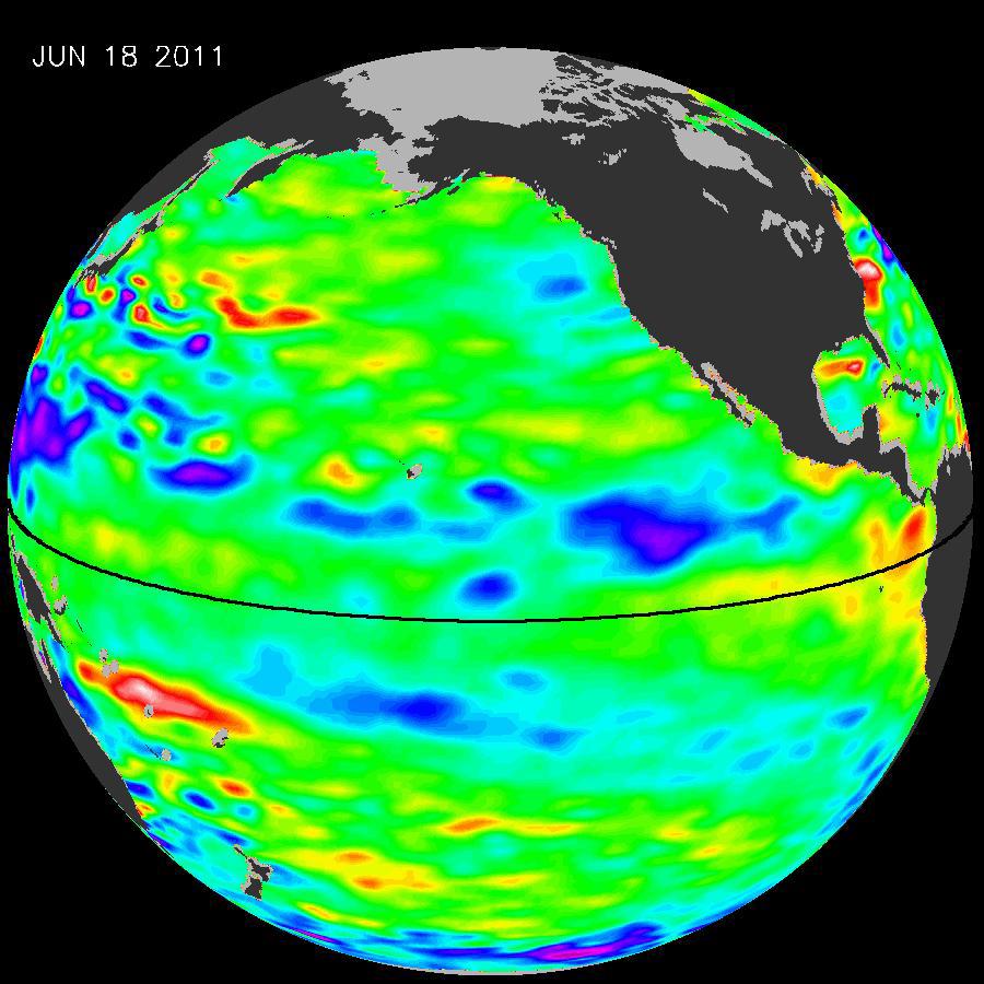
-
PIA14383:
-
La Ni�a's Exit Leaves Climate Forecasts in Limbo
Full Resolution:
TIFF
(2.433 MB)
JPEG
(104.9 kB)
|
|
|
2011-07-06 |
Earth
|
Terra
|
ASTER
|
1606x1263x3 |

|
-
PIA14382:
-
NASA Spacecraft Capture's Nabro Volcano's Continuing Eruption
Full Resolution:
TIFF
(6.095 MB)
JPEG
(409.8 kB)
|
|
|
2011-06-28 |
Earth
|
Terra
|
ASTER
|
3624x4475x3 |
|
-
PIA14289:
-
Republic of Seychelles
Full Resolution:
TIFF
(48.65 MB)
JPEG
(2.095 MB)
|
|
|
2011-06-22 |
Earth
|
Terra
|
ASTER
|
3450x4200x3 |
|
-
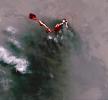
PIA14285:
-
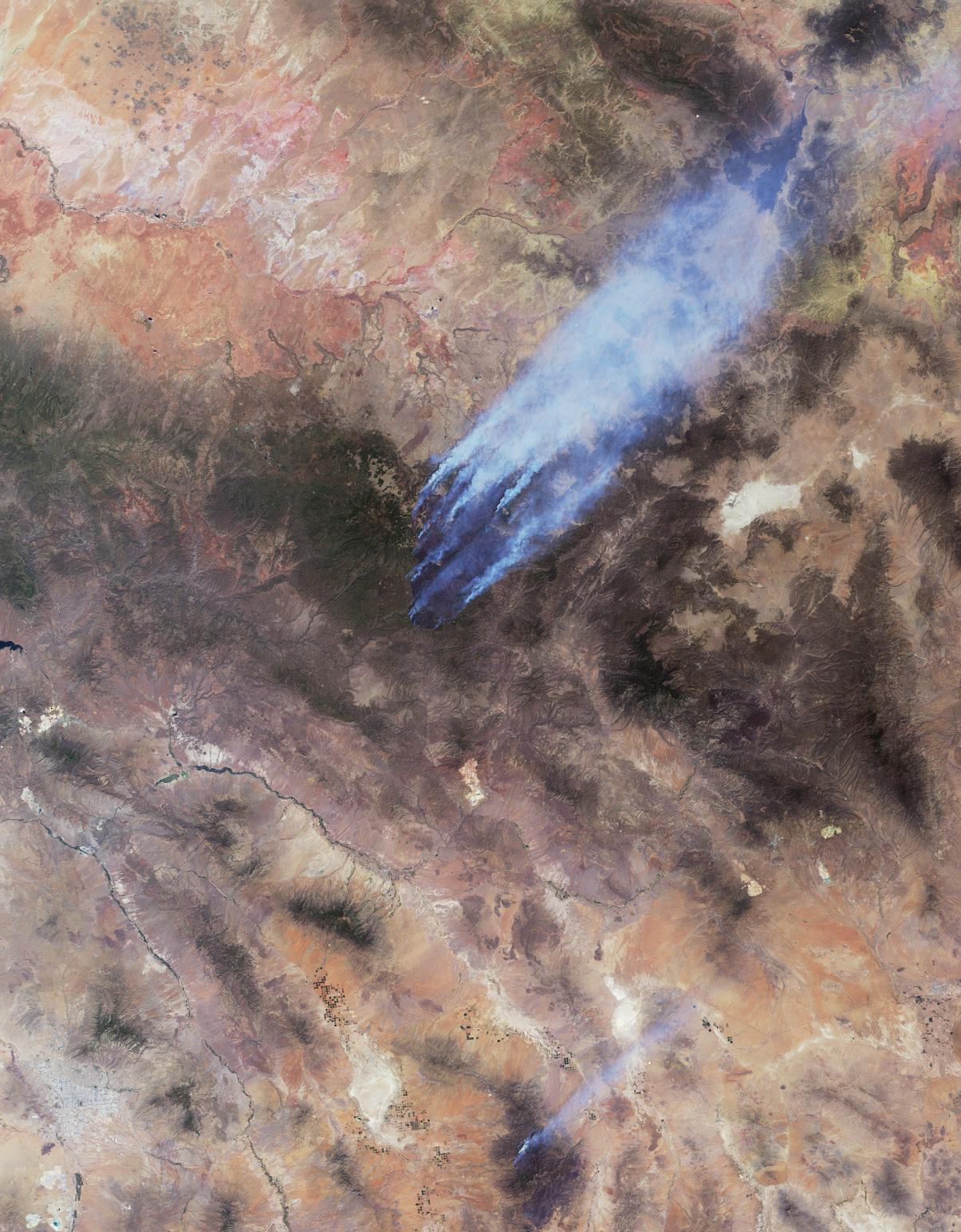
NASA Spacecraft Monitors Continuing Burn of Arizona's Largest-Ever Wildfire
Full Resolution:
TIFF
(43.47 MB)
JPEG
(2.663 MB)
|
|
|
2011-06-20 |
Earth
|
Terra
|
ASTER
|
416x413x3 |
|
-
PIA14280:
-
NASA Spacecraft Captures First Recorded Eruption of Volcano in Africa's Horn
Full Resolution:
TIFF
(516.2 kB)
JPEG
(13.51 kB)
|
|
|
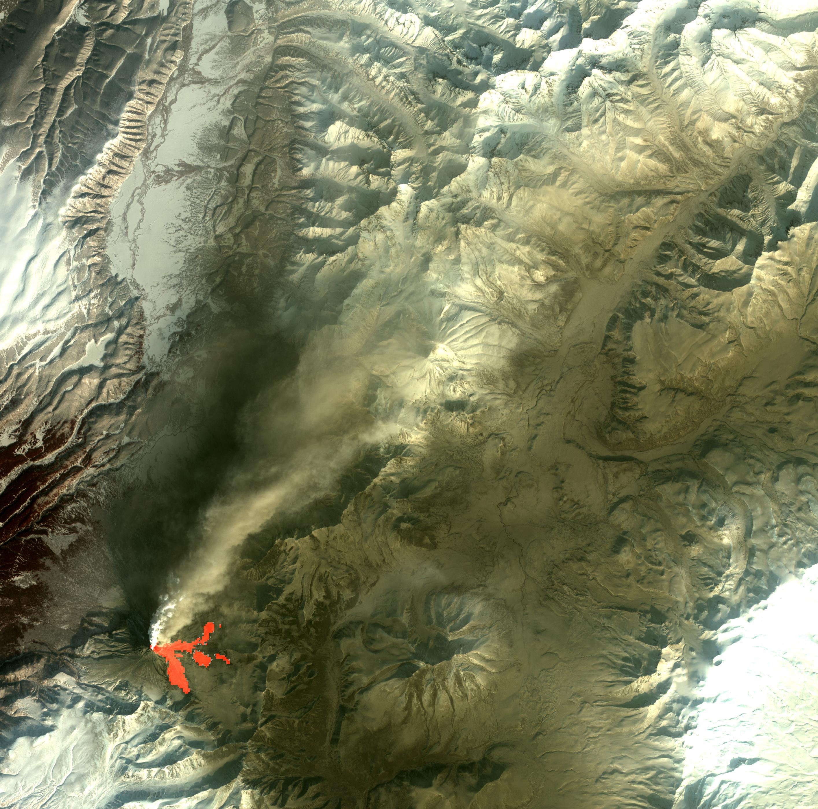
2011-06-17 |
Earth
|
Earth Observing-1 (EO-1)
|
Advanced Land Imager (ALI)
Hyperion Hyperspectral Imager
|
1800x1528x3 |
|
-
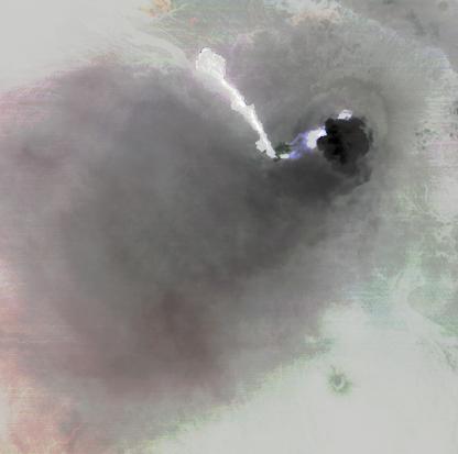
PIA14278:
-
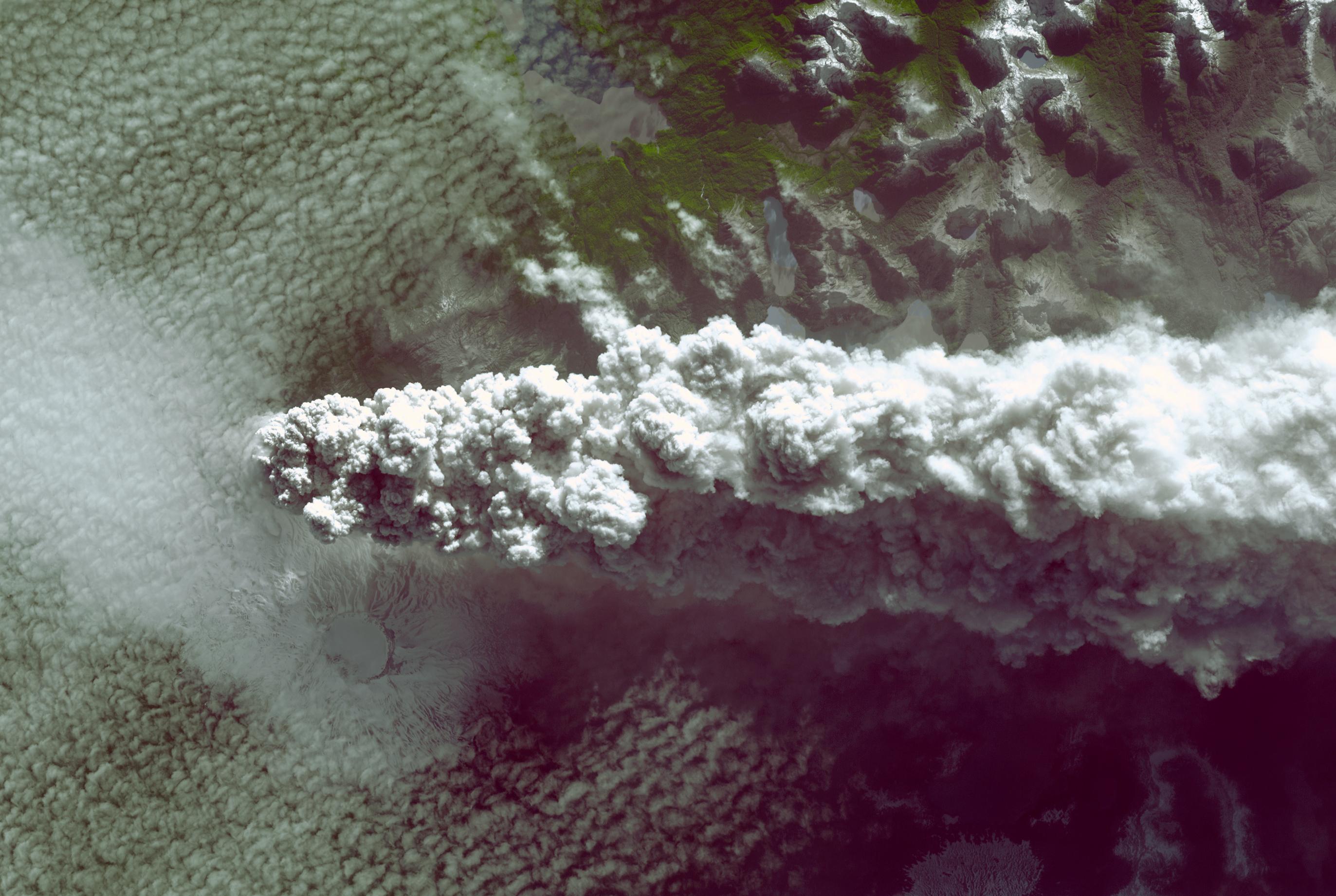
NASA's EO-1 Spacecraft Images Chile's Volcanic Eruption
Full Resolution:
TIFF
(8.264 MB)
JPEG
(456 kB)
|
|
|
2011-06-16 |
Earth
|
Terra
|
ASTER
|
1811x1321x3 |

|
-
PIA14277:
-
NASA Spacecraft Spots Florida Wildfire
Full Resolution:
TIFF
(7.188 MB)
JPEG
(262 kB)
|
|
|
2011-06-14 |
Earth
|
Terra
|
ASTER
|
2745x1842x3 |

|
-
PIA14272:
-
NASA Spacecraft Spots Fury of Disruptive Chilean Volcano
Full Resolution:
TIFF
(15.17 MB)
JPEG
(521 kB)
|
|
|
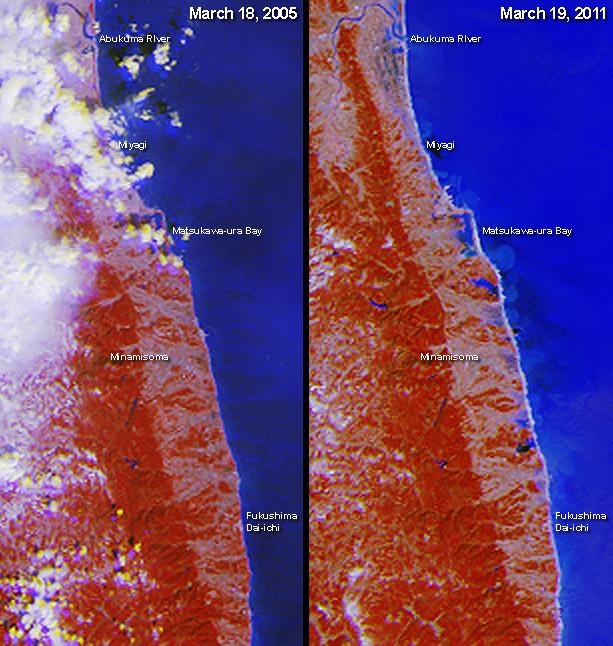
2011-06-14 |
Earth
|
Terra
|
ASTER
|
1984x2840x3 |
|
-
PIA14271:
-
Tohoku Tsunami Debris, Japan
Full Resolution:
TIFF
(16.93 MB)
JPEG
(640.7 kB)
|
|
|
2011-06-09 |
Earth
|
Terra
|
MISR
|
1205x1545x3 |
|
-
PIA14270:
-
Arizona Wildfires Burn Out of Control
Full Resolution:
TIFF
(5.592 MB)
JPEG
(322.2 kB)
|
|
|
2011-05-31 |
Earth
|
Terra
|
ASTER
|
753x557x3 |
|
-
PIA14174:
-
ASTER Sees Path of Destruction from Joplin, Mo. Tornado
Full Resolution:
TIFF
(1.26 MB)
JPEG
(106.6 kB)
|
|
|
2011-05-28 |
Earth
|
Aqua
|
AIRS
|
780x797x3 |
|
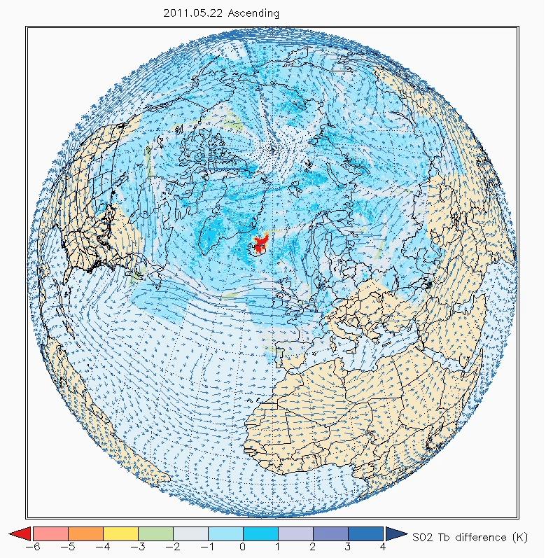
-
PIA14173:
-
NASA's AIRS Sees Sulfur Dioxide Plume from Iceland's Grímsvötn Volcano
Full Resolution:
TIFF
(1.867 MB)
JPEG
(215.3 kB)
|
|
|
2011-05-26 |
Earth
|
Terra
|
ASTER
|
2817x2325x3 |
|
-
PIA14167:
-
Singapore
Full Resolution:
TIFF
(19.65 MB)
JPEG
(1.129 MB)
|
|
|
2011-05-24 |
Earth
|
Terra
|
MISR
|
1025x1100x3 |
|
-
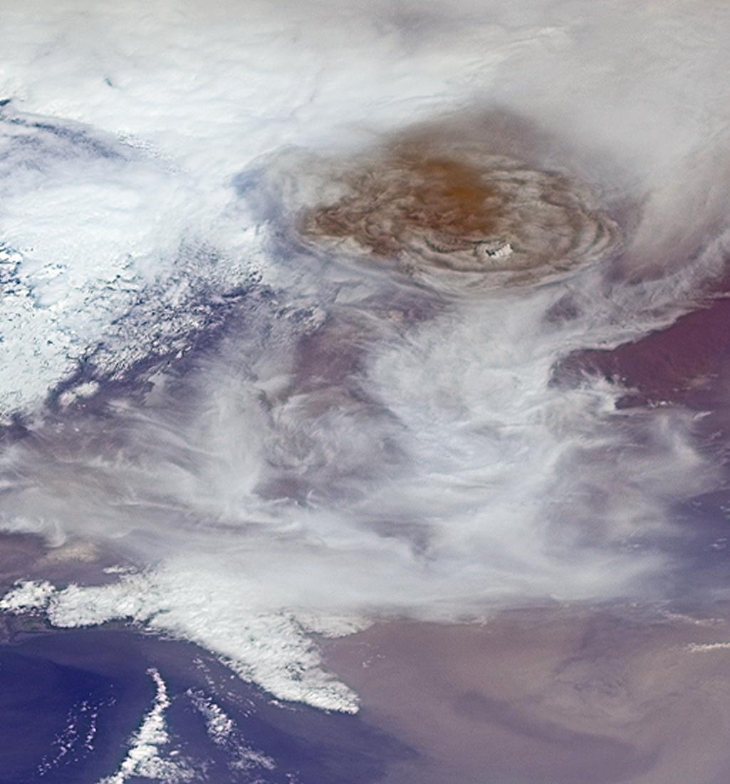
PIA14161:
-
Grímsvötn Volcano Injects Ash into the Stratosphere
Full Resolution:
TIFF
(3.387 MB)
JPEG
(115.3 kB)
|
|
|
2011-05-19 |
Earth
|
Terra
|
ASTER
|
1728x2512x3 |
|
-
PIA14155:
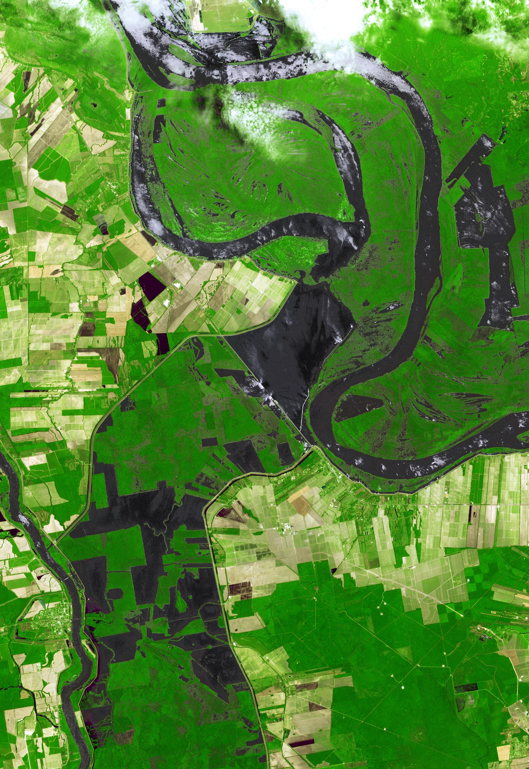
-
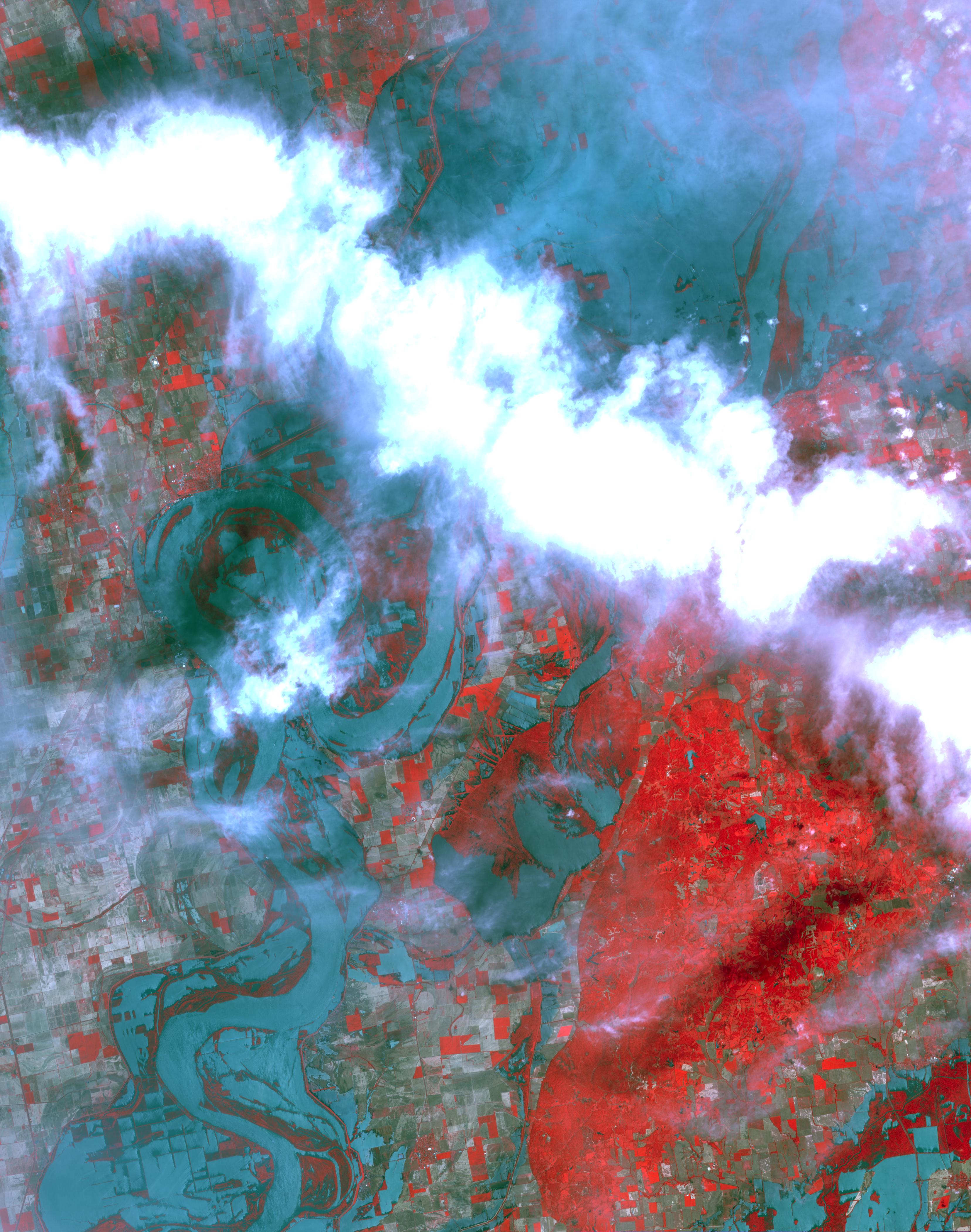
NASA Images Mississippi River Flooding in Louisiana
Full Resolution:
TIFF
(13.04 MB)
JPEG
(836.2 kB)
|
|
|
2011-05-16 |
Earth
|
Terra
|
ASTER
|
709x800x3 |
|
-
PIA14151:
-
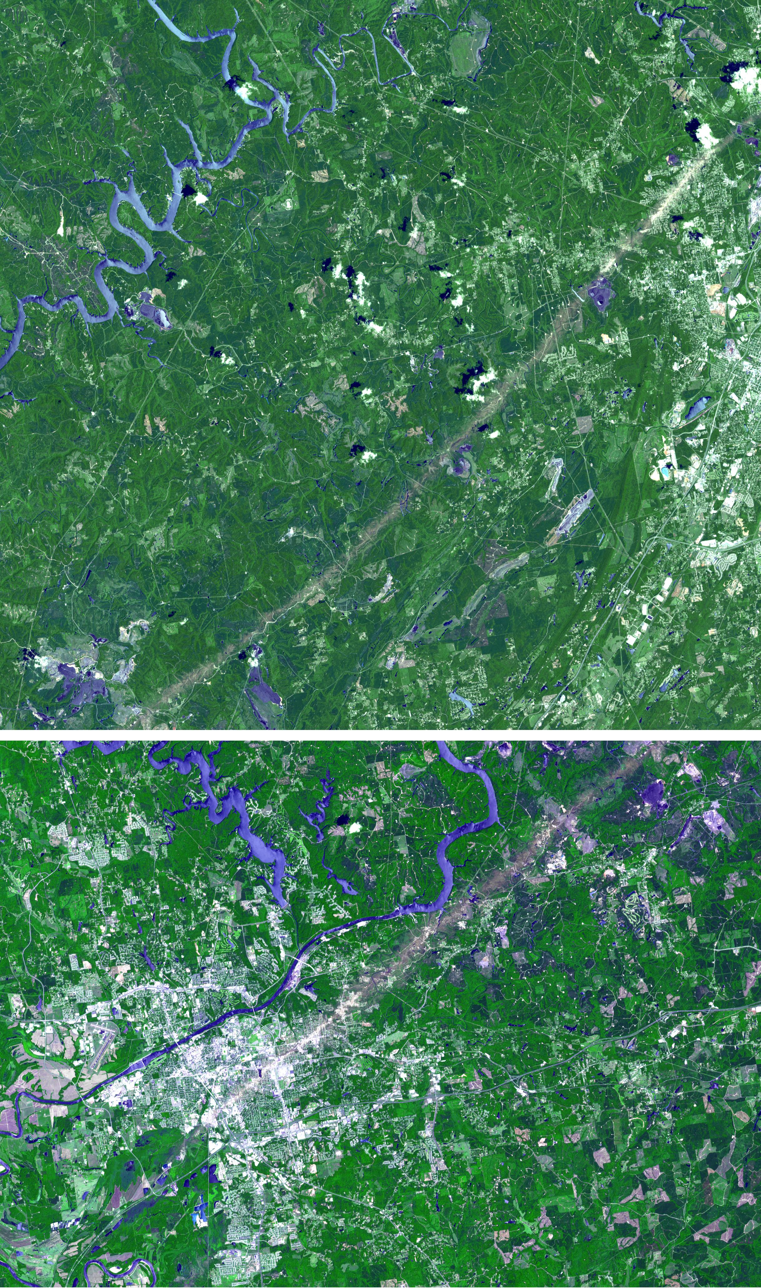
NASA Spacecraft Eyes Mississippi Flooding
Full Resolution:
TIFF
(1.704 MB)
JPEG
(149 kB)
|
|
|
2011-05-10 |
Earth
|
Terra
|
ASTER
|
3311x4200x3 |

|
-
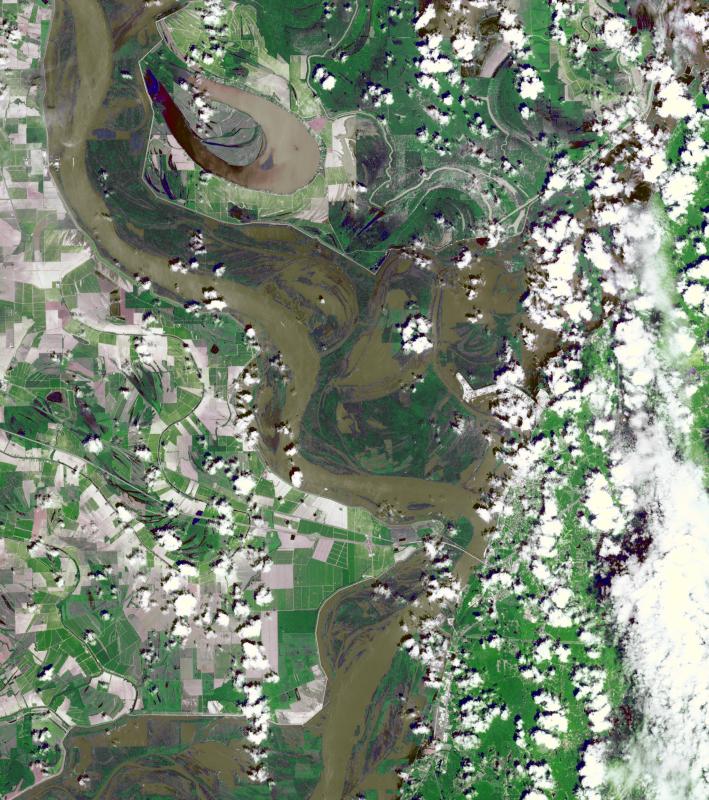
PIA14147:
-
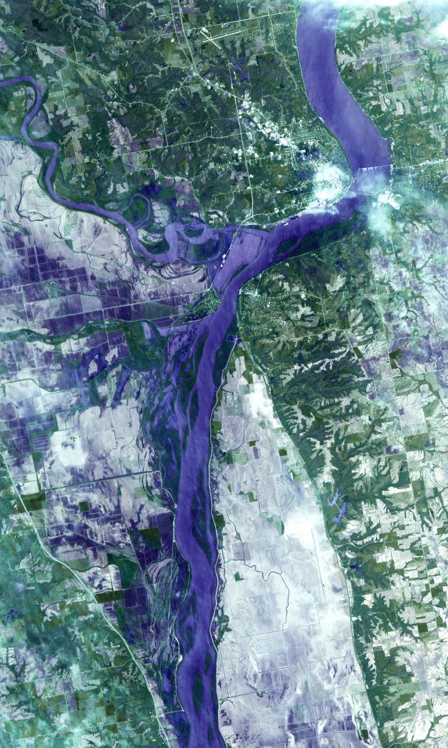
ASTER Images Flooding from Mississippi River Levee Breach
Full Resolution:
TIFF
(41.72 MB)
JPEG
(1.362 MB)
|
|
|
2011-05-10 |
Earth
|
Terra
|
ASTER
|
2037x1270x3 |
|
-
PIA14146:
-
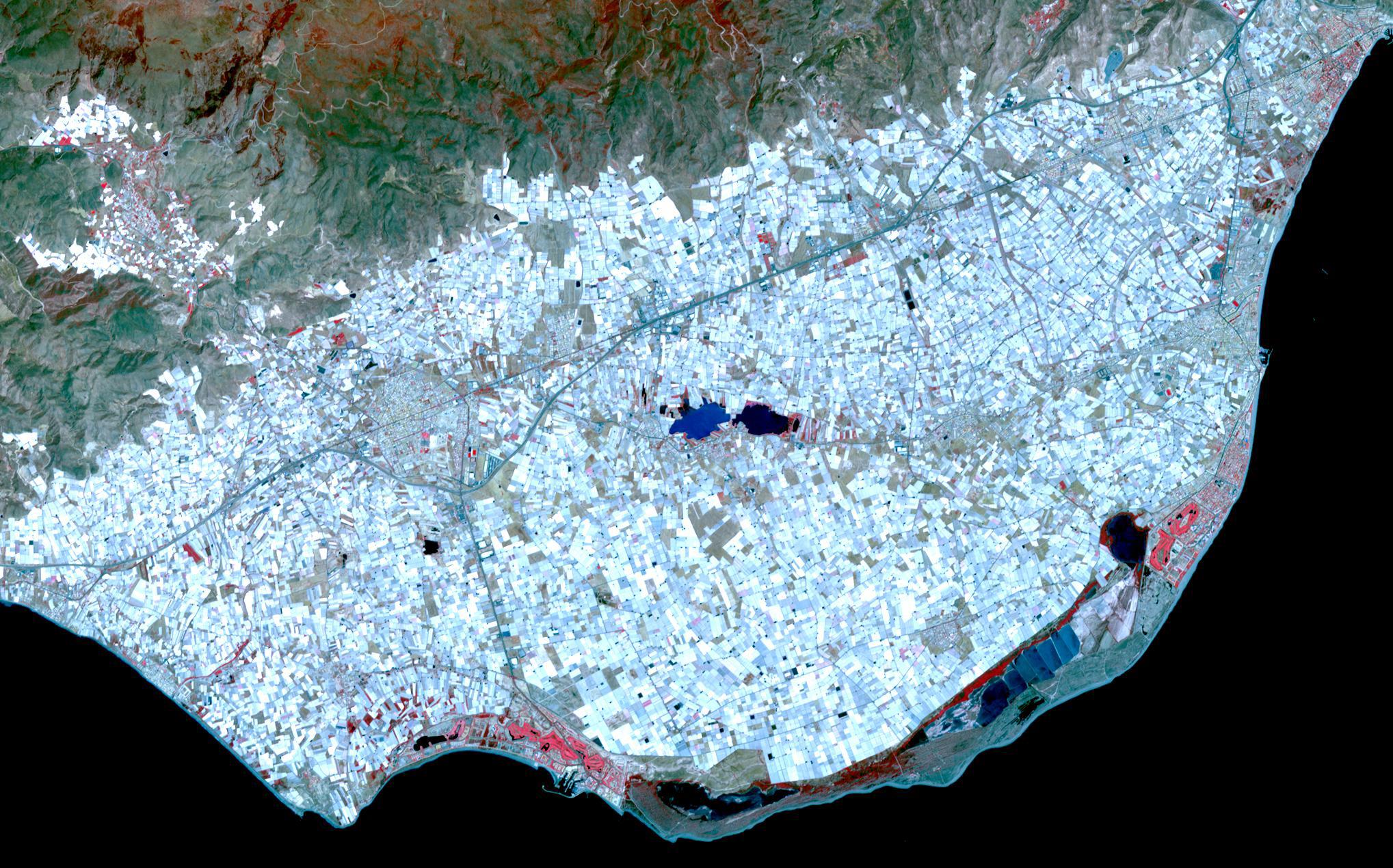
Almeria, Spain
Full Resolution:
TIFF
(7.771 MB)
JPEG
(539.6 kB)
|
|
|
2011-05-06 |
Earth
|
Terra
|
ASTER
|
2433x4120x3 |

|
-
PIA14143:
-
ASTER Images Aftermath of U.S. Tornado Outbreak
Full Resolution:
TIFF
(30.11 MB)
JPEG
(2.444 MB)
|
|
|
2011-05-04 |
Earth
|
Terra
|
ASTER
|
645x1077x3 |
|
-
PIA14137:
-
ASTER Images Midwest Flooding
Full Resolution:
TIFF
(2.086 MB)
JPEG
(182.1 kB)
|
|
|
2011-05-04 |
Earth
|
Terra
|
ASTER
|
747x1140x3 |
|
-
PIA14136:
-
ASTER Images Record Texas Wildfire
Full Resolution:
TIFF
(2.558 MB)
JPEG
(188.2 kB)
|
|
|
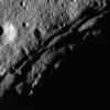
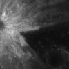
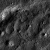
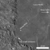
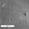
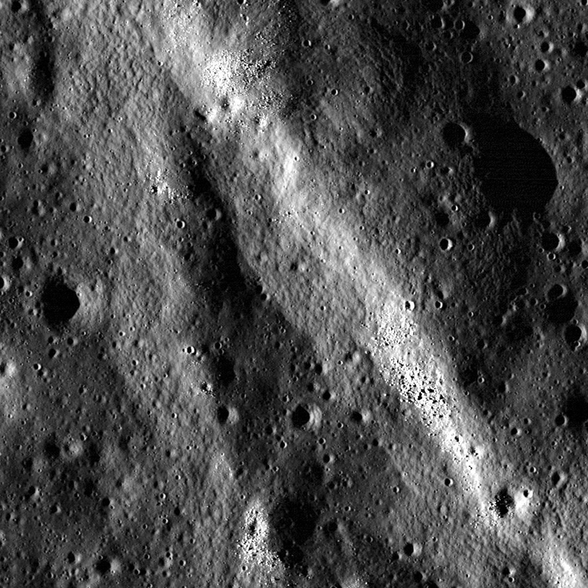
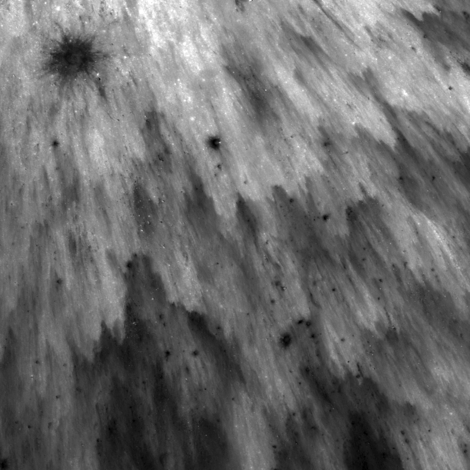
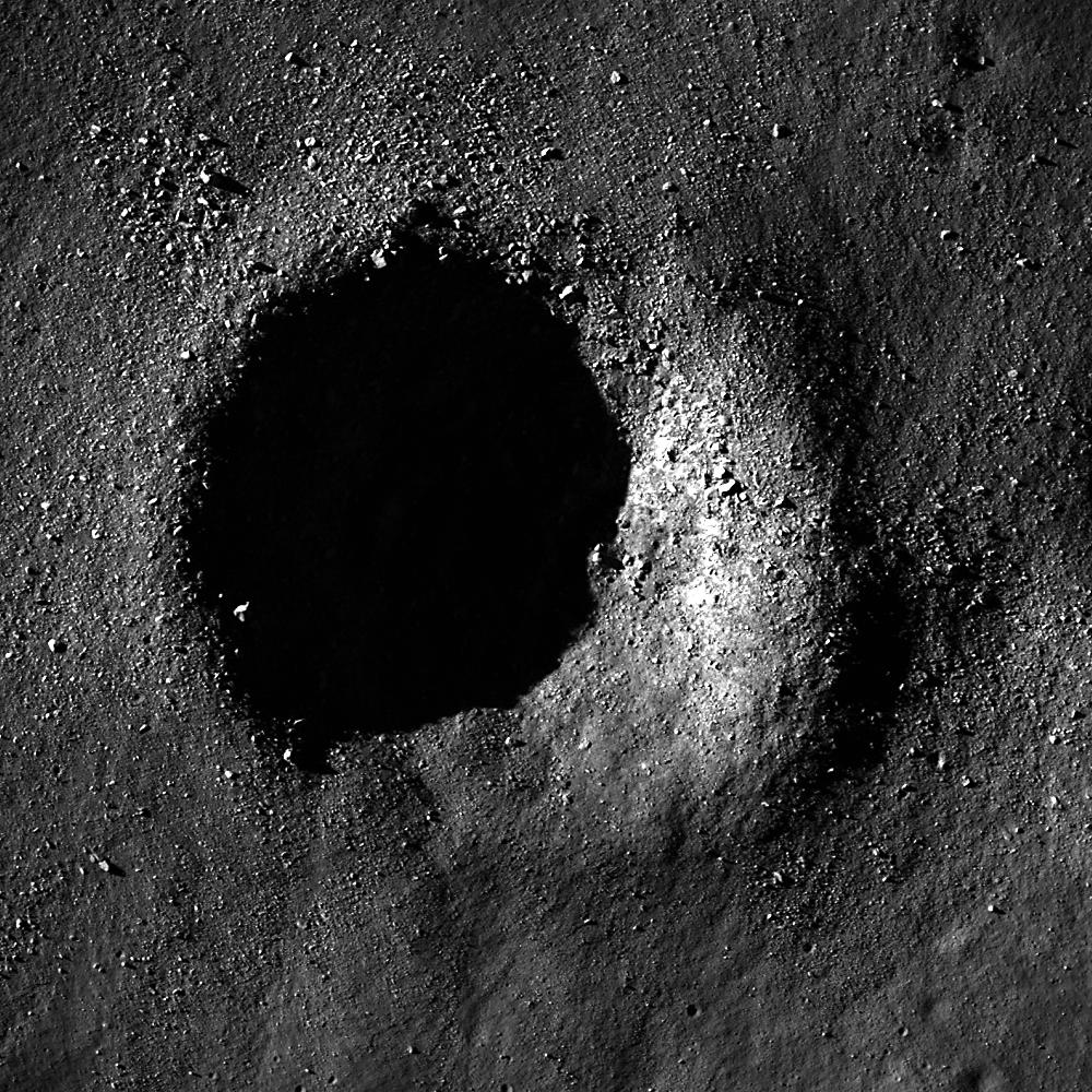
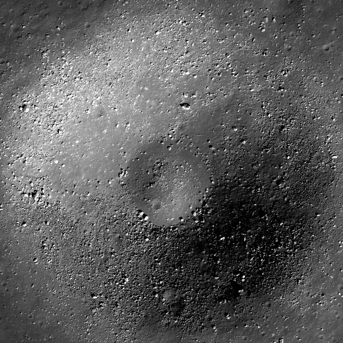
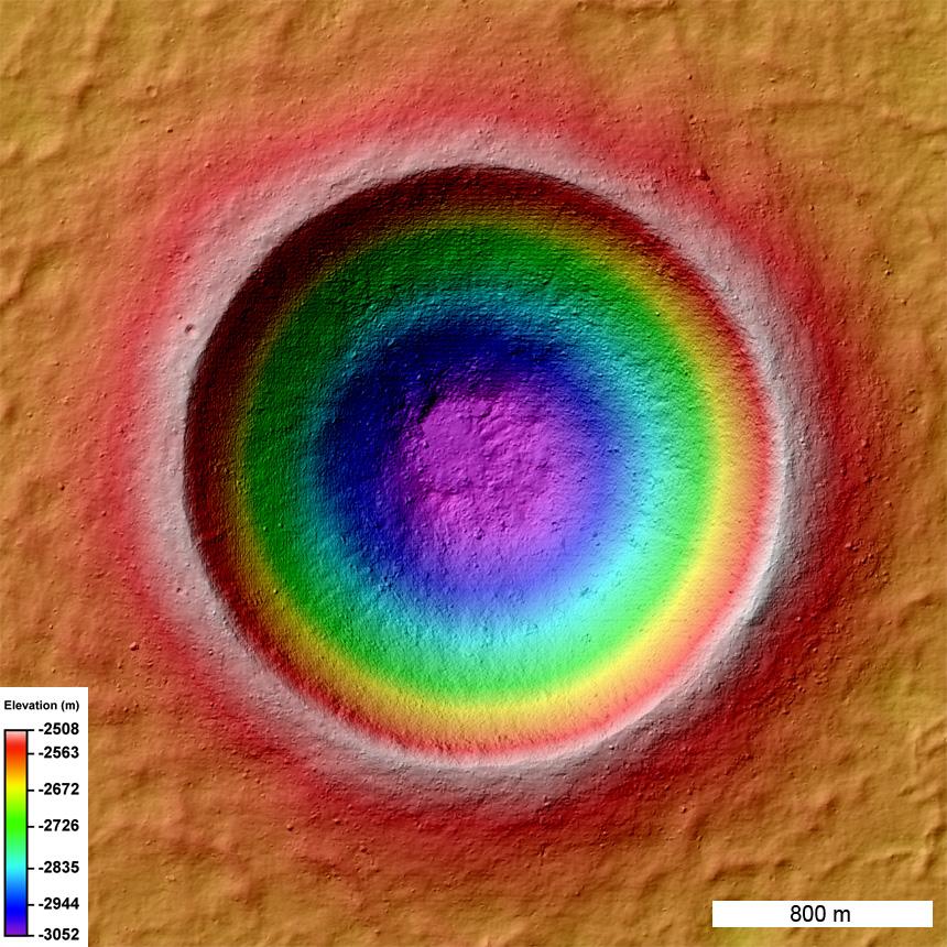
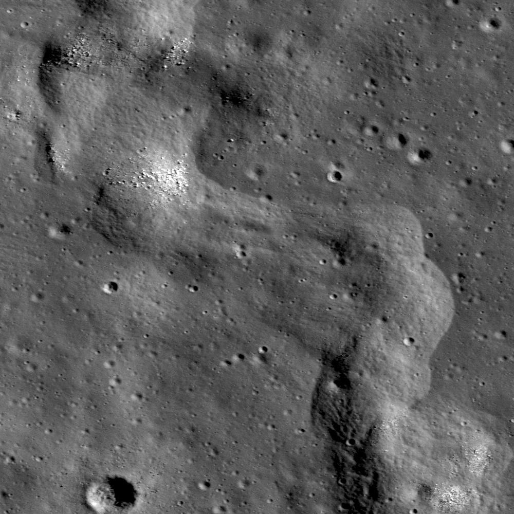
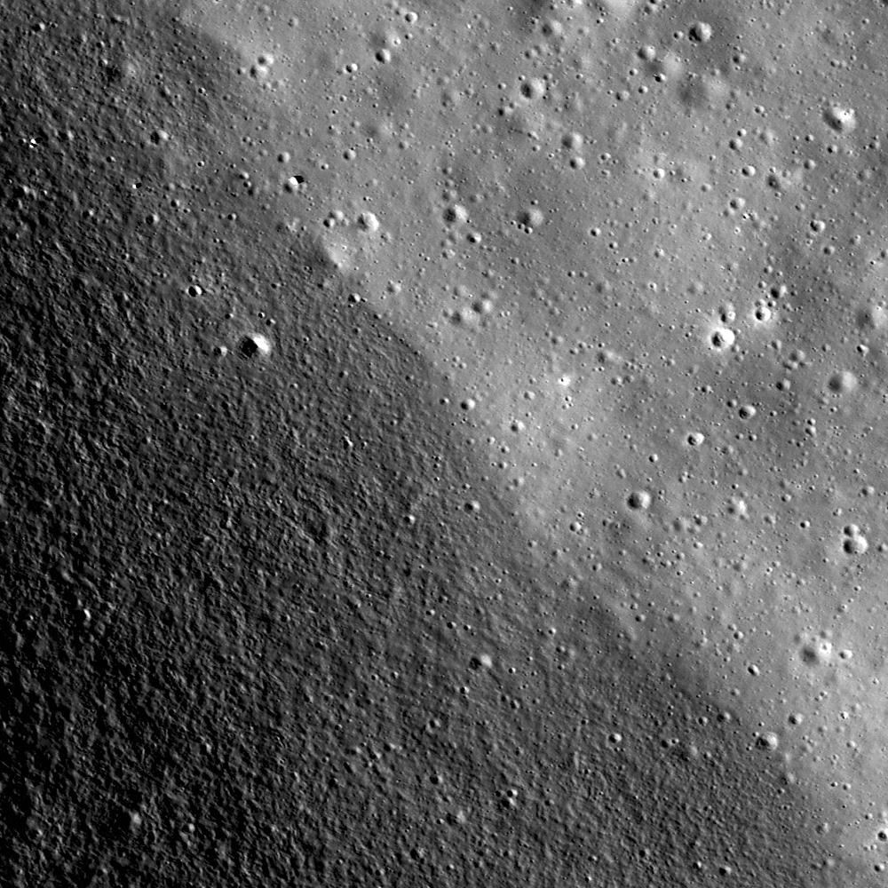
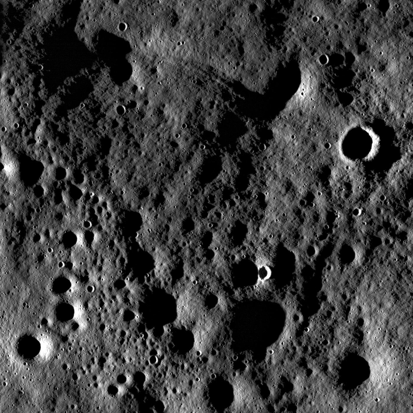
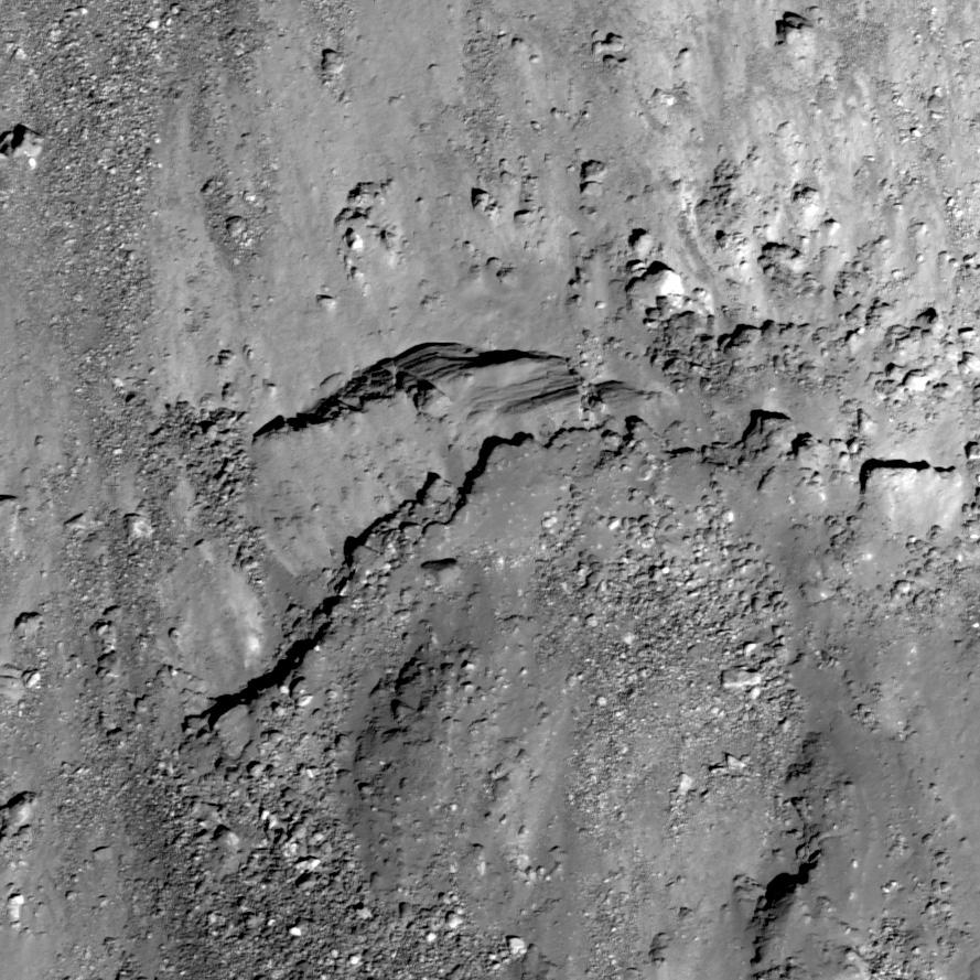
2011-04-28 |
Moon
|
Lunar Reconnaissance Orbiter (LRO)
|
Lunar Reconnaissance Orbiter Camera (NAC)
|
1200x1200x1 |
|
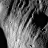
-
PIA14429:
-
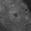
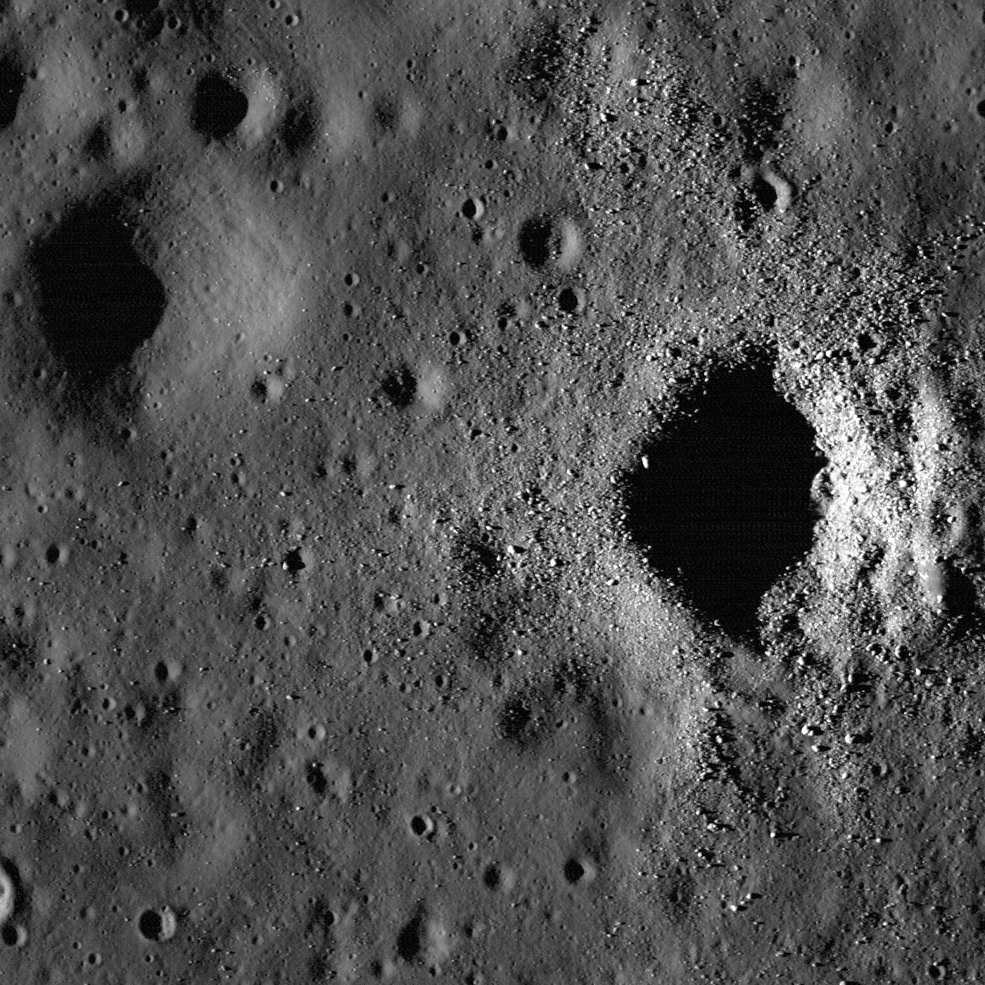
Slumping rim of Darwin C
Full Resolution:
TIFF
(1.442 MB)
JPEG
(173.3 kB)
|
|
|
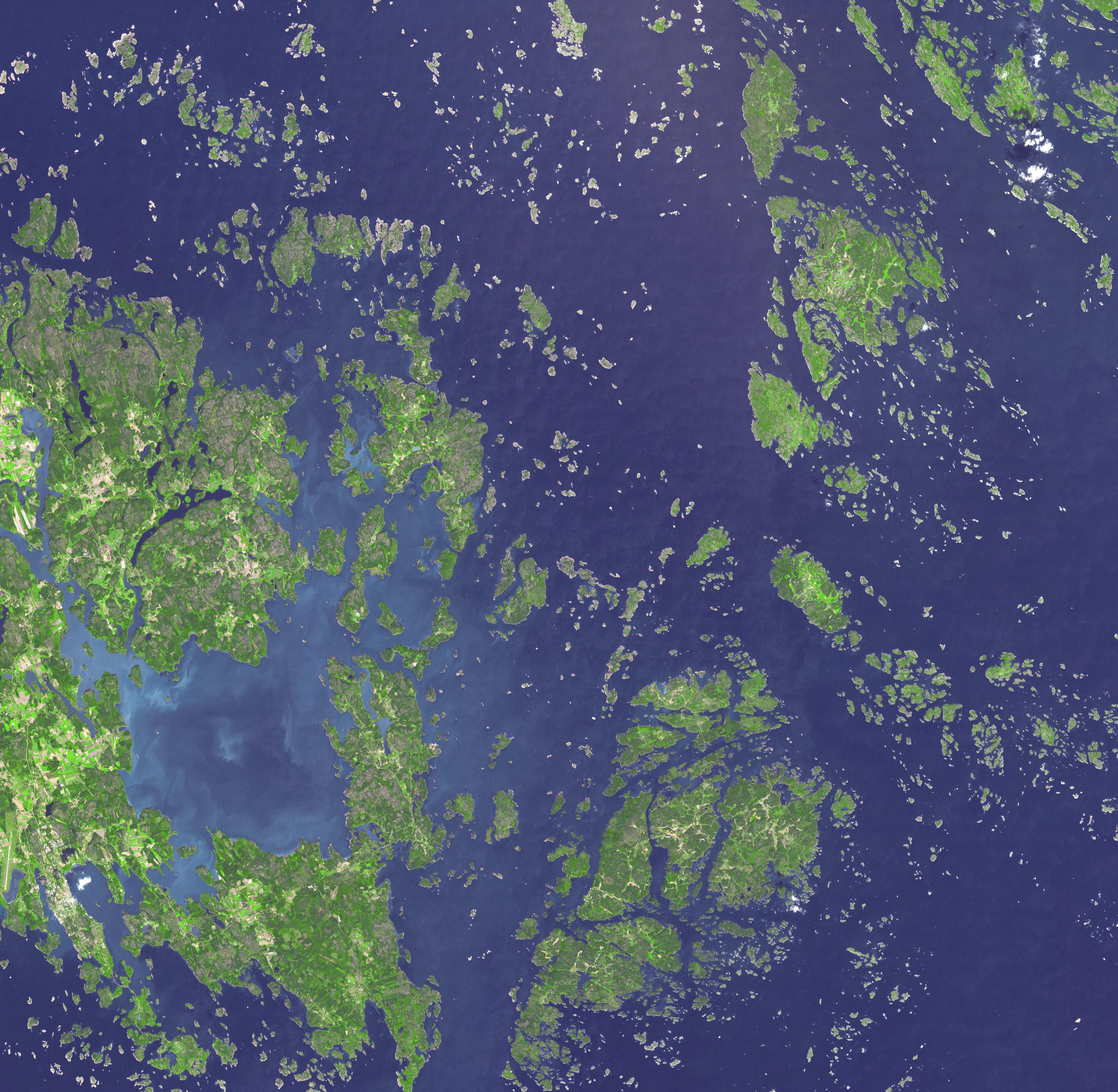
2011-04-27 |
Earth
|
Terra
|
ASTER
|
3735x3648x3 |
|
-
PIA14088:
-
Aaland Archipelago, Finland
Full Resolution:
TIFF
(40.88 MB)
JPEG
(2.018 MB)
|
|
|
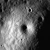
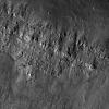
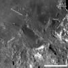
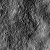
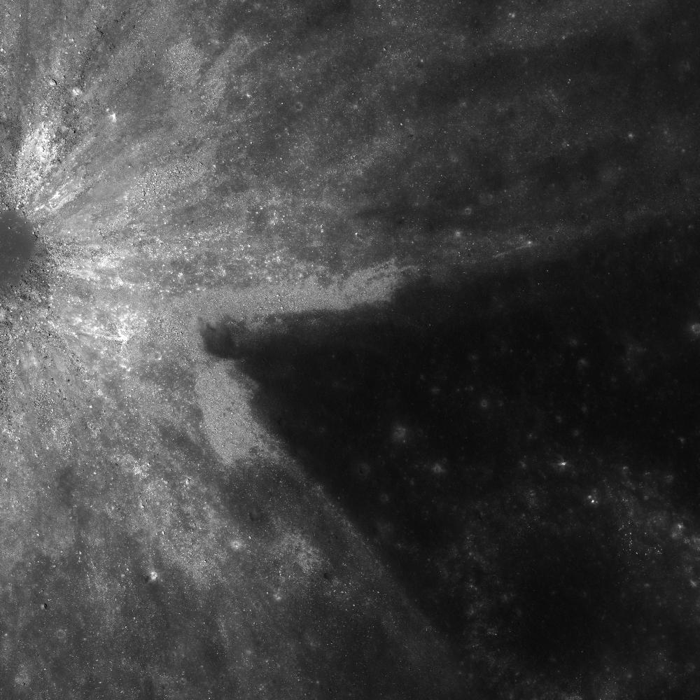
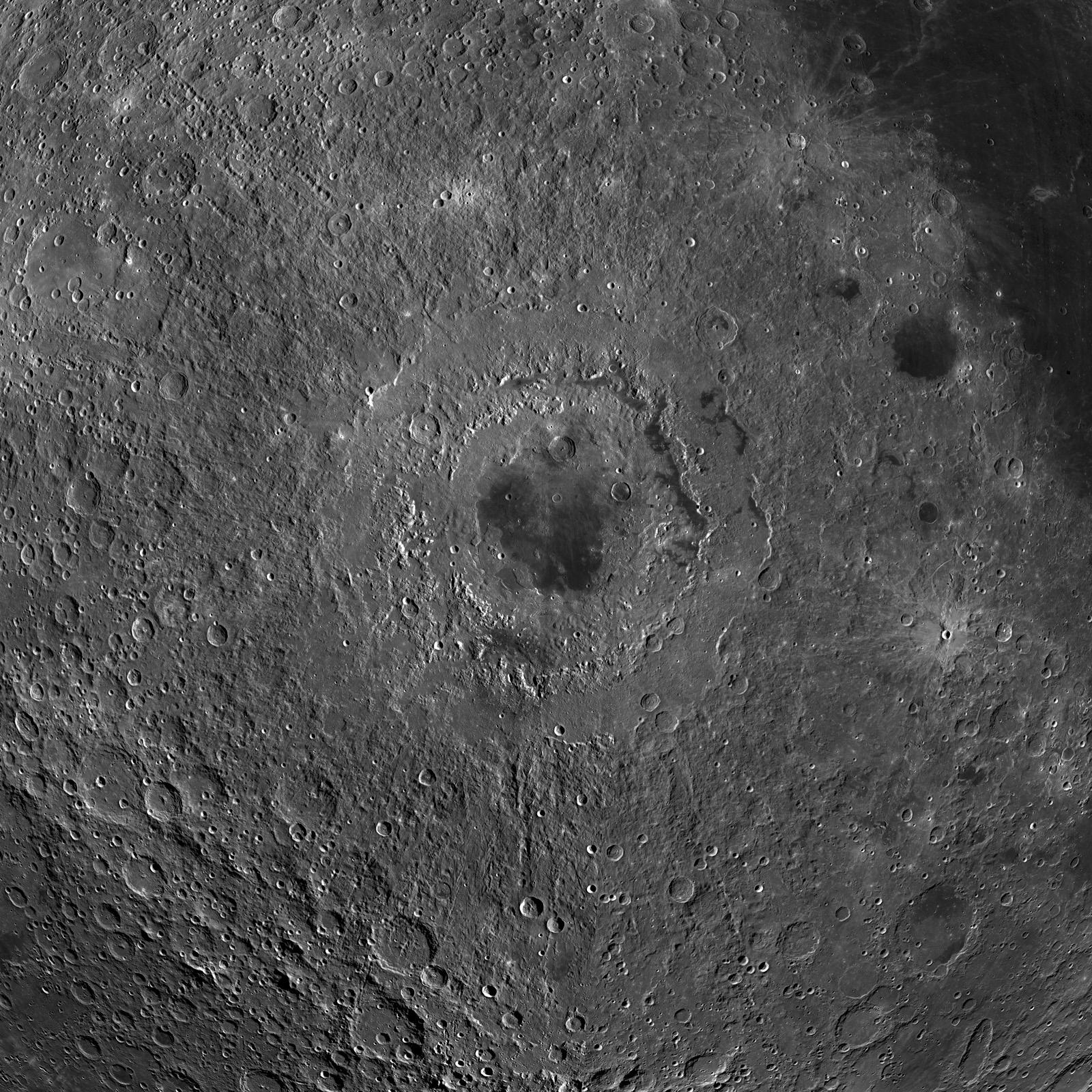
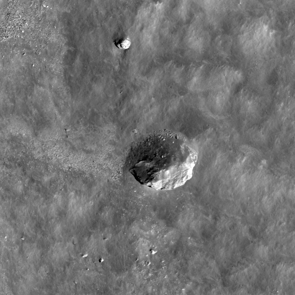
2011-04-27 |
Moon
|
Lunar Reconnaissance Orbiter (LRO)
|
Lunar Reconnaissance Orbiter Camera (NAC)
|
1600x1600x1 |
|
-
PIA14428:
-
Another Small Volcano?
Full Resolution:
TIFF
(2.563 MB)
JPEG
(448.8 kB)
|
|
|
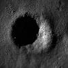
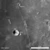
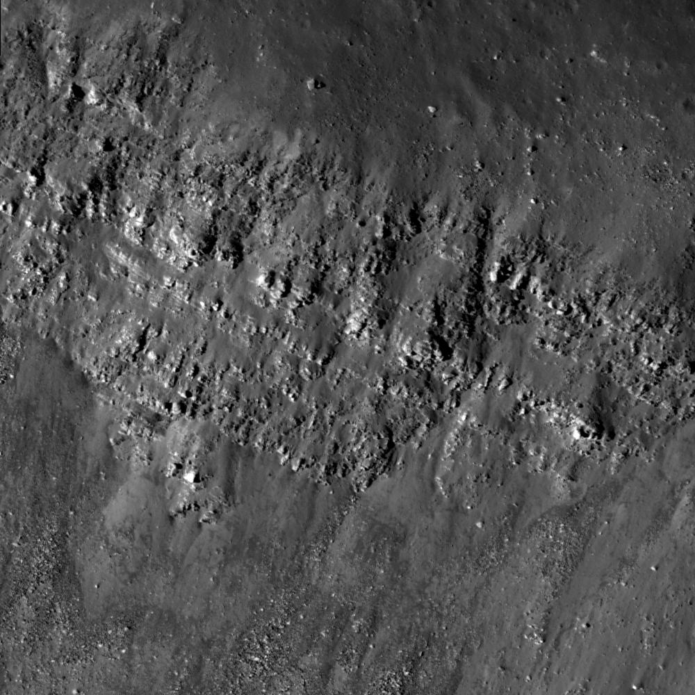
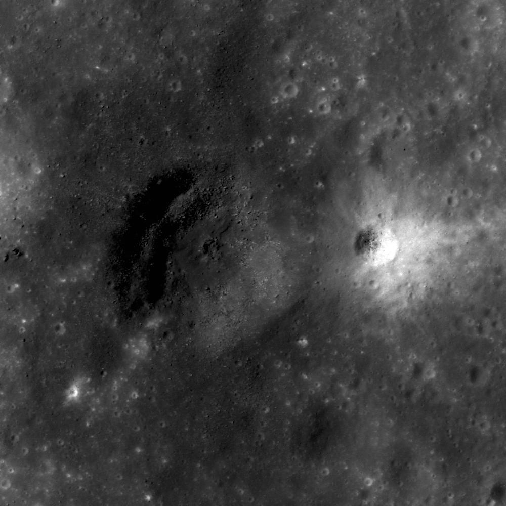
2011-04-26 |
Moon
|
Lunar Reconnaissance Orbiter (LRO)
|
Lunar Reconnaissance Orbiter Camera (NAC)
|
1200x1200x1 |

|
-
PIA14427:
-
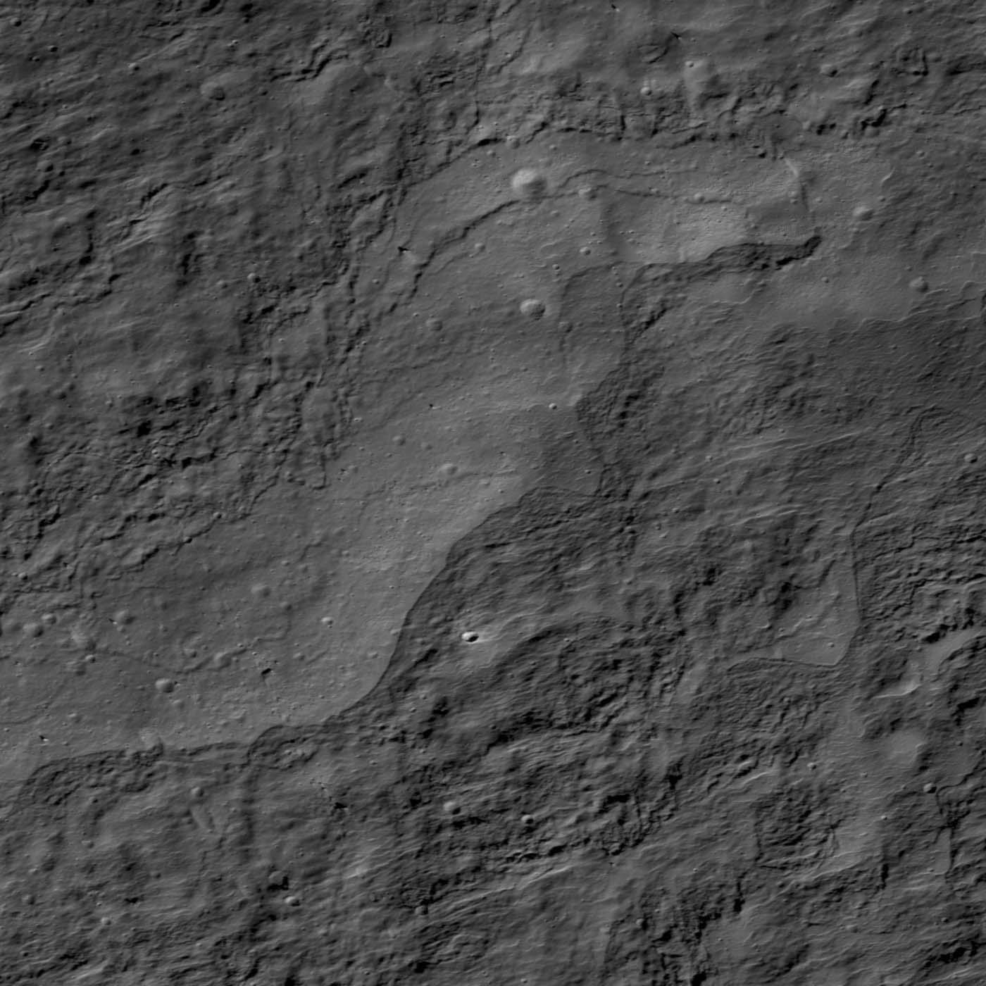
Forked Wrinkle Ridge
Full Resolution:
TIFF
(1.442 MB)
JPEG
(285.9 kB)
|
|
|
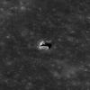
2011-04-21 |
Earth
|
Terra
|
ASTER
|
1534x2421x3 |
|
-
PIA14045:
-
NASA Satellite Images Annual Spring Thaw, Red River, North Dakota
Full Resolution:
TIFF
(3.718 MB)
JPEG
(475.5 kB)
|
|
|
2011-04-21 |
Moon
|
Lunar Reconnaissance Orbiter (LRO)
|
Lunar Reconnaissance Orbiter Camera (NAC)
|
1500x1500x1 |

|
-
PIA14426:
-
Action Shot
Full Resolution:
TIFF
(2.253 MB)
JPEG
(227.1 kB)
|
|
|
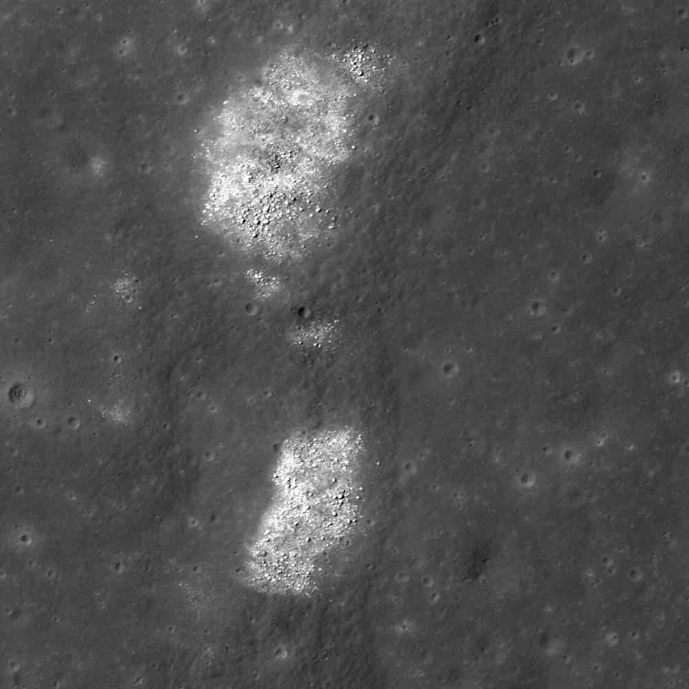
2011-04-20 |
Moon
|
Lunar Reconnaissance Orbiter (LRO)
|
Lunar Reconnaissance Orbiter Camera (NAC)
|
1000x1000x1 |
|
-
PIA14425:
-
Slice of Mare
Full Resolution:
TIFF
(1.001 MB)
JPEG
(155 kB)
|
|
|
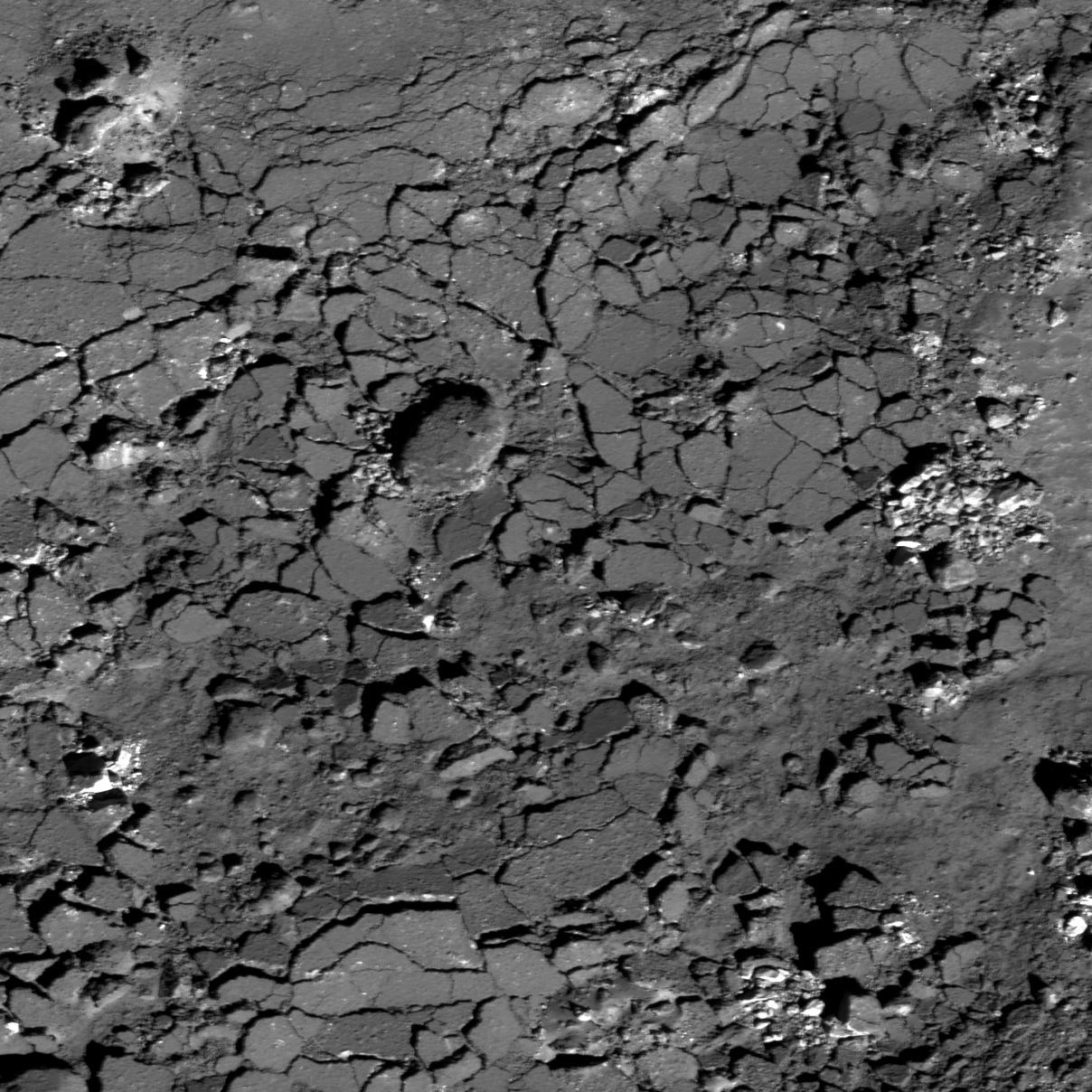
2011-04-19 |
Moon
|
Lunar Reconnaissance Orbiter (LRO)
|
Lunar Reconnaissance Orbiter Camera (NAC)
|
1000x1000x1 |
|
-
PIA14424:
-
Lava Flows Exposed in Bessel Crater
Full Resolution:
TIFF
(1.001 MB)
JPEG
(178.1 kB)
|
|
|
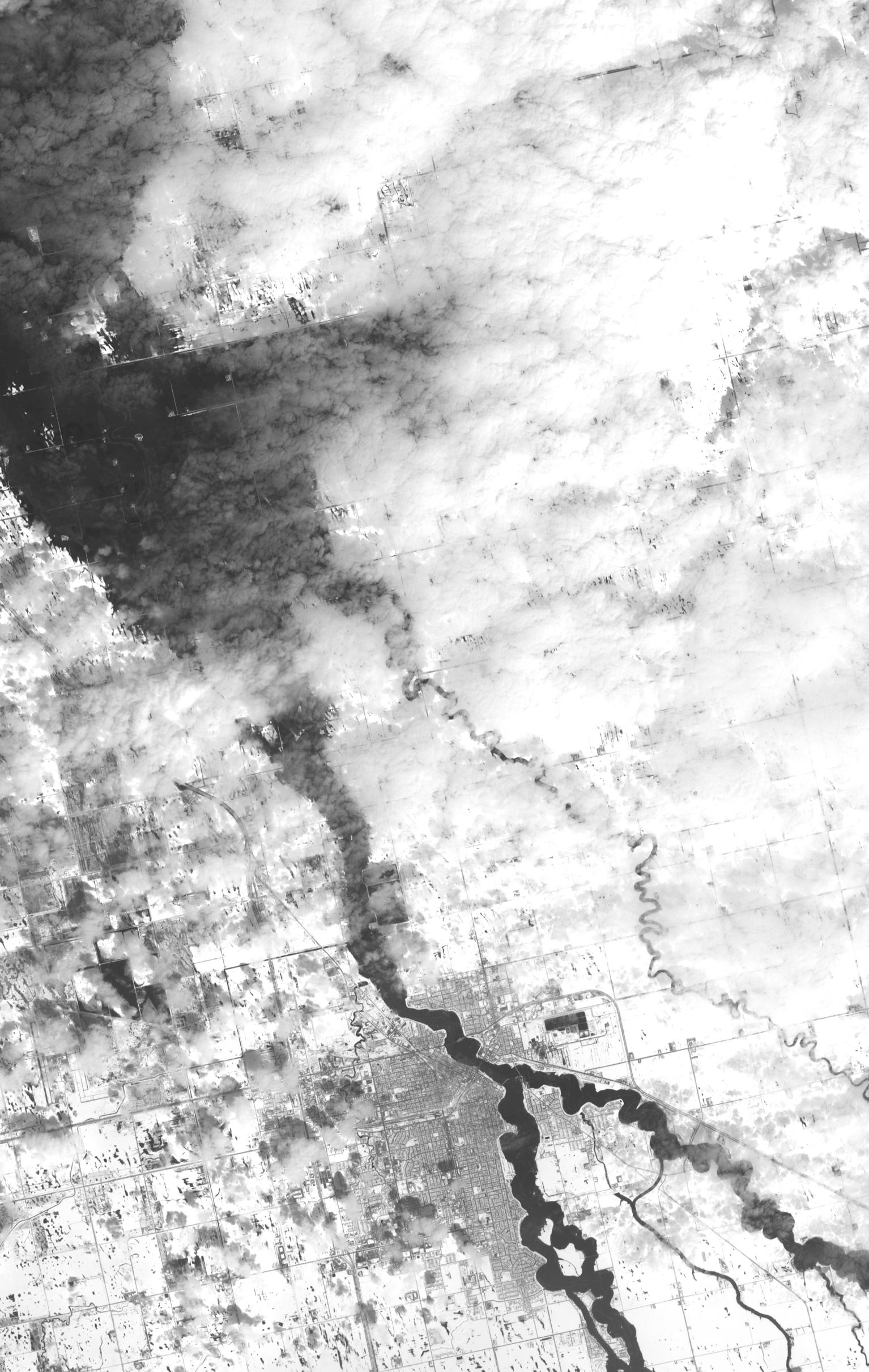
2011-04-18 |
Earth
|
Aqua
|
AIRS
|
1200x860x3 |
|
-
PIA14042:
-
NASA's AIRS Instrument Images April 16, 2011 Severe Storm/Tornado Outbreak
Full Resolution:
TIFF
(3.1 MB)
JPEG
(130.1 kB)
|
|
|
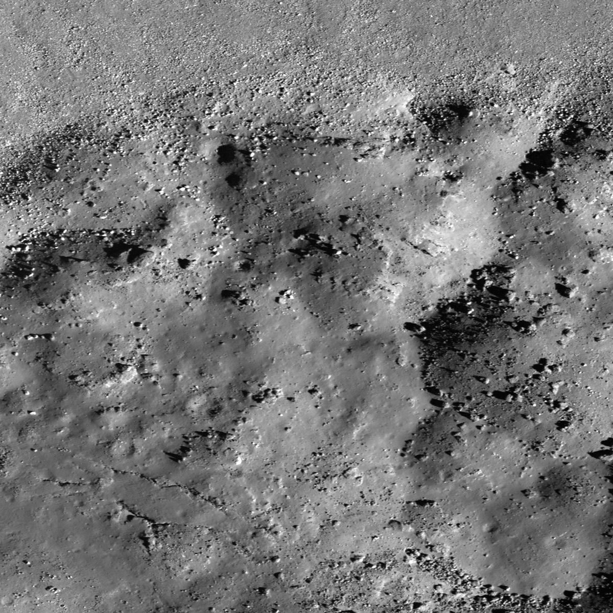
2011-04-18 |
Moon
|
Lunar Reconnaissance Orbiter (LRO)
|
Lunar Reconnaissance Orbiter Camera (NAC)
|
1000x1000x1 |
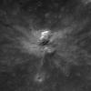
|
-
PIA14423:
-
How did I form?
Full Resolution:
TIFF
(1.001 MB)
JPEG
(80.92 kB)
|
|
|
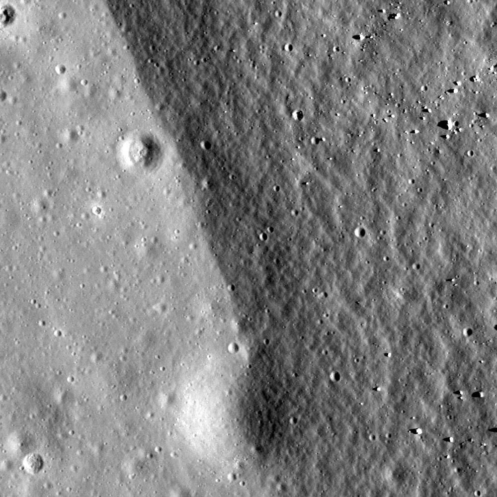
2011-04-14 |
Moon
|
Lunar Reconnaissance Orbiter (LRO)
|
Lunar Reconnaissance Orbiter Camera (NAC)
|
1200x1200x1 |
|
-
PIA14422:
-
Brisbane Z's Australean Wrinkle Ridge
Full Resolution:
TIFF
(1.442 MB)
JPEG
(308.7 kB)
|
|
|
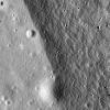
2011-04-13 |
Moon
|
Lunar Reconnaissance Orbiter (LRO)
|
Lunar Reconnaissance Orbiter Camera (NAC)
|
1000x1000x1 |
|
-
PIA14421:
-
Bouldery Crater near Mare Australe
Full Resolution:
TIFF
(1.001 MB)
JPEG
(296.7 kB)
|
|
|
2011-04-12 |
Earth
|
Terra
|
ASTER
|
1106x707x3 |
|
-
PIA14035:
-
Luxembourg
Full Resolution:
TIFF
(2.349 MB)
JPEG
(233.3 kB)
|
|
|
2011-04-08 |
Moon
|
Lunar Reconnaissance Orbiter (LRO)
|
Lunar Reconnaissance Orbiter Camera (NAC)
|
1000x1000x1 |

|
-
PIA14420:
-
Bright Ridge near Mons Hansteen
Full Resolution:
TIFF
(1.001 MB)
JPEG
(122.1 kB)
|
|
|
2011-04-06 |
Moon
|
Lunar Reconnaissance Orbiter (LRO)
|
Lunar Reconnaissance Orbiter Camera (NAC)
|
1000x1000x1 |
|
-
PIA14037:
-
Crater rim of Flamsteed P
Full Resolution:
TIFF
(1.001 MB)
JPEG
(174.8 kB)
|
|
|
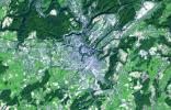
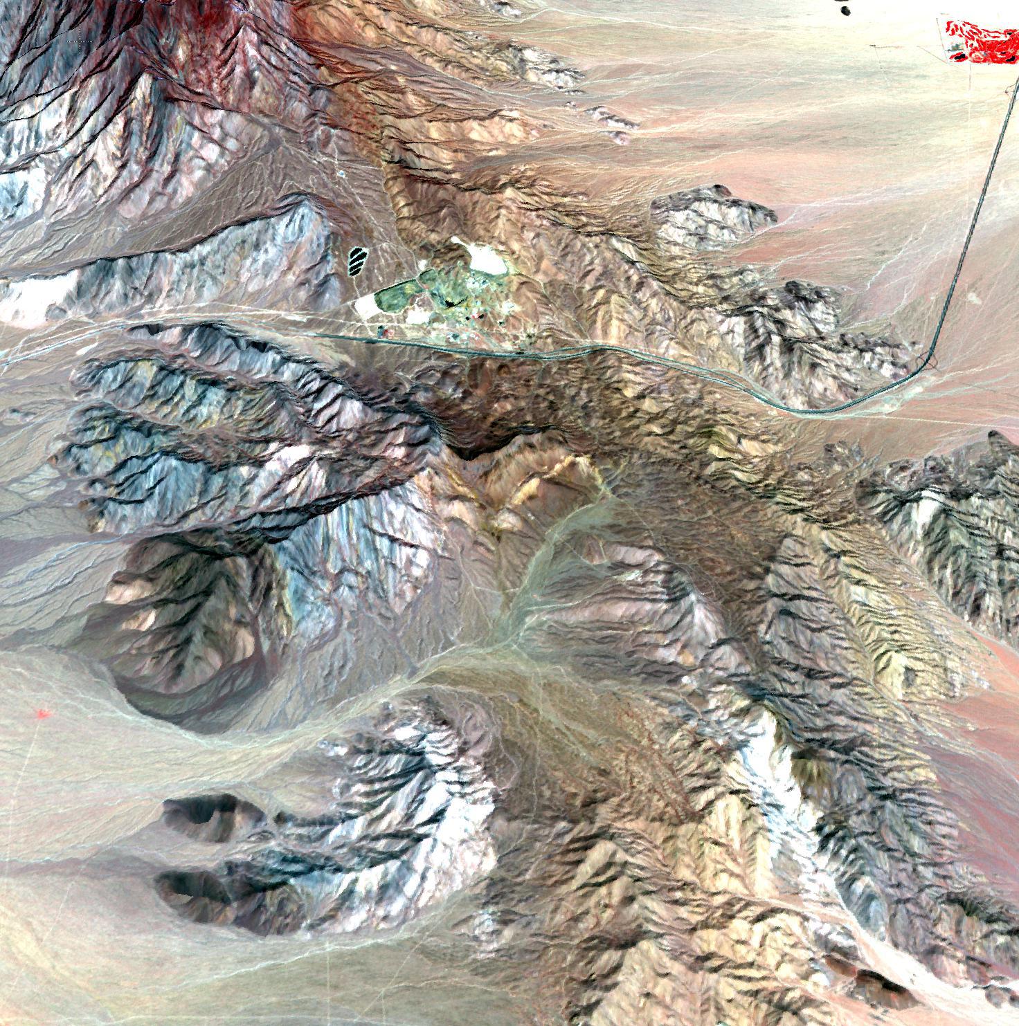
2011-04-06 |
Earth
|
Terra
|
ASTER
|
1472x1483x3 |

|
-
PIA13979:
-
Mountain Pass Mine, California
Full Resolution:
TIFF
(6.561 MB)
JPEG
(505.8 kB)
|
|
|
2011-04-05 |
Moon
|
Lunar Reconnaissance Orbiter (LRO)
|
Lunar Reconnaissance Orbiter Camera (NAC)
|
1400x1400x1 |

|
-
PIA14031:
-
Fresh Crater on Oceanus Procellarum
Full Resolution:
TIFF
(1.962 MB)
JPEG
(451 kB)
|
|
|
2011-04-01 |
Earth
|
|
Advanced Synthetic Aperture Radar
|
2768x7680x3 |
|
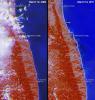
-
PIA13976:
-
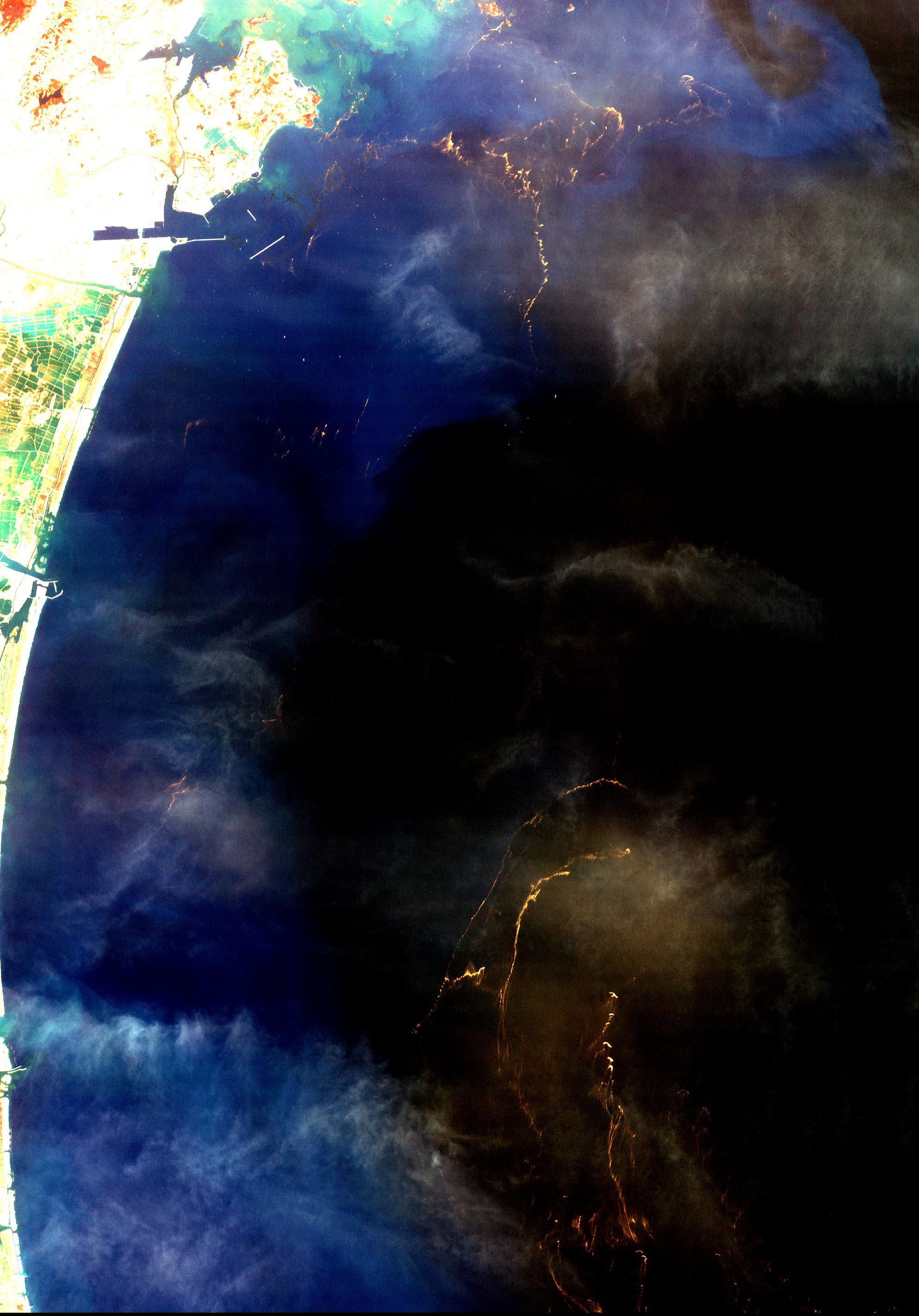
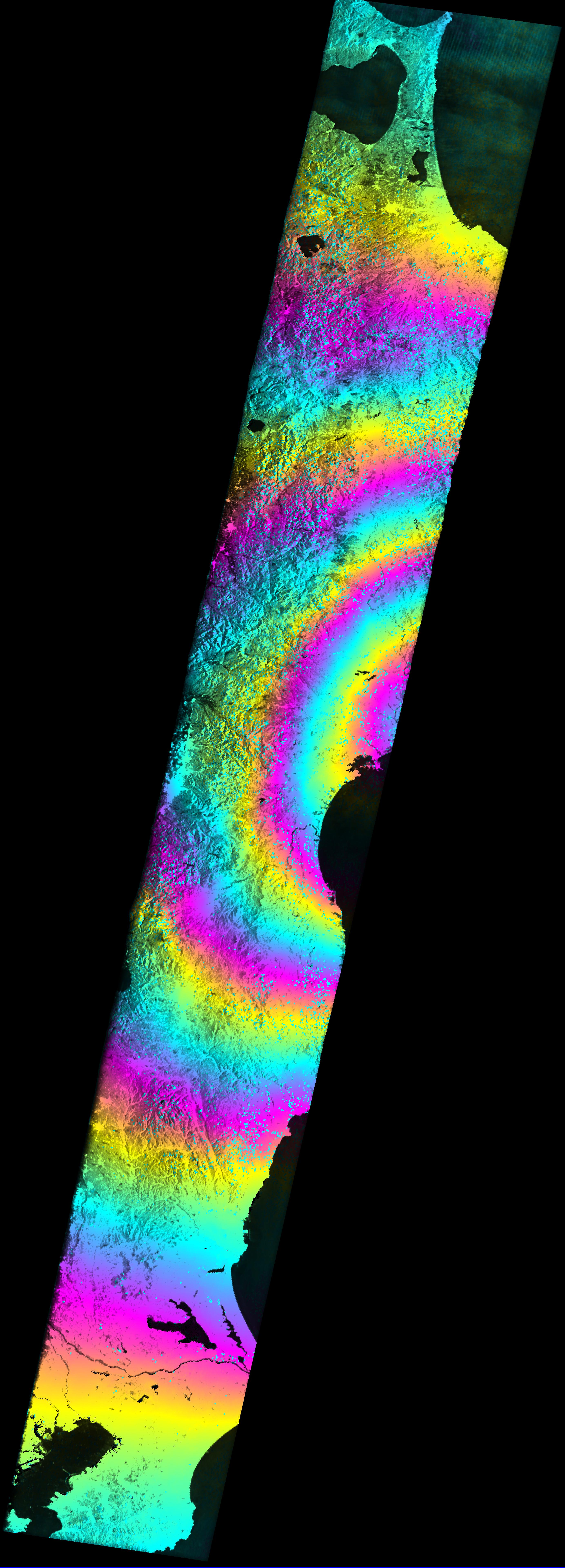
Satellite Radar Measures Tohoku, Japan Earthquake
Full Resolution:
TIFF
(63.77 MB)
JPEG
(1.95 MB)
|
|
|
2011-04-01 |
Earth
|
Envisat
|
Advanced Synthetic Aperture Radar
|
1015x1284x3 |
|
-
PIA13975:
-
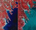
Satellite Radar Measures Tohoku, Japan Earthquake (Google Overlay)
Full Resolution:
TIFF
(3.915 MB)
JPEG
(201.9 kB)
|
|
|
2011-04-01 |
Moon
|
Lunar Reconnaissance Orbiter (LRO)
|
Lunar Reconnaissance Orbiter Camera (NAC)
|
1400x1400x1 |

|
-
PIA14030:
-
Impact Melt on Klute W Wall
Full Resolution:
TIFF
(1.962 MB)
JPEG
(220.9 kB)
|
|
|
2011-03-31 |
Moon
|
Lunar Reconnaissance Orbiter (LRO)
|
Lunar Reconnaissance Orbiter Camera (NAC)
|
1400x1400x1 |
|
-
PIA14029:
-
Post-impact Modification of Klute W
Full Resolution:
TIFF
(1.962 MB)
JPEG
(192.2 kB)
|
|
|
2011-03-24 |
Moon
|
Lunar Reconnaissance Orbiter (LRO)
|
Lunar Reconnaissance Orbiter Camera (NAC)
|
1000x1000x1 |
|
-
PIA14028:
-
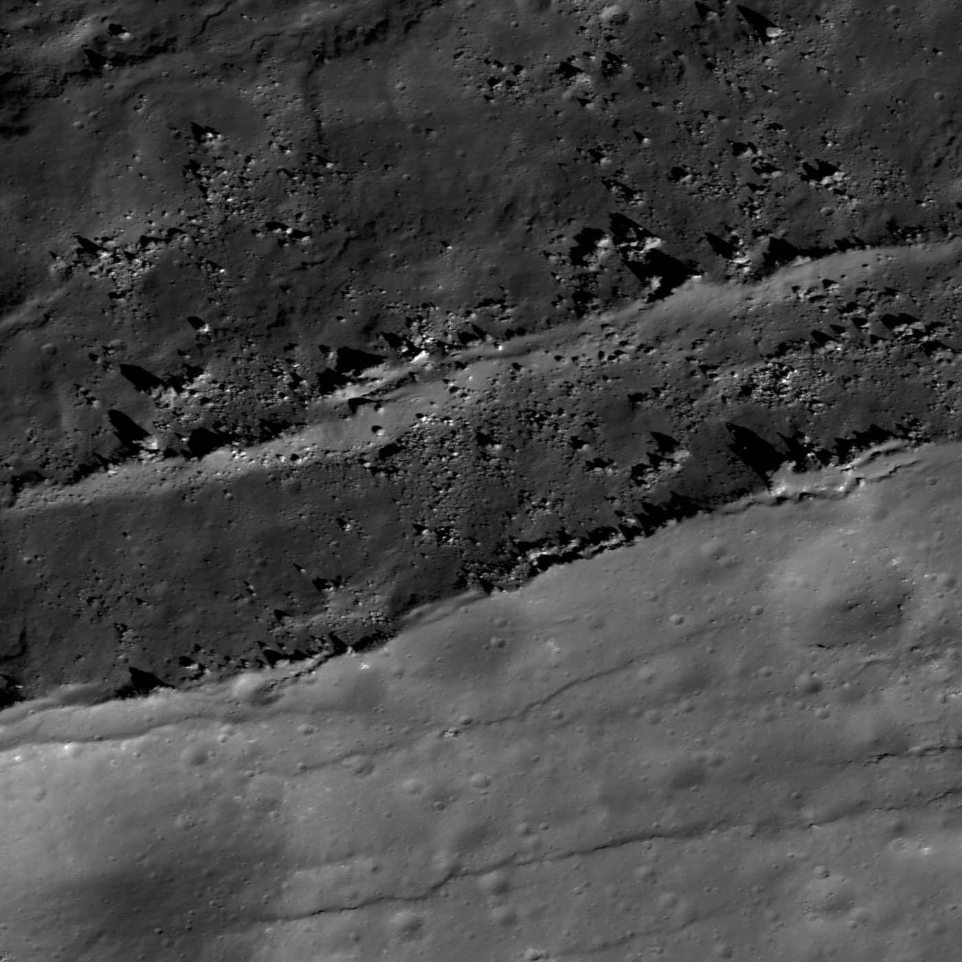
Boulder Clusters on a Ridge Crest
Full Resolution:
TIFF
(1.001 MB)
JPEG
(156.5 kB)
|
|
|
2011-03-24 |
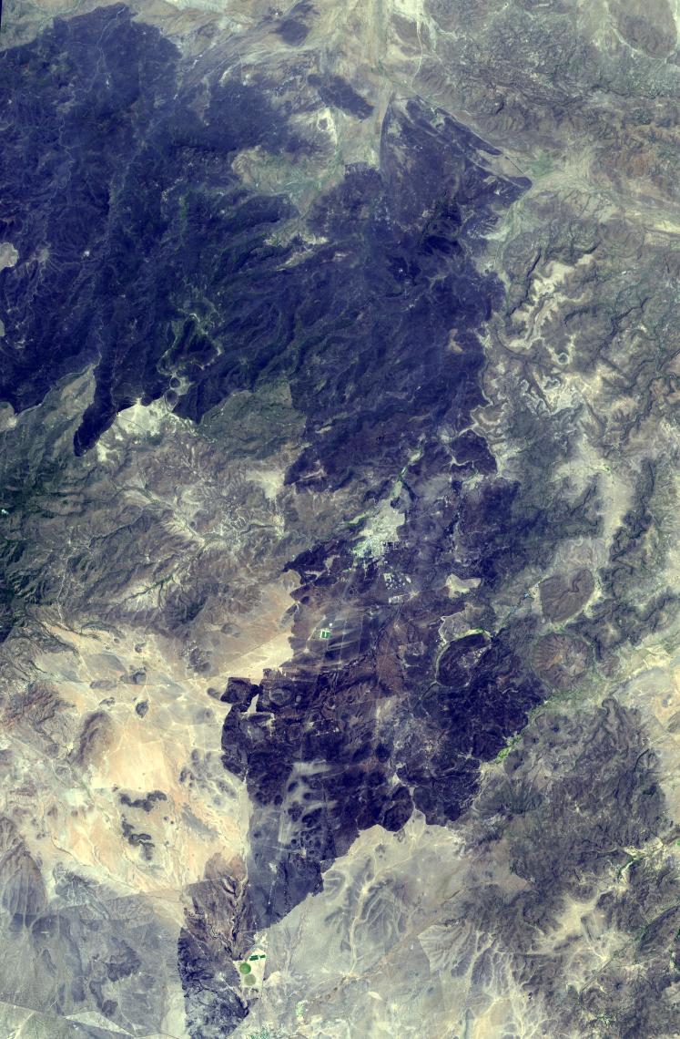
Earth
|
Terra
|
ASTER
|
1506x1486x3 |
|
-
PIA13945:
-
M'zab Valley, Algeria
Full Resolution:
TIFF
(6.726 MB)
JPEG
(579.9 kB)
|
|
|
2011-03-23 |
Moon
|
Lunar Reconnaissance Orbiter (LRO)
|
Lunar Reconnaissance Orbiter Camera (NAC)
|
1000x1000x1 |
|
-
PIA14027:
-
Scouring Secondary Ejecta
Full Resolution:
TIFF
(1.001 MB)
JPEG
(158.2 kB)
|
|
|
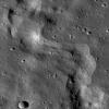
2011-03-22 |
Moon
|
Lunar Reconnaissance Orbiter (LRO)
|
Lunar Reconnaissance Orbiter Camera (NAC)
|
1200x1200x1 |

|
-
PIA14026:
-
Small Crater in Oceanus Procellarum
Full Resolution:
TIFF
(1.442 MB)
JPEG
(360.5 kB)
|
|
|
2011-03-20 |
Earth
|
Terra
|
MISR
|
613x646x3 |
|
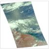
-
PIA13937:
-
MISR Images Lingering Floods from Tohoku-oki Earthquake Tsunami
Full Resolution:
TIFF
(1.19 MB)
JPEG
(80.19 kB)
|
|
|
2011-03-18 |
Moon
|
Lunar Reconnaissance Orbiter (LRO)
MESSENGER
|
Lunar Reconnaissance Orbiter Camera (NAC)
MDIS - Wide Angle
|
670x670x1 |
|
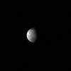
-
PIA14114:
-
The Moon as seen by MESSENGER
Full Resolution:
TIFF
(449.6 kB)
JPEG
(7.953 kB)
|
|
|
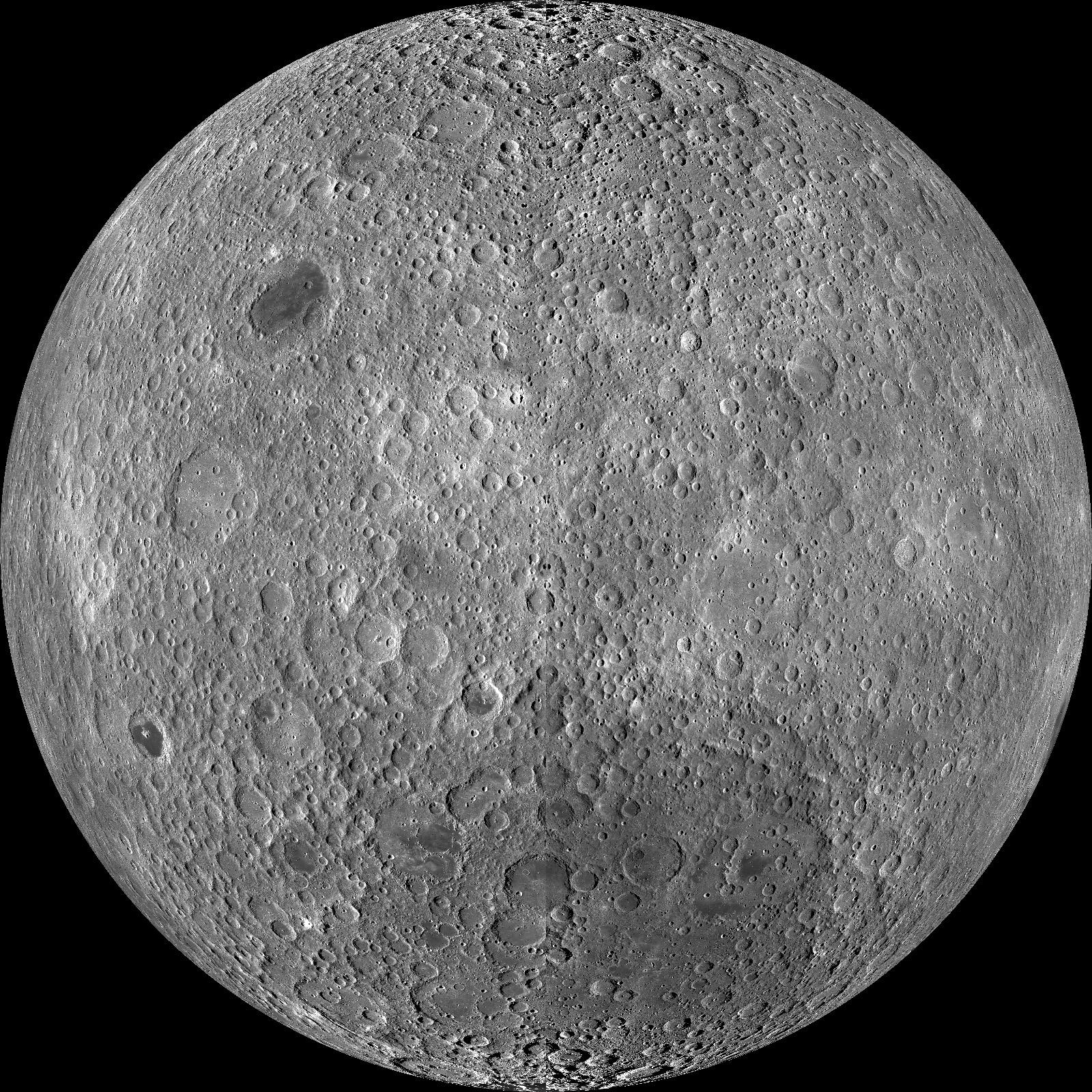
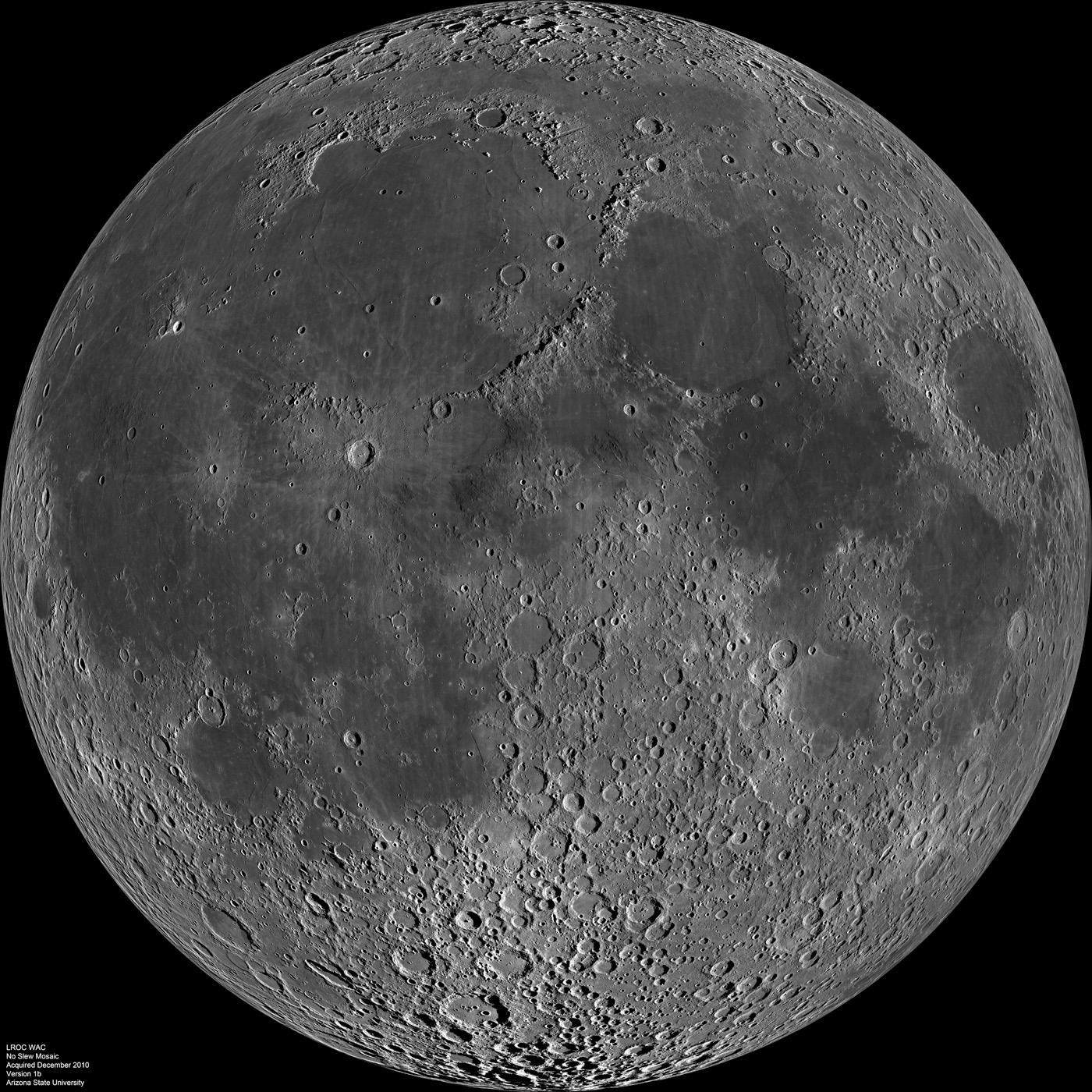
2011-03-16 |
Moon
|
Lunar Reconnaissance Orbiter (LRO)
|
Lunar Reconnaissance Orbiter Camera (WAC)
|
1242x1242x1 |
|
-
PIA14024:
-
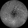
North Pole Mosaics
Full Resolution:
TIFF
(1.544 MB)
JPEG
(344.3 kB)
|
|
|
2011-03-15 |
Earth
|
Terra
|
ASTER
|
3790x3122x3 |
|
-
PIA13915:
-
NASA's ASTER Images More Effects of Japan Tsunami
Full Resolution:
TIFF
(35.5 MB)
JPEG
(2.11 MB)
|
|
|
2011-03-15 |
Moon
|
Lunar Reconnaissance Orbiter (LRO)
|
Lunar Reconnaissance Orbiter Camera (WAC)
|
1600x1600x1 |
|
-
PIA14023:
-
LROC PDS Release Number 5
Full Resolution:
TIFF
(2.563 MB)
JPEG
(611.8 kB)
|
|
|
2011-03-14 |
Moon
|
Lunar Reconnaissance Orbiter (LRO)
|
Lunar Reconnaissance Orbiter Camera (NAC)
|
860x860x3 |

|
-
PIA14022:
-
Barnstorming Linn� Crater
Full Resolution:
TIFF
(2.221 MB)
JPEG
(148 kB)
|
|
|
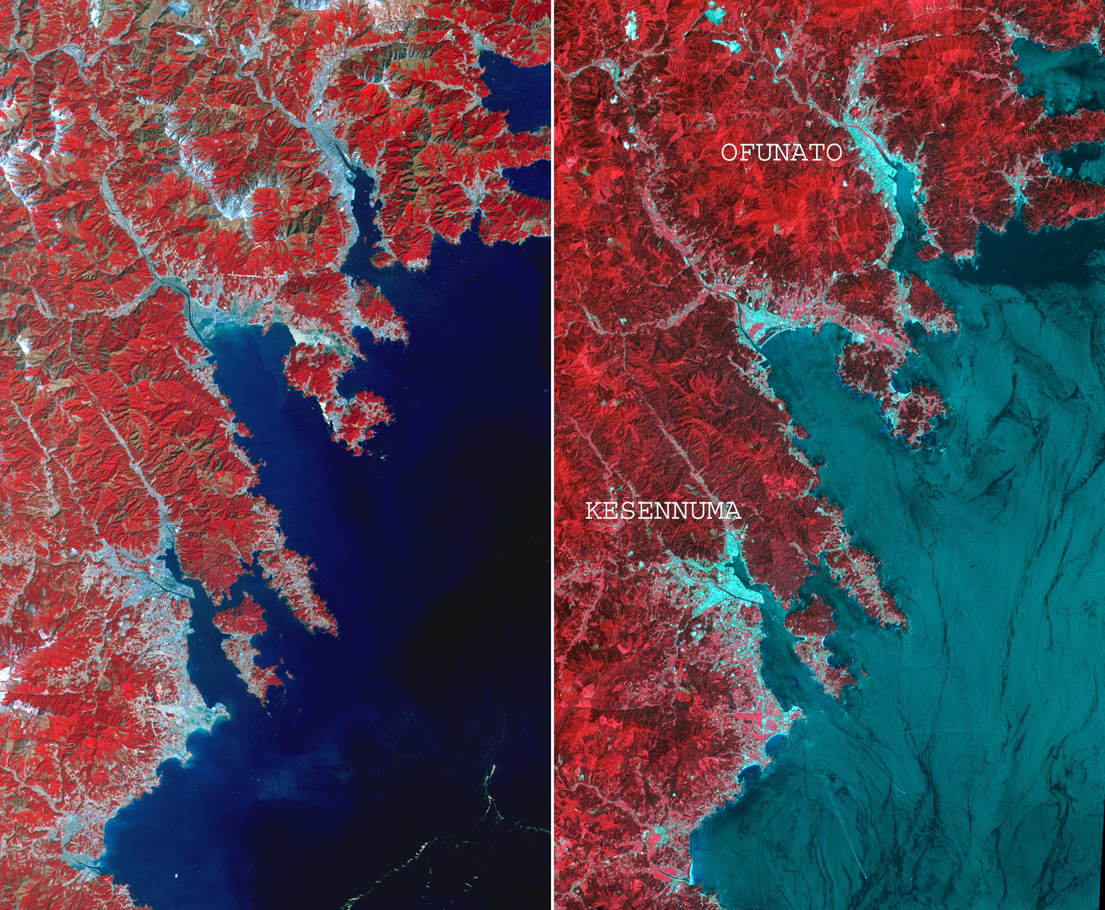
2011-03-13 |
Earth
|
Terra
|
MISR
|
1245x835x3 |
|
-
PIA13914:
-
Large Smoke Plume from Industrial Fires in Miyagi Prefecture, Japan
Full Resolution:
TIFF
(3.122 MB)
JPEG
(132 kB)
|
|
|
2011-03-12 |
Earth
|
Terra
|
MISR
|
600x400x3 |
|
-
PIA13913:
-
NASA's MISR Images Tsunami Inundation Along Japan's Eastern Coast
Full Resolution:
TIFF
(721 kB)
JPEG
(55.74 kB)
|
|
|
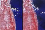
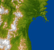
2011-03-11 |
Moon
|
Lunar Reconnaissance Orbiter (LRO)
|
Lunar Reconnaissance Orbiter Camera (WAC)
|
1600x1600x1 |

|
-
PIA14021:
-
Farside! And All the Way Around
Full Resolution:
TIFF
(2.563 MB)
JPEG
(778.5 kB)
|
|
|
2011-03-11 |
Earth
|
Shuttle Radar Topography Mission (SRTM)
|
C-Band Radar
X-Band Radar
|
6330x5879x3 |
|
-
PIA13912:
-
NASA Radar Image Shows Topography of Sendai, Japan Region
Full Resolution:
TIFF
(111.6 MB)
JPEG
(4.919 MB)
|
|
|
2011-03-10 |
Moon
|
Lunar Reconnaissance Orbiter (LRO)
|
Lunar Reconnaissance Orbiter Camera (NAC)
|
1000x1000x1 |
|
-
PIA14020:
-
Right Angle
Full Resolution:
TIFF
(1.001 MB)
JPEG
(148.5 kB)
|
|
|
2011-03-10 |
Earth
|
ARIA
|
X-band interferometric synthetic aperture radar
|
2692x863x3 |
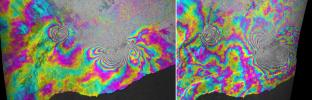
|
-
PIA13910:
-
INSAR Images Hawaii's Kilauea Volcano
Full Resolution:
TIFF
(6.977 MB)
JPEG
(732.1 kB)
|
|
|
2011-03-09 |
Moon
|
Lunar Reconnaissance Orbiter (LRO)
|
Lunar Reconnaissance Orbiter Camera (NAC)
|
1000x1000x1 |
|
-
PIA14019:
-
Buckland Boulders
Full Resolution:
TIFF
(1.001 MB)
JPEG
(151.1 kB)
|
|
|
2011-03-08 |
Moon
|
Lunar Reconnaissance Orbiter (LRO)
|
Lunar Reconnaissance Orbiter Camera (WAC)
|
1000x1000x1 |

|
-
PIA14018:
-
Boulder in Recht Crater
Full Resolution:
TIFF
(1.001 MB)
JPEG
(127.7 kB)
|
|
|
2011-03-04 |
Earth
|
UAVSAR
|
L-Band UAVSAR
|
20528x6304x3 |
|
-
PIA13902:
-
NASA Radar Captures Earth Deformation from 2010 Baja Calif. Quake
Full Resolution:
TIFF
(388.2 MB)
JPEG
(20.55 MB)
|
|
|
2011-03-03 |
Moon
|
Lunar Reconnaissance Orbiter (LRO)
|
Lunar Reconnaissance Orbiter Camera (NAC)
|
1000x1000x1 |

|
-
PIA14017:
-
Dark Halo Crater in Orientale
Full Resolution:
TIFF
(1.001 MB)
JPEG
(101.7 kB)
|
|
|
2011-03-03 |
Earth
|
Terra
|
ASTER
|
2829x2796x3 |
|
-
PIA13888:
-
Kizimen Volcano, Kamchatka
Full Resolution:
TIFF
(23.73 MB)
JPEG
(1.049 MB)
|
|
|
2011-03-02 |
Moon
|
Lunar Reconnaissance Orbiter (LRO)
|
Lunar Reconnaissance Orbiter Camera (NAC)
|
1000x1000x1 |
|
-
PIA14016:
-
Archimedes - Mare Flooded Crater
Full Resolution:
TIFF
(1.001 MB)
JPEG
(215.3 kB)
|
|
|
2011-03-01 |
Moon
|
Lunar Reconnaissance Orbiter (LRO)
|
Lunar Reconnaissance Orbiter Camera (NAC)
|
1000x1000x1 |
|
-
PIA14015:
-
Rima Calippus
Full Resolution:
TIFF
(1.001 MB)
JPEG
(149.2 kB)
|
|
|
2011-02-25 |
Moon
|
Lunar Reconnaissance Orbiter (LRO)
|
Lunar Reconnaissance Orbiter Camera (NAC)
|
1208x1208x1 |
|
-
PIA14014:
-
Fragmented Impact Melt
Full Resolution:
TIFF
(1.461 MB)
JPEG
(268.7 kB)
|
|
|
2011-02-24 |
Earth
|
Terra
|
ASTER
|
1533x1484x3 |
|
-
PIA13882:
-
NASA Spacecraft Images Region Devastated by New Zealand Quake
Full Resolution:
TIFF
(6.837 MB)
JPEG
(529.1 kB)
|
|
|
2011-02-24 |
Moon
|
Lunar Reconnaissance Orbiter (LRO)
|
Lunar Reconnaissance Orbiter Camera (NAC)
|
1200x1200x1 |

|
-
PIA14013:
-
Mounds in a Melt Pond
Full Resolution:
TIFF
(1.442 MB)
JPEG
(319 kB)
|
|
|
2011-02-23 |
Moon
|
Lunar Reconnaissance Orbiter (LRO)
|
Lunar Reconnaissance Orbiter Camera (NAC)
|
1210x1065x1 |
|
-
PIA14012:
-
Dark Streaks in Diophantus Crater
Full Resolution:
TIFF
(1.29 MB)
JPEG
(188.6 kB)
|
|
|
2011-02-21 |
Moon
|
Lunar Reconnaissance Orbiter (LRO)
|
Lunar Reconnaissance Orbiter Camera (WAC)
|
1400x1400x1 |
|
-
PIA14011:
-
Nearside Spectacular
Full Resolution:
TIFF
(1.962 MB)
JPEG
(385.1 kB)
|
|
|
2011-02-17 |
Moon
|
Lunar Reconnaissance Orbiter (LRO)
|
Lunar Reconnaissance Orbiter Camera (NAC)
Lunar Reconnaissance Orbiter Camera (WAC)
|
1000x1000x1 |
|
-
PIA14010:
-
Sinuous Chain of Depressions
Full Resolution:
TIFF
(1.001 MB)
JPEG
(122.3 kB)
|
|
|
2011-02-16 |
Moon
|
Lunar Reconnaissance Orbiter (LRO)
|
Lunar Reconnaissance Orbiter Camera (NAC)
Lunar Reconnaissance Orbiter Camera (WAC)
|
664x664x1 |
|
-
PIA14009:
-
Striated Blocks in Aristarchus Crater
Full Resolution:
TIFF
(441.6 kB)
JPEG
(84.51 kB)
|
|
|
2011-02-15 |
Moon
|
Lunar Reconnaissance Orbiter (LRO)
|
Lunar Reconnaissance Orbiter Camera (NAC)
Lunar Reconnaissance Orbiter Camera (WAC)
|
1400x1400x1 |

|
-
PIA14008:
-
Farside Northern Highlands
Full Resolution:
TIFF
(1.962 MB)
JPEG
(358.9 kB)
|
|
|
2011-02-14 |
Earth
|
Terra
|
ASTER
|
1409x1455x3 |
|
-
PIA13852:
-
Bogota, Colombia
Full Resolution:
TIFF
(6.162 MB)
JPEG
(516.8 kB)
|
|
|
2011-02-12 |
Moon
|
Lunar Reconnaissance Orbiter (LRO)
|
Lunar Reconnaissance Orbiter Camera (NAC)
|
1000x1000x1 |
|
-
PIA14007:
-
Rimae Bürg
Full Resolution:
TIFF
(1.001 MB)
JPEG
(159.6 kB)
|
|
|
2011-02-11 |
Moon
|
Lunar Reconnaissance Orbiter (LRO)
|
Lunar Reconnaissance Orbiter Camera (NAC)
Lunar Reconnaissance Orbiter Camera (WAC)
|
1500x1500x1 |
|
-
PIA14006:
-
Rima Bradley
Full Resolution:
TIFF
(2.253 MB)
JPEG
(325.7 kB)
|
|
|
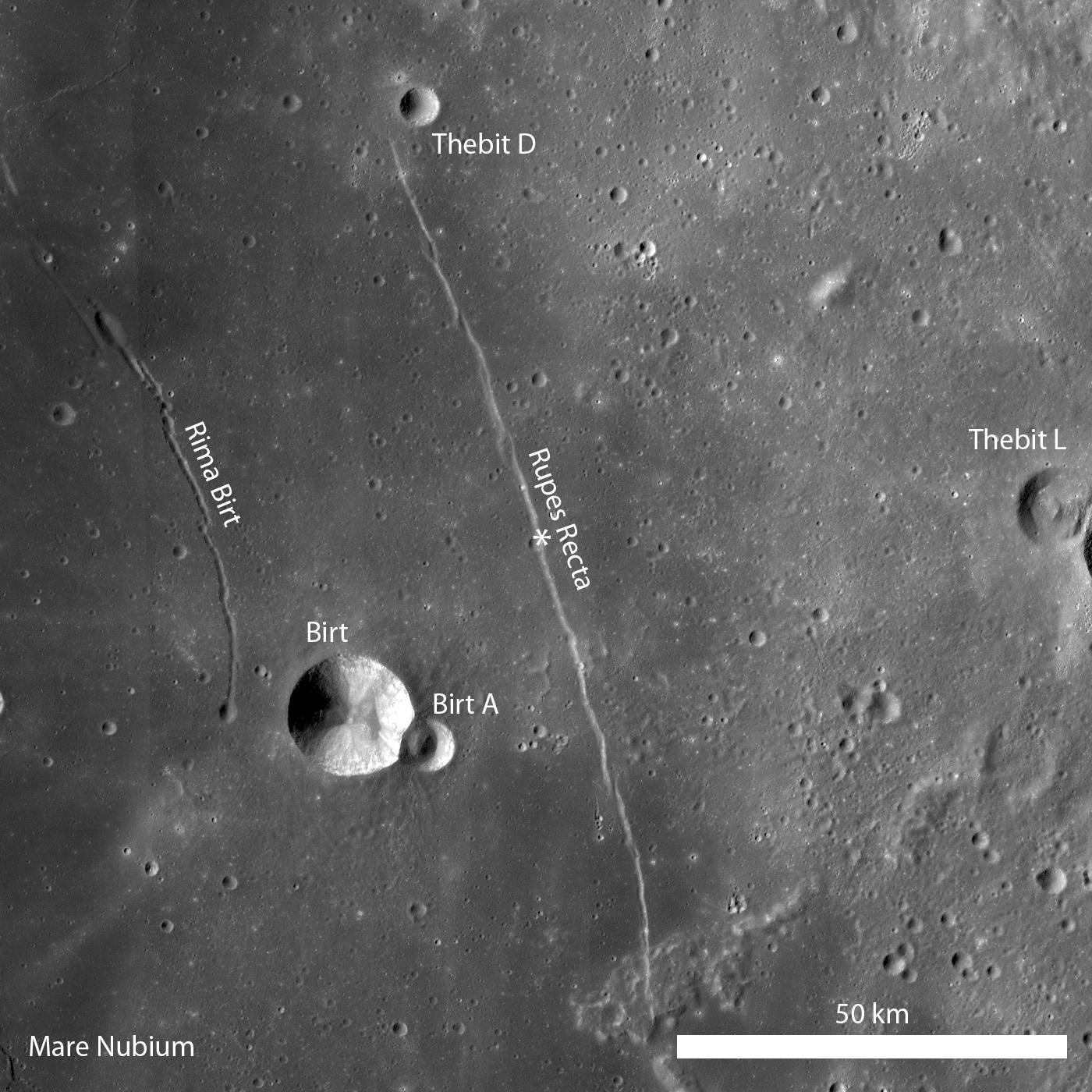
2011-02-10 |
Moon
|
Lunar Reconnaissance Orbiter (LRO)
|
Lunar Reconnaissance Orbiter Camera (NAC)
|
1400x1400x1 |
|
-
PIA14005:
-
Rupes Recta
Full Resolution:
TIFF
(1.962 MB)
JPEG
(269.8 kB)
|
|
|
2011-02-08 |
Moon
|
Lunar Reconnaissance Orbiter (LRO)
|
Lunar Reconnaissance Orbiter Camera (NAC)
|
750x750x1 |
|
-
PIA14004:
-
Sublunarean Void
Full Resolution:
TIFF
(563.3 kB)
JPEG
(70.62 kB)
|
|
|
2011-02-05 |
Moon
|
Lunar Reconnaissance Orbiter (LRO)
|
Lunar Reconnaissance Orbiter Camera (NAC)
|
438x438x1 |
|
-
PIA14003:
-
New View of Apollo 14
Full Resolution:
TIFF
(192.3 kB)
JPEG
(22.74 kB)
|
|
|
2011-02-04 |
Moon
|
Lunar Reconnaissance Orbiter (LRO)
|
Lunar Reconnaissance Orbiter Camera (WAC)
|
1318x1127x1 |

|
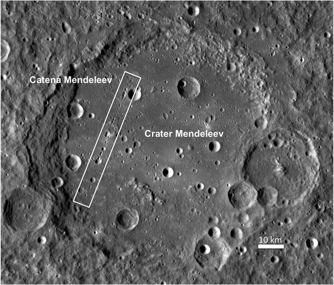
-
PIA14002:
-
Crater Mendeleev
Full Resolution:
TIFF
(1.487 MB)
JPEG
(271.1 kB)
|
|
|
2011-02-04 |
Earth
|
Aqua
|
AIRS
|
814x630x3 |
|
-
PIA13838:
-
Tropical Cyclone Yasi Spins Through Australia's Interior
Full Resolution:
TIFF
(1.54 MB)
JPEG
(103.9 kB)
|
|
|
2011-02-03 |
Moon
|
Lunar Reconnaissance Orbiter (LRO)
|
Lunar Reconnaissance Orbiter Camera (NAC)
Lunar Reconnaissance Orbiter Camera (WAC)
|
1000x1000x1 |
|
-
PIA14001:
-
Inside Catena Mendeleev
Full Resolution:
TIFF
(1.001 MB)
JPEG
(187.5 kB)
|
|
|
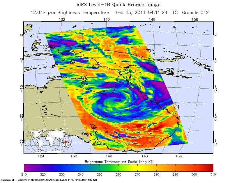
2011-02-03 |
Earth
|
Aqua
|
AIRS
|
882x630x3 |
|
-
PIA13836:
-
Yasi's Fury Rakes Northeastern Australia
Full Resolution:
TIFF
(1.669 MB)
JPEG
(105.4 kB)
|
|
|
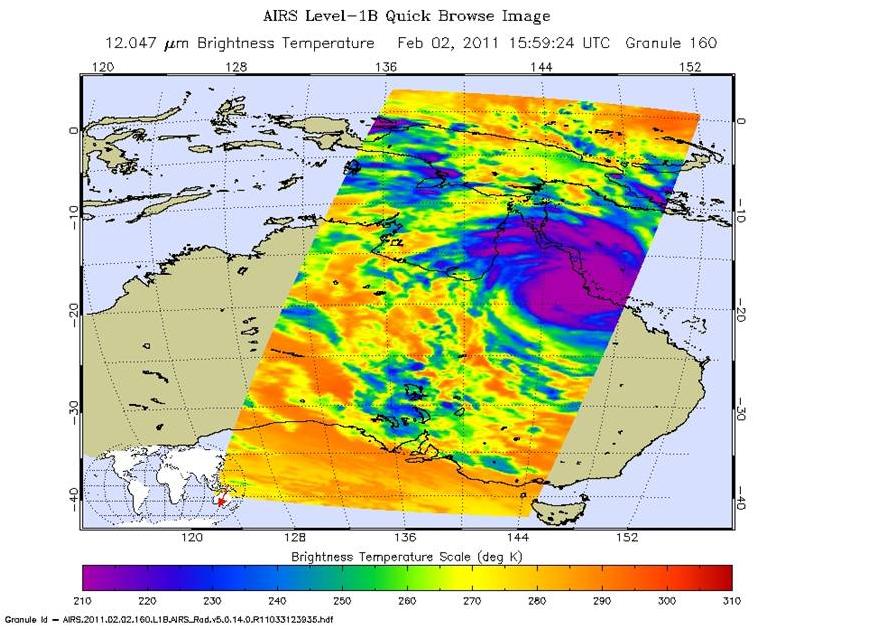
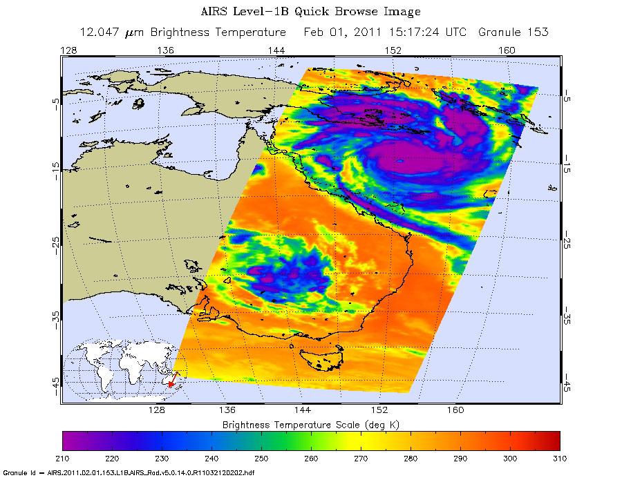
2011-02-02 |
Earth
|
Aqua
|
AIRS
|
900x695x3 |
|
-
PIA13834:
-
Monster Cyclone Yasi Eyes Australia in NASA Image
Full Resolution:
TIFF
(1.879 MB)
JPEG
(128.3 kB)
|
|
|
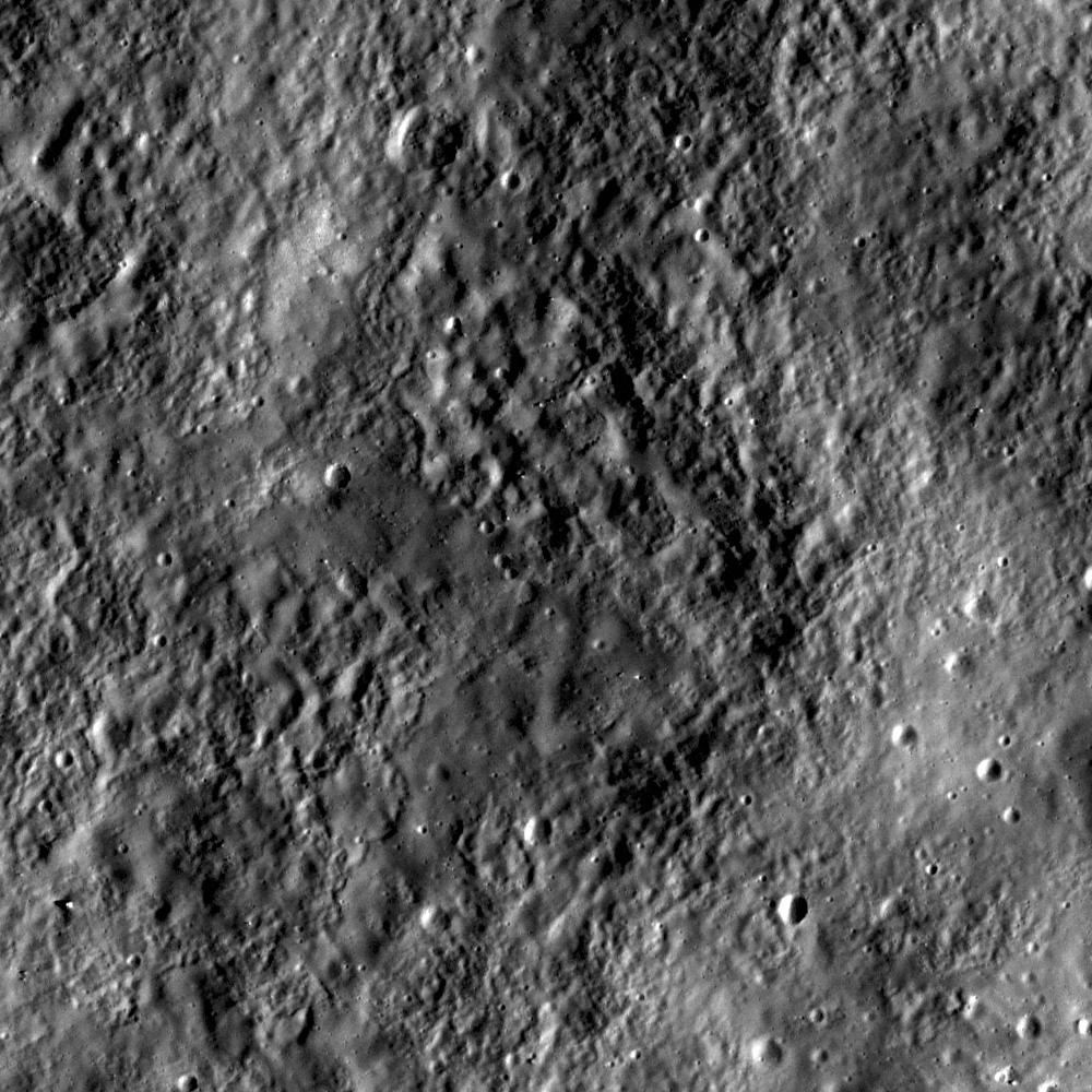
2011-02-02 |
Moon
|
Lunar Reconnaissance Orbiter (LRO)
|
Lunar Reconnaissance Orbiter Camera (NAC)
Lunar Reconnaissance Orbiter Camera (WAC)
|
889x889x1 |

|
-
PIA14000:
-
Stratified Ejecta Blocks
Full Resolution:
TIFF
(791.3 kB)
JPEG
(158.9 kB)
|
|
|
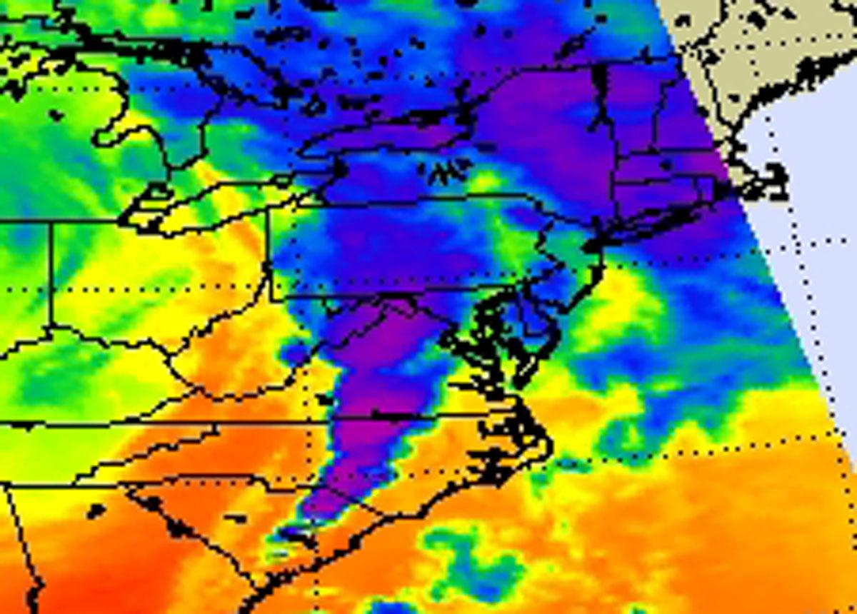
2011-02-02 |
Earth
|
Aqua
|
AIRS
|
1800x1150x3 |
|
-
PIA13831:
-
NASA's AIRS Instrument Captures Data on Monster Winter Storm Affecting 30 States
Full Resolution:
TIFF
(6.219 MB)
JPEG
(286.1 kB)
|
|
|
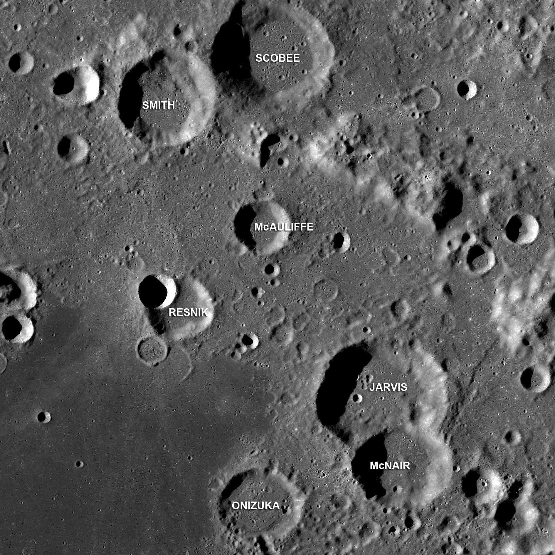
2011-01-29 |
Moon
|
Lunar Reconnaissance Orbiter (LRO)
|
Lunar Reconnaissance Orbiter Camera (WAC)
|
1890x1890x1 |

|
-
PIA13998:
-
Challenger Astronauts Memorialized on the Moon
Full Resolution:
TIFF
(3.576 MB)
JPEG
(575.1 kB)
|


