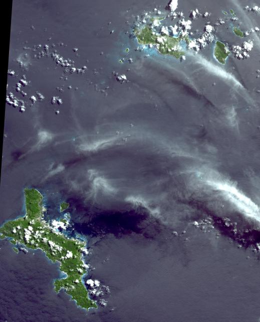
The Republic of Seychelles is an island country with an archipelago of 115 islands in the Indian Ocean. It is about 1500 kilometers east of the African continent, and spreads out over a vast area of ocean north of Madagascar. Independent from Great Britain since 1975, the country nevertheless is far more French after years of early French settlement and influence. Since independence, tourism has grown dramatically to become the primary industry of Seychelles, overtaking plantation agriculture. The image covers an area of 54 x 66 km, was acquired on April 17, 2010, and is located at 4.4 degrees south latitude, 55.6 degrees east longitude.
With its 14 spectral bands from the visible to the thermal infrared wavelength region and its high spatial resolution of 15 to 90 meters (about 50 to 300 feet), ASTER images Earth to map and monitor the changing surface of our planet. ASTER is one of five Earth-observing instruments launched Dec. 18, 1999, on Terra. The instrument was built by Japan's Ministry of Economy, Trade and Industry. A joint U.S./Japan science team is responsible for validation and calibration of the instrument and data products.
The broad spectral coverage and high spectral resolution of ASTER provides scientists in numerous disciplines with critical information for surface mapping and monitoring of dynamic conditions and temporal change. Example applications are: monitoring glacial advances and retreats; monitoring potentially active volcanoes; identifying crop stress; determining cloud morphology and physical properties; wetlands evaluation; thermal pollution monitoring; coral reef degradation; surface temperature mapping of soils and geology; and measuring surface heat balance.
The U.S. science team is located at NASA's Jet Propulsion Laboratory, Pasadena, Calif. The Terra mission is part of NASA's Science Mission Directorate, Washington, D.C.
More information about ASTER is available at http://asterweb.jpl.nasa.gov/.