Animated Video
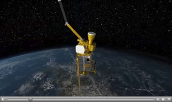
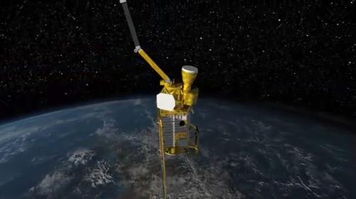
Click on the image for the movieThis animated video, created by John Howard at the Jet Propulsion Laboratory (JPL), shows the Soil Moisture Active Passive (SMAP) mission, specifically depicting how the scanning antenna will fly in space and the swath coverage over the Earth.
During the 3 year mission, SMAP will provide comprehensive global mapping measurements of soil moisture and freeze/thaw state in order to enhance the understanding of the processes that link the water, energy and carbon cycles.
Flying at an altitude of 685km, in a near-polar sun-synchronous orbit, the SMAP instrument platform includes a L-band radar and an L-band radiometer, that will rotate about the nadir axis at approximately 14 rpm; thereby, creating a conical wide swath beam of approximately 1000km, that is capable of getting global coverage every 3 days.
The L-Band radar is being built at JPL and the L-band radiometer is being built at Goddard Space Flight Center (GSFC). The SMAP mission is managed JPL in Pasadena, Calif., for the NASA's Science Mission Directorate in Washington D.C. JPL is a division of the California Institute of Technology in Pasadena.
More information about SMAP is available at http://smap.jpl.nasa.gov/.
